North Fork Shenandoah River Fishing
Virginia river fishing in Shenandoah, Warren and Rockingham counties.
 Pick for troutPiscifun Carbon X ultralight spinning reel28% OFFSale $57.99
Photo of South Fork Shenandoah River: crudmucosa, CC BY 2.0
The North Fork Shenandoah River in brief
In Shenandoah, Warren and Rockingham counties you meet the North Fork Shenandoah River, a river on the Virginia map. Supplies are nearest in Woodstock, around 2 miles off.
Boaters get 6 access sites from the DWR list. Flow comes from 3 USGS gauges. DWR lists 3 stocked reaches for trout stocking.
Virginia DWR waterbody pages, Stocked Trout Reaches and Cold Water Stream Survey layers and Boating Access Locations; USGS gauges; read November 6, 2026.
 For the trout herePiscifun Carbon XT ultralight spinning reel25% OFFSale $59.99
What Virginia DWR writes about the North Fork Shenandoah River
The North Fork Shenandoah River is a fifth order stream that drains 1,034 square miles of northeastern Virginia. The river flows north 116 miles from Northern Rockingham County to the Town of Front royal where it joins the South Fork Shenandoah to form the Shenandoah River. As the North Fork cuts through the karst geology of the Shenandoah Valley many bedrock ledges cross the channel perpendicular to the flow of the river.
Getting to North Fork Shenandoah River, per DWR
Timberville Memorial Park – Located in Timberville Memorial Park, at the corner of 5th Avenue and Memorial Park Drive. To reach the kayak launch, park in the main lot near the playground. Follow the signs and carry your boat about 50 yards across the lawn, past the picnic shelter. The hand-carry launch leads directly into a calm stretch of the North Fork.
The DWR page supplies the quoted lines on North Fork Shenandoah River.
Virginia DWR waterbody page (updated 11/17/2023), read November 6, 2026.
USGS stations on the North Fork Shenandoah River
| USGS gauge | Latest reading | Time (ET) |
|---|---|---|
| N F Shenandoah River At Cootes Store, Va | 22 cfs, 2.46 ft gage height | Nov 8 7:15 pm |
| N F Shenandoah River At Mount Jackson, Va | 93 cfs, 2.54 ft gage height | Nov 8 6:45 pm |
| N F Shenandoah River Near Strasburg, Va | 131 cfs, 1.83 ft gage height | Nov 8 6:30 pm |
US Geological Survey provisional data, retrieved Nov 8, 2026 7:32 pm ET. Provisional readings can be revised.
The North Fork Shenandoah River readings update on their own and can be revised.
| USGS site | Name |
|---|---|
| 01632000 | N F SHENANDOAH RIVER AT COOTES STORE, VA |
| 01633000 | N F SHENANDOAH RIVER AT MOUNT JACKSON, VA |
| 01634000 | N F SHENANDOAH RIVER NEAR STRASBURG, VA |
USGS instantaneous values, provisional.
Species on the DWR page for the North Fork Shenandoah River
No survey or catch data went into the North Fork Shenandoah River list beyond DWR labels.
Virginia DWR waterbody page (updated 11/17/2023), read November 6, 2026.
DWR boating access along the North Fork Shenandoah River
| Site | Recorded attributes | Owner | Location (DWR) |
|---|---|---|---|
| Catletts Ford Landing on North Fork Shenandoah River | gravel access, freshwater | DWR | From Front Royal,N on Rt522(.9);LonRt637 Guard Hill Rd(4.3);L onRt626,Catlett's Ford Rd |
| Chapmans boat ramp on North Fork Shenandoah River | concrete ramp (no dock), 1 ramp, freshwater | DWR | From Edinburgh, Rt 11 North (3.2); R on Rt 672 (2.2) |
| Deer Rapids boat ramp on North Fork Shenandoah River | dock and ramp, freshwater | VDOT | Off Rte. 744 |
| Meems Bottom boat ramp on North Fork Shenandoah River | gravel access, freshwater | No File | From New Market (4.5) North; Rt 730 East (3.2) |
| Riverton boat ramp on North Fork Shenandoah River | dock and ramp, 1 ramp, freshwater | Town of Front Royal and Warren County | From Front Royal, North on Rt 340 (.5); R on Rt 637 (100 yrds) to Ramp |
| Strasburg boat ramp on North Fork Shenandoah River | hand launch (boat slide), 1 ramp, barrier-free, freshwater | Town of Strasburg | From Strasburg, W on Rt 55, R on Industrial Road (SSR 1201) to the Park |
Ramps worth knowing close to North Fork Shenandoah River
- Fosters boat ramp on South Fork Shenandoah RiverSouth Fork Shenandoah River, 8 miles southeast
- Inskeep boat ramp on South Fork Shenandoah RiverSouth Fork Shenandoah River, 10 miles south
- Bentonville boat ramp on South Fork Shenandoah RiverSouth Fork Shenandoah River, 11 miles east
- Massanutten boat ramp on South Fork Shenandoah RiverSouth Fork Shenandoah River, 12 miles south
- White House boat ramp on South Fork Shenandoah RiverSouth Fork Shenandoah River, 14 miles south
Virginia DWR Boating Access Locations layer (attributes as recorded; lanes, fees and hours are not in the layer), read November 6, 2026.
Stocked trout sections of the North Fork Shenandoah River
| Reach | Locality | Category | Species stocked | Heritage Day | National forest |
|---|---|---|---|---|---|
| North Fork Shenandoah River (upper) | Rockingham | B (stocked 5 times between October 1 and May 15) | rainbow, brown, brook | ||
| North Fork Shenandoah (Lairs Run) | Rockingham | B (stocked 5 times between October 1 and May 15) | rainbow, brown, brook | ||
| North Fork Shenandoah River (LW bridge) | Rockingham | B (stocked 5 times between October 1 and May 15) | rainbow, brown, brook |
Catchable trout go into 3 reaches of North Fork Shenandoah River (category B).
Virginia DWR Stocked Trout Reaches and Stocked Trout Lakes layers (category, species, heritage day), read November 6, 2026.
Designated stocked trout waters require a trout license October 1 to June 15; urban waters November 1 to April 30 (as printed).
Trout trucks at the North Fork Shenandoah River, by date
| Date | Water as listed | Category | Species |
|---|---|---|---|
| April 28, 2026 | North Fork Shenandoah River | B | Brown Trout |
| March 16, 2026 | North Fork Shenandoah River | B | Rainbow Trout, Brown Trout |
| February 23, 2026 | North Fork Shenandoah River | B | Rainbow Trout, Brown Trout |
| January 15, 2026 | North Fork Shenandoah River | B | Rainbow Trout, Brown Trout |
| November 14, 2025 | North Fork Shenandoah River | B | Rainbow Trout |
| May 2, 2025 | North Fork Shenandoah River | B | Rainbow Trout, Brown Trout |
| April 11, 2025 | North Fork Shenandoah River | B | Rainbow Trout, Brook Trout, Tiger Trout |
| March 10, 2025 | North Fork Shenandoah River | B | Brown Trout, Brook Trout |
| February 7, 2025 | North Fork Shenandoah River | B | Rainbow Trout |
| January 2, 2025 | North Fork Shenandoah River | B | Rainbow Trout, Brown Trout |
| May 2, 2024 | North Fork Shenandoah River | B | Rainbow Trout, Brown Trout, Tiger Trout |
| April 4, 2024 | North Fork Shenandoah River | B | Rainbow Trout, Brown Trout, Brook Trout, Tiger Trout |
Season counts for North Fork Shenandoah River: 2025-26 5 dates; 2024-25 5 dates; 2023-24 5 dates; 2022-23 4 dates.
The North Fork Shenandoah River on the 2026 stocking plan
| Water as printed | Locality as printed | Category | Meaning | National forest |
|---|---|---|---|---|
| North Fork Shenandoah River | Rockingham County | B | stocked 5 times between October 1 and May 15 |
Virginia DWR trout stocking schedule (date, county, water, category and species as listed; DWR prints no numbers or sizes), read November 6, 2026. 2026 Catchable Trout Stocking Plan (category letters as printed), read November 6, 2026.
Virginia keep counts for the North Fork Shenandoah River
| Species as printed | Applies to | Creel | Length |
|---|---|---|---|
| Largemouth, Smallmouth Bass | statewide | 5 per day in the aggregate (combined) | No statewide length limits |
| Alabama, Spotted Bass | statewide | No statewide daily limit | No statewide length limit |
| Landlocked Striped Bass and Landlocked Striped Bass X White Bass Hybrids | statewide | 4 per day in the aggregate | No fish less than 20 inches |
| Striped Bass | Anadromous (coastal) striped bass above the fall line in all coastal rivers of the Chesapeake Bay and Crane Lake (City of Suffolk) | Creel and length limits shall be as set by the Virginia Marine Resources Commission for recreational fishing in tidal waters | no length limit printed |
| Striped Bass | Striped bass in the Meherrin, Nottoway, Blackwater (Chowan Drainage), North Landing and Northwest rivers and their tributaries plus Back Bay | No possession | no length limit printed |
| Walleye, Saugeye | statewide | 5 per day in the aggregate | No walleye or saugeye less than 18 inches |
| Sauger | statewide | 2 per day | No statewide length limits |
| White Bass | statewide | 5 per day | No statewide length limits |
| Chain Pickerel and Northern Pike | statewide | 5 per day | No statewide length limits |
| Muskellunge | statewide | 1 per day | No muskellunge less than 40 inches |
| Bluegill (bream) and other sunfish excluding Crappie, Rock Bass (redeye) and Roanoke Bass | statewide | 50 per day in the aggregate (combined) | No statewide length limits |
| Crappie (black or white) | statewide | 25 per day in the aggregate (combined) | No statewide length limits |
| Rock Bass (redeye) | statewide | 25 per day in the aggregate with Roanoke bass | No statewide length limits |
| Roanoke Bass | statewide | 25 per day in the aggregate with rock bass | No statewide length limits |
| Perch (yellow and white) | statewide | No statewide daily limit | No statewide length limit |
| Trout | statewide | 6 per day | 7 inch minimum size |
| Channel, White, and Flathead | statewide | 20 per day | No length limits |
| Blue | statewide | 20 per day | No statewide length limits |
The 2026 statewide rows are the default for North Fork Shenandoah River.
- From Route 42 bridge, Rockingham County, downstream to the confluence with the South Fork Shenandoah River at Front Royal:
- Black Bass (Smallmouth and Largemouth):
- 5 per day. No bass 11–14 inches can be harvested.
- Sunfish:
- 50 per day. No length limit
- Rock Bass:
- 25 per day. No length limit
- Muskellunge:
- 1 per day. Minimum size 40 inches
- Channel Catfish:
- 20 per day. No length limit
Virginia DWR waterbody page (updated 11/17/2023), read November 6, 2026.
Digest exceptions on North Fork Shenandoah River
| Water as printed | Species | Rule as printed |
|---|---|---|
| North Fork, South Fork and Mainstem Shenandoah River | Largemouth, Smallmouth Bass | No largemouth or smallmouth bass 11 to 14 inches |
Water-specific exceptions as printed, 2026 Freshwater Fishing in Virginia digest (eRegulations, linked from the Virginia DWR regulations page), read November 6, 2026.
A Virginia freshwater license is $23 a year for residents and $47 for nonresidents 16 and older. Designated stocked trout waters also need the $23 trout license from October 1 to June 15.
Statewide creel and length limits as printed (page updated August 17, 2026), 2026 Freshwater Fishing in Virginia digest (eRegulations, linked from the Virginia DWR regulations page), read November 6, 2026. Virginia license fees in the 2026 Freshwater Fishing in Virginia digest (licenses run one year from purchase unless noted), read November 6, 2026.
The North Fork Shenandoah River beside other Virginia streams
| Stream | Distance | DWR access sites | USGS gauges | Stocked reaches |
|---|---|---|---|---|
| North Fork Shenandoah River | this stream | 6 | 3 | 3 |
| Stony Creek | 3 miles southwest | 0 | 0 | 1 |
| Peters Mill Run | 6 miles east | 0 | 0 | 1 |
| Little Stony Creek (Shenandoah County) | 9 miles northwest | 0 | 0 | 3 |
| Hawksbill Creek | 13 miles south | 0 | 0 | 1 |
| Paddy Run | 14 miles north | 0 | 0 | 1 |
Virginia DWR Boating Access Locations and Stocked Trout Reaches, USGS gauges; read November 6, 2026.
Old Dominion stops around North Fork Shenandoah River
Other impoundments a short drive from North Fork Shenandoah River
- Bealers Ferry Pond8 miles
- Woodstock Pond9 miles
- Lake Laura15 miles
- Arrowhead Lake16 miles
Bloodworm and minnow counters en route to North Fork Shenandoah River
- Murrays Fly Shopfly shop, Edinburg, 2 miles
- Bridgewater Rod & Reelbait and tackle shop, Bridgewater
- Heartland Outfittersbait and tackle shop, Dayton
- Gregory's Lakeside Bait & Tacklebait and tackle shop, Front Royal
Towns that make a good base for North Fork Shenandoah River
- Woodstock2 miles, Shenandoah County
- Edinburg2 miles, Shenandoah County
- Mount Jackson10 miles, Shenandoah County
Each locality touching North Fork Shenandoah River, linked
- Shenandoah Countycounty seat Woodstock
- Warren Countycounty seat Front Royal
- Rockingham Countycounty seat Harrisonburg
Neighbouring rivers of the North Fork Shenandoah River
- Stony Creek3 miles
- Peters Mill Run6 miles
- Little Stony Creek (Shenandoah County)9 miles
- Hawksbill Creek13 miles
- Paddy Run14 miles
A Piscifun spread to take to North Fork Shenandoah River


Piscifun and Amazon links are affiliate links; the site earns a commission on qualifying purchases.
Photo ID for the fish swimming at North Fork Shenandoah River
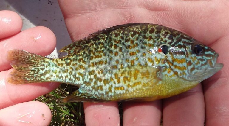
Photo: USFWS Mountain-Prairie, Public domain
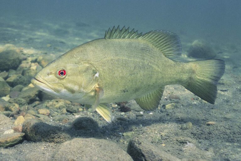
Photo: Yellowstone National Park, Public domain
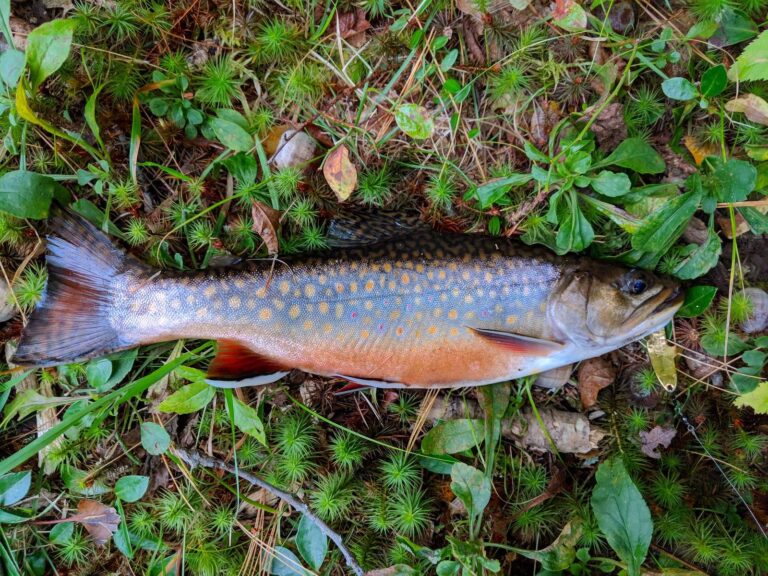
Photo: Under the same moon, CC BY 2.0
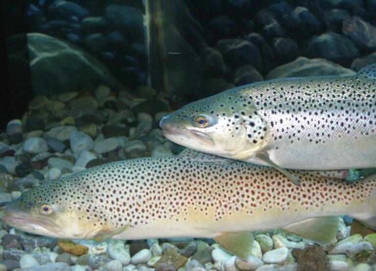
Photo: robposse, CC BY 2.0
What a Virginia tackle counter hears about the North Fork Shenandoah River
Which part of the Commonwealth holds the North Fork Shenandoah River?
Set the map on Shenandoah, Warren and Rockingham counties, about 2 miles from Woodstock.
How many access sites serve the North Fork Shenandoah River?
DWR shows 6 access sites; start at Catletts Ford Landing on North Fork Shenandoah River.
Which species does DWR list for the North Fork Shenandoah River?
DWR sources name bluegill, bullhead, common carp, channel catfish, crappie, largemouth bass and muskellunge.
Do DWR trout trucks visit the North Fork Shenandoah River?
Hatchery trout go into 3 reaches, category B. Designated stocked trout waters require a trout license October 1 to June 15; urban waters November 1 to April 30 (as printed).
Do I measure bass on the North Fork Shenandoah River?
The statewide digest row for largemouth and smallmouth bass reads: 5 per day in the aggregate (combined); No statewide length limits. Check its exception rows too.
Which license do I carry on the North Fork Shenandoah River?
A Virginia freshwater license is $23 a year for residents and $47 for nonresidents 16 and older. Designated stocked trout waters also need the $23 trout license from October 1 to June 15. Anglers under 16 need none.
Which USGS gauge reads the North Fork Shenandoah River?
Live numbers come from 3 USGS gauges above.
Does a listed fly or tackle store serve the North Fork Shenandoah River?
Try Murrays Fly Shop (about 2 miles away).
Read the USGS gauge, then fish the North Fork Shenandoah River
Know the creel limits before the first cast.