Fishing in Lincoln County, Oregon
County seat: Newport. Population 50,395.
- 4lake pages
- 52open launches
- 4river pages
 Pick for crappiePiscifun Carbon X ultralight spinning reel28% OFFSale $57.99
Photo of Yaquina Head: Bureau of Land Management, CC BY 2.0
Water in Lincoln County in figures
Lincoln County has its county offices in Newport and counted 50,395 people in 2020. The ODFW Northwest Zone rows cover most of the listed water in Lincoln County; a drainage that crosses the line can carry another zone.
4 lakes with a page of their own touch Lincoln County; Devils Lake (Lincoln County) has the biggest mapped outline. The county fronts Central Oregon Coast Subarea, Alsea Bay, Beaver Creek estuary and Depoe Bay. Count 52 open launches on the OSMB map for the county, 39 trailered. Walk-on access counts 13 mapped shore sites, with 9 piers or jetties.
Census 2020 population; BLM Oregon NHD lake outlines; OSMB Boating Access Sites; DLCD and ODFW shore access layers; 2026 Oregon Sport Fishing Regulations zone lists; read November 2, 2026.
The Lincoln County water map
OSMB launch points, DLCD and ODFW shore sites, NHD lake points, PMEP estuary points; read November 2, 2026.
Choosing a lake in Lincoln County
| Lake | Acres | Kind | OSMB launches | Fish mapped |
|---|---|---|---|---|
| Devils Lake (Lincoln County) | 673 (outline) | lake | 7 | black crappie, bluegill, brown bullhead |
| Olalla Reservoir | 103 (outline) | reservoir | 1 | bluegill, brown bullhead, largemouth bass |
| Eckman Lake | 58 (outline) | lake | 1 | largemouth bass, rainbow trout |
| Newport Reservoir | 48 (outline) | reservoir | 1 | largemouth bass, rainbow trout |
BLM Oregon hydrography lake outlines (NHD), summed by GNIS name (layer), read November 2, 2026. Species: ODFW Fish Habitat Distribution layers (ODFW ArcGIS), read November 2, 2026; a mapped species is habitat use ODFW records, not a catch report. ODFW publishes no lake depths in these layers.
 For the crappie herePiscifun Carbon XT ultralight spinning reel25% OFFSale $59.99
Saltwater fishing from Lincoln County
Lincoln County touches 11 bay, estuary or ocean-area pages.
| Water | Kind | OSMB launches | Piers and shore sites | Marinas |
|---|---|---|---|---|
| Central Oregon Coast Subarea | ODFW ocean area | 0 | 0 | 0 |
| Alsea Bay | bay | 10 | 1 | 4 |
| Beaver Creek estuary | estuary | 1 | 2 | 0 |
| Depoe Bay | bay | 1 | 3 | 1 |
| Little Creek estuary | estuary | 0 | 3 | 0 |
| Salmon River estuary | estuary | 1 | 0 | 0 |
| Siletz Bay | bay | 7 | 1 | 3 |
| Yaquina Bay | bay | 9 | 1 | 9 |
| Big Creek (Lincoln County) estuary | estuary | 0 | 0 | 0 |
| Devils Lake | estuary | 1 | 0 | 0 |
| Yachats River | estuary | 0 | 2 | 0 |
NOAA water level along Lincoln County
NOAA CO-OPS water level, preliminary reading at retrieval; station page for live data.
ODFW ocean management areas, PMEP estuaries, OSMB launches and marinas, DLCD shore sites; read November 2, 2026.
Which fish ODFW maps around Lincoln County
Tallying pages within 40 miles of Newport by species puts cutthroat trout first.
Species from ODFW Fish Habitat Distribution layers, booklet exceptions and ODFW records, counted per water page within 40 miles; habitat mapping, not a catch survey.
Smaller named still water in Lincoln County
These 4 named lakes of Lincoln County have an outline but no guide yet.
| Water | Acres (outline) | Nearest place |
|---|---|---|
| Olalla Barrier Reservoir | 16 | Toledo |
| Klickitat Lake | 12 | Philomath |
| Mill Creek Reservoir | 11 | Toledo |
| Ayers Lake | 10 | Toledo |
BLM Oregon hydrography lake outlines (NHD), summed by GNIS name (layer), read November 2, 2026.
Rivers to fish across Lincoln County
- Alsea RiverODFW maps chum, coho and fall chinook runs, 21 OSMB launches, 1 USGS gauge, 9 booklet exceptions
- Siletz RiverODFW maps chum, coho and fall chinook runs, 13 OSMB launches, 2 USGS gauges, 10 booklet exceptions
- Yaquina RiverODFW maps chum, coho and fall chinook runs, 5 OSMB launches, 4 booklet exceptions
- Yachats RiverODFW maps coho, fall chinook and winter steelhead runs, tidewater at Yachats River, 2 booklet exceptions
Unpaged rivers crossing Lincoln County (8)
- D RiverODFW maps coho and winter steelhead runs
- Little Salmon RiverODFW maps coho, fall chinook and winter steelhead runs
- Little Yaquina RiverODFW maps coho, fall chinook and winter steelhead runs
- North Fork Yachats RiverODFW maps coho, fall chinook and winter steelhead runs
- Red Riverstream
- South Fork Little Nestucca RiverODFW maps fall chinook and winter steelhead runs
- Treat RiverODFW maps winter steelhead runs
- Tumtum RiverODFW maps coho runs
Live river flow in Lincoln County
| USGS gauge | Latest reading | Time (ET) |
|---|---|---|
| Siletz River At Siletz, Or | 809 cfs, 3.96 ft gage height | Nov 11 10:30 pm |
| Siletz River Near Siletz, Or | 876 cfs, 8.71 ft gage height | Nov 11 11:00 pm |
| Alsea River Near Tidewater, Or | 279 cfs, 2.13 ft gage height | Nov 11 11:00 pm |
| Big Elk Creek Near Elk City, Or | 37 cfs, 0.91 ft gage height | Nov 11 10:45 pm |
US Geological Survey provisional data, retrieved Nov 11, 2026 11:33 pm ET. Provisional readings can be revised.
ODFW Fish Habitat Distribution stream names and runs, OSMB launches, booklet exceptions and USGS gauges; read November 2, 2026.
Putting in around Lincoln County
- Airport Ramp on Yaquina RiverYaquina River, 1 lane, trailered launch
- Alder Island Access on Siletz RiverSiletz River, 1 lane, hand carry launch
- Alsea River RV Park & MarinaAlsea River, 1 lane, trailered launch
- Barclay Slide boat ramp on Alsea RiverAlsea River, 1 lane, boat slide
- Beaver Creek Day Use boat ramp on Beaver Creek estuaryBeaver Creek estuary, 1 lane, trailered launch
- Blackberry Campground boat ramp on Alsea RiverAlsea River, 1 lane, trailered launch
- Blue Heron Landing on Devils LakeDevils Lake, 1 lane, trailered launch
- Cannon Quarry Park on Yaquina RiverYaquina River, 1 lane, trailered launch
- Chinook Bend RV and Marina on Siletz RiverSiletz River, 1 lane, trailered launch
- Coyote Rock RV Park and Marina on Siletz RiverSiletz River, trailered launch
- D River Paddle Access on Devils LakeDevils Lake, trailered launch
- Depoe Bay HarborDepoe Bay, 2 lanes, trailered launch
- Drift Creek Landing on Alsea RiverAlsea River, 1 lane, trailered launch
- East Devils Lake State Park RampDevils Lake, 1 lane, trailered launch
- East Paddle Launch on Yaquina BayYaquina Bay, 1 lane, hand carry launch
- Elk City Park on Yaquina RiverYaquina River, 1 lane, trailered launch
- Ermie Walters boat ramp on Alsea RiverAlsea River, trailered launch
- Five Rivers Launch on Alsea RiverAlsea River, trailered launch
- Happy Landing RV Park and Marina on Alsea RiverAlsea River, 1 lane, trailered launch
- Hee Hee Illahee boat ramp on Siletz RiverSiletz River, 1 lane, trailered launch
- Hellion Rapids boat ramp on Alsea RiverAlsea River, trailered launch
- Holmes Road Park on Devils LakeDevils Lake, 1 lane, trailered launch
- Ichwhit Park on Siletz RiverSiletz River, 1 lane, trailered launch
- Jack Morgan Park on Siletz RiverSiletz River, 1 lane, trailered launch
- King Silver RV Park & Marina on Alsea RiverAlsea River, 1 lane, trailered launch
- Knight Park on Salmon River estuarySalmon River estuary, 1 lane, trailered launch
- Kozy Kove boat ramp on Alsea RiverAlsea River, 1 lane, trailered launch
- Mike Bauer Wayside on Alsea RiverAlsea River, 1 lane, trailered launch
- Oaklands RV Park on Alsea RiverAlsea River, 1 lane, trailered launch
- Ojalla Bridge Slide boat ramp on Siletz RiverSiletz River, 1 lane, boat slide
- Olalla Lake AccessOlalla Reservoir, 1 lane, trailered launch
- Old Mill Park on Siletz RiverSiletz River, 1 lane, trailered launch
- Paddle Park on Yaquina RiverYaquina River, trailered launch
- Port of Alsea RampAlsea Bay, 2 lanes, trailered launch
- Port of Newport Marina & RV Park on Yaquina BayYaquina Bay, 4 lanes, trailered launch
- Quarry Hole boat ramp on Alsea RiverAlsea River, trailered launch
- Regatta Park on Devils LakeDevils Lake, 2 lanes, trailered launch
- Sand Point Park on Devils LakeDevils Lake, trailered launch
- Siletz MoorageSiletz River, 1 lane, trailered launch
- Stoney Point boat ramp on Alsea RiverAlsea River, trailered launch
- Strome Park on Siletz RiverSiletz River, 1 lane, trailered launch
- Sunset Landing RV Park & Campground on Siletz RiverSiletz River, 1 lane, trailered launch
- Taylors Landing RV Park and Marina on Alsea RiverAlsea River, hand carry launch
- Twin Bridges Park Ramp on Siletz RiverSiletz River, 1 lane, trailered launch
- W. B. Nelson State Park on Eckman LakeEckman Lake, hand carry launch
- West Paddle Launch on Yaquina BayYaquina Bay, 1 lane, hand carry launch
- Cristeser Moorage on Yaquina RiverYaquina River, hoist
- Devils Lake State Park Boat DockDevils Lake, hand carry launch
- Don Lindly Park on Alsea RiverAlsea River, na
- Embarcadero Marina Resort on Yaquina BayYaquina Bay, na
- Port of Toledo Marina on Depot SloughDepot Slough, hand carry launch
- Sawyers Landing on Yaquina BayYaquina Bay, hoist
- Moonshine Park Ramp on Siletz RiverSiletz River, closed per OSMB
- Riveredge Slide boat ramp on Alsea RiverAlsea River, closed per OSMB
The list follows the OSMB layer, including its closed and restricted flags.
Shore fishing in Lincoln County
- Depoe Bay City Parkfishing pier, Owner
- Port of Toledo on Yaquina Bayfishing pier, Port of Toledo
- Boiler Bay State Park on Depoe Bayjetty
- Newport Bayfront and Abbey Street Pier on Little Creek estuaryjetty
- Newport Marina and Fishing Pier on Little Creek estuaryjetty
- Ona Beach State Park on Beaver Creek estuaryshore site
- Port of Alsea, Waldportfishing pier
- Rocky Creek State Park on Depoe Bayjetty
- Seal Rock State Park on Beaver Creek estuaryshore site
- Siletz Bayfishing pier, Owner
- Smelt Sands State Park on Yachats Rivershore site
- Yachats State Parkshore site
- Yaquina Head Outstanding Natural Area on Little Creek estuaryjetty
Oregon State Marine Board Boating Access Sites layer (OSMB ArcGIS), read November 2, 2026; status as OSMB publishes it. Oregon Coastal Management Program (DLCD) Shoreline Access Inventory (layer) and the ODFW shore access map, read November 2, 2026.
Hatchery releases around Lincoln County
Lincoln County has 2 waters on the ODFW stocking schedule, with 10 planned releases totalling 12,396 trout.
- Devils Lake (Lincoln County)6 releases planned, next listed: Aug. 02, 2027 – Aug. 06, 2027: 1,384 legal-size trout
- Eckman Lake4 releases planned, next listed: May. 10, 2027 – May. 14, 2027: 1,332 legal-size, 50 trophy trout
ODFW weekly trout stocking schedule (planned releases; ODFW prints size classes, not species), myodfw.com, read November 2, 2026.
Fish an angler can carry home from Lincoln County
Unless the booklet names a water, the zone table settles limits in Lincoln County. The 2026 fee page lists the yearly angling license at $50 resident, $138 nonresident. For salmon and steelhead the booklet adds the Combined Angling Tag at $69 resident. The $9 Ocean Endorsement rides along with the license for ocean fishing beyond salmon and steelhead.
| Species | Limit | Season |
|---|---|---|
| Trout | Lakes: 5 per day, 3 daily limits in possession. Streams: (including tidewaters and bays): 2 per day, 3 daily limits in possession; 8-inch minimum | Lakes: Open all year Streams: (including tidewaters and bays): Open May 22 – Oct 31, unless noted under Exceptions. |
| Salmon and Steelhead | In the aggregate: 2 adult salmon or steelhead per day, 20 per year. 5 jack salmon per day, 2 daily jack limits in possession. Wild salmon bag limits are determined annually. | Closed unless noted under Exceptions. Note: Regulation changes may occur throughout the year and are posted on the MyODFW website. |
| Sturgeon | Catch-and-release only. | Streams: (including tidewaters and bays): Open during trout, salmon or steelhead seasons. |
| Bass | Lakes: 5 per day, 3 daily limits in possession unless noted under Exceptions. Streams: No limit. | Lakes: Open all year. Streams: (including tidewaters and bays): Open during trout, salmon or steelhead seasons, except tidewater areas of Columbia River. |
| Bluegill, Catfish, Crappie, Other Sunfish, Walleye, Yellow Perch, Stri. | No limit. | Lakes: Open all year. Streams: (including tidewaters and bays): Open during trout, salmon or steelhead seasons, except tidewater areas of Columbia River. |
| Marine Fish and Marine Shellfish | See Marine Zone. | See Marine Zone. |
| Smelt | Unless specifically authorized under emergency rules, it is unlawful to take or attempt to take Eulachon smelt in inland waters, including bays, rivers, estuaries, and streams. | Unless specifically authorized under emergency rules, it is unlawful to take or attempt to take Eulachon smelt in inland waters, including bays, rivers, estuari. |
| Species | Limit | Season |
|---|---|---|
| General Marine Species: Rockfish ("sea bass", "snapper"), Greenling (“. | Bag limits are set after this book is printed. Check current regulations before fishing on the Sport Bottomfish Seasons page. Retention of yelloweye and quillback rockfishes is prohibited. | Waters are open 24 hours per day. The offshore long-leader fishery is limited to fishing seaward of the 40-fathom regulatory line. |
| Lingcod (including green-colored lingcod) | 3 fish. | Waters are open 24 hours per day. The offshore long-leader fishery is limited to fishing seaward of the 40-fathom regulatory line. |
| Sablefish (black cod) | 10 fish. | Waters are open 24 hours per day. The offshore long-leader fishery is limited to fishing seaward of the 40-fathom regulatory line. |
| Flatfish (flounders, soles, sanddabs, turbots, and halibuts except Pac. | 25 fish in aggregate. | Waters are open 24 hours per day. The offshore long-leader fishery is limited to fishing seaward of the 40-fathom regulatory line. |
| Surfperch (includes all marine perch species) | 15 fish in aggregate. | Waters open all year, 24 hours per day, unless noted under Management Designations for Marine Areas. |
| Herring, Anchovy, Sardine, Topsmelt, Jacksmelt, and true smelts | 25 pounds in aggregate. | Waters open all year, 24 hours per day, unless noted under Management Designations for Marine Areas. |
| Offshore Pelagic Species: Includes all tuna and mackerel species, swor. | 25 fish in aggregate. White shark, basking shark, mega-mouth shark, and oceanic whitetip shark are prohibited and must be immediately released unharmed. | Waters open all year, 24 hours per day, unless noted under Management Designations for Marine Areas. |
| Striped Bass and/or Hybrid Bass | No limit | Waters open all year, 24 hours per day, unless noted under Management Designations for Marine Areas. |
| Sturgeon | Catch-and-release only. | Open all year. |
| Salmon and Steelhead | Ocean salmon and steelhead seasons and restrictions are set each April by the Pacific Fishery Management Council. Regulations are published each May and are available from license agents. | Ocean salmon and steelhead seasons and restrictions are set each April by the Pacific Fishery Management Council. |
| Pacific Halibut | May be taken by angling with a single line, no more than 2 hooks; and by spear. Pacific halibut seasons are managed and enforced based on port of landing. | May be taken by angling with a single line, no more than 2 hooks; and by spear. Pacific halibut seasons are managed and enforced based on port of landing. |
| Razor Clams | First 15 dug (no sorting or releasing). | Waters open all year, 24 hours per day Exceptions: Razor clams are closed Jul 15 to Sep 30 north of Tillamook Head (Clatsop County) Shellfish harvests may be cl. |
Where the Lincoln County limits change by water (27)
| Water | Species | Rule | Booklet |
|---|---|---|---|
| Alsea River (Mainstem) and Bay | hatchery steelhead | Open for hatchery steelhead Jan 1 – Apr 30 and Nov 1 – Dec 31. | p. 28 |
| Alsea River (Mainstem) and Bay | chinook, salmon | Open for Chinook salmon Aug 1 – Dec 31, up to USFS River Edge Boat Landing. | p. 28 |
| Alsea River (Mainstem) and Bay | Open for other fish as described in Marine Zone. | p. 28 | |
| Alsea River (Mainstem) and Bay | No angling from a floating device above Mill Cr. | p. 28 | |
| Alsea River, North Fork (Mouth to angling deadline marker above Alsea Hatchery fishway) | hatchery steelhead | Open for hatchery steelhead Jan 1 – Apr 30 and Dec 1-31. | p. 28 |
| Alsea River, North Fork (Mouth to angling deadline marker above Alsea Hatchery fishway) | No angling from a floating device. | p. 28 | |
| Alsea River, North Fork (Mouth to angling deadline marker above Alsea Hatchery fishway) | No angling 100 ft above and below Alsea Hatchery fishway. | p. 28 | |
| Alsea River, South Fork (Mouth to bridge at McBee Park) | hatchery steelhead | Open for hatchery steelhead Jan 1 – Apr 30 and Dec 1-31. | p. 28 |
| Alsea River, South Fork (Mouth to bridge at McBee Park) | No angling from a floating device. | p. 28 | |
| Devils Lake | trout | Only hatchery trout may be harvested. | p. 28 |
| Devils Lake | grass carp | No harvest of grass carp. | p. 28 |
| Siletz River and Bay | hatchery steelhead | Open all year for hatchery steelhead. | p. 30 |
| Siletz River and Bay | Use of bait allowed. | p. 30 | |
| Siletz River and Bay | chinook, salmon | Open for Chinook salmon Apr 1 – Jul 31 (1 wild Chinook salmon per day and 2 per season). | p. 30 |
| Siletz River and Bay | chinook, salmon | Open for Chinook salmon Aug 1 – Dec 31. | p. 30 |
| Siletz River and Bay | chinook, salmon | Open for Chinook salmon Apr 1 – Jul 31 (1 wild Chinook salmon per day and 2 per season). | p. 30 |
| Siletz River and Bay | chinook, salmon | Open for Chinook salmon Oct 7 – Dec 31. | p. 30 |
| Siletz River and Bay | chinook, salmon | Open for Chinook salmon Apr 1 – Jul 31 (1 wild Chinook salmon per day and 2 per season). | p. 30 |
| Siletz River and Bay | hatchery steelhead | Open all year for hatchery steelhead. | p. 30 |
| Siletz River and Bay | Use of bait allowed. | p. 30 |
Limits as printed in the 2026 Oregon Sport Fishing Regulations (ODFW, eRegulations edition) (Northwest Zone page), read November 2, 2026. Limits as printed in the 2026 Oregon Sport Fishing Regulations (ODFW, eRegulations edition) (Marine Zone page), read November 2, 2026. Water exceptions as printed in the 2026 Oregon Sport Fishing Regulations (ODFW, eRegulations edition) (booklet PDF; printed page shown), read November 2, 2026. In-season changes from ODFW override them. Fees as printed on the ODFW license, tag and permit fee page of the 2026 Oregon Sport Fishing Regulations (ODFW, eRegulations edition) (fees page), read November 2, 2026.
Oregon record fish near Lincoln County
Nothing on the ODFW record list comes from Lincoln County, but nearby waters hold some.
| Species | Weight | Water | Date |
|---|---|---|---|
| Coho Salmon | 25 lb 5.25 oz | Siltcoos Lake | 1966 |
| Chum Salmon | 23 lb 0 oz | Kilchis River | 1990 |
| Chinook Salmon | 83 lb 0 oz | Winchester Bay and the Umpqua estuary | 1910 |
| Striped Bass | 68 lb 0 oz | Winchester Bay and the Umpqua estuary | 1973 |
Oregon record fish as listed by Oregon Department of Fish and Wildlife (record fish article, dated March 4, 2026), read November 2, 2026.
Buying bait in Lincoln County
Shops in Lincoln County
- Harry's Bait & Tacklebait and tackle shop, Newport
- Shrimp Daddy Bait & Tacklebait and tackle shop, Waldport
- Sunset Landingbait and tackle shop, Lincoln City
- Bi-Mart (Lincoln City)sporting goods store, Lincoln City
- Carver Inc Port Dock 5marina, Newport
- Dock of the Baymarina, Waldport
- Drift Creek Landingmarina, Waldport
- Port of Newportmarina, Toledo
- Sawyer's Landing Marina & RVmarina, Newport
Guides listed in Lincoln County
- Blue Max Inccharter, Depoe Bay
- Brand X Charters LLCcharter, Newport
- Captain's Reel Deep Sea Fishing Chartercharter, Newport, (541) 265-7441
- Craig A Calkinscharter, Depoe Bay
- Depoe Bay Fishing & Whale Watching Inccharter, Depoe Bay
- Dockside Charterscharter, Depoe Bay, (541) 765-2545
- Enterprise Marine LLCcharter, Newport
- Gracie K LLCcharter, Newport
- Mariner Charters LLCcharter, Depoe Bay
- Miss Raven Charters LLCcharter, Newport
- Outer Limit Charters LLCcharter, Depoe Bay
- Robert P Waddell Chartercharter, Newport
- Samson Sport Fishing LLCcharter, Depoe Bay
- Spindrift Fishing LLCcharter, Newport
- Surfrider Charters LLCcharter, Depoe Bay
- Tacklebuster Inccharter, Depoe Bay
- Tacklebuster Sportfishingcharter, Depoe Bay, (541) 270-1223
- Tradewinds Charterscharter, Depoe Bay, (541) 765-2345
- Waddell & Kasper Charters LLCcharter, Newport
- Whale's Tail Charterscharter, Depoe Bay, (541) 921-1323
Yellow Pages and store-locator listings, guide and charter business listings (county of the business), read November 2, 2026.
Not far from Lincoln County
Towns in Lincoln County
- Newportpop. 10,256
- Lincoln Citypop. 9,815
- Toledopop. 3,546
- Waldportpop. 2,249
- Depoe Baypop. 1,515
- Siletzpop. 1,230
Next door to Lincoln County
- Benton County26 miles east
- Polk County31 miles northeast
- Yamhill County51 miles northeast
- Tillamook County57 miles north
Rods, reels and braid from Piscifun for Lincoln County


Piscifun and Amazon links are affiliate links; the site earns a commission on qualifying purchases.
Shorelines and riffles near Lincoln County, photographed
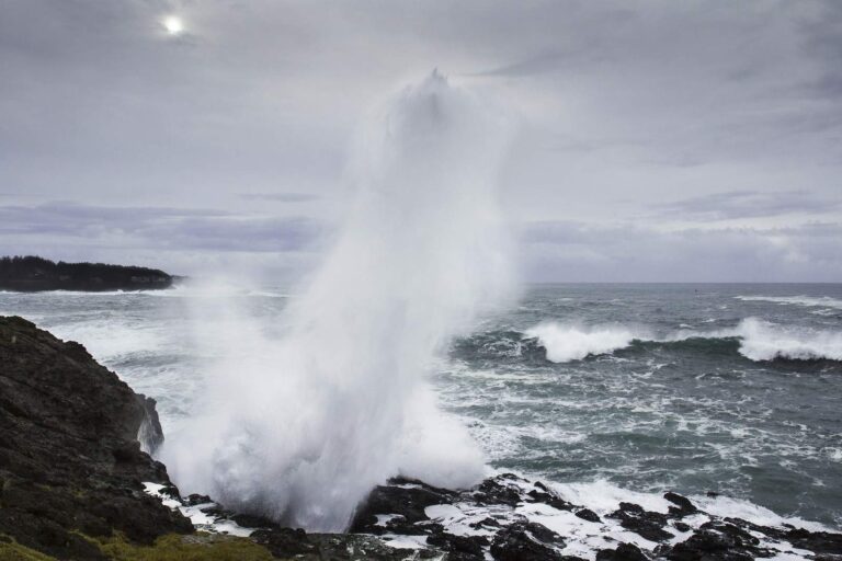
Photo: Bonnie Moreland, Public domain
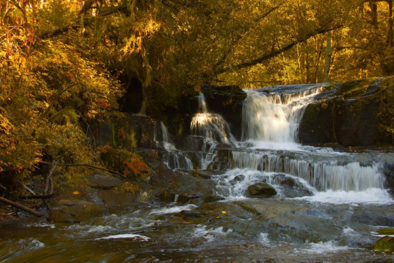
Photo: Bonnie Moreland, Public domain
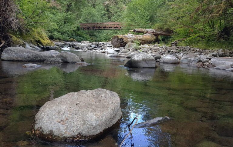
Photo: Bureau of Land Management Oregon and Washington, CC BY 2.0
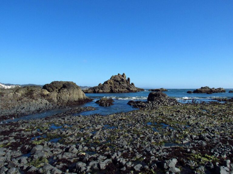
Photo: Jeff Hollett, Public domain
Questions about lakes and streams in Lincoln County
Which launches does the Marine Board map in Lincoln County?
52 open launches; 39 are trailered ramps.
What is the biggest still water touching Lincoln County?
Devils Lake (Lincoln County), about 673 acres on its mapped outline.
Which fish are mapped near Lincoln County?
Cutthroat trout lead the count of water pages within 40 miles, then largemouth bass, rainbow trout and steelhead.
Where do I restock tackle in Lincoln County?
Harry's Bait & Tackle is one of 9 shops here.
Could I book a guided day out of Lincoln County?
21 guides and charters list the county.
Which Oregon town houses Lincoln County offices?
Government sits in Newport.
Which license covers a trip to Lincoln County?
ODFW prices the 2026 annual angling license at $50 for Oregonians and $138 for nonresidents. Add the Combined Angling Tag, $69 resident, before keeping salmon or steelhead. ODFW sells the Ocean Endorsement for $9; it covers ocean fishing other than salmon and steelhead.
Which Oregon county pages adjoin Lincoln County?
By distance: Benton County, Polk County and Yamhill County.
Which ODFW zone covers Lincoln County?
The ODFW Northwest Zone table governs most named water in Lincoln County, but watershed boundaries decide each zone.
Which Lincoln County waters carry their own rules?
The 2026 booklet prints 27 water exceptions reaching this county, starting with Alsea River (Mainstem) and Bay; the table above shows each.
Can I fish the ocean from Lincoln County?
Central Oregon Coast Subarea, Alsea Bay, Beaver Creek estuary and Depoe Bay; the coastal table above links the pages.
Are trout plants planned in Lincoln County?
Yes: 2 waters on the ODFW schedule, such as Devils Lake (Lincoln County) and Eckman Lake; releases are planned, not confirmed.
Work the waters of Lincoln County
Read the exception table before keeping fish.