Fishing in Tillamook County, Oregon
County seat: Tillamook. Population 27,390.
- 5lake pages
- 55open launches
- 9river pages
 Pick for bullheadPiscifun LumiCat II catfish rod48% OFFSale $114.99
Photo of Nehalem Bay: Michael Cornelius, CC BY-SA 2.0
Tillamook County fishing at a glance
County business for Tillamook County happens in Tillamook; the 2020 Census found 27,390 residents. Expect the ODFW Northwest Zone limits on most Tillamook County waters; zones are drawn by drainage, so check any water near a divide.
Of the 5 lake guides tied to Tillamook County, Cape Meares Lake covers the most surface. Bay and ocean pages for the county cover Nehalem Bay, Nestucca Bay, Netarts Bay and Sand Lake. The Marine Board layer shows 55 open launches inside the county, 36 for trailers. Shore anglers get 19 mapped shore sites, 12 of them piers or jetties.
Census 2020 population; BLM Oregon NHD lake outlines; OSMB Boating Access Sites; DLCD and ODFW shore access layers; 2026 Oregon Sport Fishing Regulations zone lists; read November 2, 2026.
Pinning the fishing access in Tillamook County
OSMB launch points, DLCD and ODFW shore sites, NHD lake points, PMEP estuary points; read November 2, 2026.
Lake guides for Tillamook County
| Lake | Acres | Kind | OSMB launches | Fish mapped |
|---|---|---|---|---|
| Cape Meares Lake | 158 (outline) | lake | 1 | bluegill, brown bullhead, chinook salmon |
| Lake Lytle | 68 (outline) | lake | 1 | largemouth bass, rainbow trout |
| Town Lake | 10 (outline) | lake | 1 | largemouth bass, rainbow trout, chinook salmon |
| Hebo Lake | 2 (outline) | lake | 1 | brown bullhead, rainbow trout |
| Nedonna Lake | 1 (outline) | lake | 0 | rainbow trout |
BLM Oregon hydrography lake outlines (NHD), summed by GNIS name (layer), read November 2, 2026. Species: ODFW Fish Habitat Distribution layers (ODFW ArcGIS), read November 2, 2026; a mapped species is habitat use ODFW records, not a catch report. ODFW publishes no lake depths in these layers.
 For the bullhead herePiscifun Chaos XS round baitcaster36% OFFSale $57.99
The coast of Tillamook County
The coastal table for Tillamook County lists 9 ocean and estuary waters.
| Water | Kind | OSMB launches | Piers and shore sites | Marinas |
|---|---|---|---|---|
| Nehalem Bay | bay | 8 | 2 | 1 |
| Nestucca Bay | bay | 6 | 3 | 0 |
| Netarts Bay | bay | 1 | 2 | 0 |
| Sand Lake | estuary | 1 | 1 | 0 |
| Tillamook Bay | bay | 10 | 9 | 3 |
| Daley Lake | estuary | 0 | 0 | 0 |
| Lake Lytle | estuary | 1 | 1 | 0 |
| Neskowin Creek estuary | estuary | 0 | 0 | 0 |
| Smith Lake | estuary | 0 | 1 | 0 |
Coastal gauges serving Tillamook County
NOAA CO-OPS water level, preliminary reading at retrieval; station page for live data.
ODFW ocean management areas, PMEP estuaries, OSMB launches and marinas, DLCD shore sites; read November 2, 2026.
Fish counts across waters by Tillamook County
Out to 40 miles from Tillamook, chinook salmon appears on more water pages than any other species.
Species from ODFW Fish Habitat Distribution layers, booklet exceptions and ODFW records, counted per water page within 40 miles; habitat mapping, not a catch survey.
More lake outlines across Tillamook County
Another 12 named outlines fall in Tillamook County.
| Water | Acres (outline) | Nearest place |
|---|---|---|
| Smith Lake | 44 | Rockaway Beach |
| Skookum Lake | 36 | Tillamook |
| Winema Lake | 18 | Lincoln City |
| Spring Lake | 17 | Rockaway Beach |
| Miles Lake | 17 | Tillamook |
| Crescent Lake | 17 | Rockaway Beach |
| Sears Lake | 14 | Tillamook |
| Chamberlain Lake | 8 | Tillamook |
| Battle Lake | 2 | Tillamook |
| Lake Marie | 1 | Rockaway Beach |
| Seaview Lake | 1 | Rockaway Beach |
| Bay City Reservoir | 0 | Bay City |
BLM Oregon hydrography lake outlines (NHD), summed by GNIS name (layer), read November 2, 2026.
Streams that cross Tillamook County
- Kilchis RiverODFW maps chum, coho and fall chinook runs, 3 OSMB launches, 7 booklet exceptions
- Little Nestucca RiverODFW maps chum, coho and fall chinook runs, 1 OSMB launch, 7 booklet exceptions
- Nestucca RiverODFW maps chum, coho and fall chinook runs, 11 OSMB launches, 2 USGS gauges, 11 booklet exceptions
- North Fork Nehalem RiverODFW maps chum, coho and fall chinook runs, 2 OSMB launches
- Tillamook RiverODFW maps chum, coho and fall chinook runs, 2 OSMB launches, 5 booklet exceptions
- Trask RiverODFW maps chum, coho and fall chinook runs, 6 OSMB launches, 1 USGS gauge, 13 booklet exceptions
- Wilson RiverODFW maps chum, coho and fall chinook runs, 4 OSMB launches, 2 USGS gauges, 9 booklet exceptions
- Miami RiverODFW maps chum, coho and fall chinook runs, 5 booklet exceptions
- Nehalem River16 OSMB launches, 4 USGS gauges, 13 booklet exceptions
Smaller rivers of Tillamook County (12)
- East Fork South Fork Trask RiverODFW maps coho and winter steelhead runs
- Little North Fork Wilson RiverODFW maps chum, coho and fall chinook runs
- Little South Fork Kilchis Riverstream
- North Fork Kilchis RiverODFW maps coho, fall chinook and summer steelhead runs
- North Fork Salmonberry RiverODFW maps coho, fall chinook and winter steelhead runs
- North Fork Trask RiverODFW maps coho, fall chinook and spring chinook runs
- North Fork Wilson RiverODFW maps coho, fall chinook and summer steelhead runs
- South Fork Kilchis RiverODFW maps coho, fall chinook and summer steelhead runs
- South Fork Salmonberry RiverODFW maps winter steelhead runs
- South Fork Trask RiverODFW maps coho, fall chinook and spring chinook runs
- South Fork Wilson RiverODFW maps coho, fall chinook and summer steelhead runs
- West Fork North Fork Wilson RiverODFW maps winter steelhead runs
River readings across Tillamook County
| USGS gauge | Latest reading | Time (ET) |
|---|---|---|
| Nehalem River At Nehalem, Or | 7,000 cfs, 1.06 ft gage height | Nov 11 11:10 pm |
| Nehalem River Near Foss, Or | 846 cfs, 3.58 ft gage height | Nov 11 11:15 pm |
| Wilson River Near Tillamook, Or | 693 cfs, 4.83 ft gage height | Nov 11 10:30 pm |
| Trask River Above Cedar Creek, Near Tillamook, Or | 458 cfs, 6.69 ft gage height | Nov 11 11:00 pm |
| Nestucca River Near Beaver, Or | 931 cfs, 5.91 ft gage height | Nov 11 10:45 pm |
| Tucca Creek Near Blaine, Or. | 12 cfs, 11.11 ft gage height | Nov 11 10:45 pm |
US Geological Survey provisional data, retrieved Nov 11, 2026 11:33 pm ET. Provisional readings can be revised.
ODFW Fish Habitat Distribution stream names and runs, OSMB launches, booklet exceptions and USGS gauges; read November 2, 2026.
Launches listed for Tillamook County
- Aldervale boat ramp on North Fork Nehalem RiverNorth Fork Nehalem River, 1 lane, trailered launch
- Beaver Slide boat ramp on Nehalem RiverNehalem River, 1 lane, boat slide
- Big Barn Marina and RV Park on Tillamook RiverTillamook River, trailered launch
- Bixby Rd Access on Nestucca RiverNestucca River, hand carry launch
- Borba Boat Slide boat ramp on Nestucca RiverNestucca River, 1 lane, boat slide
- Brighton Marina on Nehalem RiverNehalem River, 1 lane, trailered launch
- Burtons Bridge Boat Launch on Tillamook RiverTillamook River, 1 lane, trailered launch
- Cape Meares Lake boat rampCape Meares Lake, trailered launch
- Carnahan City Park on Trask RiverTrask River, 2 lanes, trailered launch
- Cloverdale boat ramp on Nestucca RiverNestucca River, 1 lane, trailered launch
- Farmer Creek boat ramp on Nestucca RiverNestucca River, 1 lane, trailered launch
- First Bridge Ramp on Nestucca RiverNestucca River, 1 lane, trailered launch
- Fishers Point boat ramp on Nestucca RiverNestucca River, trailered launch
- Fourth Bridge launch on Nestucca RiverNestucca River, 1 lane, hand carry launch
- Hebo Lake Day Use launchHebo Lake, 1 lane, hand carry launch
- Hungry Harbor Boat Launch on Pacific Ocean (North Coast)Pacific Ocean (North Coast), 1 lane, trailered launch
- Jetty Fishery Marina on Nehalem RiverNehalem River, 1 lane, trailered launch
- Kilchis River ParkKilchis River, trailered launch
- Lake Lytle boat rampLake Lytle, 1 lane, trailered launch
- Lake Tahoe Recreation Site launchLake Tahoe, hand carry launch
- Little Nestucca RampLittle Nestucca River, 1 lane, trailered launch
- Lorens Drift boat ramp on Trask RiverTrask River, trailered launch
- Mapes Creek boat ramp on Kilchis RiverKilchis River, trailered launch
- Memaloose Point boat ramp on Tillamook BayTillamook Bay, 2 lanes, trailered launch
- Mills Bridge boat ramp on Wilson RiverWilson River, trailered launch
- Mohler Sand & Gravel boat ramp on Nehalem RiverNehalem River, trailered launch
- Morrison Eddy Campground launch on Nehalem RiverNehalem River, hand carry launch
- Nehalem Bay County RampNehalem River, 1 lane, trailered launch
- Nehalem Bay State ParkNehalem River, 1 lane, trailered launch
- Nehalem Falls Campground launchNehalem River, 1 lane, hand carry launch
- Nestucca Sporting Goods boat rampNestucca River, trailered launch
- Netarts LandingNetarts Bay, 1 lane, trailered launch
- Nip's Landing Slide on Trask RiverTrask River, 1 lane, boat slide
- Old Mill Marina Resort on Tillamook BayTillamook Bay, 2 lanes, trailered launch
- Pacific City Landing on Nestucca RiverNestucca River, 1 lane, trailered launch
- Parks Landing on Kilchis RiverKilchis River, 1 lane, trailered launch
- Peninsula Boat Slide boat ramp on Trask RiverTrask River, 1 lane, boat slide
- Port of Garibaldi Ramp on Tillamook BayTillamook Bay, 4 lanes, trailered launch
- Raines Resort launch on Nestucca RiverNestucca River, hand carry launch
- Roy Creek Park on Nehalem RiverNehalem River, trailered launch
- Siskeyville Slide boat ramp on Wilson RiverWilson River, 1 lane, boat slide
- Sollie Smith boat ramp on Wilson RiverWilson River, 1 lane, trailered launch
- Steiner Boat Launch on Trask RiverTrask River, 1 lane, trailered launch
- Stones Road boat ramp on Trask RiverTrask River, 1 lane, boat slide
- Sue H Elmore Park on Tillamook BayTillamook Bay, 1 lane, trailered launch
- Three Rivers Ramp on Nestucca RiverNestucca River, trailered launch
- Tillamook Bay Boathouse launchTillamook Bay, hand carry launch
- Town Lake RampTown Lake, 1 lane, trailered launch
- Vanderzanden Slide boat ramp on Wilson RiverWilson River, 1 lane, boat slide
- Whalen Island Boat Launch on Sand LakeSand Lake, trailered launch
- Wheeler Waterfront Park on Nehalem RiverNehalem River, 1 lane, trailered launch
- H Street Dock on Nehalem RiverNehalem River, hand carry launch
- Port of Garibaldi Guest Dock on Tillamook BayTillamook Bay, na
- Port of Garibaldi Marina on Tillamook BayTillamook Bay, na
- Tohls Street Dock on Nehalem RiverNehalem River, hand carry launch
OSMB status is shown as published: closed launches are listed without a page.
Fishing from land in Tillamook County
- Biak Ave on Tillamook Bayfishing pier, Owner
- Garibaldi Pier on Tillamook Bayfishing pier, Owner
- Garibaldi Public Pier on Tillamook Bayfishing pier, Owner
- Port of Garibaldi on Tillamook Bayfishing pier, Port of Garibaldi
- Beach Access, Cape Meares on Tillamook Bayshore site
- Bob Straub State Park on Nestucca Bayshore site
- Fisher Point Launch on Nestucca Bayjetty
- Garibaldi Pier on Tillamook Bayfishing pier, Owner
- Garibaldi Pier on Tillamook Bayfishing pier, Owner
- Happy Camp on Netarts Bayshore site
- Hobsonville Point on Tillamook Bayjetty
- Nehalem Bay State Parkshore site
- Netarts Landing Rampjetty
- Pacific City Beach at Cape Kiwanda on Nestucca Bayshore site
- Rockaway Beachshore site
- Tillamook Bay North Jetty, Barview Parkshore site
- Transient Docks and Slips-East on Tillamook Bayfishing pier, Owner
- Whalen Island County Park on Sand Lakejetty
- Wheeler waterfront park on Nehalem Bayfishing pier
Oregon State Marine Board Boating Access Sites layer (OSMB ArcGIS), read November 2, 2026; status as OSMB publishes it. Oregon Coastal Management Program (DLCD) Shoreline Access Inventory (layer) and the ODFW shore access map, read November 2, 2026.
ODFW stocking for waters of Tillamook County
Across 5 stocked waters in Tillamook County, ODFW plans 38 releases and 65,840 trout.
- Cape Meares Lake10 releases planned, next listed: Sep. 13, 2027 – Sep. 17, 2027: 300 trophy trout
- Lake Lytle4 releases planned, next listed: Apr. 19, 2027 – Apr. 23, 2027: 2,000 legal-size trout
- Town Lake10 releases planned, next listed: Sep. 13, 2027 – Sep. 17, 2027: 300 trophy trout
- Hebo Lake8 releases planned, next listed: May. 24, 2027 – May. 28, 2027: 1,250 legal-size trout
- Nedonna Lake6 releases planned, next listed: May. 24, 2027 – May. 28, 2027: 500 legal-size trout
ODFW weekly trout stocking schedule (planned releases; ODFW prints size classes, not species), myodfw.com, read November 2, 2026.
Keeper rules across Tillamook County
The zone rows apply across Tillamook County wherever no water exception steps in. Annual angling runs $50 for residents of Oregon and $138 for everyone else in 2026. Keep a salmon or steelhead and you need the Combined Angling Tag too, $69 for residents. Ocean fishing from boat, beach or jetty now takes the $9 Ocean Endorsement unless you fish only for salmon or steelhead.
| Species | Limit | Season |
|---|---|---|
| Trout | Lakes: 5 per day, 3 daily limits in possession. Streams: (including tidewaters and bays): 2 per day, 3 daily limits in possession; 8-inch minimum | Lakes: Open all year Streams: (including tidewaters and bays): Open May 22 – Oct 31, unless noted under Exceptions. |
| Salmon and Steelhead | In the aggregate: 2 adult salmon or steelhead per day, 20 per year. 5 jack salmon per day, 2 daily jack limits in possession. Wild salmon bag limits are determined annually. | Closed unless noted under Exceptions. Note: Regulation changes may occur throughout the year and are posted on the MyODFW website. |
| Sturgeon | Catch-and-release only. | Streams: (including tidewaters and bays): Open during trout, salmon or steelhead seasons. |
| Bass | Lakes: 5 per day, 3 daily limits in possession unless noted under Exceptions. Streams: No limit. | Lakes: Open all year. Streams: (including tidewaters and bays): Open during trout, salmon or steelhead seasons, except tidewater areas of Columbia River. |
| Bluegill, Catfish, Crappie, Other Sunfish, Walleye, Yellow Perch, Stri. | No limit. | Lakes: Open all year. Streams: (including tidewaters and bays): Open during trout, salmon or steelhead seasons, except tidewater areas of Columbia River. |
| Marine Fish and Marine Shellfish | See Marine Zone. | See Marine Zone. |
| Smelt | Unless specifically authorized under emergency rules, it is unlawful to take or attempt to take Eulachon smelt in inland waters, including bays, rivers, estuaries, and streams. | Unless specifically authorized under emergency rules, it is unlawful to take or attempt to take Eulachon smelt in inland waters, including bays, rivers, estuari. |
| Species | Limit | Season |
|---|---|---|
| General Marine Species: Rockfish ("sea bass", "snapper"), Greenling (“. | Bag limits are set after this book is printed. Check current regulations before fishing on the Sport Bottomfish Seasons page. Retention of yelloweye and quillback rockfishes is prohibited. | Waters are open 24 hours per day. The offshore long-leader fishery is limited to fishing seaward of the 40-fathom regulatory line. |
| Lingcod (including green-colored lingcod) | 3 fish. | Waters are open 24 hours per day. The offshore long-leader fishery is limited to fishing seaward of the 40-fathom regulatory line. |
| Sablefish (black cod) | 10 fish. | Waters are open 24 hours per day. The offshore long-leader fishery is limited to fishing seaward of the 40-fathom regulatory line. |
| Flatfish (flounders, soles, sanddabs, turbots, and halibuts except Pac. | 25 fish in aggregate. | Waters are open 24 hours per day. The offshore long-leader fishery is limited to fishing seaward of the 40-fathom regulatory line. |
| Surfperch (includes all marine perch species) | 15 fish in aggregate. | Waters open all year, 24 hours per day, unless noted under Management Designations for Marine Areas. |
| Herring, Anchovy, Sardine, Topsmelt, Jacksmelt, and true smelts | 25 pounds in aggregate. | Waters open all year, 24 hours per day, unless noted under Management Designations for Marine Areas. |
| Offshore Pelagic Species: Includes all tuna and mackerel species, swor. | 25 fish in aggregate. White shark, basking shark, mega-mouth shark, and oceanic whitetip shark are prohibited and must be immediately released unharmed. | Waters open all year, 24 hours per day, unless noted under Management Designations for Marine Areas. |
| Striped Bass and/or Hybrid Bass | No limit | Waters open all year, 24 hours per day, unless noted under Management Designations for Marine Areas. |
| Sturgeon | Catch-and-release only. | Open all year. |
| Salmon and Steelhead | Ocean salmon and steelhead seasons and restrictions are set each April by the Pacific Fishery Management Council. Regulations are published each May and are available from license agents. | Ocean salmon and steelhead seasons and restrictions are set each April by the Pacific Fishery Management Council. |
| Pacific Halibut | May be taken by angling with a single line, no more than 2 hooks; and by spear. Pacific halibut seasons are managed and enforced based on port of landing. | May be taken by angling with a single line, no more than 2 hooks; and by spear. Pacific halibut seasons are managed and enforced based on port of landing. |
| Razor Clams | First 15 dug (no sorting or releasing). | Waters open all year, 24 hours per day Exceptions: Razor clams are closed Jul 15 to Sep 30 north of Tillamook Head (Clatsop County) Shellfish harvests may be cl. |
Special rows reaching Tillamook County (73)
| Water | Species | Rule | Booklet |
|---|---|---|---|
| Cape Meares Lake | bass | 1 bass per day. | p. 28 |
| Kilchis River (Hwy 101 bridge to Tilden Bluff Rd Bridge (RM 11)) | hatchery steelhead | Open all year for hatchery steelhead. | p. 28 |
| Kilchis River (Hwy 101 bridge to Tilden Bluff Rd Bridge (RM 11)) | chinook, salmon | Open for hatchery spring Chinook salmon Jan 1 – Jul 31. | p. 28 |
| Kilchis River (Hwy 101 bridge to Tilden Bluff Rd Bridge (RM 11)) | chinook, salmon | Open for fall Chinook salmon Aug 1 – Dec 31. | p. 28 |
| Kilchis River (Hwy 101 bridge to Tilden Bluff Rd Bridge (RM 11)) | chum, salmon | Catch-and-release for chum salmon Sep 16 – Nov 15. | p. 28 |
| Kilchis River (Tilden Bluff Rd Bridge to North Fork) | hatchery steelhead | Open all year for hatchery steelhead. | p. 28 |
| Kilchis River (Tilden Bluff Rd Bridge to North Fork) | salmon | Closed all year to salmon angling. | p. 28 |
| Kilchis River (Tributaries and river sections not listed) | Closed. | p. 28 | |
| Lake Lytle | bass | 1 bass per day. | p. 29 |
| Little Nestucca River (Hwy 101 to USFS bridge at Dolph) | hatchery steelhead | Open all year for hatchery steelhead. | p. 29 |
| Little Nestucca River (Hwy 101 to USFS bridge at Dolph) | chinook, salmon | Open for hatchery spring Chinook salmon Jan 1 – Jul 31. | p. 29 |
| Little Nestucca River (Hwy 101 to USFS bridge at Dolph) | chinook, salmon | Open for fall Chinook salmon Aug 1 – Dec 31. | p. 29 |
| Little Nestucca River (Hwy 101 to USFS bridge at Dolph) | Use of bait allowed. | p. 29 | |
| Little Nestucca River (Hwy 101 to USFS bridge at Dolph) | Closed from ODFW markers up to Upton Falls. | p. 29 | |
| Little Nestucca River (Hwy 101 to USFS bridge at Dolph) | Closed from ODFW markers up to Stella Falls. | p. 29 | |
| Little Nestucca River (Tributaries and river sections not listed) | Closed. | p. 29 | |
| Miami River (Above Hwy 101 bridge) | hatchery steelhead | Open for hatchery steelhead Jan 1 – Mar 31 and May 22 – Dec 31. | p. 29 |
| Miami River (Above Hwy 101 bridge) | chinook, salmon | Open for hatchery spring Chinook salmon May 22 – Jul 31. | p. 29 |
| Miami River (Above Hwy 101 bridge) | chinook, salmon | Open for fall Chinook salmon Aug 1 – Dec 31. | p. 29 |
| Miami River (Above Hwy 101 bridge) | chum, salmon | Catch-and-release for chum salmon Sep 16 – Nov 15. | p. 29 |
Limits as printed in the 2026 Oregon Sport Fishing Regulations (ODFW, eRegulations edition) (Northwest Zone page), read November 2, 2026. Limits as printed in the 2026 Oregon Sport Fishing Regulations (ODFW, eRegulations edition) (Marine Zone page), read November 2, 2026. Water exceptions as printed in the 2026 Oregon Sport Fishing Regulations (ODFW, eRegulations edition) (booklet PDF; printed page shown), read November 2, 2026. In-season changes from ODFW override them. Fees as printed on the ODFW license, tag and permit fee page of the 2026 Oregon Sport Fishing Regulations (ODFW, eRegulations edition) (fees page), read November 2, 2026.
State records from water by Tillamook County
| Species | Weight | Water | Date |
|---|---|---|---|
| Chum Salmon | 23 lb 0 oz | Kilchis River | 1990 |
Oregon record fish as listed by Oregon Department of Fish and Wildlife (record fish article, dated March 4, 2026), read November 2, 2026.
Events fished from Tillamook County
Schedules and results list 1 event in Tillamook County, 0 on the coming calendar.
| Date | Event | Water | Organizer |
|---|---|---|---|
| Aug. 14, 2026 | 21st Annual Oregon Tuna Classic 2026 | Pacific Ocean | Oregon Tuna Classic |
Organizer schedule and results pages (ODFW publishes no tournament calendar), checked November 2026.
Shops and charters in Tillamook County
Tackle stores of Tillamook County
- Tillamook Bait Cobait and tackle shop, Tillamook
- Tillamook Sporting Goodsbait and tackle shop, Tillamook
- Wheeler Marinabait and tackle shop, Wheeler
- Wyld Edge Outfittersbait and tackle shop, Tillamook
- Garibaldi Marinamarina, Garibaldi
- Port of Garibaldi Harbormarina, Garibaldi
Guide services of Tillamook County
- Garibaldi Charterscharter, Garibaldi, (503) 322-0007
- Haystack Fishingcharter, Pacific City, (503) 679-9028
- Jb and Water Sport Fishing Charterscharter, Garibaldi, (503) 322-3474
- Kerri Lin Charterscharter, Rockaway Beach, (503) 355-2439
- Meanwhile Charters LLCcharter, Garibaldi, (503) 410-0289
- Nor'wester Charterscharter, Cloverdale, (503) 965-2238
- Siggi-G Ocean Charterscharter, Garibaldi, (503) 322-3285
- Pacific City Fishingfishing guide, Pacific City, (503) 351-9019
- Russ Morrow sportfishing guide servicefishing guide, Nehalem, (503) 310-9733
Yellow Pages and store-locator listings, guide and charter business listings (county of the business), read November 2, 2026.
In range of Tillamook County
Base towns in Tillamook County
- Tillamookpop. 5,204
- Rockaway Beachpop. 1,441
- Bay Citypop. 1,389
Counties next to Tillamook County
- Yamhill County26 miles southeast
- Washington County33 miles east
- Clatsop County39 miles north
- Polk County42 miles southeast
What Piscifun sells for a day spent on Tillamook County


Piscifun and Amazon links are affiliate links; the site earns a commission on qualifying purchases.
The look of the water close to Tillamook County
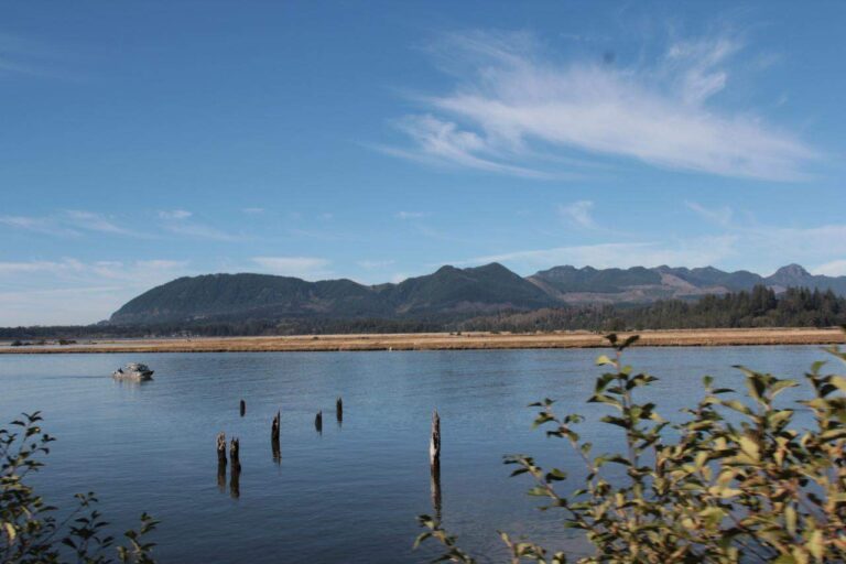
Photo: Ben Brooks, CC BY-SA 2.0
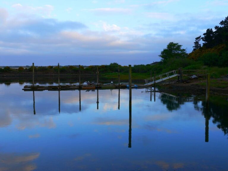
Photo: Rick Obst, CC BY 2.0
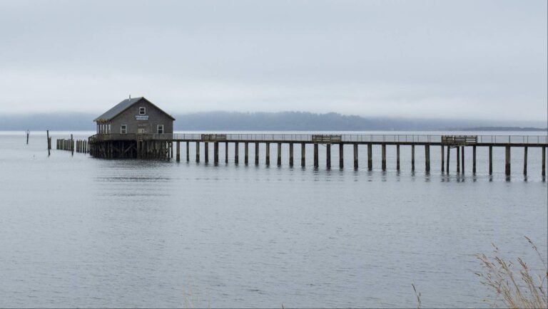
Photo: Bonnie Moreland, Public domain
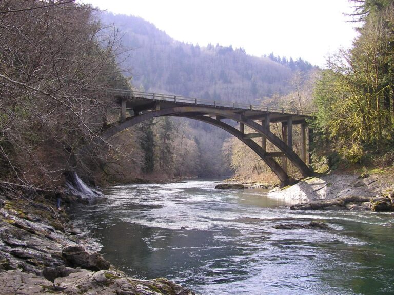
Photo: patti, CC BY-SA 2.0
Your Tillamook County fishing questions, answered
How many boat launches are open in Tillamook County?
55 open launches on the OSMB layer, 36 of them for trailers.
Which reservoir or lake tops Tillamook County by size?
Cape Meares Lake, about 158 acres on its mapped outline.
Which fish lead the water pages near Tillamook County?
Chinook salmon lead the count of water pages within 40 miles, then steelhead, coho salmon and cutthroat trout.
Which Tillamook County stores stock salmon and trout tackle?
6 in all, Tillamook Bait Co first.
Is there a drift-boat or fishing guide listed in Tillamook County?
9 guides and charters work from the county.
Which town is the administrative centre for Tillamook County?
It is Tillamook.
Do I need a license for water in Tillamook County?
Oregon residents pay $50 for the annual angling license, visitors $138. Salmon, steelhead, sturgeon and halibut also go on a Combined Angling Tag ($69 resident). The $9 Ocean Endorsement rides along with the license for ocean fishing beyond salmon and steelhead.
Which counties touch Tillamook County?
Start with Yamhill County, Washington County and Clatsop County.
What zone table do Tillamook County waters use?
The ODFW Northwest Zone rows cover most of the listed water in Tillamook County; a drainage that crosses the line can carry another zone.
Which tournaments run in Tillamook County?
1 event on file from organizer pages, none ahead yet.
Which Tillamook County waters get their own booklet rows?
The 2026 booklet prints 73 water exceptions reaching this county, starting with Cape Meares Lake; the table above shows each.
Where is the bay fishing in Tillamook County?
Nehalem Bay, Nestucca Bay, Netarts Bay and Sand Lake; the coastal table above links the pages.
How many Tillamook County waters are on the stocking schedule?
Yes: 5 waters on the ODFW schedule, such as Cape Meares Lake, Lake Lytle and Town Lake; releases are planned, not confirmed.
Has an ODFW record fish been landed in Tillamook County?
Chum Salmon, 23 lb 0 oz, from Kilchis River (1990).
Plan a day on the water in Tillamook County
Every launch page opens with directions.