Fishing in Powell County, Montana
County seat: Deer Lodge. Census 2020 residents: 6,946.
- 7lake pages
- 5ramps
- 5river pages
 Pick for salmonPiscifun Viper X spinning reel50% OFFSale $39.99
Photo of Blackfoot River: photogramma1, CC BY-SA 2.0
Fishing Powell County in brief
Deer Lodge is where Powell County keeps its offices; the county had 6,946 residents in 2020. Its Gazetteer footprint is 2,326 square miles of land and 6.3 square miles of water. By acreage or outline, Big Salmon Lake tops the 7 lakes and reservoirs with pages. Stream pages for the county: Clark Fork River, Blackfoot River and Little Blackfoot River.
FWP and State Parks together place 5 ramps and 5 other fishing sites in the county. FWP's 2026 plant report lists 7 rows in the county, 58,829 fish across 2 waters. 7 waters here carry their own exception lines in the 2026 book.
U.S. Census Bureau, 2020 Census counts (TIGERweb) and the 2023 Gazetteer, read November 12, 2026. FWP Fishing Access Sites layer (ArcGIS service) and the FishMT site pages, read November 12, 2026.
 For the salmon herePiscifun AlumiX spinning reel46% OFFSale $64.99
A map of the boat ramps and banks of Powell County
FWP Fishing Access Sites layer (ArcGIS service) and the FishMT site pages, read November 12, 2026. Lake pins are the FWP reference point for each water.
Choosing among the Montana lakes of Powell County
| Lake | Size | Access sites | Kind | MFISH lists |
|---|---|---|---|---|
| Big Salmon Lake | 972 acres | 0 | natural lake | bull trout, Westslope cutthroat trout |
| Browns Lake | 516 acres | 1 | natural lake | rainbow trout |
| Nevada Reservoir | 337 acres | 0 | reservoir | rainbow trout, Westslope cutthroat trout, yellow perch |
| Kleinschmidt Lake | 283 acres | 0 | natural lake | brook trout |
| Coopers Lake | 200 acres | 0 | natural lake | brook trout, Westslope cutthroat trout |
| Upsata Lake | 91 acres | 1 | natural lake | rainbow trout, yellow perch |
| Lena Lake | 74 acres | 0 | natural lake | Westslope cutthroat trout |
Size as the FWP FishMT page for this water prints it (FishMT), read November 12, 2026. Waters with no FishMT size print their mapped outline instead. Montana FWP Lakes reference layer (ArcGIS service) and the MFISH fish distribution layers, read November 12, 2026.
Which fish MFISH lists across Powell County waters
The count covers MFISH lists on lakes within 60 miles of Deer Lodge, with rainbow trout in front.
FWP MFISH presence layers, counted per lake page within 60 miles; presence in a layer, not a catch survey. FWP MFISH fish distribution layer (ArcGIS service), read November 12, 2026. Presence is mapping data, not a catch report.
Montana rivers and creeks running through Powell County
- Clark Fork Riverexception rules, 25 access sites, 4 USGS gauges
- Blackfoot Riverexception rules, 11 access sites, 2 USGS gauges
- Little Blackfoot Riverexception rules, 1 access site, 2 USGS gauges
- Monture Creekexception rules, 1 access site
- South Fork Flathead Riverexception rules
How Powell County rivers are running, by gauge
| USGS gauge | Latest reading | Time (ET) |
|---|---|---|
| Clark Fork At Deer Lodge Mt | 205 cfs, 2.81 ft gage height | Nov 14 2:30 pm |
| Clark Fork Ab Little Blackfoot R Nr Garrison Mt | 269 cfs, 3.31 ft gage height | Nov 14 2:45 pm |
| Little Blackfoot River Near Garrison Mt | 73 cfs, 0.71 ft gage height | Nov 14 2:30 pm |
US Geological Survey provisional data, retrieved Nov 14, 2026 3:33 pm ET. Provisional readings can be revised.
Montana FWP MFISH stream layers (ArcGIS service) for this river, read November 12, 2026. USGS Water Data for the Nation, live through the site, retrieved on page view.
Montana boat launches inside Powell County
- Brown's Lake Fishing Access Sitefishing access site, ramp (concrete), concrete surface, 72 acres; Powell County
- Cedar Meadow Fishing Access Site on Blackfoot Riverfishing access site, ramp (primitive), primitive surface, 3 acres; Powell County
- Harry Morgan Fishing Access Site on North Fork Blackfoot Riverfishing access site, ramp (gravel), gravel surface, 64 acres; Powell County
- River Junction Fishing Access Site on Blackfoot Riverfishing access site, ramp (gravel), gravel surface, 179 acres; Powell County
- Upsata Lake Fishing Access Sitefishing access site, ramp (gravel), gravel surface, 151 acres; Powell County
Bank spots within Powell County
- Kohrs Bend Fishing Access Site on Clark Fork Riverfishing access site, hand launch, 8 acres; Powell County
- Monture Creek Fishing Access Sitefishing access site, hand launch, 112 acres; Powell County
- Scotty Brown Bridge Fishing Access Site on Blackfoot Riverfishing access site, hand launch, 1 acres; Powell County
- Little Blackfoot Fishing Access Sitefishing access site, no boat facilities, 3 acres; Powell County
- Racetrack Pond FASfishing access site, no boat facilities; Powell County
FWP Fishing Access Sites layer (ArcGIS service) and the FishMT site pages, read November 12, 2026.
The short list: minor lakes inside Powell County
- Rock Creek Lakeabout 178 acres of mapped outline
- Jones Lakeabout 76 acres of mapped outline
- Evans Lakeabout 70 acres of mapped outline
- Doney Lakeabout 63 acres of mapped outline
- Bandy Reservoirabout 53 acres of mapped outline
- Shoup Lakeabout 41 acres of mapped outline
- Long Lakeabout 39 acres of mapped outline
- Racetrack Pondabout 35 acres of mapped outline
- Mountain Ben Lakeabout 34 acres of mapped outline
- Elliot Lake Upperabout 32 acres of mapped outline
- Lahrity Lakeabout 31 acres of mapped outline
- Doney Lakeabout 27 acres of mapped outline
- Elliot Lake Lowerabout 26 acres of mapped outline
- James Lakeabout 26 acres of mapped outline
- Trask Lakesabout 23 acres of mapped outline
- Caruthers Lakeabout 23 acres of mapped outline
- Mud Lakeabout 21 acres of mapped outline
- Tin Cup Lakeabout 19 acres of mapped outline
- Taylor Reservoir, Upperabout 18 acres of mapped outline
- Martin Lakeabout 18 acres of mapped outline
- Crimson Lakeabout 18 acres of mapped outline
- Tupper Lakeabout 17 acres of mapped outline
- Bowman Lake, Middleabout 15 acres of mapped outline
- Trask Lakesabout 15 acres of mapped outline
- Dolus Lake 4about 14 acres of mapped outline
- Conleys Lakeabout 14 acres of mapped outline
- Elbow Lakeabout 13 acres of mapped outline
- Bowman Lake, Upperabout 13 acres of mapped outline
- Goat Lakeabout 12 acres of mapped outline
- Upper Marshall Creek Lakeabout 11 acres of mapped outline
- Bohn Lakeabout 11 acres of mapped outline
- Kerns Lakeabout 10 acres of mapped outline
Outline area from the FWP Lakes reference layer (ArcGIS service; mapped polygon area, not an FWP surface-acre figure), read November 12, 2026. Names come from the FWP Lakes reference layer; no page and no fish list for these waters.
Exception lines printed for Powell County lakes and streams
The rules here are from the 2026 Montana Fishing Regulations, valid March 1, 2026 through the end of February 2027; FWP had published no 2027 booklet when this was checked.
- Big Salmon LakeClosed to all angling within a 300-yard radius around the inlet (where the creek enters the lake) of Big Salmon Lake. (BIG SALMON LAKE)
- Blackfoot RiverCatch-and-release for cutthroat trout. (BLACKFOOT RIVER AND TRIBUTARIES)
- Clark Fork RiverOpen entire year. (CLARK FORK RIVER)
- Little Blackfoot RiverCatch-and-release for cutthroat trout. (LITTLE BLACKFOOT RIVER AND TRIBUTARIES)
- Monture CreekCatch-and-release for cutthroat trout. (DUNHAM CREEK (tributary to Monture Creek, Blackfoot drainage))
- South Fork Flathead RiverHooks/lures must have single points only, no double or treble hooks. (SOUTH FORK FLATHEAD RIVER)
- Upsata LakeCatch-and-release for bass. (UPSATA LAKE)
2026 Montana Fishing Regulations (valid March 1, 2026 through February 28, 2027; FWP PDF), read November 12, 2026.
Hatchery fish released in Powell County this year
| Date | Water as FishMT prints it | Fish | Species |
|---|---|---|---|
| September 16, 2026 | Browns Lake | 10,400 | Rainbow trout |
| September 16, 2026 | Browns Lake | 13,172 | Rainbow trout |
| September 16, 2026 | Browns Lake | 3,120 | Rainbow trout |
| September 3, 2026 | Browns Lake | 3,462 | Rainbow trout |
| September 3, 2026 | Upsata Lake | 4,000 | Largemouth bass |
| June 17, 2026 | Browns Lake | 9,675 | Rainbow trout |
| June 17, 2026 | Browns Lake | 15,000 | Rainbow trout |
FWP FishMT stocking report for 2026, year to date (FishMT plant report), read November 12, 2026.
Record-book entries from Powell County
| Species | Weight or length as listed | Water | Year | Marked |
|---|---|---|---|---|
| Peamouth | 1.52 lbs. | Clark Fork River | 2007 | native |
Montana state record fish as FWP lists them (records page), read November 12, 2026.
Buying flies inside Powell County
Restocking leaders and line for Powell County
- Rainbow Sporting Goodsbait and tackle shop, Anaconda, 21 miles
- Flint Creek Outdoorsbait and tackle shop, Philipsburg, 27 miles
- Fran Johnson's Sports Shopbait and tackle shop, Butte, 30 miles
- Bob Ward & Sons Inc, 1925 Dewey Blvdbait and tackle shop, Butte, 31 miles
- L&P Grocerybait and tackle shop, Boulder, 31 miles
Montana outfitters who run trips to Powell County
- Five Star Expeditionsfishing guide, Deer Lodge
- North Fork Crossingfishing guide, Ovando, (406) 793-5046
Yellow Pages, State Parks and operator listings (city of business), read November 12, 2026. Guides are listed as businesses; no licence status is implied.
Grouped near Powell County on the Montana map
Montana lodging towns across Powell County
- Deer Lodge2020 count 2,938
Montana counties next to Powell County
- Lewis and Clark County33 miles northeast
- Granite County39 miles southwest
- Missoula County47 miles west
- Deer Lodge County53 miles south
Piscifun kit to stow in the truck for Montana time at Powell County


Piscifun and Amazon links are affiliate links; the site earns a commission on qualifying purchases.
Montana banks and boat docks worth a frame near Powell County
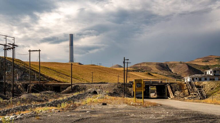
Photo: Mobilus In Mobili, CC BY-SA 2.0

Photo: Bureau of Land Management Montana and Dakotas, Public domain
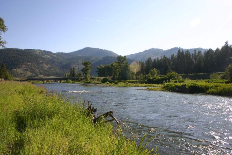
Photo: Scott Shawcroft, CC BY-SA 2.0

Photo: David Wilson, CC BY 2.0
The questions Powell County anglers trade over coffee
How many boat ramps does Powell County have in the FWP data?
The access layers list 5 ramps.
Which water in Powell County has the biggest size figure?
That is Big Salmon Lake, listed at 972 acres.
Which fish lead the MFISH lists near Powell County?
MFISH names rainbow trout on the most lake pages within 60 miles, then Westslope cutthroat trout, brook trout and yellow perch; the layer shows presence, not a catch.
Does Powell County have a marina or bait counter?
None inside the county; the list above holds the closest.
From which town does Powell County govern?
Deer Lodge.
Which licenses should Powell County anglers carry?
Anglers 12 and older buy a Conservation License, an aquatic invasive species pass and a fishing license; the 2026 Montana Fishing Regulations prints $8, $2 and $21 for a resident full season and $10, $7.50 and $100 for a nonresident.
Which counties lie closest to Powell County?
Lewis and Clark County, Granite County and Missoula County sit nearest.
How many fish may I keep in Powell County?
Limits depend on the FWP fishing district and on any exception heading printed for the water; the Western, Central and Eastern district pages on this site give the charts. The rules here are from the 2026 Montana Fishing Regulations, valid March 1, 2026 through the end of February 2027; FWP had published no 2027 booklet when this was checked.
Where do the Montana limits change in Powell County?
7 waters with a page here carry their own exception lines, beginning with Big Salmon Lake.
Which Montana waters in Powell County get hatchery fish?
The 2026 plant report lists 58,829 fish in 7 rows across 2 waters in the county.
Has a Montana state record fish come from Powell County?
Peamouth, 1.52 lbs., from Clark Fork River (2007).
Hitch the boat for Treasure State water in Powell County
Check a water's exception heading before keeping fish.