Fishing in Lewis and Clark County, Montana
County seat: Helena. Census 2020 residents: 70,973.
- 10lake pages
- 9ramps
- 7river pages
 Pick for troutPiscifun Carbon X ultralight spinning reel28% OFFSale $57.99
Photo of Missouri River: Bureau of Land Management Montana and Dakotas, Public domain
Lewis and Clark County water by the FWP numbers
Lewis and Clark County runs its courthouse out of Helena, and the 2020 Census tallied 70,973 residents. Census Gazetteer mapping gives it 3,458 square miles of land and 39.2 square miles of water. Of the 10 lakes and reservoirs given pages in the county, Canyon Ferry Lake spreads widest. Wading anglers can open Missouri River, Blackfoot River and Sun River.
County totals from FWP: 9 ramps and 9 other fishing sites without a ramp. 1,058,314 fish went into 7 waters of the county in 2026, per 79 plant rows. The book breaks from the district chart on 12 waters here.
U.S. Census Bureau, 2020 Census counts (TIGERweb) and the 2023 Gazetteer, read November 12, 2026. FWP Fishing Access Sites layer (ArcGIS service) and the FishMT site pages, read November 12, 2026.
FWP access points and lakes laid out across Lewis and Clark County
FWP Fishing Access Sites layer (ArcGIS service) and the FishMT site pages, read November 12, 2026. Lake pins are the FWP reference point for each water.
Montana reservoirs worth fishing in Lewis and Clark County
| Lake | Size | Access sites | Kind | MFISH lists |
|---|---|---|---|---|
| Canyon Ferry Lake | 33,535 acres | 0 | natural lake | brook trout, brown trout, burbot |
| Holter Reservoir | 3,667 acres | 0 | reservoir | brown trout, burbot, kokanee salmon |
| Hauser Reservoir | 3,200 acres | 2 | reservoir | brown trout, burbot, mountain whitefish |
| Lake Helena | 2,073 acres | 1 | natural lake | brown trout, burbot, mountain whitefish |
| Willow Creek Reservoir (Lewis and Clark County) | 1,314 acres | 1 | reservoir | rainbow trout |
| Gibson Reservoir | 1,289 acres | 0 | reservoir | rainbow trout |
| Upper Holter Lake | 695 acres | 0 | natural lake | brown trout, burbot, mountain whitefish |
| Helena Valley Regulating Reservoir | 553 acres | 1 | reservoir | burbot, kokanee salmon, yellow perch |
| Nilan Reservoir | 521 acres | 1 | reservoir | rainbow trout |
| Spring Meadow Lake | about 14 acres of mapped outline | 0 | natural lake | largemouth bass, pumpkinseed, rainbow trout |
Size as the FWP FishMT page for this water prints it (FishMT), read November 12, 2026. Waters with no FishMT size print their mapped outline instead. Montana FWP Lakes reference layer (ArcGIS service) and the MFISH fish distribution layers, read November 12, 2026.
 For the trout herePiscifun Carbon XT ultralight spinning reel25% OFFSale $59.99
Fish FWP maps most often close to Lewis and Clark County
Lake lists inside 60 miles of Helena mention rainbow trout most often.
FWP MFISH presence layers, counted per lake page within 60 miles; presence in a layer, not a catch survey. FWP MFISH fish distribution layer (ArcGIS service), read November 12, 2026. Presence is mapping data, not a catch report.
Creeks winding through Lewis and Clark County
- Missouri Riverexception rules, 27 access sites, 4 USGS gauges
- Blackfoot Riverexception rules, 11 access sites, 2 USGS gauges
- Sun River3 access sites, 4 USGS gauges
- Little Prickly Pear Creek2 access sites, 1 USGS gauge
- Dearborn Riverexception rules, 1 USGS gauge
- North Fork Sun Riverexception rules, 1 USGS gauge
- South Fork Sun Riverexception rules, 1 USGS gauge
Streamflow numbers recorded in Lewis and Clark County
| USGS gauge | Latest reading | Time (ET) |
|---|---|---|
| Tenmile Creek Near Rimini Mt | 6 cfs, 1.69 ft gage height | Nov 14 2:45 pm |
| Tenmile Creek Near Helena Mt | 11 cfs, 2.45 ft gage height | Nov 14 3:15 pm |
| Missouri River Bl Hauser Dam Near Helena Mt | 3,150 cfs, 3.39 ft gage height | Nov 14 3:00 pm |
US Geological Survey provisional data, retrieved Nov 14, 2026 3:33 pm ET. Provisional readings can be revised.
Montana FWP MFISH stream layers (ArcGIS service) for this river, read November 12, 2026. USGS Water Data for the Nation, live through the site, retrieved on page view.
Public ramps in Lewis and Clark County
- Craig Fishing Access Site on Missouri Riverfishing access site, ramp (concrete), concrete surface, 3 acres; Lewis and Clark County
- Helena Valley Reservoir Fishing Access Site on Helena Valley Regulating Reservoirfishing access site, ramp (gravel), gravel surface, 980 acres; Lewis and Clark County
- Nilan Reservoir Fishing Access Sitefishing access site, ramp (concrete), concrete surface, 10 acres; Lewis and Clark County
- Spite Hill Fishing Access Site on Missouri Riverfishing access site, ramp (gravel), gravel surface, 14 acres; Lewis and Clark County
- Stickney Creek Fishing Access Site on Missouri Riverfishing access site, ramp (concrete), concrete surface, 1 acres; Lewis and Clark County
- Willow Creek Reservoir Fishing Access Sitefishing access site, ramp (concrete), concrete surface, 1395 acres; Lewis and Clark County
- Wolf Creek Bridge Fishing Access Site on Missouri Riverfishing access site, ramp (concrete), concrete surface, 2 acres; Lewis and Clark County
- York Bridge Fishing Access Site on Hauser Reservoirfishing access site, ramp (concrete), concrete surface, 10 acres; Lewis and Clark County
- Black Sandy State Park Boat Rampstate park boat ramp; Lewis and Clark County
Walk-in river access across Lewis and Clark County
- Causeway Fishing Access Site on Hauser Reservoirfishing access site, no boat facilities, 4 acres; Lewis and Clark County
- Dearborn Fishing Access Site on Missouri Riverfishing access site, hand launch, 1 acres; Lewis and Clark County
- Lake Helena Fishing Access Sitefishing access site, no boat facilities, 3 acres; Lewis and Clark County
- Lichen Cliff Fishing Access Site on Little Prickly Pear Creekfishing access site, hand launch, 1 acres; Lewis and Clark County
- Prickly Pear Fishing Access Site on Little Prickly Pear Creekfishing access site, no boat facilities; Lewis and Clark County
- Upper Prickly Pear Fishing Access Sitefishing access site, no boat facilities, 36 acres; Lewis and Clark County
- Bull Pasture Fishing Access Site on Missouri Riverfishing access site, hand launch; Lewis and Clark County
- Eagle Island Fishing Access Site on Missouri Riverfishing access site, no boat facilities, 22 acres; Lewis and Clark County
- Lone Tree Fishing Access Site on Missouri Riverfishing access site, no boat facilities; Lewis and Clark County
FWP Fishing Access Sites layer (ArcGIS service) and the FishMT site pages, read November 12, 2026.
Other named Montana lakes of Lewis and Clark County, one line apiece
- Heart Lakeabout 32 acres of mapped outline
- Parker Lakeabout 19 acres of mapped outline
- Lake Otatsyabout 18 acres of mapped outline
- Camp Lake (Lewis and Clark County)about 16 acres of mapped outline
- Meadow Lake (Lewis and Clark County)about 15 acres of mapped outline
- Bighorn Lake (Lewis and Clark County)about 14 acres of mapped outline
- Canyon Lake (Lewis and Clark County)about 13 acres of mapped outline
- Upper Copper Lakeabout 10 acres of mapped outline
- Bean Lakeabout 206 acres of mapped outline
- Gravelly Range Lakeabout 124 acres of mapped outline
- Chessman Reservoirabout 103 acres of mapped outline
- Anderson Lakeabout 80 acres of mapped outline
- Diversion Lakeabout 75 acres of mapped outline
- Smith Lakeabout 70 acres of mapped outline
- Conners Lakeabout 57 acres of mapped outline
- Meyer Lakeabout 53 acres of mapped outline
- Krone Lakeabout 48 acres of mapped outline
- Beale Lakeabout 30 acres of mapped outline
- Scott Reservoirabout 25 acres of mapped outline
- Bear Lakeabout 25 acres of mapped outline
- Sink Hole Lakeabout 25 acres of mapped outline
- Smith Lakeabout 24 acres of mapped outline
- Stansfield Lakeabout 23 acres of mapped outline
- Pauls Lakeabout 22 acres of mapped outline
- Krohn Lakeabout 21 acres of mapped outline
- Soap Creek Reservoirabout 21 acres of mapped outline
- Wood Lakeabout 20 acres of mapped outline
- Silver King Lakeabout 18 acres of mapped outline
- Nett Reservoirabout 17 acres of mapped outline
- Keep Cool Lakesabout 17 acres of mapped outline
- Asarco Smelter Pondabout 15 acres of mapped outline
- Dry Creek-kerzelok Reservoirabout 14 acres of mapped outline
- Keep Cool Lakeabout 12 acres of mapped outline
- MDT Pondabout 12 acres of mapped outline
- Lake Levaleabout 12 acres of mapped outline
- Hoglund Lakeabout 12 acres of mapped outline
Outline area from the FWP Lakes reference layer (ArcGIS service; mapped polygon area, not an FWP surface-acre figure), read November 12, 2026. Names come from the FWP Lakes reference layer; no page and no fish list for these waters.
Where the regulation book breaks from the district chart in Lewis and Clark County
The rules here are from the 2026 Montana Fishing Regulations, valid March 1, 2026 through the end of February 2027; FWP had published no 2027 booklet when this was checked.
- Blackfoot RiverCatch-and-release for cutthroat trout. (BLACKFOOT RIVER AND TRIBUTARIES)
- Canyon Ferry LakeCatch-and-release for brown trout, except anglers 14 years of age or younger may take 1 brown trout daily and in possession any size. (CANYON FERRY RESERVOIR)
- Dearborn RiverOpen third Saturday in May through Nov. 30. (DEARBORN RIVER)
- Gibson ReservoirCombined trout: 5 daily and in possession. Catch-and-release for arctic grayling. (GIBSON RESERVOIR)
- Hauser ReservoirCombined trout and kokanee salmon: 5 trout and kokanee salmon daily and in combination and 10 trout and kokanee salmon in possession in any combination. (HAUSER RESERVOIR)
- Helena Valley Regulating ReservoirManually operated watercraft and watercraft powered by electric motors only. (HELENA VALLEY REGULATING RESERVOIR)
- Holter ReservoirCatch-and-release for brown trout, except anglers 14 years of age or younger may take 1 brown trout daily and in possession, any size. (HOLTER RESERVOIR)
- Lake HelenaCatch-and-release for brown trout, except anglers 14 years of age or younger may take 1 brown trout daily and in possession, any size. (LAKE HELENA)
- Missouri RiverNorthern pike: no limit. (MISSOURI RIVER)
- North Fork Sun RiverCombined trout: 3 daily and in possession, only 1 over 12 inches, all may be cutthroat trout. (NORTH FORK SUN RIVER AND TRIBUTARIES)
- South Fork Sun RiverCombined trout: 3 daily and in possession only 1 over 12 inches. (SOUTH FORK SUN RIVER AND TRIBUTARIES)
- Spring Meadow LakeCombined trout: 5 daily and in possession. (SPRING MEADOW LAKE)
2026 Montana Fishing Regulations (valid March 1, 2026 through February 28, 2027; FWP PDF), read November 12, 2026.
Fish delivered to Lewis and Clark County waters, per FWP
| Date | Water as FishMT prints it | Fish | Species |
|---|---|---|---|
| October 6, 2026 | Hauser Reservoir | 6,402 | Rainbow trout |
| October 5, 2026 | Canyon Ferry Lake | 15,720 | Rainbow trout |
| October 5, 2026 | Hauser Reservoir | 6,739 | Rainbow trout |
| October 2, 2026 | Canyon Ferry Lake | 13,473 | Rainbow trout |
| October 2, 2026 | Canyon Ferry Lake | 2,329 | Rainbow trout |
| October 2, 2026 | Canyon Ferry Lake | 13,434 | Rainbow trout |
| October 2, 2026 | Canyon Ferry Lake | 11,352 | Rainbow trout |
| October 2, 2026 | Hauser Reservoir | 7,161 | Rainbow trout |
| October 1, 2026 | Canyon Ferry Lake | 12,528 | Rainbow trout |
| October 1, 2026 | Canyon Ferry Lake | 13,489 | Rainbow trout |
FWP FishMT stocking report for 2026, year to date (FishMT plant report), read November 12, 2026.
FWP state records tied to Lewis and Clark County water
| Species | Weight or length as listed | Water | Year | Marked |
|---|---|---|---|---|
| Cisco | 2.08 lbs. | Missouri River | 2014 | not marked native |
| Kokanee salmon | 7.85 lbs. | Hauser Reservoir | 2003 | not marked native |
| Longnose sucker | 4.78 lbs. | Hauser Reservoir | 2022 | native |
| Mountain whitefish | 5.11 lbs. | Hauser Reservoir | 2007 | native |
| Shovelnose sturgeon | 14.125 lbs. | Missouri River | 2010 | native |
| Utah chub | 2.39 lbs. | Canyon Ferry Lake | 2022 | not marked native |
Montana state record fish as FWP lists them (records page), read November 12, 2026.
The weigh-in calendar for Lewis and Clark County
| Date | Event | Water | Organizer |
|---|---|---|---|
| Jan. 23, 2027 | Western Bar Fishing Derby | Willow Creek Reservoir | Western Bar |
| Feb. 6, 2027 | Broadwater County Lions Club | Canyon Ferry Reservoir | Broadwater County Lions Club |
| Feb. 13, 2027 | Montana Ducks Unlimited Ice Fishing Tournament | Canyon Ferry Reservoir | Montana Ducks Unlimited |
| Aug. 14, 2026 | John Arnold Memorial | Hauser Lake | Walleyes Unlimited UMRC |
| July 18, 2026 | Broadwater Rod & Gun Walleye Derby | Canyon Ferry | Broadwater Rod & Gun Club |
| July 11, 2026 | Augusta Kids Fishing Derby | Willow Creek Reservoir | Augusta Area Chamber of Commerice |
| June 26, 2026 | Canyon Fery Walleye Festival | Canyon Ferry | Townsend Area Chamber of Commerce |
| June 26, 2026 | Canyon Ferry Walleye Festival (2026) (result) | Canyon Ferry Lake | Canyon Ferry Walleye Festival (Townsend) |
| June 27, 2025 | Canyon Ferry Walleye Festival (2025) (result) | Canyon Ferry Lake | Canyon Ferry Walleye Festival (Townsend) |
Event as listed by the organizer (source), read November 12, 2026.
Montana tackle shops and guides in Lewis and Clark County
Where to buy flies and jigs near Lewis and Clark County
- Bob Ward & Sons Inc, 3323 Dredge Drbait and tackle shop, Helena
- Capital Sportsbait and tackle shop, Helena
- Cross Currents Orvis Fly Shopfly shop, Wolf Creek
- Crosscurrents Incbait and tackle shop, Wolf Creek
- Git Er Done Baitbait and tackle shop, Helena
- Headhuntersbait and tackle shop, Wolf Creek
- JDR Specialty Tacklebait and tackle shop, Helena
- Sportsman's Warehouse, 2990 N Sanders Stbait and tackle shop, Helena
- The Trout Shopbait and tackle shop, Wolf Creek
- Wolf Creek Anglerbait and tackle shop, Wolf Creek
- Boat Loftmarina, Wolf Creek
- Gates of the Mountains Boat Tours and Marinamarina, Helena
Montana guide services that fish Lewis and Clark County
- Craig Fellin Outfitters & Big Hole Lodgefishing guide, Helena
- CrossCurrents Fly Shop & Outfittersfly fishing guide, Craig
- Dome Mountain Outfittersfishing guide, Helena
- God's Country Outfittersfishing guide, Lincoln, (406) 362-3070
- Iron Wheel Outfittersfishing guide, Helena
- JJJ Wilderness Ranchfishing guide, Augusta
- K Bar L Ranchfishing guide, Augusta
- Living Water Guide Servicefishing guide, East Helena
Yellow Pages, State Parks and operator listings (city of business), read November 12, 2026. Guides are listed as businesses; no licence status is implied.
Minutes from Lewis and Clark County on Montana roads
Montana home bases for fishing Lewis and Clark County
- Helena2020 count 32,091
- Helena Valley Southeast2020 count 9,168
- Helena Valley West Central2020 count 8,670
- Helena Valley Northwest2020 count 4,705
- Helena Valley Northeast2020 count 3,813
- East Helena2020 count 1,944
The Montana counties around Lewis and Clark County
- Powell County33 miles southwest
- Teton County48 miles north
- Cascade County50 miles east
- Broadwater County69 miles southeast
Piscifun rods, reels and pliers worth a look before Montana water at Lewis and Clark County


Piscifun and Amazon links are affiliate links; the site earns a commission on qualifying purchases.
Prairie reservoirs and Rockies lakes by Lewis and Clark County through a lens

Photo: Miroslav Volek, CC BY 2.0
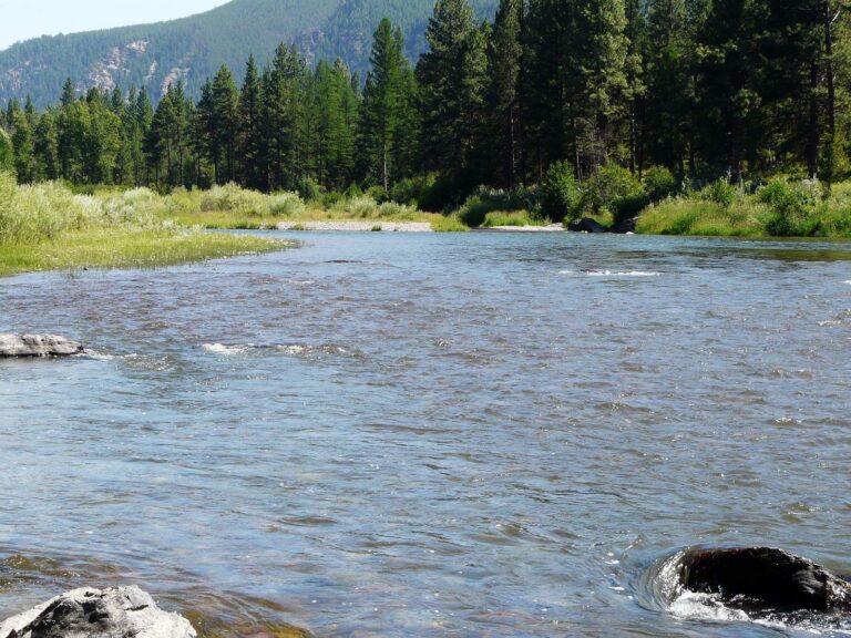
Photo: photogramma1, CC BY-SA 2.0
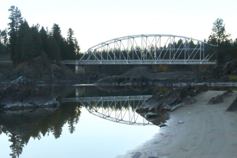
Photo: Luke Detwiler, CC BY 2.0

Photo: Shawn Michael, CC BY 2.0
Short Big Sky replies about fishing Lewis and Clark County
Can a Montana drift boat or kayak go in the water in Lewis and Clark County?
FWP and State Parks list 9 ramps, named above with directions.
Which lake tops the Montana size figures for Lewis and Clark County?
Canyon Ferry Lake, at 33,535 acres.
Which fish does MFISH list near Lewis and Clark County?
MFISH names rainbow trout on the most lake pages within 60 miles, then Westslope cutthroat trout, brook trout and brown trout; the layer shows presence, not a catch.
Is a Montana tackle shop listed in Lewis and Clark County?
14 in all, including Bob Ward & Sons Inc, 3323 Dredge Dr.
Which town is the seat for Lewis and Clark County?
County offices sit in Helena.
How much does FWP charge to fish in Lewis and Clark County?
Anglers 12 and older buy a Conservation License, an aquatic invasive species pass and a fishing license; the 2026 Montana Fishing Regulations prints $8, $2 and $21 for a resident full season and $10, $7.50 and $100 for a nonresident.
Which counties lie next to Lewis and Clark County?
By center point: Powell County, Teton County and Cascade County.
What do the limits look like for Lewis and Clark County water?
Limits depend on the FWP fishing district and on any exception heading printed for the water; the Western, Central and Eastern district pages on this site give the charts. The rules here are from the 2026 Montana Fishing Regulations, valid March 1, 2026 through the end of February 2027; FWP had published no 2027 booklet when this was checked.
Do any Lewis and Clark County waters have their own rules?
12 waters with a page here carry their own exception lines, beginning with Blackfoot River.
Does FWP stock fish in Lewis and Clark County?
The 2026 plant report lists 1,058,314 fish in 79 rows across 7 waters in the county.
Do Montana clubs hold events in Lewis and Clark County?
9 entries on file; the next is Western Bar Fishing Derby on Willow Creek Reservoir, Jan. 23, 2027.
Has Montana's Lewis and Clark County produced a state record?
Cisco, 2.08 lbs., from Missouri River (2014).
Pick a Montana lake or creek in Lewis and Clark County
Open a lake for its ramps, limits and readings.