Fishing in Granite County, Montana
County seat: Philipsburg. Census 2020 residents: 3,309.
- 3lake pages
- 0ramps
- 2river pages
 Pick for troutPiscifun Carbon X ultralight spinning reel28% OFFSale $57.99
Photo of Lake Como: Forest Service Northern Region, CC BY 2.0
Planning a first Montana trip in Granite County
The 2020 count for Granite County was 3,309 people, with Philipsburg as the seat. On the Gazetteer, the county spans 1,727 square miles of land and 5.6 square miles of water. Georgetown Lake leads the 3 lakes and reservoirs covered in Granite County. Flowing water in the county starts with Clark Fork River and Rock Creek (Granite County).
Boat anglers get 0 ramps; bank anglers get 2 other fishing sites. Across 3 waters, FWP recorded 172,835 fish planted here in 2026 (6 rows). Montana's regulation book prints special lines for 3 waters of its waters in the county.
U.S. Census Bureau, 2020 Census counts (TIGERweb) and the 2023 Gazetteer, read November 12, 2026. FWP Fishing Access Sites layer (ArcGIS service) and the FishMT site pages, read November 12, 2026.
Big Sky fishing points marked inside Granite County
FWP Fishing Access Sites layer (ArcGIS service) and the FishMT site pages, read November 12, 2026. Lake pins are the FWP reference point for each water.
Lakes spread across Granite County
| Lake | Size | Access sites | Kind | MFISH lists |
|---|---|---|---|---|
| Georgetown Lake | 2,818 acres | 1 | natural lake | brook trout, kokanee salmon, rainbow trout |
| East Fork Reservoir | 372 acres | 0 | reservoir | brook trout, bull trout, rainbow trout |
| Echo Lake (Granite County) | 102 acres | 0 | natural lake | brook trout, rainbow trout, Westslope cutthroat trout |
Few lakes inside Granite County have a page, so the nearest ones past the line follow, measured from Philipsburg.
| Lake | From Philipsburg | Size | Access sites | Kind | MFISH lists |
|---|---|---|---|---|---|
| Silver Lake (Deer Lodge County) | 12 miles south | 300 acres | 0 | natural lake | bull trout |
| Amc Settling Pond #1 | 27 miles southeast | 293 acres | 0 | pond | brown trout, rainbow trout |
| Amc Settling Pond #2 | 28 miles southeast | 526 acres | 0 | pond | brown trout, rainbow trout |
| Beavertail Pond | 30 miles northwest | 11 acres | 1 | pond | largemouth bass, rainbow trout, Westslope cutthroat trout |
| Nevada Reservoir | 40 miles northeast | 337 acres | 0 | reservoir | rainbow trout, Westslope cutthroat trout, yellow perch |
| Mussigbrod Lake | 40 miles southwest | 105 acres | 0 | natural lake | brook trout, burbot |
Size as the FWP FishMT page for this water prints it (FishMT), read November 12, 2026. Waters with no FishMT size print their mapped outline instead. Montana FWP Lakes reference layer (ArcGIS service) and the MFISH fish distribution layers, read November 12, 2026.
 For the trout herePiscifun Carbon XT ultralight spinning reel25% OFFSale $59.99
Species tallied from MFISH for waters near Granite County
Around Philipsburg, out to 60 miles, Westslope cutthroat trout appears on the most lake lists.
FWP MFISH presence layers, counted per lake page within 60 miles; presence in a layer, not a catch survey. FWP MFISH fish distribution layer (ArcGIS service), read November 12, 2026. Presence is mapping data, not a catch report.
Montana stream pages for Granite County
- Clark Fork Riverexception rules, 25 access sites, 4 USGS gauges
- Rock Creek (Granite County)1 access site, 1 USGS gauge
Live creek and river gauges across Granite County
| USGS gauge | Latest reading | Time (ET) |
|---|---|---|
| Flint Creek At Maxville Mt | 59 cfs, 2.03 ft gage height | Nov 15 3:45 pm |
| Boulder Creek At Maxville Mt | 28 cfs, 1.43 ft gage height | Nov 15 3:30 pm |
US Geological Survey provisional data, retrieved Nov 15, 2026 4:33 pm ET. Provisional readings can be revised.
Montana FWP MFISH stream layers (ArcGIS service) for this river, read November 12, 2026. USGS Water Data for the Nation, live through the site, retrieved on page view.
FWP access sites in Granite County
- Bearmouth Fishing Access Site on Clark Fork Riverfishing access site, no boat facilities, 30 acres; Granite County
- Gillies Bridge Fishing Access Site on Rock Creek (Granite County)fishing access site, hand launch; Granite County
FWP Fishing Access Sites layer (ArcGIS service) and the FishMT site pages, read November 12, 2026.
Mapped but undocumented FWP-layer lakes in Granite County
- Lower Willow Creek Reservoirabout 165 acres of mapped outline
- Fred Burr Lakeabout 143 acres of mapped outline
- Medicine Lakeabout 65 acres of mapped outline
- Big Pozega Lakeabout 53 acres of mapped outline
- Racetrack Lakeabout 45 acres of mapped outline
- Johnson Lakeabout 44 acres of mapped outline
- Unnamed Lakeabout 39 acres of mapped outline
- Fisher Lakeabout 31 acres of mapped outline
- Thornton Lake – Bigabout 30 acres of mapped outline
- Carpp Lakeabout 27 acres of mapped outline
- Edith Lakeabout 24 acres of mapped outline
- Alpine Lakeabout 23 acres of mapped outline
- Tamarack Lakeabout 21 acres of mapped outline
- Moose Lakeabout 20 acres of mapped outline
- Albicaulis Lakeabout 17 acres of mapped outline
- Thompson Lakeabout 16 acres of mapped outline
- Green Lakeabout 15 acres of mapped outline
- Stewart Lakeabout 15 acres of mapped outline
- Gold Creek Lakesabout 15 acres of mapped outline
- Whetstone Lakeabout 14 acres of mapped outline
- Crystal Lakeabout 13 acres of mapped outline
- Sidney Lakeabout 13 acres of mapped outline
- Rainbow Lakeabout 13 acres of mapped outline
- Little Pozega Lakeabout 13 acres of mapped outline
- Meadow Lakesabout 13 acres of mapped outline
- Copper Creek Lake 3about 12 acres of mapped outline
- Gold Bar Lakesabout 12 acres of mapped outline
- Fish Lakeabout 12 acres of mapped outline
- Kaiser Lakeabout 11 acres of mapped outline
- Mud Lakeabout 11 acres of mapped outline
- Conad Pondabout 10 acres of mapped outline
- Fuse Lakeabout 10 acres of mapped outline
- Ivanhoe Lakeabout 10 acres of mapped outline
Outline area from the FWP Lakes reference layer (ArcGIS service; mapped polygon area, not an FWP surface-acre figure), read November 12, 2026. Names come from the FWP Lakes reference layer; no page and no fish list for these waters.
Waters in Granite County with their own regulation lines
The rules here are from the 2026 Montana Fishing Regulations, valid March 1, 2026 through the end of February 2027; FWP had published no 2027 booklet when this was checked.
- Clark Fork RiverOpen entire year. (CLARK FORK RIVER)
- East Fork ReservoirCutthroat trout: 2 daily and in possession, only 1 over 14 inches. (EAST FORK RESERVOIR)
- Georgetown LakeOpen third Saturday in May through March 31, except for the South and East shoreline area which is only open July 1 through March 31. South and East shoreline areas described as follows: all waters from the shore or within 100 yards of shore in the area extending from a point 200 yards west of Lakeside at Georgetown Marina (along the shore, including all of Stuart Mill Bay) to a point 200 yards north from the mouth of North Fork Flint Creek. (GEORGETOWN LAKE)
2026 Montana Fishing Regulations (valid March 1, 2026 through February 28, 2027; FWP PDF), read November 12, 2026.
FWP plants logged for Granite County in 2026
| Date | Water as FishMT prints it | Fish | Species |
|---|---|---|---|
| September 8, 2026 | Echo Lake | 4,031 | Rainbow trout |
| September 8, 2026 | Georgetown Lake | 86,654 | Rainbow trout |
| July 2, 2026 | Georgetown Lake | 10,402 | Rainbow trout |
| June 23, 2026 | Georgetown Lake | 44,226 | Brook trout |
| June 15, 2026 | East Fork Reservoir | 1,050 | Westslope cutthroat trout |
| June 15, 2026 | Georgetown Lake | 26,472 | Rainbow trout |
FWP FishMT stocking report for 2026, year to date (FishMT plant report), read November 12, 2026.
Montana record fish listed near Granite County
| Species | Weight or length as listed | Water | Year | Marked |
|---|---|---|---|---|
| Peamouth | 1.52 lbs. | Clark Fork River | 2007 | native |
Montana state record fish as FWP lists them (records page), read November 12, 2026.
FWP-approved contests fishing Granite County
| Date | Event | Water | Organizer |
|---|---|---|---|
| Jan. 16, 2027 | Central Montana Perch Derby | East Fork Reservoir | Walleye Unlimited – Crooked Creek Chapter |
Event as listed by the organizer (source), read November 12, 2026.
Montana bait counters around Granite County
Bait and fly shops worth a detour before Granite County
- Flint Creek Outdoorsbait and tackle shop, Philipsburg
- Trout Bumsbait and tackle shop, Clinton
Yellow Pages, State Parks and operator listings (city of business), read November 12, 2026. Guides are listed as businesses; no licence status is implied.
Along the same valley as Granite County
Adjoining Granite County
- Deer Lodge County25 miles southeast
- Powell County39 miles northeast
- Ravalli County39 miles southwest
- Missoula County49 miles northwest
Piscifun tackle chosen for a Montana day at Granite County


Piscifun and Amazon links are affiliate links; the site earns a commission on qualifying purchases.
Big Sky shorelines and trout-stream riffles around Granite County, photographed
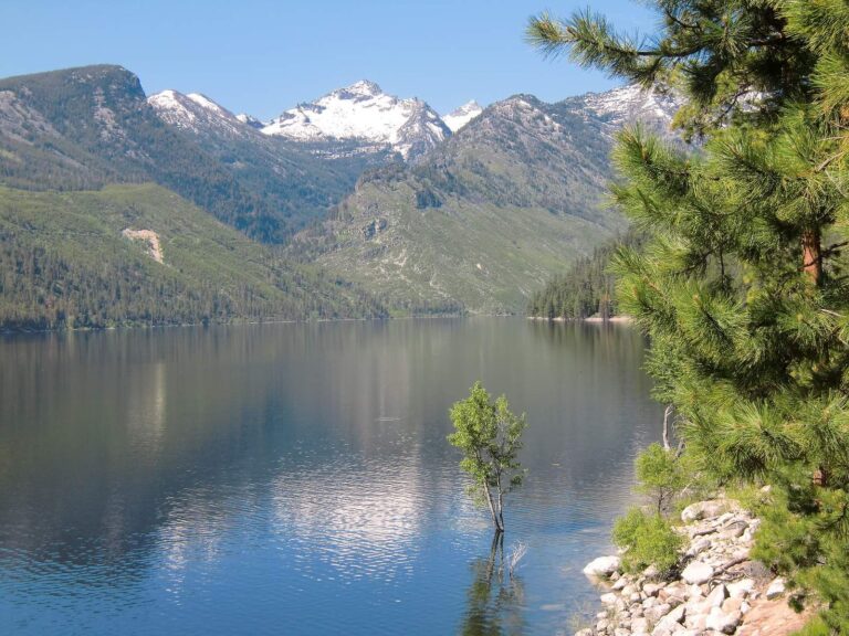
Photo: Forest Service Northern Region, CC BY 2.0
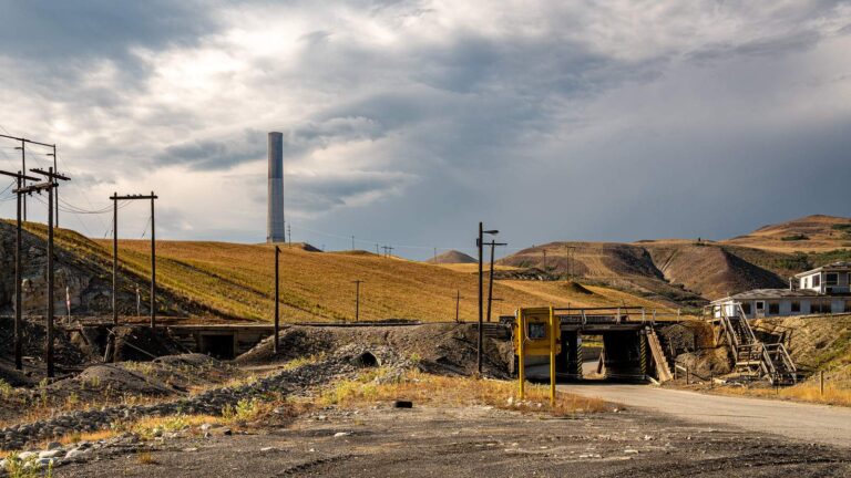
Photo: Mobilus In Mobili, CC BY-SA 2.0
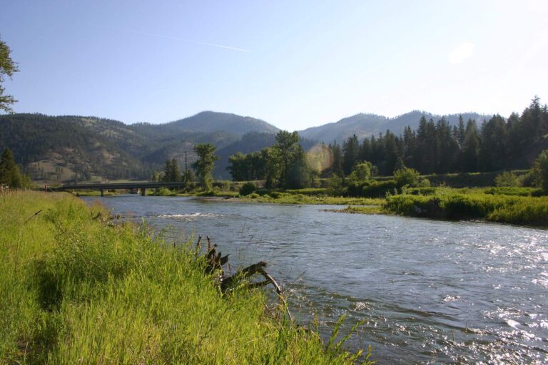
Photo: Scott Shawcroft, CC BY-SA 2.0

Photo: Justin Brockie, CC BY 2.0
Clearing up Montana myths about fishing Granite County
Which Montana ramps serve Granite County?
None in the access data; check one county over.
Which lake in Granite County has the most acreage here?
Georgetown Lake (2,818 acres).
What species does FWP map around Granite County?
MFISH names Westslope cutthroat trout on the most lake pages within 60 miles, then rainbow trout, brook trout and kokanee salmon; the layer shows presence, not a catch.
Which Montana stores in Granite County sell fishing gear?
Flint Creek Outdoors heads a list of 2.
Which town holds the Granite County offices?
That is Philipsburg.
What do I buy before fishing in Granite County?
Anglers 12 and older buy a Conservation License, an aquatic invasive species pass and a fishing license; the 2026 Montana Fishing Regulations prints $8, $2 and $21 for a resident full season and $10, $7.50 and $100 for a nonresident.
Which Montana counties should I check near Granite County?
The closest county pages are Deer Lodge County, Powell County and Ravalli County.
What is the trout limit in Granite County?
Limits depend on the FWP fishing district and on any exception heading printed for the water; the Western, Central and Eastern district pages on this site give the charts. The rules here are from the 2026 Montana Fishing Regulations, valid March 1, 2026 through the end of February 2027; FWP had published no 2027 booklet when this was checked.
Which lakes in Montana's Granite County have special limits?
3 waters with a page here carry their own exception lines, beginning with Clark Fork River.
How many fish did FWP stock in Granite County in 2026?
The 2026 plant report lists 172,835 fish in 6 rows across 3 waters in the county.
Which events fish Granite County lakes?
1 entry on file; the next is Central Montana Perch Derby on East Fork Reservoir, Jan. 16, 2027.
Which FWP records tie to Granite County?
Peamouth, 1.52 lbs., from Clark Fork River (2007).
Plan a Big Sky fishing day in Granite County
Access pages repeat FWP details with directions.