Fishing in Yazoo County, Mississippi
County seat: Yazoo City. Census 2020 residents: 26,743.
- 6named waters
- 6ramps
- 2river pages
 Pick for crappiePiscifun Carbon X ultralight spinning reel19% OFFSale $56.99
Photo of Big Black River: Richard apple, CC BY-SA 3.0
A quick look at the water in Yazoo County
Yazoo County had 26,743 residents in 2020, and its courthouse stands in Yazoo City. Yazoo County covers 922 square miles of land and 11.8 square miles of water by the Gazetteer. Wolf Lake leads the 6 waters mapped for Yazoo County by size. Flowing-water pages open with Big Black River and Yazoo River.
County totals for access: 6 boat ramps and 0 piers and fishing points sites without a ramp. The state line cuts across 2 waters in this county.
U.S. Census Bureau, 2020 Census counts (TIGERweb) and the 2023 Gazetteer, read November 19, 2026. MDWFP Fishing Dashboard boat ramps layer (ArcGIS service), read November 19, 2026. Lanes, hours and fees are not published; the fee type is a label only.
Pin by pin: Yazoo County water on the map
MDWFP Fishing Dashboard boat ramps layer (ArcGIS service), read November 19, 2026. Lanes, hours and fees are not published; the fee type is a label only. Water pins sit at the point MDWFP, MDMR or the USGS gives for each water.
Mississippi: lakes spread across Yazoo County
| Lake | Size | Access points | Kind | Operator or MDWFP label |
|---|---|---|---|---|
| Wolf Lake | 1,000 acres | 2 | lake | Mississippi Department of Wildlife, Fisheries, and Parks |
Acres as stated on the MDWFP lake page for this water (MDWFP lake page), read November 19, 2026. The MDWFP mapped polygon and the USGS outline give different figures, so each is labeled with its source. Waters with no MDWFP acreage show the layer or mapped outline figure instead, never merged. MDWFP record for this water (MDWFP source), read November 19, 2026.
Running water inside Yazoo County
- Big Black River7 access points, 3 USGS gauges, USACE site
- Yazoo River5 access points, 1 USGS gauge, USACE site
MDWFP and MDMR access-point records and USGS or USACE gauge listings for this water (source), read November 19, 2026. No flowline length is published, so none is printed. USGS Water Data for the Nation, live through the site, retrieved on page view.
Mississippi: where boats go in around Yazoo County
- Big Black River Hwy 49 Fishing Areaboat ramp; Yazoo County
- Lake George Landingboat ramp; Yazoo County
- Pat Murphy Landing on Dump Lakeboat ramp; Yazoo County
- Strickland Landing on Deer Bayouboat ramp; Yazoo County
- Wolf Lake Landingboat ramp; Yazoo County
- Yazoo City Landing on Yazoo Riverboat ramp; Yazoo County
MDWFP Fishing Dashboard boat ramps layer (ArcGIS service), read November 19, 2026. Lanes, hours and fees are not published; the fee type is a label only.
Water in Yazoo County that rides on this page
Still water: lakes, ponds and oxbows in Yazoo County
| Water | Kind | Size | MDWFP label | Access | Map pin |
|---|---|---|---|---|---|
| Dump Lake | lake | an NHD outline near 410 acres | not printed | 1 | 32.6486, -90.5971 |
| Lake George | lake | no size printed | not printed | 1 | 32.7366, -90.6083 |
MDWFP record for this water (MDWFP source), read November 19, 2026. Outline area from the USGS National Hydrography Dataset polygon (NHD service; mapped area, not a surveyed surface-acre figure), read November 19, 2026.
Creeks, bayous and rivers in Yazoo County
| Water | Kind | Size | MDWFP label | Access | Map pin |
|---|---|---|---|---|---|
| Deer Bayou | bayou | no size printed | not printed | 1 | 32.8106, -90.5994 |
MDWFP record for this water (MDWFP source), read November 19, 2026. Outline area from the USGS National Hydrography Dataset polygon (NHD service; mapped area, not a surveyed surface-acre figure), read November 19, 2026.
State-record entries near Yazoo County
| Species | Weight as printed | Water | Date | Division |
|---|---|---|---|---|
| Alligator Gar | 234 lbs | Yazoo River | 6/24/2011 | Trophy |
Freshwater records from MDWFP (mdwfp.com) and saltwater records from MDMR (dmr.ms.gov), read November 19, 2026. Angler names are not printed.
Organized events fished in Yazoo County
| Date | Event | Water | Organizer |
|---|---|---|---|
| Aug. 22, 2026 | Magnolia Crappie Club, Wolf Lake (2026-08-22) | Wolf Lake | Magnolia Crappie Club |
Event as listed by the organizer (source), read November 19, 2026.
 For the crappie herePiscifun Carbon XT ultralight spinning reel39% OFFSale $54.99
Mississippi: bait counters around Yazoo County
Mississippi: tackle stops worth a detour before Yazoo County
- Berry'sbait and tackle shop, Benton
Yellow Pages and operator listings (city of business), read November 19, 2026. Guides appear as businesses; no license or permit status is implied.
Sharing the same watershed as Yazoo County
Towns of Yazoo County
- Yazoo City2020 count 10,316
- Benton2020 count 415
What lies next to Yazoo County
- Madison County22 miles out, heading southeast
- Humphreys County26 miles out, heading north
- Sharkey County27 miles out, heading west
- Holmes County30 miles out, heading northeast
Map grouping for Yazoo County
The delta group is a editorial grouping of whole counties, and Yazoo County is inside it.
This week around Yazoo County
Mississippi fishing this week
Mississippi stocking history
Mississippi fish advisories
Piscifun tackle picked for a cypress-bank morning at Yazoo County


Piscifun and Amazon links are affiliate links; the site earns a commission on qualifying purchases.
Cypress banks and red clay shores around Yazoo County, photographed
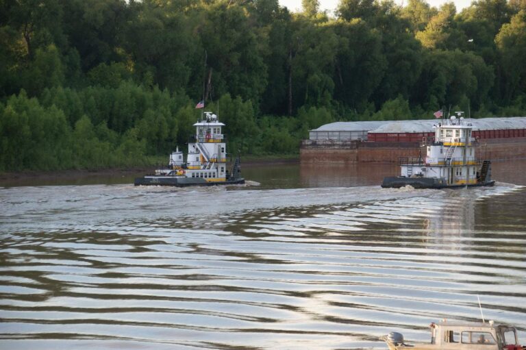
Photo: Michael Gaylard, CC BY 2.0
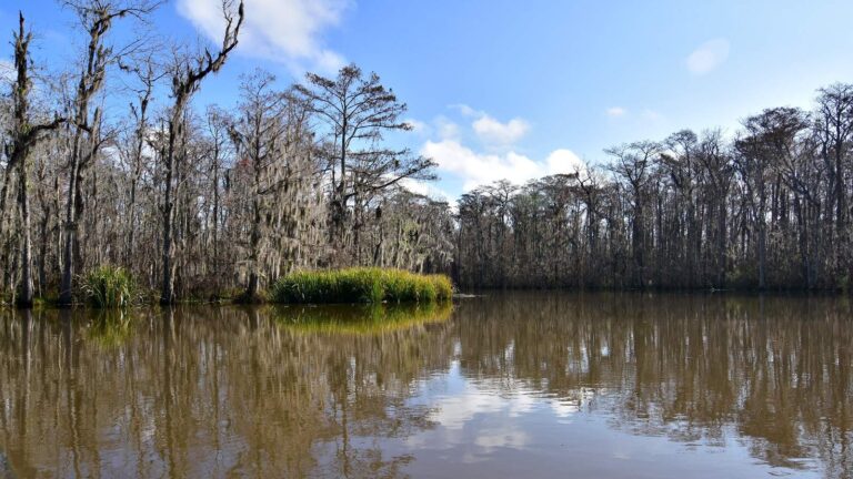
Photo: pedrik, CC BY 2.0
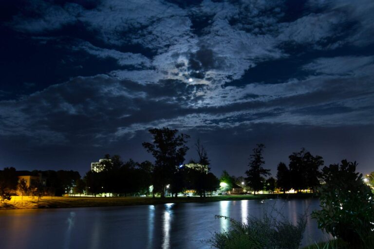
Photo: Tate Nations, CC BY 2.0
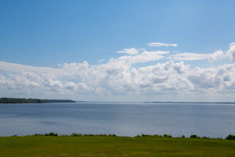
Photo: Tony Webster, CC BY 4.0
Clearing up the questions about water in Yazoo County
Which landings does Yazoo County use?
The launch layers place 6 ramps in the county.
Which water has the most acreage in Yazoo County?
Wolf Lake (1,000 acres).
Does MDWFP list a species for waters in Yazoo County?
MDWFP prints no species list for the county waters; the state record table and the species pages hold the fish information on this site.
Which counters in Yazoo County stock rods and reels?
Berry's opens the list of 1.
Where are the offices of Yazoo County found?
Its seat: Yazoo City.
Which license goes in my wallet for Yazoo County?
Residents 16 through 64 need a license for fresh or marine waters; MDWFP prints $25 for the all-game hunting and freshwater fishing license and $68 for a nonresident freshwater license, fees for agents and processing extra.
After Yazoo County, which county should I open next?
County pages nearest by distance: Madison County, Humphreys County and Sharkey County.
What is the daily limit in Yazoo County?
Limits come from the Rule 1.4 statewide rows unless the water has a row of its own, and a water-specific row replaces the statewide limit for the fish it names; each lake and river page on this site prints its rows. The numbers on this page are MDWFP statewide creel limits as read on Nov. 19, 2026 (Rule 1.4, April 2026); a water with its own rule says so, and no 2027 figure is given.
What of the waters in Yazoo County sit in the tables above?
Yes. All 6 waters named in MDWFP, MDMR and USGS records for the county sit on this page, linked or pinned.
Which tournament organizers use Yazoo County waters?
1 entry on file; nothing is dated later.
Which records tie to Yazoo County?
Alligator Gar, 234 lbs, from Yazoo River (6/24/2011).
Plan a Mississippi fishing day in Yazoo County
Access rows repeat MDWFP and MDMR details with directions.