St. Marys River Fishing
Michigan launches, harbors, bays, limits and charters on St. Marys River.
 Pick for chinook salmonPiscifun Viper X spinning reel50% OFFSale $39.99
Photo of St. Joseph Pier: Ian Rastall, CC0 1.0
St. Marys River: size, ports and fish
St. Marys River is the connecting water that drains Lake Superior past Sault Ste. Marie and the Soo Locks down to Lake Huron. Expect Atlantic, pink and Chinook salmon, walleye, yellow perch, northern pike and lake whitefish on a typical season.
Counties along it include Chippewa County. On the Michigan shore: 7 launches, 3 harbors, 14 bays, 0 river mouths, 1 charters.
 For the chinook salmon herePiscifun AlumiX spinning reel46% OFFSale $64.99
Launch sites along St. Marys River
Boat ramps reaching St. Marys River
- Ashmun Bay Park3 lanes, courtesy pier, Chippewa County
- Aune-Osborn Parkboat ramp, Chippewa County
- Brimley State Park1 lane, 10 trailer spaces, Recreation Passport, Chippewa County
- Charles T. Harvey Boat Access2 lanes, courtesy pier, toilet, Chippewa County
- Conely Point Boat Access2 lanes, 41 trailer spaces, courtesy pier, toilet, Recreation Passport, Chippewa County
- DeTour Village Boat Access2 lanes, 39 trailer spaces, courtesy pier, toilet, Recreation Passport, Chippewa County
- Sugar Island Boat Access1 lane, 7 trailer spaces, courtesy pier, toilet, Recreation Passport, Chippewa County
Public harbors serving St. Marys River
- Lime Island State HarborChippewa County, DNR managed (state owned)
- Sault Ste. Marie Charles T. Harvey MarinaChippewa County, grant in aid
- Sault Ste. Marie George Kemp MarinaChippewa County, grant in aid
Bank fishing on St. Marys River
- Bay Mills, ChippewaShore, pier, boat, 24 hours a day, 7 days a week, fee: No
- St. Mary's River fishing site, City of Sault Sainte Mariebank fishing area
MDNR boat access sites, MDNR harbors layer, MDNR fishing sites, checked October 2026.
Bays to fish on St. Marys River
- Sturgeon BayChippewa County
More named bays: Ashmun Bay, Back Bay, Grand Marais Lake, Izaak Walton Bay, Little Rapids, Maud Bay, Pigeon Cove, Potagannissing Bay, Rabbit Bay, Raber Bay, Scott Bay, Waiska Bay and Walkters Harbor.
USGS GNIS bays and stream mouths assigned to the nearest Michigan Great Lakes assessment unit.
Where St. Marys River stands today
US Army Corps of Engineers, Detroit District (CWMS) reading for Cell Dock Station (Seasonal), recorded October 19, 2026; retrieved October 22, 2026. Values are provisional.
US Army Corps of Engineers, Detroit District (CWMS) reading for Frechette Point Station (Seasonal), recorded October 19, 2026; retrieved October 22, 2026. Values are provisional.
US Army Corps of Engineers, Detroit District (CWMS) reading for Slab Dock Station (Seasonal), recorded October 19, 2026; retrieved October 22, 2026. Values are provisional.
NOAA CO-OPS Great Lakes water levels reading for Little Rapids (IGLD85), recorded October 22, 2026; retrieved October 22, 2026. Values are provisional.
NOAA CO-OPS Great Lakes water levels reading for U.S. Slip (IGLD85), recorded October 22, 2026; retrieved October 22, 2026. Values are provisional.
NOAA CO-OPS Great Lakes water levels reading for S.W. Pier, St. Marys River (IGLD85), recorded October 22, 2026; retrieved October 22, 2026. Values are provisional.
Size and bag limits on St. Marys River
| Species | Where | Limit | Season |
|---|---|---|---|
| Largemouth and smallmouth bass | All waters except Lake St. Clair, St. Clair River and Detroit River (and the Beaver Island Archipelago waters in Note 2) | 5 in any combination; minimum 14 inches | Possession: Sat. before Memorial Day – Dec. 31; catch-and-immediate-release open all year |
| Walleye | Upper Peninsula Great Lakes and inland waters, and St. Marys River | 5; minimum 15 inches | May 15 – March 15 |
| Walleye | Lower Peninsula Great Lakes (except as noted) | 5; minimum 15 inches | Open all year |
| Northern pike | Upper Peninsula Great Lakes and inland waters, and St. Marys River | 2; minimum 24 inches | May 15 – March 15 |
| Northern pike | Lower Peninsula Great Lakes, Lake St. Clair, St. Clair River and Detroit River | 2 (up to 5 pike 24 inches or greater on Lake St. Clair, St. Clair R. and Detroit R.) | Open all year |
| Flathead catfish | Statewide | 5; minimum 15 inches | Open all year |
| Channel catfish | Statewide | 10; minimum 12 inches | Open all year |
| Muskellunge (including tiger muskellunge) | All Great Lakes and inland waters and St. Marys River | Only 1 per angler per license year (April 1 – March 31); mandatory harvest registration within 24 hours; minimum 42 inches (46, 50 or 38 inches on listed waters | Possession: 1st Sat. in June – March 15; catch-and-immediate-release open all year |
| Yellow perch | Statewide (except as noted) | 25 | Open all year |
| Sunfishes (black and white crappie, bluegill, green and hybrid sunfish | Statewide | 25 in any combination of the listed species | Open all year |
| White bass | Great Lakes, Lake St. Clair, St. Marys River, St. Clair River and Detroit River | 25 | Open all year |
| Cisco, lake whitefish, round whitefish | Great Lakes, connecting waters and Type F lakes | 10 in any combination (Lake Superior: up to 10 additional round whitefish) | Open all year |
| Smelt | Statewide | 2 gallons | Open all year (see General Netting Regulations) |
| Burbot | Statewide | 5 | Open all year |
| All other species | Statewide (species not listed, not trout or salmon, not threatened or endangered) | No possession limit | Open all year |
| Trout and salmon (Atlantic, Chinook, coho and pink salmon; brook, brow | Great Lakes, Lake St. Clair, St. Marys River, St. Clair River and Detroit River | 5 total in any combination; no more than 3 of any one species, except up to 5 coho, Chinook or pink salmon. St. Marys River: 5 additional pink salmon from last | Open all year (lake trout and splake by management unit) |
One Michigan all-species license covers the Great Lakes and connecting waters too: $26 a year for residents, $76 for nonresidents or $10 for a single day.
2026 Michigan Fishing Regulations (April 1, 2026 to March 31, 2027), Great Lakes and connecting waters tables. All Michigan limits.
Stocking events in St. Marys River
Plants in St. Marys River: 37 events, 881,516 fish (2024 to 2026).
| Species | Plants | Fish |
|---|---|---|
| Walleye | 8 | 495,397 |
| Atlantic salmon | 11 | 199,744 |
| Lake trout | 4 | 100,275 |
| Rainbow trout | 11 | 62,398 |
| Lake whitefish | 2 | 23,452 |
| Brown trout | 1 | 250 |
Latest plants in St. Marys River
| Date | Species | Strain | Avg length | Number |
|---|---|---|---|---|
| July 23, 2026 | Rainbow trout | 27.9 in | 1,000 | |
| June 16, 2026 | Lake trout | Big (Parry) Sound | 19 in | 24,887 |
| June 15, 2026 | Lake trout | Big (Parry) Sound | 19.1 in | 25,324 |
| June 15, 2026 | Lake trout | Seneca Lake | 19 in | 33,746 |
| June 15, 2026 | Lake trout | Seneca Lake | 19 in | 16,318 |
| June 4, 2026 | Atlantic salmon | 15 in | 21,433 | |
| June 3, 2026 | Atlantic salmon | Landlocked | 20.3 in | 11,904 |
| June 3, 2026 | Atlantic salmon | Landlocked | 20.2 in | 11,582 |
| June 3, 2026 | Atlantic salmon | Landlocked | 19.7 in | 26,290 |
| May 19, 2026 | Rainbow trout | Michigan | 18.8 in | 9,149 |
MDNR Fish Stocking Report table (state, federal and tribal plants), January 2024 to October 2026.
A guided day on St. Marys River
- Blue Heron Charterscharter, Sault Sainte Marie, (906) 635-5134
Marina listings around St. Marys River
- All Star Marine And Power SportsSault Sainte Marie
- C H Marine ServicesSault Sainte Marie
- George Kemp MarinaSault Sainte Marie
Yellow Pages listings; charters matched by name or shore county.
More Great Lakes pages beyond St. Marys River
- Lake Superiorgreat lake
- Lake Michigangreat lake
- Lake Hurongreat lake
- Lake Eriegreat lake
- Lake St. Clairconnecting water
- St. Clair Riverconnecting water
- Detroit Riverconnecting water
What Piscifun sells for St. Marys River anglers


Piscifun and Amazon links are affiliate links; the site earns a commission on qualifying purchases.
Water around St. Marys River as the camera saw it

Photo: Notorious4life ( Uploads ), CC0 1.0


Photo: Sandysphotos2009, CC BY 2.0

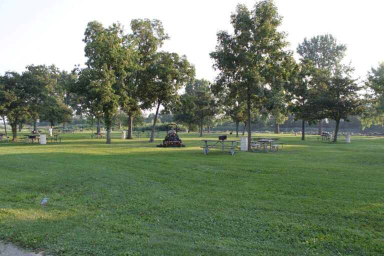
Photo: Dwight Burdette, CC BY 3.0

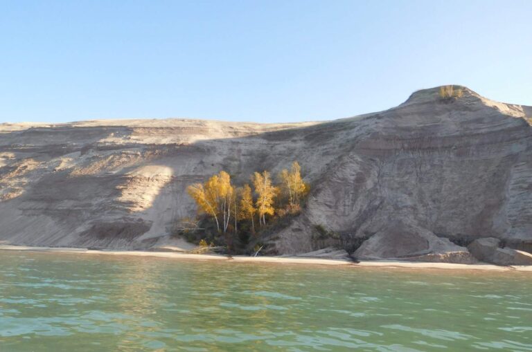
Photo: NPS, Public domain

Things to settle before fishing St. Marys River
Do I need a separate license for St. Marys River?
One Michigan all-species license covers the Great Lakes and connecting waters too: $26 a year for residents, $76 for nonresidents or $10 for a single day.
How many public ramps serve St. Marys River?
7 public launches and 3 harbors are listed on this page, busiest counties Chippewa.
What does St. Marys River hold?
Atlantic, pink and Chinook salmon, walleye, yellow perch, northern pike and lake whitefish.
Where are the river mouths on St. Marys River?
No Michigan stream mouths are listed for it on this page.
Who runs charters on St. Marys River?
1 charter listings, mostly out of Sault Sainte Marie.
How many walleye can I keep from St. Marys River?
5; minimum 15 inches; May 15 – March 15.
Which stations track the level of St. Marys River?
6 level stations on this page show dated readings from NOAA or the Corps of Engineers.
What does the MDNR plant in St. Marys River?
37 plants from 2024 to 2026 are on file, mostly rainbow trout, atlantic salmon and walleye.
Is St. Marys River a Great Lake or a river?
A connecting water: the connecting water that drains Lake Superior past Sault Ste. Marie and the Soo Locks down to Lake Huron.
Head for the shore of St. Marys River
Choose a harbor, then read the limit table.