Lake St. Clair Fishing
Michigan launches, harbors, bays, limits and charters on Lake St. Clair.
 Pick for muskellungePiscifun Viper X spinning reel50% OFFSale $39.99
Photo of St. Joseph Pier: Ian Rastall, CC0 1.0
A first look at Lake St. Clair for anglers
Lake St. Clair is the shallow lake between the St. Clair and Detroit rivers, part of the connecting waters between Lake Huron and Lake Erie. The catch here centers on muskellunge, smallmouth bass, walleye and yellow perch.
Launches here sit in Macomb County, St. Clair County and Wayne County. On the Michigan shore: 7 launches, 5 harbors, 65 bays, 15 river mouths, 7 charters.
 For the muskellunge herePiscifun AlumiX spinning reel46% OFFSale $64.99
Launch sites along Lake St. Clair
Launch sites serving Lake St. Clair
- Brandenburg Memorial Parkboat ramp, Macomb County
- Clinton River Cut Off Boat Access6 lanes, 166 trailer spaces, courtesy pier, toilet, Recreation Passport, Macomb County
- Harley Ensign Memorial Boat Accessboat ramp, 323 trailer spaces, courtesy pier, toilet, Recreation Passport, Macomb County
- Metro Beach Metro Park Westboat ramp, Macomb County
- Selfridge Boat Accessboat ramp, 197 trailer spaces, courtesy pier, toilet, Recreation Passport, Macomb County
- Deckers Landing2 lanes, 30 trailer spaces, courtesy pier, toilet, Recreation Passport, St. Clair County
- Fair Haven Boat Access3 lanes, 52 trailer spaces, courtesy pier, toilet, Recreation Passport, St. Clair County
Harbors of refuge on Lake St. Clair
- Detroit Erma Henderson ParkWayne County, grant in aid
- Grayhaven State HarborWayne County, DNR managed (state owned)
- Metro Beach Metropark MarinaMacomb County, grant in aid
- Mt. Clemens Harbor of RefugeMacomb County, Federal
- St. Clair Shores Harbor of RefugeMacomb County, Federal
MDNR boat access sites, MDNR harbors layer, MDNR fishing sites, checked October 2026.
Where streams meet Lake St. Clair
- Anchor BaySt. Clair County
Other bays on file: Baltimore Channel, Baltimore Highway, Bedford Highway, Belt Highway, Belvidere Bay, Big Fisher Highway, Big Muscamoot Bay, Blind Indian Creek, Bouvier Bay, Broad Cut, Broad Cut Highway, Bryant Highway, Campau Bay, Canoe Highway, Chenal A Bout Rond, Chene Highway, Craig Highway, Dandron Highway, Doty Highway, Drouard Bay, Fisher Bay, Fords Cove, Genow Creek Highway, Goose Bay, Grummond Highway, Horseshoe Canal, Hurlburt Highway, Ives Highway, Johnnies Highway, Joy Highway, L'anse Creuse Bay, Lands End Highway, Little Fisher Highway, Little Muscamoot Bay, Log Highway, Long Point Bay, Lower Branch, Maybury Highway, Mervue Highway and Moross Highway.
River mouths along Lake St. Clair
- Auvase CreekMacomb County
- Chapaton DrainMacomb County
- Clinton RiverMacomb County
- Crapaud CreekMacomb County
- Fox CreekWayne County
- Marsac CreekSt. Clair County
- Meldrum DrainMacomb County
- Middle Channel Saint Clair RiverSt. Clair County
- Milk RiverWayne County
- North Channel Saint Clair RiverSt. Clair County
- Peltier DrainMacomb County
- Salt River, Midland CountyMacomb County
- South Channel Saint Clair RiverSt. Clair County
- Swan Creek, Allegan CountySt. Clair County
- Tebo DrainMacomb County
USGS GNIS bays and stream mouths assigned to the nearest Michigan Great Lakes assessment unit.
Where Lake St. Clair stands today
US Army Corps of Engineers, Detroit District (CWMS) reading for Lake St Clair (IGLD85), recorded October 21, 2026; retrieved October 22, 2026. Values are provisional.
NOAA CO-OPS Great Lakes water levels reading for St Clair Shores (IGLD85), recorded October 22, 2026; retrieved October 22, 2026. Values are provisional.
NOAA CO-OPS Great Lakes water levels reading for Windmill Point (IGLD85), recorded October 22, 2026; retrieved October 22, 2026. Values are provisional.
Size and bag limits on Lake St. Clair
| Species | Where | Limit | Season |
|---|---|---|---|
| Largemouth and smallmouth bass | All waters except Lake St. Clair, St. Clair River and Detroit River (and the Beaver Island Archipelago waters in Note 2) | 5 in any combination; minimum 14 inches | Possession: Sat. before Memorial Day – Dec. 31; catch-and-immediate-release open all year |
| Largemouth and smallmouth bass | Lake St. Clair, St. Clair River, Detroit River | 5 in any combination; minimum 14 inches | Possession: 3rd Sat. in June – Dec. 31; catch-and-immediate-release open all year |
| Walleye | Upper Peninsula Great Lakes and inland waters, and St. Marys River | 5; minimum 15 inches | May 15 – March 15 |
| Walleye | Lower Peninsula Great Lakes (except as noted) | 5; minimum 15 inches | Open all year |
| Walleye | Lake Erie, Detroit River, Lake St. Clair and St. Clair River | 6 (through April 30, 2026; updated by May 1 annually); minimum 15 inches | Open all year |
| Northern pike | Upper Peninsula Great Lakes and inland waters, and St. Marys River | 2; minimum 24 inches | May 15 – March 15 |
| Northern pike | Lower Peninsula Great Lakes, Lake St. Clair, St. Clair River and Detroit River | 2 (up to 5 pike 24 inches or greater on Lake St. Clair, St. Clair R. and Detroit R.) | Open all year |
| Flathead catfish | Statewide | 5; minimum 15 inches | Open all year |
| Channel catfish | Statewide | 10; minimum 12 inches | Open all year |
| Muskellunge (including tiger muskellunge) | All Great Lakes and inland waters and St. Marys River | Only 1 per angler per license year (April 1 – March 31); mandatory harvest registration within 24 hours; minimum 42 inches (46, 50 or 38 inches on listed waters | Possession: 1st Sat. in June – March 15; catch-and-immediate-release open all year |
| Muskellunge (including tiger muskellunge) | Lake St. Clair, St. Clair River and Detroit River | Only 1 per angler per license year; mandatory harvest registration; minimum 42 inches | Possession: 1st Sat. in June – Dec. 31; catch-and-immediate-release open all year |
| Yellow perch | Statewide (except as noted) | 25 | Open all year |
| Sunfishes (black and white crappie, bluegill, green and hybrid sunfish | Statewide | 25 in any combination of the listed species | Open all year |
| White bass | Great Lakes, Lake St. Clair, St. Marys River, St. Clair River and Detroit River | 25 | Open all year |
| Cisco, lake whitefish, round whitefish | Great Lakes, connecting waters and Type F lakes | 10 in any combination (Lake Superior: up to 10 additional round whitefish) | Open all year |
| Smelt | Statewide | 2 gallons | Open all year (see General Netting Regulations) |
| Burbot | Statewide | 5 | Open all year |
| All other species | Statewide (species not listed, not trout or salmon, not threatened or endangered) | No possession limit | Open all year |
| Trout and salmon (Atlantic, Chinook, coho and pink salmon; brook, brow | Great Lakes, Lake St. Clair, St. Marys River, St. Clair River and Detroit River | 5 total in any combination; no more than 3 of any one species, except up to 5 coho, Chinook or pink salmon. St. Marys River: 5 additional pink salmon from last | Open all year (lake trout and splake by management unit) |
One Michigan all-species license covers the Great Lakes and connecting waters too: $26 a year for residents, $76 for nonresidents or $10 for a single day.
2026 Michigan Fishing Regulations (April 1, 2026 to March 31, 2027), Great Lakes and connecting waters tables. All Michigan limits.
Hiring a guide for Lake St. Clair
- Charters by Gregcharter, Belleville, (734) 796-4948
- Northbay Charterscharter, Casco, (586) 727-4991
- Fish-N-Fun Chartercharter, Detroit, (313) 882-3018
- lake St Clair Fishing Guide Servicecharter, Goodells, (810) 531-2191
- Captain Steve Jones Charterscharter, Harrison Township, (586) 469-2070
- Mr. Muskie Charterscharter, Saint Clair Shores, (586) 771-8817
- Fish Headz Sport Fishing Chartercharter, st. clair shores, (586) 243-0914
Shore marinas for Lake St. Clair
- Sassy MarinaAlgonac
- Eds Auto & Boat ServiceAllenton
- Captain's Cove Marina IncChesterfield
- L And M MarineChesterfield
- Marina Salty DogChesterfield
- Sun Up MarinaChesterfield
- Cuthbertson MarineClay
- Specialized Boat CareDearborn
- Custom EnterprisesDetroit
- Grayhaven State HarborDetroit
- Harbor Hill MarinaDetroit
- Henderson MarinaDetroit
- Johnny's Boat Propeller ServiceDetroit
- Riverside Marina Gas StationDetroit
- Safe Harbor Detroit RiverDetroit
- Worthy MarineDetroit
- Mayea MarinaFair Haven
- Molnar LeasingGibraltar
- StowawayGibraltar
- Dieball SailingGrosse Ile
- Grosse Ile Community Recreation DepartmentGrosse Ile
- Bay Harbor FiberglassHarrison Township
- Beacon Cove MarinaHarrison Township
- Blue Lagoon MarinaHarrison Township
- Boatworks MarinaHarrison Township
- Bryers Cottage MarinaHarrison Township
- Bumpers Landing Boat ClubHarrison Township
- Dockside Canvas Co.Harrison Township
- Duffy's LandingHarrison Township
- Grand Pointe MarinaHarrison Township
Yellow Pages listings; charters matched by name or shore county.
Neighbors of Lake St. Clair on the big lakes
- Lake Superiorgreat lake
- Lake Michigangreat lake
- Lake Hurongreat lake
- Lake Eriegreat lake
- St. Marys Riverconnecting water
- St. Clair Riverconnecting water
- Detroit Riverconnecting water
Reels and a weigh-scale grip for Lake St. Clair


Piscifun and Amazon links are affiliate links; the site earns a commission on qualifying purchases.
Michigan shorelines close to Lake St. Clair, in pictures

Photo: Notorious4life ( Uploads ), CC0 1.0


Photo: Sandysphotos2009, CC BY 2.0

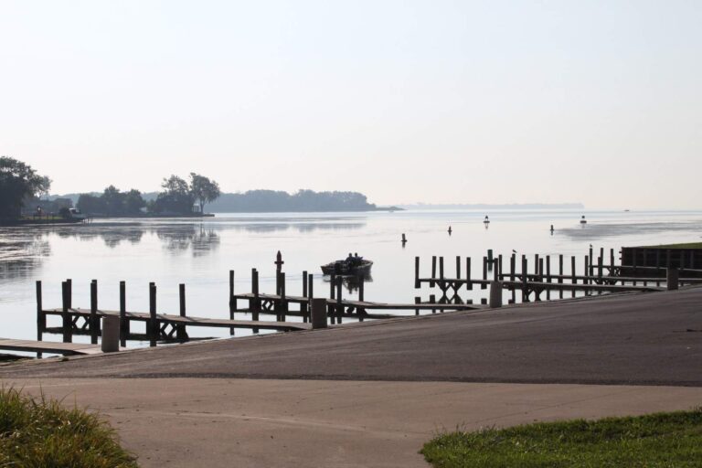
Photo: Dwight Burdette, CC BY 3.0

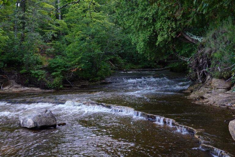
Photo: Clockman26, CC BY-SA 4.0

What to know ahead of a day at Lake St. Clair
Which license covers Lake St. Clair?
One Michigan all-species license covers the Great Lakes and connecting waters too: $26 a year for residents, $76 for nonresidents or $10 for a single day.
How many launches reach Lake St. Clair from Michigan?
7 public launches and 5 harbors are listed on this page, busiest counties Macomb and St. Clair.
What fish do anglers catch in Lake St. Clair?
Muskellunge, smallmouth bass, walleye and yellow perch.
Which rivers flow into Lake St. Clair?
15 stream mouths are listed, among them Auvase Creek, Chapaton Drain and Clinton River.
Is a Michigan charter boat available for Lake St. Clair?
7 charter listings, mostly out of Belleville, Casco and Detroit.
What is the walleye limit on Lake St. Clair?
6 (through April 30, 2026; updated by May 1 annually); minimum 15 inches; Open all year.
Where can I check the water level of Lake St. Clair?
3 level stations on this page show dated readings from NOAA or the Corps of Engineers.
Has the MDNR stocked Lake St. Clair recently?
No plants are logged for it in the MDNR table for 2024 to 2026.
Is Lake St. Clair a Great Lake or a river?
A connecting water: the shallow lake between the St. Clair and Detroit rivers, part of the connecting waters between Lake Huron and Lake Erie.
Plan a Michigan trip to Lake St. Clair
Pick a launch above and check the unit limits first.