Fishing in York County, Maine
County seat: Alfred. Census 2020 residents: 211,972.
- 472named waters
- 21ramps
- 1river pages
 Pick for brown troutPiscifun Carbon X ultralight spinning reel28% OFFSale $57.99
Photo of Saco River: Jack Flanagan, CC BY 2.0
An overview of the Maine ponds and rivers in York County
The 2020 Census found 211,972 residents across York County; its seat is Alfred. Bureau figures for the county read 991 square miles of land and 278.5 square miles of water. The county map holds 472 waters; Great East Lake takes the most room. Brooks and rivers with their own page here include Saco River.
Within county bounds the layers show 21 boat ramps, besides 60 other fishing points mapped sites that lack a ramp. The Heritage Fish program counts 4 waters inside the county line. The MDIFW schedule and the MDIFW reports give stocking dates for 2 events in York County.
U.S. Census Bureau, 2020 Census counts (TIGERweb) and the 2023 Gazetteer, read November 18, 2026. Maine GeoLibrary boat launches layer (ArcGIS service), read November 18, 2026.
Stocking dates on record for York County
- Horne PondNov. 13, 2026, Brown trout, 50 printed, 17 in., Limington, stocked, per the 2026 year-to-date report (preliminary receipt data)
- Wilson LakeNov. 13, 2026, Brown trout, 25 printed, 17 in., Acton, stocked, per the 2026 year-to-date report (preliminary receipt data)
Maine stocking this week and the week-ahead outlook
MDIFW 2026 year-to-date stocking report (MDIFW report), preliminary receipt data as of Nov. 17, 2026, read November 18, 2026. Dates, sizes and counts are as printed; the report may be corrected after review.
 For the brown trout herePiscifun Carbon XT ultralight spinning reel25% OFFSale $59.99
Each mapped pond, brook and ramp across York County
Maine GeoLibrary boat launches layer (ArcGIS service), read November 18, 2026. Water pins sit at the point MDIFW or the USGS gives for each water.
Still water in York County, woods road to coast
| Lake | Size | Access points | Kind | Fish the MDIFW lists |
|---|---|---|---|---|
| Mousam Lake | 982 acres | 0 | lake | none listed |
| Square Pond | 877 acres | 1 | pond | none listed |
| Little Ossipee Lake | 563 acres | 1 | lake | none listed |
| Wilson Lake | 308 acres | 0 | lake | brown trout, brook trout, golden shiner |
| Long Pond (Parsonsfield, York County) | 263 acres | 1 | pond | brown trout, brook trout, golden shiner |
| Adams Pond (York County) | 228 acres | 0 | pond | brook trout, common shiner, smallmouth bass |
| Kennebunk Pond | 199 acres | 0 | pond | brown trout, brook trout, white sucker |
| Horne Pond | 139 acres | 1 | pond | brown trout, brook trout, golden shiner |
| York Pond (York County) | 48 acres | 0 | pond | brook trout, chain pickerel, largemouth bass |
| Alewife Pond | 42 acres | 0 | pond | brook trout, brown bullhead, largemouth bass |
| Symmes Pond | 37 acres | 0 | pond | yellow perch, white sucker, chain pickerel |
| Isinglass Pond | 28 acres | 0 | pond | brook trout, white sucker, yellow perch |
| Deer Pond (York County) | 27 acres | 0 | pond | brown trout, rainbow trout, golden shiner |
| Moose Pond (York County) | 26 acres | 0 | pond | brown trout, brook trout, golden shiner |
| Parker Pond (York County) | 25 acres | 0 | pond | brook trout, brown bullhead, largemouth bass |
| Littlefield Pond (York County) | 21 acres | 0 | pond | brook trout, largemouth bass, golden shiner |
| Milliken Mills Pond | 5.4 acres | 0 | pond | brook trout, white sucker, largemouth bass |
| Round Pond (Lyman, York County) | 3.9 acres | 0 | pond | brook trout, white sucker, golden shiner |
| Wilcox Pond | 3.9 acres | 0 | pond | brook trout, banded killifish, threespine stickleback |
Surface acres from the MDIFW MaineLakes polygon layer for this water (ArcGIS service; geodesic acres of the mapped outline), read November 18, 2026. Waters with no acreage in the MDIFW record show their mapped outline instead. MDIFW MaineLakes layer record for this water (ArcGIS service), read November 18, 2026.
In Maine, moving water in York County
- Saco River7 access points, 1 USGS gauge, dated stocking rows
Gauges and tide stations in York County
USGS has no current reading for these gauges.
USGS National Hydrography Dataset record for this river (NHD service), read November 18, 2026. Length is the NHD flowline length inside Maine, not a fishable length. USGS Water Data for the Nation, live through the site, retrieved on page view.
What MDIFW names most often in York County
Bars count the 71 waters here where MDIFW lists the fish as present; chain pickerel leads.
MDIFW Popular Fish Species lists, counted per water; presence in the list is not a catch survey. Species named on the MDIFW lake survey map (map PDF), read November 18, 2026. A listed species was recorded for that survey, not reported as a catch.
In Maine, launch ramps across York County
- Great East Lake (Acton) Fishing Areatrailer ramp, freshwater, hard surface; York County
- Horn Pond (Acton) Fishing Areatrailer ramp, freshwater, hard surface; York County
- Horne Pond (Limington) Fishing Areatrailer ramp, freshwater, hard surface; York County
- Little Ossipee Flowage (Limerick) Fishing Area on Lake Arrowheadtrailer ramp, freshwater, hard surface; York County
- Little Ossipee Pond (Waterboro) Fishing Area on Little Ossipee Laketrailer ramp, freshwater, hard surface; York County
- Long Pond (Parsonsfield) Fishing Areatrailer ramp, freshwater, hard surface; York County
- Mousam Lake (Shapleigh) Fishing Area on Mousam Rivertrailer ramp, freshwater, hard surface; York County
- Piscataqua River (Eliot) Fishing Areatrailer ramp, all-tide ramp, hard surface; York County
- Piscataqua River (Kittery) Fishing Areatrailer ramp, all-tide ramp, hard surface; York County
- Piscataqua River (South Berwick) Fishing Areatrailer ramp, part-tide ramp, hard surface; York County
- Saco River (Biddeford) Fishing Area (east)trailer ramp, all-tide ramp, hard surface; York County
- Saco River (Biddeford) Fishing Area (west)trailer ramp, freshwater, hard surface; York County
- Saco River (Dayton) Fishing Areatrailer ramp, freshwater, gravel surface; York County
- Saco River (Dayton) Fishing Areatrailer ramp, freshwater, hard surface; York County
- Saco River (Saco) Fishing Area (east)trailer ramp, all-tide ramp, hard surface; York County
- Saco River (Saco) Fishing Area (west)trailer ramp, freshwater, hard surface; York County
- Sokokis Lake (Limerick) Fishing Areatrailer ramp, freshwater, hard surface; York County
- Spicer Pond (Shapleigh) Fishing Areacarry-in access; York County
- Square Pond (Acton) Fishing Areatrailer ramp, freshwater, hard surface; York County
- Webhannet River (Wells) Fishing Areatrailer ramp, part-tide ramp, hard surface; York County
- York Harbor (York)carry-in access; York County
Down East or North Woods: docks and piers in York County
- Barter's Creek Right-of-Way Fishing Area on Piscataqua Rivercoastal public access site; York County
- Bayview Beach on Saco Rivercoastal public access site; York County
- Beach Street Bridgecoastal public access site; York County
- Brave Boat Tidal Creek Fishing Accesscoastal public access site; York County
- Breakwater/Colony Beachcoastal public access site; York County
- Bridle Path Fishing Areacoastal public access site; York County
- Butler Preserve Fishing Areacoastal public access site; York County
- Camp Ellis Fishing Area on Saco Rivercoastal public access site, pier or wharf; York County
- Causeway Launching Areacoastal public access site; York County
- Counting House Parkcoastal public access site; York County
- Cutts Island Trail Fishing Areacoastal public access site; York County
- Eliot Municipal Sites Fishing Area on Piscataqua Rivercoastal public access site; York County
- Ferry Beach State Park on Saco Rivercoastal public access site; York County
- Footbridge Beachcoastal public access site; York County
- Footbridge Boat Rampcoastal public access site; York County
- Fort Foster Parkcoastal public access site, pier or wharf; York County
- Gil Boucher Park-Biddeford Pool Beachcoastal public access site; York County
- Goosefare Brook Fishing Accesscoastal public access site; York County
- Government Street Town Pier on Piscataqua Rivercoastal public access site, pier or wharf; York County
- Harbor Beach on York Harborcoastal public access site; York County
- Kinney Shores Beach on Saco Rivercoastal public access site; York County
- Kittery Point Town Pier and Boat Ramp on Piscataqua Rivercoastal public access site, pier or wharf; York County
- Little Beachcoastal public access site; York County
- Long Sands Beachcoastal public access site; York County
Maine GeoLibrary boat launches layer (ArcGIS service), read November 18, 2026.
Waters in York County that sit on this page instead of having their own
Maine lakes and ponds in York County
| Water | Kind | Size | Fish the MDIFW lists | Access | Map pin |
|---|---|---|---|---|---|
| Great East Lake | lake | 1,825 acres | lake trout (togue), chain pickerel, brown trout, rainbow trout | 1 | 43.5819, -70.9724 |
| Province Lake | lake | 968 acres | smallmouth bass, white sucker, largemouth bass, brown bullhead | 0 | 43.6907, -70.9947 |
| Lake Arrowhead | lake | 780 acres | smallmouth bass, brown bullhead, largemouth bass, white perch | 1 | 43.6569, -70.7415 |
| Northeast Pond (York County) | pond | 645 acres | none listed | 0 | 43.4508, -70.9620 |
| Balch Pond | pond | 577 acres | smallmouth bass, largemouth bass, golden shiner, white perch | 0 | 43.6158, -70.9717 |
| Skelton Flowage | reservoir | 436 acres | none listed | 0 | 43.5858, -70.5670 |
| Bunganut Pond | pond | 303 acres | none listed | 0 | 43.5071, -70.6998 |
| Roberts Pond (York County) | pond | 298 acres | smallmouth bass, white sucker, largemouth bass, creek chubsucker | 0 | 43.5363, -70.6420 |
| Milton Pond | pond | 270 acres | none listed | 0 | 43.4241, -70.9783 |
| Horn Pond (York County) | pond | 227 acres | landlocked salmon, brown trout, golden shiner, rainbow trout | 1 | 43.5620, -70.9599 |
| Bauneg Beg Pond | pond | 179 acres | smallmouth bass, white sucker, largemouth bass, golden shiner | 0 | 43.3649, -70.7388 |
| Holland Pond (York County) | pond | 172 acres | smallmouth bass, largemouth bass, yellow perch, white sucker | 0 | 43.7039, -70.7955 |
| Estes Lake | lake | 170 acres | smallmouth bass, white sucker, largemouth bass, brown bullhead | 0 | 43.4256, -70.6764 |
| Bell Marsh | lake | 170 acres | brook trout, brown bullhead, rainbow smelt, banded killifish | 0 | 43.2014, -70.7233 |
| West Pond | pond | 167 acres | smallmouth bass, largemouth bass, golden shiner, white perch | 0 | 43.7530, -70.8726 |
| Big Poverty Pond | pond | 147 acres | largemouth bass, white perch, golden shiner, yellow perch | 0 | 43.6261, -70.8291 |
| Murdock Lake | lake | 144 acres | largemouth bass, brown bullhead, chain pickerel | 0 | 43.3271, -70.8802 |
| Chases Pond | pond | 135 acres | chain pickerel, yellow perch | 0 | 43.1950, -70.6662 |
| Swan Pond (Lyman, York County) | pond | 132 acres | brown trout, brook trout, fallfish, rainbow smelt | 0 | 43.5207, -70.6493 |
| Spinney Creek Pond | pond | 127 acres | none listed | 0 | 43.1014, -70.7685 |
| Town House Pond | pond | 125 acres | none listed | 0 | 43.4344, -70.9828 |
| Shaker Pond | pond | 106 acres | none listed | 0 | 43.4984, -70.7227 |
| Spaulding Pond (York County) | pond | 104 acres | smallmouth bass, white sucker, largemouth bass, brown bullhead | 0 | 43.3846, -70.9858 |
| Loon Pond (York County) | pond | 95 acres | largemouth bass, smallmouth bass, golden shiner, white perch | 0 | 43.5073, -70.8769 |
| Boulter Pond | pond | 91 acres | yellow perch, chain pickerel, brown bullhead | 0 | 43.1702, -70.6984 |
| Old Falls Pond | pond | 91 acres | none listed | 0 | 43.4195, -70.6453 |
| Shapleigh Pond | pond | 82 acres | largemouth bass, white sucker, smallmouth bass, golden shiner | 0 | 43.5962, -70.8941 |
| Shy Beaver Pond | pond | 65 acres | none listed | 0 | 43.6130, -70.8126 |
| Haley Pond (York County) | pond | 65 acres | none listed | 0 | 43.7424, -70.7984 |
| Folly Pond (York County) | pond | 61 acres | yellow perch, pumpkinseed sunfish, chain pickerel, brown bullhead | 0 | 43.1987, -70.6958 |
| Lake Sherburn | lake | 60 acres | none listed | 0 | 43.5921, -70.7952 |
| Killick Pond | pond | 60 acres | brook trout, white sucker, largemouth bass, creek chubsucker | 0 | 43.6816, -70.6462 |
| Wards Pond (York County) | pond | 54 acres | smallmouth bass, white sucker, largemouth bass, creek chubsucker | 0 | 43.7538, -70.6674 |
| Pickerel Pond (York County) | pond | 52 acres | largemouth bass, yellow perch, golden shiner, chain pickerel | 0 | 43.7011, -70.7768 |
| Granny Kent Pond | pond | 52 acres | smallmouth bass, largemouth bass, golden shiner, white perch | 0 | 43.6158, -70.8417 |
| Number One Pond | pond | 51 acres | fallfish, largemouth bass, white sucker, yellow perch | 0 | 43.4467, -70.7777 |
| West Knight Pond | pond | 51 acres | brook trout, white perch, golden shiner, yellow perch | 0 | 43.2565, -70.7649 |
| Pinkham Pond (York County) | pond | 44 acres | white perch, white sucker, yellow perch, creek chubsucker | 0 | 43.6141, -70.9417 |
| Scituate Pond | pond | 41 acres | largemouth bass, brown bullhead, yellow perch, pumpkinseed sunfish | 0 | 43.1778, -70.6763 |
| Middle Branch Pond (York County) | pond | 40 acres | largemouth bass, yellow perch, golden shiner, common shiner | 0 | 43.5562, -70.7756 |
| Turner Pond (York County) | pond | 40 acres | smallmouth bass, yellow perch, white sucker, chain pickerel | 0 | 43.6192, -70.8868 |
| Goose Ponds | pond | 39 acres | none listed | 0 | 43.5600, -70.8635 |
| South Treatment Pond | pond | 38 acres | none listed | 0 | 43.4078, -70.7214 |
| Leigh's Mill Pond | pond | 36 acres | brook trout, smallmouth bass, golden shiner, white perch | 0 | 43.2201, -70.8071 |
| Northwest Pond (York County) | pond | 36 acres | largemouth bass, common shiner, yellow perch, creek chub | 0 | 43.5810, -70.7952 |
| East Treatment Pond | pond | 34 acres | none listed | 0 | 43.4100, -70.7168 |
| Middle Pond (York County) | pond | 34 acres | yellow perch, brown bullhead, chain pickerel, pumpkinseed sunfish | 0 | 43.1872, -70.6893 |
| Little Ell Pond | pond | 34 acres | none listed | 0 | 43.3466, -70.7162 |
| Stump Pond (York County) | pond | 34 acres | none listed | 0 | 43.4598, -70.7863 |
| Bartlett Pond (York County) | pond | 33 acres | largemouth bass, white sucker, yellow perch, brown bullhead | 0 | 43.5754, -70.6575 |
| Salt Snail Pond | pond | 30 acres | none listed | 0 | 43.0859, -70.7071 |
| Sand Pond (Sanford, York County) | pond | 30 acres | none listed | 0 | 43.3954, -70.7504 |
| Websters Mill Pond | pond | 29 acres | none listed | 0 | 43.7511, -70.6782 |
| Mill Pond (York County) | pond | 28 acres | none listed | 0 | 43.4705, -70.8021 |
| Unnamed Pond (Acton, York County) (MIDAS 6430) | pond | 27 acres | none listed | 0 | 43.4918, -70.9467 |
| Hansen Pond | pond | 26 acres | largemouth bass, white sucker, smallmouth bass, yellow perch | 0 | 43.5947, -70.9093 |
| Deering Pond | pond | 25 acres | yellow perch, white sucker, chain pickerel, pumpkinseed sunfish | 0 | 43.4667, -70.8218 |
| Warren Pond | pond, dated stocking rows | 25 acres | none listed | 0 | 43.2281, -70.7278 |
| Unnamed Pond (Newfield, York County) (MIDAS 3885) | pond | 24 acres | none listed | 0 | 43.6551, -70.9008 |
| Doles Pond | pond | 24 acres | chain pickerel, black crappie, brown bullhead | 0 | 43.6790, -70.7181 |
| Bell Marsh Pond | pond | 23 acres | none listed | 0 | 43.2157, -70.7188 |
| Noahs Pond | pond | 23 acres | none listed | 0 | 43.7468, -70.8458 |
| Moody Pond (York County) | pond | 23 acres | brook trout, brown bullhead, banded killifish, golden shiner | 0 | 43.5625, -70.7387 |
| Unnamed Pond (Parsonsfield, York County) (MIDAS 3185) | pond | 22 acres | none listed | 0 | 43.7706, -70.8877 |
| Boyd Pond (York County) | pond | 22 acres | largemouth bass, brown bullhead, yellow perch, pumpkinseed sunfish | 0 | 43.6827, -70.6919 |
| Spruce Pond (York County) | pond | 21 acres | none listed | 0 | 43.7768, -70.8591 |
| West Treatment Pond | pond | 20 acres | none listed | 0 | 43.4104, -70.7208 |
| Cox Pond | pond | 19 acres | yellow perch, chain pickerel, golden shiner, brown bullhead | 0 | 43.2169, -70.7709 |
| Randall Lake | lake | 18 acres | none listed | 0 | 43.7099, -70.8749 |
| Old Fishing Pond | pond | 17 acres | none listed | 0 | 43.4131, -70.7626 |
| Mud Pond (Newfield, York County) | pond | 17 acres | chain pickerel, golden shiner, pumpkinseed sunfish | 0 | 43.6127, -70.8789 |
| Etherington Pond | pond | 17 acres | none listed | 0 | 43.4276, -70.3785 |
| Hobbs Pond (York County) | pond | 17 acres | none listed | 0 | 43.3480, -70.6265 |
| North Treatment Pond | pond | 16 acres | none listed | 0 | 43.4127, -70.7193 |
| Little Poverty Pond | pond | 15 acres | brook trout | 0 | 43.6095, -70.8326 |
| Unnamed Pond (Alfred, York County) (MIDAS 6428) | pond | 15 acres | none listed | 0 | 43.4811, -70.7424 |
| Unnamed Pond (Wells, York County) (MIDAS 6418) | pond | 15 acres | none listed | 0 | 43.3783, -70.6393 |
| Unnamed Pond (York County) (MIDAS 3893) | pond | 15 acres | none listed | 0 | 43.6380, -70.9831 |
| Mousam River | lake | 14 acres | none listed | 1 | 43.4914, -70.8403 |
| Passaconway Pond | pond | 14 acres | chain pickerel, brown bullhead | 0 | 43.2014, -70.5951 |
| Unnamed Pond (Berwick, York County) | pond | 14 acres | none listed | 0 | 43.3089, -70.9092 |
| Swan Pond (Acton, York County) | pond | 13 acres | largemouth bass, creek chubsucker, yellow perch, white sucker | 0 | 43.6001, -70.9368 |
| Unnamed Pond (Kennebunkport, York County) (MIDAS 0106000301) | pond | 13 acres | none listed | 0 | 43.3472, -70.4605 |
| Smarts Pond | pond | 13 acres | chain pickerel, pumpkinseed sunfish, golden shiner | 0 | 43.6031, -70.9043 |
| Beaver Dam Pond (York County) | pond | 13 acres | brook trout, chain pickerel, brown bullhead | 0 | 43.2913, -70.7908 |
| Sand Pond (Limington, York County) | pond, Heritage Fish location | 12 acres | brook trout | 0 | 43.6916, -70.6535 |
| Beaver Pond (York County) | pond | 12 acres | none listed | 0 | 43.4062, -70.4105 |
| Unnamed Pond (Acton, York County) (MIDAS 9677) | pond | 12 acres | none listed | 0 | 43.5872, -70.9252 |
| Tarwater Pond | pond | 12 acres | none listed | 0 | 43.5476, -70.6744 |
| Curtis Pond | pond | 12 acres | none listed | 0 | 43.4120, -70.7560 |
| Spicer Pond | pond, Heritage Fish location | 11 acres | none listed | 1 | 43.5935, -70.8667 |
| Unnamed Pond (Shapleigh, York County) (MIDAS 0106000300) | pond | 11 acres | none listed | 0 | 43.5643, -70.8630 |
| Little Brook | lake | 10 acres | none listed | 0 | 43.1424, -70.7643 |
| Lone Pond | pond | 10 acres | brown bullhead, golden shiner | 0 | 43.6223, -70.6886 |
| Picture Pond | pond | 10 acres | none listed | 0 | 43.4043, -70.7628 |
| Welchs Pond | pond | 9.9 acres | none listed | 0 | 43.2113, -70.6947 |
| Mann Pond | pond | 9.6 acres | none listed | 0 | 43.6087, -70.8700 |
| Unnamed Pond (Waterboro, York County) (MIDAS 6815) | pond | 9.5 acres | none listed | 0 | 43.5679, -70.6674 |
| Champion Pond (York County) | pond | 9.4 acres | none listed | 0 | 43.7148, -70.9362 |
| Round Pond (Alfred, York County) | pond | 8.3 acres | none listed | 0 | 43.4629, -70.7175 |
| Little Boyd Pond | pond | 8.1 acres | largemouth bass, yellow perch, golden shiner, chain pickerel | 0 | 43.6789, -70.6884 |
| Unnamed Pond (Acton, York County) (MIDAS 6991) | pond | 8 acres | none listed | 0 | 43.5942, -70.9437 |
| Great Pond (York County) | pond | 7.9 acres | none listed | 0 | 43.4441, -70.3476 |
| Great Works River Reservoir (North Berwick, York County) (MIDAS 6869) | reservoir | 7.7 acres | none listed | 0 | 43.3194, -70.7472 |
| Unnamed Pond (Shapleigh, York County) (MIDAS 6809) | pond | 7.6 acres | none listed | 0 | 43.5346, -70.8062 |
| Unnamed Pond (Limerick, York County) (MIDAS 6834) | pond | 7.5 acres | none listed | 0 | 43.6811, -70.8004 |
| Great Works River Reservoir (North Berwick, York County) (MIDAS 6861) | reservoir | 7.3 acres | none listed | 0 | 43.3097, -70.7354 |
| Allen Pond (Parsonsfield, York County) | pond | 7.1 acres | none listed | 0 | 43.7726, -70.9325 |
| Duck Pond (York County) | pond | 7.1 acres | largemouth bass, white sucker, chain pickerel, brown bullhead | 0 | 43.6307, -70.5051 |
| Phillips Pond | pond | 6.7 acres | none listed | 0 | 43.2051, -70.5911 |
| Unnamed Pond (Alfred, York County) (MIDAS 3857) | pond | 6.7 acres | none listed | 0 | 43.5366, -70.7706 |
| Brimstone Pond | pond | 6.6 acres | brook trout, chain pickerel, yellow perch, brown bullhead | 0 | 43.4652, -70.5722 |
| Unnamed Pond (Eliot, York County) (MIDAS 3949) | pond | 6.5 acres | none listed | 0 | 43.1538, -70.8136 |
| Unnamed Pond (Cornish, York County) (MIDAS 3877) | pond | 6.2 acres | none listed | 0 | 43.7339, -70.8297 |
| Unnamed Pond (Lyman, York County) (MIDAS 6879) | pond | 6.2 acres | none listed | 0 | 43.4945, -70.6228 |
| Unnamed Pond (Saco, York County) (MIDAS 6819) | pond | 6.2 acres | none listed | 0 | 43.5041, -70.4784 |
| Cascade Brook (York County) | lake | 6.1 acres | none listed | 0 | 43.5530, -70.3906 |
| Unnamed Pond (Parsonsfield, York County) (MIDAS 3879) | pond | 6.1 acres | none listed | 0 | 43.7349, -70.9179 |
| Round Pond (Newfield, York County) | pond | 5.9 acres | yellow perch, chain pickerel, golden shiner, pumpkinseed sunfish | 0 | 43.6170, -70.8820 |
| Wales Pond | pond | 5.9 acres | none listed | 0 | 43.6629, -70.6383 |
| Unnamed Pond (Buxton, York County) (MIDAS 5000) | pond | 5.4 acres | none listed | 0 | 43.7055, -70.5502 |
| Unnamed Pond (Waterboro, York County) (MIDAS 6983) | pond | 5.4 acres | none listed | 0 | 43.5517, -70.7726 |
| Deerings Pond | pond | 5.3 acres | none listed | 0 | 43.0886, -70.6936 |
| Godfreys Pond | pond | 5.3 acres | none listed | 0 | 43.1186, -70.6420 |
| Lily Pond (Hollis, York County) | pond | 5.3 acres | none listed | 0 | 43.6600, -70.6369 |
| Perry Pond (York County) | pond | 5.3 acres | none listed | 0 | 43.6664, -70.8453 |
| Rock Pond (York County) | pond | 5.3 acres | none listed | 0 | 43.6103, -70.6904 |
| Dollar Pond (York County) | pond | 5.2 acres | none listed | 0 | 43.7803, -70.6787 |
| Foss Pond #1 | pond | 5.2 acres | none listed | 0 | 43.6897, -70.7103 |
| Unnamed Pond (Buxton, York County) (MIDAS 6945) | pond | 5.2 acres | none listed | 0 | 43.6495, -70.4793 |
| Unnamed Pond (Kittery, York County) (MIDAS 6913) | pond | 5.2 acres | none listed | 0 | 43.0898, -70.6756 |
| Unnamed Pond (Newfield, York County) (MIDAS 3897) | pond | 5.1 acres | none listed | 0 | 43.6345, -70.9742 |
| Long Pond (Saco, York County) | pond | 5 acres | none listed | 0 | 43.4775, -70.3866 |
| Milliken Pond | pond | 4.8 acres | none listed | 0 | 43.5207, -70.3831 |
| Sunken Pond (York County) | pond | 4.8 acres | brook trout | 0 | 43.4337, -70.7289 |
| Wallingford Pond | pond | 4.8 acres | none listed | 0 | 43.3514, -70.8902 |
| Little Long Pond (York County) | pond | 4.7 acres | none listed | 0 | 43.4065, -70.7577 |
| Cider Mill Pond | pond | 4.6 acres | brook trout, brown bullhead, chain pickerel, pumpkinseed sunfish | 0 | 43.3002, -70.7825 |
| Legion Pond | pond | 4.6 acres | none listed | 0 | 43.0926, -70.7507 |
| Nisbitt Pond | pond | 4.6 acres | none listed | 0 | 43.4502, -70.9031 |
| Unnamed Pond (Kennebunkport, York County) (MIDAS 6921) | pond | 4.6 acres | none listed | 0 | 43.3532, -70.4590 |
| Unnamed Pond (Lyman, York County) (MIDAS 6881) | pond | 4.6 acres | none listed | 0 | 43.5098, -70.5826 |
| Burnham Pond (York County) | pond | 4.5 acres | none listed | 0 | 43.6828, -70.7803 |
| Unnamed Pond (Waterboro, York County) (MIDAS 6817) | pond | 4.5 acres | none listed | 0 | 43.6191, -70.7341 |
| Allen Pond (Sanford, York County) | pond | 4.4 acres | none listed | 0 | 43.3808, -70.7437 |
| Davis Pond (York County) | pond | 4.4 acres | none listed | 0 | 43.4554, -70.5378 |
| Unnamed Pond (Shapleigh, York County) (MIDAS 6805) | pond | 4.3 acres | none listed | 0 | 43.5983, -70.8687 |
| Unnamed Pond (Kittery, York County) (MIDAS 5636) | pond | 4.2 acres | none listed | 0 | 43.0783, -70.7333 |
| Unnamed Pond (Waterboro, York County) (MIDAS 6841) | pond | 4.2 acres | none listed | 0 | 43.5380, -70.7143 |
| Unnamed Pond (Limington, York County) (MIDAS 6901) | pond | 4.1 acres | none listed | 0 | 43.6906, -70.6574 |
| Unnamed Pond (Parsonsfield, York County) (MIDAS 6851) | pond | 4.1 acres | none listed | 0 | 43.7050, -70.8794 |
| Lily Pond (Biddeford, York County) | pond | 4 acres | none listed | 0 | 43.4225, -70.3809 |
| Unnamed Pond (Hollis, York County) (MIDAS 4996) | pond | 4 acres | none listed | 0 | 43.6551, -70.6603 |
| Pond-in-the-River | pond | 3.9 acres | none listed | 0 | 43.3993, -70.7644 |
| Unnamed Pond (York, York County) (MIDAS 6777) | pond | 3.9 acres | none listed | 0 | 43.1406, -70.6670 |
| Drew Pond | pond | 3.8 acres | none listed | 0 | 43.6442, -70.9513 |
| Round Pond (Sanford, York County) | pond | 3.8 acres | none listed | 0 | 43.4018, -70.7584 |
| Unnamed Pond (Acton, York County) (MIDAS 6993) | pond | 3.8 acres | none listed | 0 | 43.5515, -70.9484 |
| Unnamed Pond (Buxton, York County) (MIDAS 6949) | pond | 3.8 acres | none listed | 0 | 43.6708, -70.5101 |
| Unnamed Pond (Kennebunk, York County) (MIDAS 3985) | pond | 3.7 acres | none listed | 0 | 43.3637, -70.5005 |
| Unnamed Pond (Newfield, York County) (MIDAS 3883) | pond | 3.7 acres | none listed | 0 | 43.6243, -70.9361 |
| Unnamed Pond (Shapleigh, York County) (MIDAS 6807) | pond | 3.7 acres | none listed | 0 | 43.5276, -70.8596 |
| Trout Pond (York County) | pond | 3.6 acres | none listed | 0 | 43.4365, -70.7262 |
| Unnamed Pond (Lebanon, York County) (MIDAS 0153) | pond | 3.6 acres | none listed | 0 | 43.4166, -70.9822 |
| Unnamed Pond (Parsonsfield, York County) (MIDAS 3187) | pond | 3.6 acres | none listed | 0 | 43.7756, -70.9069 |
| Coldwater Pond | pond, Heritage Fish location | 3.5 acres | none listed | 0 | 43.4073, -70.6331 |
| Unnamed Pond (Kennebunk, York County) (MIDAS 3989) | pond | 3.5 acres | none listed | 0 | 43.3489, -70.5255 |
| Foss Pond #2 | pond | 3.3 acres | none listed | 0 | 43.6914, -70.7125 |
| Lords Pond | pond | 3.3 acres | none listed | 0 | 43.4312, -70.3757 |
| Unnamed Pond (Biddeford, York County) (MIDAS 6959) | pond | 3.2 acres | none listed | 0 | 43.4697, -70.4867 |
| Unnamed Pond (Hollis, York County) (MIDAS 6933) | pond | 3.2 acres | none listed | 0 | 43.6536, -70.6739 |
| Unnamed Pond (Limington, York County) (MIDAS 6897) | pond | 3.1 acres | none listed | 0 | 43.6870, -70.6571 |
| Unnamed Pond (Saco, York County) (MIDAS 6821) | pond | 3.1 acres | none listed | 0 | 43.5201, -70.4302 |
| Unnamed Pond (Shapleigh, York County) (MIDAS 6811) | pond | 3.1 acres | none listed | 0 | 43.6094, -70.8382 |
| Squid | lake | 3 acres | none listed | 0 | 43.4745, -70.9277 |
| Unnamed Pond (Buxton, York County) (MIDAS 4992) | pond | 3 acres | none listed | 0 | 43.6283, -70.5011 |
| Black Pond (York County) | pond | 2.8 acres | largemouth bass, yellow perch, golden shiner, chain pickerel | 0 | 43.4599, -70.9372 |
| Darcy Mill Pond | pond | 2.8 acres | none listed | 0 | 43.3043, -70.7415 |
| Kennebunk Plains Pond | pond, Heritage Fish location | 2.8 acres | none listed | 0 | 43.3989, -70.6228 |
| Stoney Brook | lake | 2.8 acres | none listed | 0 | 43.1771, -70.7720 |
| Unnamed Pond (Waterboro, York County) (MIDAS 6829) | pond | 2.8 acres | none listed | 0 | 43.6179, -70.7025 |
| Unnamed Pond (Buxton, York County) (MIDAS 6947) | pond | 2.7 acres | none listed | 0 | 43.6948, -70.5384 |
| Unnamed Pond (Shapleigh, York County) (MIDAS 3859) | pond | 2.7 acres | none listed | 0 | 43.5531, -70.8271 |
| Sacapee Pond | pond | 2.6 acres | none listed | 0 | 43.4613, -70.8727 |
| Unnamed Pond (Acton, York County) (MIDAS 6999) | pond | 2.6 acres | none listed | 0 | 43.4977, -70.9067 |
| Unnamed Pond (Hollis, York County) (MIDAS 6931) | pond | 2.6 acres | none listed | 0 | 43.6631, -70.6483 |
| Unnamed Pond (Limington, York County) (MIDAS 6883) | pond | 2.6 acres | none listed | 0 | 43.6996, -70.6681 |
| Unnamed Pond (York, York County) (MIDAS 6781) | pond | 2.6 acres | none listed | 0 | 43.1760, -70.6650 |
| Unnamed Pond (Kennebunkport, York County) (MIDAS 6919) | pond | 2.5 acres | none listed | 0 | 43.4061, -70.4300 |
| Unnamed Pond (York, York County) (MIDAS 6775) | pond | 2.5 acres | none listed | 0 | 43.1421, -70.6558 |
| Unnamed Pond (Hollis, York County) (MIDAS 6927) | pond | 2.4 acres | none listed | 0 | 43.6636, -70.6669 |
| Unnamed Pond (Limington, York County) (MIDAS 6899) | pond | 2.4 acres | none listed | 0 | 43.6884, -70.6564 |
| Unnamed Pond (North Berwick, York County) (MIDAS 6867) | pond | 2.4 acres | none listed | 0 | 43.3538, -70.7343 |
| Unnamed Pond (Parsonsfield, York County) (MIDAS 5908) | pond | 2.4 acres | none listed | 0 | 43.8098, -70.8805 |
| Unnamed Pond (Waterboro, York County) (MIDAS 6813) | pond | 2.4 acres | none listed | 0 | 43.5572, -70.7192 |
| Mathews Millpond | lake | 2.3 acres | none listed | 0 | 43.2879, -70.8291 |
| Mud Pond (Sanford, York County) | pond | 2.3 acres | none listed | 0 | 43.3930, -70.7529 |
| Unnamed Pond (Biddeford, York County) (MIDAS 6963) | pond | 2.3 acres | none listed | 0 | 43.4718, -70.4515 |
| Unnamed Pond (Cornish, York County) (MIDAS 3945) | pond | 2.3 acres | none listed | 0 | 43.7774, -70.7757 |
| Unnamed Pond (Parsonsfield, York County) (MIDAS 6847) | pond | 2.3 acres | none listed | 0 | 43.7014, -70.8710 |
| Unnamed Pond (Shapleigh, York County) (MIDAS 3871) | pond | 2.2 acres | none listed | 0 | 43.5206, -70.8571 |
| Unnamed Pond (Kittery, York County) (MIDAS 6915) | pond | 2.1 acres | none listed | 0 | 43.0969, -70.7081 |
| Unnamed Pond (Kittery, York County) (MIDAS 6917) | pond | 2.1 acres | none listed | 0 | 43.0772, -70.7349 |
| Hall Pond #1 | pond | 2 acres | none listed | 0 | 43.2719, -70.8520 |
| Round Pond (Waterboro, York County) | pond | 2 acres | none listed | 0 | 43.5998, -70.7957 |
| Unnamed Pond (Alfred, York County) (MIDAS 6989) | pond | 2 acres | none listed | 0 | 43.4781, -70.6995 |
| Unnamed Pond (Cornish, York County) (MIDAS 3943) | pond | 2 acres | none listed | 0 | 43.8041, -70.8061 |
| Unnamed Pond (Lebanon, York County) (MIDAS 6911) | pond | 2 acres | none listed | 0 | 43.3439, -70.9389 |
| Unnamed Pond (Limington, York County) (MIDAS 6893) | pond | 2 acres | none listed | 0 | 43.7054, -70.6782 |
| Unnamed Pond (Biddeford, York County) (MIDAS 2787) | pond | 1.9 acres | none listed | 0 | 43.4437, -70.3508 |
| Unnamed Pond (Lyman, York County) (MIDAS 6875) | pond | 1.9 acres | none listed | 0 | 43.4578, -70.6075 |
| Cutts Pond | pond | 1.8 acres | none listed | 0 | 43.0920, -70.6982 |
| Unnamed Pond (Limington, York County) (MIDAS 6891) | pond | 1.8 acres | none listed | 0 | 43.7055, -70.6803 |
| Unnamed Pond (Saco, York County) (MIDAS 2803) | pond | 1.8 acres | none listed | 0 | 43.5791, -70.4794 |
| Unnamed Pond (Waterboro, York County) (MIDAS 6833) | pond | 1.8 acres | none listed | 0 | 43.6218, -70.6966 |
| Briley Pond | pond | 1.7 acres | none listed | 0 | 43.1789, -70.6145 |
| Unnamed Pond (Cornish, York County) (MIDAS 3947) | pond | 1.7 acres | none listed | 0 | 43.7764, -70.7738 |
| Unnamed Pond (Dayton, York County) | pond | 1.7 acres | none listed | 0 | 43.5767, -70.5810 |
| Unnamed Pond (Parsonsfield, York County) (MIDAS 6855) | pond | 1.7 acres | none listed | 0 | 43.7264, -70.8750 |
| Unnamed Pond (Newfield, York County) (MIDAS 3873) | pond | 1.6 acres | none listed | 0 | 43.6249, -70.8551 |
| Unnamed Pond (York, York County) (MIDAS 6789) | pond | 1.6 acres | none listed | 0 | 43.1464, -70.6328 |
| Indian Pond (York County) | pond | 1.5 acres | none listed | 0 | 43.1297, -70.6564 |
| Unnamed Pond (Kennebunk, York County) (MIDAS 3979) | pond | 1.5 acres | none listed | 0 | 43.3567, -70.5159 |
| Unnamed Pond (York, York County) (MIDAS 6779) | pond | 1.5 acres | none listed | 0 | 43.1390, -70.6679 |
| Hall Pond #3 | pond | 1.4 acres | none listed | 0 | 43.2730, -70.8536 |
| Unnamed Pond (Kennebunk, York County) (MIDAS 6925) | pond | 1.4 acres | none listed | 0 | 43.4412, -70.5710 |
| Unnamed Pond (Waterboro, York County) (MIDAS 4998) | pond | 1.4 acres | none listed | 0 | 43.6194, -70.6993 |
| Kittery Club Pond | pond, dated stocking rows | 1.3 acres | none listed | 0 | 43.1091, -70.7623 |
| Unnamed Pond (Wells, York County) (MIDAS 6791) | pond | 1.3 acres | none listed | 0 | 43.3742, -70.6596 |
| Beaver Hill Pond | pond | 1.2 acres | none listed | 0 | 43.4793, -70.7826 |
| Round Pond (South Berwick, York County) | pond | 1.2 acres | none listed | 0 | 43.2300, -70.7218 |
| Unnamed Pond (Limerick, York County) (MIDAS 3875) | pond | 1.2 acres | none listed | 0 | 43.6870, -70.7893 |
| Unnamed Pond (North Berwick, York County) (MIDAS 3861) | pond | 1.2 acres | none listed | 0 | 43.2802, -70.7521 |
| Unnamed Pond (York, York County) (MIDAS 6771) | pond | 1.2 acres | none listed | 0 | 43.1731, -70.6174 |
| Unnamed Pond (York, York County) (MIDAS 6785) | pond | 1.2 acres | none listed | 0 | 43.1299, -70.6801 |
| Pipe Dream Pond | pond | 1.1 acres | none listed | 0 | 43.8051, -70.8266 |
| Unnamed Pond (Acton, York County) (MIDAS 6995) | pond | 1.1 acres | none listed | 0 | 43.5562, -70.9006 |
| Unnamed Pond (Buxton, York County) (MIDAS 6953) | pond | 1.1 acres | none listed | 0 | 43.6600, -70.5028 |
| Unnamed Pond (Newfield, York County) (MIDAS 6871) | pond | 1.1 acres | none listed | 0 | 43.6449, -70.8888 |
| Unnamed Pond (York, York County) (MIDAS 6773) | pond | 1.1 acres | none listed | 0 | 43.1401, -70.6444 |
| Unnamed Pond (Biddeford, York County) (MIDAS 6965) | pond | 1 acres | none listed | 0 | 43.4786, -70.4892 |
| Reservoir (York County) | reservoir | 0.9 acres | none listed | 0 | 43.4886, -70.5074 |
| Short Pond | pond | 0.9 acres | none listed | 0 | 43.4736, -70.3867 |
| Staple Pond | pond | 0.9 acres | none listed | 0 | 43.2308, -70.5932 |
| Unnamed Pond (North Berwick, York County) (MIDAS 3867) | pond | 0.9 acres | none listed | 0 | 43.3160, -70.7338 |
| Unnamed Pond (Parsonsfield, York County) (MIDAS 6853) | pond | 0.9 acres | none listed | 0 | 43.7327, -70.8645 |
| Unnamed Pond (Shapleigh, York County) (MIDAS 6803) | pond | 0.9 acres | none listed | 0 | 43.5897, -70.8296 |
| Hall Pond #2 | pond | 0.8 acres | none listed | 0 | 43.2720, -70.8534 |
| Unnamed Pond (Saco, York County) (MIDAS 2805) | pond | 0.8 acres | none listed | 0 | 43.5646, -70.4545 |
| Unnamed Pond (Saco, York County) (MIDAS 2807) | pond | 0.8 acres | none listed | 0 | 43.5128, -70.4899 |
| Unnamed Pond (Acton, York County) (MIDAS 9675) | pond | 0.7 acres | none listed | 0 | 43.5240, -70.8958 |
| Unnamed Pond (Eliot, York County) (MIDAS 6937) | pond | 0.7 acres | none listed | 0 | 43.1435, -70.8114 |
| Unnamed Pond (Kennebunk, York County) (MIDAS 3981) | pond | 0.7 acres | none listed | 0 | 43.3705, -70.5154 |
| Unnamed Pond (Kennebunk, York County) (MIDAS 3987) | pond | 0.7 acres | none listed | 0 | 43.3590, -70.5059 |
| Unnamed Pond (Lebanon, York County) (MIDAS 6909) | pond | 0.7 acres | none listed | 0 | 43.3573, -70.9284 |
| Waddell Pond | pond | 0.7 acres | none listed | 0 | 43.1995, -70.5901 |
| Staples Pond (York County) | pond | 0.6 acres | none listed | 0 | 43.2349, -70.5931 |
| Unnamed Pond (Buxton, York County) (MIDAS 4990) | pond | 0.6 acres | none listed | 0 | 43.7072, -70.5479 |
| Unnamed Pond (Newfield, York County) (MIDAS 3912) | pond | 0.6 acres | none listed | 0 | 43.6254, -70.8800 |
| Unnamed Pond (Biddeford, York County) (MIDAS 6957) | pond | 0.5 acres | none listed | 0 | 43.4600, -70.4263 |
| Unnamed Pond (Newfield, York County) (MIDAS 3910) | pond | 0.5 acres | none listed | 0 | 43.6179, -70.8796 |
| Unnamed Pond (Old Orchard Beach, York County) | pond | 0.5 acres | none listed | 0 | 43.5194, -70.3857 |
| Unnamed Pond (York, York County) (MIDAS 6769) | pond | 0.5 acres | none listed | 0 | 43.1532, -70.6600 |
| Unnamed Pond (York, York County) (MIDAS 6787) | pond | 0.5 acres | none listed | 0 | 43.1289, -70.6726 |
| Unnamed Pond (Kennebunk, York County) (MIDAS 3983) | pond | 0.4 acres | none listed | 0 | 43.3638, -70.5349 |
| Unnamed Pond (Kennebunk, York County) (MIDAS 6923) | pond | 0.4 acres | none listed | 0 | 43.4315, -70.5626 |
| Unnamed Pond (Limington, York County) (MIDAS 4994) | pond | 0.4 acres | none listed | 0 | 43.6917, -70.6632 |
| Unnamed Pond (York, York County) (MIDAS 5601) | pond | 0.4 acres | none listed | 0 | 43.1264, -70.6561 |
| Blaisdell Pond (York County) | pond | 0.3 acres | none listed | 0 | 43.1346, -70.6900 |
| Champlin Mill Pond | pond | 0.3 acres | none listed | 0 | 43.3001, -70.7435 |
| Town Office Pond | pond, dated stocking rows | 0.3 acres | none listed | 0 | 43.6385, -70.6001 |
| Unnamed Pond (Shapleigh, York County) (MIDAS 6801) | pond | 0.3 acres | none listed | 0 | 43.5884, -70.8392 |
| Unnamed Pond (York County) (MIDAS 3895) | pond | 0.3 acres | none listed | 0 | 43.6347, -70.9817 |
| Unnamed Pond (York, York County) (MIDAS 6783) | pond | 0.3 acres | none listed | 0 | 43.1318, -70.6780 |
| Sam Leach pond | pond | 0.1 acres | none listed | 0 | 43.4201, -70.5197 |
MDIFW MaineLakes layer record for this water (ArcGIS service), read November 18, 2026. Outline area from the Maine DEP MIDAS lakes basemap (ArcGIS service; mapped polygon area, not a surface-acre figure from a survey), read November 18, 2026.
Brooks, streams and rivers in York County
| Water | Kind | Size | Fish the MDIFW lists | Access | Map pin |
|---|---|---|---|---|---|
| Abbott Brook (York County) | water | no size printed | none listed | 0 | 43.3017, -70.7681 |
| Adams Brook (York County) | water | no size printed | none listed | 0 | 43.2577, -70.8038 |
| Arundel Swamp Brook | water | no size printed | none listed | 0 | 43.3741, -70.4876 |
| Back Brook (York County) | water | no size printed | none listed | 0 | 43.7721, -70.7307 |
| Bartlett Brook (York County) | water | no size printed | none listed | 0 | 43.5761, -70.6591 |
| Batson River | river reach, dated stocking rows | no size printed | none listed | 0 | 43.3912, -70.4361 |
| Beaver Dam Brook | water | no size printed | none listed | 0 | 43.2742, -70.7725 |
| Beaver Pond Brook (York County) | water | no size printed | none listed | 0 | 43.4029, -70.4033 |
| Bellamy River | river reach | no size printed | none listed | 0 | 43.1286, -70.8481 |
| Bennett Brook (York County) | water | no size printed | none listed | 0 | 43.2157, -70.7534 |
| Benson Brook (York County) | water | no size printed | none listed | 0 | 43.6764, -70.8777 |
| Berrys Brook | water | no size printed | none listed | 0 | 43.0463, -70.7266 |
| Big Ledge Brook | water | no size printed | none listed | 0 | 43.5253, -70.4785 |
| Black Brook (York County) | water | no size printed | none listed | 0 | 43.7093, -70.7082 |
| Blacksmith Brook (York County) | water | no size printed | none listed | 0 | 43.3251, -70.5602 |
| Bog Brook (York County) | water | no size printed | none listed | 0 | 43.4188, -70.8697 |
| Boyd Brook | water | no size printed | none listed | 0 | 43.2631, -70.7246 |
| Boynton Brook (York County) | water | no size printed | none listed | 0 | 43.5815, -70.4739 |
| Bragdon Brook (York County) | water | no size printed | none listed | 0 | 43.2785, -70.5861 |
| Branch Brook (Newfield, York County) | water | no size printed | none listed | 0 | 43.6572, -70.9271 |
| Branch Brook (Saco, York County) | water | no size printed | none listed | 0 | 43.4962, -70.3964 |
| Branch Brook (Wells, York County) | water | no size printed | none listed | 0 | 43.3860, -70.6070 |
| Branch River | river reach | no size printed | none listed | 0 | 43.4682, -70.9803 |
| Brown Brook (York County) | water, dated stocking rows | no size printed | none listed | 0 | 43.7037, -70.7983 |
| Buff Brook | water | no size printed | none listed | 0 | 43.5987, -70.7803 |
| Bush Brook | water | no size printed | none listed | 0 | 43.4391, -70.3974 |
| Canes Brook | water | no size printed | none listed | 0 | 43.4371, -70.7264 |
| Canney Brook | water | no size printed | none listed | 0 | 43.1768, -70.8455 |
| Cape Neddick River | river reach, dated stocking rows | no size printed | none listed | 0 | no point printed |
| Carlisle Brook (York County) | water | no size printed | none listed | 0 | 43.4664, -70.6603 |
| Cascade Brook (York County) | water | no size printed | none listed | 0 | 43.5555, -70.3877 |
| Cascade Falls Brook | water, dated stocking rows | no size printed | none listed | 0 | no point printed |
| Chellis Brook | water | no size printed | none listed | 0 | 43.6742, -70.8684 |
| Chicks Brook | water | no size printed | none listed | 0 | 43.2455, -70.6774 |
| Clark Brook (York County) | water | no size printed | none listed | 0 | 43.2738, -70.9289 |
| Clay Hill Brook | water | no size printed | none listed | 0 | 43.2421, -70.6379 |
| Cocheco River | river reach | no size printed | none listed | 0 | 43.1866, -70.8394 |
| Coffin Brook (York County) | water | no size printed | none listed | 0 | 43.2733, -70.8352 |
| Cold Water Brook | water | no size printed | none listed | 0 | 43.4082, -70.6329 |
| Cole Brook (York County) | water | no size printed | none listed | 0 | 43.5006, -70.4791 |
| Conant Brook (York County) | water | no size printed | none listed | 0 | 43.5704, -70.7969 |
| Cooks Brook | water, dated stocking rows | no size printed | none listed | 0 | 43.5724, -70.6212 |
| Copp Brook | water | no size printed | none listed | 0 | 43.5745, -70.9991 |
| Crockett Brook (York County) | water | no size printed | none listed | 0 | 43.6237, -70.5932 |
| Cutts Ridge Brook | water | no size printed | none listed | 0 | 43.1396, -70.7420 |
| Davis Brook (York County) | water | no size printed | none listed | 0 | 43.5817, -70.8474 |
| Day Brook (York County) | water | no size printed | none listed | 0 | 43.3873, -70.5477 |
| Deep Brook (York County) | water | no size printed | none listed | 0 | 43.5027, -70.4761 |
| Dennett Brook | water | no size printed | none listed | 0 | 43.2974, -70.7183 |
| Depot Brook | water | no size printed | none listed | 0 | 43.3212, -70.5620 |
| Dog Brook (York County) | water | no size printed | none listed | 0 | 43.3827, -70.6734 |
| Dolly Gordon Brook | water | no size printed | none listed | 0 | 43.1452, -70.6960 |
| Driscoll Brook (York County) | water | no size printed | none listed | 0 | 43.2467, -70.8059 |
| Duck Brook (York County) | water | no size printed | none listed | 0 | 43.4255, -70.5419 |
| Dungeon Brook | water | no size printed | none listed | 0 | 43.4794, -70.4224 |
| Emerson Brook (Parsonsfield, York County) | water | no size printed | none listed | 0 | 43.7160, -70.9468 |
| Emerson Brook (York County) | water | no size printed | none listed | 0 | 43.2034, -70.8527 |
| Estes Brook | water | no size printed | none listed | 0 | 43.3541, -70.7820 |
| Farnham Brook (York County) | water | no size printed | none listed | 0 | 43.5400, -70.9625 |
| Fenderson Brook | water | no size printed | none listed | 0 | 43.7139, -70.8528 |
| Ferguson Brook (York County) | water | no size printed | none listed | 0 | 43.2656, -70.8371 |
| Fernald Brook | water | no size printed | none listed | 0 | 43.3624, -70.5264 |
| Fogg Brook (York County) | water | no size printed | none listed | 0 | 43.6181, -70.4928 |
| Foxwell Brook | water | no size printed | none listed | 0 | 43.5458, -70.4470 |
| Frost Brook (York County) | water | no size printed | none listed | 0 | 43.2834, -70.7567 |
| Fuller Brook (York County) | water | no size printed | none listed | 0 | 43.1078, -70.7242 |
| Garvin Brook | water | no size printed | none listed | 0 | 43.1909, -70.8247 |
| Goff Mill Brook | water, dated stocking rows | no size printed | none listed | 0 | 43.3923, -70.4897 |
| Goodall Brook | water | no size printed | none listed | 0 | 43.4276, -70.7707 |
| Goosefare Brook | water | no size printed | none listed | 0 | 43.5001, -70.4107 |
| Grant Brook (North Berwick, York County) | water | no size printed | none listed | 0 | 43.3604, -70.8189 |
| Grant Brook (Saco, York County) | water | no size printed | none listed | 0 | 43.5706, -70.4866 |
| Great Brook (Lebanon, York County) | water, dated stocking rows | no size printed | none listed | 0 | 43.3635, -70.9284 |
| Great Brook (Parsonsfield, York County) | water | no size printed | none listed | 0 | 43.7907, -70.9248 |
| Great Brook (York County) | water | no size printed | none listed | 0 | 43.3905, -70.9898 |
| Great Works River | river reach, dated stocking rows | no size printed | none listed | 0 | 43.3362, -70.7491 |
| Great Works River Reservoir | river reach | no size printed | none listed | 0 | no point printed |
| Green Brook (York County) | water, dated stocking rows | no size printed | none listed | 0 | no point printed |
| Hamlin Brook | water | no size printed | none listed | 0 | 43.7488, -70.6678 |
| Hamlinton Brook | water | no size printed | none listed | 0 | 43.5367, -70.7156 |
| Harmon Brook (York County) | water | no size printed | none listed | 0 | 43.5592, -70.4446 |
| Harvey Mill Stream | water | no size printed | none listed | 0 | 43.6335, -70.8066 |
| Hay Brook (York County) | water | no size printed | none listed | 0 | 43.4432, -70.7303 |
| Heath Brook (Acton, York County) | water | no size printed | none listed | 0 | 43.5054, -70.8838 |
| Heath Brook (York County) | water | no size printed | none listed | 0 | 43.3492, -70.9995 |
| Henderson Brook (York County) | water | no size printed | none listed | 0 | 43.6133, -70.7675 |
| Hilton Brook (York County) | water | no size printed | none listed | 0 | 43.2595, -70.7801 |
| Hobbs Brook (York County) | water | no size printed | none listed | 0 | 43.3654, -70.6198 |
| Hoopers Brook | water | no size printed | none listed | 0 | 43.2181, -70.6985 |
| Horse Pond Brook | water | no size printed | none listed | 0 | 43.7518, -70.6786 |
| Hussey Brook (York County) | water | no size printed | none listed | 0 | 43.2827, -70.7476 |
| Innis Brook | water | no size printed | none listed | 0 | 43.5203, -70.4294 |
| Johnson Brook (York County) | water | no size printed | none listed | 0 | 43.1301, -70.6889 |
| Josias Brook | water | no size printed | none listed | 0 | 43.2152, -70.6669 |
| Josias River | river reach, dated stocking rows | no size printed | none listed | 0 | 43.2404, -70.6064 |
| Junkins Brook | water | no size printed | none listed | 0 | 43.6458, -70.5973 |
| Keay Brook | water, dated stocking rows | no size printed | none listed | 0 | 43.3528, -70.8897 |
| Kennebunk River | river reach, dated stocking rows | no size printed | none listed | 0 | 43.3722, -70.4944 |
| Knights Brook (York County) | water | no size printed | none listed | 0 | 43.2433, -70.7443 |
| Leavitt Brook (York County) | water, dated stocking rows | no size printed | none listed | 0 | 43.6917, -70.7664 |
| Libby Brook (York County) | water | no size printed | none listed | 0 | 43.1403, -70.7074 |
| Little Brook (York County) | water | no size printed | none listed | 0 | 43.1409, -70.7668 |
| Little Ossipee River | river reach, dated stocking rows | no size printed | none listed | 0 | 43.6537, -70.7367 |
| Little River (Cornish, York County) | river reach | no size printed | none listed | 0 | 43.8043, -70.8123 |
| Little River (Kennebunkport, York County) | river reach | no size printed | none listed | 0 | 43.4197, -70.4059 |
| Little River (Lebanon, York County) | river reach, dated stocking rows | no size printed | none listed | 0 | 43.4193, -70.8505 |
| Little River (York, York County) | river reach | no size printed | none listed | 0 | 43.1709, -70.6499 |
| Littlefield River | river reach | no size printed | none listed | 0 | 43.4592, -70.7034 |
| Locke Brook | water | no size printed | none listed | 0 | 43.5877, -70.6015 |
| Long Swamp Brook | water | no size printed | none listed | 0 | 43.3560, -70.8455 |
| Lord Brook (York County) | water | no size printed | none listed | 0 | 43.1889, -70.8041 |
| Lords Brook | water | no size printed | none listed | 0 | 43.4989, -70.6194 |
| Lovers Brook | water | no size printed | none listed | 0 | 43.2529, -70.7815 |
| Macintire Junkins Brook | water | no size printed | none listed | 0 | 43.1902, -70.7429 |
| Maple Swamp Brook | water | no size printed | none listed | 0 | 43.2886, -70.7674 |
| Merrifield Brook | water | no size printed | none listed | 0 | 43.7773, -70.7621 |
| Merriland River | river reach, dated stocking rows | no size printed | none listed | 0 | 43.3467, -70.6245 |
| Middle Branch Mousam River | river reach | no size printed | none listed | 0 | 43.4643, -70.7281 |
| Mill Brook (York County) | water | no size printed | none listed | 0 | 43.5415, -70.3985 |
| Miller Brook (York County) | water | no size printed | none listed | 0 | 43.5001, -70.9727 |
| Moors Brook | water | no size printed | none listed | 0 | 43.4717, -70.4089 |
| Moulton Brook (Newfield, York County) | water | no size printed | none listed | 0 | 43.6633, -70.8671 |
| Moulton Brook (York, York County) | water | no size printed | none listed | 0 | 43.1569, -70.6733 |
| Mousam River | river reach, dated stocking rows | no size printed | none listed | 0 | 43.3968, -70.5599 |
| Muddy Brook (Hollis, York County) | water | no size printed | none listed | 0 | 43.5986, -70.6173 |
| Muddy Brook (York, York County) | water | no size printed | none listed | 0 | 43.2258, -70.6225 |
| Mulloy Brook | water | no size printed | none listed | 0 | 43.2763, -70.8346 |
| Neoutaquet River | river reach, dated stocking rows | no size printed | none listed | 0 | 43.3139, -70.7477 |
| Norton Brook (York County) | water | no size printed | none listed | 0 | 43.5631, -70.8343 |
| Ogunquit River | river reach, dated stocking rows | no size printed | none listed | 0 | 43.2647, -70.6108 |
| Pease Brook (York County) | water | no size printed | none listed | 0 | 43.7833, -70.7661 |
| Pendexter Brook | water, dated stocking rows | no size printed | none listed | 0 | 43.7044, -70.8785 |
| Perkins Brook (York County) | water | no size printed | none listed | 0 | 43.3191, -70.7179 |
| Perkins Marsh Brook | water | no size printed | none listed | 0 | 43.4161, -70.6557 |
| Pine Hill Brook | water | no size printed | none listed | 0 | 43.3051, -70.8671 |
| Piscataqua River (York County) | river reach | no size printed | none listed | 0 | 43.1034, -70.7891 |
| Pugsley Brook | water | no size printed | none listed | 0 | 43.7753, -70.7662 |
| Pump Box Brook | water | no size printed | none listed | 0 | 43.5336, -70.8339 |
| Quamphegan Brook | water | no size printed | none listed | 0 | 43.1906, -70.8053 |
| Ricker Brook | water | no size printed | none listed | 0 | 43.5847, -70.4657 |
| Rogers Brook (York County) | water | no size printed | none listed | 0 | 43.1667, -70.7516 |
| Round Swamps Brook | water | no size printed | none listed | 0 | 43.4122, -70.4646 |
| Salmon Falls River | river reach | no size printed | none listed | 0 | 43.5405, -70.9538 |
| Sandy Brook (York County) | water | no size printed | none listed | 0 | 43.5253, -70.4785 |
| Shaker Brook | water | no size printed | none listed | 0 | 43.5073, -70.7227 |
| Shoreys Brook | water | no size printed | none listed | 0 | 43.1815, -70.8216 |
| Sligo Brook | water | no size printed | none listed | 0 | 43.2071, -70.8190 |
| Smelt Brook (York County) | water, dated stocking rows | no size printed | none listed | 0 | 43.1645, -70.7236 |
| Smith Brook (Hollis, York County) | water | no size printed | none listed | 0 | 43.6476, -70.6058 |
| Smith Brook (Kennebunkport, York County) (GNIS 575587) | water | no size printed | none listed | 0 | 43.3913, -70.4323 |
| Smith Brook (Kennebunkport, York County) (GNIS 575588) | water | no size printed | none listed | 0 | 43.3996, -70.4214 |
| South River | river reach, dated stocking rows | no size printed | none listed | 0 | 43.7463, -70.9787 |
| Southside Brook | water | no size printed | none listed | 0 | 43.1282, -70.6442 |
| Spencer Brook (York County) | water | no size printed | none listed | 0 | 43.6799, -70.8002 |
| Springy Brook | water | no size printed | none listed | 0 | 43.4425, -70.6455 |
| Stevens Brook (York County) | water, dated stocking rows | no size printed | none listed | 0 | 43.2785, -70.5861 |
| Stony Brook (York County) | water | no size printed | none listed | 0 | 43.6004, -70.5966 |
| Sucker Brook (York County) | water | no size printed | none listed | 0 | 43.4412, -70.6216 |
| Sunken Branch Brook | water | no size printed | none listed | 0 | 43.5018, -70.6707 |
| Swan Pond Brook (York County) | water, dated stocking rows | no size printed | none listed | 0 | 43.4938, -70.5252 |
| Tates Brook | water | no size printed | none listed | 0 | 43.2596, -70.8939 |
| Thacher Brook | water, dated stocking rows | no size printed | none listed | 0 | 43.4871, -70.4882 |
| The Plains | water | no size printed | none listed | 0 | no point printed |
| Togue Brook | water | no size printed | none listed | 0 | 43.3401, -70.8298 |
| Trafton Brook | water | no size printed | none listed | 0 | 43.4795, -70.7399 |
| Twombly Brook | water | no size printed | none listed | 0 | 43.2306, -70.8560 |
| Tyler Brook | water | no size printed | none listed | 0 | 43.3842, -70.4498 |
| Unnamed Brook (York County) | water, dated stocking rows | no size printed | none listed | 0 | no point printed |
| Varney Brook | water | no size printed | none listed | 0 | 43.1594, -70.8516 |
| Ward Brook | water, dated stocking rows | no size printed | none listed | 0 | 43.4284, -70.5815 |
| Webhannet River | river reach | no size printed | none listed | 0 | 43.3105, -70.5711 |
| Wedgwood Brook | water | no size printed | none listed | 0 | 43.7927, -70.8568 |
| West Brook (Biddeford, York County) | water | no size printed | none listed | 0 | 43.4772, -70.4508 |
| West Brook (Wells, York County) | water, dated stocking rows | no size printed | none listed | 0 | 43.3143, -70.7104 |
| Whites Marsh Brook | water | no size printed | none listed | 0 | 43.2320, -70.7476 |
| Worster Brook | water, dated stocking rows | no size printed | none listed | 0 | 43.2763, -70.8346 |
| York River | river reach, dated stocking rows | no size printed | none listed | 0 | 43.1658, -70.7152 |
MDIFW MaineLakes layer record for this water (ArcGIS service), read November 18, 2026. Outline area from the Maine DEP MIDAS lakes basemap (ArcGIS service; mapped polygon area, not a surface-acre figure from a survey), read November 18, 2026.
Saltwater records near York County
| Species | Size as listed | Water | Year | Category |
|---|---|---|---|---|
| Striped Bass | 67.0 lbs | Sheepscot River | 1978 | Maine saltwater state record – Rod and reel |
Maine saltwater state records from the Department of Marine Resources list (DMR PDF), current January 2024, read November 18, 2026. Freshwater records are not published in a form this site could read, and angler names are not printed.
Gear stores in York County across the Pine Tree State
Counters that sell bait close to York County
- Bayside Bait & Tacklebait and tackle shop, Saco
- Beadle's Bait & Tacklebait and tackle shop, Shapleigh
- Eldredge Bros Fly Shopfly shop, Cape Neddick
- Kittery Trading Postbait and tackle shop, Kittery
- L.L.Bean Outletbait and tackle shop, Biddeford
- Saco Bay Tackle Cobait and tackle shop, Saco
- York Fish and Gamebait and tackle shop, York
- Chicks Marinamarina, Kennebunkport
- Kennebunkport Marinamarina, Kennebunkport
- Kittery Landing Marinamarina, Kittery
- Marston's Marinamarina, Saco
- Norwoods Marina Incmarina, Saco
Guides listed near York County across the Pine Tree State
- Bunny Clark Deep Sea Fishingcharter, Ogunquit
- Bunny Clark Fishing Chartercharter, Ogunquit
- Captain Satch and Sonscharter, Wells
- Libreti Rose Sport Fishing Charterscharter, Kennebunkport
- Mako Wish Fishing Charterscharter, Saco
- Powderhouse Hill Guide Servicefishing guide, South Berwick
- Riverbend Guide Servicefishing guide, Limington
- Sea Time Fishing Charterscharter, Kittery
Yellow Pages and operator listings (city of business), read November 18, 2026. Guides appear as businesses; no license or permit status is implied.
In Maine close to York County
Places to stay in York County, woods road to coast
- Biddeford2020 count 22,552
- Sanford2020 count 21,982
- Saco2020 count 20,381
- York2020 count 13,723
- Kennebunk2020 count 11,536
- Wells2020 count 11,314
- Kittery2020 count 10,070
- Old Orchard Beach2020 count 8,960
- Buxton2020 count 8,376
- Berwick2020 count 7,950
- Waterboro2020 count 7,936
- South Berwick2020 count 7,467
- Eliot2020 count 6,717
- Lebanon2020 count 6,469
- North Berwick2020 count 4,978
- Hollis2020 count 4,745
In Maine, neighbors of York County
- Cumberland County31 miles out, heading northeast
- Sagadahoc County53 miles out, heading northeast
- Androscoggin County56 miles out, heading northeast
- Lincoln County70 miles out, heading northeast
Finding bait around York County
This site files the county in its southwest Maine grouping, a map quadrant of our own and not an MDIFW district.
Week-ahead links for York County
Maine fishing this week
Maine stocking by date
Maine fish advisories
Piscifun spinning reels with spare line for a trip to York County


Piscifun and Amazon links are affiliate links; the site earns a commission on qualifying purchases.
Maine shoreline worth a frame near York County

Photo: John Marino, CC BY 2.0

Photo: Dennis Weeks, CC BY 4.0
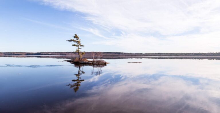
Photo: Paul VanDerWerf, CC BY 2.0
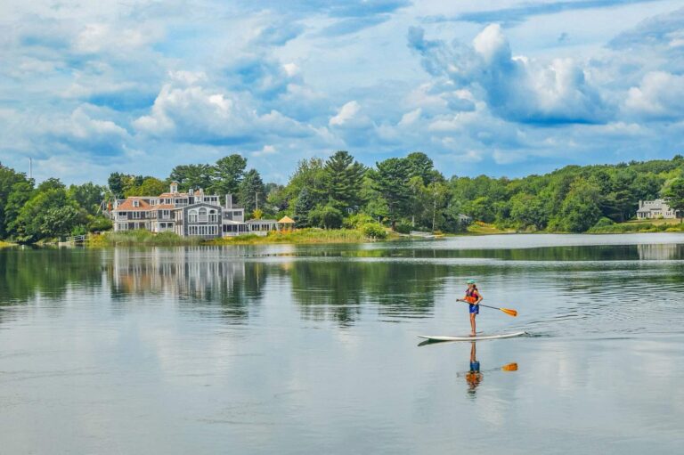
Photo: Dennis Weeks, CC BY 4.0
Fishing inside York County, Maine: the common asks
Where can I put a boat in the water in Maine's York County?
The table above already includes 21 ramps.
Which lake is the biggest in Maine's York County?
Great East Lake is the biggest, 1,825 acres.
What fish turn up on Maine water records in York County?
MDIFW lists chain pickerel on the most waters in the county, then brown bullhead, pumpkinseed sunfish and yellow perch; a listing shows presence, not a catch.
Where do Maine anglers in York County go for crankbaits and line?
14 entries, Bayside Bait & Tackle included.
What Maine town serves York County as its seat?
Alfred is the seat.
What does a Maine fishing license cost for York County?
Anglers 16 and older need a Maine fishing license for inland waters; the MDIFW fee page prints $30 for a resident season license and $83 for a nonresident one, agent fees not included.
What Maine counties are closest to York County?
Ordered by distance: Cumberland County, Sagadahoc County and Androscoggin County.
Which Maine law book limits govern the water of York County?
Limits come from the law book's statewide rows unless the water has its own entry, and an entry replaces the statewide limit for the fish it names; each lake and river page on this site prints its entry. The statewide MDIFW law pages, read on Nov. 18, 2026, supply every rule here; they carry no revision date, they cite the 2026 law book valid through Dec. 31, 2026, and no 2027 rule or fee is given.
Where do York County ponds with no page of their own show up?
This page lists the 472 waters names; a water without a page gets a row and pin.
Is stocking noted for waters in Maine's York County?
The MDIFW pages log 2 dated events for the county; the newest are in the stocking band above, and a count appears only where a source printed one.
A spruce-edge morning in York County
River pages list public access and the nearest USGS gauges.