Fishing in Sagadahoc County, Maine
County seat: Bath. Census 2020 residents: 36,699.
- 88named waters
- 10ramps
- 2river pages
 Pick for troutPiscifun Carbon X ultralight spinning reel28% OFFSale $57.99
Photo, nearby stand in for Sagadahoc County: Doug Kerr, CC BY-SA 2.0
First things to know about fishing Sagadahoc County, Maine, this season
Sagadahoc County drew 36,699 people in the 2020 Census; Bath serves as seat. County lines enclose 254 square miles of land and 116.1 square miles of water, per Census tables. The MDIFW and the USGS name 88 waters inside the county line, and Pleasant Pond (Sagadahoc County) is the largest of them by size. County river pages run from Androscoggin River and Kennebec River.
Access mapped for the county: 10 boat ramps, and 23 other fishing points more sites for shore, dock or paddling use.
U.S. Census Bureau, 2020 Census counts (TIGERweb) and the 2023 Gazetteer, read November 18, 2026. Maine GeoLibrary boat launches layer (ArcGIS service), read November 18, 2026.
Mapped: waters, ramps and shore points of Sagadahoc County
Maine GeoLibrary boat launches layer (ArcGIS service), read November 18, 2026. Water pins sit at the point MDIFW or the USGS gives for each water.
In Maine, water pages for Sagadahoc County
| Lake | Size | Access points | Kind | Fish the MDIFW lists |
|---|---|---|---|---|
| Center Pond (Sagadahoc County) | 84 acres | 0 | pond | largemouth bass, white perch, golden shiner |
| Caesar Pond | 51 acres | 0 | pond | none listed |
| Sewall Pond (Sagadahoc County) | 46 acres | 0 | pond | white perch, chain pickerel, golden shiner |
| Silver Lake (Sagadahoc County) | 12 acres | 0 | lake | brook trout |
| Sprague Pond | 9.4 acres | 0 | pond | brook trout, pumpkinseed sunfish, golden shiner |
Surface acres from the MDIFW MaineLakes polygon layer for this water (ArcGIS service; geodesic acres of the mapped outline), read November 18, 2026. Waters with no acreage in the MDIFW record show their mapped outline instead. MDIFW MaineLakes layer record for this water (ArcGIS service), read November 18, 2026.
 For the trout herePiscifun Carbon XT ultralight spinning reel25% OFFSale $59.99
Rivers to wade in Sagadahoc County across the Pine Tree State
- Androscoggin River14 access points, 3 USGS gauges, dated stocking rows
- Kennebec River11 access points, 4 USGS gauges, dated stocking rows
USGS National Hydrography Dataset record for this river (NHD service), read November 18, 2026. Length is the NHD flowline length inside Maine, not a fishable length. USGS Water Data for the Nation, live through the site, retrieved on page view.
Counting MDIFW species lists around Sagadahoc County
Tallying MDIFW lists for 10 waters in the county, golden shiner comes first.
MDIFW Popular Fish Species lists, counted per water; presence in the list is not a catch survey. Species named on the MDIFW lake survey map (map PDF), read November 18, 2026. A listed species was recorded for that survey, not reported as a catch.
Trailer launches around Sagadahoc County across the Pine Tree State
- Androscoggin River (Topsham) Fishing Areatrailer ramp, freshwater, hard surface; Sagadahoc County
- Cathance River (Bowdoinham) Fishing Areatrailer ramp, all-tide ramp, hard surface; Sagadahoc County
- Cathance River (Topsham) Fishing Areacarry-in access; Sagadahoc County
- Kennebec River (Bath) Fishing Area (north), Sagadahoc Countylanding facility; Sagadahoc County
- Kennebec River (Bath) Fishing Area (north), Sagadahoc Countytrailer ramp, all-tide ramp, hard surface; Sagadahoc County
- Kennebec River (Bath) Fishing Area (south)trailer ramp, all-tide ramp, hard surface; Sagadahoc County
- Kennebec River (Phippsburg) Fishing Areatrailer ramp, all-tide ramp, hard surface; Sagadahoc County
- Kennebec River (Richmond) Fishing Areatrailer ramp, all-tide ramp, hard surface; Sagadahoc County
- Nequasset Lake (Woolwich) Fishing Areatrailer ramp, freshwater, hard surface; Sagadahoc County
- Pleasant Cove (Woolwich) Fishing Areacarry-in access; Sagadahoc County
Mapped coastal access in Sagadahoc County
- Androscoggin Brunswick-Topsham Riverwalk Fishing Area on Androscoggin Rivercoastal public access site; Sagadahoc County
- Basin Preserve Fishing Areacoastal public access site; Sagadahoc County
- Bath Waterfront Park on Kennebec Rivercoastal public access site, pier or wharf; Sagadahoc County
- Berry Woods Preserve Fishing Areacoastal public access site; Sagadahoc County
- CMP Carry-In Fishing Areacoastal public access site; Sagadahoc County
- DeWick Farm Fishing Areacoastal public access site; Sagadahoc County
- Fort Popham State Historic Sitecoastal public access site; Sagadahoc County
- Fort Richmond Park and Boat Launch on Kennebec Rivercoastal public access site; Sagadahoc County
- Head of Tide Park on Cathance Rivercoastal public access site; Sagadahoc County
- Mailly Waterfront Park on Cathance Rivercoastal public access site; Sagadahoc County
- Merrymeeting Bay Wildlife Management Area on Cathance Rivercoastal public access site; Sagadahoc County
- North End Boat Launch on Kennebec Rivercoastal public access site; Sagadahoc County
- Popham Beach State Parkcoastal public access site; Sagadahoc County
- Popham Wharf Fishing Areacoastal public access site, pier or wharf; Sagadahoc County
- Reid State Parkcoastal public access site; Sagadahoc County
- River Landing Trail on Androscoggin Rivercoastal public access site; Sagadahoc County
- Riverfront Park on Cathance Rivercoastal public access site; Sagadahoc County
- Schoener Robinhood Cove Preserve Fishing Areacoastal public access site; Sagadahoc County
- Sewall Woods Fishing Area on Kennebec Rivercoastal public access site; Sagadahoc County
- South End Boat Launch on Kennebec Rivercoastal public access site; Sagadahoc County
- South End Park on Kennebec Rivercoastal public access site, pier or wharf; Sagadahoc County
- Swan Island Pier and Boat Launch on Kennebec Rivercoastal public access site, pier or wharf; Sagadahoc County
- Swan Island and the Steve Powell Wildlife Management Area on Kennebec Rivercoastal public access site, pier or wharf; Sagadahoc County
Maine GeoLibrary boat launches layer (ArcGIS service), read November 18, 2026.
All other named water in Sagadahoc County, with its map pin
Maine lakes and ponds in Sagadahoc County
| Water | Kind | Size | Fish the MDIFW lists | Access | Map pin |
|---|---|---|---|---|---|
| Pleasant Pond (Sagadahoc County) | pond | 971 acres | none listed | 0 | 44.1544, -69.8695 |
| Nequassett Lake | lake | 465 acres | rainbow smelt, brook trout, alewife, brown trout | 0 | 43.9519, -69.7744 |
| Winnegance Pond | pond | 212 acres | smallmouth bass, brown bullhead, largemouth bass, pumpkinseed sunfish | 0 | 43.8634, -69.8291 |
| Mill Pond (Sagadahoc County) | pond | 117 acres | none listed | 0 | 43.7919, -69.8037 |
| Umberhind Marsh | lake | 50 acres | none listed | 0 | 44.1313, -69.8278 |
| Bradley Pond (Sagadahoc County) | pond | 30 acres | none listed | 0 | 43.9939, -69.9706 |
| Wat-Tuh Lake | lake | 24 acres | largemouth bass, yellow perch, golden shiner, chain pickerel | 0 | 43.7707, -69.8605 |
| Unnamed Pond (West Bath, Sagadahoc County) | pond | 18 acres | none listed | 0 | 43.8776, -69.8489 |
| Charles Pond (Sagadahoc County) | pond, dated stocking rows | 14 acres | none listed | 0 | 43.8243, -69.7235 |
| Stoddard Pond | pond | 14 acres | none listed | 0 | 44.0270, -69.9381 |
| Houghton Pond | pond | 14 acres | yellow perch, chain pickerel | 0 | 43.8418, -69.8687 |
| Big Pond (Phippsburg, Sagadahoc County) | pond | 13 acres | none listed | 0 | 43.7125, -69.8415 |
| Campbell Pond (Sagadahoc County) | pond | 9.7 acres | none listed | 0 | 43.8514, -69.8461 |
| Clarey's Pond | pond | 9.1 acres | none listed | 0 | 43.8468, -69.7424 |
| Lily Pond (Sagadahoc County) | pond | 8.9 acres | yellow perch, chain pickerel, golden shiner, pumpkinseed sunfish | 0 | 43.8969, -69.8372 |
| Meetinghouse Pond | pond | 7.6 acres | brown trout, yellow perch, golden shiner | 0 | 43.7600, -69.8332 |
| Wolf Pond | pond | 7.5 acres | none listed | 0 | 43.9830, -69.7429 |
| Unnamed Pond (Woolwich, Sagadahoc County) (MIDAS 7761) | pond | 6.2 acres | none listed | 0 | 43.9248, -69.7603 |
| Unnamed Pond (Phippsburg, Sagadahoc County) (MIDAS 7791) | pond | 5.7 acres | none listed | 0 | 43.7650, -69.7986 |
| Big Eddy Pond | pond, dated stocking rows | 4.9 acres | none listed | 0 | 43.9339, -69.9210 |
| Unnamed Pond (Georgetown, Sagadahoc County) (MIDAS 7783) | pond | 4.9 acres | none listed | 0 | 43.8137, -69.7270 |
| Unnamed Pond (Richmond, Sagadahoc County) | pond | 4.8 acres | none listed | 0 | 44.1030, -69.8753 |
| Unnamed Pond (Bowdoin, Sagadahoc County) (MIDAS 3807) | pond | 4.5 acres | none listed | 0 | 44.0276, -69.9996 |
| Unnamed Pond (Georgetown, Sagadahoc County) (MIDAS 7777) | pond | 4.4 acres | none listed | 0 | 43.8044, -69.7355 |
| Unnamed Pond (Phippsburg, Sagadahoc County) (MIDAS 7793) | pond | 4.1 acres | none listed | 0 | 43.8434, -69.8039 |
| Unnamed Pond (Woolwich, Sagadahoc County) (MIDAS 5267) | pond | 4.1 acres | none listed | 0 | 44.0132, -69.7434 |
| Duley Pond | pond | 3.7 acres | none listed | 0 | 43.7786, -69.8274 |
| Unnamed Pond (Woolwich, Sagadahoc County) (MIDAS 7751) | pond | 3.7 acres | none listed | 0 | 43.9276, -69.7767 |
| Unnamed Pond (Woolwich, Sagadahoc County) (MIDAS 7753) | pond | 3.6 acres | none listed | 0 | 43.9861, -69.7299 |
| Woolwich Hydrilla 2 | lake | 3.4 acres | none listed | 0 | 43.9419, -69.8002 |
| Unnamed Pond (Bowdoin, Sagadahoc County) (MIDAS 7803) | pond | 3.3 acres | none listed | 0 | 44.0496, -70.0250 |
| Ice Pond (Sagadahoc County) | pond | 3.2 acres | none listed | 0 | 43.7969, -69.7234 |
| Big Pond (Perkins Twp Swan Island, Sagadahoc County) | pond | 3 acres | none listed | 0 | 44.0460, -69.8014 |
| Unnamed Pond (Woolwich, Sagadahoc County) (MIDAS 5263) | pond | 3 acres | none listed | 0 | 44.0005, -69.7959 |
| Unnamed Pond (Perkins Twp Swan Island, Sagadahoc County) (MIDAS 5264) | pond | 2.8 acres | none listed | 0 | 44.0718, -69.7943 |
| Unnamed Pond (Georgetown, Sagadahoc County) (MIDAS 7781) | pond | 2.7 acres | none listed | 0 | 43.8139, -69.7291 |
| Unnamed Pond (Woolwich, Sagadahoc County) (MIDAS 7757) | pond | 2.2 acres | none listed | 0 | 43.9588, -69.7282 |
| Unnamed Pond (Georgetown, Sagadahoc County) (MIDAS 7773) | pond | 1.8 acres | none listed | 0 | 43.7812, -69.7592 |
| Unnamed Pond (Woolwich, Sagadahoc County) (MIDAS 7755) | pond | 1.8 acres | none listed | 0 | 43.9804, -69.7353 |
| Unnamed Pond (Woolwich, Sagadahoc County) (MIDAS 7767) | pond | 1.8 acres | none listed | 0 | 43.9279, -69.7576 |
| Blaisdell Pond (Sagadahoc County) | pond | 1.7 acres | none listed | 0 | 43.7765, -69.8316 |
| Wade Pond | pond | 1.7 acres | none listed | 0 | 44.0628, -69.7961 |
| Merrymeeting Club Pond | pond | 1.1 acres | none listed | 0 | 43.9205, -69.9318 |
| Unnamed Pond (Georgetown, Sagadahoc County) (MIDAS 7769) | pond | 1.1 acres | none listed | 0 | 43.7749, -69.7657 |
| Unnamed Pond (Phippsburg, Sagadahoc County) (MIDAS 7789) | pond | 1.1 acres | none listed | 0 | 43.7540, -69.8624 |
| Farm Pond #3 | pond | 1 acres | none listed | 0 | 44.0540, -69.7942 |
| Unnamed Pond (Phippsburg, Sagadahoc County) (MIDAS 7787) | pond | 0.9 acres | none listed | 0 | 43.7259, -69.8414 |
| Birchwood Pond | pond | 0.7 acres | none listed | 0 | 43.8337, -69.8616 |
| Unnamed Pond (Phippsburg, Sagadahoc County) (MIDAS 5868) | pond | 0.7 acres | none listed | 0 | 43.8308, -69.8387 |
| Unnamed Pond (Bowdoin, Sagadahoc County) (MIDAS 7801) | pond | 0.6 acres | none listed | 0 | 44.0714, -69.9875 |
| Unnamed Pond (Georgetown, Sagadahoc County) (MIDAS 5854) | pond | 0.6 acres | none listed | 0 | 43.8344, -69.7287 |
| Unnamed Pond (Woolwich, Sagadahoc County) (MIDAS 7759) | pond | 0.5 acres | none listed | 0 | 43.9608, -69.7281 |
| Farm Pond #2 | pond | 0.4 acres | none listed | 0 | 44.0528, -69.7951 |
| Unnamed Pond (Perkins Twp Swan Island, Sagadahoc County) (MIDAS 6593) | pond | 0.4 acres | none listed | 0 | 44.0667, -69.7939 |
| Woolwich Hydrilla 1 | lake | 0.4 acres | none listed | 0 | 43.9430, -69.7991 |
| Unnamed Pond (Perkins Twp Swan Island, Sagadahoc County) (MIDAS 6591) | pond | 0.3 acres | none listed | 0 | 44.0724, -69.7965 |
| Unnamed Pond (Phippsburg, Sagadahoc County) (MIDAS 5870) | pond | 0.3 acres | none listed | 0 | 43.8311, -69.8406 |
| Unnamed Pond (Perkins Twp Swan Island, Sagadahoc County) (MIDAS 6595) | pond | 0.2 acres | none listed | 0 | 44.0588, -69.7924 |
| Farm Pond #1 | pond | 0.1 acres | none listed | 0 | 44.0523, -69.7955 |
MDIFW MaineLakes layer record for this water (ArcGIS service), read November 18, 2026. Outline area from the Maine DEP MIDAS lakes basemap (ArcGIS service; mapped polygon area, not a surface-acre figure from a survey), read November 18, 2026.
Brooks, streams and rivers in Sagadahoc County
| Water | Kind | Size | Fish the MDIFW lists | Access | Map pin |
|---|---|---|---|---|---|
| Abagadasset River | river reach | no size printed | none listed | 0 | 44.0236, -69.8455 |
| Back River (Sagadahoc County) | river reach | no size printed | none listed | 0 | 43.8946, -69.7416 |
| Back River Creek | river reach | no size printed | none listed | 0 | 43.9245, -69.7928 |
| Baker Brook (Sagadahoc County) | water | no size printed | none listed | 0 | 44.0928, -69.8164 |
| Cathance River | water | no size printed | none listed | 6 | 43.9853, -69.9127 |
| Dead River (Sagadahoc County) | river reach | no size printed | none listed | 0 | 44.1066, -69.9555 |
| Denham Stream | water | no size printed | none listed | 0 | 44.1017, -69.8735 |
| Kennebec River | water | no size printed | none listed | 23 | 44.1117, -69.7933 |
| Little Gillespie Brook | water | no size printed | none listed | 0 | 44.0778, -69.9995 |
| Little River (Georgetown, Sagadahoc County) | river reach | no size printed | none listed | 0 | 43.8081, -69.7309 |
| Little River (Lisbon, Sagadahoc County) | river reach, dated stocking rows | no size printed | none listed | 0 | 44.0001, -70.0378 |
| Mallon Brook | water | no size printed | none listed | 0 | 44.0732, -69.8884 |
| Mill Brook (Sagadahoc County) | water | no size printed | none listed | 0 | 44.0891, -69.7965 |
| Muddy River (Sagadahoc County) | river reach | no size printed | none listed | 0 | 43.9538, -69.9089 |
| Nequasset Brook | water | no size printed | none listed | 0 | 43.9424, -69.7734 |
| Pasture Brook | water | no size printed | none listed | 0 | 43.8232, -69.8333 |
| Pleasant Cove | water | no size printed | none listed | 1 | 43.9245, -69.7931 |
| Purington Brook | water | no size printed | none listed | 0 | 44.0565, -70.0207 |
| Sprague River | river reach | no size printed | none listed | 0 | 43.7290, -69.8288 |
| West Cathance Stream | water | no size printed | none listed | 0 | 44.0157, -69.9653 |
| Weymouth Brook (Sagadahoc County) | water | no size printed | none listed | 0 | 43.9803, -69.9687 |
| Wilmot Brook | water | no size printed | none listed | 0 | 44.1522, -69.7638 |
MDIFW MaineLakes layer record for this water (ArcGIS service), read November 18, 2026. Outline area from the Maine DEP MIDAS lakes basemap (ArcGIS service; mapped polygon area, not a surface-acre figure from a survey), read November 18, 2026.
MDIFW record entries on Sagadahoc County water
| Species | Size as listed | Water | Year | Category |
|---|---|---|---|---|
| Striped Bass | 67.0 lbs | Sheepscot River | 1978 | Maine saltwater state record – Rod and reel |
Maine saltwater state records from the Department of Marine Resources list (DMR PDF), current January 2024, read November 18, 2026. Freshwater records are not published in a form this site could read, and angler names are not printed.
Marinas and sporting camps in Sagadahoc County
Bait and tackle counters on the road to Sagadahoc County
- Dick's Sporting Goods (Topsham)bait and tackle shop, Topsham
Guide services around Sagadahoc County, woods road to coast
- Maine Experience Guide Servicefishing guide, Bath
Yellow Pages and operator listings (city of business), read November 18, 2026. Guides appear as businesses; no license or permit status is implied.
A short stretch of road past Sagadahoc County
In Maine, town pages within Sagadahoc County
- Topsham2020 count 9,560
- Bath2020 count 8,766
- Richmond2020 count 3,522
- Bowdoin2020 count 3,136
- Woolwich2020 count 3,068
- Bowdoinham2020 count 3,047
- Phippsburg2020 count 2,155
- West Bath2020 count 1,910
- Georgetown2020 count 1,058
Across the Maine county line from Sagadahoc County
- Lincoln County17 miles out, heading east
- Androscoggin County25 miles out, heading northwest
- Cumberland County25 miles out, heading west
- Kennebec County35 miles out, heading north
How store listings place Sagadahoc County on the Maine map
Sagadahoc County sits in the site's southwest Maine grouping for tackle shops; the label is ours, not the MDIFW's.
Current Maine pages for Sagadahoc County anglers
Maine fishing this week
Maine stocking by date
Maine fish advisories
Piscifun gear a Maine angler could carry to Sagadahoc County


Piscifun and Amazon links are affiliate links; the site earns a commission on qualifying purchases.
Ponds, brooks and rocky coves around Sagadahoc County, pictured

Photo: John Marino, CC BY 2.0
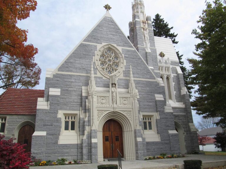
Photo: Doug Kerr, CC BY-SA 2.0
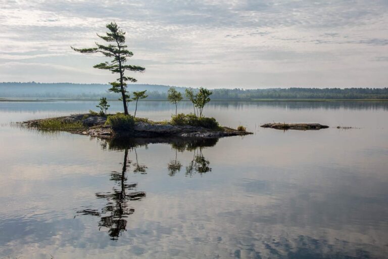
Photo: Paul VanDerWerf, CC BY 2.0
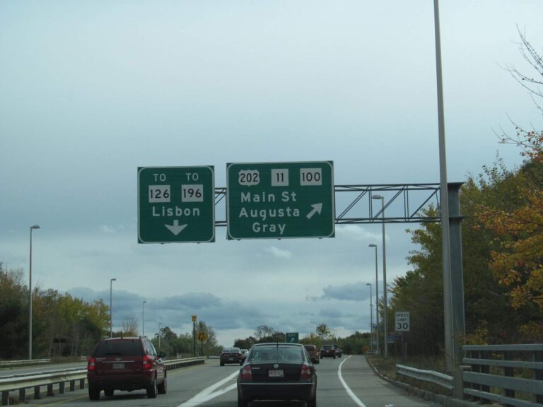
Photo: Doug Kerr, CC BY-SA 2.0
Ponds, brooks and launches of Sagadahoc County, explained
What is the launch count for Sagadahoc County in the state layer?
10 ramps turn up in the launch data.
Where does the widest Maine water sit in Sagadahoc County?
Pleasant Pond (Sagadahoc County) at 971 acres.
What fish does the MDIFW name in Sagadahoc County?
MDIFW lists golden shiner on the most waters in the county, then chain pickerel, yellow perch and brook trout; a listing shows presence, not a catch.
Where can I buy bait in Sagadahoc County, Maine?
Dick's Sporting Goods (Topsham) is a start; 1 sit in this county.
Where does Maine's Sagadahoc County keep its courthouse?
The seat falls to Bath.
Which MDIFW licenses cover fishing in Sagadahoc County?
From age 16 a Maine fishing license is required on inland water, and MDIFW prints $30 (resident season) and $83 (nonresident season), without agent fees.
What Maine counties surround Sagadahoc County?
Start from Lincoln County, Androscoggin County and Cumberland County.
How many fish may an angler in Sagadahoc County keep in a day?
Limits come from the law book's statewide rows unless the water has its own entry, and an entry replaces the statewide limit for the fish it names; each lake and river page on this site prints its entry. The rules here come from the MDIFW statewide fishing law pages as read on Nov. 18, 2026; the pages carry no revision date and point to the 2026 fishing law book, which is not valid after Dec. 31, 2026, so no 2027 rule or fee is printed.
How does this page present the tiny ponds of Sagadahoc County?
The full 88 waters are covered here, by page link or pinned row.
What Maine record fish came out of Sagadahoc County?
Striped Bass, 67.0 lbs, from Sheepscot River (1978).
Set up a Maine fishing weekend in Sagadahoc County
Water rows carry coordinates, a MDIFW species list and a map pin.