Fishing in Androscoggin County, Maine
County seat: Auburn. Census 2020 residents: 111,139.
- 143named waters
- 14ramps
- 2river pages
 Pick for troutPiscifun Carbon X ultralight spinning reel28% OFFSale $57.99
Photo of Lewiston: Doug Kerr, CC BY-SA 2.0
Androscoggin County water by the agency numbers
Auburn serves as the seat of Androscoggin County, which on record 111,139 residents in the 2020 Census. The 2023 Gazetteer measures 468 square miles of land and 29.2 square miles of water between the Maine county lines. Across the 143 waters MDIFW and USGS list for Androscoggin County, Auburn Lake is the broadest. A wader could try Androscoggin River and Royal River.
A boater can pick among 14 boat ramps; the data adds 0 other fishing points sites with no launch.
U.S. Census Bureau, 2020 Census counts (TIGERweb) and the 2023 Gazetteer, read November 18, 2026. Maine GeoLibrary boat launches layer (ArcGIS service), read November 18, 2026.
Where the MDIFW places waters and landings inside Androscoggin County
Maine GeoLibrary boat launches layer (ArcGIS service), read November 18, 2026. Water pins sit at the point MDIFW or the USGS gives for each water.
Lakes worth a look in Androscoggin County
| Lake | Size | Access points | Kind | Fish the MDIFW lists |
|---|---|---|---|---|
| Auburn Lake | 2,278 acres | 1 | lake | none listed |
| Tripp Pond | 736 acres | 0 | pond | none listed |
| Middle Range Pond | 382 acres | 0 | pond | brown trout, golden shiner, brook trout |
| Upper Range Pond | 357 acres | 1 | pond | brown trout, golden shiner, brook trout |
| Lower Range Pond | 270 acres | 1 | pond | brown trout, rainbow smelt, golden shiner |
| Long Pond (Androscoggin County) | 209 acres | 1 | pond | brown trout, brook trout, golden shiner |
| Pleasant Pond (Androscoggin County) | 191 acres | 0 | pond | brook trout, golden shiner, rainbow smelt |
| Brettuns Pond | 167 acres | 0 | pond | brown trout, brook trout, white sucker |
| Round Pond (Livermore, Androscoggin County) | 162 acres | 1 | pond | brown trout, chain pickerel, brook trout |
| Little Wilson Pond (Androscoggin County) | 112 acres | 0 | pond | brook trout, rainbow smelt, largemouth bass |
| Loon Pond (Androscoggin County) | 60 acres | 0 | pond | smallmouth bass, brown bullhead, white perch |
| Worthley Pond (Androscoggin County) | 54 acres | 0 | pond | brown trout, chain pickerel, brook trout |
| Crystal Pond (Androscoggin County) | 48 acres | 1 | pond | brown trout, chain pickerel, brook trout |
| Bartlett Pond (Androscoggin County) | 28 acres | 0 | pond | brook trout, rainbow smelt, golden shiner |
Surface acres from the MDIFW MaineLakes polygon layer for this water (ArcGIS service; geodesic acres of the mapped outline), read November 18, 2026. Waters with no acreage in the MDIFW record show their mapped outline instead. MDIFW MaineLakes layer record for this water (ArcGIS service), read November 18, 2026.
 For the trout herePiscifun Carbon XT ultralight spinning reel25% OFFSale $59.99
Brooks winding through Androscoggin County
- Androscoggin River14 access points, 3 USGS gauges, dated stocking rows
- Royal River1 access point, 1 USGS gauge, dated stocking rows
Gauge sites placed inside Androscoggin County
USGS has no current reading for these gauges.
USGS National Hydrography Dataset record for this river (NHD service), read November 18, 2026. Length is the NHD flowline length inside Maine, not a fishable length. USGS Water Data for the Nation, live through the site, retrieved on page view.
Which fish lead the MDIFW lists for Androscoggin County
Of 29 county waters with a species list, chain pickerel shows up most.
MDIFW Popular Fish Species lists, counted per water; presence in the list is not a catch survey. Species named on the MDIFW lake survey map (map PDF), read November 18, 2026. A listed species was recorded for that survey, not reported as a catch.
Down East or North Woods: public ramps in Androscoggin County
- Androscoggin River (Auburn) Fishing Area (north)trailer ramp, freshwater, hard surface; Androscoggin County
- Androscoggin River (Auburn) Fishing Area (south)carry-in access; Androscoggin County
- Androscoggin River (Durham) Fishing Areatrailer ramp, freshwater, hard surface; Androscoggin County
- Androscoggin River (Lewiston) Fishing Areacarry-in access; Androscoggin County
- Androscoggin River (Turner) Fishing Areatrailer ramp, freshwater, hard surface; Androscoggin County
- Crystal (Beal) Pond (Turner) Fishing Areacarry-in access; Androscoggin County
- Lake Auburn (Auburn) Fishing Area on Auburn Laketrailer ramp, freshwater, hard surface; Androscoggin County
- Long Pond (Livermore) Fishing Areatrailer ramp, freshwater, hard surface; Androscoggin County
- Lower Range Pond (Poland) Fishing Areatrailer ramp, freshwater, hard surface; Androscoggin County
- Round Pond (Livermore) Fishing Areatrailer ramp, freshwater, hard surface; Androscoggin County
- Runaround Pond (Durham) Fishing Areacarry-in access; Androscoggin County
- Sabattus Pond (Sabattus) Fishing Areatrailer ramp, freshwater, hard surface; Androscoggin County
- Sabattus River (Lisbon) Fishing Areatrailer ramp, freshwater, hard surface; Androscoggin County
- Upper Range Pond (Poland) Fishing Areatrailer ramp, freshwater, hard surface; Androscoggin County
Maine GeoLibrary boat launches layer (ArcGIS service), read November 18, 2026.
Remaining Maine ponds, brooks and bays of Androscoggin County, a row apiece
Maine lakes and ponds in Androscoggin County
| Water | Kind | Size | Fish the MDIFW lists | Access | Map pin |
|---|---|---|---|---|---|
| Sabattus Pond | pond | 1,976 acres | none listed | 1 | 44.1463, -70.0985 |
| Gulf Island Pond | pond | 1,438 acres | none listed | 0 | 44.1817, -70.2054 |
| Taylor Pond (Androscoggin County) | pond | 653 acres | none listed | 0 | 44.1064, -70.2794 |
| Allen Pond (Androscoggin County) | pond | 188 acres | brown trout, brook trout, golden shiner, rainbow smelt | 0 | 44.2285, -70.1607 |
| No Name Pond (Androscoggin County) | pond | 145 acres | rainbow smelt, smallmouth bass, golden shiner, largemouth bass | 0 | 44.1220, -70.1389 |
| Shaker Bog | lake | 126 acres | none listed | 0 | 43.9958, -70.3748 |
| The Basin | lake | 107 acres | none listed | 0 | 44.1831, -70.2849 |
| Moose Hill Pond | pond | 95 acres | smallmouth bass, redbreast sunfish, yellow perch, pumpkinseed sunfish | 0 | 44.4667, -70.1328 |
| Runaround Pond | pond | 83 acres | largemouth bass, white sucker, chain pickerel, brown bullhead | 1 | 43.9561, -70.1815 |
| Curtis Bog | lake | 65 acres | none listed | 0 | 44.1146, -70.0411 |
| Sutherland Pond | pond | 51 acres | yellow perch, white sucker, chain pickerel, brown bullhead | 0 | 44.0896, -70.0697 |
| Estes Bog | lake | 40 acres | none listed | 0 | 44.0213, -70.3983 |
| Berry Pond (Androscoggin County) | pond | 32 acres | smallmouth bass, white sucker, yellow perch, brown bullhead | 0 | 44.2052, -70.1789 |
| Little Sabattus Pond | pond | 26 acres | largemouth bass, white sucker, yellow perch, brown bullhead | 0 | 44.2110, -70.1356 |
| Mud Pond (Turner, Androscoggin County) (MIDAS 3744) | pond | 23 acres | brook trout, chain pickerel, largemouth bass, yellow perch | 0 | 44.2199, -70.2980 |
| Schoolhouse Pond (Androscoggin County) | pond | 21 acres | largemouth bass, white sucker, yellow perch, brown bullhead | 0 | 44.4323, -70.1141 |
| Sandy Bottom Pond | pond | 20 acres | yellow perch, white sucker, chain pickerel, brown bullhead | 0 | 44.2225, -70.2614 |
| Lily Pond (Androscoggin County) | pond | 19 acres | none listed | 0 | 44.2418, -70.2669 |
| Unnamed Pond (Greene, Androscoggin County) (MIDAS 3801) | pond | 18 acres | none listed | 0 | 44.1911, -70.1993 |
| Nelson Pond | pond | 18 acres | smallmouth bass, chain pickerel, golden shiner, brown bullhead | 0 | 44.4155, -70.2631 |
| Bonny Pond | pond | 15 acres | none listed | 0 | 44.2428, -70.0754 |
| Lard Pond (Androscoggin County) | pond | 15 acres | white perch, white sucker, yellow perch, chain pickerel | 0 | 44.1948, -70.2379 |
| Unnamed Pond (Turner, Androscoggin County) | pond | 14 acres | none listed | 0 | 44.2530, -70.2668 |
| Island Pond (Androscoggin County) | pond | 14 acres | smallmouth bass, brown bullhead, chain pickerel, banded killifish | 0 | 44.2449, -70.0873 |
| Rack Pond | pond | 8.1 acres | none listed | 0 | 44.4425, -70.1218 |
| Round Pond (Turner, Androscoggin County) | pond | 8.1 acres | yellow perch, golden shiner, chain pickerel, white sucker | 0 | 44.1932, -70.2425 |
| Lincoln Pond (Androscoggin County) | pond | 7.5 acres | lake trout (togue), fathead minnow, brook trout, blacknose dace | 0 | 44.2815, -70.2972 |
| Unnamed Pond (Livermore, Androscoggin County) (MIDAS 3815) | pond | 7.5 acres | none listed | 0 | 44.4662, -70.1969 |
| Black Pond (Androscoggin County) | pond | 7.4 acres | brown bullhead, golden shiner | 0 | 44.2309, -70.2622 |
| Turner Pond (Androscoggin County) | pond | 6.9 acres | none listed | 0 | 44.4340, -70.1223 |
| Mud Pond (Turner, Androscoggin County) (MIDAS 5788) | pond | 6.8 acres | none listed | 0 | 44.2264, -70.2609 |
| Unnamed Pond (Sabattus, Androscoggin County) (MIDAS 8933) | pond | 6.7 acres | none listed | 0 | 44.1055, -70.0297 |
| Pumphouse Pond | pond | 6.2 acres | none listed | 0 | 44.0348, -70.3548 |
| Unnamed Pond (Poland, Androscoggin County) (MIDAS 8947) | pond | 6.2 acres | none listed | 0 | 44.0278, -70.3497 |
| Round Pond (Sabattus, Androscoggin County) | pond | 6.1 acres | none listed | 0 | 44.1160, -70.0883 |
| Unnamed Pond (Livermore, Androscoggin County) (MIDAS 3710) | pond | 5.5 acres | none listed | 0 | 44.4538, -70.2368 |
| Deane Pond | pond | 5.3 acres | chain pickerel, redbreast sunfish | 0 | 44.2309, -70.1394 |
| Beaver Park Middle Pond | pond, dated stocking rows | 5 acres | none listed | 0 | 44.0296, -70.1303 |
| Pickerel Pond (Androscoggin County) | pond | 5 acres | none listed | 0 | 44.2730, -70.2712 |
| Unnamed Pond (Greene, Androscoggin County) (MIDAS 8997) | pond | 4.8 acres | none listed | 0 | 44.1670, -70.1189 |
| Unnamed Pond (Poland, Androscoggin County) (MIDAS 8953) | pond | 4.5 acres | none listed | 0 | 44.0884, -70.3575 |
| Unnamed Pond (Poland, Androscoggin County) (MIDAS 8949) | pond | 4.4 acres | none listed | 0 | 44.0310, -70.3510 |
| Mud Pond (Poland, Androscoggin County) | pond | 4.3 acres | none listed | 0 | 44.0703, -70.4218 |
| Unnamed Pond (Lewiston, Androscoggin County) (MIDAS 8969) | pond | 4.3 acres | none listed | 0 | 44.1241, -70.1928 |
| Daggett Bog | lake | 3.9 acres | none listed | 0 | 44.1829, -70.1797 |
| Dead Pond (Androscoggin County) | pond | 3.6 acres | none listed | 0 | 44.0532, -70.3819 |
| Reservoir (Androscoggin County) | reservoir | 3.5 acres | none listed | 0 | 44.1151, -70.1815 |
| Unnamed Pond (Lewiston, Androscoggin County) (MIDAS 3813) | pond | 3.3 acres | none listed | 0 | 44.0094, -70.1616 |
| Round Pond (Livermore Falls, Androscoggin County) | pond | 3.2 acres | none listed | 0 | 44.4387, -70.1214 |
| Unnamed Pond (Leeds, Androscoggin County) (MIDAS 8983) | pond | 3 acres | none listed | 0 | 44.2510, -70.0849 |
| Lake Andrews | lake | 2.8 acres | none listed | 0 | 44.1078, -70.2031 |
| Unnamed Pond (Poland, Androscoggin County) (MIDAS 8945) | pond | 2.8 acres | none listed | 0 | 44.0496, -70.3573 |
| Unnamed Pond (Leeds, Androscoggin County) (MIDAS 8985) | pond | 2.6 acres | none listed | 0 | 44.2595, -70.0839 |
| Unnamed Pond (Leeds, Androscoggin County) (MIDAS 8989) | pond | 2.5 acres | none listed | 0 | 44.2467, -70.0853 |
| Beaver Park Upper Pond | pond | 2.4 acres | none listed | 0 | 44.0277, -70.1318 |
| Unnamed Pond (Durham, Androscoggin County) | pond | 2.2 acres | none listed | 0 | 43.9781, -70.1224 |
| Unnamed Pond (Lewiston, Androscoggin County) (MIDAS 8963) | pond | 2.2 acres | none listed | 0 | 44.0906, -70.1452 |
| Unnamed Pond (Livermore Falls, Androscoggin County) (MIDAS 8955) | pond | 2.2 acres | none listed | 0 | 44.4134, -70.1202 |
| Hawkes Pond | pond | 2 acres | none listed | 0 | 44.1456, -70.3896 |
| Beaver Park New Pond | pond, dated stocking rows | 1.9 acres | none listed | 0 | 44.0283, -70.1269 |
| Unnamed Pond (Leeds, Androscoggin County) (MIDAS 8979) | pond | 1.9 acres | none listed | 0 | 44.2539, -70.0870 |
| Frog Pond (Androscoggin County) | pond | 1.6 acres | none listed | 0 | 44.2311, -70.2640 |
| Unnamed Pond (Sabattus, Androscoggin County) (MIDAS 3805) | pond | 1.4 acres | none listed | 0 | 44.1187, -70.1120 |
| Unnamed Pond (Lisbon, Androscoggin County) | pond | 1.3 acres | none listed | 0 | 44.0146, -70.0545 |
| Unnamed Pond (Sabattus, Androscoggin County) (MIDAS 8927) | pond | 1.3 acres | none listed | 0 | 44.1280, -70.0558 |
| East Strip Pond | pond | 1.1 acres | none listed | 0 | 44.2372, -70.0818 |
| Unnamed Pond (Lewiston, Androscoggin County) (MIDAS 8961) | pond | 1.1 acres | none listed | 0 | 44.1251, -70.2045 |
| Unnamed Pond (Sabattus, Androscoggin County) (MIDAS 8931) | pond | 1.1 acres | none listed | 0 | 44.1020, -70.0121 |
| Unnamed Pond (Leeds, Androscoggin County) (MIDAS 8981) | pond | 1 acres | none listed | 0 | 44.2558, -70.0861 |
| Unnamed Pond (Livermore, Androscoggin County) (MIDAS 3711) | pond | 1 acres | none listed | 0 | 44.4653, -70.2238 |
| Unnamed Pond (Leeds, Androscoggin County) (MIDAS 3819) | pond | 0.9 acres | none listed | 0 | 44.2488, -70.0866 |
| Unnamed Pond (Wales, Androscoggin County) (MIDAS 8939) | pond | 0.9 acres | none listed | 0 | 44.1785, -70.0364 |
| West Strip Pond | pond | 0.9 acres | none listed | 0 | 44.2375, -70.0826 |
| Pettingill Park Pond | pond, dated stocking rows | 0.8 acres | none listed | 0 | 44.1072, -70.2348 |
| Unnamed Pond (Greene, Androscoggin County) (MIDAS 8995) | pond | 0.8 acres | none listed | 0 | 44.1461, -70.1211 |
| Unnamed Pond (Wales, Androscoggin County) (MIDAS 8941) | pond | 0.8 acres | none listed | 0 | 44.1512, -70.0356 |
| Jag Pond | pond | 0.6 acres | none listed | 0 | 44.2624, -70.0919 |
| Unnamed Pond (Leeds, Androscoggin County) (MIDAS 3754) | pond | 0.6 acres | none listed | 0 | 44.3392, -70.1314 |
| Unnamed Pond (Lewiston, Androscoggin County) (MIDAS 8965) | pond | 0.5 acres | none listed | 0 | 44.1498, -70.1737 |
| Unnamed Pond (Livermore Falls, Androscoggin County) (MIDAS 3742) | pond | 0.5 acres | none listed | 0 | 44.4214, -70.1361 |
| Center Strip Pond | pond | 0.4 acres | none listed | 0 | 44.2375, -70.0820 |
| Unnamed Pond (Leeds, Androscoggin County) (MIDAS 3817) | pond | 0.2 acres | none listed | 0 | 44.2493, -70.0843 |
MDIFW MaineLakes layer record for this water (ArcGIS service), read November 18, 2026. Outline area from the Maine DEP MIDAS lakes basemap (ArcGIS service; mapped polygon area, not a surface-acre figure from a survey), read November 18, 2026.
Brooks, streams and rivers in Androscoggin County
| Water | Kind | Size | Fish the MDIFW lists | Access | Map pin |
|---|---|---|---|---|---|
| Alder Brook (Androscoggin County) | water | no size printed | none listed | 0 | 43.9412, -70.1602 |
| Allen Stream (Androscoggin County) | water | no size printed | none listed | 0 | 44.2855, -70.1721 |
| Barker Brook (Androscoggin County) | water | no size printed | none listed | 0 | 44.0609, -70.0643 |
| Basin Brook | water, dated stocking rows | no size printed | none listed | 0 | no point printed |
| Beals Brook | water | no size printed | none listed | 0 | 44.3761, -70.2166 |
| Bog Brook (Androscoggin County) | water | no size printed | none listed | 0 | 44.2437, -70.0729 |
| Clay Brook | water | no size printed | none listed | 0 | 44.4587, -70.1794 |
| Cool Brook | water | no size printed | none listed | 0 | 44.1168, -70.3585 |
| Dead River (Leeds, Androscoggin County) (GNIS 564878) | river reach | no size printed | none listed | 0 | 44.2223, -70.0802 |
| Dead River (Leeds, Androscoggin County) (GNIS 564881) | river reach | no size printed | none listed | 0 | 44.3174, -70.1255 |
| Dyer Brook (Androscoggin County) | water | no size printed | none listed | 0 | 43.9820, -70.1204 |
| Fisher Stream | water | no size printed | none listed | 0 | 44.0524, -70.0335 |
| Ford Brook | water | no size printed | none listed | 0 | 44.3949, -70.2244 |
| Gerrish Brook | water | no size printed | none listed | 0 | 43.9867, -70.1354 |
| Hooper Brook | water | no size printed | none listed | 0 | 44.1985, -70.1295 |
| House Brook | water | no size printed | none listed | 0 | 44.0132, -70.1665 |
| Hunton Brook | water | no size printed | none listed | 0 | 44.4064, -70.1302 |
| Indian Brook (Androscoggin County) | water | no size printed | none listed | 0 | 44.1085, -70.3214 |
| Jock Stream | water | no size printed | none listed | 0 | 44.1846, -69.9995 |
| Keith Brook | water | no size printed | none listed | 0 | 44.3682, -70.1846 |
| Libby Brook (Androscoggin County) | water | no size printed | none listed | 0 | 43.9855, -70.1950 |
| Little Androscoggin River Reservoir | river reach | no size printed | none listed | 0 | no point printed |
| Lively Brook (Androscoggin County) | water | no size printed | none listed | 0 | 44.2941, -70.2680 |
| Martin Stream (Androscoggin County) | water | no size printed | none listed | 0 | 44.3640, -70.2542 |
| Maxwell Brook | water | no size printed | none listed | 0 | 44.1004, -70.0911 |
| Meadow Brook (Durham, Androscoggin County) | water, dated stocking rows | no size printed | none listed | 0 | 43.9857, -70.0650 |
| Meadow Brook (Turner, Androscoggin County) | water | no size printed | none listed | 0 | 44.2380, -70.2549 |
| Moose Brook (Androscoggin County) | water | no size printed | none listed | 0 | 44.0292, -70.2750 |
| Morgan Brook | water | no size printed | none listed | 0 | 44.0946, -70.3359 |
| Newell Brook | water, dated stocking rows | no size printed | none listed | 0 | 43.9274, -70.0998 |
| Nezinscot River | river reach, dated stocking rows | no size printed | none listed | 0 | 44.2560, -70.2571 |
| No Name Brook | water | no size printed | none listed | 0 | 44.0660, -70.1439 |
| Pinkham Brook (Androscoggin County) | water | no size printed | none listed | 0 | 43.9792, -70.0380 |
| Potash Brook | water | no size printed | none listed | 0 | 44.0394, -70.4540 |
| Potter Brook (Androscoggin County) | water | no size printed | none listed | 0 | 44.0248, -70.0413 |
| Redwater Brook | water | no size printed | none listed | 0 | 44.4645, -70.1346 |
| Sabattus River | river reach | no size printed | none listed | 1 | 44.0112, -70.0872 |
| Salmon Brook (Androscoggin County) | water | no size printed | none listed | 0 | 44.0243, -70.1435 |
| Scott Brook (Androscoggin County) | water | no size printed | none listed | 0 | 44.3797, -70.1325 |
| Soper Mill Brook | water | no size printed | none listed | 0 | 44.0358, -70.1851 |
| Stetson Brook | water, dated stocking rows | no size printed | none listed | 0 | 44.1325, -70.1778 |
| Taylor Brook (Androscoggin County) | water | no size printed | none listed | 0 | 44.0778, -70.2356 |
| Waterhouse Brook | water | no size printed | none listed | 0 | 44.0612, -70.3882 |
| West Branch Bog Brook | water | no size printed | none listed | 0 | 44.1448, -70.3892 |
| Worthley Brook (Androscoggin County) | water | no size printed | none listed | 0 | 44.0475, -70.3319 |
MDIFW MaineLakes layer record for this water (ArcGIS service), read November 18, 2026. Outline area from the Maine DEP MIDAS lakes basemap (ArcGIS service; mapped polygon area, not a surface-acre figure from a survey), read November 18, 2026.
MDIFW record-list fish pulled from Androscoggin County water
| Species | Size as listed | Water | Year | Category |
|---|---|---|---|---|
| Striped Bass | 67.0 lbs | Sheepscot River | 1978 | Maine saltwater state record – Rod and reel |
Maine saltwater state records from the Department of Marine Resources list (DMR PDF), current January 2024, read November 18, 2026. Freshwater records are not published in a form this site could read, and angler names are not printed.
Weigh-in schedule for Androscoggin County
| Date | Event | Water | Organizer |
|---|---|---|---|
| Jan. 30, 2027 | Calais Lions Club Ice Fishing Derby (2027) | Round Pond | Calais Lions Club |
Event as listed by the organizer (source), read November 18, 2026.
Maine tackle shops and guides in Androscoggin County
Where to buy shiners and worms near Androscoggin County
- Stone's Bait & Tackelbait and tackle shop, Lewiston
- Auburn Marina & Small Enginemarina, Auburn
Yellow Pages and operator listings (city of business), read November 18, 2026. Guides appear as businesses; no license or permit status is implied.
Minutes from Androscoggin County by tote road and pavement
Home bases for fishing Androscoggin County across the Pine Tree State
- Lewiston2020 count 37,121
- Auburn2020 count 24,061
- Lisbon2020 count 9,711
- Poland2020 count 5,906
- Turner2020 count 5,817
- Sabattus2020 count 5,044
- Greene2020 count 4,376
- Lisbon Falls2020 count 4,182
- Durham2020 count 4,173
- Mechanic Falls2020 count 3,107
- Livermore Falls2020 count 3,060
- Minot2020 count 2,766
- Leeds2020 count 2,262
- Livermore2020 count 2,127
- Wales2020 count 1,608
Down East or North Woods: the counties around Androscoggin County
- Sagadahoc County25 miles out, heading southeast
- Cumberland County26 miles out, heading south
- Kennebec County28 miles out, heading northeast
- Oxford County34 miles out, heading northwest
What store listings say about Androscoggin County
For shop lists the county belongs to the southwest Maine grouping, drawn by this site from map coordinates.
Scheduled pages worth opening for Androscoggin County
Maine fishing this week
Maine stocking by date
Maine fish advisories
Piscifun rods and pliers to pack before heading toward Androscoggin County


Piscifun and Amazon links are affiliate links; the site earns a commission on qualifying purchases.
First light over the water near Androscoggin County, Maine style
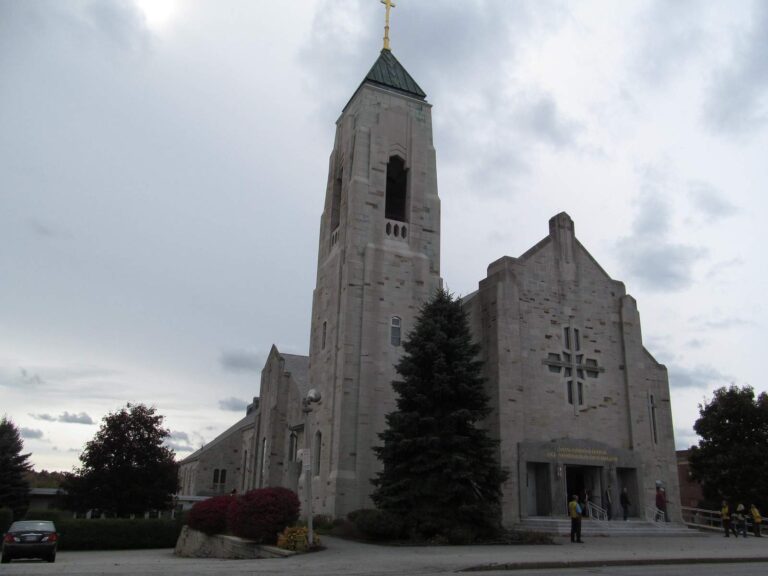
Photo: Doug Kerr, CC BY-SA 2.0

Photo: Paul VanDerWerf, CC BY 2.0
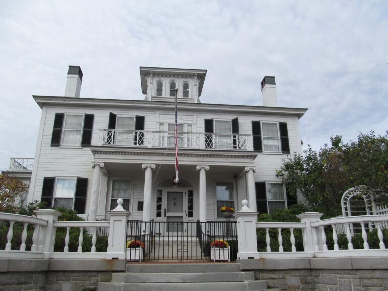
Photo: Doug Kerr, CC BY-SA 2.0
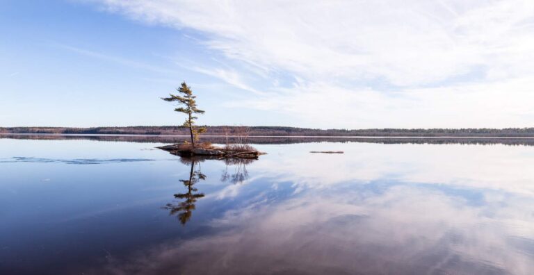
Photo: Paul VanDerWerf, CC BY 2.0
Short replies about fishing around Androscoggin County
Where can a canoe or skiff go in around Androscoggin County?
The MDIFW Fishing Atlas lists 14 ramps, named above with directions.
Which Maine lake carries the largest acre figure in Androscoggin County?
Auburn Lake: 2,278 acres.
Which fish does MDIFW list near Androscoggin County?
MDIFW lists chain pickerel on the most waters in the county, then brown bullhead, golden shiner and white sucker; a listing shows presence, not a catch.
Does a Maine tackle shop have a listing in Androscoggin County?
2 altogether, Stone's Bait & Tackel among them.
Which Maine town serves as seat for Androscoggin County?
Offices for the county are in Auburn.
How much does the MDIFW charge to fish in Androscoggin County?
Residents and nonresidents who are 16 or older buy a license for inland fishing; the season price on the MDIFW fee page is $30 for residents and $83 for nonresidents, agent fees extra.
Which Maine counties lie next to Androscoggin County?
Measured from county centers: Sagadahoc County, Cumberland County and Kennebec County.
What do Maine limits look like for Androscoggin County water?
Limits come from the law book's statewide rows unless the water has its own entry, and an entry replaces the statewide limit for the fish it names; each lake and river page on this site prints its entry. Every rule on this page was read from the MDIFW statewide law pages on Nov. 18, 2026; no revision date is shown, the 2026 law book they cite lapses on Dec. 31, 2026, and nothing for 2027 appears here.
Can I look up a named pond of Androscoggin County on this page?
Waters lacking their own page are the rows listed above, each with a pin; 143 waters are on file overall.
Do Maine clubs hold events in Androscoggin County?
1 entry on file; the next comes Calais Lions Club Ice Fishing Derby (2027) on Round Pond, Jan. 30, 2027.
Choose a brook, pond or river bend in Androscoggin County
Each pinned row gives where the water is, how big it is and which fish it lists.