Fishing in Grant County, Washington
County seat: Ephrata. Population 99,123.
- 54lake pages
- 63launches
- 3river pages
 Pick for troutPiscifun Carbon X ultralight spinning reel28% OFFSale $57.99
Photo of Banks Lake: brewbooks, CC BY-SA 2.0
Lakes, rivers and ramps of Grant County in one read
Ephrata houses the Grant County courthouse, serving 99,123 people as of the 2020 count. Trout planted here show up in the WDFW report as WDFW Region 2 releases. Columbia River straddles the line with Oregon or Idaho.
The paged lakes number 54, spread over 166,707 acres, with Lake Roosevelt on top. Among the county streams, WDFW shows anadromous runs in Columbia River. Launching comes down to 63 boat launches, run by 49 WDFW, 10 State Parks and 4 other agencies. From shore, the WDFW facilities layer lists 199 shore or access sites here, 21 of them piers or platforms.
Census 2020 population; WDFW Fish Washington lake layers, WDFW facilities and State Parks launch layers (WDFW GIS); WDFW marine areas; retrieved October 31, 2026.
 For the trout herePiscifun Carbon XT ultralight spinning reel25% OFFSale $59.99
Lake points and ramps of Grant County, mapped together
WDFW and State Parks launch layers, WDFW facilities, WDFW lake points, NHD river midpoints and WDFW marine area points. Checked November 2026.
Still water WDFW maps within Grant County
| Lake | Acres | Launches | WDFW program | Fish WDFW maps |
|---|---|---|---|---|
| Lake Roosevelt | 83,988 | 0 | Mixed species – Trout emphasis | rainbow trout, brown trout, brook trout |
| Banks Lake | 26,888 | 12 | Mixed species – Warmwater emphasis | rainbow trout, kokanee, largemouth bass |
| Wanapum Lake | 14,362 | 5 | NHD-mapped lake | |
| Potholes Reservoir | 14,282 | 11 | Mixed species – Warmwater emphasis | rainbow trout, largemouth bass, smallmouth bass |
| Rufus Woods Lake | 8,022 | 2 | Mixed species – Trout emphasis | rainbow trout, brown trout, kokanee |
| Moses Lake | 6,728 | 2 | Mixed species – Warmwater emphasis | rainbow trout, largemouth bass, smallmouth bass |
| Priest Rapids Lake | 6,387 | 1 | NHD-mapped lake | |
| Lake Lenore | 1,406 | 2 | Trout emphasis | |
| Billy Clapp Lake | 974 | 1 | Mixed species – Warmwater emphasis | rainbow trout, kokanee, largemouth bass |
| Blue Lake (Grant County) | 534 | 1 | Trout emphasis | rainbow trout |
| Winchester Wasteway | 406 | 3 | NHD-mapped lake | |
| Park Lake | 338 | 3 | Trout emphasis | rainbow trout |
| Alkali Lake | 299 | 1 | Mixed species – Warmwater emphasis | |
| Evergreen Lake | 248 | 4 | Warmwater emphasis | largemouth bass, smallmouth bass, walleye |
| Warden Lake | 200 | 1 | Trout emphasis | rainbow trout, tiger trout |
| Red Rock Lake | 171 | 1 | NHD-mapped lake | |
| Soda Lake | 154 | 0 | Mixed species – Warmwater emphasis | rainbow trout, largemouth bass, smallmouth bass |
| Upper Goose Lake | 130 | 1 | Mixed species – Trout emphasis | rainbow trout, largemouth bass, walleye |
| Deep Lake (Grant County) | 101 | 0 | Trout emphasis | rainbow trout, kokanee |
| Lenice Lake | 93 | 1 | Trout emphasis | rainbow trout |
| Dry Falls Lake | 88 | 0 | Trout emphasis | rainbow trout, brown trout, tiger trout |
| Long Lake (Grant County) | 74 | 1 | Mixed species – Warmwater emphasis | rainbow trout, largemouth bass, smallmouth bass |
| Corral Lake | 71 | 1 | Trout emphasis | rainbow trout |
| Burke Lake | 69 | 3 | Trout emphasis | rainbow trout |
| Canal Lake | 69 | 0 | Trout emphasis | rainbow trout |
| Lower Goose Lake | 65 | 1 | Warmwater emphasis | largemouth bass, walleye, yellow perch |
| Quincy Lake | 54 | 1 | Trout emphasis | rainbow trout |
| Stan Coffin Lake | 53 | 1 | Warmwater emphasis | largemouth bass, bluegill |
| Upper Hampton Lake | 52 | 0 | Trout emphasis | rainbow trout |
| Dusty Lake | 41 | 0 | Trout emphasis | rainbow trout, brown trout, tiger trout |
| Blythe Lake | 37 | 0 | Trout emphasis | rainbow trout |
| Beda Lake | 33 | 1 | Trout emphasis | rainbow trout, pumpkinseed |
| Windmill Lake | 30 | 1 | Trout emphasis | rainbow trout |
| Desert Lake Chain | 29 | 0 | Trout emphasis | rainbow trout |
| North Teal Lake | 22 | 0 | Trout emphasis | rainbow trout |
| Lower Hampton Lake | 18 | 0 | Trout emphasis | rainbow trout |
| Heart Lake (Grant County) | 18 | 0 | Trout emphasis | rainbow trout |
| Perch Lake | 16 | 0 | Trout emphasis | rainbow trout |
| Martha Lake | 16 | 1 | Trout emphasis | rainbow trout |
| South Teal Lake | 15 | 0 | Trout emphasis | rainbow trout |
| North Windmill Lake | 14 | 0 | Trout emphasis | rainbow trout |
| Homestead Lake | 12 | 0 | Trout emphasis | rainbow trout, brown trout, tiger trout |
| Chukar Lake | 12 | 0 | Trout emphasis | rainbow trout |
| Janet Lake | 10 | 0 | Trout emphasis | rainbow trout |
| Rainbow Lake (Grant County) | 10 | 0 | Trout emphasis | rainbow trout, brown trout, brook trout |
| Pillar Lake | 9 | 0 | Trout emphasis | rainbow trout |
| Ancient Lake South | 9 | 0 | Trout emphasis | rainbow trout, largemouth bass |
| June Lake | 8 | 0 | Trout emphasis | rainbow trout |
| Cattail Lake | 8 | 0 | Trout emphasis | rainbow trout |
| Upper Caliche Lake | 7 | 1 | Trout emphasis | rainbow trout |
| Widgeon Lake | 7 | 0 | Trout emphasis | rainbow trout |
| Gadwall Lake | 6 | 0 | Trout emphasis | rainbow trout |
| East Sage Lake | 6 | 0 | Trout emphasis | rainbow trout |
| West Sage Lake | 5 | 0 | Trout emphasis | rainbow trout |
WDFW Fish Washington lowland and high lake layers (surface acres as published, management emphasis, mapped species); WDFW publishes no lake depths in these layers. Retrieved October 31, 2026.
What the WDFW layers say swims near Grant County
Around Ephrata, to 50 miles, rainbow trout turns up on more water pages than the rest.
Species mapped in the WDFW Fish Washington layers, WDFW state records and the 2026 WDFW trout plants, counted per water page within 50 miles; not a survey.
Lakes in Grant County that live on this list only
WDFW and NHD maps hold 17 more named lakes in Grant County, shown with acreage and program.
| Water | Acres | WDFW program | Nearest town |
|---|---|---|---|
| Lois Lake | 4 | Trout emphasis | Warden |
| Poacher Lake | 4 | Trout emphasis | Warden |
| Shoveler Lake | 3 | Trout emphasis | Warden |
| Snipe Lake | 3 | Trout emphasis | Warden |
| Sago Lake | 3 | Trout emphasis | Warden |
| Northup Lake | 2 | Trout emphasis | Coulee Dam |
| Falcon – West Lake | 2 | Trout emphasis | Moses Lake |
| Cliff Lake | 2 | Trout emphasis | Quincy |
| Hourglass Lake | 2 | Trout emphasis | Warden |
| Lemna Lake | 2 | Trout emphasis | Warden |
| Crystal Lake | 1 | Trout emphasis | Quincy |
| Heron – Lower Lake | 1 | Trout emphasis | Moses Lake |
| Heron – Upper Lake | 1 | Trout emphasis | Moses Lake |
| Falcon – East Lake | 1 | Trout emphasis | Moses Lake |
| Cup Lake | 1 | Trout emphasis | Quincy |
| Coot Lake | 1 | Trout emphasis | Othello |
| Columbia Basin Hatchery Cr | 0 | Trout emphasis | Moses Lake North |
WDFW Fish Washington lowland and high lake layers and USGS NHD lake outlines, retrieved October 31, 2026.
Moving water with pages in Grant County
- Columbia RiverSWIFD lists chinook, chum and coho, 8 WDFW shore or access sites, 6 USGS gauges, 728 mi in Washington
- Crab Creek3 WDFW shore or access sites, 3 USGS gauges, 149 mi in Washington
- Lower Crab Creek1 WDFW shore or access site, 1 USGS gauge, 49 mi in Washington
Lesser streams of Grant County (5)
- Frenchman Hills Wasteway2 mapped launches, 3 WDFW shore or access sites, 39 mi in Washington
- Northrup Creek1 WDFW shore or access site, 7 mi in Washington
- Potholes Canal2 WDFW shore or access sites, 51 mi in Washington
- Rocky Ford Creek5 WDFW shore or access sites, 10 mi in Washington
- Winchester Wasteway2 mapped launches, 36 mi in Washington
Streamflow posted by Grant County gauges
| USGS gauge | Latest reading | Time (ET) |
|---|---|---|
| Columbia River Below Priest Rapids Dam, Wa | 61,700 cfs, 9.41 ft gage height | Nov 12 7:15 pm |
| Crab Creek Near Beverly, Wa | 157 cfs, 2.85 ft gage height | Nov 12 7:15 pm |
| Crab Creek Near Moses Lake, Wa | 47 cfs, 2.96 ft gage height | Nov 12 6:45 pm |
| Crab Creek Near Stratford, Wa | 0 cfs, 15.27 ft gage height | Nov 12 7:00 pm |
US Geological Survey provisional data, retrieved Nov 12, 2026 7:33 pm ET. Provisional readings can be revised.
USGS NHD flowlines and Washington lengths, WDFW SWIFD salmon and steelhead distribution, WDFW and State Parks launches, USGS gauges; retrieved October 31, 2026.
WDFW hatchery trucks that stopped in Grant County
The 2026 plant log for Grant County reads 14 releases and 102,691 fish, covering 8 waters.
- Park LakeRainbow, 35,000 fish at 2.5 per pound, September 28, 2026, Columbia Basin Hatchery
- Blue Lake (Grant County)Rainbow, 53,000 fish at 2.5 per pound, September 28, 2026, Columbia Basin Hatchery
- Hatchery CreekRainbow, 900 fish at 2.5 per pound, September 2, 2026, Columbia Basin Hatchery
- Hatchery CreekRainbow, 750 fish at 2.5 per pound, June 23, 2026, Columbia Basin Hatchery
- Potholes ReservoirRainbow, 250 fish at 2.5 per pound, May 29, 2026, Columbia Basin Hatchery
- Hatchery CreekRainbow, 500 fish at 2.5 per pound, May 29, 2026, Columbia Basin Hatchery
- Moses LakeRainbow, 1,200 fish at 2.5 per pound, May 1, 2026, Columbia Basin Hatchery
- Hatchery CreekRainbow, 1,421 fish at 2.5 per pound, May 1, 2026, Columbia Basin Hatchery
- Hatchery CreekRainbow, 895 fish at 2.5 per pound, April 21, 2026, Columbia Basin Hatchery
- Banks LakeRainbow, 1,200 fish at 2.5 per pound, April 17, 2026, Columbia Basin Hatchery
- Hatchery CreekRainbow, 1,000 fish at 2.5 per pound, April 8, 2026, Columbia Basin Hatchery
- Hatchery CreekRainbow, 1,000 fish at 2.5 per pound, March 31, 2026, Columbia Basin Hatchery
WDFW Trout Plants report (rows January 2 to October 27, 2026), read October 31, 2026; newest plants first.
Ramps, piers and access points of Grant County
- Alkali Lake boat launchAlkali Lake, WDFW, 1 ramp, unimproved surface surface, 3 hand launches, Discover Pass
- Billy Clapp Lake boat launchBilly Clapp Lake, WDFW, 1 ramp, concrete surface, Discover Pass
- Blue Lake boat launch (south)Blue Lake, WDFW, 1 ramp, concrete surface, 1 hand launch, Discover Pass
- Blythe boat launch on Potholes ReservoirPotholes Reservoir, WDFW, 1 ramp, concrete surface, Discover Pass
- Buckshot boat launch on Priest Rapids LakePriest Rapids Lake, Grant County PUD, 1 ramp, concrete surface
- Burke Lake (east) boat launchBurke Lake, WDFW, 1 ramp, concrete surface, Discover Pass
- Burke Lake (south) boat launchBurke Lake, WDFW, 1 ramp, concrete surface, Discover Pass
- Burke Lake (west) boat launchBurke Lake, WDFW, 1 ramp, unimproved surface surface, Discover Pass
- Caliche Lakes boat launch on Upper Caliche LakeUpper Caliche Lake, WDFW, 1 ramp, unimproved surface surface, Discover Pass
- Corral Lake boat launchCorral Lake, WDFW, 1 ramp, gravel surface, Discover Pass
- Crab Creek boat launch on Potholes ReservoirPotholes Reservoir, WDFW, 1 ramp, unimproved surface surface, Discover Pass
- Dodson & Winchester boat launch on Winchester WastewayWinchester Wasteway, WDFW, 1 ramp, concrete surface, Discover Pass
- Evergreen Reservoir (east) boat launchEvergreen Lake, WDFW, 1 ramp, concrete surface, Discover Pass
- Evergreen Reservoir (north) boat launchEvergreen Lake, WDFW, 1 ramp, concrete surface, Discover Pass
- Evergreen Reservoir (west) boat launchEvergreen Lake, WDFW, 1 ramp, unimproved surface surface, Discover Pass
- Evergreen Reservoir SW boat launchEvergreen Lake, WDFW, 1 ramp, unimproved surface surface, Discover Pass
- Frenchman Hills Lake boat launchlaunch site, WDFW, 1 ramp, unimproved surface surface, Discover Pass
- Gage Station boat launch on Lake LenoreLake Lenore, WDFW, 1 ramp, unimproved surface surface, Discover Pass
- Glen Williams boat launch on Potholes ReservoirPotholes Reservoir, WDFW, 1 ramp, concrete surface, Discover Pass
- Lind Coulee Bridge boat launch on Potholes ReservoirPotholes Reservoir, WDFW, 1 ramp, concrete surface, Discover Pass
- Lind Coulee Island boat launch on Potholes ReservoirPotholes Reservoir, WDFW, 1 ramp, unimproved surface surface, Discover Pass
- Lind Coulee Point boat launch on Potholes ReservoirPotholes Reservoir, WDFW, 1 ramp, unimproved surface surface, Discover Pass
- Long Lake boat launch (east)Long Lake, WDFW, 1 ramp, unimproved surface surface, Discover Pass
- Lower Goose Lake boat launchLower Goose Lake, WDFW, 1 ramp, unimproved surface surface, Discover Pass
- Million Dollar Mile (north) boat launch on Banks LakeBanks Lake, WDFW, 1 ramp, unimproved surface surface, Discover Pass
- Million Dollar Mile (south) boat launch on Banks LakeBanks Lake, WDFW, 1 ramp, concrete surface, Discover Pass
- Moses Lake boat launchMoses Lake, WDFW, 1 ramp, concrete surface, Discover Pass
- Osborn Bay Lake boat launch on Banks LakeBanks Lake, WDFW, 1 ramp, unimproved surface surface, Discover Pass
- Potholes, boat launchPotholes Reservoir, State Parks, Discover Pass
- Quincy Lake boat launchQuincy Lake, WDFW, 1 ramp, concrete surface, Discover Pass
- Sam Israel boat launch on Lake LenoreLake Lenore, WDFW, 1 ramp, unimproved surface surface, Discover Pass
- Sampson's Pit boat launch on Potholes ReservoirPotholes Reservoir, WDFW, 1 ramp, unimproved surface surface, Discover Pass
- Stan Coffin Lake boat launchStan Coffin Lake, WDFW, 1 ramp, concrete surface, Discover Pass
- Steamboat Rock -North Banks Lake launchBanks Lake, State Parks, Discover Pass
- Steamboat Rock -Northrup launch on Banks LakeBanks Lake, State Parks, Discover Pass
- Steamboat Rock -cove boat launch on Banks LakeBanks Lake, State Parks, Discover Pass
- Steamboat Rock launch on Banks LakeBanks Lake, State Parks, Discover Pass
- Sun Lakes launch on Park LakePark Lake, State Parks, Discover Pass
- Sunland Estates boat launch on Wanapum LakeWanapum Lake, WDFW, 1 ramp, concrete surface, Discover Pass
- Upper Goose Lake boat launchUpper Goose Lake, WDFW, 1 ramp, concrete surface, Discover Pass
- Vernita Bridge boat launchlaunch site, WDFW, 2 ramps, unimproved surface surface, Discover Pass
- Warden Lake boat launchWarden Lake, WDFW, 1 ramp, unimproved surface surface, Discover Pass
- Winchester Lake boat launch on Winchester Wasteway (north)Winchester Wasteway, WDFW, 1 ramp, unimproved surface surface, Discover Pass
- Winchester Lake boat launch on Winchester Wasteway (south)Winchester Wasteway, WDFW, 1 ramp, unimproved surface surface, Discover Pass
- Windmill-Canal-Heart Lakes boat launchWindmill Lake, WDFW, 3 ramps, concrete surface, 1 hand launch, Discover Pass
- 239 Drain boat launchlaunch site, WDFW, 1 hand launch, Discover Pass
- Beda Lake boat launchBeda Lake, WDFW, 1 hand launch, Discover Pass
- Fedesco-Harris boat launch on Winchester WastewayWinchester Wasteway, WDFW, 1 hand launch, Discover Pass
- Frenchman Hills Wasteway boat launchFrenchman Hills Wasteway, WDFW, 1 hand launch, Discover Pass
- Lenice Lake boat launchLenice Lake, WDFW, 3 hand launches, Discover Pass
- Lind Coulee East boat launch on Potholes ReservoirPotholes Reservoir, WDFW, 2 hand launches, Discover Pass
- Martha Lake boat launchMartha Lake, WDFW, 1 hand launch, Discover Pass
- Medicare Beach boat launch on Potholes ReservoirPotholes Reservoir, WDFW, 1 hand launch, Discover Pass
- Old Vantage Highway boat launch on Wanapum LakeWanapum Lake, agency not given, concrete surface
- Peninsula Park boat launch on Moses LakeMoses Lake, agency not given, concrete surface
- Red Rock Lake boat launchRed Rock Lake, agency not given, unimproved surface
- Road C & Frenchman boat launch on Frenchman Hills WastewayFrenchman Hills Wasteway, WDFW, 3 hand launches, Discover Pass
- Steamboat Rock -Northrup launch on Banks LakeBanks Lake, State Parks, Discover Pass
- Steamboat Rock launch on Banks LakeBanks Lake, State Parks, Discover Pass
- Sun Lakes launch on Park LakePark Lake, State Parks, Discover Pass
- Sun Lakes launch on Park LakePark Lake, State Parks, Discover Pass
- Warden Outfall boat launch on Potholes ReservoirPotholes Reservoir, WDFW, 1 hand launch, Discover Pass
- Winchester Lake boat launch on Winchester Wasteway (south), Grant CountyWinchester Wasteway, WDFW, 1 hand launch, Discover Pass
The pass flag is set at 59 launches: hang a Discover Pass from the mirror there.
Fishing on foot in Grant County (199)
- Outlet on Moses Lakefishing platform
- Park Lakeshore fishing site, Dock fishing
- Rocky Ford Hatcheryfishing platform
- Alkali Lake shore accessshore fishing site, Multiple shore fishing areas within short walking distance
- Alkali Lake shore accessshore fishing site, Off-highway parking, 100+ feet of shore fishing
- Alkali Lake shore access near Soap Lakeshore fishing site, Off-highway parking, 100+ feet of shore fishing
- Ancient Lakeaccess point (no launch)
- Ancient Lakes shore accessshore fishing site, Four hike-in lakes with substantial shore fishing area, can
- Banks Lake shore accessshore fishing site, 400+ meters of shore fishing area
- Banks Lake shore accessshore fishing site, Off-highway parking, 100+ meters of shore fishing, steep roc
- Banks Lake shore access near Banks Lake Southshore fishing site, Expansive shore fishing area within short walking distance
- Banks Lake shore access near Coulee Cityshore fishing site, 100+ meters of shore fishing
- Banks Lake shore access near Electric City (east), Grant Countyshore fishing site, Limited shore fishing within hiking distance
- Banks Lake shore access near Electric City (east), Grant Countyshore fishing site, Several multi-vehicle turnouts with shore fishing
- Banks Lake shore access near Electric City (south), Grant Countyshore fishing site, Multiple small off-highway parking areas with variable size
- Banks Lake shore access near Electric City (south), Grant Countyshore fishing site, Expansive shore fishing areas within walking distance
- Banks Lake shore access near Electric City (west)shore fishing site, Multiple shore fishing areas withing walkin and driving dist
- Banks Lake shore access near Grand Couleeshore fishing site, Inlet Canal with 200+ meters shore fishing area, can be stee
- Banks Lake shore access near Hartline (north)shore fishing site, Off-highway parking, expansive shore fishing area, can be st
- Banks Lake shore access near Hartline (south)shore fishing site, 200+ meters of shore fishing
- Beda Lake fishing piershore fishing site, Few shore fishing areas, best with float tube
- Billy Clapp Lake shore accessshore fishing site, 100+ meters of shore fishing, trail leading North to possibl
- Billy Clapp Lake shore access near Coulee Cityshore fishing site, 200+ meters of shore fishing area
- Blue Lake shore accessshore fishing site, Expansive off-highway parking and shore fishing
- Blue Lake shore accessshore fishing site, Expansive off-highway parking and shore fishing
- Blue Lake shore access near Coulee City (east)shore fishing site, Limited shore fishing area
- Blue Lake shore access near Coulee City (north)shore fishing site, Multiple off-highway parking areas and shore fishing through
- Blue Lake shore access near Coulee City (south), Grant Countyshore fishing site, Dirt road to multiple shore fishing areas
- Blue Lake shore access near Coulee City (south), Grant Countyshore fishing site, Dirt road to multiple shore fishing areas
- Blythe Lake shore accessshore fishing site, Numerous shore fishing areas around lake
- Burke Lake shore accessshore fishing site, Trails on both sides of lake leading to multiple shore fishi
- Burke Lake shore accessshore fishing site, Drive-to shore fishing areas
- Burke Lake shore access near Georgeshore fishing site, 150+ feet of shore fishing area with trails to multiple othe
- Canal Lake (south) shore accessaccess point (no launch)
- Canal Lake on Windmill Lakeshore fishing site, Many shore fishing areas within short walking distance from
- Castle Lakeshore fishing site, Hike-in through North end of Deep Lake, shore fishing area a
- Cattail Lake shore accessshore fishing site, Hike in, limited shore fishing areas
- Chukar Lake shore accessshore fishing site, Hike-in, limited shore fishing areas
- Clementine Lakeaccess point (no launch)
- Cliff Lake shore accessshore fishing site, Hike in, multiple shore fishing areas
- Columbia Basin Hatcheryaccess point (no launch)
- Coot Lake on North Teal Lakeshore fishing site, Several shore fishing areas, weedy
- Corral Lake SWaccess point (no launch)
- Corral Lake shore accessshore fishing site, Multiple shore fishing areas East of parking area
- Crater Lakeaccess point (no launch)
- Crater Sloughaccess point (no launch)
- Crystal Lake shore accessshore fishing site, Hike in, multiple shore fishing areas
- Cup Lake shore accessshore fishing site, Hike in past Crystal Lake, multiple shore fishing areas
- Deep Lake shore access near Coulee Cityshore fishing site, Trail to both sides of lake leading to many shore fishing ar
- Desert Lake Chain shore accessshore fishing site, Hike-in only, limited shore fishing areas depending on lake
- Dodsonaccess point (no launch)
- Dodson & Frenchman on Frenchman Hills Wastewayaccess point (no launch)
- Dry Falls Lake fishing piershore fishing site, Very limited shore fishing area, primarily accessed by float
- Dusty Lake shore accessshore fishing site, Hike in, 100+ meters of shore fishing area, lengthy trails a
- Evergreen Reservoir shore accessshore fishing site, Dirt road leading to multiple shore fishing areas
- Evergreen Reservoir shore accessshore fishing site, Parking with 100+ meters of shore fishing area
- Evergreen Reservoir shore access near George (east)shore fishing site, Trails leading away from boat launch both directions to shor
- Evergreen Reservoir shore access near George (west), Grant Countyshore fishing site, Parking with 200+ meters of shore fishing area
- Evergreen Reservoir shore access near George (west), Grant Countyshore fishing site, Limited shore fishing, follow trail along lake to more shore
- Falcon Lakes on Potholes Reservoirshore fishing site, Multiple lakes with weedy shore fishing areas, must search f
- Fedesco-Harris 2access point (no launch)
- Fedesco-Harris 3access point (no launch)
- Fishing pierfishing pier
- Fishing pierfishing pier
- Fishing pierfishing pier
- Fishing pierfishing pier
- Fishing pier on Burke Lakefishing pier
- Fishing pier on Martha Lakefishing pier
- Fishing pier on Moses Lakefishing pier
- Fishing pier on Rocky Ford Creekfishing pier
- Fishing pier on Windmill Lakefishing pier
- Fishing pier on Windmill Lakefishing pier
- Fishing pier on Windmill Lakefishing pier
- Fordair on Banks Lakeaccess point (no launch)
- Frenchman Couleeaccess point (no launch)
- Frenchman Hills 2 on Frenchman Hills Wastewayaccess point (no launch)
- Frenchman Hills 4 on Frenchman Hills Wastewayaccess point (no launch)
- Gadwall Lake shore accessshore fishing site, Hike in, multiple shore fishing areas
- Gloyd Seeps Road 10access point (no launch)
- Gloyd Seeps Road 12access point (no launch)
WDFW Facilities layer (boat launches, piers, shore sites) and the State Parks boat launch layer; retrieved October 31, 2026. Lanes and per-launch fees are not published in these layers.
The 2026-27 pamphlet rows covering Grant County
Start with the statewide table for Grant County; any Special Rule listed after it overrides those rows. WDFW sells the 2026-27 Freshwater license for $39.95 to Washington residents and $115.85 to visitors 16 and up. Keep a catch record card on you for salmon, steelhead, sturgeon or halibut; WDFW issues it with the license.
| Species | Limit | Season |
|---|---|---|
| Largemouth Bass | No min. size in lakes, ponds, and reservoirs. Only largemouth bass less than 12" may be retained, except 1 over 17" may be retained. Daily limit 5. | Lakes, ponds, and reservoirs: year-round; rivers, streams and beaver ponds: Sat. before Memorial Day through Oct. 31 |
| Largemouth Bass | No size restriction/daily limit in rivers, streams, and beaver ponds. | Lakes, ponds, and reservoirs: year-round; rivers, streams and beaver ponds: Sat. before Memorial Day through Oct. 31 |
| Smallmouth Bass | No min. size in lakes, ponds, and reservoirs. Only 1 smallmouth bass over 14" may be retained. Daily limit 10. | Lakes, ponds, and reservoirs: year-round; rivers, streams and beaver ponds: Sat. before Memorial Day through Oct. 31 |
| Smallmouth Bass | No size restriction/daily limit in rivers, streams, and beaver ponds. | Lakes, ponds, and reservoirs: year-round; rivers, streams and beaver ponds: Sat. before Memorial Day through Oct. 31 |
| Walleye | Min. size 12" in lakes, ponds, and reservoirs. Daily limit 8. Only 1 over 22" may be retained. May be caught, retained, and released alive from a livewell until daily limit is in possession. | Lakes, ponds, and reservoirs: year-round; rivers, streams and beaver ponds: Sat. before Memorial Day through Oct. 31 |
| Walleye | No size restriction/daily limit in rivers, streams, and beaver ponds. | Lakes, ponds, and reservoirs: year-round; rivers, streams and beaver ponds: Sat. before Memorial Day through Oct. 31 |
| Channel Catfish | No min. size in lakes, ponds, and reservoirs. Daily limit 5. | Lakes, ponds, and reservoirs: year-round; rivers, streams and beaver ponds: Sat. before Memorial Day through Oct. 31 |
| Channel Catfish | No min. size/daily limit in rivers, streams, and beaver ponds. | Lakes, ponds, and reservoirs: year-round; rivers, streams and beaver ponds: Sat. before Memorial Day through Oct. 31 |
| Burbot (Freshwater Ling) | No min. size. Daily limit 5. | Lakes, ponds, and reservoirs: year-round; rivers, streams and beaver ponds: Sat. before Memorial Day through Oct. 31 (p.23 general rule for |
| Crappie, Northern Pikeminnow, Peamouth Chub, Perch, Suckers, Sunfish, | No min. size. No daily limit. | Lakes, ponds, and reservoirs: year-round; rivers, streams and beaver ponds: Sat. before Memorial Day through Oct. 31 |
| Grass Carp | Closed unless otherwise listed in Special Rules. | Closed |
| Kokanee | No min. size. Daily limit 10. When fishing with bait, all kokanee that are lawful to possess and are equal to or greater than the minimum size are counted as part of the daily limit whether kept or released. | Lakes, ponds, and reservoirs: year-round; rivers, streams and beaver ponds: Sat. before Memorial Day through Oct. 31 (p.23 general rule for |
| Tiger Muskellunge (Tiger Muskie) | Min. size 50". Daily limit 1. | Lakes, ponds, and reservoirs: year-round; rivers, streams and beaver ponds: Sat. before Memorial Day through Oct. 31 (p.23 general rule for |
| Whitefish | No min. size. Daily limit 15. | Lakes, ponds, and reservoirs: year-round; rivers, streams and beaver ponds: Sat. before Memorial Day through Oct. 31 (p.23 general rule for |
| Steelhead | Release all wild steelhead. Min. size 20". Daily limit 2. Open during salmon or game fish seasons unless as otherwise listed. | Open during salmon or game fish seasons unless as otherwise listed |
| Brown Trout, Cutthroat Trout, Rainbow Trout, Golden Trout, Tiger Trout | In rivers, streams, and beaver ponds: Min. size 8". Daily limit 2. | Sat. before Memorial Day-Oct. 31 (statewide river season, p.23) |
Special Rules naming Grant County water (792)
| Water and reach | Species | Rule |
|---|---|---|
| Columbia Basin Hatchery Creek: from the hatchery outflow to confluence with Rocky Coulee Wasteway | All species | Open for juvenile anglers, senior anglers and anglers with a disability who possess a designated harvester companion card only. |
| Columbia Basin Hatchery Creek: from the hatchery outflow to confluence with Rocky Coulee Wasteway | All game fish | Statewide min. size/daily limit. (Apr. 1-Sept. 30) |
| Crab Creek: from mouth to Morgan Lake Rd. in Sec. 36 | All game fish | Statewide min. size/daily limit. (Sat. before Memorial Day-Sept. 30) |
| Crab Creek: from Morgan Lake Rd. in Sec. 36 to O’Sullivan Dam (including Marsh Units I and II impoundments) | All species | CLOSED WATERS. |
| Crab Creek: from the confluence of the Moses Lake outlets to Sand Dunes Rd. including tributaries | Bluegill | No min. size. Combined limit of bluegill and crappie is 25. (Year-round) |
| Crab Creek: from the confluence of the Moses Lake outlets to Sand Dunes Rd. including tributaries | Crappie | Min. size 9”. Combined limit of bluegill and crappie is 25. (Year-round) |
| Crab Creek: from the confluence of the Moses Lake outlets to Sand Dunes Rd. including tributaries | Yellow perch | No min. size. Daily limit 25. (Year-round) |
| Crab Creek: from the confluence of the Moses Lake outlets to Sand Dunes Rd. including tributaries | Other game fish | Statewide min. size/daily limit for lakes, ponds, and reservoirs apply. (Year-round) |
| Crab Creek: from the fountain buoy and shoreline markers of 150’ down stream of the Alder Street fill to Grant County Rd. 7 NE | Bluegill | Min. size 8”. Daily limit 5. (Year-round) |
| Crab Creek: from the fountain buoy and shoreline markers of 150’ down stream of the Alder Street fill to Grant County Rd. 7 NE | Crappie | Min. size 9”. Daily limit 10. (Year-round) |
| Crab Creek: from the fountain buoy and shoreline markers of 150’ down stream of the Alder Street fill to Grant County Rd. 7 NE | Yellow perch | No min. size. Daily limit 25. (Year-round) |
| Crab Creek: from the fountain buoy and shoreline markers of 150’ down stream of the Alder Street fill to Grant County Rd. 7 NE | Other game fish | Statewide min. size/daily limit for lakes, ponds, and reservoirs apply. (Year-round) |
| Crab Creek: above Grant County Rd. 7 and all tributaries except Goose Creek in the city of Wilbur | All game fish | Statewide min. size/daily limit. (Year-round) |
| Delaney Spring Creek | All game fish | Statewide min. size/daily limit. Except: Eastern brook trout count as part of trout daily limit. (Sat. before Memorial Day-Oct. 31) |
| Frenchman Hills Wasteways And Drains | All game fish | Statewide min. size/daily limit. Except: Eastern brook trout count as part of trout daily limit. (Year-round) |
| Grant And Adams Counties: all inlets and outlets of lakes, ponds, and reservoirs and all irrigation canals, wasteways, and drains in Grant and Adams counties ex | All game fish | Statewide rules for lakes, ponds, and reservoirs apply for all species. (Year-round) |
| Hays Creek | All game fish | Statewide min. size/daily limit. (4th Sat. in Apr.-Sept. 30) |
| Nunnally Lake Outlet: Outlet stream of Nunnally Lake | All species | CLOSED WATERS. |
| Red Rock Creek | All game fish | Statewide min. size/daily limit. (Sat. before Memorial Day-Sept. 30) |
| Rocky Ford Creek And Ponds | All species | Bank fishing only. Fly fishing only. No wading. |
Limits and seasons as printed in the 2026-2027 Washington Sport Fishing Rules (WDFW pamphlet, in effect July 1, 2026 to June 30, 2027), PDF page 27 (pamphlet PDF; eRegulations statewide freshwater page), read October 31, 2026. Special Rules as printed in the 2026-2027 Washington Sport Fishing Rules (WDFW pamphlet, in effect July 1, 2026 to June 30, 2027), pamphlet page 50 (pamphlet PDF), read on eRegulations October 31, 2026.
Grant County entries on the WDFW record list
| Species | Weight | Angler | Water | Date |
|---|---|---|---|---|
| Common Carp | 49.50 lbs | Duane Fisher | Moses Lake | June 17, 2006 |
| Yellow Bullhead | 2.38 lbs | Monica Beckley | Potholes Reservoir | Sept. 8, 2013 |
| Kokanee (non-anadromous Sockeye Salmon) | 6.25 lbs | Clarence F. Rief | Lake Roosevelt | June 26, 2003 |
| Lake Whitefish | 7.86 lbs | Gavin Boggs | Lake Roosevelt | Feb. 11, 2023 |
| Smallmouth Bass | 8.75 lbs | Ray Wonacott | Columbia River | April 23, 1966 |
| Blue Catfish | 17.75 lbs | Rangle Hawthorne | Columbia River | July 9, 1975 |
| Peamouth | 1.48 lbs | Michael Lane | Columbia River | May 10, 2026 |
| Rainbow Trout, resident (including triploid) | 29.60 lbs | Norm Butler | Rufus Woods Lake | Nov. 11, 2002 |
Washington Department of Fish and Wildlife (WDFW) sport fish records list, as of October 31, 2026.
Events launching inside Grant County
10 published events launch in or fish Grant County, with 1 upcoming.
| Date | Event | Water | Organizer |
|---|---|---|---|
| May 1, 2027 | Nixon's Marine Open | Moses Lake | Northwest Bass |
| Sept. 19, 2026 | Championship – Banks Lake | Banks Lake | Northwest Bass |
| Aug. 8, 2026 | Washington State Championship | Moses Lake | Student Angler Federation (The Bass Federation high school program) |
| July 25, 2026 | Tour Event 4 | Banks Lake | Kayak Fishing Northwest |
| June 20, 2026 | Lake Moses 2026/06/20 & 21 Camping Invitational | Moses Lake | Washington State Pond Jumperz Bass Club |
| June 13, 2026 | Potholes Tournament (Open) | Potholes Reservoir | Northwest Bass |
| May 15, 2026 | Big Bass Tournament | Potholes Reservoir | Northwest Bass |
| April 25, 2026 | Banks Lake Bass Fishing | Banks Lake | Northwest Bass |
| April 25, 2026 | Tour Event 1 | Potholes Reservoir | Kayak Fishing Northwest |
| June 14, 2025 | Moses Lake 6/14-15/2025 | Moses Lake | Washington State Pond Jumperz Bass Club |
Organizer schedule and results pages, checked November 2026.
Grant County fly shops, tackle and hired skippers
Stores keeping Grant County anglers supplied
- Desert Fly Anglerfly shop, Ephrata
- Sportsman's Warehouse Moses Lakesporting goods store, Moses Lake
Yellow Pages and chain store listings, guide and charter listings (city of business); retrieved October 31, 2026.
Places that border Grant County
Grant County towns with a fishing page
- Moses Lakepop. 25,146
- Ephratapop. 8,477
- Quincypop. 7,543
- Cascade Valleypop. 4,332
- Moses Lake Northpop. 4,050
- Mattawapop. 3,335
- Wardenpop. 2,449
- Desert Airepop. 2,288
- Royal Citypop. 1,776
- Soap Lakepop. 1,691
- Lakeviewpop. 1,068
Neighbouring Washington counties of Grant County
- Douglas County38 miles north
- Adams County48 miles east
- Franklin County54 miles southeast
- Lincoln County55 miles northeast
What Piscifun sells for a morning at Grant County


Piscifun and Amazon links are affiliate links; the site earns a commission on qualifying purchases.
How to tell one Grant County fish from another, by photo
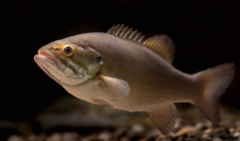
Photo: USFWS Mountain-Prairie, Public domain

Photo: USFWS – Pacific Region, CC BY 2.0
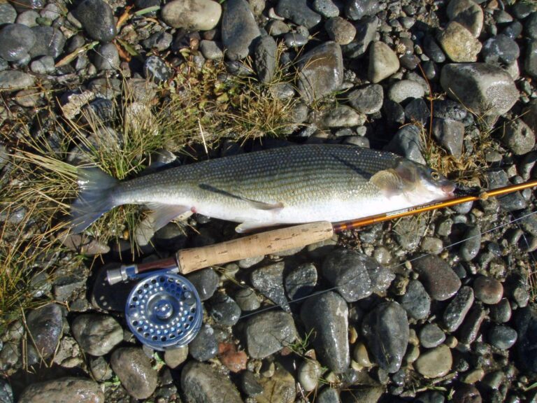
Photo: Mike Cline, Public domain

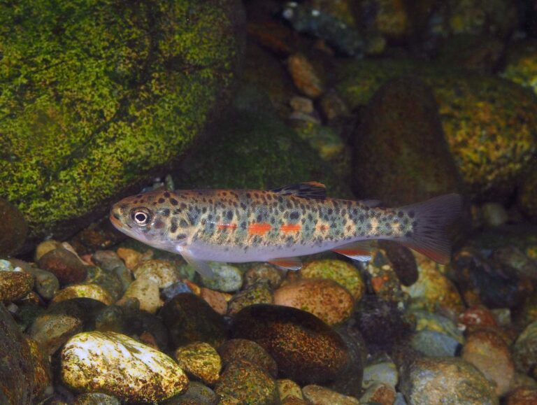
Photo: USFWS – Pacific Region, Public domain
Common questions about angling in Grant County
How many boat launches are mapped in Grant County?
63 launches in all, managed by 49 WDFW, 10 State Parks and 4 other agencies.
Which Grant County lake spreads widest in the WDFW layer?
Lake Roosevelt, at 83,988 surface acres in the WDFW layer.
Which species show up on the most waters by Grant County?
Rainbow trout lead the count of water pages within 50 miles, followed by largemouth bass, yellow perch and bluegill.
Is there a bait counter in Grant County?
There are 2, Desert Fly Angler among them.
Do any river guides call Grant County home?
No guide lists this county; the Washington guides page has the rest.
Where do Grant County residents go for county business?
The seat is Ephrata.
Which Washington license covers Grant County water?
WDFW sells the 2026-27 Freshwater license for $39.95 to Washington residents and $115.85 to visitors 16 and up.
What counties share a line with Grant County?
Neighbours by distance: Douglas County, Adams County and Franklin County.
Do clubs or derbies fish in Grant County?
10 events on file; next is Nixon's Marine Open on Moses Lake, May 1, 2027.
Where do Grant County waters depart from the statewide tables?
The 2026-27 pamphlet prints 792 Special Rule entries touching this county, starting with Columbia Basin Hatchery Creek; the table above shows the first ones.
Has a Washington record fish come from Grant County?
Common Carp, 49.50 lbs, from Moses Lake, Grant County (June 17, 2006).
How many trout went into Grant County water in 2026?
14 WDFW plants so far in 2026, 102,691 fish; the latest went into Park Lake on Sept. 28, 2026.
Hitch up the boat for Grant County
Check the Special Rules before keeping fish.