Fishing in Adams County, Washington
County seat: Ritzville. Population 20,613.
- 8lake pages
- 3launches
- 2river pages
 Pick for troutPiscifun Carbon X ultralight spinning reel28% OFFSale $57.99
Photo of Palouse River: Vineesh Devasia, CC BY 2.0
Lakes, rivers and ramps of Adams County in one read
Ritzville houses the Adams County courthouse, serving 20,613 people as of the 2020 count.
The paged lakes number 8, spread over 2,217 acres, with Sprague Lake on top. Among the county streams, WDFW shows anadromous runs in Palouse River. Launching comes down to 3 boat launches, run by 3 WDFW. WDFW maps 15 shore or access sites for bank anglers; no pier is listed.
Census 2020 population; WDFW Fish Washington lake layers, WDFW facilities and State Parks launch layers (WDFW GIS); WDFW marine areas; retrieved October 31, 2026.
Lake points and ramps of Adams County, mapped together
WDFW and State Parks launch layers, WDFW facilities, WDFW lake points, NHD river midpoints and WDFW marine area points. Checked November 2026.
Still water WDFW maps within Adams County
| Lake | Acres | Launches | WDFW program | Fish WDFW maps |
|---|---|---|---|---|
| Sprague Lake | 1,760 | 1 | Mixed species – Warmwater emphasis | rainbow trout, largemouth bass, brown bullhead |
| Cow Lake | 199 | 1 | Mixed species – Trout emphasis | rainbow trout, largemouth bass, brown bullhead |
| Fourth Of July Lake | 101 | 1 | Trout emphasis | rainbow trout |
| Shiner Lake | 81 | 0 | Warmwater emphasis | largemouth bass, yellow perch, black crappie |
| Halfmoon Lake (Adams County) | 25 | 0 | NHD-mapped lake | |
| Herman Lake | 24 | 0 | Mixed species – Warmwater emphasis | rainbow trout, largemouth bass |
| South Teal Lake | 15 | 0 | Trout emphasis | rainbow trout |
| Quail Lake | 12 | 0 | Trout emphasis | rainbow trout |
WDFW Fish Washington lowland and high lake layers (surface acres as published, management emphasis, mapped species); WDFW publishes no lake depths in these layers. Retrieved October 31, 2026.
 For the trout herePiscifun Carbon XT ultralight spinning reel25% OFFSale $59.99
What the WDFW layers say swims near Adams County
Around Ritzville, to 50 miles, rainbow trout turns up on more water pages than the rest.
Species mapped in the WDFW Fish Washington layers, WDFW state records and the 2026 WDFW trout plants, counted per water page within 50 miles; not a survey.
Moving water with pages in Adams County
- Palouse RiverSWIFD lists chinook and steelhead trout, 1 USGS gauge, 124 mi in Washington
- Lower Crab Creek1 WDFW shore or access site, 1 USGS gauge, 49 mi in Washington
Lesser streams of Adams County (1)
- Potholes Canal2 WDFW shore or access sites, 51 mi in Washington
USGS NHD flowlines and Washington lengths, WDFW SWIFD salmon and steelhead distribution, WDFW and State Parks launches, USGS gauges; retrieved October 31, 2026.
Ramps, piers and access points of Adams County
- Sprague Lake boat launchSprague Lake, WDFW, 1 ramp, concrete surface, Discover Pass
- Cow Lake boat launchCow Lake, WDFW, 1 hand launch, Discover Pass
- Lyle Lake boat launchlaunch site, WDFW, 1 hand launch, Discover Pass
The pass flag is set at 3 launches: hang a Discover Pass from the mirror there.
Fishing on foot in Adams County (15)
- Cow Lake shore accessshore fishing site, Drive-to shore fishing areas in close proximity to this loca
- Coyote Creek Pondsshore fishing site, Hike in, multiple shore fishing areas
- Deadman Lakeshore fishing site, Hike in, multiple shore fishing areas
- Halfmoon Lake shore accessshore fishing site, Numerous shore fishing areas around lake
- Herman Lake shore accessshore fishing site, Small shore fishing area, limited shore fishing around the l
- Linda Lakeaccess point (no launch)
- Lyle Lakeshore fishing site, 2-3 shore fishing areas dependent of vegetation growth, may
- McMannaman Lakeshore fishing site, Several shore fishing areas a short walk from parking lot
- Quail Lake on Herman Lakeaccess point (no launch)
- Quail Lake on Herman Lakeshore fishing site, Hike in, limited shore fishing area
- Shiner Lake shore accessshore fishing site, Walk-in through Hutchinson Lake access, rough terrain, best
- Sprague Lake shore accessshore fishing site, 100+ feet of shore fishing area, can hike to a few other fis
- Sprague Lake shore access, Adams County (east), Adams Countyshore fishing site, Rough boat launch with 2-3 shore fishing areas depending on
- Sprague Lake shore access, Adams County (east), Adams Countyshore fishing site, 100+ feet of shore fishing area, Fee required
- Sprague Lake shore access, Adams County (west)shore fishing site, 200+ feet of shore fishing area, Fee required
WDFW Facilities layer (boat launches, piers, shore sites) and the State Parks boat launch layer; retrieved October 31, 2026. Lanes and per-launch fees are not published in these layers.
Bait just over the line from Adams County
- Sportsman's Warehouse Moses Lakesporting goods store, Moses Lake, 42 miles
Yellow Pages and chain store listings; straight-line miles from Ritzville for shops with an exact point.
The 2026-27 pamphlet rows covering Adams County
Start with the statewide table for Adams County; any Special Rule listed after it overrides those rows. WDFW sells the 2026-27 Freshwater license for $39.95 to Washington residents and $115.85 to visitors 16 and up. Keep a catch record card on you for salmon, steelhead, sturgeon or halibut; WDFW issues it with the license.
| Species | Limit | Season |
|---|---|---|
| Largemouth Bass | No min. size in lakes, ponds, and reservoirs. Only largemouth bass less than 12" may be retained, except 1 over 17" may be retained. Daily limit 5. | Lakes, ponds, and reservoirs: year-round; rivers, streams and beaver ponds: Sat. before Memorial Day through Oct. 31 |
| Largemouth Bass | No size restriction/daily limit in rivers, streams, and beaver ponds. | Lakes, ponds, and reservoirs: year-round; rivers, streams and beaver ponds: Sat. before Memorial Day through Oct. 31 |
| Smallmouth Bass | No min. size in lakes, ponds, and reservoirs. Only 1 smallmouth bass over 14" may be retained. Daily limit 10. | Lakes, ponds, and reservoirs: year-round; rivers, streams and beaver ponds: Sat. before Memorial Day through Oct. 31 |
| Smallmouth Bass | No size restriction/daily limit in rivers, streams, and beaver ponds. | Lakes, ponds, and reservoirs: year-round; rivers, streams and beaver ponds: Sat. before Memorial Day through Oct. 31 |
| Walleye | Min. size 12" in lakes, ponds, and reservoirs. Daily limit 8. Only 1 over 22" may be retained. May be caught, retained, and released alive from a livewell until daily limit is in possession. | Lakes, ponds, and reservoirs: year-round; rivers, streams and beaver ponds: Sat. before Memorial Day through Oct. 31 |
| Walleye | No size restriction/daily limit in rivers, streams, and beaver ponds. | Lakes, ponds, and reservoirs: year-round; rivers, streams and beaver ponds: Sat. before Memorial Day through Oct. 31 |
| Channel Catfish | No min. size in lakes, ponds, and reservoirs. Daily limit 5. | Lakes, ponds, and reservoirs: year-round; rivers, streams and beaver ponds: Sat. before Memorial Day through Oct. 31 |
| Channel Catfish | No min. size/daily limit in rivers, streams, and beaver ponds. | Lakes, ponds, and reservoirs: year-round; rivers, streams and beaver ponds: Sat. before Memorial Day through Oct. 31 |
| Burbot (Freshwater Ling) | No min. size. Daily limit 5. | Lakes, ponds, and reservoirs: year-round; rivers, streams and beaver ponds: Sat. before Memorial Day through Oct. 31 (p.23 general rule for |
| Crappie, Northern Pikeminnow, Peamouth Chub, Perch, Suckers, Sunfish, | No min. size. No daily limit. | Lakes, ponds, and reservoirs: year-round; rivers, streams and beaver ponds: Sat. before Memorial Day through Oct. 31 |
| Grass Carp | Closed unless otherwise listed in Special Rules. | Closed |
| Kokanee | No min. size. Daily limit 10. When fishing with bait, all kokanee that are lawful to possess and are equal to or greater than the minimum size are counted as part of the daily limit whether kept or released. | Lakes, ponds, and reservoirs: year-round; rivers, streams and beaver ponds: Sat. before Memorial Day through Oct. 31 (p.23 general rule for |
| Tiger Muskellunge (Tiger Muskie) | Min. size 50". Daily limit 1. | Lakes, ponds, and reservoirs: year-round; rivers, streams and beaver ponds: Sat. before Memorial Day through Oct. 31 (p.23 general rule for |
| Whitefish | No min. size. Daily limit 15. | Lakes, ponds, and reservoirs: year-round; rivers, streams and beaver ponds: Sat. before Memorial Day through Oct. 31 (p.23 general rule for |
| Steelhead | Release all wild steelhead. Min. size 20". Daily limit 2. Open during salmon or game fish seasons unless as otherwise listed. | Open during salmon or game fish seasons unless as otherwise listed |
| Brown Trout, Cutthroat Trout, Rainbow Trout, Golden Trout, Tiger Trout | In rivers, streams, and beaver ponds: Min. size 8". Daily limit 2. | Sat. before Memorial Day-Oct. 31 (statewide river season, p.23) |
Special Rules naming Adams County water (46)
| Water and reach | Species | Rule |
|---|---|---|
| Bobcat Creek | All game fish | Statewide min. size/daily limit. (4th Sat. in Apr.-Sept. 30) |
| Coyote Creek | All game fish | Statewide min. size/daily limit. (4th Sat. in Apr.-Sept. 30) |
| Crab Creek: from mouth to Morgan Lake Rd. in Sec. 36 | All game fish | Statewide min. size/daily limit. (Sat. before Memorial Day-Sept. 30) |
| Crab Creek: from Morgan Lake Rd. in Sec. 36 to O’Sullivan Dam (including Marsh Units I and II impoundments) | All species | CLOSED WATERS. |
| Crab Creek: from the confluence of the Moses Lake outlets to Sand Dunes Rd. including tributaries | Bluegill | No min. size. Combined limit of bluegill and crappie is 25. (Year-round) |
| Crab Creek: from the confluence of the Moses Lake outlets to Sand Dunes Rd. including tributaries | Crappie | Min. size 9”. Combined limit of bluegill and crappie is 25. (Year-round) |
| Crab Creek: from the confluence of the Moses Lake outlets to Sand Dunes Rd. including tributaries | Yellow perch | No min. size. Daily limit 25. (Year-round) |
| Crab Creek: from the confluence of the Moses Lake outlets to Sand Dunes Rd. including tributaries | Other game fish | Statewide min. size/daily limit for lakes, ponds, and reservoirs apply. (Year-round) |
| Crab Creek: from the fountain buoy and shoreline markers of 150’ down stream of the Alder Street fill to Grant County Rd. 7 NE | Bluegill | Min. size 8”. Daily limit 5. (Year-round) |
| Crab Creek: from the fountain buoy and shoreline markers of 150’ down stream of the Alder Street fill to Grant County Rd. 7 NE | Crappie | Min. size 9”. Daily limit 10. (Year-round) |
| Crab Creek: from the fountain buoy and shoreline markers of 150’ down stream of the Alder Street fill to Grant County Rd. 7 NE | Yellow perch | No min. size. Daily limit 25. (Year-round) |
| Crab Creek: from the fountain buoy and shoreline markers of 150’ down stream of the Alder Street fill to Grant County Rd. 7 NE | Other game fish | Statewide min. size/daily limit for lakes, ponds, and reservoirs apply. (Year-round) |
| Crab Creek: above Grant County Rd. 7 and all tributaries except Goose Creek in the city of Wilbur | All game fish | Statewide min. size/daily limit. (Year-round) |
| Grant And Adams Counties: all inlets and outlets of lakes, ponds, and reservoirs and all irrigation canals, wasteways, and drains in Grant and Adams counties ex | All game fish | Statewide rules for lakes, ponds, and reservoirs apply for all species. (Year-round) |
| Hays Creek | All game fish | Statewide min. size/daily limit. (4th Sat. in Apr.-Sept. 30) |
| Palouse River: from mouth to the base of Palouse Falls CRC (652) | All species | Columbia River Salmon and Steelhead Endorsement (CRSSE) required for salmon and steelhead fishing (ages 15 and older). |
| Palouse River: from mouth to the base of Palouse Falls CRC (652) | All species | Two-Pole allowed. Except: It is not permissible to fish with two poles for steelhead. (June 16-Aug. 31) |
| Palouse River: from mouth to the base of Palouse Falls CRC (652) | Trout | Statewide min. size/daily limit. (Sat. before Memorial Day-Oct. 31) |
| Palouse River: from mouth to the base of Palouse Falls CRC (652) | Trout | Closed. (Nov. 1-Fri. before Memorial Day) |
| Palouse River: from mouth to the base of Palouse Falls CRC (652) | Steelhead (hatchery) | Closed. (Apr. 16-July 31) |
Limits and seasons as printed in the 2026-2027 Washington Sport Fishing Rules (WDFW pamphlet, in effect July 1, 2026 to June 30, 2027), PDF page 27 (pamphlet PDF; eRegulations statewide freshwater page), read October 31, 2026. Special Rules as printed in the 2026-2027 Washington Sport Fishing Rules (WDFW pamphlet, in effect July 1, 2026 to June 30, 2027), pamphlet page 49 (pamphlet PDF), read on eRegulations October 31, 2026.
Adams County entries on the WDFW record list
Nearest record waters to Adams County, inside 70 miles, follow.
| Species | Weight | Angler | Water | Date |
|---|---|---|---|---|
| Yellow Bullhead | 2.38 lbs | Monica Beckley | Potholes Reservoir | Sept. 8, 2013 |
| Common Carp | 49.50 lbs | Duane Fisher | Moses Lake | June 17, 2006 |
| Kokanee (non-anadromous Sockeye Salmon) | 6.25 lbs | Clarence F. Rief | Lake Roosevelt | June 26, 2003 |
| Lake Whitefish | 7.86 lbs | Gavin Boggs | Lake Roosevelt | Feb. 11, 2023 |
Washington Department of Fish and Wildlife (WDFW) sport fish records list, as of October 31, 2026.
Places that border Adams County
Adams County towns with a fishing page
- Othellopop. 8,549
- Ritzvillepop. 1,767
Neighbouring Washington counties of Adams County
- Franklin County39 miles southwest
- Lincoln County39 miles north
- Whitman County46 miles east
- Grant County48 miles west
What Piscifun sells for a morning at Adams County


Piscifun and Amazon links are affiliate links; the site earns a commission on qualifying purchases.
The shoreline country around Adams County, in pictures
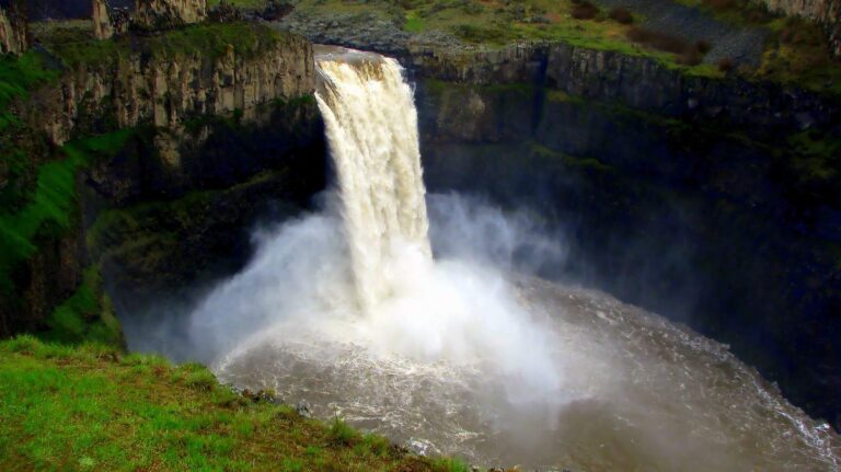
Photo: Ramanathan Kathiresan, CC BY 2.0
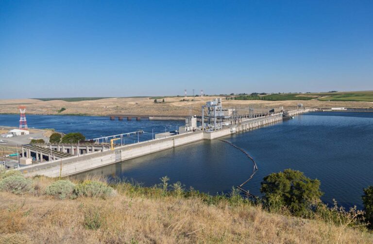
Photo: Tony Webster, CC BY 2.0
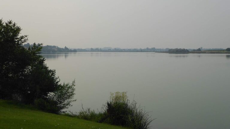
Photo: Fighting Irish 1977, CC BY 2.0
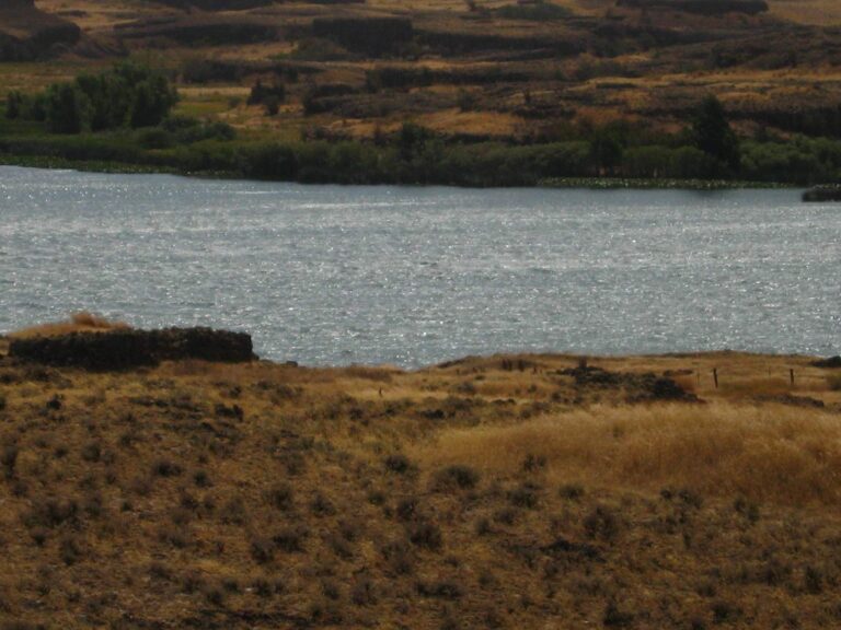
Photo: Chris Phan, CC BY 2.0
Common questions about angling in Adams County
How many boat launches are mapped in Adams County?
3 launches in all, managed by 3 WDFW.
Which Adams County lake spreads widest in the WDFW layer?
Sprague Lake, at 1,760 surface acres in the WDFW layer.
Which species show up on the most waters by Adams County?
Rainbow trout lead the count of water pages within 50 miles, followed by largemouth bass, black crappie and yellow perch.
Is there a bait counter in Adams County?
None in the county; the list above covers neighbours.
Do any river guides call Adams County home?
No guide lists this county; the Washington guides page has the rest.
Where do Adams County residents go for county business?
The seat is Ritzville.
Which Washington license covers Adams County water?
WDFW sells the 2026-27 Freshwater license for $39.95 to Washington residents and $115.85 to visitors 16 and up.
What counties share a line with Adams County?
Neighbours by distance: Franklin County, Lincoln County and Whitman County.
Where do Adams County waters depart from the statewide tables?
The 2026-27 pamphlet prints 46 Special Rule entries touching this county, starting with Bobcat Creek; the table above shows the first ones.
Hitch up the boat for Adams County
Check the Special Rules before keeping fish.