Port Susan and Port Gardner Fishing, Marine Area 8-2
WDFW Marine Area 8-2 on the Washington coast and Salish Sea, touching Snohomish and Island counties.
 Pick for troutPiscifun Carbon X ultralight spinning reel28% OFFSale $57.99
Photo of Port Susan: Cindy Shebley, CC BY 2.0
Port Susan and Port Gardner in figures
Under WAC 220-311-010, Marine Area 8-2 (Port Susan and Port Gardner) covers marine water off Snohomish and Island counties. From the mapped point, Langley lies about 2 miles away.
The access layers record 3 saltwater launches for it. Anglers without a boat have 5 piers and shore sites. The WDFW fishing area layer marks 4 named fishing areas. Read its 38 marine rule rows before keeping fish. NOAA tide predictions cover 8 NOAA tide stations.
WDFW recreational marine area layer (WAC 220-311-010) on geodataservices.wdfw.wa.gov, USGS GNIS names, WDFW and State Parks launch layers, WDFW shore fishing layer; retrieved October 31, 2026.
Mapping the borders of Port Susan and Port Gardner
- Defined(8)(b): … the Highway 532 Bridge between Camano Island and the mainland, …
- Defined(8)(c): … a line from the East Point Light on Whidbey Island to the Saratoga Pass Light #4 on Camano Island …
- Defined(8)(c): … a line from the south tip of Possession Point 110 degrees true to a shipwreck on the opposite shore.
Navigation marks on the edges of Port Susan and Port Gardner
- Light 3Light Fl G 6s
- Light 4Light Fl R 4s
- Shipwreck, MukilteoObject Center of wreck
- SR 532Bridge
WAC 220-311-010 boundary text as published in the WDFW marine area layer; NOAA light list positions; retrieved October 31, 2026.
Fish anglers target on Port Susan and Port Gardner
Fish the rules and records tie to Port Susan and Port Gardner; many more species live there.
2026-27 WDFW pamphlet marine area rows and WDFW sport fish records; retrieved October 31, 2026.
 For the trout herePiscifun Carbon XT ultralight spinning reel25% OFFSale $59.99
Major fishing areas in Port Susan and Port Gardner
- Hat Island to Camano HeadBoat Access Only
- Humpy HollowBoat Access Only
- Kayak PointShoreline Access Available
- Tulalip BubbleBoat Access Only
WDFW Major Fishing Areas layer on geodataservices.wdfw.wa.gov (names and access notes as published); retrieved October 31, 2026.
Ramps that open onto Port Susan and Port Gardner
- Hat Slough boat launch1 ramp, concrete surface, Discover Pass, Washington Department of Fish and Wildlife
- Camano Island boat launch on Port Susanboat ramp, Washington State Parks and Recreation Commission
- Davis Slough boat launch on Port Susan1 hand launch, Discover Pass, Washington Department of Fish and Wildlife
Other ramps near Port Susan and Port Gardner
- Point No Point boat launchn/a surface, Discover Pass, 12 miles southwest
- Mystery Bay, pier and floatsDiscover Pass, 12 miles west
- Big Ditch boat launch on Skagit BaySkagit Bay, 14 miles north
- Mueller Park boat launchn/a surface, Discover Pass, 18 miles northwest
- Skagit Headquarters boat launch on Wiley SloughWiley Slough, 18 miles north
- Grasser's Lagoon boat launchn/a surface, Discover Pass, 18 miles northwest
WDFW Water Access Sites and Shore Fishing Sites layers (geodataservices.wdfw.wa.gov) and the Washington State Parks boat launch layer, retrieved October 31, 2026. Parking at WDFW and State Parks launches needs a Discover Pass.
Walk-out fishing on Port Susan and Port Gardner
- Kayak Point County Park Pier on Port Susanfishing pier, Marine Area 8-2
- Langley Marina (City Pier) on Possession Soundfishing pier, Marine Area 8-2
- Everett – 10th Street Marine Park Pier on Port Gardnerfishing pier, Marine Area 8-2
- Mukilteo Fishing Piers on Possession Soundfishing pier, Marine Area 8-2
- Clinton Fishing Pier (Clinton Ferry Dock) on Possession Soundfishing pier, Marine Area 8-2
Shore access within reach of Port Susan and Port Gardner
- Port Hudson Jettyfishing pier, Marine Area 9, 15 miles
- Port Townsend – Union Wharffishing pier, Marine Area 9, 16 miles
- Coupeville Pier on Saratoga Passagefishing pier, Marine Area 8-1, 16 miles
- Fort Worden Marine Science Center Dockfishing pier, Marine Area 9, 16 miles
- Oak Harbor Marina on Saratoga Passagefishing pier, Marine Area 8-1, 18 miles
WDFW piers and shore fishing layers, retrieved October 31, 2026.
Named coves around Port Susan and Port Gardner
- Elger Baybay Island County
- Hat Sloughslough Snohomish County
- Livingston Baybay Island County
- Maple Covecove Island County
- South Passpassage/strait Snohomish County
- Triangle Covecove Island County
- Tulalip Baybay Snohomish County
USGS GNIS names inside the WDFW marine area polygon; retrieved October 31, 2026.
Tides and water level at Port Susan and Port Gardner
- Everetttide predictions, 11 miles
- Priest Pointtide predictions, 9 miles
- Tulaliptide predictions, 6 miles
- Glendale, Whidbey Islandtide predictions, 9 miles
- Sandy Point, Whidbey Islandtide predictions, 3 miles
- Spee-Bi-Dahtide predictions, 5 miles
Tide height on Port Susan and Port Gardner decides which launches and beaches work; check before you go.
NOAA CO-OPS water level and tide prediction stations inside or beside the marine area; retrieved October 31, 2026.
Marinas around Port Susan and Port Gardner (NOAA ESI record)
- Port Of Everett Marinamarina 800/729-7678
- Port Of Everett Marine Park & Boat Rampmarina 800/729-7678
- Hat Island Communitymarina 360/444-6611
- Langley Harbormarina 360/221-4246
- Tulalip Bay Marinamarina
Structure placed near Port Susan and Port Gardner
- Gedney Islandboat
NOAA Environmental Sensitivity Index atlas records (2003 to 2006); facility and reef details reflect the source year, not today. Retrieved october 31, 2026.
Washington saltwater rules on Port Susan and Port Gardner
| Species and location | Daily limit and size | Season |
|---|---|---|
| Trout | Catch-and-release. | Year-round |
| Steelhead | Daily limit 2 hatchery steelhead. | Year-round |
| Sturgeon | Catch-and-release. | Year-round |
| Mackerel | No min. size. No daily limit. | Year-round |
| Herring, Anchovy, Sardine, Sand Lance, and Smelt | No min. size. Daily limit 10 lbs., all species combined. All smelt caught must be kept and count toward the daily limit except Closed to eulachon (Columbia River smelt). For smelt: Jig gear may be used 7 days a week. Dip | Year-round |
| Pacific Halibut | Check the WDFW website at https://wdfw.wa.gov/fishing/regulations/halibut or call (360) 902-2700 in March for information on Pacific halibut seasons and regulations. No min. size. Daily limit 1. Annual limit 6. Descendin | see the pamphlet |
| Other Food Fish | No min. size. Daily limit 2 of each species. See definition. | Year-round |
| All Other Fish | CLOSED to fishing for, retaining, or possessing. | CLOSED |
| Salmon | No min. size. Daily limit 2. Release Chinook and chum. | Aug. 1-Oct. 11 |
| Salmon | CLOSED. | Oct. 12-July 31 |
| Bottomfish | Year-round season. Daily limit is a total of 15 bottomfish (See definition) subject to individual limits and seasons shown below. Fishing for bottomfish prohibited in waters deeper than 120’. Descending device required o | see the pamphlet |
| Lingcod | Hook and line season. Min. size 26”. Max. size 36”. Daily limit 1. | May 1-June 15 |
| Lingcod | Spearfishing season. Max. size 36”. Daily limit 1. | May 21-June 15 |
| Surfperch | No min. size. Daily limit 10. Except shiner perch daily limit 15: not included in bottomfish limit. | Year-round |
| Rockfish | CLOSED to fishing for, retaining, or possessing. | CLOSED |
| Pacific Cod, Pollock, Hake, and Wolf-Eel | CLOSED to retention. | Year-round |
| Sixgill, Sevengill, and Thresher Sharks | CLOSED to fishing for, retaining, or possessing. Sixgill shark may not be removed from the water. | CLOSED |
| Cabezon | Min. size 18”. Daily limit 1. | May 1-Nov. 30 |
| Trout | Catch-and-release. | Year-round |
| Steelhead | Daily limit 2 hatchery steelhead. | Year-round |
| Sturgeon | Catch-and-release. | Year-round |
| Mackerel | No min. size. No daily limit. | Year-round |
| Herring, Anchovy, Sardine, Sand Lance, and Smelt | No min. size. Daily limit 10 lbs., all species combined. All smelt caught must be kept and count toward the daily limit except Closed to eulachon (Columbia River smelt). For smelt: Jig gear may be used 7 days a week. Dip | Year-round |
| Pacific Halibut | Check the WDFW website at https://wdfw.wa.gov/fishing/regulations/halibut or call (360) 902-2700 in March for information on Pacific halibut seasons and regulations. No min. size. Daily limit 1. Annual limit 6. Descendin | see the pamphlet |
Only 24 of the 38 rows for Marine Area 8-2 fit.
Anglers 16 and older fishing marine water carry a Saltwater license ($40.71 resident, $81.70 nonresident for 2026-27) or a Combination license, plus a catch record card for salmon, sturgeon, steelhead or halibut.
Limits and seasons as printed in the 2026-2027 Washington Sport Fishing Rules (WDFW pamphlet, in effect July 1, 2026 to June 30, 2027), PDF page 123 (pamphlet PDF; eRegulations marine area page), read October 31, 2026.
Port Susan and Port Gardner against the closest bays and areas
| Water | Distance | Marine area | Launches | Piers and shore sites | Tide stations |
|---|---|---|---|---|---|
| Port Susan and Port Gardner | Marine Area 8-2 | 3 | 5 | 8 | |
| Port Susan | 6 miles | Marine Area 8-2 | 3 | 1 | 6 |
| Possession Sound | 8 miles | Marine Area 8-2 | 0 | 4 | 7 |
| Admiralty Inlet (Marine Area 9) | 9 miles | Marine Area 9 | 5 | 4 | 10 |
| Port Gardner | 11 miles | Marine Area 8-2 | 1 | 3 | 7 |
| Saratoga Passage | 13 miles | Marine Area 8-1 | 0 | 3 | 7 |
WDFW marine areas and access layers, NOAA stations; retrieved October 31, 2026.
Around the Port Susan and Port Gardner area
More bays and areas past Port Susan and Port Gardner
- Port Susan6 miles
- Possession Sound8 miles
- Admiralty Inlet (Marine Area 9)9 miles
- Port Gardner11 miles
- Saratoga Passage13 miles
Where else to fish around Port Susan and Port Gardner
- Lake Goss3 miles
- Lone Lake4 miles
- Deer Lake (Island County)7 miles
- Lake Shoecraft7 miles
- Snohomish River14 miles
- Stillaguamish River16 miles
- North Fork Stillaguamish River18 miles
- South Fork Stillaguamish River19 miles
Where to buy worms, eggs and jigs for Port Susan and Port Gardner
- Cabela's Tulalipsporting goods store, Tulalip, 11 miles
- Dick's Sporting Goods Marysvillesporting goods store, Marysville, 12 miles
- Sportsman's Warehouse Everettsporting goods store, Everett, 14 miles
- Dick's Sporting Goods Seattlesporting goods store, Seattle, 25 miles
- Possession Point Bait Cobait and tackle shop, Clinton
- Wahoo Bait Incbait and tackle shop, Freeland
Guide boats working Port Susan and Port Gardner
- A Possession Point Fishing Charterscharter, Arlington, (360) 652-3797
- Allstar Fishing Charterscharter, Everett, (425) 252-4188
- Big King Salmon Charterscharter, Mountlake Terrace, (425) 776-7688
- Sound Fly Fishingcharter, Edmonds, (206) 940-3020
- Team McMullen Tournament Fishing & Guide Servicecharter, Marysville, (425) 754-9401
Washington towns handy to Port Susan and Port Gardner
- Langley2 miles
- Camano6 miles
- Kayak Point6 miles
- Freeland6 miles
Counties that hold part of Port Susan and Port Gardner
- Snohomish Countyseat: Everett
- Island Countyseat: Coupeville
What Piscifun sells for a morning at Port Susan and Port Gardner


Piscifun and Amazon links are affiliate links; the site earns a commission on qualifying purchases.
Fish worth recognising before a day at Port Susan and Port Gardner
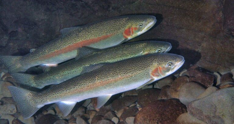
Photo: Oregon State University, CC BY-SA 2.0

Photo: USFWS Fish and Aquatic Conservation, Public domain
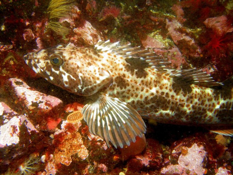
Photo: Ed Bierman, CC BY 2.0
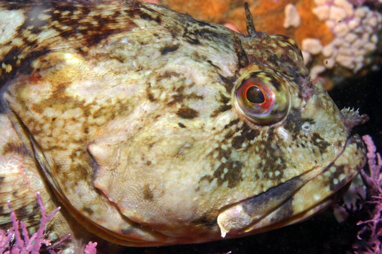
Photo: Chad King (SIMoN / MBNMS), Public domain

Port Susan and Port Gardner, asked and answered for Evergreen State anglers
Which marine area is Port Susan and Port Gardner?
Use the rows for Marine Area 8-2.
What is the salmon limit on Port Susan and Port Gardner?
Pamphlet salmon row, Marine Area 8: No min. size. Daily limit 2. Release Chinook and chum., Aug. 1-Oct. 11.
Is bottomfish open on Port Susan and Port Gardner?
WDFW prints Hook and line season. Min. size 26”. Max. size 36”. Daily limit 1. for lingcod, May 1-June 15.
Which listed saltwater ramp sits closest to Port Susan and Port Gardner?
3 launches on file; begin at Davis Slough boat launch on Port Susan.
Is there bank access on Port Susan and Port Gardner?
WDFW maps 5 piers and shore sites; Kayak Point County Park Pier on Port Susan is one.
Can out-of-state visitors fish Port Susan and Port Gardner?
Anglers 16 and older fishing marine water carry a Saltwater license ($40.71 resident, $81.70 nonresident for 2026-27) or a Combination license, plus a catch record card for salmon, sturgeon, steelhead or halibut.
Where can I check the tides for Port Susan and Port Gardner?
The tide band lists Everett and others.
Which tackle shop serves Port Susan and Port Gardner?
Cabela's Tulalip is the nearest shop we list, about 11 miles away.
Where are the fishing grounds on Port Susan and Port Gardner?
Start with Hat Island to Camano Head, Humpy Hollow and Kayak Point, one of 4 named fishing areas.
Rig the downriggers for Port Susan and Port Gardner
Every Washington saltwater fee and season sits one click away.