Fishing in Summit County, Utah
County seat: Coalville. Census 2020 residents: 42,357.
- 4lake pages
- 5launches
 Pick for troutPiscifun Carbon X ultralight spinning reel28% OFFSale $57.99
Photo of Lost Creek Reservoir: Andrey Zharkikh, CC BY 2.0
Planning a first trip in Summit County
Courthouse business for Summit County is done in Coalville; the county counted 42,357 residents in 2020. Gazetteer mapping shows 1,871 square miles of land and 10.1 square miles of water. Echo Reservoir heads the county's 4 Utah lakes and reservoirs with their own page.
Launch data from UGRC and DWR show 5 launches here, plus 10 shore or pier points on DWR's shore list. Neighborhood ponds DWR manages here include Deer Valley Ponds. Hatchery trucks made 254 logged stops in the county in 2026, releasing 388,548 fish into 124 waters.
U.S. Census Bureau, 2020 Census counts (TIGERweb) and the 2023 Gazetteer, read November 11, 2026. UGRC Boat Ramps layer (ArcGIS service) and the DWR Fish Utah access list, read November 11, 2026.
Slickrock-to-summit pins across Summit County
UGRC Boat Ramps layer (ArcGIS service) and the DWR Fish Utah access list, read November 11, 2026. Lake pins are the DWR map point for each water.
Lakes spread across Summit County
| Lake | Size | Launches | Status | DWR lists |
|---|---|---|---|---|
| Echo Reservoir | about 1,424 acres of mapped outline | 1 | reservoir | brown trout, rainbow trout, smallmouth bass, yellow perch, bonneville cutthroat trout |
| Rockport Reservoir | about 1,056 acres of mapped outline | 1 | reservoir | brown trout, rainbow trout, smallmouth bass, yellow perch |
| Stateline Res | about 263 acres of mapped outline | 0 | reservoir | rainbow trout, lake trout, tiger trout |
| Deer Valley Ponds | 3 acres | 0 | community fishery | rainbow trout, tiger trout, wiper |
Size as the DWR Fish Utah page for this water prints it (DWR), read November 11, 2026. Waters with no DWR acreage print their mapped outline instead. Utah DWR Fish Utah planner (dwrapps.utah.gov), read November 11, 2026.
 For the trout herePiscifun Carbon XT ultralight spinning reel25% OFFSale $59.99
How often DWR names each fish close to Summit County
Bars count lake pages within 40 miles of Coalville where Fish Utah rates the fish likely or possible; rainbow trout leads.
DWR Fish Utah species lists (likely or possible), counted per lake page within 40 miles; DWR’s ratings, not a catch survey. Utah DWR Fish Utah planner (dwrapps.utah.gov), read November 11, 2026.
Backcountry Utah basins of Summit County
- Uinta Mountains, Bear Riverbrook trout, bonneville cutthroat trout, tiger trout, grayling Arctic, 40 recent stocking rows
- Uinta Mountains, Beaver Creek Forksbrook trout, bonneville cutthroat trout, grayling Arctic, 40 recent stocking rows
- Uinta Mountains, Blacks Forkbrook trout, colorado River cutthroat trout, bonneville cutthroat trout, 40 recent stocking rows
- Uinta Mountains, Burnt Forkcolorado River cutthroat trout, bonneville cutthroat trout, rainbow trout, grayling Arctic, 31 recent stocking rows
- Uinta Mountains, Henrys Forkcolorado River cutthroat trout, bonneville cutthroat trout, 40 recent stocking rows
- Uinta Mountains, Mirror Lake Highwaybrook trout, rainbow trout, tiger trout, grayling Arctic, bonneville cutthroat trout, 40 recent stocking rows
- Uinta Mountains, North Slope Roadside Lakesbrook trout, rainbow trout, grayling Arctic, 40 recent stocking rows
- Uinta Mountains, Provo Riverbrook trout, bonneville cutthroat trout, grayling Arctic, 40 recent stocking rows
- Uinta Mountains, Smiths Forkbrook trout, bonneville cutthroat trout, 40 recent stocking rows
- Uinta Mountains, Weber Riverbrook trout, bonneville cutthroat trout, grayling Arctic, 40 recent stocking rows
Utah DWR Fish Utah planner (dwrapps.utah.gov), read November 11, 2026.
Further named basins on the Summit County Utah map
State maps carry 74 more named lakes inside Summit County; they stay on this list.
| Water | Size | Listed by |
|---|---|---|
| Weber River, Echo Reservoir to Wanship Dam | Approximately 9.5 miles | DWR Fish Utah |
| Smith and Morehouse Reservoir | about 193 acres of mapped outline | DWR Fish Utah |
| Meeks Cabin Reservoir | about 565 acres of mapped outline | UGRC lakes layer |
| Hoop Lake | about 172 acres of mapped outline | UGRC lakes layer |
| Red Castle Lake | about 166 acres of mapped outline | UGRC lakes layer |
| Whitney Reservoir | about 146 acres of mapped outline | UGRC lakes layer |
| Island Lake | about 112 acres of mapped outline | UGRC lakes layer |
| Washington Lake | about 97 acres of mapped outline | UGRC lakes layer |
| Beaver Meadow Reservoir | about 82 acres of mapped outline | UGRC lakes layer |
| Tamarack Lake | about 75 acres of mapped outline | UGRC lakes layer |
| Wall Lake | about 71 acres of mapped outline | UGRC lakes layer |
| Trial Lake | about 65 acres of mapped outline | UGRC lakes layer |
| Lost Lake | about 62 acres of mapped outline | UGRC lakes layer |
| Boyer Lake | about 58 acres of mapped outline | UGRC lakes layer |
| Fish Lake | about 56 acres of mapped outline | UGRC lakes layer |
| Lower Red Castle Lake | about 44 acres of mapped outline | UGRC lakes layer |
| Amethyst Lake | about 42 acres of mapped outline | UGRC lakes layer |
| Barker Reservoir | about 40 acres of mapped outline | UGRC lakes layer |
| Fish Lake | about 38 acres of mapped outline | UGRC lakes layer |
| Lyman Lake | about 37 acres of mapped outline | UGRC lakes layer |
| Beaver Lake | about 36 acres of mapped outline | UGRC lakes layer |
| Marsh Lake | about 36 acres of mapped outline | UGRC lakes layer |
| Long Lake | about 33 acres of mapped outline | UGRC lakes layer |
| Cliff Lake | about 33 acres of mapped outline | UGRC lakes layer |
| Fish Lake | about 32 acres of mapped outline | UGRC lakes layer |
| Big Elk Lake | about 32 acres of mapped outline | UGRC lakes layer |
| Lake Blanchard | about 30 acres of mapped outline | UGRC lakes layer |
| Meadow Lake | about 30 acres of mapped outline | UGRC lakes layer |
| McPheters Lake | about 27 acres of mapped outline | UGRC lakes layer |
| China Lake | about 27 acres of mapped outline | UGRC lakes layer |
| Coffin Lake | about 26 acres of mapped outline | UGRC lakes layer |
| Smiths Fork Pass Lake | about 26 acres of mapped outline | UGRC lakes layer |
| Upper Red Castle Lake | about 26 acres of mapped outline | UGRC lakes layer |
| Grassy Lake | about 24 acres of mapped outline | UGRC lakes layer |
| Jessen Lake | about 24 acres of mapped outline | UGRC lakes layer |
| Alexander Lake | about 24 acres of mapped outline | UGRC lakes layer |
| Round Lake | about 24 acres of mapped outline | UGRC lakes layer |
| Island Lake | about 22 acres of mapped outline | UGRC lakes layer |
| Scow Lake | about 22 acres of mapped outline | UGRC lakes layer |
| Bridger Lake | about 21 acres of mapped outline | UGRC lakes layer |
| Ryder Lake | about 21 acres of mapped outline | UGRC lakes layer |
| East Red Castle Lake | about 20 acres of mapped outline | UGRC lakes layer |
| Cuberant Lake | about 19 acres of mapped outline | UGRC lakes layer |
| Notch Lake | about 19 acres of mapped outline | UGRC lakes layer |
| Sand Lake | about 19 acres of mapped outline | UGRC lakes layer |
| Haystack Lake | about 18 acres of mapped outline | UGRC lakes layer |
| Star Lake | about 18 acres of mapped outline | UGRC lakes layer |
| Joyce Lake | about 18 acres of mapped outline | UGRC lakes layer |
| Henrys Fork Lake | about 17 acres of mapped outline | UGRC lakes layer |
| Kamas Lake | about 17 acres of mapped outline | UGRC lakes layer |
| Bear Lake | about 17 acres of mapped outline | UGRC lakes layer |
| Duck Lake | about 17 acres of mapped outline | UGRC lakes layer |
| Alligator Lake | about 16 acres of mapped outline | UGRC lakes layer |
| Elkhorn Reservoir | about 16 acres of mapped outline | UGRC lakes layer |
| Gilbert Lake | about 15 acres of mapped outline | UGRC lakes layer |
| Anchor Lake | about 14 acres of mapped outline | UGRC lakes layer |
| Dead Horse Lake | about 14 acres of mapped outline | UGRC lakes layer |
| Lily Lake | about 14 acres of mapped outline | UGRC lakes layer |
| Kabell Lake | about 14 acres of mapped outline | UGRC lakes layer |
| Beaver Lake | about 14 acres of mapped outline | UGRC lakes layer |
| Clyde Lake | about 14 acres of mapped outline | UGRC lakes layer |
| Lake Hessie | about 13 acres of mapped outline | UGRC lakes layer |
| Lost Lake Number Two | about 13 acres of mapped outline | UGRC lakes layer |
| Ostler Lake | about 13 acres of mapped outline | UGRC lakes layer |
| Allsop Lake | about 13 acres of mapped outline | UGRC lakes layer |
| Spectacle Lake | about 12 acres of mapped outline | UGRC lakes layer |
| Porcupine Reservoir | about 12 acres of mapped outline | UGRC lakes layer |
| Lake Lorena | about 12 acres of mapped outline | UGRC lakes layer |
| Shallow Lake | about 11 acres of mapped outline | UGRC lakes layer |
| Castle Lake | about 11 acres of mapped outline | UGRC lakes layer |
| Grahams Reservoir | about 11 acres of mapped outline | UGRC lakes layer |
| Priord Lake | about 11 acres of mapped outline | UGRC lakes layer |
| Grass Lake | about 10 acres of mapped outline | UGRC lakes layer |
| Shadow Lake | about 10 acres of mapped outline | UGRC lakes layer |
Outline area from the UGRC Utah Lakes NHD layer (ArcGIS service; mapped polygon area, not a DWR surface-acre figure), read November 11, 2026. Listed waters are not claimed to hold fish. Utah DWR Fish Utah planner (dwrapps.utah.gov), read November 11, 2026.
Utah rivers to wade in Summit County
Flow gauges around Summit County
| USGS gauge | Latest reading | Time (ET) |
|---|---|---|
| Blacks Fork Near Robertson, Wy | 75 cfs, 2.19 ft gage height | Nov 14 6:00 pm |
| Middle Fork Beaver Creek Near Lonetree, Wyo. | 18 cfs, 4.58 ft gage height | Nov 14 5:30 pm |
| Wf Beaver Cr Ab Willow Park, Near Lonetree, Wy | 1.92 ft gage height | Nov 14 5:45 pm |
| Bear River Near Utah-wyoming State Line | 105 cfs, 4.46 ft gage height | Nov 14 5:30 pm |
| Weber River Near Oakley, Ut | 98 cfs, 5.45 ft gage height | Nov 14 6:15 pm |
| Weber River Near Peoa, Utah | 77 cfs, 2.33 ft gage height | Nov 14 5:45 pm |
US Geological Survey provisional data, retrieved Nov 14, 2026 6:32 pm ET. Provisional readings can be revised.
Utah DWR Fish Utah planner (dwrapps.utah.gov), read November 11, 2026. USGS Water Data for the Nation, live through the site, retrieved on page view.
Utah trailer launches around Summit County
- Echo Reservoir Boat RampEcho Reservoir, boat ramp, for any vessel class, administered by a private operator in the UGRC layer, camp host, docks – accessible, primitive (Tent)
- Rockport State Park Boat RampRockport Reservoir, boat ramp, for any vessel class, administered by Utah State Parks in the UGRC layer, camp host, covered Picnic ares, docks – accessible
- Spirit Lake Boat RampSpirit Lake, boat ramp, for float craft, administered by the U.S. Forest Service in the UGRC layer
- Smith and Morehouse east Boat RampSmith and Morehouse Reservoir, boat ramp, for small motorized craft, administered by the U.S. Forest Service in the UGRC layer
- Smith and Morehouse west Boat RampSmith and Morehouse Reservoir, boat ramp, for small motorized craft, administered by the U.S. Forest Service in the UGRC layer
Fishing piers in Summit County
- Creamery Lane Shore Access at Weber River, Echo Reservoir to Wanship DamWeber River, Echo Reservoir to Wanship Dam, shore access
- Fishing Access 1 at Rockport ReservoirRockport Reservoir, shore access
- Fishing Access 2 at Rockport ReservoirRockport Reservoir, shore access
- Fishing Access 3 at Rockport ReservoirRockport Reservoir, shore access
- Fishing Access 4 at Rockport ReservoirRockport Reservoir, shore access
- Hobson Lane Shore Access at Weber River, Echo Reservoir to Wanship DamWeber River, Echo Reservoir to Wanship Dam, shore access
- Icy Springs Road Bridge Shore Access at Weber River, Echo Reservoir to Wanship DamWeber River, Echo Reservoir to Wanship Dam, shore access
- Icy Springs Road Shore Access at Weber River, Echo Reservoir to Wanship DamWeber River, Echo Reservoir to Wanship Dam, shore access
- Judd Lane WIA Shore Access at Weber River, Echo Reservoir to Wanship DamWeber River, Echo Reservoir to Wanship Dam, shore access
- Riverbend Road Shore Access at Weber River, Echo Reservoir to Wanship DamWeber River, Echo Reservoir to Wanship Dam, shore access
UGRC Boat Ramps layer (ArcGIS service) and the DWR Fish Utah access list, read November 11, 2026. Neither layer publishes fees or opening hours.
How the Utah reservoirs of Summit County were reading
Echo Reservoir
Reclamation daily values for Echo Reservoir, November 10, 2026.
Bureau of Reclamation Upper Colorado Region reservoir data (hydrodata), latest daily values, read November 11, 2026. Provisional.
Rockport Reservoir
Reclamation daily values for Rockport Reservoir, November 10, 2026.
Bureau of Reclamation Upper Colorado Region reservoir data (hydrodata), latest daily values, read November 11, 2026. Provisional.
Stateline Res
Reclamation daily values for Stateline Res, November 10, 2026.
Bureau of Reclamation Upper Colorado Region reservoir data (hydrodata), latest daily values, read November 11, 2026. Provisional.
Utah stocking rows for Summit County waters
Rows run newest first, with water names shortened the way DWR's 2026 table shortens them.
| Date | Water as DWR prints it | County | Fish | Species |
|---|---|---|---|---|
| October 22, 2026 | SMITH-MOREHOUSE RES | Summit | 9,870 | Grayling arctic |
| October 22, 2026 | SMITH-MOREHOUSE RES | Summit | 1,766 | Grayling arctic |
| October 22, 2026 | SMITH-MOREHOUSE RES | Summit | 729 | Grayling arctic |
| October 19, 2026 | HOOP L | Summit | 400 | Grayling arctic |
| October 19, 2026 | HOOP L | Summit | 1,601 | Grayling arctic |
| October 18, 2026 | STATELINE RES | Summit | 987 | Lake trout |
| October 14, 2026 | WASHINGTON L A-23 | Summit | 8,002 | Grayling arctic |
| October 6, 2026 | LOST L A-59 | Summit | 693 | Tiger trout |
| September 29, 2026 | ECHO RES | Summit | 1,677 | Rainbow |
| September 29, 2026 | ECHO RES | Summit | 1,536 | Rainbow |
DWR fish stocking table for 2026, year to date (DWR stocking report; water names are DWR abbreviations), read November 11, 2026.
Utah guidebook limits on Summit County water
The limits here are from the 2027 Utah Fishing Guidebook, which takes effect January 1, 2027; the 2026 Utah Fishing Guidebook stays in force through December 31, 2026 and differs only where a row says so. Start from these statewide rows in Summit County; a named water's entry replaces them. DWR charges adults $40 (resident) or $120 (nonresident) for a fishing license good 365 days from purchase.
| Species group | 2027 daily limit | 2026 daily limit | Guidebook note |
|---|---|---|---|
| Baitfish (common carp, fathead minnow, redside shiner, Utah sucker, Utah chub, white sucker) | No limit | same | (NEW) Formerly called "nongame species"; baitfish species are listed on page 20. |
| Black crappie and white crappie (a combined total) | 50 | same | – |
| Bluegill and green sunfish (a combined total) | 50 | same | – |
| Bonneville cisco | 30 | same | – |
| Bullhead | 24 | same | – |
| Burbot | No limit | same | REMINDER: Do not release any burbot you catch. All burbot caught must be immediately killed. |
| Channel catfish | 8 | same | – |
| Community fisheries | 2 | 2 | The limit includes fish of most species. All tiger muskellunge must be released. NEW: There are restrictions for largemouth bass at some waters. See page 39. |
| Crayfish | No limit | same | REMINDER: You may use bait to catch crayfish on waters where bait use is prohibited for fish, as long as none of the lines have hooks attached. |
| Kokanee salmon | See trout limit | same | Kokanee salmon are part of the total trout limit. Anglers may not possess kokanee salmon at any waterbody statewide from Sept. 10 through Nov. 30. |
| Largemouth and smallmouth bass (a combined total) | 6 | same | – |
| Northern pike | 20, only 1 over 36 inches | same | – |
Guidebook exceptions printed for Summit County waters in Utah
- Deer Valley PondsThe daily limit is 2 fish (common carp do not count toward the daily limit). (Fish Utah page)
- Echo ReservoirGeneral possession limits apply. (Fish Utah page)
- Rockport ReservoirGeneral possession limits apply. (Fish Utah page)
- Stateline ResLimit 4 trout, and no more than 1 may be a lake trout over 22 inches. (new in the 2027 guidebook, in force from January 1, 2027)
Utah special-regulation waters
2027 Utah Fishing Guidebook (effective January 1, 2027; DWR PDF), read November 11, 2026. License prices as printed in the 2027 Utah Fishing Guidebook, p. 8 (the 2026 guidebook prints the same prices; checked against the DWR fees page), read November 11, 2026.
DWR record entries from Summit County
Record fish close to Summit County came from these waters, each inside 80 miles.
| Species | Weight or length as listed | Water | Year | Category |
|---|---|---|---|---|
| Nonnative cutthroat trout | 31 ½" | East Canyon Reservoir | 2011 | catch and release (length) |
| Bonneville cutthroat trout | 10 lbs. 2.24 oz. | Lost Creek Reservoir | 2022 | catch and keep |
| Smallmouth bass | 23 ½" | Jordanelle Reservoir | 2003 | catch and release (length) |
| Utah sucker | 6 lbs. 6 oz. | Weber River | 2003 | catch and keep |
Utah state record fish as DWR lists them (records page), read November 11, 2026.
DWR-approved events fishing Summit County
Clubs and the DWR list put 1 entries on Summit County water, with 0 ahead.
| Date | Event | Water | Organizer |
|---|---|---|---|
| June 13, 2026 | UBTT Northern Utah Division, Echo Reservoir, Northern Utah (result) | Echo Reservoir | Ultimate Bass Team Tour, LLC (Cedar City, Utah) |
Event as listed by the organizer (source), read November 11, 2026.
Gear stores in Summit County
Utah bait shops and marinas of Summit County
- Fishwestbait and tackle shop, Kamas
- Marina at Rockportmarina, Peoa
Who rows clients out of Summit County
- Park City Fly Fishing Guidesfly fishing guide, Park City, (435) 631-9933
- Park City Fly Shop Guide Servicefly fishing guide, Park City, (435) 640-2864
- Utah Trout Fittersfishing guide, Park City, (973) 234-4412
Yellow Pages, Utah State Parks and NPS listings (city of business), read November 11, 2026.
In the same basin as Summit County
Town pages within Summit County
- Summit Park2020 count 8,820
- Park City2020 count 8,396
- Snyderville2020 count 6,744
- East Basin2020 count 3,023
- Kamas2020 count 2,092
- Oakley2020 count 1,588
- Francis2020 count 1,564
- Coalville2020 count 1,486
Adjoining Summit County
- Morgan County35 miles northwest
- Wasatch County38 miles south
- Duchesne County49 miles southeast
- Salt Lake County52 miles west
Piscifun tackle chosen for a Utah day at Summit County


Piscifun and Amazon links are affiliate links; the site earns a commission on qualifying purchases.
Reservoirs, high lakes and wadeable creeks around Summit County, pictured
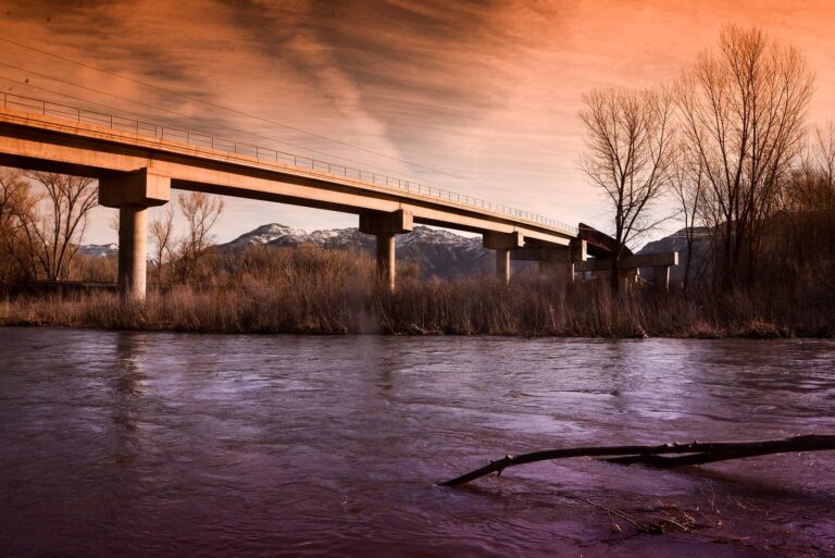
Photo: r. nial bradshaw, CC BY 2.0

Photo: rick kloeppel, CC BY 2.0
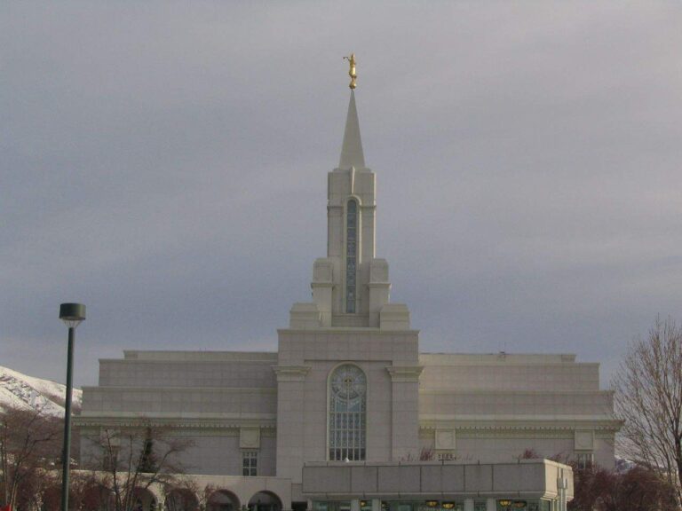
Photo: Ken Lund, CC BY-SA 2.0
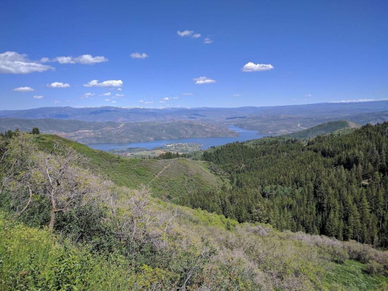
Photo: sf-dvs, CC BY 2.0
Fishing inside Summit County: the common asks
How many ramps do UGRC and DWR list for Summit County?
There are 5 launches in the state launch data.
Which Summit County lake is the biggest on this site?
Echo Reservoir (about 1,424 acres of mapped outline).
What species does Fish Utah list around Summit County?
Fish Utah rates rainbow trout likely or possible on the most lakes within 40 miles, then largemouth bass, bluegill and channel catfish.
Where can I buy bait in Summit County, Utah?
Try Fishwest; the county has 2.
What Utah town serves Summit County as its seat?
It is Coalville.
What Utah license do Summit County anglers buy?
Licenses in Utah run 365 days from the purchase date: $40 for a resident adult, $120 for a nonresident adult.
What counties surround Summit County?
Begin with Morgan County, Wasatch County and Duchesne County.
What trout rule covers Summit County?
Statewide, the trout, kokanee and grayling row sets a daily limit 4 under the 2027 guidebook; the 2026 guidebook prints the same number. Waters with their own entry can differ.
Which Summit County lakes have special limits?
4 waters with a page here carry their own rules, beginning with Deer Valley Ponds.
Is Summit County on the DWR stocking table?
The 2026 DWR table lists 388,548 fish in 254 rows across 124 waters in the county.
Which Utah events fish Summit County lakes?
1 entry on file, none dated ahead.
Set up a Utah fishing weekend in Summit County
River pages list DWR access points and live USGS flow.