Fishing in Multnomah County, Oregon
County seat: Portland. Population 815,428.
- 6lake pages
- 48open launches
- 3river pages
 Pick for crappiePiscifun Carbon X ultralight spinning reel28% OFFSale $57.99
Photo of Sandy River: David Prasad, CC BY-SA 2.0
The short version of fishing in Multnomah County
At the 2020 count Multnomah County held 815,428 residents, and its courthouse is in Portland. Most waters ODFW lists in Multnomah County fall under the ODFW Willamette Zone table, though zone lines follow drainages rather than county lines. Lake Bonneville crosses a state line, so only part of its outline is Oregon water.
The largest of 6 paged lakes in Multnomah County is Lake Bonneville. The OSMB access layer lists 48 open launches here, 20 for trailer launching.
Census 2020 population; BLM Oregon NHD lake outlines; OSMB Boating Access Sites; DLCD and ODFW shore access layers; 2026 Oregon Sport Fishing Regulations zone lists; read November 2, 2026.
Where the put-ins of Multnomah County are
OSMB launch points, DLCD and ODFW shore sites, NHD lake points, PMEP estuary points; read November 2, 2026.
Still water across Multnomah County
| Lake | Acres | Kind | OSMB launches | Fish mapped |
|---|---|---|---|---|
| Lake Bonneville | 19,452 (outline), 54% in Oregon | lake | 18 | channel catfish |
| Sturgeon Lake | 3,163 (outline) | lake | 1 | black crappie, bluegill, brown bullhead |
| Smith Lake | 508 (outline) | lake | 1 | black crappie, bluegill, brown bullhead |
| Bull Run Lake | 444 (outline) | lake | 0 | |
| Blue Lake (Multnomah County) | 66 (outline) | lake | 1 | black crappie, bluegill, carp |
| Haldeman Pond | 5 (outline) | lake | 1 | black crappie, bluegill, brown bullhead |
BLM Oregon hydrography lake outlines (NHD), summed by GNIS name (layer), read November 2, 2026. Species: ODFW Fish Habitat Distribution layers (ODFW ArcGIS), read November 2, 2026; a mapped species is habitat use ODFW records, not a catch report. ODFW publishes no lake depths in these layers.
 For the crappie herePiscifun Carbon XT ultralight spinning reel25% OFFSale $59.99
Species on the water pages near Multnomah County
Within 40 miles of Portland the most-listed fish is rainbow trout.
Species from ODFW Fish Habitat Distribution layers, booklet exceptions and ODFW records, counted per water page within 40 miles; habitat mapping, not a catch survey.
Further lakes on the Multnomah County outline map
The outline map shows 13 further named lakes in Multnomah County, listed by mapped acreage.
| Water | Acres (outline) | Nearest place |
|---|---|---|
| Bull Run Reservoir Number One | 426 | Mount Hood Villages |
| Bybee Lake | 232 | Bethany |
| Fairview Lake | 108 | Fairview |
| Jewit Lake | 90 | Fairview |
| Ramsey Lake | 20 | Bethany |
| Wahkeena Rearing Lake | 19 | Troutdale |
| Company Lake | 14 | Troutdale |
| Johnson Lake | 14 | Scappoose |
| Mud Slough | 14 | Portland |
| Blue Lake (Multnomah County) | 11 | Cascade Locks |
| Crystal Springs Lake | 11 | Milwaukie |
| City of Portland Reservoir Number 6 | 11 | Portland |
| Mount Hood College Reservoir | 2 | Troutdale |
BLM Oregon hydrography lake outlines (NHD), summed by GNIS name (layer), read November 2, 2026.
Moving water in Multnomah County
- Sandy RiverODFW maps chum, coho and fall chinook runs, 5 OSMB launches, 2 USGS gauges, 8 booklet exceptions
- Willamette RiverODFW maps coho, fall chinook and spring chinook runs, 55 OSMB launches, 10 USGS gauges, 47 booklet exceptions
- North Fork Bull Run RiverODFW maps coho, spring chinook and winter steelhead runs, 1 USGS gauge
How fast the rivers of Multnomah County are running
| USGS gauge | Latest reading | Time (ET) |
|---|---|---|
| Willamette River At Portland, Or | 13,300 cfs, 6.32 ft gage height | Nov 11 8:45 pm |
| Bull Run River Near Multnomah Falls, Or | 254 cfs, 3.77 ft gage height | Nov 11 9:00 pm |
| Crystal Springs Creek At Bybee St, Portland, Or | 13 cfs, 1.06 ft gage height | Nov 11 9:00 pm |
| Bull Run River At Lower Flume Nr Brightwood, Or | 13 cfs, 0.79 ft gage height | Nov 11 9:00 pm |
| North Fork Bull Run River Near Multnomah Falls, Or | 44 cfs, 1.10 ft gage height | Nov 11 8:45 pm |
| Beaver Creek At Troutdale, Or | 26 cfs, 7.71 ft gage height | Nov 11 8:30 pm |
US Geological Survey provisional data, retrieved Nov 11, 2026 9:33 pm ET. Provisional readings can be revised.
ODFW Fish Habitat Distribution stream names and runs, OSMB launches, booklet exceptions and USGS gauges; read November 2, 2026.
Launch sites across Multnomah County
- Airport Way Launch on Columbia SloughColumbia Slough, 1 lane, trailered launch
- Benson State Recreation Area launchBenson Lake, 1 lane, hand carry launch
- Blue Lake Park RampBlue Lake, 1 lane, trailered launch
- Cathedral Park on Willamette RiverWillamette River, 2 lanes, trailered launch
- Chinook Landing on Columbia RiverColumbia River, 6 lanes, trailered launch, OSMB status: restricted
- Columbia Blvd Launch on Columbia SloughColumbia Slough, 1 lane, hand carry launch
- Dabney State Park on Sandy RiverSandy River, 1 lane, trailered launch
- Elrod Levee Launch East on Columbia SloughColumbia Slough, 1 lane, hand carry launch
- Elrod Levee Launch West on Columbia SloughColumbia Slough, 1 lane, hand carry launch
- Freds Marina on Multnomah ChannelMultnomah Channel, 2 lanes, trailered launch
- Haldman Pond Hand Launch on Haldeman PondHaldeman Pond, hand carry launch
- Happy Rock Moorage Inc. on Multnomah ChannelMultnomah Channel, 1 lane, trailered launch
- Kelley Point Park Launch on Columbia SloughColumbia Slough, hand carry launch
- Larsons Moorage/Marina on Multnomah ChannelMultnomah Channel, 1 lane, trailered launch
- Lewis and Clark State Park on Sandy RiverSandy River, 1 lane, trailered launch
- Lower Government Island launch on Columbia RiverColumbia River, hand carry launch
- M. James Gleason Ramp on Columbia RiverColumbia River, 4 lanes, trailered launch
- Marina Way Moorage on Multnomah ChannelMultnomah Channel, 1 lane, trailered launch
- McCuddys Big Oak Marina on Multnomah ChannelMultnomah Channel, 1 lane, trailered launch
- Oxbow Regional Park on Sandy RiverSandy River, trailered launch
- Rocky Pointe Marina on Multnomah ChannelMultnomah Channel, 1 lane, trailered launch
- Roehr Park on Willamette RiverWillamette River, hand carry launch
- Rooster Rock State Park Boat Ramp on Columbia RiverColumbia River, 3 lanes, trailered launch
- Rooster Rock State Park Hand Launch on Columbia RiverColumbia River, hand carry launch
- Sauvie Island Boat Ramp on Multnomah ChannelMultnomah Channel, 1 lane, trailered launch
- Smith Bybee Wetlands Canoe LaunchSmith Lake, 1 lane, trailered launch
- Sturgeon Lake AccessSturgeon Lake, hand carry launch
- Swan Island Ramp on Swan Island BasinSwan Island Basin, 1 lane, trailered launch
- The Fishery boat ramp on Columbia RiverColumbia River, 2 lanes, trailered launch
- Tomahawk Bay Moorage on Columbia RiverColumbia River, hand carry launch
- Webster Pond Hand LaunchWebster Pond, hand carry launch
- Whitaker Ponds Canoe Launch on Columbia SloughColumbia Slough, hand carry launch
- Will-Jan Marina on Columbia RiverColumbia River, hand carry launch
- Willamette ParkWillamette River, 4 lanes, trailered launch
- Bartlett Landing on Columbia RiverColumbia River, na
- Commodores Cove boat ramp on Columbia RiverColumbia River, na
- Donaldson Marina on Columbia RiverColumbia River, launch
- Ducks Moorage on Columbia RiverColumbia River, hand carry launch
- Duckworth Memorial Dock on Willamette RiverWillamette River, hand carry launch
- Hadleys Landing on Multnomah ChannelMultnomah Channel, hand carry launch
- Hayden Bay Marina on Columbia RiverColumbia River, launch
- Jantzen Beach Fuel Dock on Columbia RiverColumbia River, na
- McCuddys Marina Marine Drive on Columbia RiverColumbia River, launch
- Multnomah Yacht Harbor Sales on Multnomah ChannelMultnomah Channel, hoist
- Riverplace Marina on Willamette RiverWillamette River, hand carry launch
- Schwitter Landing on Columbia RiverColumbia River, hand carry launch
- Sellwood Riverfront Park on Willamette RiverWillamette River, hand carry launch
- Sundance Marina on Columbia RiverColumbia River, hoist
- Dalton Point boat ramp on Columbia RiverColumbia River, closed per OSMB
Status comes straight from OSMB, and closed launches are rows only.
Oregon State Marine Board Boating Access Sites layer (OSMB ArcGIS), read November 2, 2026; status as OSMB publishes it. Oregon Coastal Management Program (DLCD) Shoreline Access Inventory (layer) and the ODFW shore access map, read November 2, 2026.
Trout stocking in Multnomah County
The ODFW schedule plans 4 trout releases for 1 water in Multnomah County, 6,000 fish in all as printed.
- Haldeman Pond4 releases planned, next listed: Apr. 19, 2027 – Apr. 23, 2027: 2,000 legal-size trout
ODFW weekly trout stocking schedule (planned releases; ODFW prints size classes, not species), myodfw.com, read November 2, 2026.
Bag rows for a day in Multnomah County
Waters in Multnomah County without an exception of their own follow the zone rows below. Oregon residents pay $50 for the annual angling license, visitors $138. Add the Combined Angling Tag, $69 resident, before keeping salmon or steelhead.
| Species | Limit | Season |
|---|---|---|
| Trout | Lakes: 5 per day, 3 daily limits in possession. Streams: catch-and-release only, unless noted under Exceptions; 8-inch minimum | Lakes: Open all year. Streams: Open May 22 – Oct 31 unless noted under Exceptions. |
| Kokanee | 10 per day unless noted under Exceptions. | Open all year. |
| Salmon and Steelhead below Willamette Falls and Columbia River Tributa. | In the aggregate: 2 adult salmon or steelhead per day, 20 per year. 5 jacks per day, 2 daily jack limits in possession. | Closed in all waters unless noted under Exceptions. |
| Salmon above Willamette Falls | 2 adult salmon per day, 5 jacks per day, 2 daily jack limits in possession. 20 salmon and steelhead per year in aggregate. | Closed in all waters unless noted under Exceptions. |
| Steelhead above Willamette Falls | 3 adult steelhead per day (in addition to daily salmon bag limit). 20 salmon and steelhead per year in aggregate. | Closed in all waters unless noted under Exceptions. |
| Sturgeon | Catch-and-release only, unless noted under Exceptions. | Catch-and-release: Open all year, except as noted under Exceptions. |
| Bass | Lakes: 5 per day, 3 daily limits in possession unless noted under Exceptions. Streams: No limit. | Lakes: Open all year. Streams: Open during trout, salmon or steelhead seasons, except mainstem Willamette River and sloughs and tidewater areas of Columbia. |
| Bluegill, Catfish, Crappie, Other Sunfish, Walleye, Yellow Perch, Stri. | No limit, unless noted under Exceptions. | Lakes: Open all year. Streams: Open during trout, salmon or steelhead seasons, except mainstem Willamette River and sloughs and tidewater areas of Columbia. |
| Pacific Lamprey | Refer to General (Statewide) Regulations for regulations covering the harvest of Pacific lamprey. | Refer to General (Statewide) Regulations for regulations covering the harvest of Pacific lamprey. |
| Smelt | Closed. | Closed. |
Booklet rows naming Multnomah County waters (57)
| Water | Species | Rule | Booklet |
|---|---|---|---|
| Haldeman Pond | Closed Jan 1 – Apr 15 and Oct 1 – Dec 31. | p. 45 | |
| Sandy River (Mouth to ODFW markers at Salmon River confluence) | trout | 5 hatchery trout per day, no minimum length. | p. 42 |
| Sandy River (Mouth to ODFW markers at Salmon River confluence) | hatchery steelhead, salmon | Open for hatchery salmon and hatchery steelhead all year. | p. 42 |
| Sandy River (Mouth to ODFW markers at Salmon River confluence) | hatchery steelhead, salmon | Combined daily bag limit of 3 hatchery salmon or hatchery steelhead. | p. 42 |
| Sandy River (Mouth to ODFW markers at Salmon River confluence) | Use of bait allowed. | p. 42 | |
| Sandy River (Mouth to ODFW markers at Salmon River confluence) | Two rod validation may be used all year. | p. 42 | |
| Sandy River (Mouth to ODFW markers at Salmon River confluence) | No angling from a floating device from 200 ft below Oxbow Park boat ramp upstream. | p. 42 | |
| Sandy River (Mouth to ODFW markers at Salmon River confluence) | chinook, salmon | Closed within 200 ft of Chinook salmon spawning areas in Oxbow Park where posted by ODFW markers Sep 16 – Nov 15. | p. 42 |
| Sandy River (Mouth to ODFW markers at Salmon River confluence) | sturgeon | Closed to sturgeon angling including catch-and-release. | p. 42 |
| Sturgeon Lake | sturgeon | Closed for sturgeon. | p. 45 |
| Willamette River (Mainstem) (Mouth to Willamette Falls including Multnomah Channel) | hatchery steelhead, salmon | Open all year for hatchery salmon and hatchery steelhead. | p. 48 |
| Willamette River (Mainstem) (Mouth to Willamette Falls including Multnomah Channel) | sturgeon | Catch-and-release for sturgeon. | p. 48 |
| Willamette River (Mainstem) (Mouth to Willamette Falls including Multnomah Channel) | sturgeon | Sturgeon angling is prohibited from the Lake Oswego-Oak Grove RR bridge up to Willamette Falls May 1 – Aug 31. | p. 48 |
| Willamette River (Mainstem) (Mouth to Willamette Falls including Multnomah Channel) | Use of bait allowed. | p. 48 | |
| Willamette River (Mainstem) (Mouth to Willamette Falls including Multnomah Channel) | See Gilbert River. | p. 48 | |
| Willamette River (Mainstem) (Mouth to Willamette Falls including Multnomah Channel) | Closed: Oregon City Wall Bank Closure Area; see picture/diagram for closure area. | p. 48 | |
| Willamette River (Mainstem) (Mouth to Willamette Falls including Multnomah Channel) | Closed: Willamette Falls Closure Area; see picture/diagram for closure area. | p. 48 | |
| Willamette River (Mainstem) (Willamette Falls to Hwy 20 bridge in Albany) | hatchery steelhead, chinook, coho, salmon | Open all year for hatchery Chinook salmon, coho salmon, and hatchery steelhead. | p. 48 |
| Willamette River (Mainstem) (Willamette Falls to Hwy 20 bridge in Albany) | sturgeon | Open for white sturgeon 1 per day and 2 per year, 38 inch minimum and 54 inch maximum fork length. | p. 48 |
| Willamette River (Mainstem) (Willamette Falls to Hwy 20 bridge in Albany) | Use of bait allowed. | p. 48 |
Limits as printed in the 2026 Oregon Sport Fishing Regulations (ODFW, eRegulations edition) (Willamette Zone page), read November 2, 2026. Water exceptions as printed in the 2026 Oregon Sport Fishing Regulations (ODFW, eRegulations edition) (booklet PDF; printed page shown), read November 2, 2026. In-season changes from ODFW override them. Fees as printed on the ODFW license, tag and permit fee page of the 2026 Oregon Sport Fishing Regulations (ODFW, eRegulations edition) (fees page), read November 2, 2026.
Record weights from Multnomah County waters
| Species | Weight | Water | Date |
|---|---|---|---|
| Shad | 6 lb 6 oz | Willamette River | 2004 |
Oregon record fish as listed by Oregon Department of Fish and Wildlife (record fish article, dated March 4, 2026), read November 2, 2026.
Bait counters around Multnomah County
Bait counters of Multnomah County
- Crowe's Bait Cobait and tackle shop, Portland
- Fisherman's Marine & Outdoor (Portland Delta Park)bait and tackle shop, Portland
- Fred's Marinabait and tackle shop, Portland
- Jack's Snacks & Tacklebait and tackle shop, Troutdale
- Northwest Flyfishing Outfitterbait and tackle shop, Portland
- Oregon Tackle Manufacturing Incbait and tackle shop, Portland
- Portland Fly Shopfly shop, Portland
- Advanced Marine Servicemarina, Portland
- Bi-Mart (Gresham)sporting goods store, Gresham
- Bi-Mart (Portland/Halsey)sporting goods store, Portland
- Bi-Mart (Portland/Woodstock)sporting goods store, Portland
- Big Eddy Marina Incmarina, Portland
- Columbia Ridge Marinamarina, Portland
- Columbia River Marinamarina, Portland
- Dick's Sporting Goods Greshamsporting goods store, Gresham
- Dick's Sporting Goods Portlandsporting goods store, Portland
- Donaldson Marinamarina, Portland
- Harbor 1 Boatyardmarina, Portland
- McCuddy's Marinamarina, Portland
- Pier West Marinamarina, Portland
- Rocky Pointe Marinamarina, Portland
- Schooner Creek Boat Worksmarina, Portland
- South Channel Marinamarina, Portland
- St John's Marine Centermarina, Portland
- Sundance Marinasmarina, Portland
- Tomahawk Island Marinamarina, Portland
- Waverly Marinamarina, Portland
- White Marine Servicemarina, Portland
Captains based in Multnomah County
- Sturgeon Frank's Guide Servicecharter, Portland, (503) 240-0631
- Northwest Flyfishing Outfitterfly fishing guide, Portland, (503) 252-1529
Yellow Pages and store-locator listings, guide and charter business listings (county of the business), read November 2, 2026.
Around Multnomah County
Communities around Multnomah County
Counties touching Multnomah County
- Clackamas County29 miles south
- Washington County33 miles west
- Hood River County37 miles east
- Columbia County42 miles northwest
Piscifun gear an angler could carry out to Multnomah County


Piscifun and Amazon links are affiliate links; the site earns a commission on qualifying purchases.
The look of the water close to Multnomah County
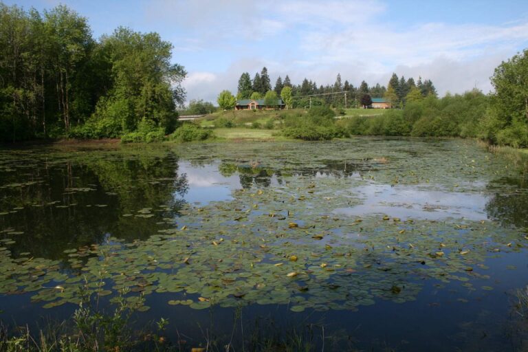
Photo: born1945, CC BY 2.0
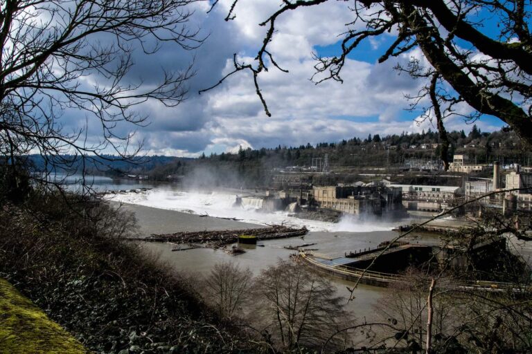
Photo: mk97007, CC BY 2.0
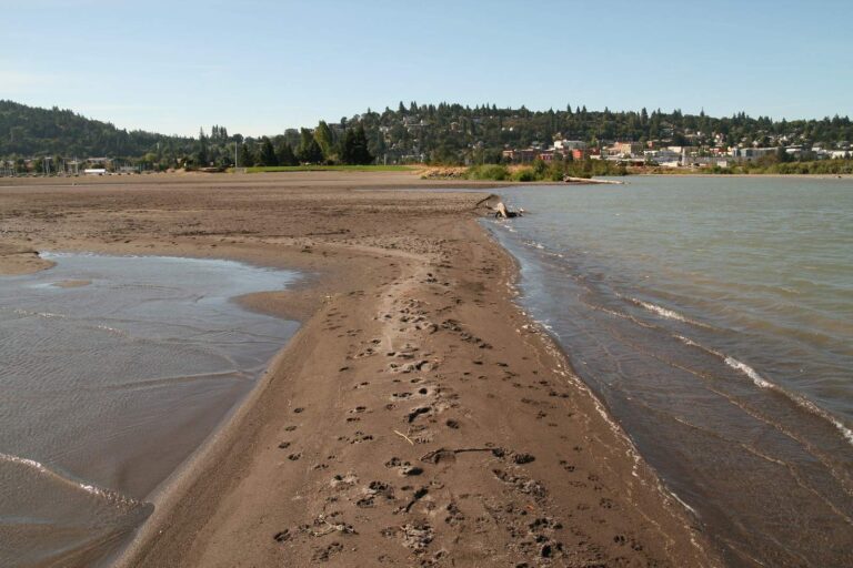
Photo: Bernt Rostad, CC BY 2.0

Photo: Bill Reynolds, CC BY 2.0
Short answers on fishing Multnomah County
Where can I put a boat in around Multnomah County?
There are 48 open launches, 20 with a trailer ramp.
Which Multnomah County lake spreads over the most mapped acres?
Lake Bonneville, about 19,452 acres on its mapped outline.
What fish show up most near Multnomah County?
Rainbow trout lead the count of water pages within 40 miles, then largemouth bass, cutthroat trout and steelhead.
Which Multnomah County stores carry fishing gear?
28 listed, including Crowe's Bait Co.
Are there charter or guide listings in Multnomah County?
2 guides and charters name this county.
In which town does Multnomah County hold court?
Portland is the seat.
What does ODFW charge to fish in Multnomah County?
Annual angling runs $50 for residents of Oregon and $138 for everyone else in 2026. Retained salmonids, sturgeon and halibut are logged on the $69 resident Combined Angling Tag.
Which counties border Multnomah County?
Clackamas County, Washington County and Hood River County lie closest.
Which regulation zone fits Multnomah County?
ODFW files most of the Multnomah County waters it names under the ODFW Willamette Zone rows, with drainages, not county lines, setting the edges.
Does the booklet set exceptions in Multnomah County?
The 2026 booklet prints 57 water exceptions reaching this county, starting with Haldeman Pond; the table above shows each.
Which Multnomah County waters get hatchery trout?
Yes: 1 water on the ODFW schedule, such as Haldeman Pond; releases are planned, not confirmed.
Which ODFW record fish came out of Multnomah County water?
Shad, 6 lb 6 oz, from Willamette River (2004).
Give Multnomah County a weekend of fishing
Launch pages give lanes, amenities and directions.