Fishing in Columbia County, Oregon
County seat: St. Helens. Population 52,589.
- 8lake pages
- 27open launches
- 3river pages
 Pick for sturgeonPiscifun LumiCat II catfish rod48% OFFSale $114.99
Photo of Willamette River: mk97007, CC BY 2.0
Columbia County fishing at a glance
County business for Columbia County happens in St. Helens; the 2020 Census found 52,589 residents. Expect the ODFW Willamette Zone limits on most Columbia County waters; zones are drawn by drainage, so check any water near a divide.
Of the 8 lake guides tied to Columbia County, Sturgeon Lake covers the most surface. The Marine Board layer shows 27 open launches inside the county, 13 for trailers.
Census 2020 population; BLM Oregon NHD lake outlines; OSMB Boating Access Sites; DLCD and ODFW shore access layers; 2026 Oregon Sport Fishing Regulations zone lists; read November 2, 2026.
 For the sturgeon herePiscifun Chaos XS round baitcaster36% OFFSale $57.99
Pinning the fishing access in Columbia County
OSMB launch points, DLCD and ODFW shore sites, NHD lake points, PMEP estuary points; read November 2, 2026.
Lake guides for Columbia County
| Lake | Acres | Kind | OSMB launches | Fish mapped |
|---|---|---|---|---|
| Sturgeon Lake | 3,163 (outline) | lake | 1 | black crappie, bluegill, brown bullhead |
| Scappoose Bay | 300 (outline) | lake | 1 | |
| McNary Lake | 214 (outline) | lake | 3 | largemouth bass |
| Crane Lake | 122 (outline) | lake | 1 | |
| Steelman Lake | 106 (outline) | lake | 1 | |
| Fishhawk Lake | 52 (outline) | lake | 0 | rainbow trout |
| Vernonia Lake | 32 (outline) | reservoir | 1 | black crappie, bluegill, largemouth bass |
| Salmonberry Reservoir | 4 (outline) | reservoir | 0 | rainbow trout |
BLM Oregon hydrography lake outlines (NHD), summed by GNIS name (layer), read November 2, 2026. Species: ODFW Fish Habitat Distribution layers (ODFW ArcGIS), read November 2, 2026; a mapped species is habitat use ODFW records, not a catch report. ODFW publishes no lake depths in these layers.
Fish counts across waters by Columbia County
Out to 40 miles from St. Helens, rainbow trout appears on more water pages than any other species.
Species from ODFW Fish Habitat Distribution layers, booklet exceptions and ODFW records, counted per water page within 40 miles; habitat mapping, not a catch survey.
More lake outlines across Columbia County
Another 27 named outlines fall in Columbia County.
| Water | Acres (outline) | Nearest place |
|---|---|---|
| Cunningham Lake | 157 | St. Helens |
| Resting Lake | 114 | Columbia City |
| Henrici Lake | 85 | St. Helens |
| Aarons Lake | 84 | Scappoose |
| Deer Island Slough | 46 | Columbia City |
| Malarky Lake | 33 | Scappoose |
| Racetrack Lake | 29 | Scappoose |
| Swan Lake | 26 | Columbia City |
| Millionaire Lake | 26 | St. Helens |
| Seal Lake | 25 | Scappoose |
| Petes Slough | 23 | Scappoose |
| Guiles Lake | 22 | Scappoose |
| Rest Lake | 20 | Scappoose |
| Grassy Lake | 18 | Scappoose |
| Adams Lake | 17 | Columbia City |
| Muckle Lake | 17 | Columbia City |
| Bryce Lake | 16 | St. Helens |
| Oak Ridge Lake | 14 | Columbia City |
| Domeyer Lake | 14 | Scappoose |
| Willow Hole | 14 | Scappoose |
| Widgeon Lake | 13 | St. Helens |
| Daves Slough | 12 | Columbia City |
| Whittier Lake | 11 | St. Helens |
| Gunners Lakes | 9 | Vernonia |
| Scout Lake | 6 | Clatskanie |
| Kauppi Lake | 6 | Vernonia |
| Floeter Pond | 2 | Vernonia |
BLM Oregon hydrography lake outlines (NHD), summed by GNIS name (layer), read November 2, 2026.
Streams that cross Columbia County
- Clatskanie RiverODFW maps chum, coho and fall chinook runs, 2 OSMB launches, 1 booklet exception
- Gilbert RiverODFW maps coho, fall chinook and winter steelhead runs, 4 booklet exceptions
- Nehalem River16 OSMB launches, 4 USGS gauges, 13 booklet exceptions
Smaller rivers of Columbia County (3)
- East Fork Nehalem RiverODFW maps coho, spring chinook and winter steelhead runs
- Little Clatskanie RiverODFW maps coho and winter steelhead runs
- North Fork Clatskanie RiverODFW maps coho and winter steelhead runs
River readings across Columbia County
| USGS gauge | Latest reading | Time (ET) |
|---|---|---|
| Columbia River At Port Westward, Near Quincy, Or | 347,000 cfs, 4.25 ft gage height | Nov 11 10:50 pm |
| Nehalem River Near Vernonia, Or | 30 cfs, 4.22 ft gage height | Nov 11 11:20 pm |
US Geological Survey provisional data, retrieved Nov 11, 2026 11:33 pm ET. Provisional readings can be revised.
ODFW Fish Habitat Distribution stream names and runs, OSMB launches, booklet exceptions and USGS gauges; read November 2, 2026.
Launches listed for Columbia County
- Anderson Park on Nehalem RiverNehalem River, 1 lane, hand carry launch
- Beaver Landing on Clatskanie RiverClatskanie River, 1 lane, trailered launch
- Clatskanie City ParkClatskanie River, 1 lane, trailered launch
- Dibblee Point Beach Landing on Columbia RiverColumbia River, hand carry launch
- Gilbert River Ramp on McNary LakeMcNary Lake, 1 lane, trailered launch
- J.J. Collins East launch on Crane LakeCrane Lake, hand carry launch
- J.J. Collins West launch on Multnomah ChannelMultnomah Channel, hand carry launch
- Kerry West Marina on Westport SloughWestport Slough, hand carry launch
- Little McNary Lake launchMcNary Lake, hand carry launch
- Mayger Beach boat ramp on Columbia RiverColumbia River, trailered launch
- McCuddys Landing on Multnomah ChannelMultnomah Channel, 1 lane, trailered launch
- Pittsburg Boat Launch on Nehalem RiverNehalem River, trailered launch
- Pixie Park on Columbia RiverColumbia River, hand carry launch
- Prescott Beach launch on Columbia RiverColumbia River, hand carry launch
- Rainier City Marina on Columbia RiverColumbia River, 2 lanes, trailered launch
- Riverfront Park Launch on Columbia RiverColumbia River, 2 lanes, trailered launch
- Sand Island Marine Park North on Columbia RiverColumbia River, hand carry launch
- Sand Island Marine Park South on Columbia RiverColumbia River, hand carry launch
- Sauvie Island Wildlife Area boat ramp on Multnomah ChannelMultnomah Channel, 2 lanes, trailered launch
- Scappoose Bay Marina ParkScappoose Bay, 3 lanes, trailered launch
- Scipios Goble Landing on Columbia RiverColumbia River, 1 lane, trailered launch
- St. Helens Marina on Columbia RiverColumbia River, 2 lanes, trailered launch
- Sturgeon Lake West Hand Launch on Steelman LakeSteelman Lake, hand carry launch
- Trojan Park AccessTrojan Pond, hand carry launch
- Vernonia Lake boat rampVernonia Lake, trailered launch
- Gilbert River Transient Tie-Up launch on McNary LakeMcNary Lake, hand carry launch
- St Helens City Docks launch on Columbia RiverColumbia River, hand carry launch
OSMB status is shown as published: closed launches are listed without a page.
Oregon State Marine Board Boating Access Sites layer (OSMB ArcGIS), read November 2, 2026; status as OSMB publishes it. Oregon Coastal Management Program (DLCD) Shoreline Access Inventory (layer) and the ODFW shore access map, read November 2, 2026.
ODFW stocking for waters of Columbia County
Across 2 stocked waters in Columbia County, ODFW plans 10 releases and 21,000 trout.
- Vernonia Lake6 releases planned, next listed: Apr. 26, 2027 – Apr. 30, 2027: 4,000 legal-size trout
- Salmonberry Reservoir4 releases planned, next listed: Apr. 19, 2027 – Apr. 23, 2027: 1,000 legal-size trout
ODFW weekly trout stocking schedule (planned releases; ODFW prints size classes, not species), myodfw.com, read November 2, 2026.
Keeper rules across Columbia County
The zone rows apply across Columbia County wherever no water exception steps in. Annual angling runs $50 for residents of Oregon and $138 for everyone else in 2026. Keep a salmon or steelhead and you need the Combined Angling Tag too, $69 for residents.
| Species | Limit | Season |
|---|---|---|
| Trout | Lakes: 5 per day, 3 daily limits in possession. Streams: catch-and-release only, unless noted under Exceptions; 8-inch minimum | Lakes: Open all year. Streams: Open May 22 – Oct 31 unless noted under Exceptions. |
| Kokanee | 10 per day unless noted under Exceptions. | Open all year. |
| Salmon and Steelhead below Willamette Falls and Columbia River Tributa. | In the aggregate: 2 adult salmon or steelhead per day, 20 per year. 5 jacks per day, 2 daily jack limits in possession. | Closed in all waters unless noted under Exceptions. |
| Salmon above Willamette Falls | 2 adult salmon per day, 5 jacks per day, 2 daily jack limits in possession. 20 salmon and steelhead per year in aggregate. | Closed in all waters unless noted under Exceptions. |
| Steelhead above Willamette Falls | 3 adult steelhead per day (in addition to daily salmon bag limit). 20 salmon and steelhead per year in aggregate. | Closed in all waters unless noted under Exceptions. |
| Sturgeon | Catch-and-release only, unless noted under Exceptions. | Catch-and-release: Open all year, except as noted under Exceptions. |
| Bass | Lakes: 5 per day, 3 daily limits in possession unless noted under Exceptions. Streams: No limit. | Lakes: Open all year. Streams: Open during trout, salmon or steelhead seasons, except mainstem Willamette River and sloughs and tidewater areas of Columbia. |
| Bluegill, Catfish, Crappie, Other Sunfish, Walleye, Yellow Perch, Stri. | No limit, unless noted under Exceptions. | Lakes: Open all year. Streams: Open during trout, salmon or steelhead seasons, except mainstem Willamette River and sloughs and tidewater areas of Columbia. |
| Pacific Lamprey | Refer to General (Statewide) Regulations for regulations covering the harvest of Pacific lamprey. | Refer to General (Statewide) Regulations for regulations covering the harvest of Pacific lamprey. |
| Smelt | Closed. | Closed. |
Special rows reaching Columbia County (24)
| Water | Species | Rule | Booklet |
|---|---|---|---|
| Clatskanie River (Mouth to Swedetown Bridge) | hatchery steelhead, chinook, salmon | Open all year for hatchery steelhead and hatchery Chinook salmon. | p. 28 |
| Fishhawk Lake | trout | Open for trout May 22 – Oct 31. | p. 28 |
| Fishhawk Lake | trout | 2 trout per day, 8 inch minimum length. | p. 28 |
| Fishhawk Lake | Artificial flies and lures only. | p. 28 | |
| Nehalem River (Mainstem) and Bay (Up to Foss Rd (CC) Bridge (RM 15.1)) | hatchery steelhead | Open all year for hatchery steelhead. | |
| Nehalem River (Mainstem) and Bay (Up to Foss Rd (CC) Bridge (RM 15.1)) | steelhead, chinook, salmon | Open for Chinook salmon Jan 1 – Sep 15. Wild Chinook salmon may be harvested; 1 per day as part of daily salmon/steelhead bag limit. | |
| Nehalem River (Mainstem) and Bay (Up to Foss Rd (CC) Bridge (RM 15.1)) | chinook, salmon | Open for Chinook salmon Sep 16 – Dec 31. | |
| Nehalem River (Mainstem) and Bay (Foss Rd (CC) Bridge (RM 15.1) to Hwy 26 bridge at Elsie) | hatchery steelhead | Open all year for hatchery steelhead. | |
| Nehalem River (Mainstem) and Bay (Foss Rd (CC) Bridge (RM 15.1) to Hwy 26 bridge at Elsie) | salmon | Closed all year to all salmon angling. | |
| Nehalem River (Mainstem) and Bay (Above Hwy 26 bridge at Elsie) | hatchery steelhead | Open for hatchery steelhead Jan 1 – Mar 31 and Dec 1-31. | |
| Nehalem River (Mainstem) and Bay (Above Hwy 26 bridge at Elsie) | Closed Sep 1 – Nov 30. | ||
| Nehalem River (Mainstem) and Bay (Above Hwy 26 bridge at Elsie) | salmon | Closed all year to all salmon angling. | |
| Nehalem River, North Fork (Mouth to Hwy 53 bridge) | hatchery steelhead | Open all year for hatchery steelhead. | p. 29 |
| Nehalem River, North Fork (Mouth to Hwy 53 bridge) | steelhead, chinook, salmon | Open for Chinook salmon Jan 1 – Sep 15. Wild Chinook salmon may be harvested; 1 per day as part of daily salmon/steelhead bag limit. | p. 29 |
| Nehalem River, North Fork (Mouth to Hwy 53 bridge) | chinook, salmon | Open for Chinook salmon Sep 16 – Dec 31. | p. 29 |
| Nehalem River, North Fork (Mouth to Hwy 53 bridge) | Angling from Nehalem Hatchery Platform open only to anglers with Disabled Veteran Angling License or Oregon Disabilities Hunting and Fishing Permit. | p. 29 | |
| Nehalem River, North Fork (Hwy 53 bridge to 4th bridge on Hamlet Rd near MP 6) | hatchery steelhead | Open all year for hatchery steelhead. | p. 29 |
| Vernonia Pond | bass | 1 bass per day. | p. 31 |
| Vernonia Pond | crappie | 10 crappie per day. | p. 31 |
| Gilbert River (From the upstream end of the Gilbert River Fishing Pier located near the confluence of the Multnomah Channel upstream to Stur | hatchery steelhead, salmon | Open Apr 16 – Sep 30 for hatchery salmon and hatchery steelhead. | p. 45 |
Limits as printed in the 2026 Oregon Sport Fishing Regulations (ODFW, eRegulations edition) (Willamette Zone page), read November 2, 2026. Water exceptions as printed in the 2026 Oregon Sport Fishing Regulations (ODFW, eRegulations edition) (booklet PDF; printed page shown), read November 2, 2026. In-season changes from ODFW override them. Fees as printed on the ODFW license, tag and permit fee page of the 2026 Oregon Sport Fishing Regulations (ODFW, eRegulations edition) (fees page), read November 2, 2026.
State records from water by Columbia County
Neighbouring waters, all within 80 miles of Columbia County, hold these records.
| Species | Weight | Water | Date |
|---|---|---|---|
| Shad | 6 lb 6 oz | Willamette River | 2004 |
| Pumpkinseed Sunfish | 0 lb 7.68 oz | Lake Oswego | 1996 |
| Smallmouth Bass | 8 lb 1.76 oz | Henry Hagg Lake | 2005 |
| Bullhead Catfish | 3 lb 7 oz | Henry Hagg Lake | 2001 |
Oregon record fish as listed by Oregon Department of Fish and Wildlife (record fish article, dated March 4, 2026), read November 2, 2026.
Shops and charters in Columbia County
Tackle stores of Columbia County
- Fins Custom Tacklebait and tackle shop, Clatskanie
- Scipio's Goble Landingbait and tackle shop, Rainier
- Bi-Mart (Scappoose)sporting goods store, Scappoose
- Coon Island Marinamarina, Scappoose
- McCuddy's Landing Marinamarina, Scappoose
Yellow Pages and store-locator listings, guide and charter business listings (county of the business), read November 2, 2026.
In range of Columbia County
Base towns in Columbia County
- St. Helenspop. 13,817
- Scappoosepop. 8,010
- Vernoniapop. 2,374
- Columbia Citypop. 1,949
- Rainierpop. 1,911
- Clatskaniepop. 1,716
Counties next to Columbia County
- Washington County27 miles south
- Clatsop County30 miles west
- Multnomah County42 miles southeast
- Tillamook County47 miles southwest
What Piscifun sells for a day spent on Columbia County


Piscifun and Amazon links are affiliate links; the site earns a commission on qualifying purchases.
Know the Columbia County catch by sight
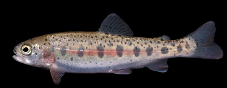
Photo: USFWS Mountain-Prairie, Public domain
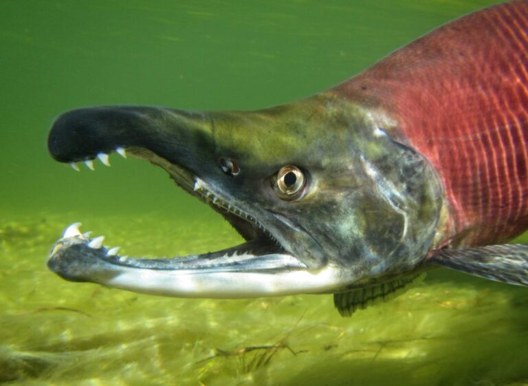
Photo: USFWS Mountain-Prairie, CC BY 2.0
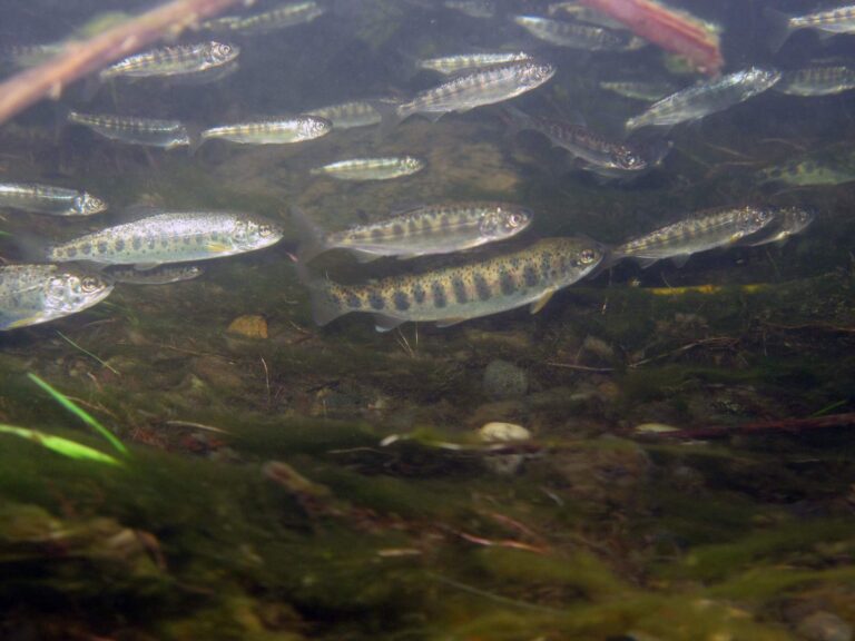
Photo: U.S. Fish and Wildlife Service Headquarters, CC BY 2.0
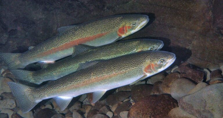
Photo: Oregon State University, CC BY-SA 2.0
Your Columbia County fishing questions, answered
How many boat launches are open in Columbia County?
27 open launches on the OSMB layer, 13 of them for trailers.
Which reservoir or lake tops Columbia County by size?
Sturgeon Lake, about 3,163 acres on its mapped outline.
Which fish lead the water pages near Columbia County?
Rainbow trout lead the count of water pages within 40 miles, then largemouth bass, coho salmon and cutthroat trout.
Which Columbia County stores stock salmon and trout tackle?
5 in all, Fins Custom Tackle first.
Is there a drift-boat or fishing guide listed in Columbia County?
No guide gives an address here.
Which town is the administrative centre for Columbia County?
It is St. Helens.
Do I need a license for water in Columbia County?
Oregon residents pay $50 for the annual angling license, visitors $138. Salmon, steelhead, sturgeon and halibut also go on a Combined Angling Tag ($69 resident).
Which counties touch Columbia County?
Start with Washington County, Clatsop County and Multnomah County.
What zone table do Columbia County waters use?
The ODFW Willamette Zone rows cover most of the listed water in Columbia County; a drainage that crosses the line can carry another zone.
Which Columbia County waters get their own booklet rows?
The 2026 booklet prints 24 water exceptions reaching this county, starting with Clatskanie River; the table above shows each.
How many Columbia County waters are on the stocking schedule?
Yes: 2 waters on the ODFW schedule, such as Vernonia Lake and Salmonberry Reservoir; releases are planned, not confirmed.
Plan a day on the water in Columbia County
Every launch page opens with directions.