Fishing near Gresham, Oregon
Multnomah County, population 114,247.
- 4 milesto nearest paged water
- 8open launches nearby
 Pick for troutPiscifun Carbon X ultralight spinning reel28% OFFSale $57.99
Photo of Sandy River: David Prasad, CC BY-SA 2.0
What Gresham offers anglers
The city of Gresham in Multnomah County had 114,247 people at the 2020 count. The first guided water from town is Blue Lake (Multnomah County), some 4 miles north. Of the nearby lakes, Smith Lake has the biggest outline at about 508 acres. Boats go in at Blue Lake Park Ramp, about 4 miles out.
Stocked trout are scheduled for Estacada Lake, roughly 15 miles away.
Census 2020 population and Gazetteer point for Gresham; miles are straight lines.
 For the trout herePiscifun Carbon XT ultralight spinning reel25% OFFSale $59.99
Reservoirs near Gresham
| Lake | Distance | Acres | Kind | OSMB launches | Fish mapped |
|---|---|---|---|---|---|
| Blue Lake (Multnomah County) | 4 miles north | 66 (outline) | lake | 1 | black crappie, bluegill, carp |
| Kellogg Lake | 11 miles southwest | 17 (outline) | lake | 1 | |
| Lake Oswego | 14 miles southwest | 431 (outline) | lake | 1 | carp, pumpkinseed sunfish |
| Estacada Lake | 15 miles south | 60 (outline) | lake | 4 | rainbow trout, steelhead |
| Smith Lake | 16 miles northwest | 508 (outline) | lake | 1 | black crappie, bluegill, brown bullhead |
| Faraday Lake | 18 miles south | 48 (outline) | lake | 0 | rainbow trout |
BLM Oregon hydrography lake outlines (NHD), summed by GNIS name (layer), read November 2, 2026. ODFW Fish Habitat Distribution layers (ODFW ArcGIS), read November 2, 2026; a mapped species is habitat use ODFW records, not a catch report.
Moving water near Gresham
- Sandy River5 miles, ODFW maps chum, coho and fall chinook runs, 5 OSMB launches, 2 USGS gauges, 8 booklet exceptions
- Bull Run River10 miles, ODFW maps coho, fall chinook and spring chinook runs, 4 USGS gauges, 5 booklet exceptions
- Clackamas River12 miles, ODFW maps coho, fall chinook and spring chinook runs, 15 OSMB launches, 5 USGS gauges, 10 booklet exceptions
- Little Sandy River13 miles, ODFW maps spring chinook and winter steelhead runs, 1 USGS gauge
Current flow close to Gresham
| USGS gauge | Latest reading | Time (ET) |
|---|---|---|
| Johnson Creek At Regner Road, At Gresham, Or | 2 cfs, 4.37 ft gage height | Nov 4 12:30 am |
| Fairview Creek At Glisan St Near Gresham, Or | 0 cfs, 4.39 ft gage height | Nov 4 1:00 am |
| Kelly Creek At Kane Road Near Gresham, Or | 0 cfs, 3.99 ft gage height | Nov 4 12:15 am |
US Geological Survey provisional data, retrieved Nov 4, 2026 1:33 am ET. Provisional readings can be revised.
ODFW stream names and runs, OSMB launches and USGS gauges; read November 2, 2026.
OSMB put-ins plotted around Gresham
- Blue Lake Park RampBlue Lake, 4 miles
- Glenn Otto City Park on Sandy RiverSandy River, 4 miles
- Lewis and Clark State Park on Sandy RiverSandy River, 4 miles
- Chinook Landing on Columbia RiverColumbia River, 4 miles
- Ducks Moorage on Columbia RiverColumbia River, 4 miles
- Dabney State Park on Sandy RiverSandy River, 4 miles
- Will-Jan Marina on Columbia RiverColumbia River, 4 miles
- Airport Way Launch on Columbia SloughColumbia Slough, 4 miles
Oregon State Marine Board Boating Access Sites layer (OSMB ArcGIS), read November 2, 2026; status as OSMB publishes it. Oregon Coastal Management Program (DLCD) Shoreline Access Inventory (layer) and the ODFW shore access map, read November 2, 2026.
ODFW releases by Gresham
| Water | Distance | Planned releases | Latest listed |
|---|---|---|---|
| Estacada Lake | 15 miles | 16 | Aug. 30, 2027 – Sep. 03, 2027: 800 legal-size trout |
| Faraday Lake | 18 miles | 11 | Sep. 27, 2027 – Oct. 01, 2027: 1,400 legal-size trout |
| Commonwealth Lake | 18 miles | 6 | May. 03, 2027 – May. 07, 2027: 2,000 legal-size, 244 trophy trout |
| North Fork Reservoir | 20 miles | 16 | Sep. 27, 2027 – Oct. 01, 2027: 3,702 legal-size trout |
| Small Fry Lake | 22 miles | 13 | Sep. 27, 2027 – Oct. 01, 2027: 334 legal-size trout |
ODFW weekly trout stocking schedule (planned releases; ODFW prints size classes, not species), myodfw.com, read November 2, 2026.
Tackle stores around Gresham
Tackle counters near Gresham
- Dick's Sporting Goods Greshamsporting goods store, Gresham, under a mile
- Bi-Mart (Gresham)sporting goods store, Gresham, 2 miles
- Jack's Snacks & Tacklebait and tackle shop, Troutdale, 4 miles
- Big Eddy Marina Incmarina, Portland, 4 miles
- Bi-Mart (Portland/Halsey)sporting goods store, Portland, 5 miles
- Northwest Flyfishing Outfitterbait and tackle shop, Portland, 6 miles
- LOONEYLURES-THEFISHSNIPERbait and tackle shop, Happy Valley, 6 miles
- Bi-Mart (Damascus)sporting goods store, Damascus, 6 miles
Paid fishing trips from Gresham
- Northwest Flyfishing Outfitterfly fishing guide, Portland, (503) 252-1529
- Sturgeon Frank's Guide Servicecharter, Portland, (503) 240-0631
Yellow Pages and store-locator listings (miles only for shops with a geocoded address) and guide or charter listings; read November 2, 2026.
Competition days near Gresham
| Date | Event | Water | Organizer |
|---|---|---|---|
| Aug. 2, 2025 | KFNW/OKBF Tour Event 5 Upper Willamette River 2025 | Willamette River | Kayak Fishing Northwest (KFNW) / Oregon Kayak Bass Fishing (OKBF) |
Organizer schedule and results pages for events in Multnomah County or within 20 miles, checked November 2026.
ODFW record catches near Gresham
| Species | Weight | Water | Date |
|---|---|---|---|
| Pumpkinseed Sunfish | 0 lb 7.68 oz | Lake Oswego | 1996 |
| White Catfish | 15 lb 0 oz | Tualatin River | 1989 |
| Shad | 6 lb 6 oz | Willamette River | 2004 |
| Smallmouth Bass | 8 lb 1.76 oz | Henry Hagg Lake | 2005 |
| Bullhead Catfish | 3 lb 7 oz | Henry Hagg Lake | 2001 |
Oregon record fish as listed by Oregon Department of Fish and Wildlife (record fish article, dated March 4, 2026), read November 2, 2026. Waters within 40 miles.
Keeper rules around Gresham
In the booklet, the bulk of Multnomah County waters sit in the ODFW Willamette Zone pages, since zones track watersheds. Budget $50 if you live in Oregon, $138 if not, for the annual angling license. Salmon, steelhead, sturgeon and halibut also go on a Combined Angling Tag ($69 resident).
| Species | Limit | Season |
|---|---|---|
| Trout | Lakes: 5 per day, 3 daily limits in possession. Streams: catch-and-release only, unless noted under Exceptions; 8-inch minimum | Lakes: Open all year. Streams: Open May 22 – Oct 31 unless noted under Exceptions. |
| Kokanee | 10 per day unless noted under Exceptions. | Open all year. |
| Salmon and Steelhead below Willamette Falls and Columbia River Tributa. | In the aggregate: 2 adult salmon or steelhead per day, 20 per year. 5 jacks per day, 2 daily jack limits in possession. | Closed in all waters unless noted under Exceptions. |
| Salmon above Willamette Falls | 2 adult salmon per day, 5 jacks per day, 2 daily jack limits in possession. 20 salmon and steelhead per year in aggregate. | Closed in all waters unless noted under Exceptions. |
| Steelhead above Willamette Falls | 3 adult steelhead per day (in addition to daily salmon bag limit). 20 salmon and steelhead per year in aggregate. | Closed in all waters unless noted under Exceptions. |
| Sturgeon | Catch-and-release only, unless noted under Exceptions. | Catch-and-release: Open all year, except as noted under Exceptions. |
| Bass | Lakes: 5 per day, 3 daily limits in possession unless noted under Exceptions. Streams: No limit. | Lakes: Open all year. Streams: Open during trout, salmon or steelhead seasons, except mainstem Willamette River and sloughs and tidewater areas of Columbia. |
| Bluegill, Catfish, Crappie, Other Sunfish, Walleye, Yellow Perch, Stri. | No limit, unless noted under Exceptions. | Lakes: Open all year. Streams: Open during trout, salmon or steelhead seasons, except mainstem Willamette River and sloughs and tidewater areas of Columbia. |
| Pacific Lamprey | Refer to General (Statewide) Regulations for regulations covering the harvest of Pacific lamprey. | Refer to General (Statewide) Regulations for regulations covering the harvest of Pacific lamprey. |
| Smelt | Closed. | Closed. |
Limits as printed in the 2026 Oregon Sport Fishing Regulations (ODFW, eRegulations edition) (Willamette Zone page), read November 2, 2026. Lake, river and bay pages print any water exception.
Close by Gresham
Other towns near Gresham
- Wood Village3 miles
- Fairview3 miles
- Troutdale3 miles
- Damascus5 miles
- Happy Valley6 miles
Which county holds Gresham
- Multnomah Countyseat: Portland
Piscifun tackle that suits a trip to Gresham


Piscifun and Amazon links are affiliate links; the site earns a commission on qualifying purchases.
The look of the water close to Gresham

Photo: Tony Webster, CC BY-SA 2.0

Photo: Bonnie Moreland, CC0 1.0
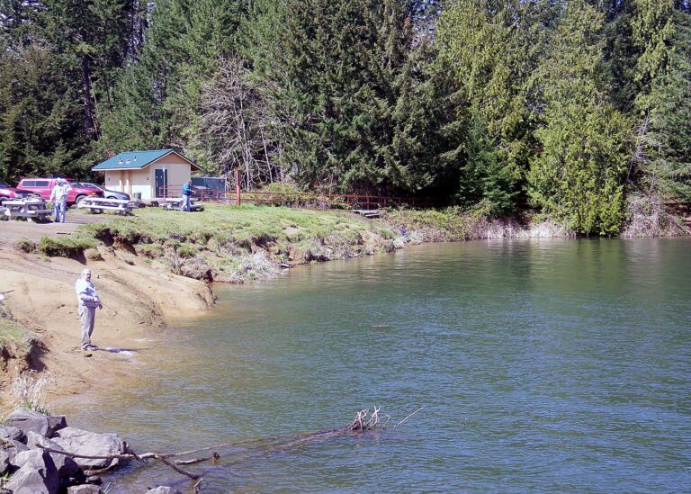
Photo: Oregon Department of Fish & Wildlife, CC BY-SA 2.0
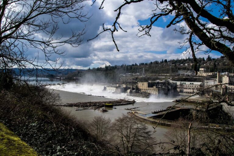
Photo: mk97007, CC BY 2.0
Answers for anglers bunking in Gresham
Which reservoir is a short drive from Gresham?
Blue Lake (Multnomah County), 4 miles north.
How far is Gresham from an open launch?
Try Blue Lake Park Ramp, 4 miles.
Which pier or jetty is handy to Gresham?
Nothing inside 15 miles on the DLCD or ODFW layers.
Which Oregon tackle counter is handiest to Gresham?
Dick's Sporting Goods Gresham, under a mile away.
Which county guide covers Gresham?
Multnomah County, Oregon.
Does a visitor in Gresham need an Oregon license?
Out-of-state anglers pay $138 for the annual license.
Which lake by Gresham gives a boat the most open water?
Smith Lake, about 508 acres, 16 miles away.
Which Census places lie beside Gresham?
The nearest are Wood Village (3 miles), Fairview (3 miles) and Troutdale (3 miles).
How far is Gresham from a stocked lake?
Estacada Lake, 15 miles away, with 16 releases on the schedule (planned, not confirmed).
What weigh-ins happen around Gresham?
Organizer pages list 1 event here, all already fished.
Which ODFW record catches came from near Gresham?
Pumpkinseed Sunfish, 0 lb 7.68 oz, from Lake Oswego.
Stay in Gresham and fish each day
Launch pages carry a directions link up top.