Fishing in Malheur County, Oregon
County seat: Vale. Population 31,571.
- 15lake pages
- 17open launches
- 2river pages
 Pick for crappiePiscifun Carbon X ultralight spinning reel28% OFFSale $57.99
Photo of Owyhee River: Bureau of Land Management Oregon and Washington, CC BY 2.0
Malheur County fishing at a glance
County business for Malheur County happens in Vale; the 2020 Census found 31,571 residents. Expect the ODFW Southeast Zone limits on most Malheur County waters; zones are drawn by drainage, so check any water near a divide. Brownlee Reservoir and Oxbow Reservoir is shared with a neighbouring state.
Of the 15 lake guides tied to Malheur County, Brownlee Reservoir covers the most surface. The Marine Board layer shows 17 open launches inside the county, 12 for trailers.
Census 2020 population; BLM Oregon NHD lake outlines; OSMB Boating Access Sites; DLCD and ODFW shore access layers; 2026 Oregon Sport Fishing Regulations zone lists; read November 2, 2026.
Pinning the fishing access in Malheur County
OSMB launch points, DLCD and ODFW shore sites, NHD lake points, PMEP estuary points; read November 2, 2026.
Lake guides for Malheur County
| Lake | Acres | Kind | OSMB launches | Fish mapped |
|---|---|---|---|---|
| Brownlee Reservoir | 13,880 (outline), 58% in Oregon | reservoir | 7 | black crappie, carp, channel catfish |
| Lake Owyhee | 11,112 (outline) | lake | 5 | black bullhead, black crappie, carp |
| Warm Springs Reservoir | 4,136 (outline) | reservoir | 2 | bluegill, bridgelip sucker, brown bullhead |
| Antelope Reservoir | 3,619 (outline) | reservoir | 1 | |
| Cow Lakes | 2,041 (outline) | lake | 1 | brown bullhead, largemouth bass, northern pikeminnow |
| Beulah Reservoir | 1,843 (outline) | reservoir | 1 | rainbow trout |
| Oxbow Reservoir | 1,106 (outline), 54% in Oregon | reservoir | 3 | bluegill, brown bullhead, channel catfish |
| Malheur Reservoir | 759 (outline) | reservoir | 1 | rainbow trout |
| Bully Creek Reservoir | 611 (outline) | reservoir | 1 | brown bullhead, channel catfish, largemouth bass |
| Pole Creek Reservoir | 70 (outline) | reservoir | 1 | rainbow trout |
| Deary Reservoir | 33 (outline) | reservoir | 0 | rainbow trout |
| Parsnip Creek Diversion Reservoir | 32 (outline) | reservoir | 0 | rainbow trout |
| Zotto Reservoir | 32 (outline) | reservoir | 0 | rainbow trout |
| Murphy Reservoir | 30 (outline) | reservoir | 0 | rainbow trout |
| Becker Ponds | 12 (outline) | lake | 0 | rainbow trout |
BLM Oregon hydrography lake outlines (NHD), summed by GNIS name (layer), read November 2, 2026. Species: ODFW Fish Habitat Distribution layers (ODFW ArcGIS), read November 2, 2026; a mapped species is habitat use ODFW records, not a catch report. ODFW publishes no lake depths in these layers.
 For the crappie herePiscifun Carbon XT ultralight spinning reel25% OFFSale $59.99
Fish counts across waters by Malheur County
Out to 40 miles from Vale, rainbow trout appears on more water pages than any other species.
Species from ODFW Fish Habitat Distribution layers, booklet exceptions and ODFW records, counted per water page within 40 miles; habitat mapping, not a catch survey.
More lake outlines across Malheur County
Another 63 named outlines fall in Malheur County.
| Water | Acres (outline) | Nearest place |
|---|---|---|
| Jaca Reservoir | 814 | Nyssa |
| Easterday Reservoir | 385 | Vale |
| Little Grassy Reservoir | 333 | Nyssa |
| Rock Creek Reservoir (Malheur County) | 192 | Nyssa |
| Coyote Creek Reservoir | 164 | Nyssa |
| Butte Reservoir | 159 | Vale |
| Gartin Reservoir | 140 | Nyssa |
| Dowell Reservoir | 139 | Hines |
| Love Reservoir | 120 | Vale |
| Scott Reservoir | 101 | Nyssa |
| Freezeout Lake | 100 | Vale |
| Parker Reservoir | 92 | Nyssa |
| Brewster Reservoir | 65 | Nyssa |
| Sheep Creek Reservoir | 63 | Nyssa |
| Upper Dry Lake Number 2 | 57 | Nyssa |
| Crowley Reservoir | 49 | Vale |
| Tex Martin Lake | 47 | Vale |
| Ben Odell Reservoir | 46 | Nyssa |
| Walls Reservoir | 46 | Vale |
| Blevins Reservoir | 44 | Nyssa |
| Chapman Reservoir | 41 | Burns |
| Peacock Lake | 41 | Nyssa |
| Batch Lake | 38 | Nyssa |
| Rockhouse Reservoir | 37 | Nyssa |
| Dry Lakes | 35 | Nyssa |
| Upper Dry Lake Number 1 | 31 | Nyssa |
| Shumway Reservoir | 29 | Vale |
| Chevally Reservoir | 26 | Nyssa |
| Hanna Reservoir | 24 | Vale |
| Copeland Reservoirs | 24 | Vale |
| Horse Hill Reservoir | 22 | Nyssa |
| Lodge Reservoir Number One | 20 | Nyssa |
| Parsnip Reservoir | 19 | Nyssa |
| Star Creek Reservoir | 18 | Vale |
| Arcadia Lake | 18 | Nyssa |
| Lower Chapman Reservoir | 18 | Burns |
| Grassy Mountain Lake | 18 | Nyssa |
| Mud Creek Reservoir Number One | 18 | Nyssa |
| Dowell Reservoir | 17 | Vale |
| Hole-in-the-Ground | 14 | Hines |
| Crater Lake | 14 | Nyssa |
| McEwen Reservoir | 14 | Burns |
| Lowe Reservoir | 13 | Vale |
| Brewster Reservoir Number Two | 13 | Nyssa |
| Moltham Reservoir Two | 13 | Baker City |
| Greeley Reservoir | 12 | Nyssa |
| Noon Reservoir | 12 | Nyssa |
| Riley Horn Reservoir | 11 | Nyssa |
| Cook Stove Reservoir | 11 | Vale |
| Twin Lakes | 11 | Nyssa |
| Trail Creek Reservoir | 11 | Nyssa |
| Emmets Hole | 11 | Nyssa |
| Dead Horse Butte Reservoir | 10 | Nyssa |
| Penn Slough | 10 | Ontario |
| David Kent Reservoir | 10 | Vale |
| Allotment Reservoir Number Three | 3 | Vale |
| Littlefield Reservoir | 3 | Vale |
| Paa nena-d Reservoir | 2 | Vale |
| South Cottonwood Reservoir | 2 | Vale |
| Upper Rattlesnake Reservoir | 1 | Hines |
| Pence Spring Reservoir | 1 | Vale |
| South Mountain Reservoir | 0 | Vale |
| Warm Springs Reservoir | 0 | Vale |
BLM Oregon hydrography lake outlines (NHD), summed by GNIS name (layer), read November 2, 2026.
Streams that cross Malheur County
- Malheur RiverODFW maps spring chinook runs, 1 USGS gauge, 4 booklet exceptions
- Owyhee River3 OSMB launches, 2 USGS gauges, 3 booklet exceptions
Smaller rivers of Malheur County (5)
- Middle Fork Owyhee Riverstream
- North Fork Malheur Riverstream
- North Fork Owyhee Riverstream
- South Fork Malheur River1 USGS gauge
- West Little Owyhee Riverstream
River readings across Malheur County
| USGS gauge | Latest reading | Time (ET) |
|---|---|---|
| Owyhee River Nr Rome Or | 107 cfs, 1.40 ft gage height | Nov 11 8:30 pm |
| Malheur River Below Nevada Dam Near Vale Or | 99 cfs, 11.07 ft gage height | Nov 11 8:30 pm |
| Owyhee River Below Owyhee Dam, Or | 29 cfs, 1.06 ft gage height | Nov 11 8:30 pm |
| South Fork Malheur River Nr Riverside, Or | 18 cfs, 6.65 ft gage height | Nov 11 8:15 pm |
US Geological Survey provisional data, retrieved Nov 11, 2026 9:33 pm ET. Provisional readings can be revised.
ODFW Fish Habitat Distribution stream names and runs, OSMB launches, booklet exceptions and USGS gauges; read November 2, 2026.
Launches listed for Malheur County
- Adrian Ramp on Snake RiverSnake River, 1 lane, hand carry launch
- Antelope Reservoir Campground boat rampAntelope Reservoir, 1 lane, trailered launch
- Beulah Reservoir RampBeulah Reservoir, 1 lane, trailered launch
- Bully Creek Campground boat rampBully Creek Reservoir, 2 lanes, trailered launch
- Gordon Gulch Day Use boat ramp on Lake OwyheeLake Owyhee, 2 lanes, trailered launch, OSMB status: restricted
- Historic Birch Creek Ranch Campground launch on Owyhee RiverOwyhee River, 1 lane, hand carry launch
- Indian Creek Ramp on Lake OwyheeLake Owyhee, 2 lanes, trailered launch
- Lake Owyhee Dam RampLake Owyhee, 1 lane, trailered launch
- Leslie Gulch boat ramp on Lake OwyheeLake Owyhee, 1 lane, trailered launch, OSMB status: restricted
- Malheur Reservoir boat rampMalheur Reservoir, 1 lane, trailered launch
- McCormack Campground boat ramp on Lake OwyheeLake Owyhee, 1 lane, trailered launch
- Nyssa River Park on Snake RiverSnake River, 1 lane, trailered launch
- Ontario State Park on Snake RiverSnake River, 1 lane, trailered launch
- Pole Creek Reservoir launchPole Creek Reservoir, 1 lane, hand carry launch
- Rome Access on Owyhee RiverOwyhee River, 1 lane, hand carry launch
- Three Forks Access on Owyhee RiverOwyhee River, 1 lane, hand carry launch
- Upper Cow Lake boat rampCow Lakes, 1 lane, trailered launch
OSMB status is shown as published: closed launches are listed without a page.
Oregon State Marine Board Boating Access Sites layer (OSMB ArcGIS), read November 2, 2026; status as OSMB publishes it. Oregon Coastal Management Program (DLCD) Shoreline Access Inventory (layer) and the ODFW shore access map, read November 2, 2026.
ODFW stocking for waters of Malheur County
Across 2 stocked waters in Malheur County, ODFW plans 4 releases and 12,300 trout.
- Bully Creek Reservoir2 releases planned, next listed: Jul. 05, 2027 – Jul. 09, 2027: 2,300 legal-size trout
- Becker Ponds2 releases planned, next listed: Oct. 04, 2027 – Oct. 08, 2027: 1,500 legal-size trout
ODFW weekly trout stocking schedule (planned releases; ODFW prints size classes, not species), myodfw.com, read November 2, 2026.
Keeper rules across Malheur County
The zone rows apply across Malheur County wherever no water exception steps in. Annual angling runs $50 for residents of Oregon and $138 for everyone else in 2026. Keep a salmon or steelhead and you need the Combined Angling Tag too, $69 for residents.
| Species | Limit | Season |
|---|---|---|
| Trout | Lakes: 5 per day, 3 daily limits in possession. Streams: 2 per day, 3 daily limits in possession; 8-inch minimum | Lakes: Open all year. Streams: Open all year, unless noted under Exceptions. |
| Kokanee | 10 per day unless noted under Exceptions. | Open all year. |
| Salmon and Steelhead | see the ODFW booklet | Closed to angling for salmon and steelhead. |
| Bass | Lakes: 5 per day, 3 daily limits in possession unless noted under Exceptions. No limit in the southwest corner of the Southeast Zone. Streams: No limit. | Lakes and Reservoirs: Open all year. Streams: Open during trout season. |
| Bluegill, Catfish, Crappie, Other Sunfish, Walleye, and Yellow Perch | No limit. | Lakes and Reservoirs: Open all year. Streams: Open during trout season. |
| Whitefish, Sucker, Northern Pikeminnow, Carp, Chub, Sculpin, and other. | No limit. | Lakes and Reservoirs: Open all year. Streams: Open during trout season. |
| Sturgeon | Catch-and-release only. | Lakes and Reservoirs: Open all year. Streams: Open during trout season. |
Special rows reaching Malheur County (12)
| Water | Species | Rule | Booklet |
|---|---|---|---|
| Malheur River (Below Otis Creek) | trout | 5 trout per day, 8 inch minimum length. | p. 63 |
| Malheur River (Below Otis Creek) | Use of bait allowed. | p. 63 | |
| Malheur River, North Fork Mouth to Beulah Reservoir | trout | 5 trout per day, 8 inch minimum length. | p. 63 |
| Malheur River, North Fork Mouth to Beulah Reservoir | Use of bait allowed. | p. 63 | |
| Owyhee River | trout | 5 rainbow trout per day, 8 inch minimum length. | p. 64 |
| Owyhee River | brown trout | Catch-and-release for brown trout. | p. 64 |
| Owyhee River | Use of bait allowed. | p. 64 | |
| Brownlee Reservoir | bass | 12 inch minimum length on bass. | p. 70 |
| Brownlee Reservoir | An Oregon angling license is required on the Powder River Arm from the mouth up to the Huntington – Richland Rd Bridge. | p. 70 | |
| Brownlee Reservoir | Brownlee Reservoir ends at the downstream point of Porter Island. | p. 70 | |
| Oxbow Reservoir | bass | 2 bass per day. | p. 70 |
| Oxbow Reservoir | bass | No harvest of bass between 12 and 16 inches. | p. 70 |
Limits as printed in the 2026 Oregon Sport Fishing Regulations (ODFW, eRegulations edition) (Southeast Zone page), read November 2, 2026. Water exceptions as printed in the 2026 Oregon Sport Fishing Regulations (ODFW, eRegulations edition) (booklet PDF; printed page shown), read November 2, 2026. In-season changes from ODFW override them. Fees as printed on the ODFW license, tag and permit fee page of the 2026 Oregon Sport Fishing Regulations (ODFW, eRegulations edition) (fees page), read November 2, 2026.
State records from water by Malheur County
| Species | Weight | Water | Date |
|---|---|---|---|
| Cutthroat Trout | 9 lb 8 oz | Malheur River | 1986 |
Oregon record fish as listed by Oregon Department of Fish and Wildlife (record fish article, dated March 4, 2026), read November 2, 2026.
Shops and charters in Malheur County
Tackle stores of Malheur County
- The Outdoorsmanbait and tackle shop, Ontario
- Bi-Mart (Ontario)sporting goods store, Ontario
Yellow Pages and store-locator listings, guide and charter business listings (county of the business), read November 2, 2026.
In range of Malheur County
Base towns in Malheur County
- Ontariopop. 11,645
- Nyssapop. 3,198
- Valepop. 1,894
Counties next to Malheur County
- Harney County70 miles west
- Baker County105 miles north
- Grant County114 miles northwest
- Lake County144 miles west
What Piscifun sells for a day spent on Malheur County


Piscifun and Amazon links are affiliate links; the site earns a commission on qualifying purchases.
Picture key to the fish of Malheur County
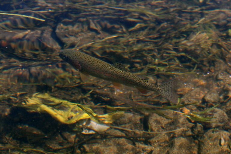
Photo: Alaska Region U.S. Fish & Wildlife Service, Public domain
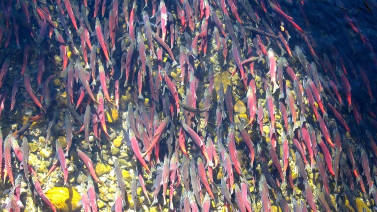
Photo: Jonathan Cook-Fisher, CC BY 2.0

Photo: gailhampshire, CC BY 2.0
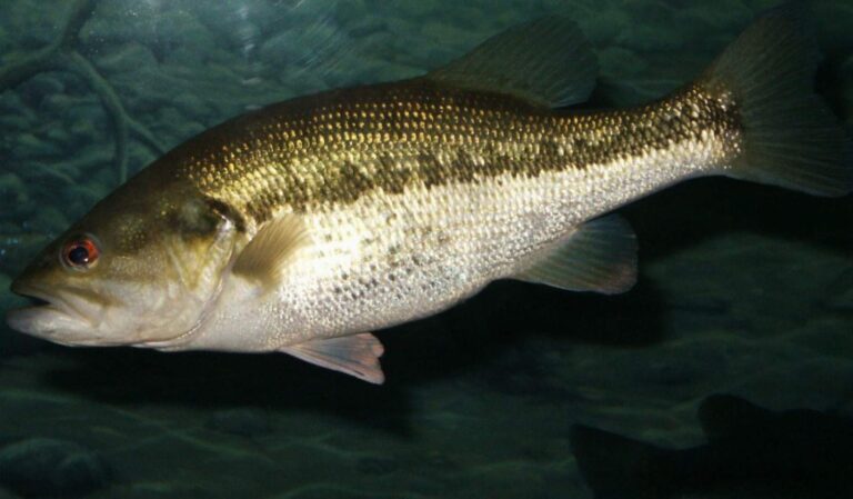
Photo: robposse, CC BY 2.0
Your Malheur County fishing questions, answered
How many boat launches are open in Malheur County?
17 open launches on the OSMB layer, 12 of them for trailers.
Which reservoir or lake tops Malheur County by size?
Brownlee Reservoir, about 13,880 acres on its mapped outline.
Which fish lead the water pages near Malheur County?
Rainbow trout lead the count of water pages within 40 miles, then smallmouth bass, channel catfish and largemouth bass.
Which Malheur County stores stock salmon and trout tackle?
2 in all, The Outdoorsman first.
Is there a drift-boat or fishing guide listed in Malheur County?
No guide gives an address here.
Which town is the administrative centre for Malheur County?
It is Vale.
Do I need a license for water in Malheur County?
Oregon residents pay $50 for the annual angling license, visitors $138. Salmon, steelhead, sturgeon and halibut also go on a Combined Angling Tag ($69 resident).
Which counties touch Malheur County?
Start with Harney County, Baker County and Grant County.
What zone table do Malheur County waters use?
The ODFW Southeast Zone rows cover most of the listed water in Malheur County; a drainage that crosses the line can carry another zone.
Which Malheur County waters get their own booklet rows?
The 2026 booklet prints 12 water exceptions reaching this county, starting with Malheur River; the table above shows each.
How many Malheur County waters are on the stocking schedule?
Yes: 2 waters on the ODFW schedule, such as Bully Creek Reservoir and Becker Ponds; releases are planned, not confirmed.
Has an ODFW record fish been landed in Malheur County?
Cutthroat Trout, 9 lb 8 oz, from Malheur River (1986).
Plan a day on the water in Malheur County
Every launch page opens with directions.