Lake Owyhee Fishing
A 11,112-acre Oregon reservoir in Malheur County.
 Pick for bullheadPiscifun LumiCat II catfish rod48% OFFSale $114.99
Photo: Bonnie Moreland, Public domain
Getting your bearings on Lake Owyhee
Summed by GNIS name, the outline pieces of Lake Owyhee come to around 11,112 acres in Malheur County. Its boat access is managed by Bureau of Reclamation, Oregon Parks and Recreation Department and Vale District BLM. The nearest Census place is Nyssa, about 23 miles off.
Boaters can pick from 5 open launch sites on the OSMB map.
BLM Oregon hydrography lake outlines (NHD), summed by GNIS name (layer), read November 2, 2026.; launch managers from the Oregon State Marine Board launch layer; Census 2023 places.
Fish to chase at Lake Owyhee
ODFW maps these fish as using Lake Owyhee; a mapped species is habitat use, not a catch report.
Habitat records behind Lake Owyhee
| Fish | Use ODFW records | Origin | Basis |
|---|---|---|---|
| Black bullhead | unknown | non native | UndocObsFish |
| Black crappie | resident multiple uses | non native | DocObsFish |
| Carp | resident multiple uses | non native | UndocObsFish |
| Channel catfish | resident multiple uses | non native | DocObsFish |
| Chiselmouth | unknown | native local | DocObsFish |
| Largemouth bass | resident multiple uses | non native | DocObsFish |
| Largescale sucker | unknown | native local | DocObsFish |
| Northern pikeminnow | unknown | native local | DocObsFish |
| Smallmouth bass | resident multiple uses | non native | DocObsFish |
| White crappie | resident multiple uses | non native | UndocObsFish |
| Yellow perch | resident multiple uses | non native | DocObsFish |
ODFW Fish Habitat Distribution layers (ODFW ArcGIS), read November 2, 2026; a mapped species is habitat use ODFW records, not a catch report.
 For the bullhead herePiscifun Chaos XS round baitcaster36% OFFSale $57.99
Boat access at Lake Owyhee
- Gordon Gulch Day Use boat ramp on Lake Owyhee2 lanes, trailered launch, OSMB status: restricted; parking, restrooms; Oregon Parks and Recreation Department; OSMB note: Gordon Gulch boat ramp is open. The water is below the bottom of the ramp. …
- Indian Creek Ramp on Lake Owyhee2 lanes, trailered launch; parking, restrooms, fuel, marina; Oregon Parks and Recreation Department
- Lake Owyhee Dam Ramp1 lane, trailered launch; parking, restrooms; Bureau of Reclamation
- Leslie Gulch boat ramp on Lake Owyhee1 lane, trailered launch, OSMB status: restricted; parking, restrooms; Vale District BLM; OSMB note: Leslie Gulch boat ramp is open. The water is below the bottom of the ramp. …
- McCormack Campground boat ramp on Lake Owyhee1 lane, trailered launch; parking, restrooms; Oregon Parks and Recreation Department
More launches close to Lake Owyhee
- Adrian Ramp on Snake RiverSnake River (Above Brownlee), 13 miles northeast
Oregon State Marine Board Boating Access Sites layer (OSMB ArcGIS), read November 2, 2026; status as OSMB publishes it.
Water level at Lake Owyhee
| USGS gauge | Latest reading | Time (ET) |
|---|---|---|
| Lake Owyhee Near Nyssa Or | 2,604.94 ft gage height | Nov 4 12:30 am |
US Geological Survey provisional data, retrieved Nov 4, 2026 1:33 am ET. Provisional readings can be revised.
U.S. Army Corps of Engineers Northwestern Division water management data (NWD dataquery), reading as of the date shown, read November 2, 2026; datum as the Corps publishes it.
This panel for Lake Owyhee updates from the USGS gauge.
Bag limits that apply at Lake Owyhee
Without a booklet entry for Lake Owyhee, this page shows the Southeast Zone rows that cover most listed waters of Malheur County; check the drainage before keeping fish.
| Species | Daily limit as printed | Season |
|---|---|---|
| Trout | Lakes: 5 per day, 3 daily limits in possession. Streams: 2 per day, 3 daily limits in possession; 8-inch minimum | Lakes: Open all year. Streams: Open all year, unless noted under Exceptions. |
| Kokanee | 10 per day unless noted under Exceptions. | Open all year. |
| Salmon and Steelhead | see the ODFW booklet | Closed to angling for salmon and steelhead. |
| Bass | Lakes: 5 per day, 3 daily limits in possession unless noted under Exceptions. No limit in the southwest corner of the Southeast Zone. Streams: No limit. | Lakes and Reservoirs: Open all year. Streams: Open during trout season. |
| Bluegill, Catfish, Crappie, Other Sunfish, Walleye, and Yellow Perch | No limit. | Lakes and Reservoirs: Open all year. Streams: Open during trout season. |
| Whitefish, Sucker, Northern Pikeminnow, Carp, Chub, Sculpin, and other. | No limit. | Lakes and Reservoirs: Open all year. Streams: Open during trout season. |
| Sturgeon | Catch-and-release only. | Lakes and Reservoirs: Open all year. Streams: Open during trout season. |
An Oregon angling license ($50 resident, $138 nonresident for 2026) covers anglers 12 and older; salmon, steelhead, sturgeon and halibut go on a Combined Angling Tag ($69 resident).
Limits as printed in the 2026 Oregon Sport Fishing Regulations (ODFW, eRegulations edition) (Southeast Zone page), read November 2, 2026.
Where Lake Owyhee ranks among close lakes
Of the five closest Oregon lakes with pages, Cow Lakes is the largest at about 2,041 acres.
| Lake | Distance | Acres | Kind | OSMB launches | Stocking weeks |
|---|---|---|---|---|---|
| Lake Owyhee | 11,112 | reservoir | 5 | 0 | |
| Bully Creek Reservoir | 30 miles north | 611 | reservoir | 1 | 2 |
| Becker Ponds | 33 miles northeast | 12 | reservoir | 0 | 2 |
| Cow Lakes | 37 miles south | 2,041 | reservoir | 1 | 0 |
| Zotto Reservoir | 41 miles northwest | 32 | reservoir | 0 | 0 |
| Pole Creek Reservoir | 46 miles north | 70 | reservoir | 1 | 0 |
BLM outlines, the OSMB launch layer and the ODFW stocking schedule; read November 2, 2026.
What surrounds Lake Owyhee for anglers
Other still water within reach of Lake Owyhee
- Bully Creek Reservoir30 miles north
- Becker Ponds33 miles northeast
- Cow Lakes37 miles south
- Zotto Reservoir41 miles northwest
- Pole Creek Reservoir46 miles north
Shops for roe, worms and spinners near Lake Owyhee
- The Outdoorsmanbait and tackle shop, Ontario
- Bi-Mart (Ontario)sporting goods store, Ontario
Towns within striking range of Lake Owyhee
- Nyssa23 miles
- Vale25 miles
- Ontario32 miles
County pages that include Lake Owyhee
- Malheur Countyseat: Vale
What Piscifun sells for a day spent on Lake Owyhee


Piscifun and Amazon links are affiliate links; the site earns a commission on qualifying purchases.
Picture key to the fish of Lake Owyhee

Photo: USFWS Mountain-Prairie, Public domain

Photo: USFWS Mountain-Prairie, Public domain
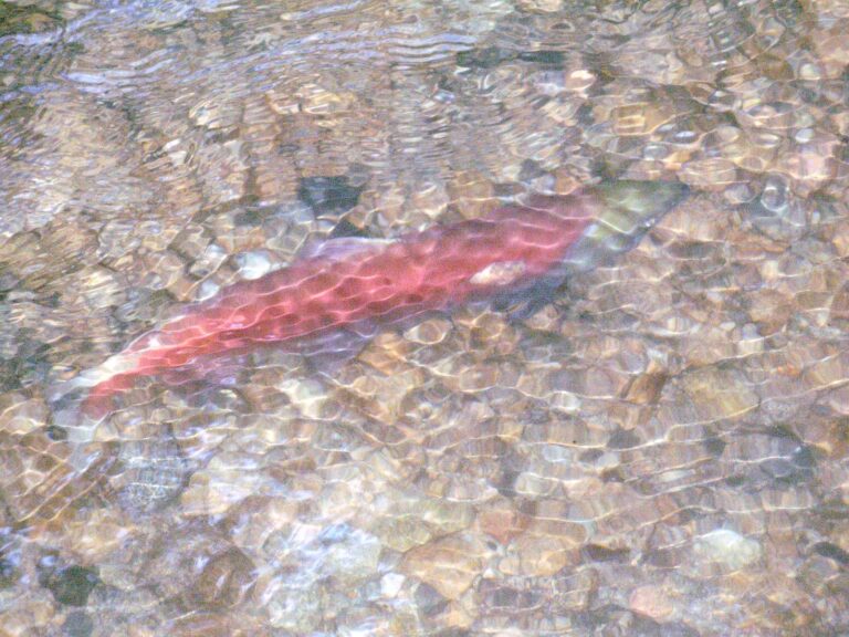
Photo: Thomas Quine, CC BY 2.0

Photo: gailhampshire, CC BY 2.0
Lake Owyhee: what Oregon anglers want to know
How do I locate Lake Owyhee on an Oregon map?
You will find it in Malheur County, about 23 miles from Nyssa.
Is Lake Owyhee large water?
Close to 11,112 acres on the NHD outline.
How many OSMB launches reach Lake Owyhee?
Gordon Gulch Day Use boat ramp on Lake Owyhee is among 5 launch sites OSMB maps.
What species does ODFW map in Lake Owyhee?
Named species: black bullhead, black crappie, carp, channel catfish, chiselmouth, largemouth bass and largescale sucker.
What may an Oregon angler keep from Lake Owyhee?
Trout: Lakes: 5 per day, 3 daily limits in possession. Streams: 2 per day, 3 daily limits in possession; 8-inch minimum.
Does a visitor from out of state need an Oregon license at Lake Owyhee?
An Oregon angling license ($50 resident, $138 nonresident for 2026) covers anglers 12 and older; salmon, steelhead, sturgeon and halibut go on a Combined Angling Tag ($69 resident).
Is shore fishing possible at Lake Owyhee?
No mapped shore site sits on it; launch areas and parks may allow bank fishing.
Where do Oregon anglers buy gear for Lake Owyhee?
Stop at The Outdoorsman in the same county.
Is Lake Owyhee full?
A reading sits in the level band.
Plan a morning on Lake Owyhee
Licenses, endorsements and water exceptions are on the regulations page.