Fishing in Klamath County, Oregon
County seat: Klamath Falls. Population 69,413.
- 27lake pages
- 50open launches
- 4river pages
 Pick for bluegillPiscifun Carbon X ultralight spinning reel28% OFFSale $57.99
Photo of Crescent Lake: Bonnie Moreland, Public domain
Getting to know the water in Klamath County
69,413 Oregonians called Klamath County home in 2020, with Klamath Falls as county seat. ODFW files most of the Klamath County waters it names under the ODFW Southeast Zone rows, with drainages, not county lines, setting the edges. Malone Pool runs over the Oregon line.
Klamath County shares 27 lake pages, and Upper Klamath Lake spreads widest. 50 open launches sit in the county on the OSMB map; 33 take a trailer.
Census 2020 population; BLM Oregon NHD lake outlines; OSMB Boating Access Sites; DLCD and ODFW shore access layers; 2026 Oregon Sport Fishing Regulations zone lists; read November 2, 2026.
A map of where to get on the water in Klamath County
OSMB launch points, DLCD and ODFW shore sites, NHD lake points, PMEP estuary points; read November 2, 2026.
Lakes to try around Klamath County
| Lake | Acres | Kind | OSMB launches | Fish mapped |
|---|---|---|---|---|
| Upper Klamath Lake | 62,057 (outline) | lake | 7 | blue chub, bluegill, brown bullhead |
| Crater Lake | 13,202 (outline) | lake | 0 | rainbow trout |
| Agency Lake | 10,312 (outline) | lake | 2 | blue chub, bluegill, brown bullhead |
| Crescent Lake | 3,824 (outline) | lake | 4 | brown trout, lake trout (mackinaw), rainbow trout |
| Gerber Reservoir | 3,811 (outline) | reservoir | 3 | black crappie, brown bullhead, klamath largescale sucker |
| Odell Lake | 3,416 (outline) | lake | 5 | lake trout (mackinaw), rainbow trout, tui chub |
| Davis Lake | 3,017 (outline) | lake | 2 | largemouth bass, rainbow trout, tui chub |
| Lake of the Woods | 1,227 (outline) | lake | 4 | blue chub, brook trout, brown bullhead |
| Summit Lake (Klamath County) | 692 (outline) | lake | 1 | brook trout, lake trout (mackinaw), rainbow trout |
| Fourmile Lake | 625 (outline) | lake | 1 | brook trout, lake trout (mackinaw), rainbow trout |
| Willow Valley Reservoir | 543 (outline) | reservoir | 1 | black crappie, bluegill, fathead minnow |
| Miller Lake | 519 (outline) | lake | 2 | brown trout, rainbow trout |
| Spring Lake | 375 (outline) | lake | 0 | tui chub |
| Lake Ewauna | 371 (outline) | lake | 1 | lost river sucker, rainbow trout, shortnose sucker |
| Round Valley Reservoir | 310 (outline) | reservoir | 1 | brown bullhead, fathead minnow, largemouth bass |
| Campbell Reservoir | 207 (outline) | reservoir | 0 | brown trout, largemouth bass, rainbow trout |
| Lost River Pool | 204 (outline) | lake | 1 | largemouth bass, rainbow trout, sacramento perch |
| John C Boyle Reservoir | 184 (outline) | reservoir | 3 | bluegill, brown bullhead, fathead minnow |
| Malone Pool | 125 (outline), 43% in Oregon | lake | 1 | brown bullhead, largemouth bass, rainbow trout |
| Harpold Reservoir | 122 (outline) | reservoir | 0 | brown bullhead, klamath largescale sucker, largemouth bass |
| Smith Reservoir (Klamath County) | 105 (outline) | reservoir | 0 | yellow perch |
| Obenchain Reservoir | 71 (outline) | reservoir | 0 | bluegill, brown bullhead, largemouth bass |
| Sycan Marsh | 67 (outline) | lake | 0 | rainbow trout |
| Upper Midway Reservoir | 50 (outline) | reservoir | 0 | largemouth bass, yellow perch |
| Dog Hollow Reservoir | 45 (outline) | reservoir | 0 | largemouth bass |
| Bumphead Reservoir | 42 (outline) | reservoir | 1 | black crappie, largemouth bass, white crappie |
| Midway Reservoir | 5 (outline) | reservoir | 1 |
BLM Oregon hydrography lake outlines (NHD), summed by GNIS name (layer), read November 2, 2026. Species: ODFW Fish Habitat Distribution layers (ODFW ArcGIS), read November 2, 2026; a mapped species is habitat use ODFW records, not a catch report. ODFW publishes no lake depths in these layers.
 For the bluegill herePiscifun Carbon XT ultralight spinning reel25% OFFSale $59.99
What the habitat maps show near Klamath County
largemouth bass tops the tally of water pages within 40 miles of Klamath Falls.
Species from ODFW Fish Habitat Distribution layers, booklet exceptions and ODFW records, counted per water page within 40 miles; habitat mapping, not a catch survey.
The rest of the named lakes in Klamath County
Klamath County holds 110 more named lakes on the outline map.
| Water | Acres (outline) | Nearest place |
|---|---|---|
| Aspen Lake | 3,562 | Klamath Falls |
| Alkali Lake | 740 | Altamont |
| Swan Lake | 734 | Altamont |
| Whiteline Reservoir | 288 | Klamath Falls |
| Wild Billy Lake | 231 | Altamont |
| Hawks Lake | 224 | Klamath Falls |
| Big Adobe Reservoir | 152 | Altamont |
| Antelope Reservoir | 150 | Lakeview |
| Nuss Lake | 145 | Altamont |
| Threemile Reservoir | 130 | Altamont |
| Long Lake | 126 | Altamont |
| Riddle Field | 126 | Altamont |
| Smokey Lake | 126 | Altamont |
| Muckney Lake | 122 | Altamont |
| Horton Reservoir | 105 | Altamont |
| McCoy Reservoir | 96 | Altamont |
| Short Lake | 95 | Altamont |
| Devil Lake | 94 | Lakeview |
| Round Lake | 93 | La Pine |
| Oatman Lake | 85 | Klamath Falls |
| Grohs Reservoir | 85 | Lakeview |
| Meadow Lake | 80 | Altamont |
| Copeland Reservoir | 79 | Altamont |
| Mallory Reservoir | 74 | Altamont |
| Little Fishhole Flat Reservoir | 72 | Lakeview |
| Pope Reservoir | 66 | Altamont |
| DeVaul Lake | 65 | Altamont |
| Wilson Lake | 59 | Altamont |
| Boggs Lake | 57 | Altamont |
| Randall Reservoir | 54 | Altamont |
| Millhayes Meadow | 54 | Klamath Falls |
| Pankey Lake | 51 | Altamont |
| Abraham Flat | 50 | Klamath Falls |
| Noble Reservoir Number One | 48 | Altamont |
| Island Lake | 45 | Eagle Point |
| Gordon Lake | 44 | Klamath Falls |
| Tull Reservoir | 40 | Lakeview |
| Fawn Lake | 40 | Oakridge |
| Gilchrist Log Pond | 39 | La Pine |
| Long Lake | 38 | Eagle Point |
| Lower Rosary Lake | 37 | Oakridge |
| Captain Jack Lake | 36 | Altamont |
| Lake Harriette | 36 | Klamath Falls |
| Dry Lake | 35 | Altamont |
| O'Connors Puddle Reservoir | 34 | Altamont |
| Worden Reservoir | 34 | Altamont |
| Buck Lake | 31 | Klamath Falls |
| Gerber Lower Division Reservoir | 31 | Altamont |
| Lone Pine Reservoir | 31 | Altamont |
| Puck Lakes | 30 | Shady Cove |
| Twenty One Reservoir | 30 | Altamont |
| Hyde Reservoir | 30 | Altamont |
| Middle Lake | 29 | Shady Cove |
| Red Lake | 29 | Eagle Point |
| Lost Lake (Klamath County) | 29 | Lakeview |
| Oldenburg Lake | 29 | La Pine |
| West Swan Lake | 29 | Eagle Point |
| Yoran Lake | 28 | Oakridge |
| Worlow Reservoir | 27 | Altamont |
| Keno Reservoir | 26 | Altamont |
| Grass Lake | 25 | Shady Cove |
| Horseshoe Lake | 24 | Eagle Point |
| Noble Reservoir | 23 | Altamont |
| Klipple Lake | 21 | Lakeview |
| Ritter Reservoir | 20 | Altamont |
| Isherwood Lake | 18 | Eagle Point |
| Fivemile Reservoir | 17 | Altamont |
| Stag Lake | 16 | Oakridge |
| Trapper Lake | 16 | Shady Cove |
| Dee Lake | 16 | Eagle Point |
| Largent Pond | 15 | Klamath Falls |
| Lake Alta | 15 | Shady Cove |
| Margurette Lake | 15 | Shady Cove |
| Pear Lake | 15 | Eagle Point |
| Windy Lakes | 13 | Oakridge |
| Lockey Flat | 12 | Altamont |
| Bingham Lakes | 12 | Oakridge |
| Meek Lake | 12 | Oakridge |
| Diamond View Lake | 12 | Oakridge |
| Whitmore Reservoir | 11 | Altamont |
| Badger Lake | 10 | Eagle Point |
| Darlene Lake | 10 | Oakridge |
| Snell Lake | 10 | Oakridge |
| Blue Lake (Klamath County) | 10 | Eagle Point |
| Cliff Lake | 10 | Shady Cove |
| South Pass Lake | 9 | Klamath Falls |
| Lake Sonya | 9 | Shady Cove |
| Suzanne Lake | 9 | Oakridge |
| Lake Como | 7 | Klamath Falls |
| Heavenly Twin Lakes | 7 | Eagle Point |
| Carey Lake | 6 | Eagle Point |
| North Rosary Lake | 6 | Oakridge |
| Wizzard Lake | 6 | Shady Cove |
| Beal Lake | 5 | Eagle Point |
| Lake Ivern | 5 | Shady Cove |
| Mud Lake | 5 | Eagle Point |
| Maiden Lake | 4 | La Pine |
| Deep Lake | 4 | Shady Cove |
| Snow Lakes | 4 | Shady Cove |
| Echo Lake | 4 | Klamath Falls |
| Lake Elizabeth | 3 | Eagle Point |
| Lake Francis | 3 | Klamath Falls |
| Farrell Lake | 3 | Oakridge |
| Woodpecker Lake | 2 | Eagle Point |
| Donna Lake | 2 | Shady Cove |
| Mystic Lake | 2 | Klamath Falls |
| Bert Lake | 2 | Eagle Point |
| Wind Lake | 2 | Shady Cove |
| Clover Lake | 2 | Klamath Falls |
| Paragon Lake | 1 | Klamath Falls |
BLM Oregon hydrography lake outlines (NHD), summed by GNIS name (layer), read November 2, 2026.
Drift and wade water in Klamath County
- Sprague RiverODFW maps fall chinook, spring chinook and summer steelhead runs, 3 OSMB launches, 1 USGS gauge, 4 booklet exceptions
- Williamson RiverODFW maps fall chinook, spring chinook and summer steelhead runs, 3 OSMB launches, 2 USGS gauges, 10 booklet exceptions
- Wood RiverODFW maps fall chinook, spring chinook and summer steelhead runs, 3 OSMB launches, 1 USGS gauge, 4 booklet exceptions
- Lost River4 USGS gauges, 1 booklet exception
Other named rivers of Klamath County (3)
- North Fork Sprague RiverODFW maps fall chinook, spring chinook and summer steelhead runs
- South Fork Sprague RiverODFW maps fall chinook, spring chinook and summer steelhead runs
- Sycan RiverODFW maps fall chinook, spring chinook and summer steelhead runs
Stream gauges in Klamath County
| USGS gauge | Latest reading | Time (ET) |
|---|---|---|
| Link River At Klamath Falls, Or | 1,050 cfs, 1.79 ft gage height | Nov 13 12:20 am |
| Klamath River Blw John C.boyle Pwrplnt, Nr Keno,or | 944 cfs, 3.93 ft gage height | Nov 12 11:45 pm |
| Klamath River At Keno, Or | 747 cfs, 4.72 ft gage height | Nov 13 12:20 am |
| Williamson River Blw Sprague River Nr Chiloquin,or | 548 cfs, 3.47 ft gage height | Nov 12 11:45 pm |
| Wood River Near Klamath Agency, Or | 329 cfs, 0.90 ft gage height | Nov 12 11:40 pm |
| Sprague River Near Chiloquin, Or | 212 cfs, 1.54 ft gage height | Nov 12 11:30 pm |
US Geological Survey provisional data, retrieved Nov 13, 2026 12:34 am ET. Provisional readings can be revised.
ODFW Fish Habitat Distribution stream names and runs, OSMB launches, booklet exceptions and USGS gauges; read November 2, 2026.
Where to launch in Klamath County
- Aspen Point boat ramp on Lake of the WoodsLake of the Woods, 1 lane, trailered launch
- Barnes Valley boat ramp on Gerber ReservoirGerber Reservoir, 1 lane, trailered launch
- Beatty Access on Sprague RiverSprague River, 1 lane, trailered launch
- Bumphead Reservoir launchBumphead Reservoir, 1 lane, hand carry launch
- Collier Memorial State Park on Williamson RiverWilliamson River, 1 lane, trailered launch
- Crescent Lake Low Water RampCrescent Lake, 1 lane, trailered launch
- Crystal Springs boat ramp on Lost River PoolLost River Pool, 1 lane, trailered launch
- Eagle Ridge boat ramp on Upper Klamath LakeUpper Klamath Lake, 2 lanes, trailered launch
- East Davis Lake Campground launchDavis Lake, hand carry launch
- Fourmile Lake Campground boat rampFourmile Lake, 1 lane, trailered launch
- Hagelstein Park on Upper Klamath LakeUpper Klamath Lake, 1 lane, trailered launch
- Jackson F Kimball State Recreation Site launch on Wood RiverWood River, hand carry launch
- Keno Recreation Area boat ramp on Klamath RiverKlamath River, 1 lane, trailered launch
- Lake of the Woods Resort launchLake of the Woods, 1 lane, hand carry launch
- Malheur Road Take-Out launch on Sprague RiverSprague River, 1 lane, hand carry launch
- Malone Pool AccessMalone Pool, trailered launch
- Malone Springs Day Use boat ramp on Crystal CreekCrystal Creek, 1 lane, trailered launch
- Midway launchMidway Reservoir, 1 lane, hand carry launch
- Miller Island Ramp on Klamath RiverKlamath River, 2 lanes, trailered launch
- Moonshine Falls launch on Klamath RiverKlamath River, hand carry launch
- Moore Park Marina #1 on Upper Klamath LakeUpper Klamath Lake, 2 lanes, trailered launch
- Moore Park Marina #2 on Upper Klamath LakeUpper Klamath Lake, 1 lane, trailered launch
- Nimrod 1 boat ramp on Sprague RiverSprague River, 1 lane, trailered launch
- North Gerber Campground boat rampGerber Reservoir, 2 lanes, trailered launch
- Odell Lake Resort boat rampOdell Lake, 1 lane, trailered launch
- Odessa Campground boat ramp on Odessa CreekOdessa Creek, 1 lane, trailered launch
- Pioneer Park East on John C Boyle ReservoirJohn C Boyle Reservoir, 1 lane, trailered launch
- Pioneer Park West on John C Boyle ReservoirJohn C Boyle Reservoir, 1 lane, hand carry launch
- Rainbow Bay boat ramp on Lake of the WoodsLake of the Woods, 1 lane, trailered launch
- Rocky Point Ramp on Upper Klamath LakeUpper Klamath Lake, 1 lane, trailered launch
- Rocky Point Resort launch on Recreation CreekRecreation Creek, hand carry launch
- Round Valley AccessRound Valley Reservoir, 1 lane, hand carry launch
- Shelter Cove Resort boat ramp on Odell LakeOdell Lake, 2 lanes, trailered launch
- South Gerber Campground boat rampGerber Reservoir, 1 lane, trailered launch
- Spring Creek Day Use launchSpring Creek, 1 lane, hand carry launch
- Spring Creek Headwaters launchSpring Creek, 1 lane, hand carry launch
- Spring Island Launch on Klamath RiverKlamath River, 1 lane, hand carry launch
- Summit Lake boat rampSummit Lake, trailered launch
- Sunset Day Use boat ramp on Lake of the WoodsLake of the Woods, 1 lane, trailered launch
- Topsy boat ramp on John C Boyle ReservoirJohn C Boyle Reservoir, 1 lane, trailered launch
- Tranquil Cove Day Use Area launch on Crescent LakeCrescent Lake, hand carry launch
- Veterans Memorial Park on Lake EwaunaLake Ewauna, 1 lane, trailered launch
- Waterwheel Campground boat ramp on Williamson RiverWilliamson River, 1 lane, trailered launch
- West Davis Day Use Area boat rampDavis Lake, 1 lane, trailered launch
- Williamson River RampWilliamson River, 1 lane, trailered launch, OSMB status: restricted
- Willow Valley RampWillow Valley Reservoir, 1 lane, trailered launch
- Wocus Bay Ramp on Upper Klamath LakeUpper Klamath Lake, 2 lanes, trailered launch
- Wood River Day Use Area launchWood River, hand carry launch
- Wood River Wetland launch on Agency LakeAgency Lake, hand carry launch
- Pelican Marina on Upper Klamath LakeUpper Klamath Lake, launch
- Crescent Lake Campground boat rampCrescent Lake, closed per OSMB
- Digit Point Campground boat ramp on Miller LakeMiller Lake, closed per OSMB
- Gideon Creek Day Use Area launch on Miller LakeMiller Lake, closed per OSMB
- Henzel Park on Agency LakeAgency Lake, closed per OSMB
- Petric Park on Wood RiverWood River, closed per OSMB
- Princess Creek Campground boat ramp on Odell LakeOdell Lake, closed per OSMB
- Spring Boat Launch on Crescent LakeCrescent Lake, closed per OSMB
- Sunset Cove Campground boat ramp on Odell LakeOdell Lake, closed per OSMB
- Trapper Creek Campground boat ramp on Odell LakeOdell Lake, closed per OSMB
Closed sites stay as plain rows; check the OSMB note on any restricted launch.
Oregon State Marine Board Boating Access Sites layer (OSMB ArcGIS), read November 2, 2026; status as OSMB publishes it. Oregon Coastal Management Program (DLCD) Shoreline Access Inventory (layer) and the ODFW shore access map, read November 2, 2026.
Stocked lakes and ponds of Klamath County
Planned stocking in Klamath County: 36 releases, 4 waters, 55,000 trout by the schedule.
- Lake of the Woods16 releases planned, next listed: Sep. 13, 2027 – Sep. 17, 2027: 1,500 legal-size trout
- Fourmile Lake12 releases planned, next listed: Sep. 13, 2027 – Sep. 17, 2027: 2,000 legal-size trout
- Miller Lake6 releases planned, next listed: Sep. 13, 2027 – Sep. 17, 2027: 2,000 legal-size trout
- Spring Lake2 releases planned, next listed: Mar. 08, 2027 – Mar. 12, 2027: 1,000 legal-size trout
ODFW weekly trout stocking schedule (planned releases; ODFW prints size classes, not species), myodfw.com, read November 2, 2026.
The booklet table for Klamath County
Every Klamath County water missing from the exception list uses the zone limits. ODFW prices the 2026 annual angling license at $50 for Oregonians and $138 for nonresidents. The Combined Angling Tag ($69 resident) records any salmon, steelhead, sturgeon or halibut kept.
| Species | Limit | Season |
|---|---|---|
| Trout | Lakes: 5 per day, 3 daily limits in possession. Streams: 2 per day, 3 daily limits in possession; 8-inch minimum | Lakes: Open all year. Streams: Open all year, unless noted under Exceptions. |
| Kokanee | 10 per day unless noted under Exceptions. | Open all year. |
| Salmon and Steelhead | see the ODFW booklet | Closed to angling for salmon and steelhead. |
| Bass | Lakes: 5 per day, 3 daily limits in possession unless noted under Exceptions. No limit in the southwest corner of the Southeast Zone. Streams: No limit. | Lakes and Reservoirs: Open all year. Streams: Open during trout season. |
| Bluegill, Catfish, Crappie, Other Sunfish, Walleye, and Yellow Perch | No limit. | Lakes and Reservoirs: Open all year. Streams: Open during trout season. |
| Whitefish, Sucker, Northern Pikeminnow, Carp, Chub, Sculpin, and other. | No limit. | Lakes and Reservoirs: Open all year. Streams: Open during trout season. |
| Sturgeon | Catch-and-release only. | Lakes and Reservoirs: Open all year. Streams: Open during trout season. |
Exceptions printed for Klamath County (33)
| Water | Species | Rule | Booklet |
|---|---|---|---|
| Crescent Lake | lake trout | 1 lake trout per day, 24 inch minimum length. | p. 53 |
| Odell Lake | Open Apr 22 – Oct 31. | p. 55 | |
| Odell Lake | kokanee | 25 kokanee per day. No size limits. | p. 55 |
| Odell Lake | lake trout | 1 lake trout per day, 24 inch minimum length. | p. 55 |
| Odell Lake | bull trout | Harvest of bull trout prohibited. | p. 55 |
| Odell Lake | Closed between ODFW markers and the mouth of Trapper Cr. | p. 55 | |
| Odell Lake | Closed between ODFW markers and Odell Cr outlet. | p. 55 | |
| Odell Lake | Closed to angling on tributaries. | p. 55 | |
| Agency Lake | trout | Catch-and-release for rainbow trout. | p. 63 |
| Agency Lake | Artificial flies and lures only. | p. 63 | |
| Lake of the Woods | bass | 5 bass per day, only 1 bass over 15 inches may be harvested. | p. 63 |
| Lake of the Woods | Angling allowed 24 hours per day for all species. | p. 63 | |
| Lost River and Tributaries | Use of bait allowed. | p. 63 | |
| Miller Lake | Angling allowed 24 hours per day for all species. | p. 63 | |
| Sprague River (Mainstem) | Open Apr 22 – Oct 31. | p. 64 | |
| Sprague River (Mainstem) | trout | 1 rainbow trout per day, 15 inch minimum length. | p. 64 |
| Sprague River (Mainstem) | Use of bait allowed from Saddle Mt Pit Rd Bridge up to Godowa Springs Rd. | p. 64 | |
| Sprague River, North Fork and Tributaries | Use of bait allowed on the mainstem and tributaries above the lowermost 3372 Rd crossing. | p. 64 | |
| Williamson River (Mouth to Chiloquin Bridge) | Open May 22 – Oct 31. | p. 64 | |
| Williamson River (Mouth to Chiloquin Bridge) | trout | Catch-and-release for rainbow trout. | p. 64 |
Limits as printed in the 2026 Oregon Sport Fishing Regulations (ODFW, eRegulations edition) (Southeast Zone page), read November 2, 2026. Water exceptions as printed in the 2026 Oregon Sport Fishing Regulations (ODFW, eRegulations edition) (booklet PDF; printed page shown), read November 2, 2026. In-season changes from ODFW override them. Fees as printed on the ODFW license, tag and permit fee page of the 2026 Oregon Sport Fishing Regulations (ODFW, eRegulations edition) (fees page), read November 2, 2026.
ODFW records tied to Klamath County
| Species | Weight | Water | Date |
|---|---|---|---|
| Macinaw or Lake Trout | 40 lb 8 oz | Odell Lake | 1984 |
| Black Crappie | 4 lb 0 oz | Lost River | 1978 |
| White Crappie | 4 lb 12 oz | Gerber Reservoir | 1967 |
| Sacramento Perch | 0 lb 11.2 oz | Lost River | 1998 |
Oregon record fish as listed by Oregon Department of Fish and Wildlife (record fish article, dated March 4, 2026), read November 2, 2026.
Kokanee, bass and salmon contests in Klamath County
9 organizer events involve Klamath County; 1 remain.
| Date | Event | Water | Organizer |
|---|---|---|---|
| June 12, 2027 | Kokanee Power of Oregon Crescent Lake Derby 2027 | Crescent Lake | Kokanee Power of Oregon |
| date not printed | Kokanee Power of Oregon Odell Lake Derby 2026 | Odell Lake | Kokanee Power of Oregon |
| date not printed | Kokanee Power of Oregon Crescent Lake Derby 2026 | Crescent Lake | Kokanee Power of Oregon |
| date not printed | Kokanee Power of Oregon Odell Lake Derby 2025 | Odell Lake | Kokanee Power of Oregon |
| date not printed | Kokanee Power of Oregon Crescent Lake Derby 2025 | Crescent Lake | Kokanee Power of Oregon |
| date not printed | Kokanee Power of Oregon Odell Derby 2026 | Odell Lake | Kokanee Power of Oregon |
| date not printed | Kokanee Power of Oregon Crescent Derby 2026 | Crescent Lake | Kokanee Power of Oregon |
| date not printed | Kokanee Power of Oregon Odell Derby 2025 | Odell Lake | Kokanee Power of Oregon |
| date not printed | Kokanee Power of Oregon Crescent Derby 2025 | Crescent Lake | Kokanee Power of Oregon |
Organizer schedule and results pages (ODFW publishes no tournament calendar), checked November 2026.
Where Klamath County anglers stock up
Listed shops across Klamath County
- Cascade Outdoorsbait and tackle shop, Klamath Falls
- Lakeshore Landingbait and tackle shop, Klamath Falls
- Parker's Rod & Gunbait and tackle shop, Klamath Falls
- Bi-Mart (Klamath Falls)sporting goods store, Klamath Falls
- Sportsman's Warehouse Klamath Fallssporting goods store, Klamath Falls
Yellow Pages and store-locator listings, guide and charter business listings (county of the business), read November 2, 2026.
Near Klamath County
Cities and towns of Klamath County
- Klamath Fallspop. 21,813
- Altamontpop. 20,233
Across the line from Klamath County
- Jackson County56 miles west
- Lake County64 miles east
- Douglas County87 miles northwest
- Deschutes County88 miles north
Piscifun reels and line chosen with Klamath County in mind


Piscifun and Amazon links are affiliate links; the site earns a commission on qualifying purchases.
Shorelines and riffles near Klamath County, photographed
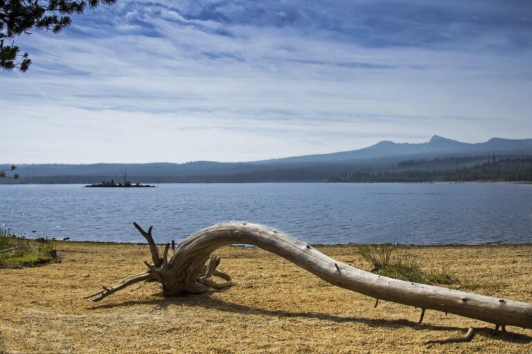
Photo: Bonnie Moreland, Public domain
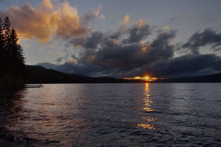
Photo: Bonnie Moreland, Public domain
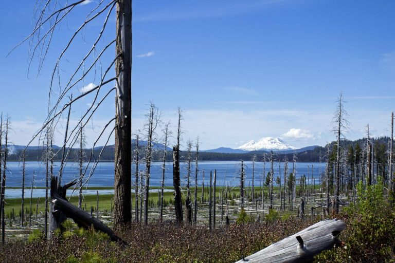
Photo: Bonnie Moreland, Public domain

Photo: Bonnie Moreland, Public domain
Settling the usual questions about water in Klamath County
Where are the boat ramps in Klamath County?
OSMB shows 50 open launches; 33 take trailers.
What is the biggest lake outline on the Klamath County map?
Upper Klamath Lake, about 62,057 acres on its mapped outline.
What can an angler target in Klamath County?
Largemouth bass lead the count of water pages within 40 miles, then rainbow trout, brown bullhead and yellow perch.
Is there a bait and tackle store in Klamath County?
Cascade Outdoors heads 5 listings.
Do guide services list an address in Klamath County?
No charter or guide names it.
Where is the Klamath County seat?
Klamath Falls holds the courthouse.
Which fishing license fits Klamath County?
The 2026 fee page lists the yearly angling license at $50 resident, $138 nonresident. Keep a salmon or steelhead and you need the Combined Angling Tag too, $69 for residents.
Which county centre sits nearest Klamath County?
Closest by centre point: Jackson County, Lake County and Douglas County.
Which zone rows govern Klamath County?
In the booklet, the bulk of Klamath County waters sit in the ODFW Southeast Zone pages, since zones track watersheds.
What is the next weigh-in in Klamath County?
9 events on file; next up is Kokanee Power of Oregon Crescent Lake Derby 2027 on Crescent Lake, June 12, 2027.
Which exception rows reach Klamath County?
The 2026 booklet prints 33 water exceptions reaching this county, starting with Crescent Lake; the table above shows each.
Which waters in Klamath County does ODFW plant?
Yes: 4 waters on the ODFW schedule, such as Lake of the Woods, Fourmile Lake and Miller Lake; releases are planned, not confirmed.
Which ODFW records name Klamath County water?
Macinaw or Lake Trout, 40 lb 8 oz, from Odell Lake (1984).
Choose your Klamath County water
Lake pages list launches, species and limits.