Jarrett Bay Fishing
Carteret County, coastal fishing waters.
 Pick for striped bassPiscifun Viper X spinning reel50% OFFSale $39.99
Photo of South River: Gerry Dincher, CC BY-SA 2.0
Jarrett Bay through an angler’s eyes
The bay called Jarrett Bay borders Carteret County. At its center point, the boundary rule reads coastal fishing waters. It lies in the Central Southern Management Area for striped bass.
Nearby you will find 12 coastal launches and 3 DCM access sites.
 For the striped bass herePiscifun AlumiX spinning reel46% OFFSale $64.99
Where to fish Jarrett Bay on a map
NCDMF reef guide, NC DCM access sites, NCWRC access areas and OpenStreetMap, checked October 2026.
Piers and beach access on Jarrett Bay
Beach and waterfront access near Jarrett Bay
- Marshallberg, Marshallberg10 parking, estuarine
- The Straits, Carteret County47 parking
- Southern Gateway for Outer Banks National Scenic Byway, Carteret County6 parking, estuarine
The DCM layer counts 3 access points within 8 miles of Jarrett Bay.
NCDMF pier list and NC DCM Beach and Waterfront Access sites.
Access areas around Jarrett Bay
- Unnamed slipway (Carteret County)boat ramp, coastal waters, 1 mile
- Unnamed slipway (Carteret County)boat ramp, coastal waters, 1 mile
- Unnamed slipway (Carteret County)boat ramp, coastal waters, 2 miles
- Oyster Creek2 lanes, 13 trailer spaces, 3 docks, coastal waters, 3 miles
- Unnamed slipway (Carteret County)boat ramp, coastal waters, 3 miles
- Unnamed slipway (Carteret County)boat ramp, coastal waters, 4 miles
- Unnamed slipway (Carteret County)boat ramp, coastal waters, 4 miles
- Unnamed slipway (Carteret County)boat ramp, coastal waters, 5 miles
- Unnamed slipway (Carteret County)boat ramp, coastal waters, 5 miles
- Unnamed slipway (Carteret County)boat ramp, coastal waters, 5 miles
- Unnamed slipway (Carteret County)boat ramp, coastal waters, 5 miles
- Unnamed slipway (Carteret County)boat ramp, coastal waters, 5 miles
NCWRC Boating Access Areas and OpenStreetMap slipways.
Reef sites close to Jarrett Bay
| Reef | Depth (ft) | Materials | Built | Distance |
|---|---|---|---|---|
| AR-275 Billy Smith Reef | 55 | Concrete (3), Vessel (2), Reef Ball (2) | 1991 to 2007 | 12 miles |
| AR-285 George Summerlin Reef | 65 | Concrete (3), Vessel (1), Metal (1), Reef Ball (1) | 1989 to 2007 | 17 miles |
| AR-315 Atlantic Beach Reef | 49 | Concrete (17), Vessel (5), Unknown (4), Metal (2), Aircraft (2), Reef Ball (2), Other (1) | 1974 to 2008 | 17 miles |
| AR-380 Bogue Sound Reef | 15 | Reef Ball (2) | 2018 to 2021 | 19 miles |
| AR-396 Oriental | 15 | Reef Ball (4), Natural Material (3), Tires (3), Concrete (2) | 1973 to 2013 | 19 miles |
| AR-320 Clifton Moss Reef | 50 | Concrete (25), Metal (2), Vessel (2) | 1986 to 2020 | 20 miles |
NCDMF Artificial Reef Program. All North Carolina reefs.
Inlets by Jarrett Bay
- Unnamed breakwater (Davis)breakwater, 1 mile
- Unnamed breakwater (Davis)breakwater, 2 miles
- Unnamed breakwater (Davis)breakwater, 2 miles
- Unnamed breakwater (Davis)breakwater, 2 miles
- Unnamed breakwater (Carteret)breakwater, 3 miles
- Unnamed breakwater (Carteret)breakwater, 3 miles
USGS GNIS, NC DCM inlet hazard areas and OpenStreetMap.
Regulations on Jarrett Bay
Coastal and joint limits; striped bass under the Central Southern Management Area.
| Species | Daily creel | Size | Season |
|---|---|---|---|
| Red drum | 1 a day | 18-27 in | Year-round |
| Flounder (all species) | 1 a day | 15 in minimum | Sept. 1-14, 2026 |
| Spotted seatrout | 3 a day | 14-20 in, plus 1 over 26 in | Open (reopened July 1, 2026) |
| Weakfish | 1 a day | 12 in minimum | open all year unless closed by proclamation |
| Black drum | 10 a day | 14-25 in, plus 1 over 25 in | open all year unless closed by proclamation |
| Sheepshead | 5 a day | 14 in minimum | open all year unless closed by proclamation |
| Striped bass (Central Southern Management Area) | none may be kept | no size limit | open all year unless closed by proclamation |
| Bluefish | 5 a day | no size limit | open all year unless closed by proclamation |
| Spanish mackerel | 15 a day | 12 in minimum | open all year unless closed by proclamation |
| Cobia | 1 a day | 36 in minimum | May 1 – Dec. 31, 2026 |
| Spot | 3 a day | 14-20 in, plus 1 over 26 in | Open (reopened July 1, 2026) |
| Atlantic croaker | 50 a day | no size limit | open all year unless closed by proclamation |
| Blue crab (recreational) | 50 a day | no size limit | open all year unless closed by proclamation |
NCDMF recreational size and bag limits and 2026 proclamations, checked October 2026. Coastal and joint limits.
Captains and shops by Jarrett Bay
Book a guide near Jarrett Bay
- A1a Fishingcoastal charter (trip type not stated), Morehead City, (252) 241-0210
- BreakDay Charterscoastal charter (trip type not stated), Atlantic Beach, (252) 732-0990
- Cape Lookout Charterscoastal charter (trip type not stated), emerald isle, (252) 241-0210
- Captain Stacycoastal charter (trip type not stated), Atlantic Beach, (252) 648-6155
- Crystal Coast Charterscoastal charter (trip type not stated), Beaufort, (202) 369-1063
- Crystal Coast Charterscoastal charter (trip type not stated), Morehead City, (252) 808-7067
- Down East Guide Servicecoastal charter (trip type not stated), Morehead City, (252) 671-3474
- Reel Faith Fishing Charterscoastal charter (trip type not stated), Morehead City, (919) 369-6403
Tackle counters around Jarrett Bay
- Joann's Lil Shopcountry store with bait, Beaufort, 4 miles
- Cape Pointe Marinamarina, Harkers Island, 8 miles
- Cedar Creek Marinamarina, Carteret, 8 miles
- Loggerhead The Boathouse Marinamarina, Beaufort, 10 miles
- Boat House Weddingsmarina, Carteret, 10 miles
- Safe Harbor Jarrett Baymarina, Beaufort, 11 miles
Short drives from Jarrett Bay
Home bases near Jarrett Bay
- Davis1 mile
- Marshallberg5 miles
- Harkers Island7 miles
- Atlantic10 miles
Next sounds over from Jarrett Bay
- Core Sound4 miles east
- Nelson Bay7 miles northeast
- Back Sound9 miles southwest
- South River12 miles north
County pages tied to Jarrett Bay
Reels and a lip grip from Piscifun


Piscifun and Amazon links are affiliate links; the site earns a commission on qualifying purchases.
Common catches near Jarrett Bay
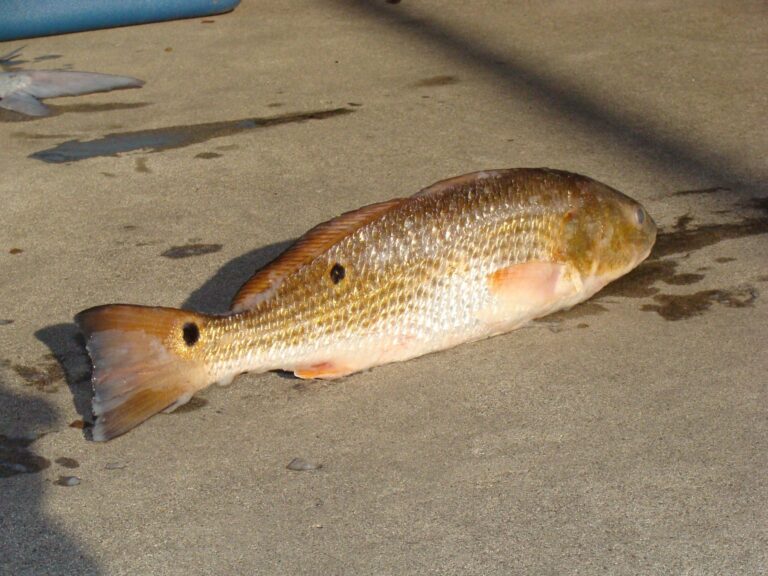
Photo: Geeklikepi, CC BY-SA 3.0


Photo: Smithsonian Environmental Research Center, CC BY 2.0

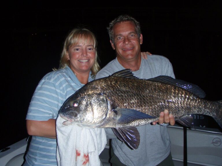
Photo: Attackgirl (talk) (Uploads), Public domain

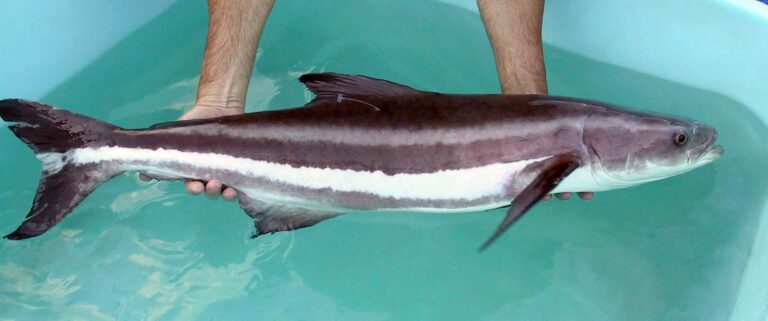
Photo: Jorge Alarcon or Dr. Daniel Benetti, Public domain

Quick facts on Jarrett Bay
Which counties touch Jarrett Bay?
It lies along Carteret County (coastal fishing waters).
Which license do I need on Jarrett Bay?
Coastal waters take a Coastal Recreational Fishing License from age 16 ($20 resident, $40 nonresident).
How many red drum can I keep on Jarrett Bay?
Red drum: 1 a day, 18-27 in; Year-round.
What is the flounder limit on Jarrett Bay?
Flounder: 1 a day, 15 in minimum; season Sept. 1-14, 2026.
What are the striper rules on Jarrett Bay?
Central Southern Management Area applies. Was open April 1-30, 2026; 1 fish, 18 in minimum, 22-27 in protected
Where do boats go in on Jarrett Bay?
Unnamed slipway (Carteret County) is closest of 12 coastal launches.
Do piers near Jarrett Bay cover my license?
None within 12 miles.
Can I book a charter close to Jarrett Bay?
There are 18 charters and guides in the county listings.
Is a tackle shop close to Jarrett Bay?
Joann's Lil Shop sits about 4 miles away.
Block out a day for Jarrett Bay
Read the coastal limits before the trip.