North Carolina Artificial Reefs
Every NCDMF ocean and estuarine reef with depth, materials and buoy bearings.
Photo of Franklinville: Indy beetle, CC0 1.0

NCDMF artificial reefs
NCDMF lists 56 artificial reef sites in its public layers: 30 ocean, federal waters, 13 ocean, state waters, 12 estuarine and 1 unclassed. Each row gives depth, materials and the published bearing from a buoy.
Cape Hatteras reefs
| Reef | Class | Depth (ft) | Materials | Location | Built |
|---|---|---|---|---|---|
| AR-130 | ocean, federal waters | 60 | Reef Ball (88), Concrete (47), Metal (3) | 345.3° magnetic – 11.6 nm from Oregon Inlet Sea Buoy | 1986-2020 |
| AR-140 | ocean, federal waters | 57 | Concrete (51), Metal (1), Vessel (1) | 343.4° magnetic – 8.2 nm from Oregon Inlet Sea Buoy | 1986-2021 |
| AR-145 | ocean, federal waters | 65 | Concrete (56), Vessel (3), Aircraft (2) | 35.3° magnetic – 7.7 nm from Oregon Inlet Sea Buoy | 1944-2021 |
| AR-160 Oregon Inlet Reef (Oregon Inlet Reef) | ocean, state waters | 70 | Concrete (78), Reef Ball (2), Vessel (2) | 136.5° magnetic – 5.7 nm from Oregon Inlet Sea Buoy | 1974-2021 |
| AR-220 | ocean, federal waters | 64 | Reef Ball (6), Concrete (1) | 97.5° magnetic – 4.6 nm from Hatteras Inlet Sea Buoy | 1986-2001 |
| AR-225 | ocean, federal waters | 67 | Concrete (2), Metal (1) | 106.5° magnetic – 6.1 nm from Hatteras Inlet Sea Buoy | 1986-1986 |
| AR-230 Mr. J.C. Reef (Mr. J.C. Reef) | ocean, federal waters | 72 | Vessel (3) | 133.7° magnetic – 4.2 nm from Hatteras Inlet Sea Buoy | 1987-1991 |
| AR-250 | ocean, federal waters | 83 | Concrete (3), Metal (1) | 146.9° magnetic – 7.1 nm from Ocracoke Inlet Sea Buoy | 1990-2021 |
| AR-255 | ocean, federal waters | 84 | Concrete (2), Metal (1) | 167.8° magnetic – 8 nm from Ocracoke Inlet Sea Buoy | 1995-2022 |
Cape Lookout reefs
| Reef | Class | Depth (ft) | Materials | Location | Built |
|---|---|---|---|---|---|
| AR-275 Billy Smith Reef (Billy Smith Reef) | ocean, state waters | 55 | Concrete (3), Vessel (2), Reef Ball (2) | 89.2° magnetic – 2.5 nm from New Drum Inlet | 1991-2007 |
| AR-285 George Summerlin Reef (George Summerlin Reef) | ocean, federal waters | 65 | Concrete (3), Vessel (1), Metal (1), Reef Ball (1) | 341.1° magnetic – 3.9 nm from Cape Lookout Shoals Lighted Buoy #2 | 1989-2007 |
| AR-300 Hardie's Reef (Hardie's Reef) | ocean, federal waters | 90 | Concrete (4), Vessel (1) | 163.6° magnetic – 11.1 nm from Cape Lookout Shoals Lighted Buoy #2 or 128.1° magnetic – 11.8 nm from Cape Lookout Shoals Lighted Buoy #6 | 1989-1993 |
| AR-302 Yancey (Yancey) | ocean, federal waters | 160 | Concrete (2), Vessel (1) | 126.8° magnetic – 33.7 nm from Beaufort Inlet Sea Buoy or 142.9° magnetic – 21.7 nm from Cape Lookout Shoals Lighted Buoy #2 | 1990-1993 |
| AR-305 Carteret County Sportfishing Association Reef (Carteret County Sportfishing Association Reef) | ocean, federal waters | 105 | Vessel (4), Concrete (1) | 162.5° magnetic – 18.3 nm from Beaufort Inlet Sea Buoy | 1988-2024 |
| AR-315 Atlantic Beach Reef (Atlantic Beach Reef) | ocean, state waters | 49 | Concrete (17), Vessel (5), Unknown (4), Metal (2), Aircraft (2), Reef Ball (2), Other (1) | 239.1° magnetic – 3.6 nm from Beaufort Inlet at Fort Macon Jetty | 1974-2008 |
| AR-320 Clifton Moss Reef (Clifton Moss Reef) | ocean, state waters | 50 | Concrete (25), Metal (2), Vessel (2) | 242.1° magnetic – 6.8 nm from Beaufort Inlet at Fort Macon Jetty | 1986-2020 |
| AR-330 Howard Chapin Reef (Howard Chapin Reef) | ocean, federal waters | 60 | Concrete (9), Vessel (7), Metal (2), Reef Ball (2), Fiberglass (1), Aircraft (1) | 251.6° magnetic – 8.1 nm from Beaufort Inlet Sea Buoy or 217.8° magnetic – 11.9 nm from Beaufort Inlet at Fort Macon Jetty | 1990-2023 |
| AR-340 J. Paul Tyndall Reef (J. Paul Tyndall Reef) | ocean, federal waters | 58 | Concrete (21), Fiberglass (2), Reef Ball (1), Metal (1) | 106.7° magnetic – 7.2 nm from Bogue Inlet Sea Buoy or 258.1° magnetic – 13.8 nm from Beaufort Inlet Sea Buoy | 1986-2020 |
| AR-342 Onslow Bay Sport Fishing Club Reef (Onslow Bay Sport Fishing Club Reef) | ocean, state waters | 49 | Concrete (10), Metal (1), Tires (1) | 97.9° magnetic – 3.4 nm from Bogue Inlet Sea Buoy or 265.9° magnetic – 17.1 nm from Beaufort Inlet Sea Buoy | 1983-2007 |
| AR-345 Swansboro Rotary Club Reef (Swansboro Rotary Club Reef) | ocean, federal waters | 60 | Reef Ball (3), Concrete (3), Vessel (1), Metal (1) | 120° magnetic – 8.2 nm from Bogue Inlet Sea Buoy or 249.8° magnetic – 14.2 nm from Beaufort Inlet Sea Buoy | 1986-2006 |
Long Bay reefs
| Reef | Class | Depth (ft) | Materials | Location | Built |
|---|---|---|---|---|---|
| AR-400 Robert "Bob" Black Tower Reef (Robert "Bob" Black Tower Reef) | ocean, federal waters | 66 | Vessel (1) | 329.4° magnetic – 0.7 nm from Frying Pan Tower | 2004-2004 |
| AR-420 Tom McGlammery Reef (Tom McGlammery Reef) | ocean, federal waters | 30 | Concrete (8), Reef Ball (3), Vessel (2), Metal (1) | 317.3° magnetic – 5.7 nm from Cape Fear River Sea Buoy, 226.7° magnetic – 4.6 nm from Oak Island Light, or 104.3° magnetic – 6.7 nm from Lockwood's Folly Sea Buoy | 1987-2008 |
| AR-425 Yaupon Beach Reef (Yaupon Beach Reef) | ocean, state waters | 30 | Concrete (18), Reef Ball (5) | 326.5° magnetic – 7.4 nm from Cape Fear River Sea Buoy, 252° magnetic – 3.8 nm from Oak Island Light, or 87.1° magnetic – 6.3 nm from Lockswood's Folly Inlet Sea Buoy | 1986-2006 |
| AR-430 Jim Knight Reef (Jim Knight Reef) | ocean, state waters | 34 | Concrete (17), Vessel (1) | 305.6° magnetic – 8.3 nm from Cape Fear River Sea Buoy, 248.2° magnetic – 6.7 nm from Oak Island Light, or 105.7° magnetic – 3.8 nm from Lockwood's Folly Inlet Sea Buoy | 2013-2022 |
| AR-440 Brunswick County Fishing Club Reef (Brunswick County Fishing Club Reef) | ocean, federal waters | 42 | Concrete (12), Metal (3), Vessel (2), Reef Ball (1) | 282.9° magnetic – 9.1 nm from Cape Fear River Sea Buoy, 237.6° magnetic – 9.9 nm from Oak Island Light, or 158.1° magnetic – 4.1 nm from Lockwood's Folly Inlet Sea Buo | 1987-2010 |
| AR-445 Dale McDowell Reef (Dale McDowell Reef) | ocean, federal waters | 53 | Concrete (5), Reef Ball (3), Vessel (2), Other (2) | 250.8° magnetic – 9.3 nm from Cape Fear River Sea Buoy, 218.7° magnetic – 13.3 nm from Oak Island Light, or 170° magnetic – 9.1 nm from Lockwood's Folly Inlet Sea Buoy | 1991-2008 |
| AR-455 Dale Ward Reef (Dale Ward Reef) | ocean, federal waters | 46 | Concrete (9), Reef Ball (4), Vessel (1) | 263.6° magnetic – 12.4 nm from Cape Fear River Sea Buoy or 194.8° magnetic – 7.5 nm from Lockwood's Folly Inlet Sea Buoy | 1992-2008 |
| AR-460 Fisherman's Reef (Fisherman's Reef) | ocean, federal waters | 38 | Concrete (5), Reef Ball (3), Metal (3), Vessel (2) | 155.4° magnetic – 2.8 nm from Shallotte Inlet Sea Buoy or 231.3° magnetic – 7.5 nm from Lockwood's Folly Inlet Sea Buoy | 1986-2010 |
| AR-465 Gary Ennis Reef (Gary Ennis Reef) | ocean, federal waters | 84 | Reef Ball (2), Concrete (2), Vessel (1) | 186.3° magnetic – 23.8 nm from Cape Fear River Sea Buoy River Inlet, 165.2° magnetic – 30.5 nm from Lockwood's Folly Inlet Sea Buoy, or 151.5° magnetic – 31.2 nm from Shallotte Inlet Sea Buoy | 1996-2005 |
Sounds and Rivers reefs
| Reef | Class | Depth (ft) | Materials | Location | Built |
|---|---|---|---|---|---|
| AR-191 Black Walnut Point Reef (Black Walnut Point Reef) | estuarine | 261.9° magnetic – 2.6 nm from Chowan River Entrance Light | |||
| AR-291 Bayview Reef (Bayview Reef) | estuarine | 15 | Concrete (7), Reef Ball (6) | 100 FT offshore Town of Bayview, near the mouth of Bath Creek | 2012-2022 |
| AR-292 Quilley Point (Quilley Point) | estuarine | 15 | Tires (1) | 80.9° magnetic – 0.8 nm from Pungo River Daybeacon #5 80.9° magnetic – 0.8 nm from Pungo River Daybeacon #5 | 1985-1985 |
| AR-296 Hatteras Island Business Association Reef (Hatteras Island Business Association Reef) | estuarine | 15 | Natural Material (295) | 8.7° magnetic – 1.4 nm from Frisco Channel Light #6 or 227.9° magnetic – 0.5 nm from Quilley Point | 2002-2024 |
| AR-298 Ocracoke (Ocracoke) | estuarine | 15 | Natural Material (69), Concrete (18), Reef Ball (4), Vessel (3) | 21.9° magnetic – 1.5 nm from Big Foot Slough Channel Light #13 | 1986-2024 |
| AR-392 New Bern (New Bern) | estuarine | 15 | Concrete (585), Reef Ball (495), Natural Material (112), Tires (4) | 130.1° magnetic – 1.8 nm from Union Point Park, New Bern | 1984-2013 |
| AR-396 Oriental (Oriental) | estuarine | 15 | Reef Ball (4), Natural Material (3), Tires (3), Concrete (2) | 901 yds. SE of Whitehurst Point near Oriental | 1973-2013 |
| AR-398 New River (New River) | estuarine | 15 | Concrete (9) | 115° magnetic – 0.4 nm from South of Town Point in the New River | 2010-2010 |
Southern Onslow Bay reefs
| Reef | Class | Depth (ft) | Materials | Location | Built |
|---|---|---|---|---|---|
| AR-355 New River Reef (New River Reef) | ocean, federal waters | 50 | Concrete (7), Metal (1) | 172.1° magnetic – 9.9 nm from New River Inlet Sea Buoy or 76.2° magnetic – 15.3 nm from New Topsail Inlet Sea Buoy | 1986-1993 |
| AR-360 Topsail Reef (Topsail Reef) | ocean, state waters | 44 | Concrete (2), Reef Ball (1) | 57.1° magnetic – 2 nm from New Topsail Inlet Sea Buoy | 1992-2023 |
| AR-362 Tom Boyette Reef (Tom Boyette Reef) | ocean, federal waters | 54 | Concrete (2), Metal (1) | 114.1° magnetic – 8 nm from New Topsail Inlet Sea Buoy | 1986-2002 |
| AR-364 Billy Murrell Reef (Billy Murrell Reef) | ocean, state waters | 44 | Vessel (5), Concrete (2), Fiberglass (1), Atlantic Pods (1) | 33.1° magnetic – 6.1 nm from Masonboro Inlet Sea Buoy or 204.1° magnetic – 6.5 nm from New Topsail Inlet Sea Buoy | 1988-2015 |
| AR-366 | ocean, federal waters | 66 | Concrete (4), Metal (2) | 113.5° magnetic – 13.1 nm from New Topsail Inlet Sea Buoy | 1986-2004 |
| AR-368 | ocean, federal waters | 66 | Vessel (2), Concrete (2), Metal (1) | 125.5° magnetic – 14.9 nm from New Topsail Inlet Sea Buoy or 82.5° magnetic – 18.3 nm from Masonboro Inlet Sea Buoy | 1986-2022 |
| AR-370 Meares Harris Reef (Meares Harris Reef) | ocean, state waters | 52 | Vessel (7), Concrete (4), Atlantic Pods (1) | 78.4° magnetic – 2.3 nm from Masonboro Inlet Sea Buoy | 1970-2015 |
| AR-372 Veteran's Memorial Reef (Veteran's Memorial Reef) | ocean, federal waters | 48 | Concrete (4), Vessel (2), Reef Ball (2), Metal (1), Atlantic Pods (1) | 140.1° magnetic – 4.8 nm from Masonboro Inlet Sea Buoy or 65.7° magnetic – 5.3 nm from Carolina Beach Inlet Sea Buoy | 1986-2024 |
| AR-376 | ocean, federal waters | 60 | Concrete (2), Metal (1) | 126.3° magnetic – 9.9 nm from Masonboro Inlet Sea Buoy or 89.5° magnetic – 9.7 nm from Carolina Beach Inlet Sea Buoy | 1986-1997 |
| AR-378 Phillip Wolfe Reef (Phillip Wolfe Reef) | ocean, state waters | 40 | Concrete (7), Reef Ball (2), Vessel (1), Atlantic Pods (1) | 185.7° magnetic – 3.2 nm from Carolina Beach Inlet Sea Buoy | 1993-2015 |
| AR-378B | ocean, state waters | 39 | Vessel (3) | 163.9° magnetic – 4.3 nm from Carolina Beach Inlet Sea Buoy | 1982-1982 |
| AR-382 Dredge Wreck Reef (Dredge Wreck Reef) | ocean, federal waters | 58 | Reef Ball (4), Vessel (3) | 117.5° magnetic – 10.4 nm from Carolina Beach Inlet Sea Buoy | 1931-2001 |
| AR-386 Lennon / Hyde Reef (Lennon / Hyde Reef) | ocean, federal waters | 78 | Vessel (3), Metal (1) | 127.1° magnetic – 17.6 nm from Masonboro Inlet Sea Buoy | 1986-1995 |
Unassigned reefs
| Reef | Class | Depth (ft) | Materials | Location | Built |
|---|---|---|---|---|---|
| AR-165 | ocean, state waters | 70 | Concrete (85), Vessel (3), Metal (2), Reef Ball (1) | 2020-2022 | |
| AR-197 Roanoke Island (Roanoke Island) | estuarine | 15 | Natural Material (34), Tires (1) | 2019-2021 | |
| AR-293 | 15 | Reef Ball (1) | 2023-2023 | ||
| AR-380 Bogue Sound Reef (Bogue Sound Reef) | estuarine | 15 | Reef Ball (2) | 2018-2021 | |
| AR-381 | estuarine | ||||
| AR-491 | estuarine |
North Carolina waters, pictured
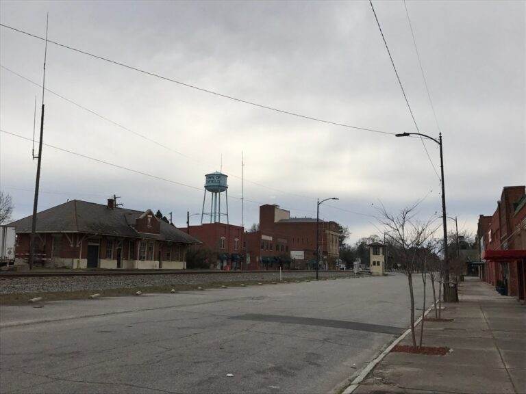
Photo: Indy beetle, CC0 1.0

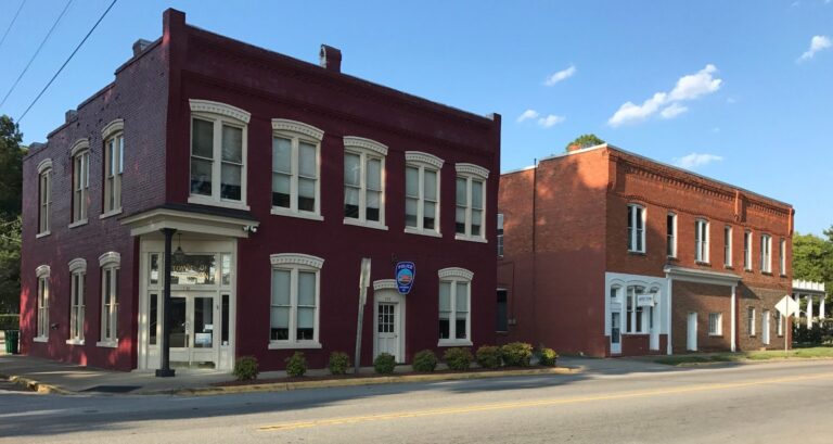
Photo: Indy beetle, CC0 1.0

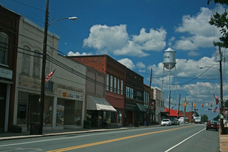
Photo: Matt Tillett from Cumberland, MD, USA, CC BY 2.0
.jpg)
Photo: Jerrye & Roy Klotz, MD, CC BY-SA 3.0

Artificial reef questions
How many artificial reefs does North Carolina have?
56 sites in the NCDMF public layers.
Who builds North Carolina reefs?
The NCDMF Artificial Reef Program.
Are there reefs in the sounds?
Yes, estuarine reefs in Pamlico Sound and the rivers that feed it.
Do reefs have special rules?
Reefs beyond 3 miles sit in federal special management zones with gear rules.
How deep are ocean reefs?
Most ocean sites run about 40 to 100 feet deep, as listed per reef.
How do I find a reef?
Each row gives the NCDMF bearing and distance from a sea buoy.
What are reefs made of?
Reef balls, concrete pipe, metal, sunken vessels and aircraft, as listed.
Where does this data come from?
The NCDMF reef guide and its 2025 reef material layer.