Fishing in Hill County, Montana
County seat: Havre. Census 2020 residents: 16,309.
- 4lake pages
- 1ramp
- 2river pages
 Pick for crappiePiscifun Carbon X ultralight spinning reel28% OFFSale $57.99
Photo of Missouri River: Miroslav Volek, CC BY 2.0
Fishing Hill County in brief
Havre is where Hill County keeps its offices; the county had 16,309 residents in 2020. Its Gazetteer footprint is 2,899 square miles of land and 17.1 square miles of water. By acreage or outline, Fresno Reservoir tops the 4 lakes and reservoirs with pages. Stream pages for the county: Milk River and Marias River.
FWP and State Parks together place 1 ramp and 2 other fishing sites in the county. FWP's 2026 plant report lists 19 rows in the county, 184,966 fish across 6 waters. 1 water here carry their own exception lines in the 2026 book.
U.S. Census Bureau, 2020 Census counts (TIGERweb) and the 2023 Gazetteer, read November 12, 2026. FWP Fishing Access Sites layer (ArcGIS service) and the FishMT site pages, read November 12, 2026.
A map of the boat ramps and banks of Hill County
FWP Fishing Access Sites layer (ArcGIS service) and the FishMT site pages, read November 12, 2026. Lake pins are the FWP reference point for each water.
Choosing among the Montana lakes of Hill County
| Lake | Size | Access sites | Kind | MFISH lists |
|---|---|---|---|---|
| Fresno Reservoir | 3,185 acres | 0 | reservoir | black crappie, lake whitefish, northern pike |
| Beaver Creek Reservoir | about 179 acres of mapped outline | 0 | reservoir | northern pike, rainbow trout, smallmouth bass |
| Bailey Reservoir | 85 acres | 1 | reservoir | black crappie, northern pike, walleye |
| Bearpaw Lake | 48 acres | 1 | natural lake | brook trout, rainbow trout, smallmouth bass |
Size as the FWP FishMT page for this water prints it (FishMT), read November 12, 2026. Waters with no FishMT size print their mapped outline instead. Montana FWP Lakes reference layer (ArcGIS service) and the MFISH fish distribution layers, read November 12, 2026.
 For the crappie herePiscifun Carbon XT ultralight spinning reel25% OFFSale $59.99
Which fish MFISH lists across Hill County waters
The count covers MFISH lists on lakes within 60 miles of Havre, with rainbow trout in front.
FWP MFISH presence layers, counted per lake page within 60 miles; presence in a layer, not a catch survey. FWP MFISH fish distribution layer (ArcGIS service), read November 12, 2026. Presence is mapping data, not a catch report.
Montana rivers and creeks running through Hill County
- Milk River3 access sites, 4 USGS gauges
- Marias Riverexception rules, 1 access site, 4 USGS gauges
How Hill County rivers are running, by gauge
| USGS gauge | Latest reading | Time (ET) |
|---|---|---|
| Boxelder Creek Near Rocky Boy, Mt | 2 cfs, 4.04 ft gage height | Oct 1 1:37 am Not updated since Oct 1, 1997. |
| Boxelder Creek At Box Elder, Mt | 6 cfs, 7.20 ft gage height | Nov 15 4:00 pm |
US Geological Survey provisional data, retrieved Nov 15, 2026 4:33 pm ET. Provisional readings can be revised.
Montana FWP MFISH stream layers (ArcGIS service) for this river, read November 12, 2026. USGS Water Data for the Nation, live through the site, retrieved on page view.
Montana boat launches inside Hill County
- Fresno Tailwater Fishing Access Site on Milk Riverfishing access site, ramp (gravel), gravel surface, 36 acres; Hill County
Bank spots within Hill County
- Bailey Reservoir Fishing Access Sitefishing access site, no boat facilities, 107 acres; Hill County
- Bearpaw Lake Fishing Access Sitefishing access site, no boat facilities, 185 acres; Hill County
FWP Fishing Access Sites layer (ArcGIS service) and the FishMT site pages, read November 12, 2026.
The short list: minor lakes inside Hill County
- Mud Lakeabout 490 acres of mapped outline
- Hingham Lakeabout 342 acres of mapped outline
- Martin Lakeabout 241 acres of mapped outline
- Halfway Lakeabout 241 acres of mapped outline
- Grassy Lakeabout 201 acres of mapped outline
- McKinnsey Reservoirabout 182 acres of mapped outline
- Lake Thibadeauabout 145 acres of mapped outline
- Creedman Reservoirabout 136 acres of mapped outline
- Burkhartsmeyer Reservoirabout 132 acres of mapped outline
- Grassy Lakeabout 118 acres of mapped outline
- Chain Of Lakesabout 105 acres of mapped outline
- Sands Lakeabout 98 acres of mapped outline
- Fresno WMA Reservoirabout 82 acres of mapped outline
- Dry Lakeabout 57 acres of mapped outline
- Grassy Lakeabout 51 acres of mapped outline
- Sage Lakeabout 50 acres of mapped outline
- Goodian Reservoirabout 46 acres of mapped outline
- Schnitzmeier Reservoirabout 30 acres of mapped outline
- Prescott Reservoirabout 26 acres of mapped outline
- Laird Lakeabout 25 acres of mapped outline
- McLean Reservoirabout 24 acres of mapped outline
- Lightning Reservoirabout 20 acres of mapped outline
- Pasma Reservoirabout 16 acres of mapped outline
- Schoenborn Reservoirabout 16 acres of mapped outline
- Lohman Reservoirabout 14 acres of mapped outline
- U N Reservoirabout 13 acres of mapped outline
- Hanson Reservoirabout 12 acres of mapped outline
- McSloy Reservoirabout 12 acres of mapped outline
- Stink Lakeabout 10 acres of mapped outline
Outline area from the FWP Lakes reference layer (ArcGIS service; mapped polygon area, not an FWP surface-acre figure), read November 12, 2026. Names come from the FWP Lakes reference layer; no page and no fish list for these waters.
Exception lines printed for Hill County lakes and streams
The rules here are from the 2026 Montana Fishing Regulations, valid March 1, 2026 through the end of February 2027; FWP had published no 2027 booklet when this was checked.
- Marias RiverSauger/walleye: 5 daily only 2 may be a sauger. Possession limit is 10, only 4 may be sauger. (MARIAS RIVER)
2026 Montana Fishing Regulations (valid March 1, 2026 through February 28, 2027; FWP PDF), read November 12, 2026.
Hatchery fish released in Hill County this year
| Date | Water as FishMT prints it | Fish | Species |
|---|---|---|---|
| October 1, 2026 | Bailey Reservoir | 1 | Rainbow trout |
| September 17, 2026 | Marias River | 5,588 | Brown trout |
| September 17, 2026 | Marias River | 10,410 | Rainbow trout |
| September 16, 2026 | Bearpaw Lake (; Beaver Lake) | 5,279 | Rainbow trout |
| September 15, 2026 | Bearpaw Lake (; Beaver Lake) | 9,182 | Rainbow trout |
| September 14, 2026 | Bearpaw Lake (; Beaver Lake) | 9,339 | Rainbow trout |
| August 4, 2026 | Beaver Creek Reservoir | 5,000 | Walleye |
| July 17, 2026 | Marias River | 5,004 | Rainbow trout |
| July 8, 2026 | Fresno Reservoir | 27,585 | Yellow perch |
| July 2, 2026 | Bearpaw Lake (; Beaver Lake) | 4,000 | Rainbow trout |
FWP FishMT stocking report for 2026, year to date (FishMT plant report), read November 12, 2026.
Record-book entries from Hill County
| Species | Weight or length as listed | Water | Year | Marked |
|---|---|---|---|---|
| Blue sucker | 13.29 lbs. | Marias River | 2019 | not marked native |
| Brown trout | 32.42 lbs. | Marias River | 2021 | not marked native |
| Mountain sucker | 1.60 oz. | Beaver Creek Reservoir | 2001 | native |
| Stonecat | 0.54 lbs. | Milk River | 1996 | native |
Montana state record fish as FWP lists them (records page), read November 12, 2026.
Derby and club days around Hill County
| Date | Event | Water | Organizer |
|---|---|---|---|
| Jan. 23, 2027 | Fresno Ice Fishing Tournament | Fresno Reservoir | Fresno Tavern |
| June 12, 2026 | Fresno Challenge | Fresno Reservoir | Fresno Chapter of MT Walleyes Unlimited |
| June 6, 2026 | 27th Annual Milk River Catfish Classic | Milk River | Montana Catfish Association |
Event as listed by the organizer (source), read November 12, 2026.
Grouped near Hill County on the Montana map
Montana lodging towns across Hill County
- Havre2020 count 9,362
Montana counties next to Hill County
- Liberty County43 miles west
- Chouteau County54 miles south
- Blaine County54 miles east
- Toole County74 miles west
Piscifun kit to stow in the truck for Montana time at Hill County


Piscifun and Amazon links are affiliate links; the site earns a commission on qualifying purchases.
Early light on the water near Hill County, Big Sky style
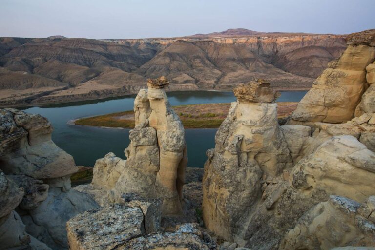
Photo: Bureau of Land Management Montana and Dakotas, Public domain

Photo: David Schott, CC BY 2.0
The questions Hill County anglers trade over coffee
How many boat ramps does Hill County have in the FWP data?
The access layers list 1 ramp.
Which water in Hill County has the biggest size figure?
That is Fresno Reservoir, listed at 3,185 acres.
Which fish lead the MFISH lists near Hill County?
MFISH names rainbow trout on the most lake pages within 60 miles, then walleye, largemouth bass and northern pike; the layer shows presence, not a catch.
Does Hill County have a marina or bait counter?
None inside the county; the list above holds the closest.
From which town does Hill County govern?
Havre.
Which licenses should Hill County anglers carry?
Anglers 12 and older buy a Conservation License, an aquatic invasive species pass and a fishing license; the 2026 Montana Fishing Regulations prints $8, $2 and $21 for a resident full season and $10, $7.50 and $100 for a nonresident.
Which counties lie closest to Hill County?
Liberty County, Chouteau County and Blaine County sit nearest.
How many fish may I keep in Hill County?
Limits depend on the FWP fishing district and on any exception heading printed for the water; the Western, Central and Eastern district pages on this site give the charts. The rules here are from the 2026 Montana Fishing Regulations, valid March 1, 2026 through the end of February 2027; FWP had published no 2027 booklet when this was checked.
Where do the Montana limits change in Hill County?
1 water with a page here carry their own exception lines, beginning with Marias River.
Which Montana waters in Hill County get hatchery fish?
The 2026 plant report lists 184,966 fish in 19 rows across 6 waters in the county.
Is a Montana tournament coming to Hill County?
3 entries on file; the next is Fresno Ice Fishing Tournament on Fresno Reservoir, Jan. 23, 2027.
Has a Montana state record fish come from Hill County?
Blue sucker, 13.29 lbs., from Marias River (2019).
Hitch the boat for Treasure State water in Hill County
Check a water's exception heading before keeping fish.