Fishing in Chouteau County, Montana
County seat: Fort Benton. Census 2020 residents: 5,895.
- 0other sites
- 3ramps
- 2river pages
 Pick for rainbow troutPiscifun Carbon X ultralight spinning reel28% OFFSale $57.99
Photo of Havre: Warren LeMay, CC BY-SA 2.0
Planning a first Montana trip in Chouteau County
The 2020 count for Chouteau County was 5,895 people, with Fort Benton as the seat. On the Gazetteer, the county spans 3,973 square miles of land and 24.2 square miles of water. Flowing water in the county starts with Missouri River and Marias River.
Boat anglers get 3 ramps; bank anglers get 0 other fishing sites. Across 1 water, FWP recorded 21,002 fish planted here in 2026 (3 rows). Montana's regulation book prints special lines for 2 waters of its waters in the county.
U.S. Census Bureau, 2020 Census counts (TIGERweb) and the 2023 Gazetteer, read November 12, 2026. FWP Fishing Access Sites layer (ArcGIS service) and the FishMT site pages, read November 12, 2026.
Big Sky fishing points marked inside Chouteau County
FWP Fishing Access Sites layer (ArcGIS service) and the FishMT site pages, read November 12, 2026. Lake pins are the FWP reference point for each water.
Lakes spread across Chouteau County
Few lakes inside Chouteau County have a page, so the nearest ones past the line follow, measured from Fort Benton.
| Lake | From Fort Benton | Size | Access sites | Kind | MFISH lists |
|---|---|---|---|---|---|
| Kolar Reservoir 2 | 39 miles south | about 14 acres of mapped outline | 0 | reservoir | largemouth bass, rainbow trout, Westslope cutthroat trout |
| Wadsworth Lake | 40 miles southwest | about 43 acres of mapped outline | 0 | natural lake | largemouth bass, rainbow trout, walleye |
| Tiber Reservoir | 44 miles northwest | 14,842 acres | 0 | reservoir | burbot, cisco, northern pike |
| Bailey Reservoir | 51 miles northeast | 85 acres | 1 | reservoir | black crappie, northern pike, walleye |
| Bearpaw Lake | 57 miles northeast | 48 acres | 1 | natural lake | brook trout, rainbow trout, smallmouth bass |
| Beaver Creek Reservoir | 59 miles northeast | about 179 acres of mapped outline | 0 | reservoir | northern pike, rainbow trout, smallmouth bass |
Size as the FWP FishMT page for this water prints it (FishMT), read November 12, 2026. Waters with no FishMT size print their mapped outline instead. Montana FWP Lakes reference layer (ArcGIS service) and the MFISH fish distribution layers, read November 12, 2026.
 For the rainbow trout herePiscifun Carbon XT ultralight spinning reel25% OFFSale $59.99
Species tallied from MFISH for waters near Chouteau County
Around Fort Benton, out to 60 miles, rainbow trout appears on the most lake lists.
FWP MFISH presence layers, counted per lake page within 60 miles; presence in a layer, not a catch survey. FWP MFISH fish distribution layer (ArcGIS service), read November 12, 2026. Presence is mapping data, not a catch report.
Montana stream pages for Chouteau County
- Missouri Riverexception rules, 27 access sites, 4 USGS gauges
- Marias Riverexception rules, 1 access site, 4 USGS gauges
Live creek and river gauges across Chouteau County
| USGS gauge | Latest reading | Time (ET) |
|---|---|---|
| Missouri River At Fort Benton Mt | 4,470 cfs, 1.97 ft gage height | Nov 15 3:30 pm |
| Teton River At Loma Mt | 2.18 ft gage height | Nov 15 3:30 pm |
US Geological Survey provisional data, retrieved Nov 15, 2026 4:33 pm ET. Provisional readings can be revised.
Montana FWP MFISH stream layers (ArcGIS service) for this river, read November 12, 2026. USGS Water Data for the Nation, live through the site, retrieved on page view.
Montana put-ins listed for Chouteau County
- Carter Ferry Fishing Access Site on Missouri Riverfishing access site, ramp (gravel), gravel surface, 20 acres; Chouteau County
- Loma Bridge Fishing Access Site on Marias Riverfishing access site, ramp (gravel), gravel surface, 5 acres; Chouteau County
- Widow Coulee Fishing Access Site on Missouri Riverfishing access site, ramp (concrete), concrete surface, 3 acres; Chouteau County
FWP Fishing Access Sites layer (ArcGIS service) and the FishMT site pages, read November 12, 2026.
Mapped but undocumented FWP-layer lakes in Chouteau County
- Kingsbury Lakeabout 1,375 acres of mapped outline
- Big Lakeabout 1,154 acres of mapped outline
- White Lakeabout 753 acres of mapped outline
- Lonesome Lakeabout 732 acres of mapped outline
- Shonkin Lakeabout 502 acres of mapped outline
- Harwood Lakeabout 387 acres of mapped outline
- Dammel Pondabout 200 acres of mapped outline
- Lost Lakeabout 168 acres of mapped outline
- Clear Lakeabout 128 acres of mapped outline
- Seifort Reservoirabout 93 acres of mapped outline
- Big Sag Lakeabout 93 acres of mapped outline
- Clawitter Reservoirabout 85 acres of mapped outline
- Sand Lakeabout 68 acres of mapped outline
- Rice Reservoirabout 64 acres of mapped outline
- Boneau Reservoirabout 63 acres of mapped outline
- Floweree Lakeabout 48 acres of mapped outline
- Twelvemile Coulee Reservoirabout 47 acres of mapped outline
- Panton Coulee Reservoirabout 32 acres of mapped outline
- Briggs Reservoirabout 19 acres of mapped outline
- Lees Lakeabout 19 acres of mapped outline
- Antelope Lakeabout 18 acres of mapped outline
- Williamson Reservoirabout 18 acres of mapped outline
- Onstadt Resabout 16 acres of mapped outline
- Leningtons Reservoirabout 12 acres of mapped outline
- Eightmile Springsabout 12 acres of mapped outline
- Silvan Pondabout 11 acres of mapped outline
- Nepil Reservoirabout 11 acres of mapped outline
Outline area from the FWP Lakes reference layer (ArcGIS service; mapped polygon area, not an FWP surface-acre figure), read November 12, 2026. Names come from the FWP Lakes reference layer; no page and no fish list for these waters.
Waters in Chouteau County with their own regulation lines
The rules here are from the 2026 Montana Fishing Regulations, valid March 1, 2026 through the end of February 2027; FWP had published no 2027 booklet when this was checked.
- Marias RiverSauger/walleye: 5 daily only 2 may be a sauger. Possession limit is 10, only 4 may be sauger. (MARIAS RIVER)
- Missouri RiverNorthern pike: no limit. (MISSOURI RIVER)
2026 Montana Fishing Regulations (valid March 1, 2026 through February 28, 2027; FWP PDF), read November 12, 2026.
FWP plants logged for Chouteau County in 2026
| Date | Water as FishMT prints it | Fish | Species |
|---|---|---|---|
| September 17, 2026 | Marias River | 5,588 | Brown trout |
| September 17, 2026 | Marias River | 10,410 | Rainbow trout |
| July 17, 2026 | Marias River | 5,004 | Rainbow trout |
FWP FishMT stocking report for 2026, year to date (FishMT plant report), read November 12, 2026.
Montana record fish listed near Chouteau County
| Species | Weight or length as listed | Water | Year | Marked |
|---|---|---|---|---|
| Blue sucker | 13.29 lbs. | Marias River | 2019 | not marked native |
| Brown trout | 32.42 lbs. | Marias River | 2021 | not marked native |
| Cisco | 2.08 lbs. | Missouri River | 2014 | not marked native |
| Shovelnose sturgeon | 14.125 lbs. | Missouri River | 2010 | native |
Montana state record fish as FWP lists them (records page), read November 12, 2026.
Montana bait counters around Chouteau County
Bait and fly shops worth a detour before Chouteau County
- Mystic Watersbait and tackle shop, Great Falls, 37 miles
- Scheels, 1200 10th Ave S Ste 92bait and tackle shop, Great Falls, 37 miles
- Cross Currents Orvis Fly Shopfly shop, Wolf Creek, 80 miles
- Headhuntersbait and tackle shop, Wolf Creek, 80 miles
- The Trout Shopbait and tackle shop, Wolf Creek, 80 miles
Yellow Pages, State Parks and operator listings (city of business), read November 12, 2026. Guides are listed as businesses; no licence status is implied.
Along the same valley as Chouteau County
Montana cities and towns of Chouteau County
- Fort Benton2020 count 1,449
Adjoining Chouteau County
- Hill County54 miles north
- Liberty County54 miles northwest
- Cascade County58 miles southwest
- Judith Basin County59 miles south
Piscifun tackle chosen for a Montana day at Chouteau County


Piscifun and Amazon links are affiliate links; the site earns a commission on qualifying purchases.
Blue-ribbon creeks, canyon lakes and wide rivers around Chouteau County, pictured

Photo: V Smoothe, CC BY 2.0
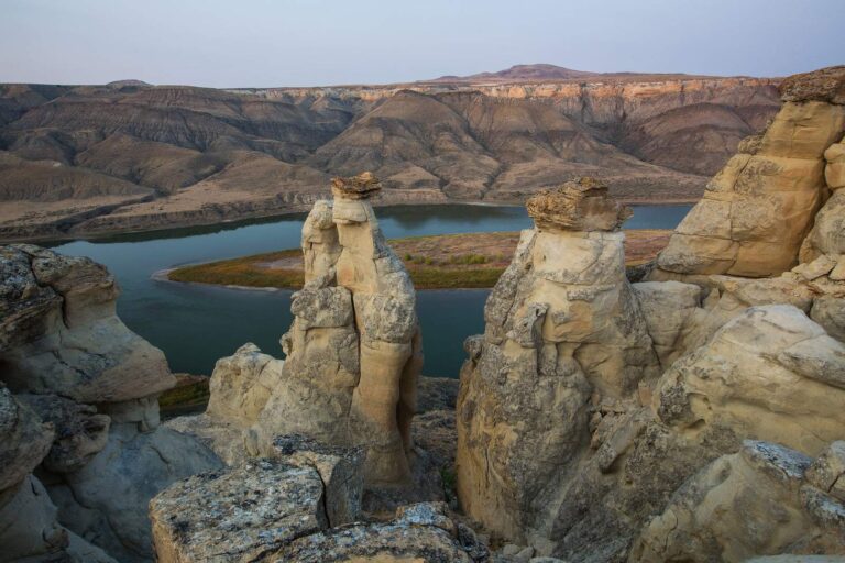
Photo: Bureau of Land Management Montana and Dakotas, Public domain
Clearing up Montana myths about fishing Chouteau County
Which Montana ramps serve Chouteau County?
3 ramps show up in the access data for the county.
Which lake in Chouteau County has the most acreage here?
No lake inside the county has a page here; Kolar Reservoir 2, 39 miles from Fort Benton, is the closest one.
What species does FWP map around Chouteau County?
MFISH names rainbow trout on the most lake pages within 60 miles, then walleye, largemouth bass and yellow perch; the layer shows presence, not a catch.
Which Montana stores in Chouteau County sell fishing gear?
Each nearby listing is past the county line.
Which town holds the Chouteau County offices?
That is Fort Benton.
What do I buy before fishing in Chouteau County?
Anglers 12 and older buy a Conservation License, an aquatic invasive species pass and a fishing license; the 2026 Montana Fishing Regulations prints $8, $2 and $21 for a resident full season and $10, $7.50 and $100 for a nonresident.
Which Montana counties should I check near Chouteau County?
The closest county pages are Hill County, Liberty County and Cascade County.
What is the trout limit in Chouteau County?
Limits depend on the FWP fishing district and on any exception heading printed for the water; the Western, Central and Eastern district pages on this site give the charts. The rules here are from the 2026 Montana Fishing Regulations, valid March 1, 2026 through the end of February 2027; FWP had published no 2027 booklet when this was checked.
Which lakes in Montana's Chouteau County have special limits?
2 waters with a page here carry their own exception lines, beginning with Marias River.
How many fish did FWP stock in Chouteau County in 2026?
The 2026 plant report lists 21,002 fish in 3 rows across 1 water in the county.
Which FWP records tie to Chouteau County?
Blue sucker, 13.29 lbs., from Marias River (2019).
Plan a Big Sky fishing day in Chouteau County
Access pages repeat FWP details with directions.