Fishing in Glacier County, Montana
County seat: Cut Bank. Census 2020 residents: 13,778.
- 13lake pages
- 0ramps
- 1river pages
 Pick for troutPiscifun Carbon X ultralight spinning reel28% OFFSale $57.99
Photo of Kalispell: David Wilson, CC BY 4.0
First things to know about fishing Montana's Glacier County
At the 2020 Census Glacier County held 13,778 residents, and its seat is Cut Bank. Inside its borders the Census counts 2,995 square miles of land and 40.8 square miles of water. This site writes up 13 lakes and reservoirs here, and St. Mary Lake is the largest by size. The county's river pages cover Marias River.
Hatchery runs in 2026 put 65,653 fish in 4 county waters (6 rows). Special regulation lines apply to 1 water in the county.
U.S. Census Bureau, 2020 Census counts (TIGERweb) and the 2023 Gazetteer, read November 12, 2026. FWP Fishing Access Sites layer (ArcGIS service) and the FishMT site pages, read November 12, 2026.
The Treasure State water map of Glacier County
FWP Fishing Access Sites layer (ArcGIS service) and the FishMT site pages, read November 12, 2026. Lake pins are the FWP reference point for each water.
Montana lake pages for Glacier County
| Lake | Size | Access sites | Kind | MFISH lists |
|---|---|---|---|---|
| St. Mary Lake | 3,933 acres | 0 | natural lake | brook trout, burbot, lake trout |
| Lower Saint Mary Lake | 2,177 acres | 0 | natural lake | bull trout, lake trout, lake whitefish |
| Duck Lake | 1,446 acres | 0 | natural lake | brown trout, bull trout |
| Sherburne Lake | 1,368 acres | 0 | natural lake | brook trout, burbot, kokanee salmon |
| Waterton Lake | 1,009 acres | 0 | natural lake | brook trout, lake whitefish |
| Mission Lake | 755 acres | 0 | natural lake | brown trout, kokanee salmon, rainbow trout |
| Four Horns Lake | 719 acres | 0 | natural lake | brown trout, rainbow trout, Yellowstone cutthroat trout |
| Upper Two Medicine Lake (Glacier County, about 708 acres) | 708 acres | 0 | natural lake | brook trout |
| Two Medicine Lake | 424 acres | 0 | natural lake | brook trout |
| Kipp Lake | 312 acres | 0 | natural lake | brown trout |
| Glenns Lake | 262 acres | 0 | natural lake | mountain whitefish |
| Goose Lake (Glacier County) | 242 acres | 0 | natural lake | Westslope cutthroat trout |
| Cosley Lake | 222 acres | 0 | natural lake | lake trout, mountain whitefish, rainbow trout |
Size as the FWP FishMT page for this water prints it (FishMT), read November 12, 2026. Waters with no FishMT size print their mapped outline instead. Montana FWP Lakes reference layer (ArcGIS service) and the MFISH fish distribution layers, read November 12, 2026.
 For the trout herePiscifun Carbon XT ultralight spinning reel25% OFFSale $59.99
Counting MFISH species words near Glacier County
Summing MFISH lists for lakes within 60 miles of Cut Bank, rainbow trout comes first.
FWP MFISH presence layers, counted per lake page within 60 miles; presence in a layer, not a catch survey. FWP MFISH fish distribution layer (ArcGIS service), read November 12, 2026. Presence is mapping data, not a catch report.
Montana rivers to wade in Glacier County
- Marias Riverexception rules, 1 access site, 4 USGS gauges
USGS gauges reporting across Montana's Glacier County
| USGS gauge | Latest reading | Time (ET) |
|---|---|---|
| Swiftcurrent Creek At Many Glacier Mt | 50 cfs, 1.76 ft gage height | Nov 15 3:30 pm |
| St. Mary River Near Babb Mt | 108 cfs, 2.01 ft gage height | Nov 15 4:15 pm |
US Geological Survey provisional data, retrieved Nov 15, 2026 4:33 pm ET. Provisional readings can be revised.
Montana FWP MFISH stream layers (ArcGIS service) for this river, read November 12, 2026. USGS Water Data for the Nation, live through the site, retrieved on page view.
Named basins on the Montana map of Glacier County
- Elizabeth Lakeabout 194 acres of mapped outline
- Upper Two Medicine Lakeabout 152 acres of mapped outline
- Red Eagle Lakeabout 138 acres of mapped outline
- Lake Josephine (Glacier County)about 130 acres of mapped outline
- Gunsight Lakeabout 114 acres of mapped outline
- Upper Mission Lakeabout 102 acres of mapped outline
- Swiftcurrent Lakeabout 100 acres of mapped outline
- Waterton Lake (Canada)about 2,431 acres of mapped outline
- Buffalo Lakeabout 559 acres of mapped outline
- Hay Lakeabout 421 acres of mapped outline
- Sharp Lakeabout 264 acres of mapped outline
- Horse Lakeabout 238 acres of mapped outline
- Croffs Lakeabout 237 acres of mapped outline
- Helen Lakeabout 168 acres of mapped outline
- Lake Wurdemanabout 165 acres of mapped outline
- Grassy Lakeabout 160 acres of mapped outline
- Boundary Lakeabout 125 acres of mapped outline
- Dog Gun Lakeabout 124 acres of mapped outline
- Iceberg Lakeabout 108 acres of mapped outline
- Pike Lakeabout 104 acres of mapped outline
- Lake Nooneyabout 89 acres of mapped outline
- Sue Lakeabout 88 acres of mapped outline
- Carcajou Lakeabout 87 acres of mapped outline
- Lake Francisabout 86 acres of mapped outline
- Guardipee Lakeabout 82 acres of mapped outline
- Grinnell Lakeabout 79 acres of mapped outline
- No Chief Lakeabout 73 acres of mapped outline
- Margaret Lakeabout 72 acres of mapped outline
- Goat Lakeabout 70 acres of mapped outline
- Spider Lakeabout 70 acres of mapped outline
- Hope Lakeabout 69 acres of mapped outline
- Little Buffalo Lakeabout 60 acres of mapped outline
- Lukins Lakeabout 55 acres of mapped outline
- Carlow Lakeabout 54 acres of mapped outline
- Kennedy Lakeabout 54 acres of mapped outline
- Miche Wabun Lakeabout 50 acres of mapped outline
- Magee Lakeabout 49 acres of mapped outline
- Hidden Lakeabout 49 acres of mapped outline
- Pitamakan Lakeabout 46 acres of mapped outline
- Oldman Lakeabout 44 acres of mapped outline
Outline area from the FWP Lakes reference layer (ArcGIS service; mapped polygon area, not an FWP surface-acre figure), read November 12, 2026. Names come from the FWP Lakes reference layer; no page and no fish list for these waters.
Montana exception headings that touch Glacier County waters
The rules here are from the 2026 Montana Fishing Regulations, valid March 1, 2026 through the end of February 2027; FWP had published no 2027 booklet when this was checked.
- Marias RiverSauger/walleye: 5 daily only 2 may be a sauger. Possession limit is 10, only 4 may be sauger. (MARIAS RIVER)
2026 Montana Fishing Regulations (valid March 1, 2026 through February 28, 2027; FWP PDF), read November 12, 2026.
FishMT stocking rows for Glacier County waters
| Date | Water as FishMT prints it | Fish | Species |
|---|---|---|---|
| September 17, 2026 | Marias River | 5,588 | Brown trout |
| September 17, 2026 | Marias River | 10,410 | Rainbow trout |
| July 17, 2026 | Marias River | 5,004 | Rainbow trout |
| May 12, 2026 | Duck Lake | 18,867 | Brown trout |
| May 12, 2026 | Kipp Lake | 12,892 | Brown trout |
| May 12, 2026 | Mission Lake | 12,892 | Brown trout |
FWP FishMT stocking report for 2026, year to date (FishMT plant report), read November 12, 2026.
FWP record entries on Glacier County water
| Species | Weight or length as listed | Water | Year | Marked |
|---|---|---|---|---|
| Blue sucker | 13.29 lbs. | Marias River | 2019 | not marked native |
| Brown trout | 32.42 lbs. | Marias River | 2021 | not marked native |
Montana state record fish as FWP lists them (records page), read November 12, 2026.
Where Montana anglers in Glacier County shop
Tackle counters on the road to Glacier County
- Arends Fly Shopfly shop, Columbia Falls, 85 miles
- Salmon Forks Outfittersbait and tackle shop, Columbia Falls, 87 miles
- Montana Fly Cofly shop, Columbia Falls, 88 miles
- Two River Gearbait and tackle shop, Bigfork, 89 miles
- Bayside Park & Marine Centermarina, Bigfork, 89 miles
Montana guide businesses close to Glacier County
- Morning Star Troutfitters/Svcfishing guide, Browning, (406) 338-2785
Yellow Pages, State Parks and operator listings (city of business), read November 12, 2026. Guides are listed as businesses; no licence status is implied.
A short stretch past Glacier County
Town pages within Glacier County
- Cut Bank2020 count 3,056
- North Browning2020 count 2,653
- Browning2020 count 1,018
Across the Montana county line from Glacier County
- Pondera County48 miles southeast
- Flathead County56 miles southwest
- Toole County58 miles east
- Teton County69 miles southeast
Piscifun gear a Treasure State angler could bring to Glacier County


Piscifun and Amazon links are affiliate links; the site earns a commission on qualifying purchases.
Early light on the water near Glacier County, Big Sky style
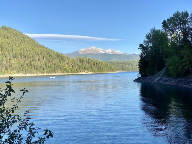
Photo: Warren LeMay, CC BY-SA 2.0

Photo: Brandon Olafsson, CC BY 2.0
Lakes, forks and ramps of Glacier County, explained
How many Fishing Access Site ramps does FWP list for Glacier County?
Not inside the county; the nearest ramps are across the line.
Where is the widest water in Glacier County?
St. Mary Lake, with 3,933 acres.
What fish does FWP name near Glacier County?
MFISH names rainbow trout on the most lake pages within 60 miles, then brook trout, brown trout and northern pike; the layer shows presence, not a catch.
Where can I buy bait in Glacier County, Montana?
The closest Montana shops sit outside the county and appear above.
Where does Montana's Glacier County keep its courthouse?
Cut Bank has it.
Which Montana licenses cover fishing in Glacier County?
Anglers 12 and older buy a Conservation License, an aquatic invasive species pass and a fishing license; the 2026 Montana Fishing Regulations prints $8, $2 and $21 for a resident full season and $10, $7.50 and $100 for a nonresident.
What counties surround Glacier County?
Begin with Pondera County, Flathead County and Toole County.
How many trout may a Montana angler in Glacier County take home?
Limits depend on the FWP fishing district and on any exception heading printed for the water; the Western, Central and Eastern district pages on this site give the charts. The rules here are from the 2026 Montana Fishing Regulations, valid March 1, 2026 through the end of February 2027; FWP had published no 2027 booklet when this was checked.
Are there special Montana rules on Glacier County lakes?
1 water with a page here carry their own exception lines, beginning with Marias River.
Did FWP hatchery trucks visit Montana's Glacier County this year?
The 2026 plant report lists 65,653 fish in 6 rows across 4 waters in the county.
What Montana record fish came out of Glacier County?
Blue sucker, 13.29 lbs., from Marias River (2019).
Set up a Montana fishing weekend in Glacier County
Lake pages carry access sites, MFISH species lists and exception rules.