Reynolds Creek Fishing
This creek crosses LaPorte and Porter counties; DNR put-and-take salmonid stream.
 Pick for largemouthPiscifun Chaos Pro CNC baitcasting reel25% OFFSale $97.99
Photo, nearby stand in for Reynolds Creek: Kevin Dooley, CC BY 2.0
Reading Reynolds Creek before you wade in
Reynolds Creek is an Indiana creek that runs 4 miles of mapped NHD line in LaPorte and Porter counties. On state lists it is DNR put-and-take salmonid stream and DNR salmonid stream. Gas and ice are closest in Westville, about 4 miles away.
Further down are the access sites and the keep rules.
USGS NHD named flowlines (mapped length in Indiana, not a DNR figure); Indiana DNR stream designation layers and Fishing Access Sites, read November 5, 2026.
Reynolds Creek on DNR stream lists
- DesignationDNR put-and-take salmonid stream
- DesignationDNR salmonid stream
- Reach as listedSalt Creek system also part of this system.
Each line above for Reynolds Creek is a state list entry, printed as listed.
Natural Resources Commission Outstanding Rivers list (2013), DNR put-and-take and salmonid stream layers, Indiana navigable waterways list; read November 5, 2026.
Reaching Reynolds Creek
You will not find Reynolds Creek on the DNR access layer.
More DNR launches that reach Reynolds Creek
- Westville boat ramp on Clear LakeClear Lake, 3 miles
- Long Lake boat ramp (north), Porter CountyLong Lake, 8 miles
- Trail Creek Marina on Lake MichiganLake Michigan, 9 miles
- Winding Creek Cove boat ramp on Trail Creek (LaPorte County)Trail Creek (LaPorte County), 9 miles
Indiana DNR Fishing Access Sites layer (shown on the DNR Where to Fish map; attributes as recorded, blank where not recorded), read November 5, 2026.
Bag counts and inch rules on Reynolds Creek
| Species as printed | Daily limit | Size limit |
|---|---|---|
| Black Bass: largemouth, smallmouth, and spotted bass (in rivers and streams) | 5, any combination of largemouth, smallmouth, or spotted bass | No fish 12 to 15 inches may be kept, and no more than two fish over 15 inches may be kept |
| Catfish: Channel, Blue, Flathead (in rivers and streams) | Unlimited | 13 inches; not more than one blue catfish that’s at least 35 inches, one flathead catfish at least 35 inches, and one channel catfish at least 28 inches or longer may be kept |
| Bluegill | Unlimited | no size limit |
| Redear Sunfish | 25 | no size limit |
| White Bass, Hybrid Striped Bass | 12, any combination of white bass or hybrid striped bass | No more than two fish may exceed 17 inches |
| Walleye, Walleye-Sauger Hybrid (Saugeye), Sauger | 6, any combination of walleye, walleye-sauger hybrid, and sauger | For walleye: 14 inches south of SR 26; 16 inches north of SR 26 For sauger and saugeye: No size limit |
| Northern Pike | 3 | 24 inches; no more than one 30 inches or longer |
River and stream rows apply to Reynolds Creek for bass and catfish; other species follow the statewide table.
- Inland troutInland Trout sizes & limits | Species | Daily Bag Limit | Minimum Size | Brook Trout | 5, any combination of brook, rainbow, or brown trout; no more than one may be brown trout | 7 inches* | Rainbow Trout | Brown Trout | *There is no minimum size limit for trout caught from lakes, except for an 18-inch size limit for brown trout at Oliver, Olin, and Martin lakes in LaGrange County and Brookville Lake tailwater (East Fork Whitewater River) in Franklin County. |
Anglers 18 and older carry an Indiana fishing license ($23 a year for residents, $60 for nonresidents). Fishing for trout or salmon also needs the $11 trout/salmon stamp.
Statewide limits as printed, 2026-2027 Indiana Fishing Regulations Guide (eRegulations, linked from the Indiana DNR), read November 5, 2026. Indiana DNR license fees (license year April 1 to March 31), read November 5, 2026.
 For the largemouth herePiscifun AlinoX 300 low profile baitcaster34% OFFSale $104.99
Five streams close to Reynolds Creek
The closest stream page to Reynolds Creek is East Arm Little Calumet River, about 5 miles away.
| Stream | Distance | Mapped NHD miles in IN | USGS gauges | DNR ramps |
|---|---|---|---|---|
| Reynolds Creek | this stream | 4 | 0 | 0 |
| East Arm Little Calumet River | 5 miles west | 19 | 0 | 0 |
| Coffee Creek (Porter County) | 5 miles west | 10 | 0 | 0 |
| Trail Creek (LaPorte County) | 9 miles north | 6 | 2 | 1 |
| Salt Creek (Porter County) | 12 miles southwest | 16 | 2 | 0 |
| Slocum Ditch (LaPorte and Porter Counties) | 13 miles south | 9 | 0 | 0 |
USGS NHD and gauges, Indiana DNR Fishing Access Sites; read November 5, 2026.
A Hoosier back-road drive from Reynolds Creek
Other lakes a county or two from Reynolds Creek
- Clear Lake (Porter County)3 miles
- Long Lake (Porter County)8 miles
- Flint Lake8 miles
- Loomis Lake9 miles
Grab bait on the way into Reynolds Creek
- Stevens Marinemarina, Michigan City, 6 miles
- Country Bait & Taxidermybait and tackle shop, Valparaiso, 7 miles
- BPR Marine Servicesmarina, Michigan City, 7 miles
- Michigan City Bait Cobait and tackle shop, Trail Creek, 8 miles
- The Bait Shopbait and tackle shop, Valparaiso, 8 miles
- Chiefsbaitbait and tackle shop, Michigan City, 8 miles
Guided Indiana trips on Reynolds Creek
- Canadian Fly-In Fishingcharter, Michigan City, (219) 872-8849
- Captain Q Charterscharter, Portage, (219) 869-0297
- Cloud Nine Fishing Charterscharter, Michigan City, (219) 898-5090
- Fire Drill Charterscharter, Michigan City, (219) 898-8111
- Rainmaker Charterscharter, Portage, (219) 762-9336
Indiana towns close to Reynolds Creek
- Westville4 miles
- Chesterton7 miles
- Trail Creek8 miles
Other Indiana rivers near Reynolds Creek
The counties Reynolds Creek passes through
- LaPorte County
- Porter County
Piscifun gear a Hoosier angler might bring to Reynolds Creek


Piscifun and Amazon links are affiliate links; the site earns a commission on qualifying purchases.
Fish to know on sight at Reynolds Creek
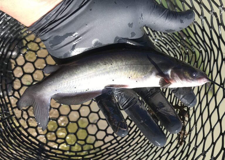
Photo: Oregon Department of Fish & Wildlife, CC BY-SA 2.0

Photo: USFWS Mountain-Prairie, Public domain

Photo: USFWS Mountain-Prairie, Public domain

Photo: USFWS Mountain-Prairie, Public domain
Reynolds Creek: questions Hoosier anglers bring up
Through which Indiana country does Reynolds Creek wind?
Its counties are LaPorte and Porter counties, and its mapped point is about 4 miles from Westville.
What is the mapped length of Reynolds Creek?
The NHD map shows 4 miles of line in Indiana; that is a mapping figure, not a DNR survey.
Can I put a boat in Reynolds Creek?
The DNR maps no access site on it; use legal road crossings.
What might bite for a Hoosier angler in Reynolds Creek?
No species are named for it in DNR data.
Is there a slot limit on Reynolds Creek?
The guide row for rivers and streams reads: 5, any combination of largemouth, smallmouth, or spotted bass; No fish 12 to 15 inches may be kept, and no more than two fish over 15 inches may be kept
Which Indiana license papers cover Reynolds Creek?
Anglers 18 and older carry an Indiana fishing license ($23 a year for residents, $60 for nonresidents). Fishing for trout or salmon also needs the $11 trout/salmon stamp.
How high is Reynolds Creek running?
No live flow exists for it.
Which listed shop can outfit a Hoosier trip to Reynolds Creek?
Stop at Stevens Marine, about 6 miles away,.
Is Reynolds Creek on a special state list?
State lists name it: DNR put-and-take salmonid stream; DNR salmonid stream.
Load the canoe for Reynolds Creek
Check the stream rows before you keep a bass.