Salt Creek (Porter County) Fishing
An Indiana creek through Porter County; DNR put-and-take salmonid stream.
 Pick for steelheadPiscifun Viper X spinning reel50% OFFSale $39.99
Photo of Lake Michigan: Ken Lund, CC BY-SA 2.0
Salt Creek (Porter County), the Hoosier rundown
Salt Creek (Porter County) covers 16 miles of NHD-mapped channel in Porter County. State lists class it as DNR put-and-take salmonid stream and DNR salmonid stream. South Haven is the nearest Census place, about 1 mile from the mapped point.
You can check 2 USGS gauges for today. Steelhead and salmon climb it from Lake Michigan.
USGS NHD named flowlines (mapped length in Indiana, not a DNR figure); Indiana DNR stream designation layers and Fishing Access Sites, read November 5, 2026.
 For the steelhead herePiscifun AlumiX spinning reel46% OFFSale $64.99
What the state lists Salt Creek (Porter County) as
- DesignationDNR put-and-take salmonid stream
- DesignationDNR salmonid stream
- Reach as listedAlso part of EF Calumet River and Tribs. system
- Reach as listedSalt Creek system also part of this system.
- Navigableon the Indiana navigable waterways list
For Salt Creek (Porter County), the reach notes are the wording of the source lists.
Natural Resources Commission Outstanding Rivers list (2013), DNR put-and-take and salmonid stream layers, Indiana navigable waterways list; read November 5, 2026.
What Salt Creek (Porter County) is doing right now
| USGS gauge | Latest reading | Time (ET) |
|---|---|---|
| Salt Creek Near Harrodsburg, In | 6.61 ft gage height | Nov 6 11:45 pm |
| Salt Creek At Valparaiso, In | 11 cfs, 3.24 ft gage height | Nov 7 12:00 am |
US Geological Survey provisional data, retrieved Nov 7, 2026 12:34 am ET. Provisional readings can be revised.
Live USGS data on Salt Creek (Porter County) may still be revised.
NWS stage figures for Salt Creek (Porter County)
| NWS gauge | Reading | Flow | Flood category | Time (UTC) |
|---|---|---|---|---|
| Salt Creek (IN) near Harrodsburg | 6.84 ft | – | no flooding | 2026-11-05 19:45:00 UTC |
| Salt Creek (IN) at Valparaiso | 3.23 ft | 0.0111 kcfs | no flooding | 2026-11-05 20:00:00 UTC |
NOAA National Water Prediction Service gauge readings (water.noaa.gov), read November 5, 2026; dated readings, not live (kcfs = thousand cubic feet per second).
USGS instantaneous values, provisional.
The fish the DNR records for Salt Creek (Porter County)
DNR lists produced this Salt Creek (Porter County) species line.
Indiana DNR Fishing Access Sites species fields, Indiana DNR fish stocking dashboard (year, month, water, species, number and average length as listed; repeat stockings summed by DNR), read November 5, 2026; Indiana DNR Indiana Record Fish Program list (keeper: Indiana DNR Division of Fish & Wildlife (Indiana Record Fish Program); angler names left off here), read November 5, 2026.
Getting onto Salt Creek (Porter County)
| Site | Type | Recorded attributes | Managed by |
|---|---|---|---|
| Deer Run Park on Salt Creek (Porter County) | shore access | restrooms | Division of Fish & Wildlife, Public Access South/ Deer Run Park |
| Salt Creek PFA shore access | shore access | no fee recorded | Division of Fish & Wildlife, Public Access North |
| Haven Hollow Park on Salt Creek (Porter County) | fishing pier | fishing pier, restrooms, no fee recorded | Portage Parks Dept. |
| Imagination Glen Park on Salt Creek (Porter County) | shore access | restrooms, no fee recorded | Portage Parks Dept. |
| Chustak State Fishing Area on Salt Creek (Porter County) | shore access | ADA access, no fee recorded | Division of Fish & Wildlife, Public Access North/ Lake Michigan Office |
| Sugar Creek Dam shore access | shore access | no fee recorded, Electric only | Atterbury Fish & Wildlife Area |
| Tulip Pit (Greene-Sullivan) boat ramp | boat ramp | boat ramp, fee: Lake Permit Required, Electric only | Greene-Sullivan State Forest |
| Crosley Fish & Wildlife Area on Birch Pond | shore access | no fee recorded, Electric only | Crosley Fish & Wildlife Area |
| Mason Pit (Greene-Sullivan) shore access | shore access | fee: Lake Permit Required | Greene-Sullivan State Forest |
Indiana DNR Fishing Access Sites layer (shown on the DNR Where to Fish map; attributes as recorded, blank where not recorded), read November 5, 2026.
Salmon and steelhead runs up Salt Creek (Porter County)
- Coho and Chinook salmon (stream)September through mid-November
- Skamania (summer-run) steelhead (stream)Mid-July to mid-October; winter months January through March, depending on stream conditions; return from July (sometimes mid-June), spawn mid-February to March
- Michigan (winter-run) steelhead (stream)Mid-November to mid-March; return from mid to late October with the bulk in February and March; spawn March to mid-April
- Coho salmon (lake, boat and pier)Boat season from ice-out (mid-February to April); March to mid-May coho are close to 90 percent of the catch within two miles of shore; shore anglers best March through April
- Tributary rulesTributary Restrictions Possession of a fish spear, gig, gaff, bowfishing equipment, crossbow, grab hook, spear gun, club, snag hook, or underwater spear is prohibited in the following water bodies: in or adjacent to the Galena River (LaPorte County), Trail Creek (LaPorte County), the East Branch of the Little Calumet River (LaPorte and Porter counties), Salt Creek (Porter County), the West Branch of the Little Calumet River (Lake and Porter counties), Burns Ditch (Lake and Porter counties), Deep River downstream from the dam at Lake George (Lake County), and the tributaries to these waters.
- ClosuresTributary Closures No fishing is allowed within 100 feet upstream of the Trail Creek sea lamprey barrier or downstream to the Pottawattomie Country Club Golf Course property line located adjacent to Springland Avenue in Michigan City. Fishing is not allowed within 100 feet above or below the Praxair Dam on the East Branch of the Little Calumet River.
- DNR shoreline guideRuns through Imagination Glen County Park and Haven Hollow Park; state-managed Chustak Public Fishing Area and Salt Creek Public Fishing Area near Valparaiso (guide p.4)
Anglers 18 and older carry an Indiana fishing license ($23 a year for residents, $60 for nonresidents). Fishing for trout or salmon in Lake Michigan and its tributaries also needs the $11 trout/salmon stamp.
Indiana DNR Lake Michigan fishing page and Lake Michigan section of the 2026-2027 Indiana Fishing Regulations Guide, read November 5, 2026.
Stocking dashboard lines for Salt Creek (Porter County)
| Year | Month | Species as listed | Number | Avg length (in) |
|---|---|---|---|---|
| 2025 | Multiple | Steelhead | 55,203 | 6.09 |
| 2024 | December | Steelhead | 26,878 | 6.62 |
| 2023 | Multiple | Steelhead | 57,219 | 6.97 |
| 2022 | Multiple | Steelhead | 87,299 | 6.96 |
| 2021 | March | Steelhead | 28,028 | 7.28 |
| 2019 | Multiple | Steelhead | 102,286 | 5.2 |
| 2018 | March | Steelhead | 30,989 | 7.4 |
| 2017 | October | Coho Salmon | 25,041 | 6.26 |
| 2017 | March | Steelhead | 30,019 | 7.1 |
| 2016 | Multiple | Steelhead | 171,772 | 4.28 |
| 2015 | April | Coho Salmon | 42,474 | 3.33 |
| 2015 | Multiple | Steelhead | 77,472 | 4.27 |
Indiana DNR fish stocking dashboard (year, month, water, species, number and average length as listed; repeat stockings summed by DNR), read November 5, 2026.
Bag and size rules on Salt Creek (Porter County)
| Species as printed | Daily limit | Size limit |
|---|---|---|
| Black Bass: largemouth, smallmouth, and spotted bass (in rivers and streams) | 5, any combination of largemouth, smallmouth, or spotted bass | No fish 12 to 15 inches may be kept, and no more than two fish over 15 inches may be kept |
| Catfish: Channel, Blue, Flathead (in rivers and streams) | Unlimited | 13 inches; not more than one blue catfish that’s at least 35 inches, one flathead catfish at least 35 inches, and one channel catfish at least 28 inches or longer may be kept |
| Bluegill | Unlimited | no size limit |
| Redear Sunfish | 25 | no size limit |
| White Bass, Hybrid Striped Bass | 12, any combination of white bass or hybrid striped bass | No more than two fish may exceed 17 inches |
| Walleye, Walleye-Sauger Hybrid (Saugeye), Sauger | 6, any combination of walleye, walleye-sauger hybrid, and sauger | For walleye: 14 inches south of SR 26; 16 inches north of SR 26 For sauger and saugeye: No size limit |
| Northern Pike | 3 | 24 inches; no more than one 30 inches or longer |
Bass and catfish in Salt Creek (Porter County) fall under the river and stream rows of the guide.
- Inland troutInland Trout sizes & limits | Species | Daily Bag Limit | Minimum Size | Brook Trout | 5, any combination of brook, rainbow, or brown trout; no more than one may be brown trout | 7 inches* | Rainbow Trout | Brown Trout | *There is no minimum size limit for trout caught from lakes, except for an 18-inch size limit for brown trout at Oliver, Olin, and Martin lakes in LaGrange County and Brookville Lake tailwater (East Fork Whitewater River) in Franklin County. |
Anglers 18 and older carry an Indiana fishing license ($23 a year for residents, $60 for nonresidents). Fishing for trout or salmon also needs the $11 trout/salmon stamp.
Statewide limits as printed, 2026-2027 Indiana Fishing Regulations Guide (eRegulations, linked from the Indiana DNR), read November 5, 2026. Indiana DNR license fees (license year April 1 to March 31), read November 5, 2026.
Salt Creek (Porter County) in a table with nearby streams
Next over from Salt Creek (Porter County): Coffee Creek (Porter County), around 6 miles away.
| Stream | Distance | Mapped NHD miles in IN | USGS gauges | DNR ramps |
|---|---|---|---|---|
| Salt Creek (Porter County) | this stream | 16 | 2 | 0 |
| Coffee Creek (Porter County) | 6 miles northeast | 10 | 0 | 0 |
| Deep River | 7 miles west | 23 | 3 | 1 |
| East Arm Little Calumet River | 9 miles northeast | 19 | 0 | 0 |
| Little Calumet River | 11 miles west | 19 | 7 | 0 |
| Crooked Creek (LaPorte and Porter Counties) | 11 miles southeast | 16 | 1 | 0 |
USGS NHD and gauges, Indiana DNR Fishing Access Sites; read November 5, 2026.
A few Hoosier miles off Salt Creek (Porter County)
Other lakes a state-road drive from Salt Creek (Porter County)
- Spectacle Lake3 miles
- Loomis Lake4 miles
- Long Lake (Porter County)4 miles
- Flint Lake4 miles
Topping off the minnow bucket near Salt Creek (Porter County)
- Lair's Pawn-Sports-Petbait and tackle shop, Portage, 4 miles
- Country Bait & Taxidermybait and tackle shop, Valparaiso, 5 miles
- The Bait Shopbait and tackle shop, Valparaiso, 5 miles
- Erwin's Marinemarina, Valparaiso, 6 miles
- Bass Pro Shops Portagesporting goods store, Portage, 6 miles
- Burns Harbor Townmarina, Chesterton, 7 miles
Indiana guides who fish Salt Creek (Porter County)
- Captain Q Charterscharter, Portage, (219) 869-0297
- Fin Addict Charter Fishingcharter, (219) 331-5377
- Rainmaker Charterscharter, Portage, (219) 762-9336
Towns with a motel near Salt Creek (Porter County)
- South Haven1 mile
- Shorewood Forest4 miles
- Valparaiso5 miles
Indiana streams near Salt Creek (Porter County)
- Coffee Creek (Porter County)6 miles
- Deep River7 miles
- East Arm Little Calumet River9 miles
- Little Calumet River11 miles
- Crooked Creek (LaPorte and Porter Counties)11 miles
Indiana counties along Salt Creek (Porter County)
- Porter County
Piscifun tackle for the next run to Salt Creek (Porter County)


Piscifun and Amazon links are affiliate links; the site earns a commission on qualifying purchases.
Picture ID for the fish swimming at Salt Creek (Porter County)

Photo: Alaska Region U.S. Fish & Wildlife Service, Public domain
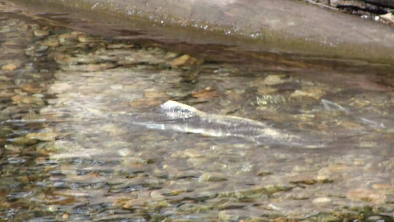
Photo: gailhampshire, CC BY 2.0

Photo: robposse, CC BY 2.0
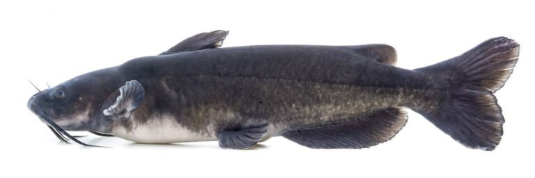
Photo: USFWS Mountain-Prairie, Public domain
Plain answers about Salt Creek (Porter County)
Where in Indiana is Salt Creek (Porter County)?
It crosses Porter County, and its mapped point is about 1 mile from South Haven.
How many miles of Salt Creek (Porter County) are in Indiana?
The NHD map shows 16 miles of line in Indiana; that is a mapping figure, not a DNR survey.
Which DNR access site puts me on Salt Creek (Porter County)?
9 access sites are mapped, Deer Run Park on Salt Creek (Porter County) among them.
What swims in Salt Creek (Porter County)?
The DNR lists bluegill, crappie, largemouth bass, redear sunfish, salmon, trout and steelhead trout.
May I keep a 13-inch bass from Salt Creek (Porter County)?
The guide row for rivers and streams reads: 5, any combination of largemouth, smallmouth, or spotted bass; No fish 12 to 15 inches may be kept, and no more than two fish over 15 inches may be kept
What will an Indiana license run me for Salt Creek (Porter County)?
Anglers 18 and older carry an Indiana fishing license ($23 a year for residents, $60 for nonresidents). Fishing for trout or salmon also needs the $11 trout/salmon stamp.
Where can I check the flow of Salt Creek (Porter County)?
See Salt Creek Near Harrodsburg, IN above.
What tackle store is closest on the drive to Salt Creek (Porter County)?
Lair's Pawn-Sports-Pet, about 4 miles away, heads the list.
Is Salt Creek (Porter County) an Outstanding River?
State lists name it: DNR put-and-take salmonid stream; DNR salmonid stream.
Is Salt Creek (Porter County) a steelhead stream?
Coho and Chinook salmon (stream): September through mid-November. Skamania (summer-run) steelhead (stream): Mid-July to mid-October; winter months January through March, depending on stream conditions; return from July (sometimes mid-June), spawn mid-February to March. Michigan (winter-run) steelhead (stream): Mid-November to mid-March; return from mid to late October with the bulk in February and March; spawn March to mid-April.
Wade into Salt Creek (Porter County) this season
The flow panel tells you when to go.