Fishing in Vigo County, Indiana
County seat: Terre Haute. Population 106,153 (2020 Census).
- 11lake pages
- 8DNR boat ramps
- 2river pages
 Pick for redear sunfishPiscifun Carbon X ultralight spinning reel28% OFFSale $57.99
Photo of Cecil M. Harden Lake: LouisvilleUSACE, CC BY 2.0
Vigo County fishing, sized up
Seat: Terre Haute. People: 106,153, per the 2020 Census tally for Vigo County. DNR lake records here list DNR fisheries district 5. Wabash River carries a border-water note in the guide.
The county's 11 paged lakes are headed, by size, by Green Valley Lake. A trailer can splash at 8 boat ramps in the county, per DNR records. Without a boat, 7 piers and shore sites are on the DNR list. County water appears in 303 stocking rows of the DNR stocking data.
Census 2020 population; Indiana DNR public lakes layer (county, owner, fisheries district number, location text), read November 5, 2026. Indiana DNR Fishing Access Sites layer (shown on the DNR Where to Fish map; attributes as recorded, blank where not recorded), read November 5, 2026. Indiana DNR fish stocking dashboard (year, month, water, species, number and average length as listed; repeat stockings summed by DNR), read November 5, 2026.
Hoosier access pins for Vigo County
Indiana DNR Fishing Access Sites layer (shown on the DNR Where to Fish map; attributes as recorded, blank where not recorded), read November 5, 2026. Lake points from the Indiana DNR public lakes layer (county, owner, fisheries district number, location text), read November 5, 2026.
Ponds, pits and lakes across Vigo County
| Lake | Area | Max depth | Kind | Ramps | Fish the DNR names |
|---|---|---|---|---|---|
| Green Valley Lake | 50 acres (NHD outline area) | lake | 1 | bluegill, redear sunfish, catfish | |
| W. Keith Ruble Lake | 27 acres (NHD outline area) | lake | 1 | bluegill, redear sunfish, catfish | |
| Burns Lake | 19 acres (NHD outline area) | lake | 1 | bluegill, redear sunfish, catfish | |
| Bell Pond | pond | 0 | |||
| Deming Park Back Pond | pond | 0 | largemouth bass, bluegill, channel catfish | ||
| Deming Park Front Pond | pond | 0 | bluegill, redear sunfish, common carp | ||
| Dobbs Park Pond | pond | 0 | bluegill, redear sunfish, catfish | ||
| Funk Lake | lake | 0 | crappie, bluegill, channel catfish | ||
| J.I. Case Marsh | lake | 1 | bluegill, redear sunfish, catfish | ||
| Maple Avenue Lake | lake | 1 | bluegill, largemouth bass, trout | ||
| Prairie Creek Park Lake | lake | 1 | bluegill, redear sunfish, catfish |
Acres are the NHD outline area of the mapped lake (USGS National Hydrography Dataset via IndianaMap), not a DNR survey figure. Maximum depths from DNR Status & Trends surveys with the survey year. Indiana DNR Fishing Access Sites layer (shown on the DNR Where to Fish map; attributes as recorded, blank where not recorded), read November 5, 2026.
 For the redear sunfish herePiscifun Carbon XT ultralight spinning reel25% OFFSale $59.99
Which fish the DNR lists near Vigo County
Within 50 miles of Terre Haute, bluegill shows up on more lake pages than any other species.
Species the DNR names on lakes and access sites, the DNR stocking dashboard and record list, counted per lake page within 50 miles; not a survey of fish numbers.
The rest of the Vigo County lake list
1 smaller named waters of Vigo County round out the county list.
| Water | Kind | Area | Nearest town |
|---|---|---|---|
| Prarie Creek Park Front Pond | pond | Farmersburg |
Indiana DNR public lakes layer (county, owner, fisheries district number, location text), read November 5, 2026. Acres are the NHD outline area of the mapped lake (USGS National Hydrography Dataset via IndianaMap), not a DNR survey figure.
Rivers that cross Vigo County
- Wabash RiverNRC Outstanding River (2013 list), 30 DNR access sites, 18 USGS gauges, shared with Illinois
- Busseron Creek1 USGS gauge
Named streams of Vigo County without a page (1)
- Turman Creek26.6 mi of mapped NHD line in Indiana
Current gauge data for Vigo County
| USGS gauge | Latest reading | Time (ET) |
|---|---|---|
| Wabash River At Terre Haute, In | 4,280 cfs, 5.16 ft gage height | Nov 13 12:30 am |
| Sugar Creek At West Terre Haute, In | 3 cfs, 1.45 ft gage height | Nov 13 12:45 am |
US Geological Survey provisional data, retrieved Nov 13, 2026 1:33 am ET. Provisional readings can be revised.
NHD named flowlines (mapped length in Indiana), DNR Outstanding River, put-and-take and salmonid stream lists, DNR access sites and USGS gauges (live readings); read November 5, 2026.
Weather Service stage snapshots for Vigo County
| Gauge | Reading | Flow | Flood category | Time (UTC) |
|---|---|---|---|---|
| Wabash River at Terre Haute…US Hwy 150 Eastbound | 5.33 ft | 4.52 kcfs | no flooding | 2026-11-05 19:30:00 UTC |
| Sugar Creek at West Terre Haute, IN | 1.53 ft | – | not defined | 2026-11-05 19:45:00 UTC |
| Big Raccoon Creek at Coxville | 6.95 ft | 0.531 kcfs | no flooding | 2026-11-05 19:45:00 UTC |
| Eel River at Bowling Green | 2.54 ft | 0.119 kcfs | no flooding | 2026-11-05 19:30:00 UTC |
| Big Walnut Creek (IN) near Reelsville | 0.89 ft | – | no flooding | 2026-11-05 19:30:00 UTC |
Copied once from the Weather Service, each reading with its time.
NOAA National Water Prediction Service gauge readings (water.noaa.gov), read November 5, 2026; dated readings, not live (kcfs = thousand cubic feet per second).
Recorded ramps in Vigo County
- Fairbanks Park on Wabash RiverWabash River, concrete ramp, fishing pier, courtesy dock, ADA access, restrooms, lights, no fee recorded
- Green Valley PFA boat rampGreen Valley Lake, concrete ramp, fishing pier, restrooms, no fee recorded, Electric only
- Hawthorn County Park on Burns LakeBurns Lake, boat ramp, courtesy dock, restrooms, lights, no fee recorded, Electric only
- J.I. Case Marsh boat rampJ.I. Case Marsh, concrete ramp, fishing pier, lights, no fee recorded, Electric only
- Maple Avenue Nature ParkMaple Avenue Lake, boat ramp, restrooms, lights, no fee recorded, Electric only
- Prairie Creek Lake & Ponds boat ramp on Prairie Creek Park LakePrairie Creek Park Lake, boat ramp, no fee recorded, Electric only
- Robert Hunter Kearns boat ramp on Wabash RiverWabash River, concrete ramp, no fee recorded
- W. Keith Ruble Lake boat rampW. Keith Ruble Lake, concrete ramp, fishing pier, courtesy dock, ADA access, restrooms, lights, no fee recorded, Electric only
Vigo County spots for boatless anglers
- Deming Park on Deming Park Back PondDeming Park Back Pond, shore access, restrooms, lights, no fee recorded
- Deming Park on Deming Park Front PondDeming Park Front Pond, fishing pier, restrooms, lights, no fee recorded
- Dobbs Park PondDobbs Park Pond, fishing pier, restrooms, lights, no fee recorded
- Dobbs Park Pond (Dobbs Park)Dobbs Park Pond, urban fishing site
- Maple Avenue Park Lake (Maple Avenue Park)Maple Avenue Lake, urban fishing site
- Bell Pond shore accessBell Pond, shore access, no fee recorded
- Wabashiki FWA Funk LakeFunk Lake, shore access, no fee recorded, Electric only
Indiana DNR Fishing Access Sites layer (shown on the DNR Where to Fish map; attributes as recorded, blank where not recorded), read November 5, 2026.
Fish released into Vigo County water
| Year | Month | Water | Species (as listed) | Number | Avg length (in) |
|---|---|---|---|---|---|
| 2026 | October | Burns Lake | Channel Catfish | 325 | 8.33 |
| 2026 | October | Deming Park Back Pond | Channel Catfish | 150 | 10.6 |
| 2026 | October | Deming Park Front Pond | Channel Catfish | 110 | 10.6 |
| 2026 | October | Funk Lake | Channel Catfish | 228 | 8.62 |
| 2026 | October | Green Valley Lake | Channel Catfish | 473 | 8.62 |
| 2026 | October | Maple Avenue Lake | Channel Catfish | 418 | 8.62 |
| 2026 | October | W. Keith Ruble Lake | Channel Catfish | 420 | 8.62 |
| 2026 | March | Maple Avenue Lake | Rainbow Trout | 666 | 12.2 |
| 2026 | Multiple | Dobbs Park Pond | Channel Catfish | 790 | 11.36 |
| 2025 | October | Burns Lake | Channel Catfish | 856 | 7.86 |
| 2025 | October | Deming Park Back Pond | Channel Catfish | 150 | 7.8 |
| 2025 | October | Deming Park Front Pond | Channel Catfish | 110 | 7.8 |
| 2025 | October | Maple Avenue Lake | Channel Catfish | 1,100 | 7.86 |
| 2025 | March | Maple Avenue Lake | Rainbow Trout | 731 | 9.52 |
| 2025 | Multiple | Dobbs Park Pond | Channel Catfish | 790 | 11.23 |
| 2024 | November | Deming Park Back Pond | Channel Catfish | 150 | 7.7 |
| 2024 | November | Deming Park Front Pond | Channel Catfish | 110 | 7.7 |
| 2024 | October | Dobbs Park Pond | Bluegill | 2,250 | 1.3 |
| 2024 | October | Funk Lake | Channel Catfish | 300 | 8.64 |
| 2024 | October | Maple Avenue Lake | Bluegill | 8,250 | 1.3 |
| 2024 | October | Maple Avenue Lake | Channel Catfish | 550 | 8.64 |
| 2024 | October | W. Keith Ruble Lake | Channel Catfish | 553 | 8.64 |
| 2024 | Multiple | Dobbs Park Pond | Channel Catfish | 740 | 10.74 |
| 2023 | October | Burns Lake | Channel Catfish | 856 | 9.39 |
| 2023 | October | Deming Park Back Pond | Channel Catfish | 150 | 8.5 |
| 2023 | October | Deming Park Front Pond | Channel Catfish | 110 | 8.5 |
| 2023 | October | Green Valley Lake | Channel Catfish | 1,244 | 9.39 |
| 2023 | October | Maple Avenue Lake | Channel Catfish | 1,100 | 9.39 |
| 2023 | March | Maple Avenue Lake | Rainbow Trout | 863 | 11.9 |
| 2023 | Multiple | Dobbs Park Pond | Channel Catfish | 864 | 12.35 |
Where the 2026 trout plan reaches Vigo County
| Season | Water as printed | Location | Planned number | Species |
|---|---|---|---|---|
| Spring lakes (mid-March to mid-April) | Maple Ave. Park Lake | 1,150 | Rainbow Trout |
Indiana DNR fish stocking dashboard (year, month, water, species, number and average length as listed; repeat stockings summed by DNR), read November 5, 2026; rows reach the county through the water they name. Indiana DNR 2026 trout stocking plan (updated March 20, 2026; planned targets, DNR notes actual numbers may vary), read November 5, 2026.
Stringer math for Vigo County anglers
Statewide rows hold across Vigo County; named special waters follow the table. Hoosiers 18 and up pay $23 for a year of fishing; anglers from other states pay $60.
| Species | Daily limit | Size limit |
|---|---|---|
| Bluegill | Unlimited | no size limit |
| Redear Sunfish | 25 | no size limit |
| Black Bass: largemouth, smallmouth, and spotted bass (in lakes) | 5, any combination of largemouth, smallmouth, or spotted bass | 14 inches |
| Black Bass: largemouth, smallmouth, and spotted bass (in rivers and streams) | 5, any combination of largemouth, smallmouth, or spotted bass | No fish 12 to 15 inches may be kept, and no more than two fish over 15 inches may be kept |
| Black Bass: largemouth, smallmouth, and spotted bass (in Lake Michigan) | 3, any combination of largemouth, smallmouth, or spotted bass | 14 inches |
| Yellow Bass | Unlimited | no size limit |
| White Bass, Hybrid Striped Bass | 12, any combination of white bass or hybrid striped bass | No more than two fish may exceed 17 inches |
| Striped Bass | 2 | no size limit |
| Rock Bass | 25 | no size limit |
| Crappie | 25 | no size limit |
| Walleye, Walleye-Sauger Hybrid (Saugeye), Sauger | 6, any combination of walleye, walleye-sauger hybrid, and sauger | For walleye: 14 inches south of SR 26; 16 inches north of SR 26 For sauger and saugeye: No size limit |
| Muskellunge and Tiger Muskellunge | 1 muskellunge or 1 tiger muskellunge | 36 inches |
| Northern Pike | 3 | 24 inches; no more than one 30 inches or longer |
| Yellow Perch | Unlimited (15 only on Lake Michigan) | no size limit |
| Catfish: Channel, Blue, Flathead (in rivers and streams) | Unlimited | 13 inches; not more than one blue catfish that’s at least 35 inches, one flathead catfish at least 35 inches, and one channel catfish at least 28 inches or longer may be kept |
| Catfish: Channel, Blue, Flathead (in lakes) | 10 | None; not more than one blue catfish that’s at least 35 inches, one flathead catfish at least 35 inches, and one channel catfish at least 28 inches or longer may be kept |
| Bullhead | Unlimited | no size limit |
| Shovelnose Sturgeon | Unlimited | 25 inches (fork length) |
Guide entries naming Vigo County lakes (1)
| Water (counties) | Species | Rule as printed |
|---|---|---|
| Deming Park lakes (Vigo) | Black Bass | No minimum size limit |
Statewide limits as printed, 2026-2027 Indiana Fishing Regulations Guide (eRegulations, linked from the Indiana DNR), read November 5, 2026. Special regulation waters as printed, 2026-2027 Indiana Fishing Regulations Guide (eRegulations, linked from the Indiana DNR), read November 5, 2026. Indiana DNR license fees (license year April 1 to March 31), read November 5, 2026.
Record-book catches near Vigo County
| Species | Weight | Water | County | Year |
|---|---|---|---|---|
| Spotted Bass | 5 lb. 5 oz. | not printed | Vigo County | 2006 |
Indiana DNR Indiana Record Fish Program list (keeper: Indiana DNR Division of Fish & Wildlife (Indiana Record Fish Program); angler names left off here), read November 5, 2026.
Vigo County shops, marinas and guides
Shops listed for Vigo County
- Academy Sports + Outdoors Terre Hautesporting goods store, Terre Haute
- Dick's Sporting Goods Terre Haute, 3500 S. Us Hwy 41sporting goods store, Terre Haute
- Dick's Sporting Goods Terre Haute, 4700 S Us Hwy 41sporting goods store, Terre Haute
Charters and guides near Vigo County
- Humes Outdoorsfishing guide, (812) 870-8359
- White River Guide Servicefishing guide, (317) 691-7388
Yellow Pages, chain store and DNR property listings; the DNR licensed fishing guide list and tourism bureau charter listings (matched by the waters they list or their county), read November 5, 2026.
Close to Vigo County
Vigo County town guides
- Terre Hautepop. 58,389
- North Terre Hautepop. 4,222
- West Terre Hautepop. 2,157
- Seelyvillepop. 1,012
Bordering counties of Vigo County
- Clay County15 miles east
- Sullivan County24 miles south
- Parke County26 miles northeast
- Vermillion County29 miles north
Piscifun reels to toss in the boat for Vigo County


Piscifun and Amazon links are affiliate links; the site earns a commission on qualifying purchases.
Picture ID for the fish swimming at Vigo County

Photo: USFWS Mountain-Prairie, Public domain

Photo: USFWS Mountain-Prairie, Public domain
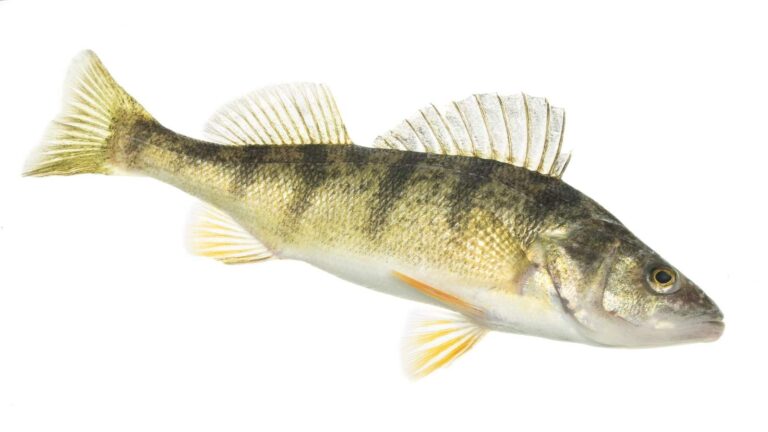
Photo: USFWS Mountain-Prairie, Public domain
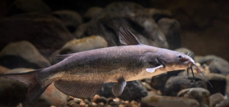
Photo: USFWS Mountain-Prairie, Public domain
Questions on Vigo County water
Where does a bass boat go in across Vigo County?
The DNR count is 8 boat ramps; Fairbanks Park on Wabash River is one of them.
Which paged lake in Vigo County covers the most ground?
Green Valley Lake, at 50 acres (NHD outline area).
What might a visiting angler target in Vigo County?
Bluegill leads the count of lake pages within 50 miles, then largemouth bass, redear sunfish and catfish; the DNR names them on lake and access records.
Is there a bait shop listed in Vigo County?
Academy Sports + Outdoors Terre Haute heads a county list of 3.
In which town does Vigo County keep its seat?
Terre Haute holds the courthouse.
What license does Vigo County fishing call for?
Hoosiers 18 and up pay $23 for a year of fishing; anglers from other states pay $60.
Which counties lie just past Vigo County?
Measured centre to centre, Clay County, Sullivan County and Parke County are nearest.
What district number do Vigo County lakes carry?
The DNR lake layer gives the county's own lakes the number for DNR fisheries district 5.
Does Vigo County have a public fishing pier?
The DNR layer lists 7 piers and shore sites, such as Deming Park on Deming Park Back Pond.
Which special water entries reach Vigo County?
The guide lists 1 special regulation water in this county, starting with Deming Park lakes; the table above shows each.
Has the DNR released fish into Vigo County water?
The DNR dashboard carries 303 rows; the newest lists 790 Channel Catfish, 11.36 in average (Multiple 2026) in Dobbs Park Pond.
Which record lines name Vigo County?
Spotted Bass, 5 lb. 5 oz., 2006, from county water.
Spend a Saturday on Vigo County water
Lake pages carry ramps, survey depths and guide rules.