Fishing in Perry County, Indiana
County seat: Tell City. Population 19,170 (2020 Census).
- 10lake pages
- 13DNR boat ramps
- 3river pages
 Pick for redear sunfishPiscifun Carbon X ultralight spinning reel28% OFFSale $57.99
Photo of Patoka Lake: LouisvilleUSACE, CC BY 2.0
How Perry County shapes up for fishing
The 2020 Census counted 19,170 people in Perry County; Tell City is the seat. Its own DNR lakes carry the number for DNR fisheries district 6 in the state lake layer. Perry County fronts the Ohio River with 6 access sites recorded by the DNR.
Biggest among 10 county lake pages: Lake Celina. County lines hold 13 boat ramps by the DNR access count. Walk-up fishing comes from 8 piers and shore sites in DNR data. The DNR stocking dashboard holds 75 stocking rows for county waters.
Census 2020 population; Indiana DNR public lakes layer (county, owner, fisheries district number, location text), read November 5, 2026. Indiana DNR Fishing Access Sites layer (shown on the DNR Where to Fish map; attributes as recorded, blank where not recorded), read November 5, 2026. Indiana DNR fish stocking dashboard (year, month, water, species, number and average length as listed; repeat stockings summed by DNR), read November 5, 2026.
Mapped boat and bank access in Perry County
Indiana DNR Fishing Access Sites layer (shown on the DNR Where to Fish map; attributes as recorded, blank where not recorded), read November 5, 2026. Lake points from the Indiana DNR public lakes layer (county, owner, fisheries district number, location text), read November 5, 2026.
Glacial lakes, pits and reservoirs of Perry County
| Lake | Area | Max depth | Kind | Ramps | Fish the DNR names |
|---|---|---|---|---|---|
| Lake Celina | 157 acres (NHD outline area) | lake | 1 | bluegill, redear sunfish, crappie | |
| Tipsaw Lake | 137 acres (NHD outline area) | lake | 1 | bluegill, redear sunfish, crappie | |
| Indian Lake (Perry County) | 129 acres (NHD outline area) | lake | 1 | bluegill, redear sunfish, crappie | |
| Saddle Lake | 41 acres (NHD outline area) | lake | 1 | bluegill, redear sunfish, catfish | |
| Oriole Lake | 3 acres (NHD outline area) | lake | 1 | bluegill, redear sunfish, largemouth bass | |
| Harding Pond | 0 acres (NHD outline area) | pond | 0 | bluegill, redear sunfish, largemouth bass | |
| Branchville Pond | pond | 0 | bluegill, redear sunfish, largemouth bass | ||
| Deer Creek Lake | lake | 0 | common carp, catfish, crappie | ||
| German Ridge Lake | lake | 0 | bluegill, redear sunfish, largemouth bass | ||
| Porsche Lake | lake | 0 | bluegill, redear sunfish, largemouth bass |
Acres are the NHD outline area of the mapped lake (USGS National Hydrography Dataset via IndianaMap), not a DNR survey figure. Maximum depths from DNR Status & Trends surveys with the survey year. Indiana DNR Fishing Access Sites layer (shown on the DNR Where to Fish map; attributes as recorded, blank where not recorded), read November 5, 2026.
 For the redear sunfish herePiscifun Carbon XT ultralight spinning reel25% OFFSale $59.99
Big-river access in Perry County
The Ohio River page covers the whole Indiana shore; this county's ramps come next.
- Cannelton boat ramp on Ohio RiverOhio River, boat ramp, ADA access, no fee recorded
- Derby boat ramp on Ohio RiverOhio River, boat ramp, fishing pier, courtesy dock, restrooms, lights, fee: Entry Fee
- Poison Creek boat ramp on Ohio RiverOhio River, boat ramp, no fee recorded
- Rome boat ramp on Ohio RiverOhio River, boat ramp, courtesy dock, no fee recorded
- Tell City boat ramp on Ohio RiverOhio River, concrete ramp, restrooms, lights, no fee recorded
- Troy boat ramp on Ohio RiverOhio River, concrete ramp, courtesy dock, lights, no fee recorded
Bass in rivers of these counties, per the guide: All rivers and streams in Posey, Vanderburgh, Warrick, Spencer, Perry, Crawford, Harrison, Floyd, Clark, Jefferson, Switzerland, Ohio, and Dearborn counties (with the exception of the Blue River, where the slot limit applies in Crawford, Harrison, and Washington counties).
Ohio River rows and reciprocity as printed, 2026-2027 Indiana Fishing Regulations Guide (eRegulations, linked from the Indiana DNR), read November 5, 2026. Indiana DNR Fishing Access Sites layer (shown on the DNR Where to Fish map; attributes as recorded, blank where not recorded), read November 5, 2026.
Species tallied from lake guides around Perry County
Each bar is a tally of lake pages within 50 miles of Tell City naming the fish; largemouth bass is first.
Species the DNR names on lakes and access sites, the DNR stocking dashboard and record list, counted per lake page within 50 miles; not a survey of fish numbers.
Perry County ponds named here without a guide
A further 13 named waters of Perry County are rows here rather than pages.
| Water | Kind | Area | Nearest town |
|---|---|---|---|
| Mill Lake | lake | 28 acres (NHD outline area) | Tell City |
| Deer Lake | lake | 2 acres (NHD outline area) | Cannelton |
| Timberlake Pond | pond | 2 acres (NHD outline area) | Tell City |
| Middle Deer Pond | pond | 1 acres (NHD outline area) | Tell City |
| Gerber Pond | pond | 1 acres (NHD outline area) | Cannelton |
| Derby Pond | pond | 1 acres (NHD outline area) | Tell City |
| Lost Lake Pond | pond | 0 acres (NHD outline area) | Tell City |
| Gatchel Pond | pond | 0 acres (NHD outline area) | Tell City |
| East Deer Pond | pond | 0 acres (NHD outline area) | Cannelton |
| Helwig Hollow Pond | pond | 0 acres (NHD outline area) | Cannelton |
| Beaver Hollow Pond | pond | Ferdinand | |
| Kellems Lake | lake | Tell City | |
| Rainbow Lake | lake | Tell City |
Indiana DNR public lakes layer (county, owner, fisheries district number, location text), read November 5, 2026. Acres are the NHD outline area of the mapped lake (USGS National Hydrography Dataset via IndianaMap), not a DNR survey figure.
Current to fish in Perry County
- Stinking ForkNRC Outstanding River (2013 list)
- Middle Fork Anderson River1 USGS gauge
- Anderson River1 DNR access site
Perry County streams shown as rows (10)
- Clover Lick Creek2.1 mi of mapped NHD line in Indiana
- East Deer Creek4.2 mi of mapped NHD line in Indiana
- Fanny Creek1.7 mi of mapped NHD line in Indiana
- Indian Fork5.1 mi of mapped NHD line in Indiana
- Kingley Creek1.1 mi of mapped NHD line in Indiana
- Little Oil Creek9.2 mi of mapped NHD line in Indiana
- Neglie Creek4.0 mi of mapped NHD line in Indiana
- Oil Creek (Perry County)NRC Outstanding River (2013 list)
- Sample Run0.8 mi of mapped NHD line in Indiana
- Webb Branch1.5 mi of mapped NHD line in Indiana
Perry County USGS stations
| USGS gauge | Latest reading | Time (ET) |
|---|---|---|
| Ohio River At Cannelton Dam At Cannelton, In | 35,000 cfs, 11.45 ft gage height | Nov 12 7:00 pm |
| Middle Fork Anderson River At Bristow, In | 8 cfs, 4.79 ft gage height | Nov 12 11:30 pm |
US Geological Survey provisional data, retrieved Nov 13, 2026 12:34 am ET. Provisional readings can be revised.
NHD named flowlines (mapped length in Indiana), DNR Outstanding River, put-and-take and salmonid stream lists, DNR access sites and USGS gauges (live readings); read November 5, 2026.
Dated stream stages near Perry County
| Gauge | Reading | Flow | Flood category | Time (UTC) |
|---|---|---|---|---|
| Ohio River at Cannelton Lock and Dam | 12.7 ft | 64 kcfs | no flooding | 2026-11-05 20:00:00 UTC |
| Middle Fork Anderson River at Bristow | 5.16 ft | – | not defined | 2026-11-05 19:30:00 UTC |
| Ohio River at Owensboro | 19.85 ft | – | no flooding | 2026-11-05 19:30:00 UTC |
Weather Service values here were read once and keep their own time stamp.
NOAA National Water Prediction Service gauge readings (water.noaa.gov), read November 5, 2026; dated readings, not live (kcfs = thousand cubic feet per second).
Perry County access sites for trailers
- Anderson River boat rampAnderson River, concrete ramp, no fee recorded
- Cannelton boat ramp on Ohio RiverOhio River, boat ramp, ADA access, no fee recorded
- Derby boat ramp on Ohio RiverOhio River, boat ramp, fishing pier, courtesy dock, restrooms, lights, fee: Entry Fee
- Indian Lake boat rampIndian Lake, concrete ramp, courtesy dock, restrooms, fee: Entry Fee, Electric only
- Lake Celina boat rampLake Celina, concrete ramp, fishing pier, courtesy dock, ADA access, restrooms, lights, fee: Entry Fee, Electric only
- Oriole Lake boat rampOriole Lake, other ramp, no fee recorded, Electric only
- Poison Creek boat ramp on Ohio RiverOhio River, boat ramp, no fee recorded
- Rainbow Lake boat rampRainbow Lake, gravel ramp, restrooms, no fee recorded, Electric only
- Rome boat ramp on Ohio RiverOhio River, boat ramp, courtesy dock, no fee recorded
- Saddle Lake boat rampSaddle Lake, concrete ramp, restrooms, no fee recorded, Electric only
- Tell City boat ramp on Ohio RiverOhio River, concrete ramp, restrooms, lights, no fee recorded
- Tipsaw Lake boat rampTipsaw Lake, concrete ramp, courtesy dock, restrooms, lights, fee: Entry Fee, Electric only
- Troy boat ramp on Ohio RiverOhio River, concrete ramp, courtesy dock, lights, no fee recorded
Shore sites and piers of Perry County
- German Ridge Lake shore accessGerman Ridge Lake, shore access, restrooms, no fee recorded, Electric only
- Branchville Pond shore accessBranchville Pond, shore access, no fee recorded, Electric only
- Deer Creek Lake shore accessDeer Creek Lake, shore access, no fee recorded, Electric only
- Deuchers Pond shore accessDeuchers Pond, shore access, no fee recorded, Electric only
- Harding Pond shore accessHarding Pond, shore access, no fee recorded
- Hemlock Lake shore accessHemlock Lake, shore access, no fee recorded, Electric only
- Porsch Lake shore access on Porsche LakePorsche Lake, shore access, no fee recorded, Electric only
- Unnamed Pond shore accessUnnamed Pond, shore access, no fee recorded, Electric only
Indiana DNR Fishing Access Sites layer (shown on the DNR Where to Fish map; attributes as recorded, blank where not recorded), read November 5, 2026.
Stocking rows for Perry County lakes
| Year | Month | Water | Species (as listed) | Number | Avg length (in) |
|---|---|---|---|---|---|
| 2026 | October | Branchville Pond | Channel Catfish | 50 | 8.49 |
| 2026 | October | German Ridge Lake | Channel Catfish | 105 | 8.49 |
| 2025 | October | German Ridge Lake | Channel Catfish | 150 | 7.95 |
| 2024 | October | Branchville Pond | Channel Catfish | 50 | 9.09 |
| 2023 | October | German Ridge Lake | Channel Catfish | 150 | 9.52 |
| 2022 | October | Branchville Pond | Channel Catfish | 50 | 8.6 |
| 2022 | October | German Ridge Lake | Channel Catfish | 150 | 8.6 |
| 2021 | October | German Ridge Lake | Channel Catfish | 150 | 11.02 |
| 2020 | October | Branchville Pond | Channel Catfish | 50 | 9.38 |
| 2020 | October | German Ridge Lake | Channel Catfish | 150 | 9.38 |
| 2019 | October | German Ridge Lake | Channel Catfish | 150 | 8.95 |
| 2018 | October | Branchville Pond | Channel Catfish | 50 | 7.65 |
| 2018 | October | German Ridge Lake | Channel Catfish | 150 | 7.65 |
| 2017 | October | German Ridge Lake | Channel Catfish | 150 | 10.42 |
| 2016 | October | German Ridge Lake | Channel Catfish | 150 | 10.43 |
| 2013 | October | German Ridge Lake | Channel Catfish | 150 | 9.86 |
| 2013 | May | German Ridge Lake | Rainbow Trout | 100 | 11.0 |
| 2009 | November | German Ridge Lake | Bluegill | 2,504 | 2.13 |
| 2009 | November | German Ridge Lake | Largemouth Bass | 660 | 3.14 |
| 2009 | November | German Ridge Lake | Redear Sunfish | 852 | 1.41 |
| 2004 | November | German Ridge Lake | Bluegill | 2,293 | 0.99 |
| 2004 | November | German Ridge Lake | Largemouth Bass | 600 | 4.3 |
| 2004 | November | German Ridge Lake | Redear Sunfish | 874 | 1.31 |
| 2001 | November | Deer Creek Lake | Grass Carp | 300 | |
| 1996 | October | German Ridge Lake | Channel Catfish | 50 | 8.7 |
| 1996 | October | Oriole Lake | Channel Catfish | 50 | 8.7 |
| 1994 | October | German Ridge Lake | Channel Catfish | 50 | 8.3 |
| 1994 | October | Oriole Lake | Channel Catfish | 50 | 8.3 |
| 1993 | October | German Ridge Lake | Channel Catfish | 100 | 9.1 |
| 1993 | October | Oriole Lake | Channel Catfish | 50 | 9.1 |
Indiana DNR fish stocking dashboard (year, month, water, species, number and average length as listed; repeat stockings summed by DNR), read November 5, 2026; rows reach the county through the water they name.
The 2026-27 guide rows for Perry County
Waters of Perry County follow the statewide rows below unless the guide names them as a special regulation water. Plan on $23 for a resident annual license, or $60 if you live outside Indiana.
| Species | Daily limit | Size limit |
|---|---|---|
| Bluegill | Unlimited | no size limit |
| Redear Sunfish | 25 | no size limit |
| Black Bass: largemouth, smallmouth, and spotted bass (in lakes) | 5, any combination of largemouth, smallmouth, or spotted bass | 14 inches |
| Black Bass: largemouth, smallmouth, and spotted bass (in rivers and streams) | 5, any combination of largemouth, smallmouth, or spotted bass | No fish 12 to 15 inches may be kept, and no more than two fish over 15 inches may be kept |
| Black Bass: largemouth, smallmouth, and spotted bass (in Lake Michigan) | 3, any combination of largemouth, smallmouth, or spotted bass | 14 inches |
| Yellow Bass | Unlimited | no size limit |
| White Bass, Hybrid Striped Bass | 12, any combination of white bass or hybrid striped bass | No more than two fish may exceed 17 inches |
| Striped Bass | 2 | no size limit |
| Rock Bass | 25 | no size limit |
| Crappie | 25 | no size limit |
| Walleye, Walleye-Sauger Hybrid (Saugeye), Sauger | 6, any combination of walleye, walleye-sauger hybrid, and sauger | For walleye: 14 inches south of SR 26; 16 inches north of SR 26 For sauger and saugeye: No size limit |
| Muskellunge and Tiger Muskellunge | 1 muskellunge or 1 tiger muskellunge | 36 inches |
| Northern Pike | 3 | 24 inches; no more than one 30 inches or longer |
| Yellow Perch | Unlimited (15 only on Lake Michigan) | no size limit |
| Catfish: Channel, Blue, Flathead (in rivers and streams) | Unlimited | 13 inches; not more than one blue catfish that’s at least 35 inches, one flathead catfish at least 35 inches, and one channel catfish at least 28 inches or longer may be kept |
| Catfish: Channel, Blue, Flathead (in lakes) | 10 | None; not more than one blue catfish that’s at least 35 inches, one flathead catfish at least 35 inches, and one channel catfish at least 28 inches or longer may be kept |
| Bullhead | Unlimited | no size limit |
| Shovelnose Sturgeon | Unlimited | 25 inches (fork length) |
Main-stem Ohio River limits off Perry County
| Species | Daily limit | Size limit |
|---|---|---|
| Largemouth, smallmouth and spotted bass | 6, any combination of largemouth, smallmouth, or spotted bass | 12 inches No size limit on spotted bass |
| Hybrid striped, striped, white and yellow bass | 30, any combination of hybrid, striped, white, or yellow bass | No more than four fish may be 15 inches or longer |
| Rock Bass | 15 | no size limit |
| Blue Catfish | Unlimited | 13 inches; no more than one may be 35 inches or longer |
| Channel Catfish | Unlimited | 13 inches; no more than one may be 28 inches or longer |
| Flathead Catfish | Unlimited | 13 inches; no more than one may be 35 inches or longer |
| Crappie | 30 | no size limit |
| Muskellunge and tiger muskellunge | 2, any combination of muskellunge or tiger muskellunge | 30 inches |
| Walleye, sauger and saugeye | 6, any combination of walleye, sauger, or hybrid walleye | 14 inches |
| Shovelnose Sturgeon | Unlimited | 25 inches (fork length) |
Statewide limits as printed, 2026-2027 Indiana Fishing Regulations Guide (eRegulations, linked from the Indiana DNR), read November 5, 2026. Ohio River rows and reciprocity as printed, 2026-2027 Indiana Fishing Regulations Guide (eRegulations, linked from the Indiana DNR), read November 5, 2026. Indiana DNR license fees (license year April 1 to March 31), read November 5, 2026.
Hoosier record holders close to Perry County
Perry County holds no state record, so the closest record waters follow.
| Species | Weight | Water | County | Year |
|---|---|---|---|---|
| Blue Catfish | 104 lb. | Ohio River | not printed | 1999 |
| Longnose Gar | 23 lb. 12.2 oz. | Ohio River | Floyd County | 2025 |
| Striped Bass | 40 lb. 3.8 oz. | Blue River (Crawford and Harrison Counties) | Harrison County | 2023 |
Indiana DNR Indiana Record Fish Program list (keeper: Indiana DNR Division of Fish & Wildlife (Indiana Record Fish Program); angler names left off here), read November 5, 2026.
Weigh-ins on Perry County water
13 organizer events tie to Perry County water, and 2 are still ahead.
Organizer schedule and results pages (the DNR publishes no tournament calendar); most listings are Indiana Bass Federation member club events; checked November 2026.
Shops and hired help in Perry County
Minnows, line and lures in Perry County
- Big Tales Fishing Tacklebait and tackle shop, Tell City
Paid fishing trips in Perry County
- The Obsession Outdoorsfishing guide, (502) 548-6886
- Top 2% Guide Services LLCfishing guide, (573) 418-2148
- Twin Eagles Catfish Chartersfishing guide, (812) 719-6777
Yellow Pages, chain store and DNR property listings; the DNR licensed fishing guide list and tourism bureau charter listings (matched by the waters they list or their county), read November 5, 2026.
Next stops from Perry County
Communities inside Perry County
- Tell Citypop. 7,506
- Canneltonpop. 1,524
The counties ringing Perry County
- Crawford County18 miles northeast
- Spencer County21 miles west
- Dubois County24 miles northwest
- Harrison County29 miles east
A Piscifun lineup sized for Perry County


Piscifun and Amazon links are affiliate links; the site earns a commission on qualifying purchases.
Hardwood shorelines around Perry County through a lens
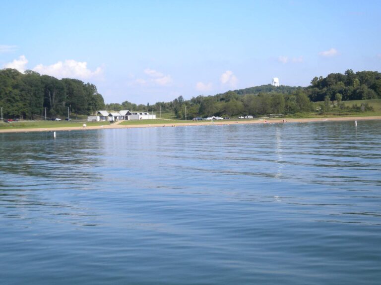
Photo: Deana Hunter, CC BY 2.0
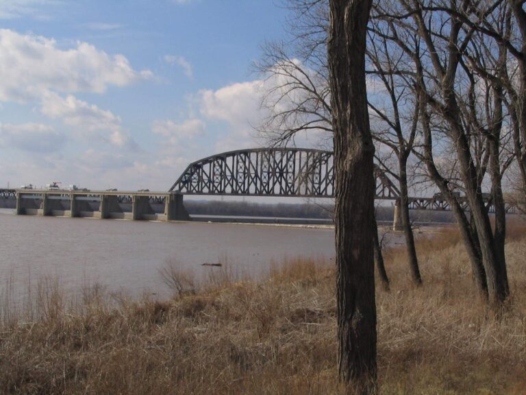
Photo: Ken Lund, CC BY-SA 2.0

Photo: LunchboxLarry, CC BY 2.0
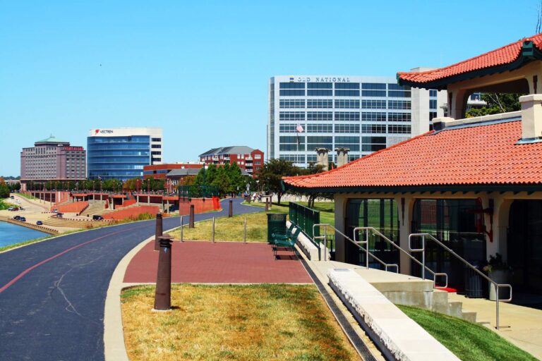
Photo: greeblie, CC BY 2.0
Common questions for Perry County anglers
Where can a trailered boat be launched in Perry County?
You can pick from 13 boat ramps, Anderson River boat ramp among them.
Which lake in Perry County maps the largest?
Lake Celina, at 157 acres (NHD outline area).
Which fish live in the lakes around Perry County, per the DNR?
Largemouth bass leads the count of lake pages within 50 miles, then bluegill, redear sunfish and catfish; the DNR names them on lake and access records.
Which listed shops in Perry County carry fishing gear?
The listings hold 1 here, such as Big Tales Fishing Tackle.
Where is Perry County county business done?
Courthouse business happens in Tell City.
What does the DNR charge to fish Perry County water?
Plan on $23 for a resident annual license, or $60 if you live outside Indiana.
Which counties border Perry County?
Crawford County, Spencer County and Dubois County sit closest on the map.
Which district does the DNR lake layer give Perry County?
The DNR lake layer gives the county's own lakes the number for DNR fisheries district 6.
Where can kids fish without a boat in Perry County?
The DNR layer lists 8 piers and shore sites, such as German Ridge Lake shore access.
When is the next posted weigh-in on Perry County water?
13 events on file; the next is Phoenix BFL Team/Solo Ohio River-Tanners Creek (June 2027) on Ohio River, June 26, 2027.
Which fish did the DNR release into Perry County lately?
The DNR dashboard carries 75 rows; the newest lists 105 Channel Catfish, 8.49 in average (October 2026) in German Ridge Lake.
Does Perry County border the Ohio River?
The Ohio River forms the Perry County line, and 6 access sites reach it from the Indiana side.
Give a sunrise to the lakes of Perry County
Each ramp page opens with a directions link.