Ohio River Fishing in Indiana
The Indiana bank of the Ohio River across 12 counties, with Kentucky reciprocity on the main stem.
 Pick for catfishPiscifun LumiCat II catfish rod48% OFFSale $114.99
Photo: William Alden, CC BY-SA 4.0
The Indiana bank of the Ohio River
From Lawrenceburg to Mount Vernon the Ohio River is the Indiana and Kentucky line.
Boaters and bank anglers get 27 ramps and 4 shore sites on the DNR layer.
Indiana DNR Fishing Access Sites layer (shown on the DNR Where to Fish map; attributes as recorded, blank where not recorded), read November 5, 2026. Ohio River rows and reciprocity as printed, 2026-2027 Indiana Fishing Regulations Guide (eRegulations, linked from the Indiana DNR), read November 5, 2026.
 For the catfish herePiscifun Chaos XS round baitcaster36% OFFSale $57.99
The Ohio River regulations
| Species as printed | Daily limit | Size limit |
|---|---|---|
| Largemouth, smallmouth and spotted bass | 6, any combination of largemouth, smallmouth, or spotted bass | 12 inches No size limit on spotted bass |
| Hybrid striped, striped, white and yellow bass | 30, any combination of hybrid, striped, white, or yellow bass | No more than four fish may be 15 inches or longer |
| Rock Bass | 15 | no size limit |
| Blue Catfish | Unlimited | 13 inches; no more than one may be 35 inches or longer |
| Channel Catfish | Unlimited | 13 inches; no more than one may be 28 inches or longer |
| Flathead Catfish | Unlimited | 13 inches; no more than one may be 35 inches or longer |
| Crappie | 30 | no size limit |
| Muskellunge and tiger muskellunge | 2, any combination of muskellunge or tiger muskellunge | 30 inches |
| Walleye, sauger and saugeye | 6, any combination of walleye, sauger, or hybrid walleye | 14 inches |
| Shovelnose Sturgeon | Unlimited | 25 inches (fork length) |
- Ohio River rulesFishing on the Ohio These regulations are the result of a cooperative effort by Indiana and five other Ohio River states. In many cases, these rules differ significantly from other laws and regulations in Indiana. These rules and regulations apply only to the main stem of the Ohio River and do not include the tributaries or embayments for which general Indiana fishing regulations apply. An agreement between Indiana and Kentucky allows that each state will recognize the fishing license issued by the other state on the main stem of the Ohio River, excluding embayments and tributaries. This means anglers can fish the Ohio River bank to bank with a license issued by either state. To fish Indiana or Kentucky embayments or tributaries, a license from that state must be obtained. An angler must abide by the regulations of the state by which they are licensed, except when fishing from the …
- Where to fishWhere to Fish on the Ohio Fishing within 200 yards below any dam on the Ohio River can only be done with a fishing pole or hand line. Fishing sites include: J.T. Myers Dam (Uniontown Dam)—15 miles southwest of Mount Vernon in Posey County, accessible at Hovey Lake Fish & Wildlife Area Newburgh Dam—in the town of Newburgh off SR 66 Cannelton Dam—follow Taylor Street south from SR 66 in Cannelton McAlpine Dam—located at Clarksville Falls of the Ohio State Park—accessible boat ramp located at George Rogers Clark Homesite in Clarksville (Access at New Albany off of Water Street in Jaycee Riverfront Park) Markland Dam—near Markland in Switzerland County. Accessible at DamVue River Camp or Vevay boat ramp Access fees may be charged at some sites. See map below for dam locations. Map of Indiana’s Wabash and Ohio rivers showing major dam locations including J.T. Myers, Newburgh,
- Minnows and crayfishMinnows & Crayfish Minnows and crayfish can be taken from the Ohio River only by the following methods: A minnow trap that does not exceed 3 feet long and 18 inches in diameter and does not have a throat opening greater than 2 inches in diameter A dip net no more than 3 feet in diameter A minnow seine no more than 30 feet long and 6 feet deep that does not have a mesh size larger than ¼ inch bar mesh A cast net not to exceed 20 feet in diameter that does not have a mesh size larger than ¾ inch stretch
- Tributary bass, 13 countiesAll rivers and streams in Posey, Vanderburgh, Warrick, Spencer, Perry, Crawford, Harrison, Floyd, Clark, Jefferson, Switzerland, Ohio, and Dearborn counties (with the exception of the Blue River, where the slot limit applies in Crawford, Harrison, and Washington counties).
Ohio River rows and reciprocity as printed, 2026-2027 Indiana Fishing Regulations Guide (eRegulations, linked from the Indiana DNR), read November 5, 2026.
The Kentucky bank of the Ohio River
- ReciprocityIndiana and Kentucky — Ohio River — The reciprocal agreement allows residents of either state to fish the river proper (main stem) with either state’s fishing license. If you are fishing in a connecting tributary/embayment you'll need to have a fishing license for that particular state.
Reciprocity stops at the mouths of tributaries.
Anglers 18 and older carry an Indiana fishing license ($23 a year for residents, $60 for nonresidents).
Indiana and Kentucky reciprocity text as printed, 2026-2027 Indiana Fishing Regulations Guide (eRegulations, linked from the Indiana DNR), read November 5, 2026.
Where boats head out onto the Ohio River
| Site | Type | Recorded attributes | Managed by |
|---|---|---|---|
| Duffy's Landing on Ohio River | boat ramp | concrete ramp, ADA access, no fee recorded | Division of Fish & Wildlife, Public Access South/ Jeffersonville Parks |
| Madison Ramp on Ohio River | boat ramp | concrete ramp, no fee recorded | City of Madison |
| Bryant Creek boat ramp on Ohio River | boat ramp | boat ramp, no fee recorded | |
| Rome boat ramp on Ohio River | boat ramp | boat ramp, courtesy dock, no fee recorded | Town of Rome |
| George Rogers Clark Homesite boat ramp on Ohio River | boat ramp | concrete ramp, ADA access, no fee recorded | Falls of the Ohio State Park |
| Paul W. Ogle Riverfront Park on Ohio River | boat ramp | concrete ramp, no fee recorded | Vevay Parks Department |
| Dress Plaza Ramp on Ohio River | boat ramp | concrete ramp, fishing pier, lights, no fee recorded | City of Evansville |
| Rockport boat ramp on Ohio River | boat ramp | boat ramp, lights, fee: Entry Fee | Switzerland County Parks |
| Grandview boat ramp on Ohio River | boat ramp | concrete ramp, ADA access, restrooms, lights, no fee recorded | Town of Grandview |
| Sherburn Park Ramp on Ohio River | boat ramp | boat ramp, courtesy dock, lights, no fee recorded | City of Mount Vernon |
| Rising Sun boat ramp on Ohio River | boat ramp | concrete ramp, ADA access | City of Rising Sun |
| Tell City boat ramp on Ohio River | boat ramp | concrete ramp, restrooms, lights, no fee recorded | Division of Fish & Wildlife, Public Access South/ City of Tell City |
| Patriot Ramp on Ohio River | boat ramp | boat ramp, no fee recorded | Switzerland County Parks |
| Hovey Lake – Ohio River boat ramp | boat ramp | concrete ramp, no fee recorded | Division of Fish & Wildlife, Public Access South |
| Troy boat ramp on Ohio River | boat ramp | concrete ramp, courtesy dock, lights, no fee recorded | Division of Fish & Wildlife, Public Access South |
| Blue River Public Access Site on Ohio River | boat ramp | boat ramp, ADA access, no fee recorded | Town of Leavenworth |
| Jaycees Boat Ramp on Ohio River | boat ramp | concrete ramp, restrooms, lights, no fee recorded | City of New Albany |
| Cannelton boat ramp on Ohio River | boat ramp | boat ramp, ADA access, no fee recorded | City of Cannelton |
| Alton boat ramp on Ohio River | boat ramp | concrete ramp, ADA access, no fee recorded | Town of Alton |
| Charlestown Landing on Ohio River | boat ramp | boat ramp, courtesy dock, ADA access, restrooms, fee: Entry Fee | Charlestown State Park |
| Poison Creek boat ramp on Ohio River | boat ramp | boat ramp, no fee recorded | |
| Derby boat ramp on Ohio River | boat ramp | boat ramp, fishing pier, courtesy dock, restrooms, lights, fee: Entry Fee | Town of Derby |
| Vevay River Park on Ohio River | boat ramp | concrete ramp, ADA access, no fee recorded | Vevay Parks Department |
| Alcoa boat ramp on Ohio River | boat ramp | concrete ramp, no fee recorded | Division of Fish & Wildlife, Public Access South/ Alcoa Aluminum Co. |
| Ohio River (Newburgh Park Dept) | boat ramp | concrete ramp, courtesy dock, fee: Entry Fee | Town of Newburgh |
| Ratliff Landing Tanners Creek on Ohio River | boat ramp | concrete ramp, courtesy dock, lights, no fee recorded | City of Lawrenceburg |
| Brooksburg Public Access Site on Ohio River | boat ramp | concrete ramp, ADA access, no fee recorded | Public Access South |
| Markland Dam Park on Ohio River | shore access | no fee recorded | Switzerland County Parks |
| Falls of the Ohio/ Fisherman's Point shore access | shore access | fee: Entry Fee | Falls of the Ohio State Park |
| Falls of the Ohio/ Below Interpretive Center shore access | shore access | restrooms, lights, fee: Entry Fee | Falls of the Ohio State Park |
| Falls of the Ohio/ By McAlpine Dam shore access | shore access | restrooms, lights, fee: Entry Fee | Falls of the Ohio State Park |
Indiana DNR Fishing Access Sites layer (shown on the DNR Where to Fish map; attributes as recorded, blank where not recorded), read November 5, 2026.
Gauge readings down the Ohio River
| NWS gauge | Reading | Flow | Flood category | Time (UTC) |
|---|---|---|---|---|
| Ohio River at Clifty Creek | 421.96 ft | – | no flooding | 2026-11-05 20:00:00 UTC |
| Ohio River at Cannelton Lock and Dam | 12.7 ft | 64 kcfs | no flooding | 2026-11-05 20:00:00 UTC |
| Ohio River at Evansville | 14.94 ft | 68.8 kcfs | no flooding | 2026-11-05 20:00:00 UTC |
| Ohio River at Henderson | 13.12 ft | 68.2 kcfs | no flooding | 2026-11-05 19:45:00 UTC |
| Ohio River at Markland Lower | 14.83 ft | 56.1 kcfs | no flooding | 2026-11-05 19:45:00 UTC |
| Ohio River at McAlpine Lower | 13.16 ft | – | no flooding | 2026-11-05 20:00:00 UTC |
| Ohio River at McAlpine Upper | 12.63 ft | 213 kcfs | no flooding | 2026-11-05 20:00:00 UTC |
| Ohio River at Louisville Water Tower | 12.84 ft | – | not defined | 2026-11-05 20:00:00 UTC |
| Ohio River at Newburgh Lock and Dam | 15 ft | 59 kcfs | no flooding | 2026-11-05 20:00:00 UTC |
| Ohio River at Owensboro | 19.85 ft | – | no flooding | 2026-11-05 19:30:00 UTC |
| Ohio River at Riverview Park | 12.32 ft | – | not defined | 2026-11-05 19:45:00 UTC |
| Ohio River at J.T. Myers Lock and Dam | 14.16 ft | 76 kcfs | no flooding | 2026-11-05 19:00:00 UTC |
NOAA National Water Prediction Service gauge readings (water.noaa.gov), read November 5, 2026; dated readings, not live (kcfs = thousand cubic feet per second).
| USGS gauge | Latest reading | Time (ET) |
|---|---|---|
| Ohio River At Cannelton Dam At Cannelton, In | 31,000 cfs, 11.40 ft gage height | Nov 6 9:00 pm |
| Ohio River At Newburgh Lock And Dam, In | 14.49 ft gage height | Nov 6 10:00 pm |
| Ohio River At Evansville, In | 14.79 ft gage height | Nov 6 10:00 pm |
US Geological Survey provisional data, retrieved Nov 6, 2026 10:33 pm ET. Provisional readings can be revised.
USGS instantaneous values, provisional.
Hatchery rows for the Ohio River
| Year | Month | Species as listed | Number | Avg length (in) |
|---|---|---|---|---|
| 2020 | August | Hybrid Striped Bass | 55,112 | 3.21 |
Indiana DNR fish stocking dashboard (year, month, water, species, number and average length as listed; repeat stockings summed by DNR), read November 5, 2026.
DNR record rows naming the Ohio River
| Species | Weight as printed | Year | Water as listed | County |
|---|---|---|---|---|
| Blue Catfish | 104 lb. | 1999 | Ohio River | |
| Longnose Gar | 23 lb. 12.2 oz. | 2025 | Ohio River | Floyd |
Indiana DNR Indiana Record Fish Program list (keeper: Indiana DNR Division of Fish & Wildlife (Indiana Record Fish Program); angler names left off here), read November 5, 2026.
Bass trail stops on the Ohio River
Bass trail and club dates with launch ramps and printed weights on the Indiana bank have their own page.
A short haul from Ohio River
Indiana bank counties of the Ohio River
- Clark Countyseat: Jeffersonville
- Crawford Countyseat: English
- Dearborn Countyseat: Lawrenceburg
- Floyd Countyseat: New Albany
- Jefferson Countyseat: Madison
- Ohio Countyseat: Rising Sun
- Perry Countyseat: Tell City
- Posey Countyseat: Mount Vernon
- Spencer Countyseat: Rockport
- Switzerland Countyseat: Vevay
- Warrick Countyseat: Boonville
- Vanderburgh Countyseat: Evansville
Places to eat and sleep near Ohio River
- CanneltonPerry County
- NewburghWarrick County
- Mount VernonPosey County
- Tell CityPerry County
- RockportSpencer County
- VevaySwitzerland County
- LawrenceburgDearborn County
- AuroraDearborn County
- MadisonJefferson County
- New AlbanyFloyd County
Stores stocking hooks and line around Ohio River
- Wormie's Bait & Tacklebait and tackle shop, Lawrenceburg, under a mile
- B & B Bait & Suppliesbait and tackle shop, Patriot, under a mile
- Adams Marinamarina, Madison, under a mile
- Big Tales Fishing Tacklebait and tackle shop, Tell City, under a mile
- Rivercrest Marinamarina, Madison, 1 mile
- Indiana Port Commmarina, Mount Vernon, 1 mile
- Dwillsbait.Combait and tackle shop, Evansville, 2 miles
- Newt's Bait Housebait and tackle shop, Aurora, 2 miles
A Piscifun lineup sized for Ohio River


Piscifun and Amazon links are affiliate links; the site earns a commission on qualifying purchases.
Hardwood shorelines around Ohio River through a lens
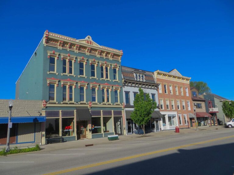
Photo: David Wilson, CC BY 2.0
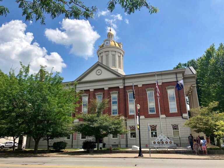
Photo: Warren LeMay, CC0 1.0

Photo: Deana Hunter, CC BY 2.0
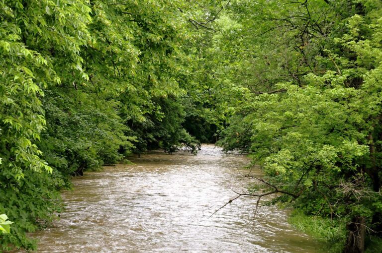
Photo: Kevin Burkett, CC BY-SA 2.0
Plain answers about the Ohio River
Can I fish the Ohio River with an Indiana license?
Yes on the main stem: residents of Indiana or Kentucky may use either state license there; a connecting tributary or embayment needs that state license.
How many bass can I keep from the Ohio River?
6, any combination of largemouth, smallmouth, or spotted bass; size: 12 inches. No size limit on spotted bass.
Is there a size limit on spotted bass in the Ohio River?
The guide row for Ohio River bass reads: 12 inches. No size limit on spotted bass.
What bass rule covers creeks in the Ohio River counties?
12-inch minimum size limit (5 bass daily limit). Blue River in Crawford, Harrison and Washington counties (slot limit applies).
Which Indiana counties border the Ohio River?
Clark County, Crawford County, Dearborn County, Floyd County, Jefferson County, Ohio County, Perry County, Posey County, Spencer County, Switzerland County, Warrick County and Vanderburgh County.
Where can I launch on the Indiana side of the Ohio River?
The DNR maps 27 ramps, among them Duffy's Landing on Ohio River, Madison Ramp on Ohio River and Bryant Creek boat ramp on Ohio River.
Where can I check Ohio River stages?
12 NWS gauges at dams and towns print in the level band with the UTC time read; they are dated, not live.
Can I fish right below an Ohio River dam?
Where to Fish on the Ohio Fishing within 200 yards below any dam on the Ohio River can only be done with a fishing pole or hand line. Fishing sites include: J.T. Myers Dam (Uniontown Dam)—15 miles southwest of Mount Vernon in Posey County, accessible at …
Which Indiana state records came from the Ohio River?
2 records, the heaviest being Blue Catfish at 104 lb. (1999).
Plan a day on the Ohio from an Indiana ramp
Read the Ohio River rows and the Kentucky agreement before launching.