Fishing in Floyd County, Indiana
County seat: New Albany. Population 80,484 (2020 Census).
- 2lake pages
- 1DNR boat ramps
- 4river pages
 Pick for catfishPiscifun LumiCat II catfish rod48% OFFSale $114.99
Photo of Ohio River: William Alden, CC BY-SA 4.0
Floyd County for the angler, in short
At the 2020 count Floyd County had 80,484 residents, with county offices in New Albany. Lakes inside the county show DNR fisheries district 6 in DNR data. Kentucky lies across the Ohio from Floyd County; DNR data lists 1 access site on this side.
The DNR Fishing Access Sites layer places 1 boat ramp inside the county. DNR access data also shows 3 piers and shore sites. DNR stocking data lists 75 stocking rows for lakes and streams here.
Census 2020 population; Indiana DNR public lakes layer (county, owner, fisheries district number, location text), read November 5, 2026. Indiana DNR Fishing Access Sites layer (shown on the DNR Where to Fish map; attributes as recorded, blank where not recorded), read November 5, 2026. Indiana DNR fish stocking dashboard (year, month, water, species, number and average length as listed; repeat stockings summed by DNR), read November 5, 2026.
Every DNR access point across Floyd County, pinned
Indiana DNR Fishing Access Sites layer (shown on the DNR Where to Fish map; attributes as recorded, blank where not recorded), read November 5, 2026. Lake points from the Indiana DNR public lakes layer (county, owner, fisheries district number, location text), read November 5, 2026.
The paged lakes of Floyd County
| Lake | Area | Max depth | Kind | Ramps | Fish the DNR names |
|---|---|---|---|---|---|
| IU Southeast Pond | pond | 0 | channel catfish | ||
| Kiwanis Lake | lake | 0 | channel catfish, catfish, largemouth bass |
Lake pages just past Floyd County follow, with miles from New Albany.
| Lake | From New Albany | Area | Max depth | Kind | Ramps | Fish the DNR names |
|---|---|---|---|---|---|---|
| Deam Lake | 11 miles north | 190 acres (NHD outline area) | lake | 1 | bluegill, redear sunfish, catfish | |
| Buffalo Trace Lake | 17 miles northwest | lake | 0 | bluegill, redear sunfish, catfish | ||
| Pine Lake (Clark County) | 17 miles north | 1 acres (NHD outline area) | lake | 0 | bluegill, redear sunfish, catfish | |
| Franke Lake | 17 miles north | 8 acres (NHD outline area) | lake | 1 | bluegill, redear sunfish, catfish | |
| Oak Lake | 17 miles north | 4 acres (NHD outline area) | lake | 0 | bluegill, redear sunfish, catfish | |
| Schlamm Lake | 18 miles north | 19 acres (NHD outline area) | lake | 1 | bluegill, redear sunfish, catfish |
Acres are the NHD outline area of the mapped lake (USGS National Hydrography Dataset via IndianaMap), not a DNR survey figure. Maximum depths from DNR Status & Trends surveys with the survey year. Indiana DNR Fishing Access Sites layer (shown on the DNR Where to Fish map; attributes as recorded, blank where not recorded), read November 5, 2026.
 For the catfish herePiscifun Chaos XS round baitcaster36% OFFSale $57.99
Ohio River landings in Floyd County
The Ohio River page has the river limits; here are the county's access sites.
- Jaycees Boat Ramp on Ohio RiverOhio River, concrete ramp, restrooms, lights, no fee recorded
The guide's river bass note for the Ohio River counties reads: All rivers and streams in Posey, Vanderburgh, Warrick, Spencer, Perry, Crawford, Harrison, Floyd, Clark, Jefferson, Switzerland, Ohio, and Dearborn counties (with the exception of the Blue River, where the slot limit applies in Crawford, Harrison, and Washington counties).
Ohio River rows and reciprocity as printed, 2026-2027 Indiana Fishing Regulations Guide (eRegulations, linked from the Indiana DNR), read November 5, 2026. Indiana DNR Fishing Access Sites layer (shown on the DNR Where to Fish map; attributes as recorded, blank where not recorded), read November 5, 2026.
Most-named fish on water close to Floyd County
Bars count lake guides within 50 miles of New Albany where the DNR names each fish; bluegill comes up most.
Species the DNR names on lakes and access sites, the DNR stocking dashboard and record list, counted per lake page within 50 miles; not a survey of fish numbers.
Smaller lakes on the Floyd County roll
These 1 Floyd County waters are listed until the DNR publishes more on them.
| Water | Kind | Area | Nearest town |
|---|---|---|---|
| Georgetown Lake | lake | 14 acres (NHD outline area) | Georgetown |
Indiana DNR public lakes layer (county, owner, fisheries district number, location text), read November 5, 2026. Acres are the NHD outline area of the mapped lake (USGS National Hydrography Dataset via IndianaMap), not a DNR survey figure.
Floyd County creeks with a guide
- Buck Creek (Floyd and Harrison Counties)NRC Outstanding River (2013 list), 3 USGS gauges
- Indian Creek (Clark and Floyd Counties)NRC Outstanding River (2013 list)
- Little Indian Creek (Clark and Floyd Counties)NRC Outstanding River (2013 list)
- Silver Creek (Clark and Floyd Counties)1 USGS gauge
Floyd County stream gauges, live
| USGS gauge | Latest reading | Time (ET) |
|---|---|---|
| Silver Ck At Brown's Station Way At New Albany, In | 6.36 ft gage height | Nov 13 12:00 am |
US Geological Survey provisional data, retrieved Nov 13, 2026 12:34 am ET. Provisional readings can be revised.
NHD named flowlines (mapped length in Indiana), DNR Outstanding River, put-and-take and salmonid stream lists, DNR access sites and USGS gauges (live readings); read November 5, 2026.
Stage and discharge notes by Floyd County
| Gauge | Reading | Flow | Flood category | Time (UTC) |
|---|---|---|---|---|
| Ohio River at McAlpine Lower | 13.16 ft | – | no flooding | 2026-11-05 20:00:00 UTC |
| Ohio River at McAlpine Upper | 12.63 ft | 213 kcfs | no flooding | 2026-11-05 20:00:00 UTC |
| Silver Creek (IN) at Sellersburg | 4.85 ft | 0.0873 kcfs | not defined | 2026-11-05 19:30:00 UTC |
| Ohio River at Louisville Water Tower | 12.84 ft | – | not defined | 2026-11-05 20:00:00 UTC |
| Ohio River at Riverview Park | 12.32 ft | – | not defined | 2026-11-05 19:45:00 UTC |
The forecast-service figures show when they were taken and do not update.
NOAA National Water Prediction Service gauge readings (water.noaa.gov), read November 5, 2026; dated readings, not live (kcfs = thousand cubic feet per second).
Floyd County launch sites on the DNR layer
- Jaycees Boat Ramp on Ohio RiverOhio River, concrete ramp, restrooms, lights, no fee recorded
Piers and shore access across Floyd County
- Kiwanis Lake (Sam Peden Community Park)Kiwanis Lake, urban fishing site
- Kiwanis Lake Urban Fishing SiteKiwanis Lake, shore access
- Silver Creek LandingSilver Creek (Clark and Floyd Counties), shore access, ADA access, no fee recorded
Indiana DNR Fishing Access Sites layer (shown on the DNR Where to Fish map; attributes as recorded, blank where not recorded), read November 5, 2026.
Floyd County stocking history
| Year | Month | Water | Species (as listed) | Number | Avg length (in) |
|---|---|---|---|---|---|
| 2025 | November | IU Southeast Pond | Channel Catfish | 360 | 8.64 |
| 2025 | November | Kiwanis Lake | Channel Catfish | 690 | 8.64 |
| 2024 | November | IU Southeast Pond | Channel Catfish | 310 | 8.37 |
| 2024 | November | Kiwanis Lake | Channel Catfish | 390 | 8.37 |
| 2023 | October | IU Southeast Pond | Channel Catfish | 360 | 8.5 |
| 2023 | October | Kiwanis Lake | Channel Catfish | 690 | 8.5 |
| 2022 | November | IU Southeast Pond | Channel Catfish | 360 | 8.6 |
| 2022 | November | Kiwanis Lake | Channel Catfish | 690 | 8.6 |
| 2021 | November | IU Southeast Pond | Channel Catfish | 288 | 9.09 |
| 2021 | November | Kiwanis Lake | Channel Catfish | 552 | 9.09 |
| 2020 | October | IU Southeast Pond | Channel Catfish | 360 | 8.11 |
| 2020 | October | Kiwanis Lake | Channel Catfish | 690 | 8.11 |
| 2019 | October | IU Southeast Pond | Channel Catfish | 360 | 8.6 |
| 2019 | October | Kiwanis Lake | Channel Catfish | 690 | 8.6 |
| 2018 | October | IU Southeast Pond | Channel Catfish | 360 | 8.02 |
| 2018 | Multiple | Kiwanis Lake | Channel Catfish | 1,868 | 6.87 |
| 2017 | October | IU Southeast Pond | Channel Catfish | 360 | 9.45 |
| 2017 | October | Kiwanis Lake | Channel Catfish | 690 | 9.45 |
| 2016 | November | IU Southeast Pond | Channel Catfish | 360 | 7.8 |
| 2016 | November | Kiwanis Lake | Channel Catfish | 690 | 8.6 |
| 2016 | September | Kiwanis Lake | Bluegill | 790 | 3.65 |
| 2016 | September | Kiwanis Lake | Hybrid Sunfish | 8 | 8.0 |
| 2016 | September | Kiwanis Lake | Largemouth Bass | 127 | 10.17 |
| 2015 | October | IU Southeast Pond | Channel Catfish | 360 | 9.08 |
| 2015 | October | Kiwanis Lake | Channel Catfish | 690 | 9.08 |
| 2014 | October | IU Southeast Pond | Channel Catfish | 300 | 9.2 |
| 2014 | October | Kiwanis Lake | Channel Catfish | 690 | 9.2 |
| 2013 | October | IU Southeast Pond | Channel Catfish | 360 | 9.04 |
| 2013 | Multiple | Kiwanis Lake | Channel Catfish | 1,452 | 12.94 |
| 2012 | October | IU Southeast Pond | Channel Catfish | 327 | 9.09 |
Indiana DNR fish stocking dashboard (year, month, water, species, number and average length as listed; repeat stockings summed by DNR), read November 5, 2026; rows reach the county through the water they name.
Minnow runs out of Floyd County
- Bass Pro Shops Clarksvillesporting goods store, Clarksville, 4 miles
- Dick's Sporting Goods Jeffersonvillesporting goods store, Jeffersonville, 4 miles
- Academy Sports + Outdoors Jeffersonvillesporting goods store, Jeffersonville, 4 miles
- Four Seasons Market & Baitbait and tackle shop, Borden, 9 miles
- Sawyer's Wholesale Bait Cobait and tackle shop, Charlestown, 13 miles
Yellow Pages and chain store listings; straight-line miles from New Albany.
Guide limits that cover Floyd County
The statewide limits cover Floyd County except where the guide lists a water by name. Indiana residents buy the annual license for $23; out-of-state anglers spend $60.
| Species | Daily limit | Size limit |
|---|---|---|
| Bluegill | Unlimited | no size limit |
| Redear Sunfish | 25 | no size limit |
| Black Bass: largemouth, smallmouth, and spotted bass (in lakes) | 5, any combination of largemouth, smallmouth, or spotted bass | 14 inches |
| Black Bass: largemouth, smallmouth, and spotted bass (in rivers and streams) | 5, any combination of largemouth, smallmouth, or spotted bass | No fish 12 to 15 inches may be kept, and no more than two fish over 15 inches may be kept |
| Black Bass: largemouth, smallmouth, and spotted bass (in Lake Michigan) | 3, any combination of largemouth, smallmouth, or spotted bass | 14 inches |
| Yellow Bass | Unlimited | no size limit |
| White Bass, Hybrid Striped Bass | 12, any combination of white bass or hybrid striped bass | No more than two fish may exceed 17 inches |
| Striped Bass | 2 | no size limit |
| Rock Bass | 25 | no size limit |
| Crappie | 25 | no size limit |
| Walleye, Walleye-Sauger Hybrid (Saugeye), Sauger | 6, any combination of walleye, walleye-sauger hybrid, and sauger | For walleye: 14 inches south of SR 26; 16 inches north of SR 26 For sauger and saugeye: No size limit |
| Muskellunge and Tiger Muskellunge | 1 muskellunge or 1 tiger muskellunge | 36 inches |
| Northern Pike | 3 | 24 inches; no more than one 30 inches or longer |
| Yellow Perch | Unlimited (15 only on Lake Michigan) | no size limit |
| Catfish: Channel, Blue, Flathead (in rivers and streams) | Unlimited | 13 inches; not more than one blue catfish that’s at least 35 inches, one flathead catfish at least 35 inches, and one channel catfish at least 28 inches or longer may be kept |
| Catfish: Channel, Blue, Flathead (in lakes) | 10 | None; not more than one blue catfish that’s at least 35 inches, one flathead catfish at least 35 inches, and one channel catfish at least 28 inches or longer may be kept |
| Bullhead | Unlimited | no size limit |
| Shovelnose Sturgeon | Unlimited | 25 inches (fork length) |
River rows that apply in Floyd County
| Species | Daily limit | Size limit |
|---|---|---|
| Largemouth, smallmouth and spotted bass | 6, any combination of largemouth, smallmouth, or spotted bass | 12 inches No size limit on spotted bass |
| Hybrid striped, striped, white and yellow bass | 30, any combination of hybrid, striped, white, or yellow bass | No more than four fish may be 15 inches or longer |
| Rock Bass | 15 | no size limit |
| Blue Catfish | Unlimited | 13 inches; no more than one may be 35 inches or longer |
| Channel Catfish | Unlimited | 13 inches; no more than one may be 28 inches or longer |
| Flathead Catfish | Unlimited | 13 inches; no more than one may be 35 inches or longer |
| Crappie | 30 | no size limit |
| Muskellunge and tiger muskellunge | 2, any combination of muskellunge or tiger muskellunge | 30 inches |
| Walleye, sauger and saugeye | 6, any combination of walleye, sauger, or hybrid walleye | 14 inches |
| Shovelnose Sturgeon | Unlimited | 25 inches (fork length) |
Statewide limits as printed, 2026-2027 Indiana Fishing Regulations Guide (eRegulations, linked from the Indiana DNR), read November 5, 2026. Ohio River rows and reciprocity as printed, 2026-2027 Indiana Fishing Regulations Guide (eRegulations, linked from the Indiana DNR), read November 5, 2026. Indiana DNR license fees (license year April 1 to March 31), read November 5, 2026.
Record Fish Program lines naming Floyd County
| Species | Weight | Water | County | Year |
|---|---|---|---|---|
| Longnose Gar | 23 lb. 12.2 oz. | Ohio River | Floyd County | 2025 |
Indiana DNR Indiana Record Fish Program list (keeper: Indiana DNR Division of Fish & Wildlife (Indiana Record Fish Program); angler names left off here), read November 5, 2026.
Bass club tournaments across Floyd County
Floyd County lakes host 13 posted events; 2 have not been fished yet.
Organizer schedule and results pages (the DNR publishes no tournament calendar); most listings are Indiana Bass Federation member club events; checked November 2026.
Gear and guide listings for Floyd County
Floyd County fishing guides
- The Obsession Outdoorsfishing guide, (502) 548-6886
- Top 2% Guide Services LLCfishing guide, (573) 418-2148
- Twin Eagles Catfish Chartersfishing guide, (812) 719-6777
Yellow Pages, chain store and DNR property listings; the DNR licensed fishing guide list and tourism bureau charter listings (matched by the waters they list or their county), read November 5, 2026.
Neighbouring pages for Floyd County
Town pages for Floyd County
- New Albanypop. 37,841
- Georgetownpop. 3,805
- Greenvillepop. 1,365
Neighbours of Floyd County
- Harrison County14 miles southwest
- Clark County15 miles northeast
- Washington County22 miles northwest
- Scott County26 miles north
Spinning reels from Piscifun suited to Floyd County


Piscifun and Amazon links are affiliate links; the site earns a commission on qualifying purchases.
Fish to know on sight at Floyd County

Photo: USFWS Mountain-Prairie, Public domain

Photo: USFWS Mountain-Prairie, Public domain

Photo: Heath Alseike, CC BY 2.0
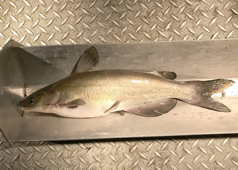
Photo: Oregon Department of Fish & Wildlife, CC BY-SA 2.0
Floyd County fishing questions
Does Floyd County offer a public boat ramp?
The DNR lists 1 boat ramp; Jaycees Boat Ramp on Ohio River is the first.
Which Floyd County lake has the most mapped area?
No lake guide falls inside; Deam Lake, 11 miles away, is the closest.
What species does the DNR name on lakes around Floyd County?
Bluegill leads the count of lake pages within 50 miles, then largemouth bass, redear sunfish and channel catfish; the DNR names them on lake and access records.
Where does a Floyd County angler buy minnows?
Bait here comes from stores across the county line.
In which town are the Floyd County offices located?
The seat is New Albany.
What does a non-Hoosier pay to fish in Floyd County?
Indiana residents buy the annual license for $23; out-of-state anglers spend $60.
Which Indiana counties are close to Floyd County?
Look at Harrison County, Clark County and Washington County next.
Does the DNR number a district for Floyd County lakes?
The DNR lake layer gives the county's own lakes the number for DNR fisheries district 6.
Is there shore access in Floyd County?
The DNR layer lists 3 piers and shore sites, such as Kiwanis Lake (Sam Peden Community Park).
How many events list Floyd County water?
13 events on file; the next is Phoenix BFL Team/Solo Ohio River-Tanners Creek (June 2027) on Ohio River, June 26, 2027.
Are Floyd County lakes stocked?
The DNR dashboard carries 75 rows; the newest lists 690 Channel Catfish, 8.64 in average (November 2025) in Kiwanis Lake.
Which record weights name Floyd County as the county?
Longnose Gar, 23 lb. 12.2 oz., 2025, from Ohio River.
Is there Ohio River access in Floyd County?
Along the Ohio River, Floyd County holds 1 access site in the DNR access layer.
Fish Floyd County for a whole weekend
River pages carry USGS gauges that update themselves.