Fishing in Idaho County, Idaho
County seat: Grangeville. Population 16,541.
- 33lake pages
- 15launch sites
- 25river pages
 Pick for salmonPiscifun Viper X spinning reel50% OFFSale $39.99
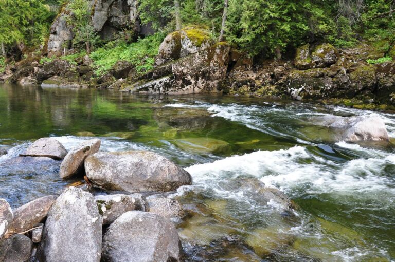
Photo of Selway River: Forest Service Northern Region, CC BY 2.0
Reservoirs, creeks and launches of Idaho County at a glance
Idaho County keeps its courthouse in Grangeville, and the 2020 Census put 16,541 people inside the county. The IDFG Fishing Planner files 82% of the county's listed waters under the IDFG Clearwater Region; drainage lines, not the county line, decide the rest. The Planner also lists 442 high mountain lakes here, most reached by trail.
Lake guides cover 33 waters totalling 1,335 acres; Big Hazard Lake is the biggest. Ocean-run fish show up on the game fish lists of Salmon River, Middle Fork Salmon River, South Fork Salmon River and Clearwater River. Agency maps show 15 launch sites (7 IDFG, 5 Forest Service and 3 BLM). IDFG maps 9 walk-in access sites for anglers on foot.
Census 2020 population and county seat; IDFG Idaho Fishing Planner (list of Idaho waters), read November 7, 2026. IDFG Fishing and Boating Access Sites layer (ArcGIS service), read November 7, 2026.
 For the salmon herePiscifun AlumiX spinning reel46% OFFSale $64.99
A map of Idaho County launches and lake points
IDFG Fishing and Boating Access Sites, BLM and Forest Service launch points, Fishing Planner lake points (outlet) and stream midpoints. Checked November 2026.
Idaho County lakes and reservoirs with their own page
| Lake | Acres | Launches | Kind | Game fish IDFG names |
|---|---|---|---|---|
| Big Hazard Lake | 142 | 0 | high mountain lake | brook trout, rainbow trout |
| Big Sand Lake | 75 | 0 | high mountain lake | |
| Hazard Lake | 63 | 0 | high mountain lake | brook trout, rainbow trout |
| Moores Lake | 56 | 0 | high mountain lake | |
| Fish Lake (Idaho County) near Kamiah | 54 | 0 | high mountain lake | |
| Canyon Lake | 54 | 0 | high mountain lake | rainbow trout |
| Marion Meadows | 53 | 0 | high mountain lake | |
| Baldy Lake | 47 | 0 | high mountain lake | rainbow trout |
| Old Man Lake | 46 | 0 | high mountain lake | brook trout |
| Sheep Lake | 45 | 0 | high mountain lake | rainbow trout |
| Crystal Lake (Idaho County) | 45 | 0 | high mountain lake | |
| Cub Lake | 42 | 0 | high mountain lake | |
| Black Lake (Idaho County) | 41 | 0 | high mountain lake | rainbow trout |
| Upper Hazard Lake | 39 | 0 | high mountain lake | brook trout, tiger muskellunge, rainbow trout |
| Battle Lake | 36 | 0 | high mountain lake | rainbow trout |
| Tolo Lake | 36 | 1 | lake | bluegill and sunfish, largemouth bass, channel catfish |
| Middle Walton Lake | 32 | 0 | high mountain lake | |
| North White Cap Lake | 32 | 0 | high mountain lake | rainbow trout |
| Parachute Lake | 32 | 0 | high mountain lake | |
| Fish Lake (Idaho County) near McCall | 32 | 0 | high mountain lake | cutthroat trout, rainbow trout, rainbow x cutthroat trout |
| Sheepeater Lake | 31 | 0 | high mountain lake | cutthroat trout, golden trout |
| White Sand Lake | 30 | 0 | high mountain lake | |
| Lily Lake | 30 | 0 | high mountain lake | |
| Fish Lake (Idaho County) near Grangeville | 30 | 0 | high mountain lake | |
| Florence Lake | 30 | 0 | high mountain lake | cutthroat trout, rainbow trout |
| Elizabeth Lake | 29 | 0 | high mountain lake | brook trout, cutthroat trout |
| Long Lake | 29 | 0 | high mountain lake | |
| North Goat Lake | 29 | 0 | high mountain lake | |
| Moose Jaw Meadows | 28 | 0 | high mountain lake | |
| Coquina Lake | 28 | 0 | high mountain lake | |
| Emerald Lake (Idaho County) | 27 | 0 | high mountain lake | rainbow trout |
| Hoodoo Lake (Idaho County) | 6 | 0 | high mountain lake | rainbow trout |
| Long Gulch Pond | 5 | 1 | lake |
Surface acres as listed in the IDFG Idaho Fishing Planner, read November 7, 2026. Game fish are the Planner’s recommended species; IDFG prints no lake depths there.
Which fish the Planner ties to water near Idaho County
Out to 50 miles from Grangeville, rainbow trout turns up on the most lake pages.
IDFG Fishing Planner recommended game fish and stocking rows, counted per lake page within 50 miles; not a creel survey.
More named Idaho County lakes on the Planner list
Another 423 named lakes in Idaho County have too few published facts for a page and are listed here by size.
| Water | Acres | Kind | Nearest town |
|---|---|---|---|
| Hungry Lake | 25 | high mountain lake | Kamiah |
| North Walton Lakes | 24 | high mountain lake | Kamiah |
| Bigfoot Lake | 24 | high mountain lake | Salmon |
| Lower Two Lake | 23 | high mountain lake | Kamiah |
| Lloyd Lake | 23 | high mountain lake | Kamiah |
| Maud Lake | 23 | high mountain lake | Kamiah |
| Spread Point Lake | 23 | high mountain lake | Grangeville |
| Bell Lake | 22 | high mountain lake | Salmon |
| Rainbow Lake | 22 | high mountain lake | McCall |
| Indian Lake (Idaho County) | 21 | high mountain lake | Kamiah |
| Bills Lake | 21 | high mountain lake | Salmon |
| Running Lake | 21 | high mountain lake | Grangeville |
| Upper Two Lake | 21 | high mountain lake | Kamiah |
| Flossie Lake | 20 | high mountain lake | McCall |
| Lower Wiseboy Lake | 20 | high mountain lake | Grangeville |
| Brushy Fork Lake | 19 | high mountain lake | Salmon |
| Moose Lake | 19 | high mountain lake | Kamiah |
| Corky Lake | 19 | high mountain lake | Kamiah |
| South Lake Creek Lake | 19 | high mountain lake | Grangeville |
| East Wind Lake | 18 | high mountain lake | Kamiah |
| Bear Lake | 18 | high mountain lake | Grangeville |
| Marshall Lake | 17 | high mountain lake | McCall |
| Upper Bear Lake | 17 | high mountain lake | Salmon |
| Wildhorse Lake | 16 | high mountain lake | Grangeville |
| Park Lake | 16 | high mountain lake | Kamiah |
| Buck Lake | 16 | high mountain lake | McCall |
| Gem Lake | 16 | high mountain lake | McCall |
| Disappointment Lake | 15 | high mountain lake | McCall |
| North Lone Lake | 15 | high mountain lake | Kamiah |
| Duck Lake | 15 | high mountain lake | Kamiah |
| Upper Trilby Lake | 15 | high mountain lake | Grangeville |
| Middle Wind Lake | 14 | high mountain lake | Kamiah |
| Colt Lake | 14 | high mountain lake | Kamiah |
| Isaac Lake | 14 | high mountain lake | Kamiah |
| Hump Lake | 14 | high mountain lake | Grangeville |
| Kettle Lake | 14 | high mountain lake | Kamiah |
| Upper Gospel Lake | 14 | high mountain lake | Grangeville |
| Storm Lake | 13 | high mountain lake | Kamiah |
| May Lake | 13 | high mountain lake | Kamiah |
| Lower Trilby Lake | 13 | high mountain lake | Grangeville |
| Siah Lake | 13 | high mountain lake | Kamiah |
| West Goat Lake | 13 | high mountain lake | Kamiah |
| Dog Lake | 13 | high mountain lake | McCall |
| South Lone Lake | 13 | high mountain lake | Kamiah |
| Upper Twin Lake | 13 | high mountain lake | Grangeville |
| Middle North Three Links Lake (Valhalla) | 12 | high mountain lake | Kamiah |
| Cutthroat Lake | 12 | high mountain lake | McCall |
| Duck Lake | 12 | high mountain lake | McCall |
| South Doe Lake | 12 | high mountain lake | Kamiah |
| Tadpole Lake | 12 | high mountain lake | Kamiah |
| East Dennis Lake | 12 | high mountain lake | Salmon |
| Saddle Lake | 12 | high mountain lake | Grangeville |
| South White Cap Lake | 12 | high mountain lake | Salmon |
| Porphyry Lake | 12 | high mountain lake | Kamiah |
| Lower Gospel Lake | 12 | high mountain lake | Grangeville |
| Scribner Lake | 12 | high mountain lake | McCall |
| East Dead Elk Lake | 11 | high mountain lake | Kamiah |
| Swet Lake | 11 | high mountain lake | Salmon |
| Twin Lakes (Lower) | 11 | high mountain lake | Grangeville |
| Gold Pan Lake | 11 | high mountain lake | Salmon |
| Hidden Lake (Idaho County) | 11 | high mountain lake | McCall |
| Kidney Lake | 11 | high mountain lake | Kamiah |
| Lower Diamond Lake | 11 | high mountain lake | Salmon |
| Rainbow Lake | 11 | high mountain lake | Grangeville |
| Sponge Lake | 11 | high mountain lake | Kamiah |
| North North Three Links Lake (Neck Island) | 11 | high mountain lake | Kamiah |
| Ruby Lake | 11 | high mountain lake | Grangeville |
| Dodge Lake | 11 | high mountain lake | Kamiah |
| South Goat Lake | 11 | high mountain lake | Kamiah |
| Moose Lake | 11 | high mountain lake | Kamiah |
| South Spruce Creek Lake | 10 | high mountain lake | Kamiah |
| North Creek Lake | 10 | high mountain lake | McCall |
| Skookum Lake | 10 | high mountain lake | Kamiah |
| South Walton Lake | 10 | high mountain lake | Kamiah |
| Lower Slate Lake | 10 | high mountain lake | Grangeville |
| Echo Lake | 10 | high mountain lake | McCall |
| Shining Lake | 10 | high mountain lake | Grangeville |
| Hidden Lake (Idaho County) | 9 | high mountain lake | Salmon |
| Serene Lake | 9 | high mountain lake | McCall |
| Shelf Lake | 9 | high mountain lake | McCall |
| Upper North Three Links Lake (Mecca) | 9 | high mountain lake | Kamiah |
| East Colt Creek Lake | 9 | high mountain lake | Kamiah |
| Upper Elk Track Lake | 9 | high mountain lake | Salmon |
| West Dennis Lake | 9 | high mountain lake | Salmon |
| Bitch Lake | 9 | high mountain lake | Kamiah |
| Deer Lake | 9 | high mountain lake | Grangeville |
| Quartzite Lake | 9 | high mountain lake | Grangeville |
| Brown Lake | 9 | high mountain lake | Grangeville |
| Lottie Lake | 9 | high mountain lake | Kamiah |
| Twentymile Lake | 9 | high mountain lake | Grangeville |
| Moore Lake | 9 | high mountain lake | Kamiah |
| Hard Creek Lake | 8 | high mountain lake | McCall |
| West Lake Creek Lake | 8 | high mountain lake | Grangeville |
| California Lake | 8 | high mountain lake | Kamiah |
| East Triple Creek Lake | 8 | high mountain lake | Salmon |
| Union Lake | 8 | high mountain lake | McCall |
| Grouse Lake | 8 | high mountain lake | Kamiah |
| Lower Garnet Lake | 8 | high mountain lake | Kamiah |
| Mirror Lake | 8 | high mountain lake | McCall |
| Little Park Lake | 8 | high mountain lake | Kamiah |
| Triangle Lake | 8 | high mountain lake | McCall |
| John Lake | 8 | high mountain lake | McCall |
| Rock Lake | 8 | high mountain lake | Kamiah |
| Elk Lake | 8 | high mountain lake | McCall |
| Swartz Pond | 8 | lake | Grangeville |
| Wounded Doe Lake | 8 | high mountain lake | Kamiah |
| Lake Rock Lake | 7 | high mountain lake | McCall |
| West Fork Lake Creek Lake | 7 | high mountain lake | McCall |
| Stingray Lake | 7 | high mountain lake | Salmon |
| Lloyds Lake | 7 | high mountain lake | McCall |
| Middle Dennis Lake | 7 | high mountain lake | Salmon |
| West White Cap Lake | 7 | high mountain lake | Salmon |
| Coolwater Lake | 7 | high mountain lake | Kamiah |
| Wahoo Lake | 7 | high mountain lake | Kamiah |
| Basin Lake | 7 | high mountain lake | McCall |
| Hamilton Lakes | 7 | high mountain lake | Salmon |
| Hidden Lake (Idaho County) | 7 | high mountain lake | Grangeville |
| Lost Lake | 7 | high mountain lake | Grangeville |
| Middle Knob Lake | 7 | high mountain lake | Grangeville |
| Upper Cannon Lake | 7 | high mountain lake | McCall |
Alpine lakes make up 442 of these. Idaho high mountain lakes
IDFG Idaho Fishing Planner (list of Idaho waters), read November 7, 2026.
Rivers and trout creeks of Idaho County
- Salmon RiverIDFG recommended water, steelhead or salmon listed, 4 USGS gauges, 425.3 mi Planner length
- Middle Fork Salmon RiverIDFG recommended water, steelhead or salmon listed, 105.6 mi Planner length
- Selway RiverIDFG recommended water, 1 USGS gauge, 100.1 mi Planner length
- South Fork Salmon RiverIDFG recommended water, steelhead or salmon listed, 90.3 mi Planner length
- Clearwater RiverIDFG recommended water, steelhead or salmon listed, 3 USGS gauges, 74.8 mi Planner length
- Lochsa RiverIDFG recommended water, steelhead or salmon listed, 1 USGS gauge, 69.2 mi Planner length
- South Fork Clearwater RiverIDFG recommended water, steelhead or salmon listed, 62.9 mi Planner length
- Little Salmon RiverIDFG recommended water, steelhead or salmon listed, 1 USGS gauge, 52 mi Planner length
- Red RiverIDFG recommended water, 30.4 mi Planner length
- Middle Fork Clearwater RiverIDFG recommended water, steelhead or salmon listed, 23.3 mi Planner length
- Crooked ForkIDFG recommended water, 23.2 mi Planner length
- American RiverIDFG recommended water, steelhead or salmon listed, 22.4 mi Planner length
- Crooked CreekIDFG recommended water, steelhead or salmon listed, 21.8 mi Planner length
- Newsome CreekIDFG recommended water, 16.1 mi Planner length
- Crooked River (Idaho County)IDFG recommended water, 13.1 mi Planner length
- Brushy Fork CreekIDFG recommended water, 8 mi Planner length
- Lightning Creek (Idaho County)1 launch, 3.4 mi Planner length
- Vinegar Creek1 launch, 1.3 mi Planner length
- Snake River1 launch, 14 USGS gauges
- Lawyer Creek1 USGS gauge, 44.6 mi Planner length
- East Fork Moose Creek34.8 mi Planner length
- Secesh Riversteelhead or salmon listed, 28.9 mi Planner length
- Rapid Riversteelhead or salmon listed, 22.8 mi Planner length
- North Fork Moose Creek20.8 mi Planner length
- Brushy Fork20.2 mi Planner length
Idaho County creeks the Planner names, listed here only (1399)
- Lolo Creek47 mi
- Meadow Creek43.7 mi
- Cayuse Creek35.9 mi
- Cottonwood Creek32.3 mi
- Chamberlain Creek28.8 mi
- Weitas Creek28.5 mi
- Bargamin Creek25.6 mi
- White Cap Creek25.2 mi
- Colt Killed Creek23.3 mi
- Bear Creek22.8 mi
- Slate Creek22.4 mi
- Clear Creek22.3 mi
- Running Creek21.3 mi
- Fish Creek21.1 mi
- French Creek21.1 mi
- Warren Creek20.2 mi
- Big Sand Creek19.9 mi
- Big Mallard Creek19.8 mi
- Johns Creek19.6 mi
- Eldorado Creek18.5 mi
- Threemile Creek18.5 mi
- Warm Springs Creek16.9 mi
- Cub Creek16.6 mi
- Cottonwood Creek16.3 mi
- McCalla Creek16.3 mi
- Rhoda Creek16.3 mi
- Hazard Creek16.2 mi
- Mill Creek16.1 mi
- Tenmile Creek16 mi
- Lake Creek15.8 mi
- Old Man Creek15.6 mi
- Sabe Creek15.3 mi
- Divide Creek15.2 mi
- Hemlock Creek15 mi
- Little Slate Creek15 mi
- Wolf Creek15 mi
- Pettibone Creek14.9 mi
- Shebang Creek14.9 mi
- Meadow Creek14.7 mi
- Rice Creek14.7 mi
- Three Links Creek14.7 mi
- Wind River14.3 mi
- Deep Creek14.1 mi
- Little Clearwater River14.1 mi
- Sheep Creek14.1 mi
- Canyon Creek13.9 mi
- Hungery Creek13.8 mi
- Boulder Creek13.7 mi
- Middle Creek13.7 mi
- South Fork White Bird Creek13.7 mi
- Paradise Creek13.6 mi
- Lake Creek13.3 mi
- Maggie Creek13.2 mi
- Big Creek13.1 mi
- Butcher Creek13.1 mi
- Eagle Creek13.1 mi
- Goat Creek13.1 mi
- Granite Creek13 mi
- California Creek12.8 mi
- Indian Creek12.7 mi
- Marten Creek12.6 mi
- Hard Creek12.5 mi
- Little French Creek12.5 mi
- Stockney Creek12.5 mi
- Big Ramey Creek12.3 mi
- Cave Creek12.3 mi
- Silver Creek12.2 mi
- Buck Lake Creek12 mi
- Deep Creek12 mi
- South Fork Red River11.9 mi
- Partridge Creek11.5 mi
- Beaver Creek11.4 mi
- Cedar Creek11.4 mi
- Fish Lake Creek11.4 mi
- Pete King Creek11.4 mi
- Colt Creek11.3 mi
- Red Rock Creek11.2 mi
- Elkhorn Creek11.1 mi
- Summit Creek11 mi
- Grave Creek10.8 mi
Live river readings in Idaho County
| USGS gauge | Latest reading | Time (ET) |
|---|---|---|
| Salmon River At White Bird Id | 3,820 cfs, 12.42 ft gage height | Nov 13 7:45 pm |
| Selway River Nr Lowell Id | 654 cfs, 3.17 ft gage height | Nov 13 8:00 pm |
| Lochsa River Nr Lowell Id | 510 cfs, 2.06 ft gage height | Nov 13 8:00 pm |
| Sf Clearwater River At Stites Id | 153 cfs, 2.58 ft gage height | Nov 13 8:15 pm |
| Little Salmon River At Riggins Id | 131 cfs, 2.34 ft gage height | Nov 13 8:00 pm |
| Upper Clear Creek Near Kooskia, Id | 28.60 ft gage height | Nov 13 8:15 pm |
US Geological Survey provisional data, retrieved Nov 13, 2026 8:32 pm ET. Provisional readings can be revised.
IDFG Idaho Fishing Planner (list of Idaho waters), read November 7, 2026. Stream lengths as printed in the Planner; USGS gauges live.
Where Idaho County streams carry steelhead or salmon
- Salmon RiverIDFG Southwest Region
- Middle Fork Salmon RiverIDFG Salmon Region
- South Fork Salmon RiverIDFG Southwest Region
- Clearwater RiverIDFG Clearwater Region
- Lochsa RiverIDFG Clearwater Region
- South Fork Clearwater RiverIDFG Clearwater Region
- Little Salmon RiverIDFG Southwest Region
- Middle Fork Clearwater RiverIDFG Clearwater Region
- American RiverIDFG Clearwater Region
- Crooked CreekIDFG Clearwater Region
- Secesh RiverIDFG Southwest Region
- Rapid RiverIDFG Southwest Region
Steelhead and salmon seasons come from separate Fish and Game Commission proclamations, which this site could not read during the November 2026 IDFG site maintenance. Idaho steelhead and salmon rules
IDFG Idaho Fishing Planner (list of Idaho waters), read November 7, 2026.
Stocking rows for Idaho County water
IDFG lists 5,495 hatchery releases into Idaho County water on its Planner pages: 546,297,080 fish in 31 waters.
- Salmon RiverRainbow Trout – Triploid, 26 fish, Catchable (6+ inches), November 5, 2026
- Snake RiverRainbow Trout – Triploid, 500 fish, Catchable (12-14 inches), October 27, 2026
- Snake RiverRainbow Trout – Triploid, 21,576 fish, Catchable (6+ inches), October 22, 2026
- Snake RiverRainbow Trout – Triploid, 5,846 fish, Catchable (12-14 inches), October 21, 2026
- Tolo LakeRainbow Trout – Triploid, 1,047 fish, Catchable (12-14 inches), October 13, 2026
- Salmon RiverCutthroat Trout – Westslope, 38,679 fish, Fry (0-3 inches), October 13, 2026
- Sheep LakeRainbow Trout – Triploid, 4,023 fish, Fry (0-3 inches), September 20, 2026
- Baldy LakeRainbow Trout – Triploid, 1,508 fish, Fry (0-3 inches), September 20, 2026
- Upper Hazard LakeRainbow Trout – Triploid, 1,007 fish, Fry (0-3 inches), September 14, 2026
- Tolo LakeChannel Catfish, 600 fish, Catchable (6+ inches), August 11, 2026
- Salmon RiverRainbow Trout – Triploid, 1,066 fish, Catchable (12-14 inches), August 11, 2026
- Salmon RiverRainbow Trout – Triploid, 2,451 fish, Catchable (12-14 inches), August 7, 2026
Stocking rows as printed on the IDFG Fishing Planner water pages (date, species, number and size as listed), read November 7, 2026. Newest releases first.
Launches and walk-in access of Idaho County
- Button Beach boat ramplaunch site, IDFG, boating access, ramp, restroom, camping
- Campbell Flat boat ramplaunch site, IDFG, boating access, ramp, restroom
- Fenn Pond launchFenn Pond, Forest Service, lake and pond fishing
- Five Mile Pond launchlaunch site, Forest Service, lake and pond fishing
- Lightning Creek boat rampLightning Creek, IDFG, boating access, ramp, restroom, camping
- Long Gulch boat rampLong Gulch Pond, IDFG, boating access, restroom, camping
- Maynard Hole boat ramplaunch site, IDFG, boating access, ramp, restroom
- Pittsburg Landing Boat Launchlaunch site, Forest Service, boating – motorized, ramp
- Tolo Lake boat rampTolo Lake, IDFG, boating access, ramp, dock, restroom
- Twin Bridges boat ramp (west)launch site, IDFG, boating access, ramp, restroom, camping
- Whitewater Boating Site launchlaunch site, Forest Service, boating – motorized
- Lucile Recreation Site launchlaunch site, BLM, boat launch
- Old Lucile Recreation Site launchlaunch site, BLM, boat launch
- Paradise Boating Site launchlaunch site, Forest Service, boating – non-motorized
- Vinegar Creek launchVinegar Creek, BLM, boat launch
IDFG bank spots of Idaho County (9)
- George's Hole fishing accessfishing access, restroom
- Hazzard Creek fishing accessfishing access, restroom, camping
- Strupp fishing accessfishing access, restroom
- Kooskia Game Check fishing accessfishing access, restroom, camping
- Lower Bluff fishing accessfishing access, restroom
- Pasture Hole – Mile Post 192 fishing accessfishing access, restroom
- Rattlesnake fishing accessfishing access
- Scotts Accessfishing access, restroom
- Upper Bluff – Mile Post 190 fishing accessfishing access, restroom, camping
IDFG Fishing and Boating Access Sites layer (ArcGIS service), read November 7, 2026. BLM and Forest Service points as published; lanes and ramp counts are not fields in any layer.
Fish an angler may keep across Idaho County
This is the IDFG Clearwater Region block, since most of Idaho County's listed water sits in it; special rules printed for a water come first. The annual license fee written into Idaho Code 36-416 is $28.75 for an Idahoan and $106.25 for a visitor; GoOutdoorsIdaho and vendors add processing.
| Group | Rule as printed |
|---|---|
| Bass | In rivers and streams, no bag, length or possession limits; In lakes and reservoirs, limit is 6, both species combined |
| Brook Trout | Brook Trout limit is 25; Harvest allowed during any open season unless otherwise noted under Special Rules – if gear or bait restrictions are listed, they apply when fishing for Brook Trout |
| Bull Trout | Bull Trout – catch-and-release |
| Kokanee | Kokanee limit is 25 |
| Salmon | Spring and summer Chinook Salmon seasons and limits are set by the Idaho Fish and Game Commission and issued in separate brochures; Seasons and limits for fall Chinook Salmon and Coho Salmon can be found here; Sockeye Salmon fishing is prohibited. Defined as ocean-run Oncorhynchus nerka longer than 14 inches in the Snake River drainage below Hells Canyon Dam, the Salmon River drainage (excluding above Mosquito Flat D |
| Steelhead | Defined as Rainbow Trout longer than 20 inches in the Snake River drainage below Hells Canyon Dam, the Salmon River drainage (excluding lakes and reservoirs), and the Clearwater River drainage (excluding that portion above Dworshak Dam, and lakes); Fishing for steelhead is prohibited unless a steelhead season is specifically opened for that water. See fishing regulations for details |
| Sturgeon | Sturgeon – catch-and-release; Sturgeon must not be removed from the water and must be released upon landing; Barbless hooks, sliding swivel device to secure a weight, and a lighter test line to secure weight to sliding swivel device are required. See fishing regulations for details |
| Tiger Muskie | Tiger Muskie limit is 2, none under 40 inches |
| Trout | In rivers and streams, trout limit is 2, all species combined; In lakes, reservoirs, ditches and canals, trout limit is 6, all species combined; Bull Trout and Brook Trout are listed separately |
| Walleye | No bag, length, or possession limits. Harvest is encouraged (Stocked illegally in this Region. May be harmful to existing fisheries.) |
| Whitefish | Whitefish limit is 25; Harvest allowed during any open season unless otherwise noted under Special Rules – if gear or bait restrictions are listed, they apply when fishing for whitefish |
| Protected Nongame Fish | May not be harvested or possessed |
| All Other Fish Species | No bag, length, or possession limits |
A few listed waters belong to the IDFG Southwest Region. Every region table
Idaho County water carrying special rules (22)
- American RiverAll Waters Open All Year
- Brushy ForkAll Waters Open All Year
- Brushy Fork CreekAll Waters Open All Year
- Clearwater RiverAll Waters Open All Year
- Crooked CreekAll Waters Open All Year
- Crooked ForkAll Waters Open All Year
- Crooked River (Idaho County)All Waters Open All Year
- East Fork Moose CreekAll Waters Open All Year
- Little Salmon RiverAll Waters Open All Year
- Lochsa RiverAll Waters Open All Year
- Middle Fork Clearwater RiverAll Waters Open All Year
- Middle Fork Salmon RiverAll Waters Open All Year
- Newsome CreekAll Waters Open All Year
- North Fork Moose CreekAll Waters Open All Year
- Rapid RiverAll Waters Open All Year
- Red RiverAll Waters Open All Year
- Salmon RiverAll Waters Open All Year
- Secesh RiverAll Waters Open All Year
- Selway RiverAll Waters Open All Year
- Snake RiverAll Waters Open All Year
All Idaho special rules by water
Region bag limits from Idaho Fishing Seasons and Rules, 2025-2027 for the Clearwater Region, as printed on IDFG Fishing Planner water pages (the brochure PDF on idfg.idaho.gov was unreachable during site maintenance), read November 7, 2026. Fishing license fees as set in Idaho Code 36-416 (statute; IDFG sale prices add vendor and processing fees), read November 7, 2026.
2026 Idaho records tied to Idaho County
Record catches closest to Idaho County came from the waters below, all inside 80 miles.
| Species | Record | Kind | Water | Date |
|---|---|---|---|---|
| Rainbow Trout | 20.03 pounds | certified weight | Dworshak Reservoir | Jan. 13, 2026 |
| Lake Trout | 43.25 inches | catch-and-release (length) | Payette Lake | date not printed |
Idaho state record fish, read November 8, 2026. A partial list: records IDFG announced in 2026.
Tackle, flies and outfitters in Idaho County
Idaho tackle counters in Idaho County
- Dale & Jill's Sporting Goodsbait and tackle shop, Kamiah
- Hells Canyon Outfittersbait and tackle shop, Riggins
- Little River Bait & Tacklebait and tackle shop, Riggins
- Mountain River Outfittersbait and tackle shop, Riggins
- Riggins Tackle Shopbait and tackle shop, Riggins
- Salmon River Toursbait and tackle shop, Riggins
Guides and outfitters based in Idaho County
- Rapid River Outfittersfishing guide, Riggins, (208) 628-3862
- Hammer Down River Excursionsjet boat tours and fishing trips, White Bird, (208) 839-9993
Yellow Pages and chain store listings, guide listings (city of business); retrieved November 7, 2026.
Idaho highways leading out of Idaho County
Motels and diners for a Idaho County trip
- Grangevillepop. 3,308
Idaho county guides sharing a line with Idaho County
- Lewis County53 miles northwest
- Clearwater County58 miles north
- Valley County69 miles south
- Nez Perce County70 miles northwest
Rods, reels and pliers from Piscifun before Idaho County


Piscifun and Amazon links are affiliate links; the site earns a commission on qualifying purchases.
Brief answers on fishing Idaho County
How many IDFG, BLM and Forest Service launches serve Idaho County?
15 launch sites on the access layers (7 IDFG, 5 Forest Service and 3 BLM).
Which lake in Idaho County does IDFG list with the most acres?
Big Hazard Lake, at 142 acres in the IDFG Fishing Planner.
Which game fish does IDFG name on water near Idaho County?
Rainbow trout lead the count of lake pages within 50 miles, followed by largemouth bass, bluegill and sunfish and white crappie.
Which Idaho County stores keep hooks and flies?
6 in all, starting with Dale & Jill's Sporting Goods.
How many Idaho guide listings name a Idaho County town?
Count 2 guide listings with a local city.
Which Idaho town holds the Idaho County county offices?
Grangeville is the seat.
Does fishing in Idaho County need an Idaho license?
The annual license fee written into Idaho Code 36-416 is $28.75 for an Idahoan and $106.25 for a visitor; GoOutdoorsIdaho and vendors add processing.
Which Idaho county guides ring Idaho County?
The nearest county pages are Lewis County, Clearwater County and Valley County.
Which IDFG region covers most Idaho County water?
82% of the Planner waters sit in the IDFG Clearwater Region.
Does IDFG print special rules for any Idaho County water?
The Planner prints special rules for 22 county waters with a page here, starting with American River; the list above shows the first ones.
Does IDFG stock fish in Idaho County?
5,495 IDFG releases listed on Planner pages, 546,297,080 fish; the newest went into Salmon River on Nov. 5, 2026.
Can I fish for salmon in Idaho County?
The Planner lists steelhead or salmon on Salmon River, Middle Fork Salmon River and South Fork Salmon River. This page leaves out steelhead and salmon dates because the Commission proclamations were not reachable on the IDFG site in November 2026.
Choose an IDFG lake or river in Idaho County
Open a lake for its launches, limits and releases.