Fishing in Dyer County, Tennessee
County seat: Dyersburg. 2020 Census: 36,801 residents.
- 4named waters
- 7ramps and marinas
- 1river pages
 Pick for troutPiscifun Carbon X ultralight spinning reel28% OFFSale $57.99
Photo of Reelfoot Lake: Sharon, CC BY-SA 2.0
Opening facts for fishing Dyer County in Tennessee
County offices for Dyer County are in Dyersburg, and the 2020 Census put the population at 36,801. Census tables list 512 square miles of land and 13.8 square miles of water for the county. For current, begin with Mississippi River.
TWRA maps 7 boat ramps and marinas plus 0 other fishing sites inside the line. Named-water limits cover 1 water in Dyer County.
U.S. Census Bureau, 2020 Census counts (TIGERweb) and the 2023 Gazetteer, read November 18, 2026. TWRA public access record (TWRA), read November 18, 2026.
Where TWRA puts the landings of Dyer County
TWRA public access record (TWRA), read November 18, 2026. Water pins use the point in the TWRA or USGS record.
Tennessee lake pages tied to Dyer County
These sit beyond the Dyer County line, with miles from Dyersburg.
| Water | From Dyersburg | Size | TWRA sites | Type | Fish on the TWRA list |
|---|---|---|---|---|---|
| Reelfoot Lake | 24 miles to the north | 10,427 acres | 17 | lake | no TWRA list |
| Herb Parsons Lake | 64 miles to the south | 177 acres | 1 | lake | no TWRA list |
| Wolf River | 68 miles to the south | acreage not printed | 5 | river | no TWRA list |
| Kentucky Lake | 76 miles to the east | about 102,199 acres of mapped outline | 89 | reservoir, TVA-listed | no TWRA list |
Surface acres as published for this water (source), read November 18, 2026. Waters with no published acreage show their NHD outline instead. TWRA record for this water (TWRA), read November 18, 2026.
Rivers to float or wade in Dyer County
- Mississippi Rivernamed in the guide, 6 TWRA access sites, 1 USGS gauge
TWRA and agency records for this river (source), read November 18, 2026. USGS Water Data for the Nation, live through the site, retrieved on page view.
Tennessee trailer launches spread around Dyer County
- Bogota HWY 78 Boat Ramp on Obion Riverboat ramp; free to launch; Dyer County
- Bradley Town Boat Ramp on Obion Riverboat ramp; free to launch; Dyer County
- Bungee Access Area on Mississippi Riverboat ramp; free to launch; Dyer County
- Parker Ditch Boat Ramp on Forked Deer Riverboat ramp; free to launch; Dyer County
- Public boat ramp on Obion Riverboat ramp; free to launch; Dyer County
- Rhodes Lake Boat Launchboat ramp; Dyer County
- Unionville Bat Ramp on Forked Deer Riverboat ramp; free to launch; Dyer County
TWRA public access record (TWRA), read November 18, 2026.
Smaller named waters of Dyer County, each with a pin
Rivers, creeks and tailwaters in Dyer County
| Water | Type | Size | Fish on the TWRA list | TWRA sites | Map pin |
|---|---|---|---|---|---|
| Forked Deer River | river | acreage not printed | no TWRA list | 3 | 35.9127, -89.1248 |
| Obion River | river | acreage not printed | no TWRA list | 4 | 36.0807, -89.4520 |
TWRA record for this water (TWRA), read November 18, 2026. Outline area from the USGS National Hydrography Dataset waterbody layer (NHD service; mapped polygon area, not an agency surface-acre figure), read November 18, 2026.
Other named water in Dyer County
No TWRA lake record covers these, so the rows stay short.
| Water | Type | Size | Fish on the TWRA list | TWRA sites | Map pin |
|---|---|---|---|---|---|
| Rhodes Lake | lake | acreage not printed | no TWRA list | 0 | 35.9545, -89.5951 |
TWRA record for this water (TWRA), read November 18, 2026. Outline area from the USGS National Hydrography Dataset waterbody layer (NHD service; mapped polygon area, not an agency surface-acre figure), read November 18, 2026.
Waters of Dyer County the 2026-27 guide names
The rules here are from the 2026-27 Tennessee Fishing Guide as TWRA posts it online, last updated September 15, 2026; TWRA had published no 2027-28 guide when this site checked.
- Mississippi RiverBlack Bass: 10 per day, no length limit. (Mississippi River (includes adjacent sloughs, bayous, and all river runs and chutes, that are accessible by boat from the river proper))
2026-27 Tennessee Fishing Guide (TWRA), read November 18, 2026.
Trophy-list catches out of Dyer County
| Species | Weight as listed | Water | Year | Class |
|---|---|---|---|---|
| White Bass | 5 lbs. 10 oz. | Mississippi River | 2003 | Class A |
| Black Carp | 114 lbs., 3 oz. (k) | Mississippi River | 2023 | Class B |
| Flathead Catfish | 92 lbs. (k) | Mississippi River | 2000 | Class B |
Tennessee state record fish from TWRA (TWRA page), read November 18, 2026. Angler names are not printed.
Marinas and bait shops in Dyer County
Tackle counters along the road to Dyer County
- Boyette's Resortmarina, Tiptonville, 22 miles
- Reelfoot Quik Shop & Lodgebait and tackle shop, Tiptonville, 22 miles
- Bo's Landingbait and tackle shop, Tiptonville, 22 miles
- Cravens Bait Shopbait and tackle shop, Tiptonville, 23 miles
- Whitehall Grocery & Bait Shopbait and tackle shop, Trenton, 28 miles
Shop and marina listings from directories and operator pages (city of business), read November 18, 2026. Guides are listed as businesses; no license is implied.
A short drive along the ridge from Dyer County
Tennessee town pages inside Dyer County
- Dyersburg2020 count 16,164
- Newbern2020 count 3,349
Over the Tennessee county line from Dyer County
- Lake County20 miles to the north
- Crockett County22 miles to the southeast
- Lauderdale County24 miles to the southwest
- Obion County25 miles to the northeast
Shop lists covering Dyer County
Dyer County is listed with West Tennessee on the shop pages, a site grouping by longitude.
Dated Tennessee pages for Dyer County anglers
Tennessee fishing this week
Tennessee trout stocking by date
Tennessee fish advisories
 For the trout herePiscifun Carbon XT ultralight spinning reel25% OFFSale $59.99
Piscifun gear a Tennessee angler could stow for Dyer County


Piscifun and Amazon links are affiliate links; the site earns a commission on qualifying purchases.
Hollow creeks and river bends by Dyer County through a lens
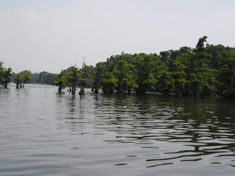
Photo: Ken Ratcliff, CC BY 2.0

Photo: Egan Snow, CC BY-SA 2.0
Lakes, creeks and ramps of Dyer County, answered
How many launches does TWRA map in Dyer County?
The county has 7 ramps and marinas on the TWRA map.
Which TVA or TWRA lake spreads widest in Dyer County?
No lake in the county has a published acreage; the stream rows above cover what the records hold.
Which fish are in the creeks and lakes of Dyer County?
Each lake and stream row above shows the fish TWRA lists for it, where it lists any.
Where can I buy bait in Dyer County, Tennessee?
The nearest shops are outside the county and appear above.
Which town has the Dyer County courthouse square?
Dyersburg holds it.
Do visitors to Dyer County need a TWRA license to fish?
Anglers 13 and older need a Tennessee fishing license; TWRA lists the resident combo hunt/fish license at $33 and the nonresident annual fishing all species license at $98.
Which Tennessee counties ring Dyer County?
Start with Lake County, Crockett County and Lauderdale County.
How many crappie or bass can I keep in Dyer County?
The statewide lines in the 2026-27 Tennessee Fishing Guide apply unless TWRA lists the water by name, and a named-water line wins for the fish it covers; each lake, river and tailwater page here prints its own lines. The rules here are from the 2026-27 Tennessee Fishing Guide as TWRA posts it online, last updated September 15, 2026; TWRA had published no 2027-28 guide when this site checked.
How are the smaller waters of Dyer County listed?
Every one of the 4 named waters on file is listed, linked or pinned.
Are there named-water rules in Dyer County?
1 water with pages here carry their own lines in the 2026-27 guide, starting with Mississippi River.
Which TWRA record fish were landed in Dyer County?
White Bass, 5 lbs. 10 oz., from Mississippi River (2003).
Set up a weekend of fishing in Dyer County
Each water row carries its pin and TWRA species list.