Tennessee Fish Consumption Advisories
TDEC fish-tissue and bacteria postings by water, county and pollutant, revised Aug. 25, 2026.
 For weighing a catchPiscifun Lip gripper with digital scale27% OFFSale $39.99
Photo of Boone Lake: Kyle Hartshorn, CC BY 2.0
Tennessee waters TDEC has posted
TDEC's posted-waters list (revised Aug. 25, 2026) holds 60 fish-tissue rows and 26 bacteria rows. Approximately 264,000 reservoir acres and 600 river miles are currently posted due to contaminated fish (TDEC PDF p. 5); about 100 river miles posted for bacteria (p. 1).
*Precautionary Advisory – Children, pregnant women, and nursing mothers should not consume the fish species named. All other persons should limit consumption of the named species to one meal per month. (TDEC PDF, p. 17)
Rows whose advice reads "Do not eat the fish." or "Fish should not be eaten." are do-not-eat advisories for the stretch named.
TDEC posted fish consumption advisories (TDEC), as of Aug. 2026, read November 18, 2026.
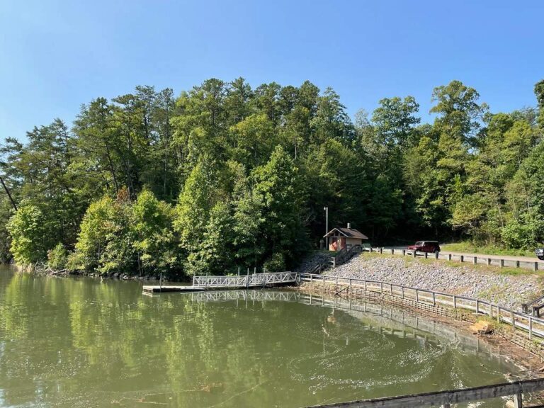
Photo of Parksville Lake: US Forest Service – Southern Region, Public domain
Fish-tissue advisories in West Tennessee
| Water | County | Portion | Pollutant | Advice as posted |
|---|---|---|---|---|
| Beech Reservoir | Henderson | Entirety (877 acres) | Mercury | Precautionary advisory for largemouth bass.* |
| Big Sandy River and Embayment | Henry, Benton, Carroll and Henderson | From Kentucky Reservoir (Tennessee River) to origin (including embayment). (River mile 0.0 to 59.0) | Mercury | Precautionary advisory for all bass species.* |
| Cypress Creek | Shelby | From Wolf River to origin (7.7 miles) | Chlordane, Dieldrin, Endrin, PCBs. | Do not eat the fish. |
| Davy Crockett Lake | Crockett | Entirety (87 acres) | Mercury | Precautionary advisory for largemouth bass. |
| Gibson County Lake | Gibson | Entirety (560 acres) | Mercury | Precautionary advisory for largemouth bass. |
| Hatchie River | Hardeman | From Highway 100 (river mile 126.9) to Hwy 64 (River Mile 147.9). | Mercury | Precautionary advisory for black bass.* |
| Herb Parsons Lake | Fayette | Entirety (177 acres) | Mercury | Precautionary advisory for largemouth bass.* |
| Lake Lajoie | Hardeman | Chickasaw State Park (54 acres) | Mercury | Precautionary advisory for large mouth bass.* |
| Lake Placid | Chester | Chickasaw State Park (54 acres) | Mercury | Precautionary advisory for large mouth bass.* |
| Loosahatchie River | Shelby | From Mississippi River to Hwy 14, Austin Peay Highway (River mile 0.0 to17.0) | Chlordane, Endrin, Dieldrin, Mercury | Do not eat the fish. |
| McKellar Lake | Shelby | Entirety (1,573 acres ) | Chlordane, Endrin, Dieldrin, Dioxin, PCBs. Mercury | Do not eat the fish. |
| Mississippi River | Shelby | From Mississippi state line to just downstream of Meeman-Shelby State Park (31 miles) including Wolf River Harbor/Lagoon. | Chlordane, Endrin, Dieldrin, Dioxin, PCBs. Mercury | Do not eat any fish except silver carp and bighead carp. Commercial fishing prohibited by TWRA for all species excluding silver carp and bighead carp. |
| Nonconnah Creek | Shelby | From McKellar Lake to Horn Lake Road (River mile 0.0 to 1.8) | Chlordane, Endrin, Dieldrin, Dioxin, PCBs | Do not eat the fish. Advisory ends at Horn Lake Road bridge. |
| North Fork Forked Deer River | Dyer, Gibson | From Middle Fork Forked Deer River (River mile 17.6) to State Highway 188 (River mile 23.6) | Mercury | Precautionary advisory for largemouth bass.* |
| Pickwick Reservoir | Hardin, Lauderdale | Entire reservoir portion in Tennessee (5800 acres) Tennessee River from Pickwick dam to Tennessee and Alabama state line | PCBs | Precautionary advisory for catfish* |
| Springville Bottom | Henry | Entirety (36,850 acres), Impounded area upstream of West Sandy Dike) | Mercury | Precautionary advisory for black bass and crappie.* |
| Wolf River | Shelby | From Mississippi River to Germantown Road (River mile 0.0 – 18.9) | Chlordane, Endrin, Dieldrin, Dioxin, PCBs Mercury | Do not eat the fish. |
TDEC posted fish consumption advisories (TDEC), as of Aug. 2026, read November 18, 2026.
Fish-tissue advisories in Middle Tennessee
| Water | County | Portion | Pollutant | Advice as posted |
|---|---|---|---|---|
| Beech Creek | Wayne | From Tennessee River to origin (16.7 miles) | Mercury | Do not eat the fish. Avoid contact with sediment between Leatherwood Branch and Smith Branch. |
| Buffalo River | Humphreys, Perry | From Duck River to Highway 438 ( 31.6 miles) | Mercury | Precautionary advisory for smallmouth bass.* |
| Center Hill Reservoir | Dekalb, Putnam | Entire reservoir (23,051 acres) | Mercury | Precautionary advisory for any size black bass (largemouth, smallmouth, spotted.) and walleye over 19 inches.* |
| Cheatham Reservoir | Cheatham, Davidson, Dickson | Entire reservoir (7450 acres) Cumberland River from Cheatham Dam to Old Hickory Dam. | PCBs | Precautionary advisory for black bass (largemouth, smallmouth, spotted) from Briley Parkway bridge crossing in Pennington Bend (Cumberland River Mile 200) downstream to Briley Parkway (Andrew B. Gibson Bridge) in Cockrell Bend (Cumberland River Mile 182).* Precautionary advisory for Catfish entire reservoir. |
| Duck River | Humphreys, Hickman | From Cold Bramch (River mile 11.5) to Interstate 40 (River mile 31.8) | Mercury, PCB | Precautionary advisory for black bass (largemouth, smallmouth and spotted) for mercury. Precautionary advisory for Catfish for PCB.* |
| East Fork Stones River | Rutherford | From West Fork Stones River to Betty Ford Road (15.4 miles) | Mercury | Precautionary advisory for all bass species. |
| Fall Creek Falls Lake | Van Buren | Entirety (351 acres) | Mercury | Precautionary advisory for largemouth bass. |
| Normandy Reservoir | Bedford Coffee | Entirety (3,260 acres) | Mercury | Precautionary advisory for black bass (largemouth, smallmouth and spotted).* |
| Standing Stone State Park Lake | Overton | Entirety (855 acres) | Mercury | Precautionary advisory for largemouth bass |
| Woods Reservoir | Franklin | Entirety (3,908 acres) | PCBs | Precautionary advisory for catfish. |
TDEC posted fish consumption advisories (TDEC), as of Aug. 2026, read November 18, 2026.
Fish-tissue advisories in East Tennessee
| Water | County | Portion | Pollutant | Advice as posted |
|---|---|---|---|---|
| Abrams Creek | Blount | From Chilhowee Reservoir to Abrams Falls (14.6 miles), within Great Smokey Mountains National Park | Mercury | Precautionary advisory for smallmouth bass.* |
| Bear Creek | Roane | From East Fork Poplar Creek to Hwy 95 (River mile 2.8) | Mercury, PCBs | Fish should not be eaten. |
| Beaver Creek | Sullivan | From Boone Reservoir to Tennessee/Virginia State Line (20.0 miles) | PCBs | Do not consume Carp. |
| Boone Reservoir | Sullivan, Washington | Entirety (4,400 acres) | PCBs, chlordane | Precautionary advisory for carp and catfish.* |
| Chattanooga Creek | Hamilton | From Tennessee River (Nickajack Reservoir) to Georgia state line (7.7 miles) | PCBs, chlordane | Fish should not be eaten. |
| Cherokee Reservoir | Granger, Hamblen, Hawkins, Jefferson | Entirety (28,780 acres) | Mercury | Precautionary advisory for black bass (largemouth, smallmouth, spotted) and Catfish.* |
| Chilhowee Reservoir | Blount, Monroe | Entirety (1,749 acres) | Mercury | Precautionary advisory for all black bass (largemouth, smallmouth, spotted). |
| Daddy’s Creek | Cumberland, Morgan | From Obed River to Interstate 40 (River mile 20). | Mercury | Precautionary advisory for smallmouth bass.* |
| Dale Hollow Reservoir | Clay, Pickett | Entire reservoir within Tennessee (27, 700 acres) | Mercury | Precautionary advisory for walleye and black bass (largemouth, smallmouth, spotted.)* |
| East Fork Poplar Creek | Anderson, Roane | From Poplar Creek embayment(Watts Bar Reservoir) to New Hope Pond (River mile 15.0) | Mercury, PCBs | Fish should not be eaten. |
| Emory River | Roane, Morgan | From Highway 27 (River mile 12.4) to Obed River (River mile 28.4) | Mercury | Precautionary advisory for all fish.* |
| Fort Loudoun Reservoir | Loudon, Blount, Knox | Entirety (14,600 acres) | PCBs, Mercury (Upper portion only) | Commercial fishing for catfish prohibited by TWRA. All size catfish and largemouth bass over two pounds, should not be eaten. Precautionary advisory for any sized largemouth bass from Highway 129 to the confluence of Holston and French Broad Rivers (534 acres).* |
| Fort Patrick Henry Reservoir | Sullivan | Entirety (872 acres). | PCBs | Precautionary Advisory for Catfish.* |
| French Broad River | Knox, Sevier | From Tennessee River to Douglas Dam. (32.1 miles) | Mercury | Precautionary advisory for Black Bass (largemouth, smallmouth, spotted). |
| French Broad River | Cocke | From Rankin Bridge (River mile 71.4) to Hwy 321 (River mile 77.5) | Mercury | Precautionary advisory for largemouth bass.* |
| Hiwassee River | Meigs, McMinn, Bradley | From Highway 58 (River mile 7.4) to railroad bridge just upstream of U. S. Highway 11 (River mile 18.9) | Mercury | Precautionary advisory for largemouth bass.* |
| Holston River | Hawkins, Sullivan | From John Sevier retention weir (River mile 106.2) to the confluence of North Fork Holston River and South Fork Holston River (River mile 142.3) | Mercury | Precautionary advisory for all fish.* |
| Little River | Blount | From Tennessee River (Ft Loudoun Reservoir) to “The Sinks” (River mile 41.5) | Mercury PCBs | Do not consume largemouth bass in Little River embayment of Fort Loudoun Lake (to confluence with Roddy Branch in Rockwood, River mile 5.5) due to PCBs. Precautionary advisory* for black bass (largemouth, smallmouth and spotted) from Hwy 129 (river mile 2.6) to “The Sinks” (River Mile 41.5) due to Mercury. |
| Melton Hill Reservoir | Knox, Anderson | Entirety (5,690 acres) | PCBs | Catfish should not be eaten. |
| Mitchell Branch | Roane | From Poplar Creek to origin (East Tennessee Technology Park, ORNL property). (1.0 miles) | Mercury, PCBs | Precautionary advisory all species.* |
| Nickajack Reservoir | Hamilton, Marion | Entirety (10,370 acres) | PCBs | Precautionary advisory for catfish.* |
| Nolichucky River | Cocke, Greene, Hamblen, Unicoi, Washington | From Douglas Reservoir (French Broad River) to North Carolina state line (99.21 miles) including Davy Crockett Lake. | Mercury | Precautionary advisory the entire length within Tennessee for black bass (largemouth, smallmouth and spotted). Precautionary advisory for channel catfish in the lower portion from Douglas Reservoir to the mouth of Bent Creek at river mile 14.9.* |
| Norris Reservoir | Campbell, Anderson, Union, Claiborne, Grainger | Clinch River Arm from Powell River to Indian Creek (River mile 148.2) (15,213 Acres) | Mercury | Precautionary advisory for largemouth bass, striped bass, smallmouth bass, and sauger.* |
| North Fork Holston River | Sullivan, Hawkins | From Holston River to Virginia state line (6.2 miles) – | Mercury | Do not eat the fish. Advisory goes to TN/VA line. |
| Parksville Reservoir | Polk | Entirety (1,907 acres) | PCBs | Precautionary advisory for catfish.* |
| Pigeon River | Cocke | From French Broad River to Vinson Island at Interstate 40 (River mile 12.4) | Mercury | Precautionary advisory for smallmouth bass and channel catfish.* |
| Poplar Creek Embayment of Watts Bar Reservoir | Roane | From Clinch River (Watts Bar Reservoir) to East Fork Poplar Creek (River mile 5.5) | Mercury, PCBs | Fish should not be eaten. |
| Sequatchie River | Marion | From Guntersville Reservoir (Tennessee River) to Highway 283 (River mile 22.1) | Mercury | Precautionary advisory for largemouth bass.* |
| South Holston Reservoir | Sullivan | Entire reservoir within Tennessee (7,206 acres) | Mercury | Precautionary advisory for largemouth bass.* |
| Tellico Reservoir | Loudon, Monroe | Entirety (16,500 acres) | PCBs | Precautionary advisory for catfish.* |
| Watauga Reservoir | Carter, Johnson | Entirety (6,427 acres) | Mercury | Precautionary advisory for largemouth bass and channel catfish.* |
| Watts Bar Reservoir | Anderson, Roane | From Clinch River confluence with Tennessee River (Watts Bar Reservoir) to Melton Hill Dam (1,000 acres) including Emory River Embayment. | PCBs | Striped bass should not be eaten. Precautionary advisory for catfish and sauger |
| Watts Bar Reservoir | Loudon, Meigs, Rhea, Roane, | From Watts Bar Dam to Fort Loudoun Dam (Tennessee River portion, 38,000 acres). | PCBs | Catfish, striped bass and hybrid (striped-white) bass should not be eaten. Precautionary advisory for white bass, sauger, carp, smallmouth buffalo and largemouth bass.* |
TDEC posted fish consumption advisories (TDEC), as of Aug. 2026, read November 18, 2026.
Tennessee streams posted for bacteria
These waters are posted against swimming, wading and other water contact because of bacteria. They are not fish-tissue advisories.
| Water | County | Portion | Source as noted |
|---|---|---|---|
| Beaver Creek (Bristol) | Sullivan | From Boone Lake to Virginia Line (20.0 miles) | Bristol urban runoff and nonpoint sources in Virginia. |
| Beech Creek | Wayne | From Leatherwood Branch to Smith Branch | Source appears to be old chlor-alkali cells from Muscle Shoals that were used as bridges which have been removed. |
| Browns Creek | Davidson | From Cheatham Reservoir (Cumberland River) to confluence of West Fork Browns Creek and Middle Fork Browns Creek (4.3 miles) | Metro Nashville collection system overflows and urban runoff. |
| Chattanooga Creek | Hamilton | From Nickajack Reservoir (Tennessee River) to GA line (7.7 miles) | Chattanooga collection system issues. |
| Citico Creek unnamed tributary | Hamilton | From Citico Creek to origin, (including any unnamed tributaries) (1.2 miles) | Chattanooga urban runoff and collection system issues. (Tributary runs through Carver Recreational Complex. |
| Coal Creek | Anderson | From Clinch River to Rocky Top STP. (3.3 miles) | Rocky Top STP. |
| Cumberland River | Davidson | Bordeaux Bridge (River mile 185.7) to Woodland Street Bridge (River mile 190.6) | Metro Nashville collection system overflows and urban runoff. |
| Cypress Creek (tributary to Wolf River) | Shelby | From Wolf River to origin (7.7 miles) | Memphis urban runoff and collection system issues. |
| Dry Creek | Davidson | From Cheatham Reservoir (Cumberland River) to the second bend of the creek (River mile 0.0 to 0.1) | Metro Nashville collection system overflows and urban runoff. |
| Dudley Creek | Sevier | From West Prong Little Pigeon River to origin, including any unnamed tributaries. (5.7 miles) | Improper connections to storm sewers, collection system issues, and failing septic tanks. |
| East Fork Poplar Creek | Roane, Anderson | From Poplar Creek embayment to New Hope Pond (15.0 miles) | Oak Ridge urban runoff and collection system issues. |
| East Fork of Third Creek | Knox | From Third Creek to Middlebrook Pike (River mile 0.0 to 0.8) | Knoxville urban runoff and collection system issues. |
| First Creek | Knox | From Neyland Drive to Topeka Street near I-640 (Mile 0.2 to 4.0) | Knoxville urban runoff and collection system issues |
| Gibson Creek | Davidson | From Cheatham Reservoir (Cumberland River) to Neeley’s Branch (River mile 0.0 to 0.2) | Metro Nashville collection system overflows and urban runoff. |
| Goose Creek | Knox | From Fort Loudoun Reservoir (Tennessee River) to origin (including any unnamed tributaries) (4.0 miles) | Knoxville urban runoff and collection system issues. |
| Little Duck River | Coffee | From Duck River to Old Stone Fort State Park boundary (2.3 miles) | Manchester collection system issues. |
| McCrory Creek | Davidson | From Stones River to unnamed tributary (River mile 0.0 to 0.2) | Metro Nashville collection system overflows and urban runoff. |
| Richland Creek | Davidson | From Cheatham Reservoir (Cumberland River) to West Park (River mile 0.0 to 2.2) | Metro Nashville collection system overflows and urban runoff. |
| Second Creek | Knox | From Fort Loudoun Reservoir (Tennessee River) to origin (including any unnamed tributaries) (2.9 miles) | Knoxville urban runoff and collection system issues. |
| Sinking Creek | Washington | From Watauga River to Catbird Creek (River mile 0.0 to 2.8) | Urban runoff and livestock. |
| Stringers Branch | Hamilton | From Nickajack Reservoir (Tennessee River) to Ormand Drive (River mile 0.0 to 5.4) | Chattanooga collection system issues. |
| Third Creek | Knox | From Fort Loudoun Reservoir to East Fork (River mile 0.0 to 1.4), | Knoxville urban runoff and collection system issues. |
| Trace Creek | Clay | From Old Gamaliel Road bridge to Max Bean Road bridge (2.9 miles) | Unpermitted concentrated animal feeding operation (CAFO) |
| Tributary to McCrory Creek | Davidson | From McCrory Creek (at river mile 0.2) to 0.1 miles upstream. (River mile 0.0 to 0.1 | Metro Nashville collection system overflows and urban runoff. |
| Turkey Creek | Hamblen | From Cherokee Reservoir to Henry Street (River mile 0.0 to 5.3) | Morristown urban runoff and collection system issues. |
| Wilson Branch | Clay | From confluence with Trace Creek to origin (2.1 miles). | Unpermitted concentrated animal feeding operation (CAFO) |
TDEC posted fish consumption advisories (TDEC), as of Aug. 2026, read November 18, 2026.
Tennessee fish advisories, answered
Which Tennessee lakes have fish advisories?
58 waters carry fish-tissue advisories, Abrams Creek, Bear Creek, Beaver Creek and Beech Creek among them.
What does a precautionary advisory mean?
*Precautionary Advisory – Children, pregnant women, and nursing mothers should not consume the fish species named. All other persons should limit consumption of the named species to one meal per month. (TDEC PDF, p. 17)
What does "do not eat" mean?
Rows whose advice reads "Do not eat the fish." or "Fish should not be eaten." are do-not-eat advisories for the stretch named.
What is the most common pollutant?
Mercury, in 34 rows.
Are catch-and-release anglers affected?
No. Advisories cover eating fish; catch and release is not restricted by them.
What about swimming advisories?
26 streams are posted for bacteria; avoid contact with that water.
Who do I call about an advisory?
TDEC at 1-888-891-TDEC (8332).
How current is this list?
TDEC revised it on Aug. 25, 2026; this site read it November 18, 2026.