Fishing in Clay County, Tennessee
County seat: Celina. 2020 Census: 7,581 residents.
- 4named waters
- 27ramps and marinas
- 1river pages
 Pick for troutPiscifun Carbon X ultralight spinning reel28% OFFSale $57.99
Photo of Dale Hollow Lake: Stewart Bowman, Public domain
Fishing Clay County, Tennessee, in brief
Celina anchors Clay County, a county of 7,581 residents as of 2020. By Gazetteer measure the county covers 237 square miles of land and 22.8 square miles of water. The 4 named waters logged for the county are led in size by Dale Hollow Lake. The county touches TVA water: Dale Hollow Lake and Cordell Hull Lake. Flowing water here includes Cumberland River.
27 boat ramps and marinas and 0 other fishing sites sit inside Clay County, by TWRA count. 2 waters in the county carry named-water lines in the TWRA guide.
U.S. Census Bureau, 2020 Census counts (TIGERweb) and the 2023 Gazetteer, read November 18, 2026. TWRA public access record (TWRA), read November 18, 2026.
A TWRA-backed map of Clay County fishing water
TWRA public access record (TWRA), read November 18, 2026. Water pins use the point in the TWRA or USGS record.
Picking one Tennessee lake out of Clay County
| Lake | Size | TWRA sites | Type | Fish on the TWRA list |
|---|---|---|---|---|
| Dale Hollow Lake | 27,700 acres | 31 | reservoir, TVA-listed | no TWRA list |
| Cordell Hull Lake | 13,920 acres | 15 | reservoir, TVA-listed | no TWRA list |
Surface acres as published for this water (source), read November 18, 2026. Waters with no published acreage show their NHD outline instead. TWRA record for this water (TWRA), read November 18, 2026.
Tennessee rivers and creeks cutting through Clay County
- Cumberland River14 TWRA access sites, 4 USGS gauges
How the Clay County creeks and rivers are running today
USGS has no current reading for these gauges.
TWRA and agency records for this river (source), read November 18, 2026. USGS Water Data for the Nation, live through the site, retrieved on page view.
Tennessee boat launches inside the Clay County line
- Butler's Landing Launch Ramp on Cumberland Riverboat ramp; free to launch; Clay County
- Butlers Landing on Cumberland Riverboat ramp; free to launch; Clay County
- Cedar Hill Marina and Resort on Dale Hollow Lakemarina; courtesy dock, fishing pier, restrooms; fee charged; Clay County
- Cedar Hill Marina on Dale Hollow Lakemarina; courtesy dock, restrooms, bait; fee charged; Clay County
- Dale Hollow Dam Boat Ramp on Obey Riverboat ramp; fishing pier, restrooms, camping; free to launch; Clay County
- Dale Hollow Marinamarina; courtesy dock, fishing pier, restrooms; fee charged; Clay County
- Dale Hollow Marinamarina; courtesy dock, restrooms, bait; fee charged; Clay County
- Donaldson Park Boat Ramp on Obey Riverboat ramp; free to launch; Clay County
- Donaldson Park on Obey Riverboat ramp; bait; free to launch; Clay County
- Holly Creek Dock on Dale Hollow Lakeboat ramp; restrooms, bait; fee charged; Clay County
- Holly Creek Marina on Dale Hollow Lakemarina; Clay County
- Holly Creek Marina on Dale Hollow Lakemarina; courtesy dock, restrooms, bait; fee charged; Clay County
- Horse Creek Marina on Dale Hollow Lakemarina; courtesy dock, restrooms, bait; fee charged; Clay County
- Horse Creek Resort on Dale Hollow Lakeboat ramp; courtesy dock, fishing pier, restrooms; free to launch; Clay County
- Horse Creek Resort on Dale Hollow Lakemarina; Clay County
- Lillydale Boat Ramp on Dale Hollow Lakeboat ramp; courtesy dock, restrooms, camping; fee charged; Clay County
- Lilydale Boat Ramp on Dale Hollow Lakeboat ramp; courtesy dock, fishing pier, restrooms; fee charged; Clay County
- Livingston Marina on Dale Hollow Lakemarina; courtesy dock, fishing pier, restrooms; fee charged; Clay County
- Mitchell Creek Marina on Dale Hollow Lakemarina; courtesy dock, restrooms, bait; free to launch; Clay County
- Mitchell Creek Marina on Dale Hollow Lakemarina; courtesy dock, restrooms; fee charged; Clay County
- Moody Boat Ramp on Obey Riverboat ramp; Clay County
- Moody Boat Ramp on Obey Riverboat ramp; fishing pier, restrooms; free to launch; Clay County
- Pleasant Grove Day Use Area on Dale Hollow Lakeboat ramp; courtesy dock, restrooms, bait; fee charged; Clay County
- Pleasant Grove Recreation Area on Dale Hollow Lakeboat ramp; courtesy dock, restrooms, bait; fee charged; Clay County
TWRA public access record (TWRA), read November 18, 2026.
The rest of the Clay County water, listed with coordinates
Rivers, creeks and tailwaters in Clay County
| Water | Type | Size | Fish on the TWRA list | TWRA sites | Map pin |
|---|---|---|---|---|---|
| Obey River | tailwater below a dam | acreage not printed | no TWRA list | 5 | 36.5466, -85.4774 |
TWRA record for this water (TWRA), read November 18, 2026. Outline area from the USGS National Hydrography Dataset waterbody layer (NHD service; mapped polygon area, not an agency surface-acre figure), read November 18, 2026.
Limits that differ from statewide in Clay County
The rules here are from the 2026-27 Tennessee Fishing Guide as TWRA posts it online, last updated September 15, 2026; TWRA had published no 2027-28 guide when this site checked.
- Cordell Hull LakeBlack Bass: Five (5) per day in combination. (Cordell Hull)
- Dale Hollow LakeAll Species: No more than 4 rods and reels per angler may be used. (Dale Hollow)
2026-27 Tennessee Fishing Guide (TWRA), read November 18, 2026.
TWRA record-book fish tied to Clay County
| Species | Weight as listed | Water | Year | Class |
|---|---|---|---|---|
| Smallmouth Bass | 11 lbs. 15 oz. | Dale Hollow Lake | 1955 | Class A |
| Striped Bass | 65 lbs. 6 oz | Cordell Hull Lake | 2000 | Class A |
| Goldeye | 14 oz. | Cumberland River | 1993 | Class A |
| River Carpsucker | 8 lbs., 1 oz. (i) | Cordell Hull Lake | 2020 | Class B |
Tennessee state record fish from TWRA (TWRA page), read November 18, 2026. Angler names are not printed.
Organizer schedules naming water in Clay County
| Date | Event | Water | Organizer |
|---|---|---|---|
| Feb. 27, 2027 | Phoenix Bass Fishing League Team/Solo | Dale Hollow Lake | Major League Fishing |
| March 13, 2027 | Phoenix Bass Fishing League Team/Solo | Dale Hollow Lake | Major League Fishing |
| Nov. 11, 2027 | Toyota Series Championship | Dale Hollow Lake | Major League Fishing |
| April 26, 2025 | Bassmaster Kayak Series at Dale Hollow (held) | Dale Hollow Lake | B.A.S.S. Kayak Series |
| March 22, 2025 | BFL Mountain Division event (held) | Dale Hollow Lake | MLF Phoenix Bass Fishing League |
| March 1, 2025 | BFL Mountain Division opener (held) | Dale Hollow Lake | MLF Phoenix Bass Fishing League |
| April 9, 2024 | Bass Pro Tour Stage Three (held) | Dale Hollow Lake | MLF Bass Pro Tour |
Event as listed by the organizer (source), read November 18, 2026.
Buying tackle inside Clay County
Restocking hooks and line before Clay County
- Punisher Luresbait and tackle shop, Celina
- Dale Hollow Marinamarina, Celina
- Jaws on the Watermarina, Allons
- Mitchell Creek Marina (Allons)marina, Allons
- Mitchell Creek Marina (Moss)marina, Moss
- Safe Harbor Holly Creekmarina, Celina
Shop and marina listings from directories and operator pages (city of business), read November 18, 2026. Guides are listed as businesses; no license is implied.
Clustered near Clay County on the Tennessee map
Tennessee towns with lodging across Clay County
- Celina2020 count 1,422
Tennessee counties pressed against Clay County
- Jackson County15 miles to the southwest
- Overton County20 miles to the southeast
- Macon County25 miles to the west
- Pickett County26 miles to the east
Where Clay County falls on the shop lists
Middle Tennessee is this site's shop grouping for Clay County, set by map position.
Current Tennessee pages worth a look from Clay County
Tennessee fishing this week
Tennessee trout stocking by date
Tennessee fish advisories
 For the trout herePiscifun Carbon XT ultralight spinning reel25% OFFSale $59.99
Piscifun kit for a few casts at Clay County


Piscifun and Amazon links are affiliate links; the site earns a commission on qualifying purchases.
Reservoir coves and ridge-line water around Clay County, photographed
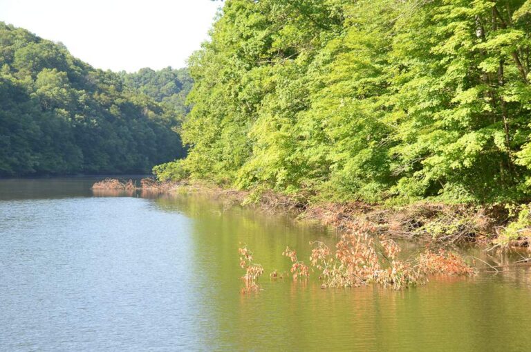
Photo: David Wiley, CC BY 2.0

Photo: Ken Lund, CC BY-SA 2.0
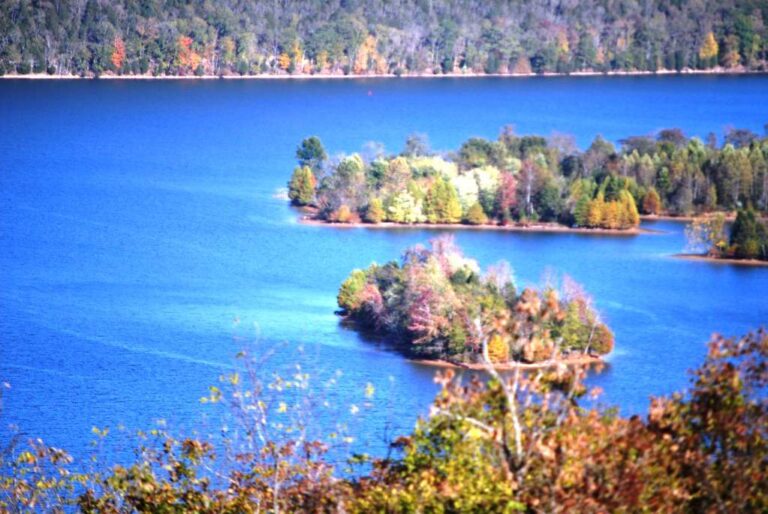
Photo: dozier.donald, CC BY-SA 2.0
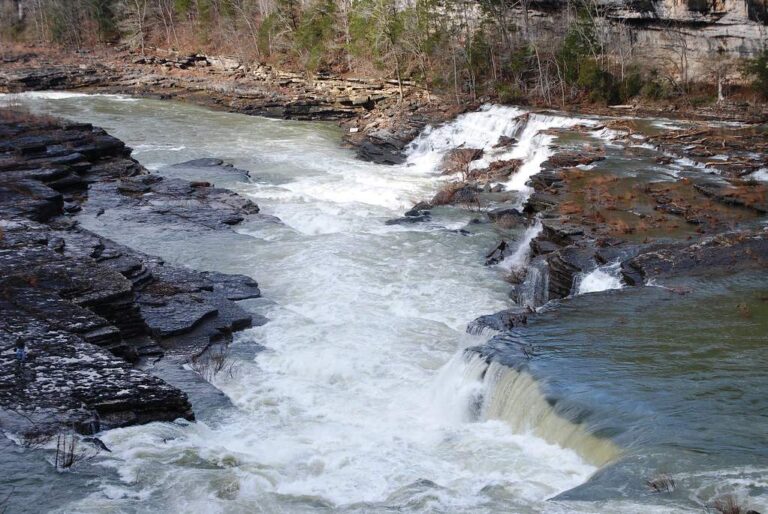
Photo: dozier.donald, CC BY-SA 2.0
Bait-shop questions about the water of Clay County
How many public boat ramps are in Clay County, Tennessee?
27 ramps and marinas, per the TWRA access map.
Which water in Clay County has the most acreage?
Dale Hollow Lake is largest, with 27,700 acres.
What could end up on a stringer in Clay County, Tennessee?
Each lake and stream row above shows the fish TWRA lists for it, where it lists any.
Does Clay County have a marina store or bait shop?
6; Punisher Lures is listed first.
Where does Clay County keep its county government?
Celina.
Is a TWRA license required on Clay County lakes and creeks?
Anglers 13 and older need a Tennessee fishing license; TWRA lists the resident combo hunt/fish license at $33 and the nonresident annual fishing all species license at $98.
Which counties border Clay County, Tennessee?
Jackson County, Overton County and Macon County sit closest.
How many fish may I keep from Clay County water?
The statewide lines in the 2026-27 Tennessee Fishing Guide apply unless TWRA lists the water by name, and a named-water line wins for the fish it covers; each lake, river and tailwater page here prints its own lines. The rules here are from the 2026-27 Tennessee Fishing Guide as TWRA posts it online, last updated September 15, 2026; TWRA had published no 2027-28 guide when this site checked.
Is every lake in Clay County listed here?
All 4 named waters on file show up, either linked or as a row with coordinates.
Where does the TWRA guide change limits in Clay County?
2 waters with pages here carry their own lines in the 2026-27 guide, starting with Cordell Hull Lake.
Is a bass or crappie trail coming to Clay County?
7 events on file; the next is Phoenix Bass Fishing League Team/Solo on Dale Hollow Lake, Feb. 27, 2027.
Has a Tennessee state record come from Clay County?
Smallmouth Bass, 11 lbs. 15 oz., from Dale Hollow Reservoir (1955).
Hitch the bass boat and head for Clay County, Tennessee
Check the guide line for a lake before you keep fish.