Lake Umatilla Fishing
A 50,097-acre Oregon reservoir in Morrow County and 3 other counties, shared across a state line.
 Pick for crappiePiscifun Carbon X ultralight spinning reel28% OFFSale $57.99
Photo of John Day River: Bonnie Moreland, Public domain
Opening notes on Lake Umatilla
Mapped from BLM hydrography, Lake Umatilla spreads across about 50,097 acres of Morrow County and 3 other counties. About 44% of the BLM outline counts as Oregon water. The launch operators OSMB names are Boardman Parks District, City of Arlington and City of Umatilla. Fuel and food are closest in Boardman, near 12 miles away.
OSMB records 12 open launch sites that reach it.
BLM Oregon hydrography lake outlines (NHD), summed by GNIS name (layer), read November 2, 2026.; launch managers from the Oregon State Marine Board launch layer; Census 2023 places.
Which fish ODFW records in Lake Umatilla
Each fish listed for Lake Umatilla comes from an ODFW habitat polygon, a booklet rule or a record.
How ODFW tags the fish of Lake Umatilla
| Fish | Use ODFW records | Origin | Basis |
|---|---|---|---|
| Black crappie | resident multiple uses | non native | UndocObsFish |
| Channel catfish | resident multiple uses | non native | UndocObsFish |
| Chiselmouth | unknown | native local | DocObsFish |
| Largemouth bass | resident multiple uses | non native | UndocObsFish |
| Largescale sucker | unknown | native local | DocObsFish |
| Northern pikeminnow | unknown | native local | DocObsFish |
| Peamouth | unknown | native local | DocObsFish |
| Smallmouth bass | resident multiple uses | non native | UndocObsFish |
| Yellow perch | resident multiple uses | non native | DocObsFish |
ODFW Fish Habitat Distribution layers (ODFW ArcGIS), read November 2, 2026; a mapped species is habitat use ODFW records, not a catch report.
 For the crappie herePiscifun Carbon XT ultralight spinning reel25% OFFSale $59.99
OSMB launches on Lake Umatilla
- 1st Street Irrigon Launch on Lake Umatilla1 lane, trailered launch; parking; U.S. Army Corps of Engineers
- Blalock Canyon boat ramp on Lake Umatillatrailered launch; parking; U.S. Army Corps of Engineers
- Boardman Marina Park on Lake Umatilla2 lanes, trailered launch; parking, restrooms, pumpout, marina; Boardman Parks District
- Earl Snell Memorial Park Paddle Launch on Lake Umatilla1 lane, hand carry launch; parking, restrooms, hand launch; City of Arlington
- Irrigon Marina Ramp on Lake Umatilla2 lanes, trailered launch; parking, restrooms, pumpout, marina, life jacket loaner station; Irrigon Parks District
- Lepage Park on Lake Umatilla3 lanes, trailered launch; parking, restrooms, use fee, short-term tie-up, pumpout; U.S. Army Corps of Engineers
- Patterson Park on Lake Umatilla1 lane, trailered launch; parking; U.S. Army Corps of Engineers
- Port of Arlington Hand Launch on Lake Umatilla1 lane, hand carry launch; parking, restrooms, hand launch; Port of Arlington
- Port of Arlington Marina on Lake Umatillahand carry launch; parking, restrooms, use fee, short-term tie-up, fuel; Port of Arlington
- Port of Arlington Ramp on Lake Umatilla1 lane, trailered launch; parking, restrooms, fuel, pumpout, marina; Port of Arlington
- Threemile Canyon Park on Lake Umatilla1 lane, trailered launch; parking, restrooms; U.S. Army Corps of Engineers
- Umatilla Marina4 lanes, trailered launch; parking, restrooms, use fee, short-term tie-up, fuel; City of Umatilla
Alternate launches near Lake Umatilla
- Willow Creek AccessWillow Creek, 4 miles southwest
Oregon State Marine Board Boating Access Sites layer (OSMB ArcGIS), read November 2, 2026; status as OSMB publishes it.
Level readings for Lake Umatilla
U.S. Army Corps of Engineers Northwestern Division water management data (NWD dataquery), reading as of the date shown, read November 2, 2026; datum as the Corps publishes it.
Corps water managers publish the Lake Umatilla figure shown, with its date.
Oregon limits at Lake Umatilla
The Northeast Zone table appears here because most listed waters in Morrow County fall under it; Lake Umatilla is not named in the booklet.
| Species | Daily limit as printed | Season |
|---|---|---|
| Trout | Lakes: 5 per day, 3 daily limits in possession. Streams: 2 per day, 3 daily limits in possession; 8-inch minimum | Lakes: Open all year. Streams: Open May 22 – Oct 31, unless noted under Exceptions. |
| Kokanee | 10 per day unless noted under Exceptions. | Open all year. |
| Salmon | See Umatilla River under Exceptions. There is no annual limit on hatchery salmon as long as the appropriate number of Hatchery Harvest Tags have been purchased to record the catch. | Closed in all waters unless noted by species under Exceptions. |
| Steelhead | 3 per day. | Closed in all waters unless noted by species under Exceptions. |
| Sturgeon | Catch-and-release only. | Lakes: Open all year. Streams: Open during trout, salmon or steelhead seasons only, except portions of Columbia River tributaries flooded by John Day and. |
| Bass | Lakes: 5 per day, 3 daily limits in possession unless noted under Exceptions. Streams: No limit. | Lakes: Open all year. Streams: Open during trout, salmon or steelhead seasons only, except portions of Columbia River tributaries flooded by John Day and. |
| Bluegill, Catfish, Crappie, Other Sunfish, Walleye, Yellow Perch, Suck. | No limit. | Lakes: Open all year. Streams: Open during trout, salmon or steelhead seasons only, except portions of Columbia River tributaries flooded by John Day and. |
Licenses on shared water at Lake Umatilla
Check the shared-water notes in the booklet before crossing the line on Lake Umatilla.
An Oregon angling license ($50 resident, $138 nonresident for 2026) covers anglers 12 and older; salmon, steelhead, sturgeon and halibut go on a Combined Angling Tag ($69 resident).
Limits as printed in the 2026 Oregon Sport Fishing Regulations (ODFW, eRegulations edition) (Northeast Zone page), read November 2, 2026.
How Lake Umatilla stacks against its neighbours
Lake Wallula leads this group on size, with roughly 32,492 acres.
| Lake | Distance | Acres | Kind | OSMB launches | Stocking weeks |
|---|---|---|---|---|---|
| Lake Umatilla | 50,097 | reservoir | 12 | 0 | |
| Willow Lake (Gilliam County) | 4 miles southwest | 307 | reservoir | 1 | 0 |
| Cold Springs Reservoir | 38 miles east | 1,440 | reservoir | 0 | 0 |
| Willow Creek Reservoir (Morrow County) | 38 miles southeast | 154 | reservoir | 1 | 0 |
| Lake Wallula | 48 miles east | 32,492 | reservoir | 5 | 0 |
| Cutsforth Pond | 53 miles southeast | 0 | lake | 0 | 4 |
BLM outlines, the OSMB launch layer and the ODFW stocking schedule; read November 2, 2026.
Around Lake Umatilla: Oregon towns, tackle and more water
Nearby lakes worth a look after Lake Umatilla
- Willow Lake (Gilliam County)4 miles southwest
- Cold Springs Reservoir38 miles east
- Willow Creek Reservoir (Morrow County)38 miles southeast
- Lake Wallula48 miles east
- Cutsforth Pond53 miles southeast
Stores that outfit trips to Lake Umatilla
- Irrigon Park & Marinamarina, Irrigon, 23 miles
- Gorge Outfitters Supplybait and tackle shop, Rufus
- Blue Mountain Anglers & Flyfly shop, Pendleton
- Bi-Mart (Hermiston)sporting goods store, Hermiston
- Bi-Mart (Pendleton)sporting goods store, Pendleton
Oregon towns to sleep in near Lake Umatilla
- Boardman12 miles
- Irrigon23 miles
- Umatilla30 miles
County fishing pages tied to Lake Umatilla
- Morrow Countyseat: Heppner
- Gilliam Countyseat: Condon
- Umatilla Countyseat: Pendleton
- Sherman Countyseat: Moro
A Piscifun kit worth stowing before you head to Lake Umatilla


Piscifun and Amazon links are affiliate links; the site earns a commission on qualifying purchases.
Know the Lake Umatilla catch by sight
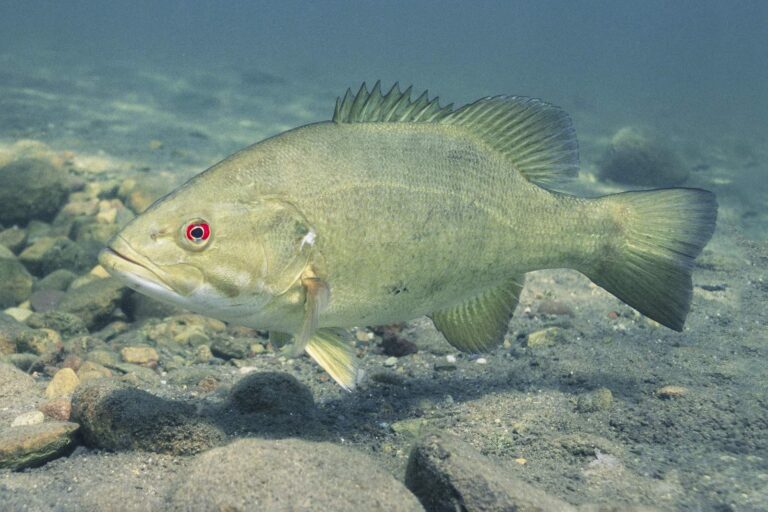
Photo: Yellowstone National Park, Public domain
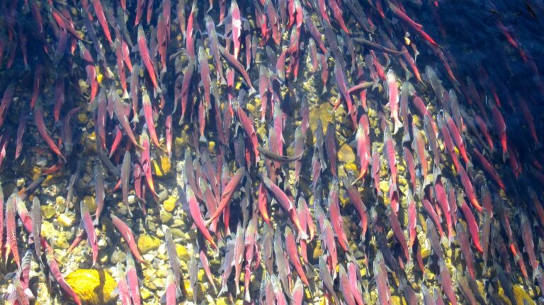
Photo: Jonathan Cook-Fisher, CC BY 2.0

Photo: gailhampshire, CC BY 2.0
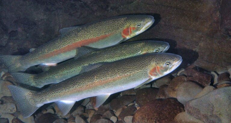
Photo: Oregon State University, CC BY-SA 2.0
Lake Umatilla, the usual questions settled
Which Oregon county holds Lake Umatilla?
Aim for Morrow County and 3 other counties, about 12 miles from Boardman.
How much surface does Lake Umatilla have?
Roughly 50,097 acres on the hydrography outline, about 44% of it in Oregon.
Can I tow a trailer boat to Lake Umatilla in Oregon?
OSMB maps 12 launch sites; 1st Street Irrigon Launch on Lake Umatilla is one.
What can an Oregon angler hook at Lake Umatilla?
Look for black crappie, channel catfish, chiselmouth, largemouth bass, largescale sucker, northern pikeminnow and peamouth.
Which Oregon rules apply on Lake Umatilla?
Trout: Lakes: 5 per day, 3 daily limits in possession. Streams: 2 per day, 3 daily limits in possession; 8-inch minimum.
What does an Oregon license for Lake Umatilla cost in 2026?
An Oregon angling license ($50 resident, $138 nonresident for 2026) covers anglers 12 and older; salmon, steelhead, sturgeon and halibut go on a Combined Angling Tag ($69 resident).
Can I fish Lake Umatilla from an Oregon shoreline?
Neither DLCD nor ODFW maps shore access on it.
Where can I buy an ODFW license near Lake Umatilla?
Try Irrigon Park & Marina, roughly 23 miles away.
Is there a USGS or Corps gauge on Lake Umatilla?
The level band shows the latest reading with its source.
Hook up the trailer and aim for Lake Umatilla
Read the zone rows, then choose the launch closest to your water.