Cold Springs Reservoir Fishing
A 1,440-acre Oregon reservoir in Umatilla County.
 Pick for bullheadPiscifun LumiCat II catfish rod48% OFFSale $114.99
Photo of Snake River: Ken Lund, CC BY-SA 2.0
Cold Springs Reservoir for a first-time Oregon visit
Cold Springs Reservoir is a reservoir of Umatilla County whose NHD outline measures near 1,440 acres. Launches on it are run by U.S. Fish and Wildlife Service. Stanfield, around 6 miles away, is the closest town on the Census list.
Access, the booklet rows and nearby lakes come next.
BLM Oregon hydrography lake outlines (NHD), summed by GNIS name (layer), read November 2, 2026.; launch managers from the Oregon State Marine Board launch layer; Census 2023 places.
What lives in Cold Springs Reservoir
Treat the Cold Springs Reservoir list as where ODFW records fish, not as a survey of numbers.
Origin notes for fish in Cold Springs Reservoir
| Fish | Use ODFW records | Origin | Basis |
|---|---|---|---|
| Bluegill | resident multiple uses | non native | UndocObsFish |
| Brown bullhead | resident multiple uses | non native | UndocObsFish |
| Largemouth bass | resident multiple uses | non native | UndocObsFish |
| Smallmouth bass | resident multiple uses | non native | UndocObsFish |
| White crappie | resident multiple uses | non native | UndocObsFish |
ODFW Fish Habitat Distribution layers (ODFW ArcGIS), read November 2, 2026; a mapped species is habitat use ODFW records, not a catch report.
 For the bullhead herePiscifun Chaos XS round baitcaster36% OFFSale $57.99
Putting a boat on Cold Springs Reservoir
OSMB maps no launch site on Cold Springs Reservoir, so the nearest ones elsewhere follow.
Skip Cold Springs Reservoir boat ramp; OSMB lists it as closed.
Launches a brief haul from Cold Springs Reservoir
- Warehouse Beach Boat Ramp on Lake WallulaColumbia River (Lake Wallula), 4 miles north
- Hat Rock State Park on Lake WallulaColumbia River (Lake Wallula), 4 miles north
- Warehouse Beach Paddle Launch on Lake WallulaColumbia River (Lake Wallula), 4 miles north
- McNary Yacht Club boat ramp on Lake WallulaColumbia River (Lake Wallula), 4 miles north
- McNary Dam Oregon Ramp on Lake WallulaColumbia River (Lake Wallula), 8 miles northwest
- Umatilla Fish Hatchery Put-in launchUmatilla River, 8 miles west
Oregon State Marine Board Boating Access Sites layer (OSMB ArcGIS), read November 2, 2026; status as OSMB publishes it.
Taking fish home from Cold Springs Reservoir
The booklet does not name Cold Springs Reservoir itself; the Northeast Zone table shown is the one for most listed waters in Umatilla County, so confirm the zone on the ODFW map.
| Species | Daily limit as printed | Season |
|---|---|---|
| Trout | Lakes: 5 per day, 3 daily limits in possession. Streams: 2 per day, 3 daily limits in possession; 8-inch minimum | Lakes: Open all year. Streams: Open May 22 – Oct 31, unless noted under Exceptions. |
| Kokanee | 10 per day unless noted under Exceptions. | Open all year. |
| Salmon | See Umatilla River under Exceptions. There is no annual limit on hatchery salmon as long as the appropriate number of Hatchery Harvest Tags have been purchased to record the catch. | Closed in all waters unless noted by species under Exceptions. |
| Steelhead | 3 per day. | Closed in all waters unless noted by species under Exceptions. |
| Sturgeon | Catch-and-release only. | Lakes: Open all year. Streams: Open during trout, salmon or steelhead seasons only, except portions of Columbia River tributaries flooded by John Day and. |
| Bass | Lakes: 5 per day, 3 daily limits in possession unless noted under Exceptions. Streams: No limit. | Lakes: Open all year. Streams: Open during trout, salmon or steelhead seasons only, except portions of Columbia River tributaries flooded by John Day and. |
| Bluegill, Catfish, Crappie, Other Sunfish, Walleye, Yellow Perch, Suck. | No limit. | Lakes: Open all year. Streams: Open during trout, salmon or steelhead seasons only, except portions of Columbia River tributaries flooded by John Day and. |
An Oregon angling license ($50 resident, $138 nonresident for 2026) covers anglers 12 and older; salmon, steelhead, sturgeon and halibut go on a Combined Angling Tag ($69 resident).
Limits as printed in the 2026 Oregon Sport Fishing Regulations (ODFW, eRegulations edition) (Northeast Zone page), read November 2, 2026.
Nearby lakes alongside Cold Springs Reservoir
By outline area, Lake Umatilla tops the nearby lakes at about 50,097 acres.
| Lake | Distance | Acres | Kind | OSMB launches | Stocking weeks |
|---|---|---|---|---|---|
| Cold Springs Reservoir | 1,440 | reservoir | 0 | 0 | |
| Lake Wallula | 13 miles northeast | 32,492 | reservoir | 5 | 0 |
| McKay Reservoir | 26 miles southeast | 1,174 | reservoir | 2 | 0 |
| Lake Umatilla | 38 miles west | 50,097 | reservoir | 12 | 0 |
| Willow Creek Reservoir (Morrow County) | 40 miles southwest | 154 | reservoir | 1 | 0 |
| Willow Lake (Gilliam County) | 42 miles west | 307 | reservoir | 1 | 0 |
BLM outlines, the OSMB launch layer and the ODFW stocking schedule; read November 2, 2026.
Within an easy drive of Cold Springs Reservoir
Lakes for a second day near Cold Springs Reservoir
- Lake Wallula13 miles northeast
- McKay Reservoir26 miles southeast
- Lake Umatilla38 miles west
- Willow Creek Reservoir (Morrow County)40 miles southwest
- Willow Lake (Gilliam County)42 miles west
Picking up tackle for Cold Springs Reservoir
- Bi-Mart (Hermiston)sporting goods store, Hermiston, 7 miles
- Irrigon Park & Marinamarina, Irrigon, 17 miles
- Bi-Mart (Pendleton)sporting goods store, Pendleton, 22 miles
- Blue Mountain Anglers & Flyfly shop, Pendleton
Towns that work as a base for Cold Springs Reservoir
- Stanfield6 miles
- Hermiston7 miles
- Umatilla10 miles
The counties around Cold Springs Reservoir
- Umatilla Countyseat: Pendleton
Rods, reels and braid from Piscifun for Cold Springs Reservoir


Piscifun and Amazon links are affiliate links; the site earns a commission on qualifying purchases.
What the Cold Springs Reservoir species look like
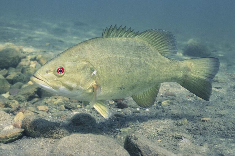
Photo: Yellowstone National Park, Public domain
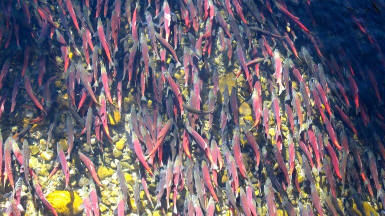
Photo: Jonathan Cook-Fisher, CC BY 2.0

Photo: gailhampshire, CC BY 2.0
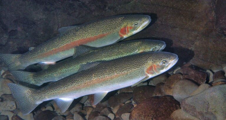
Photo: Oregon State University, CC BY-SA 2.0
What gets asked about Cold Springs Reservoir first
What corner of Oregon holds Cold Springs Reservoir?
Its county is Umatilla County, about 6 miles from Stanfield.
How big is Cold Springs Reservoir on the PMEP map?
About 1,440 acres mapped.
Where does OSMB map a launch on Cold Springs Reservoir?
Nearest OSMB launch: Warehouse Beach Boat Ramp on Lake Wallula, 4 miles.
What does ODFW record in Cold Springs Reservoir?
The habitat layers and booklet list bluegill, brown bullhead, largemouth bass, smallmouth bass and white crappie.
Does the booklet set special rules for Cold Springs Reservoir?
Trout: Lakes: 5 per day, 3 daily limits in possession. Streams: 2 per day, 3 daily limits in possession; 8-inch minimum.
What are the 2026 fees for fishing Cold Springs Reservoir?
An Oregon angling license ($50 resident, $138 nonresident for 2026) covers anglers 12 and older; salmon, steelhead, sturgeon and halibut go on a Combined Angling Tag ($69 resident).
Where can I fish Cold Springs Reservoir without a boat in Oregon?
The shore lists skip this water.
Who sells Oregon bait near Cold Springs Reservoir?
The nearest listed counter is Bi-Mart (Hermiston), roughly 7 miles away.
Take the Oregon back roads to Cold Springs Reservoir
Every Oregon fee and bag limit is one click away.