Fishing in Sherman County, Oregon
County seat: Moro. Population 1,870.
- 2lake pages
- 8open launches
- 2river pages
 Pick for crappiePiscifun Carbon X ultralight spinning reel28% OFFSale $57.99
Photo of Deschutes River: Bonnie Moreland, Public domain
First look at fishing in Sherman County
Census 2020 placed 1,870 people in Sherman County, governed from Moro. In the booklet, the bulk of Sherman County waters sit in the ODFW Central Zone pages, since zones track watersheds. The state line splits Lake Umatilla and Lake Celilo.
Lake Umatilla leads the 2 paged lakes reaching into Sherman County by outline acreage. OSMB maps 8 open launches here, 7 of them built for trailered boats.
Census 2020 population; BLM Oregon NHD lake outlines; OSMB Boating Access Sites; DLCD and ODFW shore access layers; 2026 Oregon Sport Fishing Regulations zone lists; read November 2, 2026.
Launches, lakes and shore spots of Sherman County on one map
OSMB launch points, DLCD and ODFW shore sites, NHD lake points, PMEP estuary points; read November 2, 2026.
Reservoirs inside Sherman County
| Lake | Acres | Kind | OSMB launches | Fish mapped |
|---|---|---|---|---|
| Lake Umatilla | 50,097 (outline), 44% in Oregon | lake | 12 | black crappie, channel catfish, chiselmouth |
| Lake Celilo | 8,763 (outline), 44% in Oregon | lake | 4 | channel catfish |
Past the Sherman County line, these lakes with pages come up first from Moro.
| Lake | From Moro | Acres | Kind | OSMB launches | Fish mapped |
|---|---|---|---|---|---|
| Taylor Lake | 25 miles northwest | 25 (outline) | lake | 1 | bluegill, largemouth bass, rainbow trout |
| Pine Hollow Reservoir | 32 miles southwest | 227 (outline) | reservoir | 2 | bluegill, brown bullhead, largemouth bass |
| Lake Bonneville | 32 miles northwest | 19,452 (outline), 54% in Oregon | lake | 18 | channel catfish |
| Rock Creek Reservoir (Wasco County) | 37 miles southwest | 88 (outline) | reservoir | 1 | bluegill, brown bullhead, largemouth bass |
| Willow Lake (Gilliam County) | 41 miles northeast | 307 (outline) | lake | 1 | rainbow trout |
| Badger Lake | 42 miles west | 46 (outline) | lake | 1 | brook trout, rainbow trout |
BLM Oregon hydrography lake outlines (NHD), summed by GNIS name (layer), read November 2, 2026. Species: ODFW Fish Habitat Distribution layers (ODFW ArcGIS), read November 2, 2026; a mapped species is habitat use ODFW records, not a catch report. ODFW publishes no lake depths in these layers.
 For the crappie herePiscifun Carbon XT ultralight spinning reel25% OFFSale $59.99
The species tally near Sherman County
Each bar counts the lake, river and bay pages within 40 miles of Moro that list the fish; largemouth bass shows up most.
Species from ODFW Fish Habitat Distribution layers, booklet exceptions and ODFW records, counted per water page within 40 miles; habitat mapping, not a catch survey.
Lakes of Sherman County listed here only
1 smaller lakes in Sherman County are listed here only.
| Water | Acres (outline) | Nearest place |
|---|---|---|
| Bibby Pond | 10 | The Dalles |
BLM Oregon hydrography lake outlines (NHD), summed by GNIS name (layer), read November 2, 2026.
River guides for Sherman County
- Deschutes RiverODFW maps fall chinook, sockeye and spring chinook runs, 43 OSMB launches, 4 USGS gauges, 23 booklet exceptions
- John Day River18 OSMB launches, 3 USGS gauges, 20 booklet exceptions
Gauge stations around Sherman County
| USGS gauge | Latest reading | Time (ET) |
|---|---|---|
| John Day River At Mcdonald Ferry, Or | 268 cfs, 2.26 ft gage height | Nov 11 10:45 pm |
US Geological Survey provisional data, retrieved Nov 11, 2026 11:33 pm ET. Provisional readings can be revised.
ODFW Fish Habitat Distribution stream names and runs, OSMB launches, booklet exceptions and USGS gauges; read November 2, 2026.
OSMB launches in Sherman County
- Beavertail Campground boat ramp on Deschutes RiverDeschutes River, 1 lane, trailered launch
- Buckhollow boat ramp on Deschutes RiverDeschutes River, trailered launch
- Giles French Park on Lake CeliloLake Celilo, 1 lane, trailered launch
- Lepage Park on Lake UmatillaLake Umatilla, 3 lanes, trailered launch
- Macks Canyon boat ramp on Deschutes RiverDeschutes River, trailered launch
- McDonald launchlaunch, hand carry launch
- Pine Tree boat ramp on Deschutes RiverDeschutes River, trailered launch
- Rufus Landing on Lake CeliloLake Celilo, 1 lane, trailered launch
Launches marked closed on the OSMB layer get no page; restricted ones carry the OSMB note on theirs.
Oregon State Marine Board Boating Access Sites layer (OSMB ArcGIS), read November 2, 2026; status as OSMB publishes it. Oregon Coastal Management Program (DLCD) Shoreline Access Inventory (layer) and the ODFW shore access map, read November 2, 2026.
Daily limits for Sherman County waters
Begin with the zone rows for Sherman County, then check the exception list for the water you fish. Budget $50 if you live in Oregon, $138 if not, for the annual angling license. Salmon, steelhead, sturgeon and halibut also go on a Combined Angling Tag ($69 resident).
| Species | Limit | Season |
|---|---|---|
| Trout | Lakes: 5 per day, 3 daily limits in possession. Streams: 2 per day, 3 daily limits in possession; 8-inch minimum | Lakes: Open all year. Streams: Open May 22 – Oct 31, unless noted under Exceptions. |
| Kokanee | 10 per day unless noted under Exceptions. | Open all year. |
| Salmon and Steelhead | In the aggregate: 2 adult salmon or steelhead per day, 20 per year. 5 jack salmon per day, 2 daily jack limits in possession, with the exception that one additional hatchery steelhead may be retained per day for a total. | Closed in all waters unless noted by species under Exceptions. |
| Sturgeon | Catch-and-release only. | Lakes: Open all year. Streams: Open during trout, salmon or steelhead seasons. |
| Bass | Lakes: 5 per day, 3 daily limits in possession unless noted under Exceptions. Streams: No limit. | Lakes: Open all year. Streams: Open during trout, salmon or steelhead seasons only, except portions of Columbia River tributaries flooded by Bonneville and The. |
| Bluegill, Catfish, Crappie, Other Sunfish, Walleye, Yellow Perch, Whit. | No limit. | Lakes: Open all year. Streams: Open during trout, salmon or steelhead seasons only, except portions of Columbia River tributaries flooded by Bonneville and The. |
Water-by-water rules in Sherman County (43)
| Water | Species | Rule | Booklet |
|---|---|---|---|
| John Day River (Clatsop Co.) | hatchery steelhead, chinook, salmon | Open all year for hatchery steelhead and hatchery Chinook salmon. | p. 28 |
| John Day River (Clatsop Co.) | Use of bait allowed. | p. 28 | |
| Deschutes River (I-84 bridge to Sherars Falls) | hatchery steelhead, trout | Open all year for trout and hatchery steelhead. | p. 52 |
| Deschutes River (I-84 bridge to Sherars Falls) | trout | 2 rainbow trout per day, 10 inch minimum and 13 inch maximum length. | p. 52 |
| Deschutes River (I-84 bridge to Sherars Falls) | chinook, salmon | Open for Chinook salmon Aug 1 – Oct 31. | p. 52 |
| Deschutes River (I-84 bridge to Sherars Falls) | coho, salmon | Open for coho salmon Aug 1 – Dec 31. | p. 52 |
| Deschutes River (I-84 bridge to Sherars Falls) | Bait allowed only from Sherars Falls downstream to upper trestle (approx. 3 Mi). | p. 52 | |
| Deschutes River (I-84 bridge to Sherars Falls) | No angling from a floating device. | p. 52 | |
| Deschutes River (I-84 bridge to Sherars Falls) | Closed from Sherars Falls downstream to Buck Hollow Cr (approx. 1 Mi) Apr 1 – Jul 31. | p. 52 | |
| Deschutes River (Sherars Falls to Northern Boundary of the Warm Springs Reservation (including White River upstream to first falls)) | hatchery steelhead, trout | Open all year for trout and hatchery steelhead. | p. 52 |
| Deschutes River (Sherars Falls to Northern Boundary of the Warm Springs Reservation (including White River upstream to first falls)) | trout | 2 rainbow trout per day, 10 inch minimum and 13 inch maximum length. | p. 52 |
| Deschutes River (Sherars Falls to Northern Boundary of the Warm Springs Reservation (including White River upstream to first falls)) | coho, salmon | Open for coho salmon Aug 1 – Dec 31. | p. 52 |
| Deschutes River (Sherars Falls to Northern Boundary of the Warm Springs Reservation (including White River upstream to first falls)) | No angling from a floating device. | p. 52 | |
| Deschutes River (Northern Boundary of the Warm Springs Reservation to the Pelton Regulating Reservoir.) | hatchery steelhead, trout | Open Apr 22 – Dec 31 for trout and hatchery steelhead. | p. 52 |
| Deschutes River (Northern Boundary of the Warm Springs Reservation to the Pelton Regulating Reservoir.) | trout | 2 rainbow trout per day, 10 inch minimum and 13 inch maximum length. | p. 52 |
| Deschutes River (Northern Boundary of the Warm Springs Reservation to the Pelton Regulating Reservoir.) | coho, salmon | Open for coho salmon Aug 1 – Dec 31. | p. 52 |
| Deschutes River (Northern Boundary of the Warm Springs Reservation to the Pelton Regulating Reservoir.) | No angling from a floating device. | p. 52 | |
| Deschutes River (Northern Boundary of the Warm Springs Reservation to the Pelton Regulating Reservoir.) | See Lake Simtustus. | p. 52 | |
| Deschutes River (Northern Boundary of the Warm Springs Reservation to the Pelton Regulating Reservoir.) | Closed from Pelton Regulating Dam downstream approx. 600 ft to ODFW markers. | p. 52 | |
| Deschutes River (Lake Billy Chinook to Benham Falls) | trout | Open all year for trout. | p. 52 |
Limits as printed in the 2026 Oregon Sport Fishing Regulations (ODFW, eRegulations edition) (Central Zone page), read November 2, 2026. Water exceptions as printed in the 2026 Oregon Sport Fishing Regulations (ODFW, eRegulations edition) (booklet PDF; printed page shown), read November 2, 2026. In-season changes from ODFW override them. Fees as printed on the ODFW license, tag and permit fee page of the 2026 Oregon Sport Fishing Regulations (ODFW, eRegulations edition) (fees page), read November 2, 2026.
Record-book catches around Sherman County
| Species | Weight | Water | Date |
|---|---|---|---|
| Brook Trout | 9 lb 6 oz | Deschutes River | 1980 |
| Mountain Whitefish | 5 lb 12 oz | Deschutes River | 2021 |
Oregon record fish as listed by Oregon Department of Fish and Wildlife (record fish article, dated March 4, 2026), read November 2, 2026.
Gear stores across Sherman County
Sherman County bait and tackle
- Gorge Outfitters Supplybait and tackle shop, Rufus
Yellow Pages and store-locator listings, guide and charter business listings (county of the business), read November 2, 2026.
Close by Sherman County
Neighbours of Sherman County
- Gilliam County20 miles east
- Wasco County29 miles southwest
- Hood River County48 miles west
- Morrow County52 miles east
Piscifun tackle that suits a trip to Sherman County


Piscifun and Amazon links are affiliate links; the site earns a commission on qualifying purchases.
What the Sherman County species look like
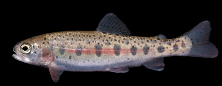
Photo: USFWS Mountain-Prairie, Public domain
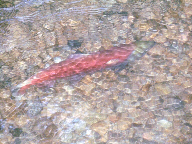
Photo: Thomas Quine, CC BY 2.0

Photo: U.S. Fish and Wildlife Service, Public domain

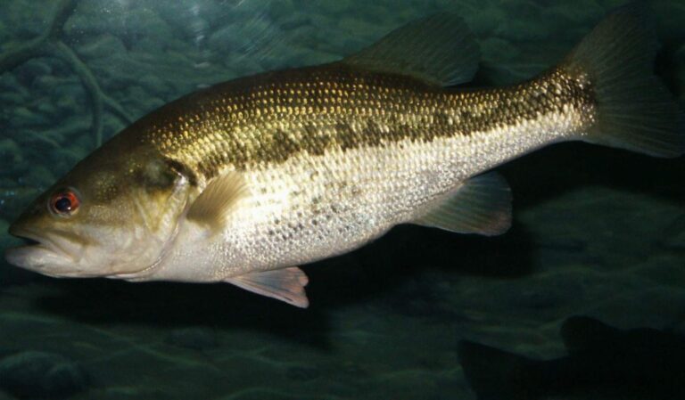
Photo: robposse, CC BY 2.0
Fishing in Sherman County: the questions that come up
Can I launch a trailered boat in Sherman County?
Count 8 open launches, 7 for trailers.
Which Sherman County lake has the widest outline?
Lake Umatilla, about 50,097 acres on its mapped outline.
What species live in water around Sherman County?
Largemouth bass lead the count of water pages within 40 miles, then rainbow trout, bluegill and channel catfish.
Where can Sherman County anglers buy roe, shrimp or worms?
Try Gorge Outfitters Supply; 1 are listed.
How many guide or charter listings give Sherman County as home port?
No guide names it; the Oregon guides page has the roster.
Where is Sherman County governed from?
The seat is Moro.
What does ODFW charge an out-of-state angler in Sherman County?
A year of Oregon angling privileges costs $50 in state and $138 from out of state this season. For salmon and steelhead the booklet adds the Combined Angling Tag at $69 resident.
Which Oregon counties are a short drive from Sherman County?
Try Gilliam County, Wasco County and Hood River County.
Which booklet zone applies in Sherman County?
Most waters ODFW lists in Sherman County fall under the ODFW Central Zone table, though zone lines follow drainages rather than county lines.
Are there water-specific limits in Sherman County?
The 2026 booklet prints 43 water exceptions reaching this county, starting with John Day River (Clatsop Co.); the table above shows each.
What record-list weights trace to Sherman County?
Brook Trout, 9 lb 6 oz, from Deschutes River (1980).
Point the rig toward Sherman County
Each Oregon river page shows its USGS gauges live.