Lower Columbia River estuary Fishing
A coastal estuary in Clatsop County, about 135,902 acres of tidal habitat.
 Pick for rockfishPiscifun AlinoX 400 baitcaster with bait clicker25% OFFSale $149.99
Photo: Rennett Stowe, CC BY 2.0
Where an Oregon day on Lower Columbia River estuary begins
In Clatsop County, Lower Columbia River estuary spreads across roughly 54,999 hectares, or about 135,902 acres, per PMEP. It is typed riverine estuary. Its ocean water belongs to the Columbia River Subarea. Astoria sits roughly 9 miles away.
There are 11 launch sites on the OSMB map here. The shore lists add 16 dock, pier or jetty sites.
Pacific Marine and Estuarine Fish Habitat Partnership estuary extent (PMEP), read November 2, 2026. Census 2023 places.
Launch sites around Lower Columbia River estuary
- Aldrich Point boat ramp on Columbia RiverColumbia River (Pacific to Westport); 1 lane, trailered launch; parking, restrooms; Clatsop County
- Carnahan County Park on Cullaby LakeCullaby Lake; trailered launch; parking, restrooms; Clatsop County
- Cullaby Lake ParkCullaby Lake; 2 lanes, trailered launch; parking, restrooms, use fee; Clatsop County
- East Basin Boat Ramp on Columbia RiverColumbia River (Pacific to Westport); 2 lanes, trailered launch; parking, restrooms, short-term tie-up, marina; Port of Astoria
- Hammond Marina on Columbia RiverColumbia River (Pacific to Westport); 4 lanes, trailered launch; parking, restrooms, use fee, short-term tie-up, fuel; City of Warrenton
- John Day ParkJohn Day River (Clatsop County); 2 lanes, trailered launch; parking, restrooms, use fee; Clatsop County
- Lewis and Clark River Boat RampLewis and Clark River; trailered launch; parking; Clatsop County
- Netul Landing on Lewis and Clark RiverLewis and Clark River; 1 lane, trailered launch; parking, restrooms; National Parks Service
- Second Street Park on Skipanon RiverSkipanon River; hand carry launch; parking, short-term tie-up, hand launch; City of Warrenton
- Warrenton Marina Ramp on Skipanon RiverSkipanon River; 2 lanes, trailered launch; parking, restrooms, use fee, life jacket loaner station; City of Warrenton
- Youngs Bay Yacht Club boat ramp on Lower Columbia River estuaryYoungs Bay; 1 lane, trailered launch; parking, restrooms; City of Astoria
Shore fishing around Lower Columbia River estuary
- Astoria Yacht Club Park on Lower Columbia River estuaryfishing pier, Unknown
- 17th Street, Astoria on Lower Columbia River estuaryfishing pier, Unknown
- Basin St. on Lower Columbia River estuaryfishing pier, Unknown
- Marine Drive and Columbia Avenue on Lower Columbia River estuaryfishing pier, Unknown
- 2nd Street on Lower Columbia River estuaryfishing pier, Unknown
- 6th Street Pier on Lower Columbia River estuaryfishing pier, Astoria
- 17th Street, Astoria on Lower Columbia River estuaryfishing pier, Unknown
- 17th Street Pier (Civic Pier) on Lower Columbia River estuaryfishing pier, Unknown
- 9th Street River Park on Lower Columbia River estuaryfishing pier, Astoria
- 12th Street on Lower Columbia River estuaryfishing pier, Unknown
- 14th Street Ferry Landing on Lower Columbia River estuaryfishing pier, Unknown
- 12th – 17th Street on Lower Columbia River estuaryfishing pier, Unknown
- 17th Street, Astoria on Lower Columbia River estuaryfishing pier, Unknown
- 36th Street on Lower Columbia River estuaryfishing pier, Unknown
- 39th Street on Lower Columbia River estuaryfishing pier, Unknown
- Area D on Lower Columbia River estuaryfishing pier, OPRD
Moorage and marinas around Lower Columbia River estuary
- Port of Astoria – West Mooring Basinmarina (Oregon Certified Clean Marina), Astoria, 503-325-8279
- Port of Astoria – Pier 3 Boatyardmarina (Oregon Certified Clean Marina), Astoria, 503-791-7731
- Warrenton Marinamarina (Oregon Certified Clean Marina), Warrenton, 503-861-3822
- Skipanon Marinamarina (Oregon Certified Clean Marina), Warrenton, 503-861-0362
- East Basin Boat Ramp
- Hammond Marina
Oregon State Marine Board Boating Access Sites layer (OSMB ArcGIS), read November 2, 2026; status as OSMB publishes it. Oregon Coastal Management Program (DLCD) Shoreline Access Inventory (layer) and the ODFW shore access map, read November 2, 2026.
Sloughs and channels in Lower Columbia River estuary
- Cathlamet Baybay
- Clifton Channelchannel
- Cooperage Sloughgut
- Harrington Point Rangechannel
- Ilwaco Channelchannel
- Red Sloughgut
- Prairie Channelchannel
- South Channelchannel
- Tongue Point Channelchannel
- Woody Island Channelchannel
- Youngs Baybay
- North Channelchannel
- Upper Desdemona Shoalchannel
- Lower Desdemona Shoalchannel
- Tansy Point Turn and Rangechannel
- Marsh Island Creekgut
- John Day Channelchannel
- Astoria Rangechannel
- Sand Island Rangechannel
- Quarantine Anchoragechannel
The named arms of Lower Columbia River estuary are listed as USGS records them.
USGS GNIS domestic names inside the PMEP estuary extent, read November 2, 2026.
Water level gauges near Lower Columbia River estuary
NOAA CO-OPS water level, preliminary reading at retrieval; station page for live data.
- Knappa, Knappa SloughNOAA tide predictions
- Settlers Point, Oreg.NOAA tide predictions
- ASTORIA (Tongue Point), Oreg.NOAA tide predictions
Tide timing drives both boating and clamming on Lower Columbia River estuary.
NOAA CO-OPS stations and tide predictions, read November 2, 2026.
Daily limits at Lower Columbia River estuary
| Species | Daily limit as printed | Season |
|---|---|---|
| General Marine Species: Rockfish ("sea bass", "snapper"), Greenling (“. | Bag limits are set after this book is printed. Check current regulations before fishing on the Sport Bottomfish Seasons page. Retention of yelloweye and quillback rockfishes is prohibited. | Waters are open 24 hours per day. The offshore long-leader fishery is limited to fishing seaward of the 40-fathom regulatory line. |
| Lingcod (including green-colored lingcod) | 3 fish. | Waters are open 24 hours per day. The offshore long-leader fishery is limited to fishing seaward of the 40-fathom regulatory line. |
| Sablefish (black cod) | 10 fish. | Waters are open 24 hours per day. The offshore long-leader fishery is limited to fishing seaward of the 40-fathom regulatory line. |
| Flatfish (flounders, soles, sanddabs, turbots, and halibuts except Pac. | 25 fish in aggregate. | Waters are open 24 hours per day. The offshore long-leader fishery is limited to fishing seaward of the 40-fathom regulatory line. |
| Surfperch (includes all marine perch species) | 15 fish in aggregate. | Waters open all year, 24 hours per day, unless noted under Management Designations for Marine Areas. |
| Herring, Anchovy, Sardine, Topsmelt, Jacksmelt, and true smelts | 25 pounds in aggregate. | Waters open all year, 24 hours per day, unless noted under Management Designations for Marine Areas. |
| Offshore Pelagic Species: Includes all tuna and mackerel species, swor. | 25 fish in aggregate. White shark, basking shark, mega-mouth shark, and oceanic whitetip shark are prohibited and must be immediately released unharmed. | Waters open all year, 24 hours per day, unless noted under Management Designations for Marine Areas. |
| Striped Bass and/or Hybrid Bass | No limit | Waters open all year, 24 hours per day, unless noted under Management Designations for Marine Areas. |
| Sturgeon | Catch-and-release only. | Open all year. |
| Salmon and Steelhead | Ocean salmon and steelhead seasons and restrictions are set each April by the Pacific Fishery Management Council. Regulations are published each May and are available from license agents. | Ocean salmon and steelhead seasons and restrictions are set each April by the Pacific Fishery Management Council. |
| Pacific Halibut | May be taken by angling with a single line, no more than 2 hooks; and by spear. Pacific halibut seasons are managed and enforced based on port of landing. | May be taken by angling with a single line, no more than 2 hooks; and by spear. Pacific halibut seasons are managed and enforced based on port of landing. |
| Razor Clams | First 15 dug (no sorting or releasing). | Waters open all year, 24 hours per day Exceptions: Razor clams are closed Jul 15 to Sep 30 north of Tillamook Head (Clatsop County) Shellfish harvests may be cl. |
Ocean fishing calendar for Lower Columbia River estuary
| Fishery and area | Season | Limit |
|---|---|---|
| crab, Bays, beaches, estuaries, tide pools, piers and jetties | Open for crabbing all year, 24 hours per day. | Dungeness crab 12 (males only); 5-3/4" minimum size |
Ocean seasons as published by ODFW (myodfw.com, myodfw.com, dfw.state.or.us, eregulations.com), read November 2, 2026; ODFW changes ocean seasons in season.
Bays and estuaries such as Lower Columbia River estuary follow the Marine Zone rows; salmon and steelhead in tidewater follow the river exceptions.
An Oregon angling license ($50 resident, $138 nonresident for 2026) covers anglers 12 and older; ocean fishing from boats, beaches and jetties now also needs the Ocean Endorsement ($9 annual) unless you fish only for salmon or steelhead.
Limits as printed in the 2026 Oregon Sport Fishing Regulations (ODFW, eRegulations edition) (Marine Zone page), read November 2, 2026.
 For the rockfish herePiscifun Saltflow offshore rod25% OFFSale $299.99
The ocean area offshore of Lower Columbia River estuary
Lower Columbia River estuary boats fish the Columbia River Subarea; halibut as printed: All-Depth Season: Closed for the remainder of 2026.
Neighbouring estuaries measured against Lower Columbia River estuary
| Bay or estuary | Distance | Acres (PMEP) | OSMB launches | Shore sites | Marinas |
|---|---|---|---|---|---|
| Lower Columbia River estuary | 135,902 | 11 | 16 | 6 | |
| Ecola Creek estuary | 27 miles southwest | 54 | 0 | 2 | 0 |
| Nehalem Bay | 38 miles south | 5,253 | 8 | 2 | 1 |
| Tillamook Bay | 50 miles south | 14,028 | 10 | 9 | 3 |
| Netarts Bay | 59 miles south | 2,634 | 1 | 2 | 0 |
| Sand Lake | 67 miles south | 1,177 | 1 | 1 | 0 |
PMEP extents, OSMB launches, DLCD and ODFW shore sites, Clean Marina list; read November 2, 2026.
Inland Oregon options near Lower Columbia River estuary
Streams in the same country as the Lower Columbia River estuary
- Klaskanine River11 miles
- Lewis and Clark River12 miles
- Youngs River12 miles
- Skipanon River13 miles
Port districts by Lower Columbia River estuary
- Port of AstoriaClatsop County
Other still water within reach of Lower Columbia River estuary
- Cullaby Lake16 miles southwest
- Coffenbury Lake16 miles west
- Sunset Lake17 miles southwest
- Fishhawk Lake18 miles southeast
Shops for roe, worms and spinners near Lower Columbia River estuary
- Port of Astoriamarina, Astoria, 11 miles
- Skipanon Landingmarina, Warrenton, 14 miles
- Bi-Mart (Seaside)sporting goods store, Seaside, 21 miles
- Fins Custom Tacklebait and tackle shop, Clatskanie, 23 miles
- Port of Astoria Marina Mooringmarina, Astoria
- Port-Astoria West Basin Fuelmarina, Astoria
Guide services for Lower Columbia River estuary
- Astoria Fishing Charters and Guide Servicecharter, Astoria, (503) 436-2845
- Charlton Deep Sea Charterscharter, Warrenton, (503) 861-2429
- Tiki Charters-Astoriacharter, Astoria, (503) 325-7818
Towns within striking range of Lower Columbia River estuary
- Astoria9 miles
- Warrenton15 miles
- Gearhart19 miles
County pages that include Lower Columbia River estuary
- Clatsop Countyseat: Astoria
What Piscifun sells for a day spent on Lower Columbia River estuary


Piscifun and Amazon links are affiliate links; the site earns a commission on qualifying purchases.
Know the Lower Columbia River estuary catch by sight
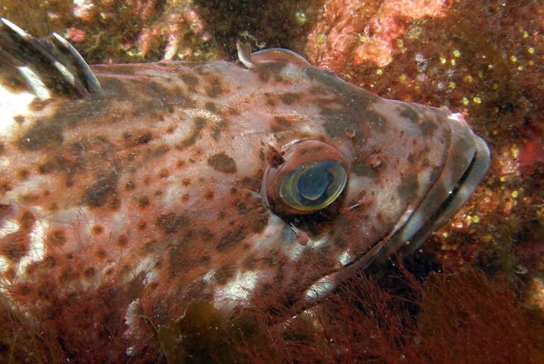
Photo: Ed Bierman, CC BY 2.0

Photo: USFWS Pacific Southwest Region, CC BY 2.0
Lower Columbia River estuary: what Oregon anglers want to know
Where on the Oregon coast is Lower Columbia River estuary?
You will find it in Clatsop County, about 9 miles from Astoria.
Is Lower Columbia River estuary a large estuary?
Close to 135,902 acres of estuary.
Which OSMB launch serves Lower Columbia River estuary?
Aldrich Point boat ramp on Columbia River is among 11 launch sites.
Where do people clam at Lower Columbia River estuary?
There is no ODFW crab and clam page for it. Shellfish gathering needs its own license.
What may I keep at Lower Columbia River estuary?
Razor Clams: First 15 dug (no sorting or releasing).
Does a visitor from out of state need an Oregon license at Lower Columbia River estuary?
An Oregon angling license ($50 resident, $138 nonresident for 2026) covers anglers 12 and older; ocean fishing from boats, beaches and jetties now also needs the Ocean Endorsement ($9 annual) unless you fish only for salmon or steelhead.
Where do bank anglers go at Lower Columbia River estuary?
The shore lists show 16 shore sites, such as Astoria Yacht Club Park on Lower Columbia River estuary.
Where do Oregon anglers buy gear for Lower Columbia River estuary?
Stop at Port of Astoria, roughly 11 miles away.
When is low tide at Lower Columbia River estuary?
Open the NOAA predictions for Knappa, Knappa Slough.
Plan a tide on Lower Columbia River estuary
Licenses, endorsements and water exceptions are on the regulations page.