Fishing in Sweet Grass County, Montana
County seat: Big Timber. Census 2020 residents: 3,678.
- 2lake pages
- 4ramps
- 2river pages
 Pick for troutPiscifun Carbon X ultralight spinning reel28% OFFSale $57.99
Photo of Livingston: Tracy Hunter, CC BY 2.0
Sweet Grass County water by the FWP numbers
Sweet Grass County runs its courthouse out of Big Timber, and the 2020 Census tallied 3,678 residents. Census Gazetteer mapping gives it 1,856 square miles of land and 6.7 square miles of water. Of the 2 lakes and reservoirs given pages in the county, Lower Glaston Lake spreads widest. Wading anglers can open Yellowstone River and Boulder River (Sweet Grass County).
County totals from FWP: 4 ramps and 2 other fishing sites without a ramp. The book breaks from the district chart on 1 water here.
U.S. Census Bureau, 2020 Census counts (TIGERweb) and the 2023 Gazetteer, read November 12, 2026. FWP Fishing Access Sites layer (ArcGIS service) and the FishMT site pages, read November 12, 2026.
FWP access points and lakes laid out across Sweet Grass County
FWP Fishing Access Sites layer (ArcGIS service) and the FishMT site pages, read November 12, 2026. Lake pins are the FWP reference point for each water.
Montana reservoirs worth fishing in Sweet Grass County
| Lake | Size | Access sites | Kind | MFISH lists |
|---|---|---|---|---|
| Lower Glaston Lake | 514 acres | 0 | natural lake | brown trout, yellow perch |
| Upper Glaston Lake | 334 acres | 0 | natural lake | brown trout, yellow perch |
The nearest lake pages to Big Timber all lie outside Sweet Grass County.
| Lake | From Big Timber | Size | Access sites | Kind | MFISH lists |
|---|---|---|---|---|---|
| Lebo Lake | 33 miles north | 309 acres | 0 | natural lake | tiger muskellunge |
| Sioux Charley Lake | 35 miles south | about 12 acres of mapped outline | 0 | natural lake | brook trout |
| Cottonwood Reservoir | 38 miles west | 239 acres | 0 | reservoir | Yellowstone cutthroat trout |
| Mystic Lake (Stillwater County) | 43 miles south | 436 acres | 0 | natural lake | rainbow trout |
| Deadmans Basin Reservoir | 43 miles northeast | 1,954 acres | 1 | reservoir | brown trout, kokanee salmon, rainbow trout |
| Cooney Reservoir | 44 miles southeast | 733 acres | 0 | reservoir | black crappie, brown trout, burbot |
Size as the FWP FishMT page for this water prints it (FishMT), read November 12, 2026. Waters with no FishMT size print their mapped outline instead. Montana FWP Lakes reference layer (ArcGIS service) and the MFISH fish distribution layers, read November 12, 2026.
 For the trout herePiscifun Carbon XT ultralight spinning reel25% OFFSale $59.99
Fish FWP maps most often close to Sweet Grass County
Lake lists inside 60 miles of Big Timber mention Yellowstone cutthroat trout most often.
FWP MFISH presence layers, counted per lake page within 60 miles; presence in a layer, not a catch survey. FWP MFISH fish distribution layer (ArcGIS service), read November 12, 2026. Presence is mapping data, not a catch report.
Creeks winding through Sweet Grass County
- Yellowstone Riverexception rules, 47 access sites, 4 USGS gauges
- Boulder River (Sweet Grass County)2 access sites, 1 USGS gauge
Streamflow numbers recorded in Sweet Grass County
| USGS gauge | Latest reading | Time (ET) |
|---|---|---|
| East Boulder River Bl Dry Fork Cr Nr Mcleod, Mt | 8 cfs, 2.06 ft gage height | Nov 15 3:30 pm |
| Boulder River At Big Timber Mt | 134 cfs, 1.28 ft gage height | Nov 15 3:00 pm |
US Geological Survey provisional data, retrieved Nov 15, 2026 4:33 pm ET. Provisional readings can be revised.
Montana FWP MFISH stream layers (ArcGIS service) for this river, read November 12, 2026. USGS Water Data for the Nation, live through the site, retrieved on page view.
Public ramps in Sweet Grass County
- Bratten Fishing Access Site on Yellowstone Riverfishing access site, ramp (gravel), gravel surface, 93 acres; Sweet Grass County
- Grey Bear Fishing Access Site on Yellowstone Riverfishing access site, ramp (gravel), gravel surface, 25 acres; Sweet Grass County
- Otter Creek Fishing Access Site on Yellowstone Riverfishing access site, ramp (concrete), concrete surface, 29 acres; Sweet Grass County
- Pelican Fishing Access Site on Yellowstone Riverfishing access site, ramp (concrete), concrete surface, 122 acres; Sweet Grass County
Walk-in river access across Sweet Grass County
- Big Rock Fishing Access Site on Boulder River (Sweet Grass County)fishing access site, hand launch, 76 acres; Sweet Grass County
- Boulder Forks Fishing Access Sitefishing access site, hand launch, 72 acres; Sweet Grass County
FWP Fishing Access Sites layer (ArcGIS service) and the FishMT site pages, read November 12, 2026.
Other named Montana lakes of Sweet Grass County, one line apiece
- Lightning Lakeabout 56 acres of mapped outline
- Wounded Man Lakeabout 39 acres of mapped outline
- Pentad Lakeabout 30 acres of mapped outline
- Rainbow Lake #2about 26 acres of mapped outline
- Mirror Lakeabout 24 acres of mapped outline
- Fish Lake (Sweet Grass County)about 17 acres of mapped outline
- Owl Lakeabout 16 acres of mapped outline
- Favonius Lakeabout 15 acres of mapped outline
- Horseshoe Lake (Sweet Grass County)about 14 acres of mapped outline
- Jordan Lakeabout 14 acres of mapped outline
- Camp Lake (Sweet Grass County)about 12 acres of mapped outline
- Narrow Escape Lakeabout 12 acres of mapped outline
- Burnt Gulch Lakeabout 11 acres of mapped outline
- Rainbow Lake #4about 10 acres of mapped outline
- Lake Pinchotabout 74 acres of mapped outline
- Rein Lakeabout 66 acres of mapped outline
- Kent Lakeabout 34 acres of mapped outline
- Jay Lakeabout 28 acres of mapped outline
- Swamp Lakeabout 23 acres of mapped outline
- Lavold Reservoirabout 22 acres of mapped outline
- Crazy Lakeabout 16 acres of mapped outline
- Sunken Rock Lakeabout 14 acres of mapped outline
- Martes Lakeabout 13 acres of mapped outline
- Blue Lakeabout 12 acres of mapped outline
- Diamond Lakeabout 12 acres of mapped outline
- Lake Raymondabout 10 acres of mapped outline
- Beley Pondabout 10 acres of mapped outline
Outline area from the FWP Lakes reference layer (ArcGIS service; mapped polygon area, not an FWP surface-acre figure), read November 12, 2026. Names come from the FWP Lakes reference layer; no page and no fish list for these waters.
Where the regulation book breaks from the district chart in Sweet Grass County
The rules here are from the 2026 Montana Fishing Regulations, valid March 1, 2026 through the end of February 2027; FWP had published no 2027 booklet when this was checked.
- Yellowstone RiverCatch-and-release for cutthroat trout. (YELLOWSTONE RIVER)
2026 Montana Fishing Regulations (valid March 1, 2026 through February 28, 2027; FWP PDF), read November 12, 2026.
FWP state records tied to Sweet Grass County water
| Species | Weight or length as listed | Water | Year | Marked |
|---|---|---|---|---|
| River carpsucker | 7.915 lbs | Yellowstone River | 2022 | native |
Montana state record fish as FWP lists them (records page), read November 12, 2026.
The weigh-in calendar for Sweet Grass County
| Date | Event | Water | Organizer |
|---|---|---|---|
| Oct. 17, 2026 | Yellowstone River Rats Walleye Tournament | Yellowstone River and tributaries | Yellowstone River Rats |
| Oct. 3, 2026 | Glendive Walleye Tournament | Yellowstone River | Visit Glendive |
| Sept. 12, 2026 | Yellowstone River Classic | Yellowstone River, Tongue River | Miles City Chapter of Walleyes Unlimited |
| July 18, 2026 | Monster Catfish Roundup | Yellowstone River | Montana Catfish Association |
| June 13, 2026 | Savage Volunteer Fire Dept Catfish Tournament | Yellowstone River | Savage Volunteer Fire Department |
| May 16, 2026 | Land of the Giants Tournament | Yellowstone River and tributaries | Visit Glendive |
| May 9, 2026 | 20th Annual Yellowstone Challenge | Yellowstone River | Montana Catfish Association |
Event as listed by the organizer (source), read November 12, 2026.
Montana tackle shops and guides in Sweet Grass County
Where to buy flies and jigs near Sweet Grass County
- Yellowstone Sporting Goodsbait and tackle shop, Livingston, 33 miles
- Yellowstone Anglerbait and tackle shop, Livingston, 33 miles
- Hatch Finders Fly Shopfly shop, Livingston, 33 miles
- Nelson's Guides and Fliesbait and tackle shop, Livingston, 36 miles
- The Bozeman Anglerbait and tackle shop, Bozeman, 52 miles
Montana guide services that fish Sweet Grass County
- Absaroka Beartooth Outfittersfishing guide, Big Timber
- Sweet Cast Anglerfishing guide, Big Timber, (406) 932-4469
Yellow Pages, State Parks and operator listings (city of business), read November 12, 2026. Guides are listed as businesses; no licence status is implied.
Minutes from Sweet Grass County on Montana roads
Montana home bases for fishing Sweet Grass County
- Big Timber2020 count 1,650
The Montana counties around Sweet Grass County
- Stillwater County29 miles east
- Park County37 miles southwest
- Wheatland County48 miles north
- Golden Valley County54 miles northeast
Piscifun rods, reels and pliers worth a look before Montana water at Sweet Grass County


Piscifun and Amazon links are affiliate links; the site earns a commission on qualifying purchases.
Divide-country water near Sweet Grass County, on camera
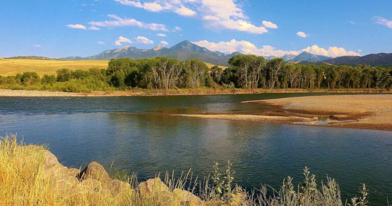
Photo: Tracy Hunter, CC BY 2.0

Photo: Bureau of Land Management Montana and Dakotas, Public domain
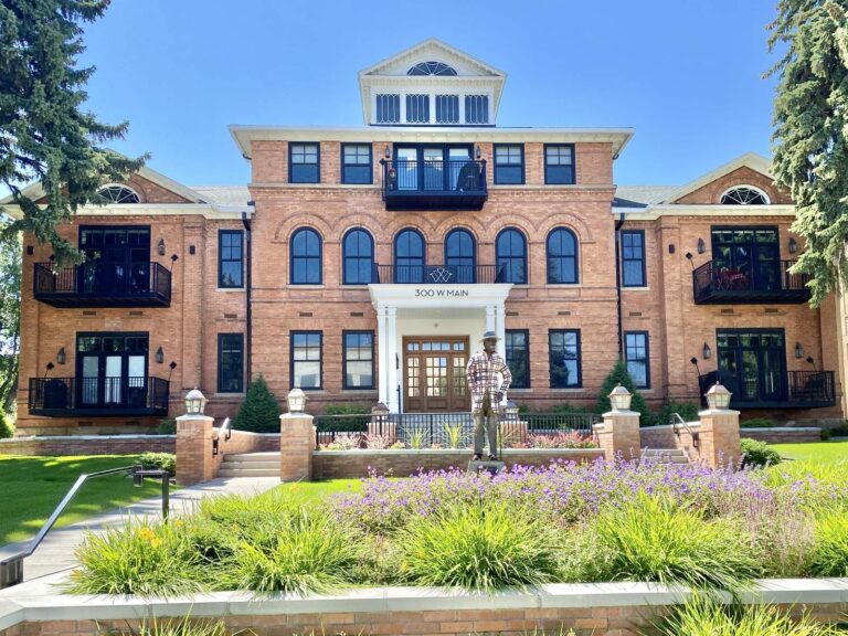
Photo: Warren LeMay, CC BY-SA 2.0
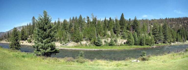
Photo: Jon Parise, CC BY-SA 2.0
Short Big Sky replies about fishing Sweet Grass County
Can a Montana drift boat or kayak go in the water in Sweet Grass County?
FWP and State Parks list 4 ramps, named above with directions.
Which lake tops the Montana size figures for Sweet Grass County?
Lower Glaston Lake, at 514 acres.
Which fish does MFISH list near Sweet Grass County?
MFISH names Yellowstone cutthroat trout on the most lake pages within 60 miles, then rainbow trout, brook trout and brown trout; the layer shows presence, not a catch.
Is a Montana tackle shop listed in Sweet Grass County?
No tackle listing sits within the county.
Which town is the seat for Sweet Grass County?
County offices sit in Big Timber.
How much does FWP charge to fish in Sweet Grass County?
Anglers 12 and older buy a Conservation License, an aquatic invasive species pass and a fishing license; the 2026 Montana Fishing Regulations prints $8, $2 and $21 for a resident full season and $10, $7.50 and $100 for a nonresident.
Which counties lie next to Sweet Grass County?
By center point: Stillwater County, Park County and Wheatland County.
What do the limits look like for Sweet Grass County water?
Limits depend on the FWP fishing district and on any exception heading printed for the water; the Western, Central and Eastern district pages on this site give the charts. The rules here are from the 2026 Montana Fishing Regulations, valid March 1, 2026 through the end of February 2027; FWP had published no 2027 booklet when this was checked.
Do any Sweet Grass County waters have their own rules?
1 water with a page here carry their own exception lines, beginning with Yellowstone River.
Do Montana clubs hold events in Sweet Grass County?
7 entries on file, none dated ahead.
Has Montana's Sweet Grass County produced a state record?
River carpsucker, 7.915 lbs, from Yellowstone River (2022).
Pick a Montana lake or creek in Sweet Grass County
Open a lake for its ramps, limits and readings.