Fishing in Madison County, Montana
County seat: Virginia City. Census 2020 residents: 8,623.
- 7lake pages
- 15ramps
- 5river pages
 Pick for troutPiscifun Carbon X ultralight spinning reel28% OFFSale $57.99
Photo of Madison River: Bureau of Land Management, CC BY 2.0
An overview of the Montana water in Madison County
A Census 2020 population of 8,623 makes up Madison County, governed from Virginia City. The Census measures 3,588 square miles of land and 15.4 square miles of water inside the line. The county carries 7 lakes and reservoirs with write-ups; Ennis Lake is biggest. Running water with its own page here includes Madison River, Big Hole River and Jefferson River.
Inside the county line sit 15 ramps and 9 other fishing sites that have no ramp. The 2026 plant report logs 2 deliveries here: 62,428 fish into 2 waters. The 2026 book lists exception rules for 8 waters in the county.
U.S. Census Bureau, 2020 Census counts (TIGERweb) and the 2023 Gazetteer, read November 12, 2026. FWP Fishing Access Sites layer (ArcGIS service) and the FishMT site pages, read November 12, 2026.
Pins for every Montana access site and lake in Madison County
FWP Fishing Access Sites layer (ArcGIS service) and the FishMT site pages, read November 12, 2026. Lake pins are the FWP reference point for each water.
Montana still water inside Madison County
| Lake | Size | Access sites | Kind | MFISH lists |
|---|---|---|---|---|
| Ennis Lake | 3,692 acres | 1 | natural lake | brown trout, mountain whitefish, rainbow trout |
| Ruby River Reservoir | 941 acres | 0 | reservoir | mountain whitefish, rainbow trout |
| Willow Creek Reservoir (Madison County) | 713 acres | 1 | reservoir | rainbow trout, Westslope cutthroat trout |
| Quake Lake | 612 acres | 0 | natural lake | mountain whitefish, rainbow trout |
| Cliff Lake (Madison County) | 608 acres | 0 | natural lake | mountain whitefish, rainbow trout |
| Wade Lake | 202 acres | 0 | natural lake | brown trout, rainbow trout |
| Hidden Lake (Madison County) | 147 acres | 0 | natural lake | brown trout, rainbow trout |
Size as the FWP FishMT page for this water prints it (FishMT), read November 12, 2026. Waters with no FishMT size print their mapped outline instead. Montana FWP Lakes reference layer (ArcGIS service) and the MFISH fish distribution layers, read November 12, 2026.
 For the trout herePiscifun Carbon XT ultralight spinning reel25% OFFSale $59.99
The Montana presence tally for Madison County
Bars count lake pages within 60 miles of Virginia City where the MFISH layer lists the fish; rainbow trout leads.
FWP MFISH presence layers, counted per lake page within 60 miles; presence in a layer, not a catch survey. FWP MFISH fish distribution layer (ArcGIS service), read November 12, 2026. Presence is mapping data, not a catch report.
Moving Montana water in Madison County
- Madison Riverexception rules, 12 access sites, 4 USGS gauges
- Big Hole Riverexception rules, 10 access sites, 4 USGS gauges
- Jefferson Riverexception rules, 10 access sites, 3 USGS gauges
- Beaverhead Riverexception rules, 6 access sites, 4 USGS gauges
- Ruby Riverexception rules, 5 access sites, 3 USGS gauges
Water-level stations inside Madison County
| USGS gauge | Latest reading | Time (ET) |
|---|---|---|
| Beaverhead River Near Twin Bridges Mt | 237 cfs, 3.39 ft gage height | Nov 15 4:15 pm |
| Ruby River Above Reservoir Near Alder, Mt | 98 cfs, 2.94 ft gage height | Nov 15 3:45 pm |
| Ruby River Below Reservoir Near Alder, Mt | 42 cfs, 2.32 ft gage height | Nov 15 3:45 pm |
US Geological Survey provisional data, retrieved Nov 15, 2026 4:33 pm ET. Provisional readings can be revised.
Montana FWP MFISH stream layers (ArcGIS service) for this river, read November 12, 2026. USGS Water Data for the Nation, live through the site, retrieved on page view.
Montana launch ramps across Madison County
- Brownes Bridge Fishing Access Site on Big Hole Riverfishing access site, ramp (gravel), gravel surface, 10 acres; Madison County
- Burnt Tree Hole Fishing Access Site on Madison Riverfishing access site, ramp (concrete), concrete surface, 29 acres; Madison County
- Damselfly Fishing Access Site on Madison Riverfishing access site, ramp (concrete), concrete surface, 2 acres; Madison County
- Eight Mile Ford Fishing Access Site on Madison Riverfishing access site, ramp (gravel), gravel surface, 30 acres; Madison County
- Harrison Lake Fishing Access Site on Willow Creek Reservoir (Madison County)fishing access site, ramp (concrete), concrete surface, 40 acres; Madison County
- Hell's Canyon Fishing Access Site on Jefferson Riverfishing access site, ramp (gravel), gravel surface, 4 acres; Madison County
- Kountz Bridge Fishing Access Site on Jefferson Riverfishing access site, ramp (concrete), concrete surface, 38 acres; Madison County
- Lyons Bridge Fishing Access Site on Madison Riverfishing access site, ramp (concrete), concrete surface, 3 acres; Madison County
- McAtee Bridge Fishing Access Site on Madison Riverfishing access site, ramp (gravel), gravel surface, 8 acres; Madison County
- Silver Star Fishing Access Site on Jefferson Riverfishing access site, ramp (concrete), concrete surface, 24 acres; Madison County
- Tony Schoonen FAS on Big Hole Riverfishing access site, ramp (gravel), gravel surface, 12 acres; Madison County
- Valley Garden Fishing Access Site on Madison Riverfishing access site, ramp (gravel), gravel surface, 143 acres; Madison County
- Varney Bridge Fishing Access Site on Madison Riverfishing access site, ramp (concrete), concrete surface, 8 acres; Madison County
- Ennis Fishing Access Sitefishing access site, ramp (gravel), gravel surface, 49 acres; Madison County
- Raynolds' Pass Fishing Access Sitefishing access site, ramp (gravel), gravel surface, 170 acres; Madison County
Docks and piers in Madison County
- Alder Bridge Fishing Access Site on Ruby Riverfishing access site, no boat facilities, 12 acres; Madison County
- Meadow Lake Fishing Access Site on Ennis Lakefishing access site, no boat facilities, 8 acres; Madison County
- Ruby Dam Fishing Access Sitefishing access site, no boat facilities, 8 acres; Madison County
- Ruby Island Fishing Access Sitefishing access site, no boat facilities, 46 acres; Madison County
- Silver Springs Bridge Fishing Access Site on Ruby Riverfishing access site, no boat facilities, 23 acres; Madison County
- Three Dollar Bridge Fishing Access Site on Madison Riverfishing access site, no boat facilities, 101 acres; Madison County
- Vigilante Fishing Access Site on Ruby Riverfishing access site, no boat facilities, 69 acres; Madison County
- Kalsta Bridge Fishing Access Site on Big Hole Riverfishing access site, no boat facilities, 6 acres; Madison County
- Parrot Castle Fishing Access Site on Jefferson Riverfishing access site, no boat facilities, 33 acres; Madison County
FWP Fishing Access Sites layer (ArcGIS service) and the FishMT site pages, read November 12, 2026.
Little lakes of Madison County that carry only a name and outline
- Upper Branham Lakesabout 18 acres of mapped outline
- Noble Lakeabout 18 acres of mapped outline
- South Meadow Creek Lakeabout 71 acres of mapped outline
- Twin Lakesabout 38 acres of mapped outline
- Cedar Lakeabout 36 acres of mapped outline
- Cataract Lakeabout 35 acres of mapped outline
- Dry Lakeabout 35 acres of mapped outline
- Bell Lakeabout 24 acres of mapped outline
- Dutchman Lakeabout 23 acres of mapped outline
- Hollow Top Lakeabout 22 acres of mapped outline
- Sheep Lakeabout 20 acres of mapped outline
- Diamond Lakeabout 17 acres of mapped outline
- Brentin Lakeabout 16 acres of mapped outline
- Blue Danube Lakeabout 15 acres of mapped outline
- Green Hollow Reservoirabout 15 acres of mapped outline
- Axolotl Lakeabout 14 acres of mapped outline
- Cliff Lakeabout 14 acres of mapped outline
- Echo Lakeabout 14 acres of mapped outline
- Louise Lakeabout 13 acres of mapped outline
- No Man Lakeabout 13 acres of mapped outline
- Sailor Lakeabout 13 acres of mapped outline
- Spanish Lakesabout 12 acres of mapped outline
- Twin Lakesabout 12 acres of mapped outline
- Lower Branham Lakeabout 12 acres of mapped outline
- Sureshot Lakeabout 11 acres of mapped outline
- Romy Lakeabout 11 acres of mapped outline
- Twin Lakesabout 11 acres of mapped outline
- Mine Lakeabout 11 acres of mapped outline
- Deep Lakeabout 10 acres of mapped outline
Outline area from the FWP Lakes reference layer (ArcGIS service; mapped polygon area, not an FWP surface-acre figure), read November 12, 2026. Names come from the FWP Lakes reference layer; no page and no fish list for these waters.
Rule changes the book lists for Madison County waters
The rules here are from the 2026 Montana Fishing Regulations, valid March 1, 2026 through the end of February 2027; FWP had published no 2027 booklet when this was checked.
- Beaverhead RiverRainbow trout: Catch-and-release only. (BEAVERHEAD RIVER)
- Big Hole RiverCatch-and-release for arctic grayling. (BIG HOLE RIVER)
- Hidden Lake (Madison County)Open June 15 through Nov. 30. (HIDDEN LAKE AND TRIBUTARIES (Madison County))
- Jefferson RiverNorthern pike: no limit. (JEFFERSON RIVER)
- Madison RiverCatch-and-release for rainbow trout, except anglers 14 years of age or younger may take 1 rainbow trout daily and in possession, any size. (MADISON RIVER)
- Ruby RiverCombined trout: all may be cutthroat trout. (RUBY RIVER)
- Ruby River ReservoirOpen third Saturday in May through Nov. 30. (RUBY RIVER RESERVOIR)
- Wade LakeSpawning channel and channel inlet closed as posted. (WADE LAKE (Madison County))
2026 Montana Fishing Regulations (valid March 1, 2026 through February 28, 2027; FWP PDF), read November 12, 2026.
The 2026 plant report for Madison County
| Date | Water as FishMT prints it | Fish | Species |
|---|---|---|---|
| June 22, 2026 | Ruby River Reservoir | 52,428 | Rainbow trout |
| April 29, 2026 | Willow Creek Reservoir | 10,000 | Kokanee salmon |
FWP FishMT stocking report for 2026, year to date (FishMT plant report), read November 12, 2026.
Where Madison County shows up in the FWP record list
| Species | Weight or length as listed | Water | Year | Marked |
|---|---|---|---|---|
| Utah chub | 2.39 lbs. | Canyon Ferry Lake | 2022 | not marked native |
| Kokanee salmon | 7.85 lbs. | Hauser Reservoir | 2003 | not marked native |
| Longnose sucker | 4.78 lbs. | Hauser Reservoir | 2022 | native |
| Mountain whitefish | 5.11 lbs. | Hauser Reservoir | 2007 | native |
Montana state record fish as FWP lists them (records page), read November 12, 2026.
Gear stores in Madison County
Shops the Madison County regulars swear by
- Fishtales Outfittingbait and tackle shop, Sheridan
- Greco's On the Flyfly shop, Ennis
- Harman Fly Shopfly shop, Sheridan
- Madison River Fishing Co Incbait and tackle shop, Ennis
- The Tackle Shop – Outfitter and Fly Shopfly shop, Ennis
Montana guides listed near Madison County
- Adam Shaw-Doran Fishingfishing guide, Mc Allister, (406) 570-9919
- Adventures Outfitting LLCfishing guide, Ennis
- Big Hole C4 Lodgefishing guide, Twin Bridges, (406) 684-5760
- Four Rivers Fishing Cofishing guide, Sheridan, (406) 684-5651
- Highlands To Islands Guide Servicefishing guide, Ennis, (406) 682-7677
- Jack River Outfittersfishing guide, Mc Allister, (406) 682-4948
- Madison Double Rfishing guide, Ennis, (406) 682-5555
- Madison River Fishing Companyfishing guide, Ennis, (406) 682-4293
Yellow Pages, State Parks and operator listings (city of business), read November 12, 2026. Guides are listed as businesses; no licence status is implied.
In Montana close to Madison County
Montana neighbors of Madison County
- Gallatin County39 miles east
- Beaverhead County49 miles west
- Silver Bow County53 miles northwest
- Jefferson County56 miles north
Piscifun reels and line to pack for a Montana trip to Madison County


Piscifun and Amazon links are affiliate links; the site earns a commission on qualifying purchases.
Big Sky shorelines and trout-stream riffles around Madison County, photographed
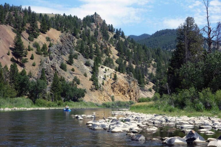
Photo: Tom Hart, CC BY 2.0

Photo: Bureau of Land Management Montana and Dakotas, Public domain

Photo: Nicolas Henderson, CC BY 2.0

Photo: Phil Price, CC BY-SA 2.0
Fishing inside Madison County, Montana: the common asks
Where can I put a boat in the water in Montana's Madison County?
15 ramps, each in the access list above.
Which Montana lake is the biggest in Madison County?
Ennis Lake leads with 3,692 acres.
What fish turn up on FWP pages near Madison County?
MFISH names rainbow trout on the most lake pages within 60 miles, then brown trout, Arctic grayling and burbot; the layer shows presence, not a catch.
Where do Montana anglers in Madison County pick up flies and jigs?
5 listings, Fishtales Outfitting among them.
What Montana town serves Madison County as its seat?
It is Virginia City.
What does a Montana fishing license cost for Madison County?
Anglers 12 and older buy a Conservation License, an aquatic invasive species pass and a fishing license; the 2026 Montana Fishing Regulations prints $8, $2 and $21 for a resident full season and $10, $7.50 and $100 for a nonresident.
What Montana counties are closest to Madison County?
Nearest first: Gallatin County, Beaverhead County and Silver Bow County.
What limits cover Madison County water?
Limits depend on the FWP fishing district and on any exception heading printed for the water; the Western, Central and Eastern district pages on this site give the charts. The rules here are from the 2026 Montana Fishing Regulations, valid March 1, 2026 through the end of February 2027; FWP had published no 2027 booklet when this was checked.
Does the regulation book list exceptions for Madison County water?
8 waters with a page here carry their own exception lines, beginning with Beaverhead River.
Is Montana's Madison County on the 2026 plant report?
The 2026 plant report lists 62,428 fish in 2 rows across 2 waters in the county.
A prairie or Rockies morning in Madison County
River pages list access sites and live USGS flow.