Fishing in Dawson County, Montana
County seat: Glendive. Census 2020 residents: 8,940.
- 1lake pages
- 3ramps
- 1river pages
 Pick for crappiePiscifun Carbon X ultralight spinning reel28% OFFSale $57.99
Photo of Yellowstone River: Bureau of Land Management Montana and Dakotas, Public domain
Dawson County: the Montana short version
County business for Dawson County happens in Glendive, home county to 8,940 people as of 2020. Gazetteer totals: 2,372 square miles of land and 11.5 square miles of water. 1 lake or reservoir have their own page in Dawson County, with Johnson Reservoir ahead on size. For a stream day, start with Yellowstone River.
FWP lists 3 ramps in the county and 1 other fishing site more without a ramp. FishMT's 2026 grid shows 5,000 fish stocked in the county over 1 row and 1 water. Check the exception headings for 1 water before keeping fish.
U.S. Census Bureau, 2020 Census counts (TIGERweb) and the 2023 Gazetteer, read November 12, 2026. FWP Fishing Access Sites layer (ArcGIS service) and the FishMT site pages, read November 12, 2026.
Plotting Dawson County lakes, launches and walk-in sites
FWP Fishing Access Sites layer (ArcGIS service) and the FishMT site pages, read November 12, 2026. Lake pins are the FWP reference point for each water.
Reservoirs and ponds in Dawson County, Montana
| Lake | Size | Access sites | Kind | MFISH lists |
|---|---|---|---|---|
| Johnson Reservoir | 31 acres | 1 | reservoir | yellow perch |
With only a handful of paged lakes in Dawson County, here are the closest from Glendive.
| Lake | From Glendive | Size | Access sites | Kind | MFISH lists |
|---|---|---|---|---|---|
| Gartside Reservoir | 39 miles northeast | 44 acres | 1 | reservoir | black crappie, bluegill, walleye |
| South Sandstone Reservoir | 55 miles south | 114 acres | 1 | reservoir | black crappie, northern pike, smallmouth bass |
| Spotted Eagle Lake | 73 miles southwest | about 25 acres of mapped outline | 0 | natural lake | black bullhead, black crappie, bluegill |
| Frazer Lake | 89 miles northwest | 310 acres | 0 | natural lake | largemouth bass, northern pike, rainbow trout |
| Medicine Lake (Sheridan County) | 95 miles north | 8,931 acres | 0 | natural lake | northern pike |
| Fort Peck Powerhouse Tailrace | 102 miles northwest | 1,302 acres | 0 | natural lake | burbot, channel catfish, cisco |
Size as the FWP FishMT page for this water prints it (FishMT), read November 12, 2026. Waters with no FishMT size print their mapped outline instead. Montana FWP Lakes reference layer (ArcGIS service) and the MFISH fish distribution layers, read November 12, 2026.
 For the crappie herePiscifun Carbon XT ultralight spinning reel25% OFFSale $59.99
What the MFISH layer names around Dawson County
Out to 120 miles from Glendive, MFISH names northern pike on more lake pages than any other fish.
FWP MFISH presence layers, counted per lake page within 120 miles; presence in a layer, not a catch survey. FWP MFISH fish distribution layer (ArcGIS service), read November 12, 2026. Presence is mapping data, not a catch report.
Streams crossing Dawson County
- Yellowstone Riverexception rules, 47 access sites, 4 USGS gauges
Gauge readings logged within Dawson County
| USGS gauge | Latest reading | Time (ET) |
|---|---|---|
| Yellowstone River At Glendive, Mt | 5,360 cfs, 42.87 ft gage height | Nov 15 3:00 pm |
US Geological Survey provisional data, retrieved Nov 15, 2026 4:33 pm ET. Provisional readings can be revised.
Montana FWP MFISH stream layers (ArcGIS service) for this river, read November 12, 2026. USGS Water Data for the Nation, live through the site, retrieved on page view.
Montana ramps and hand launches in Dawson County
- Black Bridge Fishing Access Site on Yellowstone Riverfishing access site, ramp (concrete), concrete surface, 79 acres; Dawson County
- Stipek Fishing Access Site on Yellowstone Riverfishing access site, ramp (concrete), concrete surface, 119 acres; Dawson County
- Intake Dam Fishing Access Sitefishing access site, ramp (concrete), concrete surface, 405 acres; Dawson County
Montana shore spots spread over Dawson County
- Johnson Reservoir Fishing Access Sitefishing access site, no boat facilities, 30 acres; Dawson County
FWP Fishing Access Sites layer (ArcGIS service) and the FishMT site pages, read November 12, 2026.
FWP layer names for Dawson County waters without a write-up
- Malkuch Reservoirabout 59 acres of mapped outline
- Knudson Pondabout 33 acres of mapped outline
- Wold Reservoirabout 31 acres of mapped outline
- Lindsay Reservoirabout 30 acres of mapped outline
- Botch Reservoirabout 18 acres of mapped outline
- Crisafulli Lakeabout 16 acres of mapped outline
- Upper Labell Reservoirabout 15 acres of mapped outline
- Lee Pondabout 14 acres of mapped outline
- Twin Forks Reservoirabout 14 acres of mapped outline
- Keeland Reservoirabout 12 acres of mapped outline
- Rattlesnake Reservoirabout 12 acres of mapped outline
- Longs Reservoirabout 12 acres of mapped outline
- Wilgosh Reservoirabout 11 acres of mapped outline
- Slagsvold Reservoirabout 10 acres of mapped outline
Outline area from the FWP Lakes reference layer (ArcGIS service; mapped polygon area, not an FWP surface-acre figure), read November 12, 2026. Names come from the FWP Lakes reference layer; no page and no fish list for these waters.
Montana special rules by water in Dawson County
The rules here are from the 2026 Montana Fishing Regulations, valid March 1, 2026 through the end of February 2027; FWP had published no 2027 booklet when this was checked.
- Yellowstone RiverCatch-and-release for cutthroat trout. (YELLOWSTONE RIVER)
2026 Montana Fishing Regulations (valid March 1, 2026 through February 28, 2027; FWP PDF), read November 12, 2026.
Where FWP stocked fish in Dawson County
| Date | Water as FishMT prints it | Fish | Species |
|---|---|---|---|
| July 2, 2026 | Johnson Reservoir | 5,000 | Yellow perch |
FWP FishMT stocking report for 2026, year to date (FishMT plant report), read November 12, 2026.
Montana state-record catches around Dawson County
| Species | Weight or length as listed | Water | Year | Marked |
|---|---|---|---|---|
| River carpsucker | 7.915 lbs | Yellowstone River | 2022 | native |
Montana state record fish as FWP lists them (records page), read November 12, 2026.
Organized fishing events on Dawson County water
| Date | Event | Water | Organizer |
|---|---|---|---|
| Oct. 17, 2026 | Yellowstone River Rats Walleye Tournament | Yellowstone River and tributaries | Yellowstone River Rats |
| Oct. 3, 2026 | Glendive Walleye Tournament | Yellowstone River | Visit Glendive |
| Sept. 12, 2026 | Yellowstone River Classic | Yellowstone River, Tongue River | Miles City Chapter of Walleyes Unlimited |
| July 18, 2026 | Monster Catfish Roundup | Yellowstone River | Montana Catfish Association |
| June 13, 2026 | Savage Volunteer Fire Dept Catfish Tournament | Yellowstone River | Savage Volunteer Fire Department |
| May 16, 2026 | Land of the Giants Tournament | Yellowstone River and tributaries | Visit Glendive |
| May 9, 2026 | 20th Annual Yellowstone Challenge | Yellowstone River | Montana Catfish Association |
Event as listed by the organizer (source), read November 12, 2026.
Montana fly shops and tackle stores of Dawson County
Gear stores within reach of Dawson County
- Rock Creek Marinamarina, Fort Peck, 84 miles
Yellow Pages, State Parks and operator listings (city of business), read November 12, 2026. Guides are listed as businesses; no licence status is implied.
Montana places mapped beside Dawson County
Montana towns in Dawson County with their own pages
- Glendive2020 count 4,873
Montana counties sharing a line with Dawson County
- Wibaux County36 miles southeast
- Richland County39 miles northeast
- Prairie County42 miles southwest
- McCone County47 miles northwest
A Piscifun bundle sized for Big Sky fishing at Dawson County


Piscifun and Amazon links are affiliate links; the site earns a commission on qualifying purchases.
Blue-ribbon creeks, canyon lakes and wide rivers around Dawson County, pictured

Photo: Bureau of Land Management Montana and Dakotas, Public domain
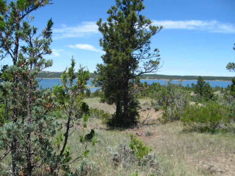
Photo: USFWS Mountain-Prairie, Public domain

Photo: David Schott, CC BY 2.0
What Montanans ask about the water in Dawson County
Are there public Montana ramps in Dawson County?
FWP maps 3 ramps inside the county.
Which reservoir leads Dawson County on size?
On size, Johnson Reservoir: 31 acres.
Which species keep appearing in MFISH lists around Dawson County?
MFISH names northern pike on the most lake pages within 120 miles, then largemouth bass, yellow perch and common carp; the layer shows presence, not a catch.
Which Montana shops in Dawson County carry tackle?
The county itself has none on file; stores close by appear above.
Which Montana town is the county seat of Dawson County?
The seat is Glendive.
Do I need a Montana license to fish in Dawson County?
Anglers 12 and older buy a Conservation License, an aquatic invasive species pass and a fishing license; the 2026 Montana Fishing Regulations prints $8, $2 and $21 for a resident full season and $10, $7.50 and $100 for a nonresident.
Which Montana county pages sit near Dawson County?
Look at Wibaux County, Richland County and Prairie County.
Is there a daily limit in Dawson County?
Limits depend on the FWP fishing district and on any exception heading printed for the water; the Western, Central and Eastern district pages on this site give the charts. The rules here are from the 2026 Montana Fishing Regulations, valid March 1, 2026 through the end of February 2027; FWP had published no 2027 booklet when this was checked.
Which waters in Dawson County break from the district chart?
1 water with a page here carry their own exception lines, beginning with Yellowstone River.
How much FWP stocking does Dawson County see?
The 2026 plant report lists 5,000 fish in 1 row across 1 water in the county.
Are there fishing contests in Dawson County?
7 entries on file, none dated ahead.
Is Dawson County water on the FWP record list?
River carpsucker, 7.915 lbs, from Yellowstone River (2022).
Work the Montana lakes and streams of Dawson County
Every access page carries a directions link.