Okatibbee Reservoir Fishing
Mississippi reservoir listed at 3,500 acres, found in Lauderdale County.
 Pick for largemouthPiscifun Chaos Pro CNC baitcasting reel25% OFFSale $97.99
Photo of Ross Barnett Reservoir: Rhett Sutphin, CC BY 2.0
Okatibbee Reservoir at a glance, Mississippi
Okatibbee Reservoir lies in Lauderdale County; the page text calls it 3,500 acres. The record gives U.S. Army Corps of Engineers as the operating agency. Census town closest to it: Collinsville, roughly 3 miles off.
The ramp layer lists 7 ramps on it.
MDWFP record for Okatibbee Reservoir (MDWFP source), read November 19, 2026.
Acres as stated on the MDWFP lake page for Okatibbee Reservoir (MDWFP lake page), read November 19, 2026. The MDWFP mapped polygon and the USGS outline give different figures, so each is labeled with its source.
Outline area from the USGS National Hydrography Dataset polygon (NHD service; mapped area, not a surveyed surface-acre figure), read November 19, 2026.
U.S. Census Bureau, 2020 Census counts (TIGERweb) and the 2023 Gazetteer, read November 19, 2026.
Why Okatibbee Reservoir has more than one acreage
Each source counts the water its own way, so Okatibbee Reservoir shows 3,500 acres (MDWFP lake page), 3,764 acres of mapped polygon (MDWFP polygon) and about 3,764 acres of mapped outline (USGS outline).
Treat each number as the source describes it and no more.
Acres as stated on the MDWFP lake page for Okatibbee Reservoir (MDWFP lake page), read November 19, 2026. The MDWFP mapped polygon and the USGS outline give different figures, so each is labeled with its source.
Outline area from the USGS National Hydrography Dataset polygon (NHD service; mapped area, not a surveyed surface-acre figure), read November 19, 2026.
The state's short profile of Okatibbee Reservoir
From the fisheries bureau page for Okatibbee Reservoir: "Okatibbee Reservoir is operated by the U.S. Army Corps of Engineers (COE)."
Check with U.S. Army Corps of Engineers before you count on a gate, a campground or a launch fee.
MDWFP record for Okatibbee Reservoir (MDWFP source), read November 19, 2026.
Hauling the boat down to Okatibbee Reservoir
- Collinsville Fishing Area on Okatibbee Reservoirboat ramp
- Gin Creek Fishing Area on Okatibbee Reservoirboat ramp
- Okatibbee Reservoir W Bank Fishing Areaboat ramp
- Pine Springs Fishing Area on Okatibbee Reservoirboat ramp
- Twiddley Branch Campground on Okatibbee Reservoirboat ramp
- Pat Harrison Water Park #1 on Okatibbee Reservoirboat ramp
- Pat Harrison Water Park #2 on Okatibbee Reservoirboat ramp
No row says when a ramp opens or what it charges; ask the operator.
MDWFP Fishing Dashboard boat ramps layer (ArcGIS service), read November 19, 2026. Lanes, hours and fees are not published; the fee type is a label only.
Recent level numbers for Okatibbee Reservoir
USACE readings for Okatibbee Reservoir, Nov. 19, 2:00 a.m. EST.
USACE CWMS reporting API for Okatibbee Lake (water.usace.army.mil), readings as served with their time stamps, read November 19, 2026. Not live; elevations carry the datum the Corps lists.
USACE readings for Okatibbee Reservoir, Nov. 19, 2:00 a.m. EST.
USACE CWMS reporting API for Okatibbee Lake (water.usace.army.mil), readings as served with their time stamps, read November 19, 2026. Not live; elevations carry the datum the Corps lists.
Only the USGS line refreshes on page view; the rest are snapshots with their times.
Rows to read before a stringer leaves Okatibbee Reservoir
Start with the statewide table for Okatibbee Reservoir; where a lake page prints its own length or creel row, that row is shown after it. Where MDWFP prints a rule for one water it appears in the rows on this page with its source; waters with no row follow the statewide limits.
| Fish as printed | Daily limit as printed | Minimum size as printed | Special |
|---|---|---|---|
| Black bass (combined largemouth, spotted, smallmouth) | 10 | ||
| Sauger | 10 | ||
| Walleye | 3 | Harvest and possession of walleye prohibited in Lake Lamar Bruce, Elvis Presley Lake, Lake Monroe, Choctaw Lake (Choctaw County) (public-water-body page) and in the Old Tombigbee River and its tributaries north of Hwy 278 (Monroe, Itawamba, Prentiss counties) (Rule 1.4 A.3). Water-specific creel in waters table. | |
| Striped bass and striped bass hybrids | 6 | 15 in minimum | |
| Crappie (combined black and white) | 30 | Lake-specific crappie rules apply (e.g. 12 in / 10 per day on Sardis, Grenada, Enid, Arkabutla). | |
| Bream (combined bluegill, redear and other sunfish) | 100 | ||
| Alligator gar | 2 | Alligator gar harvest prohibited on Bee Lake (Holmes County). | |
| Paddlefish | 2 | must be less than 30 in (measured eye to fork of tail) | Paddlefish over 30 in must be released; no harvest in the Tenn-Tom Waterway, Tombigbee River and tributaries, or Pickwick Lake. |
| Catfish (blue, channel, flathead) | 10 only at MDWFP State Fishing Lakes and State Park Lakes; no creel limit on other waters | On border waters with Alabama and Tennessee: 1 catfish over 34 in per person per day. | |
| Any game or sport fish species not listed | no daily creel limit | Rule 1.4 A.1.b. | |
| All sturgeon (Alabama, Atlantic, pallid, shovelnose) | 0 (harvest and possession prohibited in all Mississippi waters) | Rule 1.4 A.7. |
MDWFP statewide creel limits (Rule 1.4, April 2026) and the lake pages supply these rules as read on Nov. 19, 2026; where a lake page and the rule table differ, the table governs, and nothing for 2027 appears.
A resident freshwater angler who also hunts pays $25 for the all-game license, and a nonresident pays $68 for freshwater fishing, according to the MDWFP prices, before agent fees.
MDWFP statewide creel limits (Rule 1.4, updated April 2026) and public water body regulations (mdwfp.com), read November 19, 2026. Web pages summarize 40 Miss. Admin. Code Part 3; the rule text controls.
License prices from the MDWFP price page (mdwfp.com), read November 19, 2026. Agent and process fees are not included.
 For the largemouth herePiscifun AlinoX 300 low profile baitcaster34% OFFSale $104.99
Organizer events held on Okatibbee Reservoir
Contest dates, organizers and results for Okatibbee Reservoir are gathered on a linked page.
Mississippi: places mapped beside Okatibbee Reservoir
Mississippi: lakes worth a detour from Okatibbee Reservoir
- Lake Tom Bailey17 miles east
- Ross Barnett Reservoir68 miles west
- Aberdeen Lake94 miles north
- Bee Lake100 miles northwest
- Wolf Lake101 miles west
Pick up live bait and tackle around Okatibbee Reservoir
- Coves Nest Marinamarina, Collinsville, 2 miles
- Pelican's Cover RV Resort & Marinamarina, Collinsville, 2 miles
- Lee's Bait Shopbait and tackle shop, Meridian, 7 miles
- Walmart, 2400 Hwy 19 Northbait and tackle shop, Meridian, 9 miles
- Lauderdale Co Farm Supplybait and tackle shop, Meridian, 11 miles
- Academy Sports + Outdoors (Meridian)bait and tackle shop, Meridian, 12 miles
Mississippi towns with beds near Okatibbee Reservoir
- Collinsville3 miles
- Marion10 miles
- Meridian11 miles
Mississippi: counties touching Okatibbee Reservoir
- Lauderdale Countyseat: Meridian
A Piscifun bundle sized for Mississippi lakes and bayous like Okatibbee Reservoir


Piscifun and Amazon links are affiliate links; the site earns a commission on qualifying purchases.
Cypress banks and red clay shores around Okatibbee Reservoir, photographed
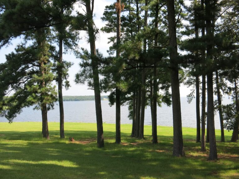
Photo: James Case, CC BY 2.0
Photo: James Case, CC BY 2.0

Photo: Paul Lowry, CC BY 2.0
Photo: Lester Snapwell, CC BY 2.0
Okatibbee Reservoir answered in a few plain questions in Mississippi
Which acre figure goes with Okatibbee Reservoir?
Quick check: MDWFP's lake page states 3,500 acres. The polygon and outline figures differ, so they are labeled with their sources.
Where in Mississippi is Okatibbee Reservoir?
In practice: The county list for Okatibbee Reservoir reads: Lauderdale County.
What ramps are mapped at Okatibbee Reservoir?
Plainly: Ramp data count 7 ramps, including Collinsville Fishing Area on Okatibbee Reservoir. Open or closed status is not in the data.
What creel numbers apply at Okatibbee Reservoir?
Quick check: The Rule 1.4 statewide table applies; no lake-page row was found. Confirm limits on mdwfp.com before you go.
Which Mississippi license goes with a day at Okatibbee Reservoir?
In practice: A resident freshwater angler who also hunts pays $25 for the all-game license, and a nonresident pays $68 for freshwater fishing, according to the MDWFP prices, before agent fees.
Is any listed shop within reach of Okatibbee Reservoir?
Plainly: Coves Nest Marina, about 2 miles away, is first on the list.
Which town supplies anglers at Okatibbee Reservoir?
Quick check: Census data put Collinsville nearest, roughly 3 miles off in a straight line.
What pages cover the waters around Okatibbee Reservoir?
In practice: Waters nearby with a page of their own: Lake Tom Bailey, Ross Barnett Reservoir and Aberdeen Lake.
What should go into a phone map for Okatibbee Reservoir?
Plainly: The Directions button opens a map pinned at the coordinates on file for Okatibbee Reservoir. Ask the owner or the county before relying on access.
Where do I find readings for Okatibbee Reservoir?
Quick check: Yes: the level band prints every reading with its agency and time, and only USGS numbers refresh when the page loads.
Which page collects the events on Okatibbee Reservoir?
In practice: The tournament page linked above gathers dated events with each organizer and any posted results.
Be on the water at dawn at Okatibbee Reservoir
Check fees and limits first.