Fishing in Monroe County, Mississippi
County seat: Aberdeen. Census 2020 residents: 34,180.
- 10named waters
- 13ramps
- 2river pages
 Pick for largemouthPiscifun Chaos Pro CNC baitcasting reel31% OFFSale $89.99
Photo of Columbus: Lester Snapwell, CC BY 2.0
An overview of the lakes and rivers in Monroe County
The 2020 Census found 34,180 people in Monroe County, with Aberdeen as the seat. In Gazetteer terms the county spans 765 square miles of land and 7 square miles of water. The county map holds 10 waters; Aberdeen Lake spreads over the most area. Rivers with a page of their own here include Tombigbee River and Town Creek (Lee County).
Inside the line the layers show 13 boat ramps, besides 5 piers and fishing points mapped sites that lack a ramp. The stocking history names 2 rows in Monroe County, each by year only. Water-specific rows touch 1 water in the county. Crossing the line applies to 2 waters; check which license covers each.
U.S. Census Bureau, 2020 Census counts (TIGERweb) and the 2023 Gazetteer, read November 19, 2026. MDWFP Fishing Dashboard boat ramps layer (ArcGIS service), read November 19, 2026. Lanes, hours and fees are not published; the fee type is a label only.
Yearly stocking rows tied to Monroe County
- Aberdeen Lakereported for 2025, Largemouth bass
- Aberdeen Lakereported for 2022, Largemouth bass, 84,000 printed
MDWFP publishes no stocking schedule; these rows are history printed by year. Mississippi stocking page
MDWFP stocking history as printed in its 2026 Reel Facts sheets (MDWFP source), year only, read November 19, 2026. MDWFP publishes no dated stocking schedule or report.
 For the largemouth herePiscifun AlinoX 300 low profile baitcaster34% OFFSale $104.99
Bayous, lakes and landings pinned across Monroe County
MDWFP Fishing Dashboard boat ramps layer (ArcGIS service), read November 19, 2026. Lanes, hours and fees are not published; the fee type is a label only. Water pins sit at the point MDWFP, MDMR or the USGS gives for each water.
Mississippi: still water inside Monroe County
| Lake | Size | Access points | Kind | Operator or MDWFP label |
|---|---|---|---|---|
| Aberdeen Lake | 4,121 acres | 4 | lake | U.S. Army Corps of Engineers |
Acres as stated on the MDWFP lake page for this water (MDWFP lake page), read November 19, 2026. The MDWFP mapped polygon and the USGS outline give different figures, so each is labeled with its source. Waters with no MDWFP acreage show the layer or mapped outline figure instead, never merged. MDWFP record for this water (MDWFP source), read November 19, 2026.
Mississippi: moving water in Monroe County
- Tombigbee River6 access points, 4 USGS gauges, USACE site
- Town Creek (Lee County)2 USGS gauges, USACE site
Gauge readings tied to Monroe County
USGS has no current reading for these gauges.
MDWFP and MDMR access-point records and USGS or USACE gauge listings for this water (source), read November 19, 2026. No flowline length is published, so none is printed. USGS Water Data for the Nation, live through the site, retrieved on page view.
Mississippi: launch ramps across Monroe County
- Aberdeen Marina on Aberdeen Lakeboat ramp; Monroe County
- Amory Rec. Area on Lock A Tenn Tomboat ramp; Monroe County
- Becker Bottom Access on Aberdeen Lakeboat ramp; Monroe County
- Blue Bluff Campground on Aberdeen Lakeboat ramp; Monroe County
- Blue Bluff Ramp on Aberdeen Lakeboat ramp; Monroe County
- Cockerham Bridge Fishing Area on Buttahatchie Riverboat ramp; Monroe County
- Devil's Elbow Fishing Area on Columbus Lakeboat ramp; Monroe County
- Glover Wilkins Lock Fishing Area on Lock B Tenn Tomboat ramp; Monroe County
- Hamilton Landing on Columbus Lakeboat ramp; Monroe County
- Hwy 278 Landing on Tombigbee Riverboat ramp; Monroe County
- Lake Monroe Fishing Areaboat ramp; Monroe County
- Morgan's Landing on Tombigbee Riverboat ramp; Monroe County
- Smithville Marina on Lock B Tenn Tomboat ramp; Monroe County
Fishing piers in Monroe County
- Lake Monroe Pier #1fishing pier; Monroe County
- Lake Monroe Pier #2fishing pier; Monroe County
- Lock B Fishing Pier on Lock B Tenn Tom Spillwayfishing pier; Monroe County
- McALPINE LAKE AMORY PARKfishing pier; Monroe County
- Westside Pier on Lock A Tenn Tom Spillwayfishing pier; Monroe County
MDWFP Fishing Dashboard boat ramps layer (ArcGIS service), read November 19, 2026. Lanes, hours and fees are not published; the fee type is a label only.
Named water of Monroe County logged here with its coordinates
Still water: lakes, ponds and oxbows in Monroe County
| Water | Kind | Size | MDWFP label | Access | Map pin |
|---|---|---|---|---|---|
| Lake Monroe | lake | 99 acres | state fishing lake (MDWFP Fisheries Bureau; in the state-lake block of the lake list) | 3 | 33.9483, -88.5657 |
| McALPINE LAKE | lake | about 2.6 acres on the MDWFP layer | not printed | 1 | 33.9935, -88.4858 |
MDWFP record for this water (MDWFP source), read November 19, 2026. Outline area from the USGS National Hydrography Dataset polygon (NHD service; mapped area, not a surveyed surface-acre figure), read November 19, 2026.
Creeks, bayous and rivers in Monroe County
| Water | Kind | Size | MDWFP label | Access | Map pin |
|---|---|---|---|---|---|
| Buttahatchee River | river reach, border water | no size printed | not printed | 0 | 33.7900, -88.3153 |
| Buttahatchie River | river reach | no size printed | not printed | 1 | 33.7899, -88.3154 |
| Lock A Tenn Tom | river reach | no size printed | not printed | 1 | 34.0083, -88.4770 |
| Lock A Tenn Tom Spillway | water | no size printed | not printed | 1 | 34.0123, -88.4909 |
| Lock B Tenn Tom Spillway | water | no size printed | not printed | 2 | 34.0624, -88.4262 |
MDWFP record for this water (MDWFP source), read November 19, 2026. Outline area from the USGS National Hydrography Dataset polygon (NHD service; mapped area, not a surveyed surface-acre figure), read November 19, 2026.
Length and creel lines for Monroe County water
Every rule here comes from MDWFP Rule 1.4 (statewide creel limits, updated April 2026) and the MDWFP public water body pages, read Nov. 19, 2026; the rule text controls and no 2027 rule or fee is printed.
- Aberdeen LakeBlack bass (combined largemouth, spotted, smallmouth), 14 in minimum
MDWFP statewide creel limits (Rule 1.4, updated April 2026) and public water body regulations (mdwfp.com), read November 19, 2026. Web pages summarize 40 Miss. Admin. Code Part 3; the rule text controls.
Freshwater and Gulf records with a place near Monroe County
| Species | Weight as printed | Water | Date | Division |
|---|---|---|---|---|
| Bowfin | 13 lbs 10 oz | Tombigbee River | 3/5/1994 | Trophy |
Freshwater records from MDWFP (mdwfp.com) and saltwater records from MDMR (dmr.ms.gov), read November 19, 2026. Angler names are not printed.
Contests staged over Monroe County water
| Date | Event | Water | Organizer |
|---|---|---|---|
| March 21, 2026 | Fishers of Men Mississippi Central (Classic), Aberdeen Lake (2026) | Aberdeen Lake | Fishers of Men National Tournament Trail |
Event as listed by the organizer (source), read November 19, 2026.
Mississippi: gear stores in Monroe County
Mississippi: counters that sell bait close to Monroe County
- Aberdeen Marinabait and tackle shop, Aberdeen
- Baker's Bait Shopbait and tackle shop, Amory
- Twisted Hook Bait and Tackle Supplybait and tackle shop, Amory
- Walmart Supercenter (Amory)bait and tackle shop, Amory
- Smithville Marinamarina, Smithville
Yellow Pages and operator listings (city of business), read November 19, 2026. Guides appear as businesses; no license or permit status is implied.
In Mississippi close to Monroe County
Towns to stay in around Monroe County
- Amory2020 count 6,666
- Aberdeen2020 count 4,961
- Nettleton2020 count 1,935
- Smithville2020 count 509
Mississippi: neighbors of Monroe County
- Clay County23 miles out, heading southwest
- Chickasaw County27 miles out, heading west
- Itawamba County28 miles out, heading north
- Lowndes County29 miles out, heading south
Finding Monroe County among the five map groups
This site files the county in its hills group, a map grouping of our own and not an MDWFP region.
Dated pages for fishing in Monroe County
Mississippi fishing this week
Mississippi stocking history
Mississippi fish advisories
Piscifun reels and spare spools for a day around Monroe County


Piscifun and Amazon links are affiliate links; the site earns a commission on qualifying purchases.
Oxbows, creeks and pine-ringed lakes around Monroe County, pictured
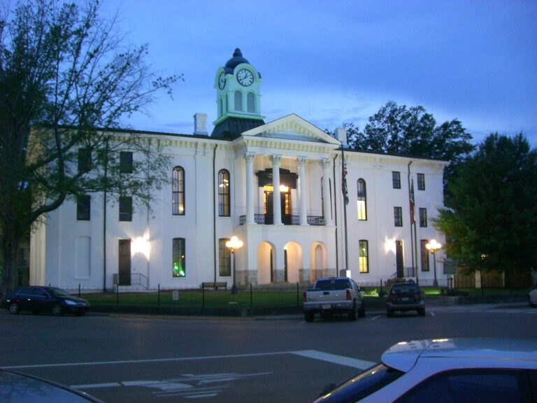
Photo: Kevin, CC BY 2.0
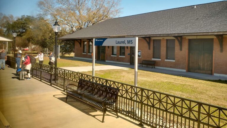
Photo: Paul Lowry, CC BY 2.0
Fishing inside Monroe County, Mississippi: the common asks
Where do trailers back down to the water in Monroe County?
The list above already includes 13 ramps.
Which lake is the biggest in Monroe County?
Aberdeen Lake is the biggest, 4,121 acres.
Which fish turn up in the stocking history for Monroe County?
Stocking history rows for the county name largemouth bass; a stocking row shows what a hatchery reported, not a catch.
Where do anglers in Monroe County go for crankbaits and line?
5 entries, Aberdeen Marina included.
Where is the seat of Monroe County located?
Aberdeen is the seat.
What does a Mississippi fishing license cost for Monroe County?
From the MDWFP price page: $25 for a resident all-game hunting and freshwater fishing license, $68 for a nonresident freshwater fishing license, agent fees not counted.
What counties are nearest Monroe County?
Ordered by distance: Clay County, Chickasaw County and Itawamba County.
Which limits govern the water of Monroe County?
Limits come from the Rule 1.4 statewide rows unless the water has a row of its own, and a water-specific row replaces the statewide limit for the fish it names; each lake and river page on this site prints its rows. Every rule here comes from MDWFP Rule 1.4 (statewide creel limits, updated April 2026) and the MDWFP public water body pages, read Nov. 19, 2026; the rule text controls and no 2027 rule or fee is printed.
Where do Monroe County waters with no page of their own show up?
This page lists the 10 waters; a water without a page gets a row and pin.
Does MDWFP print water-specific rows for Monroe County?
1 water with a page here carry rule rows of their own, beginning with Aberdeen Lake.
Is stocking noted for waters in Monroe County?
The stocking history lists 2 rows for the county, each by year only; MDWFP publishes no dated schedule, so nothing here counts as stocked now.
Have organizers posted a derby on Monroe County water?
1 entry on file; nothing is dated later.
What state-record fish originate in Monroe County?
Bowfin, 13 lbs 10 oz, from Tombigbee River (Brooksville) (3/5/1994).
A cane-pole morning in Monroe County
River pages carry their access points and the gauges nearest them.