Fishing in Worcester County, Maryland
County seat: Snow Hill. Census 2020 residents: 52,460.
- 28named waters
- 18ramps
- 1river pages
 Pick for troutPiscifun Carbon X ultralight spinning reel19% OFFSale $56.99
Photo of Pocomoke River: U. S. Fish and Wildlife Service – Northeast Region, CC BY 2.0
A short tour of the water in Worcester County
In Maryland, the 2020 Census found 52,460 people in Worcester County, with Snow Hill as the seat. On the Gazetteer sheet the county runs to 468 square miles of land and 226.5 square miles of water. Rivers with a page of their own here include Pocomoke River.
DNR layers place 18 boat ramps within county limits, with 28 piers and fishing points extra sites that have no ramp. The tidal rows cover 16 tidal waters, each under the DNR tidal limits. 2 stocking entries in Worcester County sit in the 2026 trout stocking table; the latest delivery is dated March 17, 2026. Crossing the line applies to 1 water; check which license covers each.
U.S. Census Bureau, 2020 Census counts (TIGERweb) and the 2023 Gazetteer, read November 20, 2026. DNR Maryland Water Access Sites layer (ArcGIS service), read November 20, 2026. Lanes, hours and fees are as the layer publishes them and are not a statement of condition.
 For the trout herePiscifun Carbon XT ultralight spinning reel39% OFFSale $54.99
Dated stocking rows tied to Worcester County
- Shad Landing PondMarch 17, 2026, Rainbow/Golden, 500 fish
- Shad Landing PondFeb. 17, 2026, Rainbow/Golden, 500 fish
DNR publishes only the current season; these rows run to the last delivery of 2026. Maryland stocking page
Stocking events from the Maryland DNR trout stocking feed behind its Trout Stocking page (DNR trout stocking), read November 20, 2026. DNR lists only the current season; the closure code is not interpreted.
Coves, ponds and ramps pinned across Worcester County
DNR Maryland Water Access Sites layer (ArcGIS service), read November 20, 2026. Lanes, hours and fees are as the layer publishes them and are not a statement of condition. Water pins sit at the point DNR or the USGS gives for each water.
Still-water choices in Worcester County
In Maryland, A drive from Snow Hill beyond Worcester County brings these waters within reach.
| Water | From Snow Hill | Size | Access points | Kind | Operator or DNR label |
|---|---|---|---|---|---|
| Beaverdam Creek | 17 miles out, heading northwest | no size printed | 1 | creek | not printed |
| Chicamacomico River | 34 miles out, heading northwest | no size printed | 2 | river reach | not printed |
| Choptank River | 52 miles out, heading northwest | no size printed | 24 | river reach | not printed |
| Tuckahoe Creek | 58 miles out, heading northwest | no size printed | 8 | creek | not printed |
Acres as stated in the DNR hotspot page text for this water (DNR hotspot page), read November 20, 2026. The DNR Maryland Lakes polygon gives a different figure, so each is labeled with its source. Waters with no DNR acreage show the layer or mapped outline figure instead, never merged. Maryland DNR record for this water (Maryland DNR source), read November 20, 2026.
Maryland: moving water across Worcester County
- Pocomoke River17 access points, 1 USGS gauge
Gauge readings tied to Worcester County for Maryland anglers
USGS has no current reading for these gauges.
Maryland DNR access-site and trout-stocking records, special management layers and USGS or NOAA station listings for this water (source), read November 20, 2026. No flowline length is published, so none is printed. USGS Water Data for the Nation, live through the site, retrieved on page view.
Maryland: where boats go in across Worcester County
- 64th Street boat ramp – Ocean Cityboat ramp, concrete surface; Worcester County
- Assateague – State Park on Sinepuxent Bayboat ramp, concrete surface; Worcester County
- Byrd Park – East on Pocomoke Riverboat ramp, concrete surface; Worcester County
- Byrd Park – West on Pocomoke Riverboat ramp, concrete surface; Worcester County
- Caribbean Drive boat ramp on Assawoman Bayboat ramp, concrete surface; Worcester County
- Cedar Hall Wharf Fishing Area on Pocomoke Riverboat ramp, concrete surface; Worcester County
- George Island Landing on Chincoteague Bayboat ramp, concrete surface; Worcester County
- Gum Point Landing on Turville Creekboat ramp, concrete surface; Worcester County
- Mason Landing on Massey Creekboat ramp, concrete surface; Worcester County
- Pocomoke City / Laurel St. boat ramp on Pocomoke Riverboat ramp, concrete surface; Worcester County
- Pocomoke State Park – Milburn Landing on Pocomoke Riverboat ramp, concrete surface; Worcester County
- Pocomoke State Park – Shad Landing on Pocomoke Riverboat ramp, concrete surface; Worcester County
- Public Landing boat ramp on Chincoteague Bayboat ramp, concrete surface; Worcester County
- Shell Mill Landingboat ramp, concrete surface; Worcester County
- South Point on Sinepuxent Bayboat ramp, concrete surface; Worcester County
- Taylors Landing on Chincoteague Bayboat ramp, concrete surface; Worcester County
- West Ocean City Fishing Area on Sinepuxent Bayboat ramp, concrete surface; Worcester County
- Winter Quarters Landing on Pocomoke Riverboat ramp, concrete surface; Worcester County
Maryland: fishing piers of Worcester County
- 9th Street Pier on Assawoman Bayfishing pier; Worcester County
- Assateague – Bayside Drive Fishing Area on Sinepuxent Bayshore fishing access; Worcester County
- Assateague – Old Ferry Landing on Sinepuxent Bayshore fishing access; Worcester County
- Assateague State Park on Sinepuxent Bayfishing pier; Worcester County
- Byrd Park on Pocomoke Riverfishing pier; Worcester County
- Cedar Hall Wharf Fishing Area on Pocomoke Rivershore fishing access; Worcester County
- George Island Landing on Chincoteague Bayfishing pier; Worcester County
- Gum Point Landing on Turville Creekshore fishing access; Worcester County
- Hayes Landing Road Bridge on Newport Creekshore fishing access; Worcester County
- Inlet Park on Ocean City Inletshore fishing access; Worcester County
- Mason Landing on Massey Creekshore fishing access; Worcester County
- Newtown Pond Fishing Areafishing pier; Worcester County
- Northside Park on Assawoman Bayfishing pier; Worcester County
- Ocean City – Chicago Avenue Fishing Area on Assawoman Bayshore fishing access; Worcester County
- Ocean City Fishing Pier on Atlantic Oceanfishing pier; Worcester County
- Oceanic Pier on Assawoman Bayfishing pier; Worcester County
- Pocomoke City Fishing Area on Pocomoke Riverfishing pier; Worcester County
- Pocomoke State Park – Milburn Landing on Pocomoke Riverfishing pier; Worcester County
- Pocomoke State Park – Shad Landing on Pocomoke Riverfishing pier; Worcester County
- Porters Crossing Road Bridge Fishing Area on Pocomoke Rivershore fishing access; Worcester County
- Public Landing on Chincoteague Bayfishing pier; Worcester County
- Route 50 Bridge Fishing Area on Assawoman Bayshore fishing access; Worcester County
- Shell Mill Landingshore fishing access; Worcester County
- South Point on Sinepuxent Bayshore fishing access; Worcester County
DNR Maryland Water Access Sites layer (ArcGIS service), read November 20, 2026. Lanes, hours and fees are as the layer publishes them and are not a statement of condition.
Named water of Worcester County logged here with its coordinates in Maryland
Still water: lakes, ponds and impoundments in Worcester County
| Water | Kind | Size | DNR label | Access | Map pin |
|---|---|---|---|---|---|
| NewTown Pond | pond | no size printed | Worcester County | 1 | 38.0668, -75.5422 |
| Ocean Pines South Gate Pond | pond | no size printed | not printed | 0 | 38.3779, -75.1626 |
| Shad Landing Pond | pond, stocking history | no size printed | not printed | 0 | 38.1400, -75.4395 |
Maryland DNR record for this water (Maryland DNR source), read November 20, 2026. Outline area from the USGS National Hydrography Dataset polygon (NHD service; mapped area, not a surveyed surface-acre figure), read November 20, 2026.
Creeks, branches and rivers in Worcester County
| Water | Kind | Size | DNR label | Access | Map pin |
|---|---|---|---|---|---|
| Bassett Creek | creek | no size printed | not printed | 0 | 38.2681, -75.2442 |
| Birch Branch | creek | no size printed | not printed | 0 | 38.4093, -75.2124 |
| Bottle Branch | creek | no size printed | not printed | 0 | 38.3167, -75.2163 |
| Buntings Gut | creek | no size printed | not printed | 0 | 38.1390, -75.1836 |
| Massey Creek | creek | no size printed | not printed | 2 | 38.2375, -75.2573 |
| Nassawango Creek | creek | no size printed | not printed | 0 | 38.2289, -75.4714 |
| Newport Creek | creek | no size printed | not printed | 1 | 38.2862, -75.2071 |
| Turville Creek | creek | no size printed | not printed | 2 | 38.3565, -75.1606 |
Maryland DNR record for this water (Maryland DNR source), read November 20, 2026. Outline area from the USGS National Hydrography Dataset polygon (NHD service; mapped area, not a surveyed surface-acre figure), read November 20, 2026.
Tidal waters, bays and coves in Worcester County
DNR sets the tidal limits for these rows; none has a NOAA level station of its own.
| Water | Kind | Size | DNR label | Access | Map pin |
|---|---|---|---|---|---|
| African Queen Reef | tidal water | no size printed | not printed | 0 | 38.1516, -74.9525 |
| Brockanorton Bay | tidal water | no size printed | not printed | 1 | 38.0993, -75.3380 |
| Chincoteague Bay | tidal water | no size printed | not printed | 6 | 38.0766, -75.3616 |
| Del-Jersey-Land Inshore (USS Radford Site) reef | tidal water | no size printed | not printed | 0 | 38.5000, -74.5000 |
| Great Eastern Reef | tidal water | no size printed | not printed | 0 | 38.2083, -74.7316 |
| Great Gull Reef | tidal water | no size printed | not printed | 0 | 38.2685, -75.0299 |
| Isle of Wight Reef | tidal water | no size printed | not printed | 0 | 38.3818, -74.9784 |
| Jackspot Reef | tidal water | no size printed | not printed | 0 | 38.0905, -74.8121 |
| Kelly's Reef | tidal water | no size printed | not printed | 0 | 38.2768, -75.0752 |
| New Bass Grounds Reef | tidal water | no size printed | not printed | 0 | 38.2972, -74.9167 |
| Old Bass Grounds Reef -Box 1 | tidal water | no size printed | not printed | 0 | 38.2968, -74.8972 |
| Old Bass Grounds Reef -Box 2 | tidal water | no size printed | not printed | 0 | 38.2870, -74.8849 |
| Purnell's Reef | tidal water | no size printed | not printed | 0 | 38.3500, -75.0583 |
| Research Reef | tidal water | no size printed | not printed | 0 | 38.3235, -74.9396 |
| Sinepuxent Bay | tidal water | no size printed | not printed | 8 | 38.2166, -75.1626 |
| Windmill Cove | tidal water | no size printed | not printed | 0 | 38.1984, -75.2617 |
Maryland DNR record for this water (Maryland DNR source), read November 20, 2026. Outline area from the USGS National Hydrography Dataset polygon (NHD service; mapped area, not a surveyed surface-acre figure), read November 20, 2026.
Nontidal and tidal records with a place near Worcester County
| Species | Weight as printed | Water | Date | Division |
|---|---|---|---|---|
| Longnose Gar | 20.5 lbs. | Marshyhope Creek | 2/08/2025 | Chesapeake Bay Division |
| Chesapeake Channa (northern Snakehead) | 21.8 lbs. | Susquehanna River | 6/07/2025 | Invasive |
State records from the DNR record pages (dnr.maryland.gov) as printed in the Maryland Guide (eregulations.com), read November 20, 2026. Angler names are not printed.
Contests staged over Worcester County water in Maryland
| Date | Event | Water | Organizer |
|---|---|---|---|
| Dec. 16, 2026 | Wednesday Only Bass Club open bass tournament, Pocomoke River | Pocomoke River | Wednesday Only Bass Club |
| July 8, 2027 | Ocean City Tuna Tournament (2027, 40th year) | Ocean City and Atlantic Ocean | Ocean City Fishing Center |
| July 23, 2027 | Huk Big Fish Classic (2027) | Ocean City and Atlantic Ocean | Big Fish Classic |
| Aug. 2, 2027 | White Marlin Open (2027) | Ocean City and Atlantic Ocean | White Marlin Open |
| Nov. 18, 2026 | Wednesday Only Bass Club open bass tournament, Pocomoke River | Pocomoke River | Wednesday Only Bass Club |
| Oct. 28, 2026 | Never On Sunday club bass tournament, Pocomoke River | Pocomoke River | Never On Sunday |
| Oct. 10, 2026 | Ocean City Inshore Classic (10th) (2026) | Ocean City and Atlantic Ocean | Atlantic Tackle |
| Sept. 26, 2026 | Delaware Bass Nation open bass tournament, Pocomoke River | Pocomoke River | Delaware Bass Nation |
| Sept. 17, 2026 | Ocean City Marlin Club Challenge Cup (46th) (2026) | Ocean City and Atlantic Ocean | Ocean City Marlin Club |
| Sept. 13, 2026 | Flounder Pounder (21st) (2026) | Ocean City and Atlantic Ocean | Bahia Marina |
Event as listed by the organizer (source), read November 20, 2026.
Maryland: bait and guide help in Worcester County
Restock hooks and line around Worcester County
- Atlantic Tacklebait and tackle shop, Ocean City
- Boss Hogg Fishingbait and tackle shop, Ocean City
- Elliott's on the Avenuebait and tackle shop, Ocean City
- Oyster Bay Tacklebait and tackle shop, Ocean City
- Sea Hawk Sports Centerbait and tackle shop, Pocomoke City
- Skips Bait & Tackle Shopbait and tackle shop, Ocean City
- Sunset Provisionsbait and tackle shop, Ocean City
- Talbot Street Tacklebait and tackle shop, Ocean City
- U Wanna Fishbait and tackle shop, Ocean City
- Advanced Marinamarina, Ocean City
- Bahia Marinamarina, Ocean City
- OC Fisherman's Marinamarina, Ocean City
Maryland: guides who fish Worcester County
- 30 Deep Sportfishingcharter, Ocean City, (443) 679-7873
- 5 Star Charters Tours and Taxicharter, Ocean City, (610) 310-2079
- All In Sport Fishingcharter, Ocean City, (302) 362-8150
- Alltackle Incfishing guide, Ocean City, (410) 213-2840
- Angler Deep Sea Fishingcharter, Ocean City, (410) 289-7424
- Back Bay Adventuresfishing guide, Ocean City, (443) 783-4633
- Bahia Marina at Fish Talescharter, Ocean City, (410) 289-7438
- Bayside Guide Service/Wayne Blankscharter, Ocean City, (443) 944-5484
Business directory and operator listings (city of business), read November 20, 2026. Guides appear as businesses; no license or permit status is implied.
Closest neighbors on the map to Worcester County
Towns of Worcester County
- Ocean Pines2020 count 12,145
- Ocean City2020 count 6,844
- Berlin2020 count 5,026
- West Ocean City2020 count 4,952
- Pocomoke City2020 count 4,295
- Snow Hill2020 count 2,156
- Girdletree2020 count 141
- Stockton2020 count 91
Maryland: counties that border Worcester County
- Wicomico County20 miles out, heading northwest
- Somerset County31 miles out, heading west
- Dorchester County42 miles out, heading west
- Caroline County53 miles out, heading northwest
Finding Worcester County among the six map groups
This site files the county in its the Lower Eastern Shore group, a map grouping of our own and not an DNR region.
Lower Eastern Shore tackle shops
Dated pages for fishing in Worcester County for Maryland anglers
Maryland fishing this week
Maryland stocking history
Maryland fish advisories
Piscifun reels with spare spools for a tidewater day at Worcester County


Piscifun and Amazon links are affiliate links; the site earns a commission on qualifying purchases.
Coves, ponds and ridge-line lakes around Worcester County, pictured
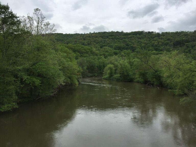
Photo: Famartin, CC BY-SA 4.0


Photo: Famartin, CC BY-SA 4.0

Wetting a line in Worcester County: the usual questions
Maryland: Where do trailers back down to the water in Worcester County?
18 ramps appear in the list above.
Maryland: Which lake is the biggest in Worcester County?
In Maryland, no water in this county carries a size figure in the records; the rows above show what the layers hold.
Maryland: Which fish turn up in the stocking history for Worcester County?
The county stocking rows name rainbow trout/golden rainbow trout; a stocking row shows what a hatchery delivered, not a catch.
Where do anglers in Worcester County go for crankbaits and line in Maryland?
20 entries, Atlantic Tackle included.
Where is the seat of Worcester County located in Maryland?
In Maryland, Snow Hill is the seat.
What does a Maryland fishing license cost for Worcester County?
From the 2026 fee table: $32 for a resident nontidal sport fishing license, $55 for a nonresident one, before any service fee.
Maryland: What counties are nearest Worcester County?
Ordered by distance: Wicomico County, Somerset County and Dorchester County.
Maryland: Which limits govern the water of Worcester County?
Limits come from the DNR statewide tables unless the water has a row of its own, and a water-specific row replaces the statewide limit for the fish it names; each lake and river page on this site prints its rows. Every rule here comes from the 2026 Maryland Guide to Fishing and Crabbing summary pages that DNR links, read Nov. 20, 2026; COMAR controls and no 2027 rule or fee is printed.
Where do Worcester County waters with no page of their own show up in Maryland?
Below are the 28 waters; any that lack a page of their own appear as a pinned row.
Maryland: Is stocking noted for waters in Worcester County?
The 2026 trout stocking table lists 2 deliveries for the county, the latest dated March 17, 2026; DNR publishes only the current season, and fall stocking is complete.
Have organizers posted a derby on Worcester County water in Maryland?
32 entries on file; the next comes Wednesday Only Bass Club open bass tournament, Pocomoke River on Pocomoke River, Dec. 16, 2026.
A first-light cast in Worcester County
In Maryland, river pages carry their access points and the gauges nearest them.