Atlantic Ocean Fishing
A tidal water in Worcester County, Maryland.
 Pick for largemouthPiscifun Chaos Pro CNC baitcasting reel31% OFFSale $89.99
Photo of Pocomoke River: U. S. Fish and Wildlife Service – Northeast Region, CC BY 2.0
Maryland: water within reach of Atlantic Ocean
DNR access sites name Atlantic Ocean in Worcester County, and NOAA supplies the tide gauge used on this page. Readings come from Ocean City Inlet. West Ocean City is the closest Census town, roughly 2 miles away.
Also mapped: 1 site for fishing from land.
DNR Maryland Water Access Sites layer (ArcGIS service), read November 20, 2026. Lanes, hours and fees are as the layer publishes them and are not a statement of condition.
U.S. Census Bureau, 2020 Census counts (TIGERweb) and the 2023 Gazetteer, read November 20, 2026.
Maryland: launching at Atlantic Ocean
DNR maps no boat ramp on Atlantic Ocean; a hand-carried boat or a launch on a neighboring water is the plan.
Casting without a boat at Atlantic Ocean
- Ocean City Fishing Pier on Atlantic Oceanfishing pier
Read each entry as a mapped point, not as a confirmed usable ramp.
DNR Maryland Water Access Sites layer (ArcGIS service), read November 20, 2026. Lanes, hours and fees are as the layer publishes them and are not a statement of condition.
NOAA water level for Atlantic Ocean, with its time
NOAA CO-OPS Ocean City Inlet station readings for Atlantic Ocean, retrieved November 20, 2026.
NOAA CO-OPS Tides and Currents (tidesandcurrents.noaa.gov), observed water level and temperature as served with their GMT time stamps, read November 20, 2026. Datum MLLW; observations, not predictions.
USGS values reload with the page, while Corps and NOAA values are snapshots printed with their own times.
Bay and ocean limits for a trip to Atlantic Ocean
Salt and brackish anglers at Atlantic Ocean use the tidal tables, not the nontidal one. A first block of rows, read Nov. 20, 2026, is copied here.
| Fish | Area | Minimum size as printed | Creel as printed | Season as printed |
|---|---|---|---|---|
| American Eel | Chesapeake Bay and its tidal tributaries | 9 inches | Daily—25 | Jan. 1–Aug. 31, except open year round for spears and baited traps or pots |
| Atlantic Menhaden | Chesapeake Bay and its tidal tributaries | None | None | Open Year Round |
| Bass (Largemouth and Smallmouth) | Chesapeake Bay and its tidal tributaries | 15 inches; March 1–June 15 | Daily—5 in aggregate | Open Year Round |
| Bass (Largemouth and Smallmouth) | Chesapeake Bay and its tidal tributaries | 12 inches; June 16 through last day in February | Daily—5 in aggregate | Open Year Round |
| Black Drum | Chesapeake Bay and its tidal tributaries | 16 inches | Daily—1, Boat Limit—6 | Open Year Round |
| Black Sea Bass | Chesapeake Bay and its tidal tributaries | 12 1/2" inches (excluding tail filament) | Daily—15 | May 1–Dec. 31 |
| Bluefish | Chesapeake Bay and its tidal tributaries | 8 inches | Shore or Private Boat: 5 per person, For-Hire Boat: 7 per person | Open Year Round |
| Catfish | Chesapeake Bay and its tidal tributaries | None | None | Open Year Round |
| Chain Pickerel (Pike) | Chesapeake Bay and its tidal tributaries | 14 inches | Daily—10 | May 1–March 14 |
| Cobia | Chesapeake Bay and its tidal tributaries | 43 inches (total length) | 1 cobia per person per day; or up to 2 cobia per vessel per day if there are 2 or more individuals on the vessel | June 15–Sept. 20 |
| Croaker (Hardhead) | Chesapeake Bay and its tidal tributaries | 9 inches | Daily—25 | Open Year Round |
| Longnose gar | Chesapeake Bay and its tidal tributaries | None | April 15–June 30: Daily—1 | Open Year Round |
| Longnose gar | Chesapeake Bay and its tidal tributaries | None | July 1–April 14: Daily—5 | Open Year Round |
| Chesapeake Channa (Northern Snakehead) | Chesapeake Bay and its tidal tributaries | None | None | Open Year Round |
Full tables, including the Atlantic coastal rows and the Potomac River rules that the Potomac River Fisheries Commission writes, are on the license and regulations page.
From the 2026 fee table: $32 for a resident nontidal sport fishing license, $55 for a nonresident one, before any service fee.
Rules as summarized in the Maryland Guide to Fishing and Crabbing (DNR-linked eRegulations summary pages) and the DNR Fishing Regulations page (eregulations.com), read November 20, 2026. These are abridged summaries; the Code of Maryland Regulations (COMAR) text controls.
License fees from the 2026 table in the Maryland Guide to Fishing and Crabbing (eregulations.com), read November 20, 2026. Agent and service fees may apply.
 For the largemouth herePiscifun AlinoX 300 low profile baitcaster34% OFFSale $104.99
Closest neighbors on the map to Atlantic Ocean
More lakes within a short drive of Atlantic Ocean
- Ocean City Inletunder a mile southwest
- Assawoman Bayunder a mile north
- McCreadys Cove50 miles west
- Forrest Landing Cove78 miles west
- Rock Hall Harbor84 miles northwest
Restock hooks and line around Atlantic Ocean
- Elliott's on the Avenuebait and tackle shop, Ocean City, under a mile
- Skips Bait & Tackle Shopbait and tackle shop, Ocean City, under a mile
- Talbot Street Tacklebait and tackle shop, Ocean City, under a mile
- Sunset Marina Amenities Buildingmarina, Ocean City, under a mile
- Atlantic Tacklebait and tackle shop, Ocean City, under a mile
- Ocean City Fishing Centermarina, Ocean City, under a mile
Maryland: guides who fish Atlantic Ocean
- 30 Deep Sportfishingcharter, Ocean City, (443) 679-7873
- 5 Star Charters Tours and Taxicharter, Ocean City, (610) 310-2079
- All In Sport Fishingcharter, Ocean City, (302) 362-8150
- Angler Deep Sea Fishingcharter, Ocean City, (410) 289-7424
- Bahia Marina at Fish Talescharter, Ocean City, (410) 289-7438
- Bayside Guide Service/Wayne Blankscharter, Ocean City, (443) 944-5484
- Bet Sea Sport Fishing LLC / Eric Mihalycharter, Ocean City, (302) 841-7781
- Boss Hogg Fishing Chartercharter, Ocean City, (410) 458-1164
Lodging towns near Atlantic Ocean
- West Ocean City2 miles
- Ocean City5 miles
- Ocean Pines5 miles
Finding Atlantic Ocean among the county pages
- Worcester Countyseat: Snow Hill
Piscifun reels with spare spools for a tidewater day at Atlantic Ocean


Piscifun and Amazon links are affiliate links; the site earns a commission on qualifying purchases.
Coves, ponds and ridge-line lakes around Atlantic Ocean, pictured
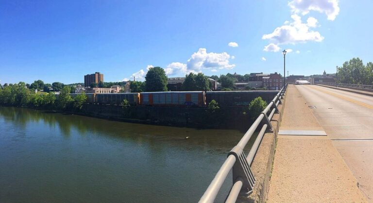
Photo: Andre Carrotflower, CC BY-SA 4.0


Photo: U.S. Army Corps of Engineers, CC BY 2.0

Four or five answers before a morning on Atlantic Ocean
Where along the Bay or coast is the Atlantic Ocean pinned?
Short answer: Atlantic Ocean is in Worcester County, nearest town West Ocean City.
Is there a trailer ramp at the Atlantic Ocean?
Worth knowing: No ramp is mapped on it, so plan on shore fishing or a launch on a neighboring water.
Is a tidal license needed at the Atlantic Ocean?
From the pages: From the 2026 fee table: $32 for a resident nontidal sport fishing license, $55 for a nonresident one, before any service fee.
Which tidal rules apply at the Atlantic Ocean?
Short answer: DNR-linked Maryland guide tables set the tidal and coastal rows; the page copies the first rows with the date they were read.
What does the water level near the Atlantic Ocean measure?
Worth knowing: The figures come from NOAA station Ocean City Inlet and are observed values with GMT time stamps, not predictions and not live.
Which bait shop on the list is closest to the Atlantic Ocean?
From the pages: Elliott's on the Avenue, under a mile away, is first on the list.
Which community borders the water at the Atlantic Ocean?
Short answer: The nearest listed town is West Ocean City, about 2 miles away as the crow flies.
What other pages cover water around the Atlantic Ocean?
Worth knowing: Close by, these have full pages: Ocean City Inlet, Assawoman Bay and McCreadys Cove.
What goes into a phone map for the Atlantic Ocean?
From the pages: Hit Directions to open a map with the Atlantic Ocean placed at its filed coordinates. Access is never guaranteed; check first.
Pencil in a Maryland weekend at Atlantic Ocean
Fees and rules live on one page.