Kentucky Lake Levels and River Flows
Dated Corps dam and river readings from four districts, USGS lake gauges and the biggest gauged Kentucky streams.
 Angler pickPiscifun Viper X spinning reel50% OFFSale $39.99
Photo of Carr Creek Lake: LouisvilleUSACE, CC BY 2.0
Where Kentucky dam and gauge figures come from
Four Corps of Engineers districts report Kentucky dams and rivers: Louisville (Barren, Green, Nolin, Rough, Taylorsville, Cave Run and the Ohio locks), Nashville (Lake Cumberland, Dale Hollow, Laurel River, Martins Fork, Lake Barkley and the Kentucky Lock reading), Huntington (Fishtrap, Dewey, Yatesville, Paintsville, Grayson, Carr Creek and Buckhorn) and Memphis on the Mississippi. Their figures come from USACE Access to Water and print with the reading time; they are snapshots from the build, not live feeds.
USGS lake and stream gauges load live on the water pages. TVA serves its Kentucky Dam page behind a browser challenge, so the Kentucky Lake pool figure comes from the Corps Kentucky Lock location instead.
| USGS gauge | Latest reading | Time (ET) |
|---|---|---|
| Ohio River At Old Shawneetown, Il-ky | 255,000 cfs, 15.77 ft gage height | Feb 9 9:45 am Not updated since Feb 9, 2024. |
| Ohio River At Louisville, Ky | 33,500 cfs, 11.51 ft gage height | Nov 12 8:45 pm |
| Ohio River At Water Tower At Louisville, Ky | 36,100 cfs, 13.23 ft gage height | Nov 12 9:00 pm |
US Geological Survey provisional data, retrieved Nov 12, 2026 9:33 pm ET. Provisional readings can be revised.
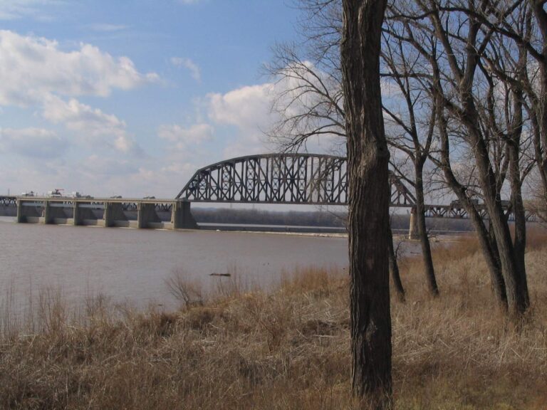
Photo of Ohio River: Ken Lund, CC BY-SA 2.0
Kentucky dam readings from the Corps
| Water | District | Latest reading | Read at |
|---|---|---|---|
| Dewey Lake | USACE Huntington District | 649.4 ft pool elevation (NGVD29); 648.62 ft guide-curve elevation (NGVD29) | November 10, 2026 20:30 UTC |
| Fishtrap Lake | USACE Huntington District | 753.76 ft pool elevation (NGVD29); 751.8 ft guide-curve elevation (NGVD29) | November 10, 2026 20:45 UTC |
| Grayson Lake | USACE Huntington District | 641.63 ft pool elevation (NGVD29); 642.6 ft guide-curve elevation (NGVD29) | November 10, 2026 20:30 UTC |
| Greenup Locks And Dam | USACE Huntington District | 12.89 ft river stage; 14.91 ft tailwater stage | November 10, 2026 20:45 UTC |
| Paintsville Lake | USACE Huntington District | 708.49 ft pool elevation (NGVD29); 709 ft guide-curve elevation (NGVD29) | November 10, 2026 21:00 UTC |
| Yatesville Lake | USACE Huntington District | 628.18 ft pool elevation (NGVD29); 628.35 ft guide-curve elevation (NGVD29) | November 10, 2026 20:30 UTC |
| Barren River Lake | USACE Louisville District | 538.8 ft pool elevation (NGVD29); 2,870 cfs release | November 10, 2026 12:00 UTC |
| Buckhorn Lake | USACE Louisville District | 776.08 ft pool elevation (NGVD29); 455.61 cfs release | November 10, 2026 20:15 UTC |
| Carr Creek Lake | USACE Louisville District | 1,021.69 ft pool elevation (NGVD29); 78.67 cfs release | November 10, 2026 20:15 UTC |
| Cave Run Lake | USACE Louisville District | 729.71 ft pool elevation (NGVD29); 519.03 cfs release | November 10, 2026 20:05 UTC |
| Green River Lake | USACE Louisville District | 673.76 ft pool elevation (NGVD29); 76.26 cfs release | November 10, 2026 11:00 UTC |
| Nolin River Lake | USACE Louisville District | 507.3 ft pool elevation (NGVD29); 1,557.86 cfs release | November 10, 2026 19:50 UTC |
| Rough River Lake | USACE Louisville District | 479.22 ft pool elevation (NGVD29); 811.42 cfs release | November 10, 2026 12:00 UTC |
| Taylorsville Lake | USACE Louisville District | 545.82 ft pool elevation (NGVD29); 49.71 cfs release | November 10, 2026 11:00 UTC |
| Lake Barkley | USACE Nashville District | 354.7 ft pool elevation (NGVD29); 302.7 ft tailwater elevation (NGVD29) | November 10, 2026 18:00 UTC |
| Dale Hollow Lake | USACE Nashville District | 637.97 ft pool elevation (NGVD29); 505.57 ft tailwater elevation (NGVD29) | November 10, 2026 18:00 UTC |
| Kentucky Lake | USACE Nashville District | 354.48 ft pool elevation (NGVD29); 301.7 ft tailwater elevation (NGVD29) | November 10, 2026 21:00 UTC |
| Laurel River Lake | USACE Nashville District | 999.57 ft pool elevation (NGVD29); 756.07 ft tailwater elevation (NGVD29) | November 10, 2026 21:00 UTC |
| Martins Fork Lake | USACE Nashville District | 1,303.32 ft pool elevation (NGVD29); 25.76 cfs release | November 10, 2026 20:30 UTC |
| Lake Cumberland | USACE Nashville District | 690.41 ft pool elevation (NGVD29); 543.41 ft tailwater elevation (NGVD29) | November 10, 2026 20:00 UTC |
USACE Access to Water (water.usace.army.mil) latest values for the Louisville, Nashville, Huntington and Memphis districts, read November 10, 2026; provisional, datum as USACE lists it.
Corps river and lock readings in Kentucky
| Site | District | Latest reading | Read at |
|---|---|---|---|
| Barren River At Bowling Green, K | USACE Louisville District | 9.11 ft river stage | November 10, 2026 20:45 UTC |
| Barren River Near Finney, Ky | USACE Louisville District | 84.08 ft river stage; 66.92 F water temperature | November 10, 2026 20:00 UTC |
| Carr Fork Near Sassafras, Ky | USACE Louisville District | 8.28 ft river stage; 64.76 F water temperature | November 10, 2026 20:00 UTC |
| Cumberland River – Smithland Ky | USACE Louisville District | 302.49 ft pool elevation (NGVD29) | November 10, 2026 21:00 UTC |
| Ohio River @ Cincinnati, Oh | USACE Louisville District | 3,048.62 ft pool elevation (NAVD88); 2,620.57 ft river stage | November 10, 2026 21:00 UTC |
| Clarks River At Almo, Ky | USACE Nashville District | 9.28 cfs release; 4.2 ft river stage | November 10, 2026 20:15 UTC |
| Little River Near Cadiz, Ky | USACE Nashville District | 29.48 cfs release; 2.31 ft river stage | November 10, 2026 21:00 UTC |
| Martins Fork Dam Tailwater | USACE Nashville District | 25.76 cfs release | November 10, 2026 20:30 UTC |
| Martins Fork At Clover Fork Near Harlan, Ky | USACE Nashville District | 1,160.13 ft pool elevation (NGVD29); 27.66 cfs release | November 10, 2026 20:30 UTC |
| Lake Cumberland Tailwater | USACE Nashville District | 20 cfs release | November 10, 2026 20:00 UTC |
| Yellow Creek Near Middlesboro, Ky | USACE Nashville District | 1,100.96 ft pool elevation (NGVD29) | November 10, 2026 20:30 UTC |
| Ashland | USACE Huntington District | 34.47 ft river stage | November 10, 2026 21:00 UTC |
| Blaine | USACE Huntington District | 45.48 cfs release; 2.81 ft river stage | November 10, 2026 20:45 UTC |
| Elkhorn City | USACE Huntington District | 490.08 cfs release; 7.22 ft river stage | November 10, 2026 20:30 UTC |
| Fullers | USACE Huntington District | 772 cfs release; 3.62 ft river stage | November 10, 2026 20:30 UTC |
| Grayson | USACE Huntington District | 168 cfs release; 5.03 ft river stage | November 10, 2026 21:00 UTC |
| Leon | USACE Huntington District | 171.06 cfs release; 4.75 ft river stage | November 10, 2026 21:00 UTC |
| Maysville | USACE Huntington District | 34.55 ft river stage | November 10, 2026 21:00 UTC |
| Meta | USACE Huntington District | 11.36 cfs release; 3.26 ft river stage | November 10, 2026 20:30 UTC |
| Paintsvilleky | USACE Huntington District | 829.96 cfs release; 3.65 ft river stage | November 10, 2026 20:45 UTC |
| Pikeville | USACE Huntington District | 774.73 cfs release; 7.4 ft river stage | November 10, 2026 21:00 UTC |
| Prestonsburg | USACE Huntington District | 781.3 cfs release; 2.83 ft river stage | November 10, 2026 20:45 UTC |
| Mississippi River @ Hickman | USACE Memphis District | 286,616 cfs release; 8.64 ft river stage | November 10, 2026 21:00 UTC |
| Mississippi River @ Wickliffe | USACE Memphis District | 15.64 ft river stage | November 10, 2026 20:00 UTC |
USACE Access to Water river locations, read November 10, 2026; provisional.
USGS lake gauges in Kentucky
| Gauge | Gage height (ft) | Time |
|---|---|---|
| Elkhorn Lake At Jenkins, Ky | 3.0 | November 10, 2026 |
| Grayson Lake Near Leon, Ky | 41.63 | November 10, 2026 |
| Olive Hill Reservoir Nr Olive Hill, Ky | no recent value | November 10, 2026 |
| Cave Run Lake Near Farmers, Ky | 29.71 | November 10, 2026 |
| Carr Creek Lake Near Sassafras, Ky | 21.69 | November 10, 2026 |
| Buckhorn Lake At Buckhorn, Ky | 76.04 | November 10, 2026 |
| Herrington Lake Near Burgin, Ky | no recent value | November 10, 2026 |
| Taylorsville Lake Near Taylorsville, Ky | 45.8 | November 10, 2026 |
| Green River Lake Near Campbellsville, Ky | 73.74 | November 10, 2026 |
| Nolin Lake Near Kyrock, Ky | 107.26 | November 10, 2026 |
| Barren River Lake Near Finney, Ky | 38.51 | November 10, 2026 |
| Rough River Lake Near Falls Of Rough, Ky | 78.99 | November 10, 2026 |
| Martins Fork Lk At Martins Fk Dam Nr Smith, Ky | 10.7 | November 10, 2026 |
USGS Water Data for the Nation, live through the site, retrieved on page view.
Kentucky streams gauged over the largest watersheds
USGS instantaneous values (provisional), read November 10, 2026; river pages show their nearest gauges live.
Kentucky water level questions
Do the Kentucky dam figures update by themselves?
The USGS gauges on water pages are live; Corps readings are dated snapshots with their time printed.
Which Corps districts cover Kentucky?
Louisville District, Nashville District, Huntington District and Memphis District.
Why is there no TVA reading for Kentucky Lake?
TVA answers scripts with a challenge page, so the pool figure comes from the Corps Kentucky Lock location.
How many Corps dams in Kentucky show a dated reading?
20 projects with readings.
What is a guide-curve elevation?
The seasonal target pool the Corps manages toward, printed beside the actual elevation where the Corps lists it.
Where do I see release flows below a dam?
On the tailwater pages, from the Corps project readings.
Which datum do elevations use?
The vertical datum the Corps lists for each location, usually NGVD29.
How often are Corps figures refreshed?
They were read when the pages were built; open the Corps location page for the current value.