Taylorsville Lake Fishing
A Kentucky lake of 3,014 acres in Anderson and Spencer counties.
 Pick for largemouth bassPiscifun Chaos Pro CNC baitcasting reel25% OFFSale $97.99
Photo: LouisvilleUSACE, CC BY 2.0
Lake level today
Reading at 8:15 pm EST, Nov 12US Geological Survey gauge 03295597, Taylorsville Lake near Taylorsville, KY. Provisional data, refreshed hourly.
Taylorsville Lake by its KDFWR numbers
Per its KDFWR listing, Taylorsville Lake covers 3,014 acres across Anderson and Spencer counties. The KDFWR lakes layer lists the owner as Army Corps of Engineers. Taylorsville is the nearest town at roughly 7 miles.
The KDFWR access layer maps 5 ramps and carry-down launches on it. KDFWR also maps 1 pier or bank site. Its own rulebook runs to 10 special-regulation lines.
Acreage as KDFWR notes it on the Taylorsville Lake waterbody page (KDFWR), read November 10, 2026.
KDFWR waterbody page for Taylorsville Lake, read November 10, 2026.
U.S. Census Bureau, 2020 Census counts (TIGERweb) and the 2023 Gazetteer, read November 10, 2026.
KDFWR notes and documents on Taylorsville Lake
Documents KDFWR links from Taylorsville Lake
- Taylorsville Lake Fish Attractors in Google maps!KDFWR link
- Taylorsville Lake Largemouth Bass Fishing Quality AssessmentKDFWR link
KDFWR waterbody page for Taylorsville Lake, read November 10, 2026.
 For the largemouth bass herePiscifun AlinoX 300 low profile baitcaster34% OFFSale $104.99
Species named in the Taylorsville Lake rule table
For Taylorsville Lake, these fish appear in KDFWR rules or stocking lists; abundance is not implied.
KDFWR waterbody page for Taylorsville Lake, read November 10, 2026.
Trailering a boat onto Taylorsville Lake
- Chowning Lane Boat Ramp on Taylorsville Lakeboat ramp, paved, multiple lanes, courtesy dock; parking for 51 or more vehicles, paved lot; no fee; open year-round, all hours
- Possum Ridge (State Park Ramp) on Taylorsville Lakeboat ramp, paved, multiple lanes, courtesy dock; parking for 51 or more vehicles, paved lot; no fee; open year-round, all hours
- Settlers Trace Boat Ramp on Taylorsville Lakeboat ramp, paved, multiple lanes, courtesy dock, marina; parking for 51 or more vehicles, paved lot; no fee; open year-round, all hours
- Taylorsville Lake Tailwater Rampboat ramp, paved, single lane; parking for 25 or fewer vehicles, paved lot; no fee; open year-round, all hours
- Van Buren Ramp on Taylorsville Lakeboat ramp, paved, multiple lanes, courtesy dock; parking for 51 or more vehicles, paved lot; no fee; open year-round, all hours
Bank casting along Taylorsville Lake
- Taylorsville Tailwater Bank Accessbank access; open year-round, all hours
Next-nearest ramps to Taylorsville Lake
- Taylorsville City Ramp on Salt RiverSalt River, 6 miles west
- Willisburg Lake RampWillisburg Lake, 12 miles south
- Beaver RampBeaver Lake, 13 miles east
- Salt River Access 2Salt River, 14 miles east
- Clear Creek AccessClear Creek, 15 miles north
Where a Taylorsville Lake site charges, KDFWR says so without an amount; ask the operator for the price.
KDFWR Fishing Access Sites in Kentucky layer (ArcGIS service: lanes as single or multiple, fees as yes or no, hours as categories), read November 10, 2026.
Latest elevation figures for Taylorsville Lake
| USGS gauge | Latest reading | Time (ET) |
|---|---|---|
| Taylorsville Lake Near Taylorsville, Ky | 45.78 ft gage height, 545.78 ft lake elevation | Nov 12 8:15 pm |
US Geological Survey provisional data, retrieved Nov 12, 2026 8:32 pm ET. Provisional readings can be revised.
USACE Louisville District reading at Taylorsville Lake for Taylorsville Lake, November 10, 2026 11:00 UTC.
USACE Louisville District via USACE Access to Water (location page), latest values at retrieval November 10, 2026. Provisional.
Each Taylorsville Lake figure names its agency and time; Corps values are a snapshot.
Creel rules at Taylorsville Lake
The KDFWR page for Taylorsville Lake carries this regulation table word for word.
| Species | Rule as KDFWR prints it | Notes |
|---|---|---|
| Largemouth Bass | Must be 15 inches or over, Statewide creel limits apply | |
| Smallmouth Bass | Must be 15 inches or over, Statewide creel limits apply | |
| White Crappie | Must be 10 inches or over – Limit 15 Crappie, Black or White, per angler | |
| Black Crappie | Must be 10 inches or over – Limit 15 Crappie, Black or White, per angler | |
| Hybrid Striped Bass | Statewide Regulations Apply | |
| White Bass | Statewide Regulations Apply | |
| Blue Catfish | Limit 15 per angler, channel catfish and blue catfish combined – No more than 1 fish may be over 25 inches | |
| Channel Catfish | Limit 15 per angler, channel catfish and blue catfish combined – No more than 1 fish may be over 25 inches | |
| Saugeye | Must be 14 inches or over, Limit 6 per angler |
KDFWR waterbody page for Taylorsville Lake, read November 10, 2026.
Taylorsville Lake in the guide special-water list
- TAYLORSVILLE LAKELake upper boundary is Dry Dock Road on Salt River.
- TAYLORSVILLE LAKECrappie: 10-inch minimum size limit, 15-fish daily limit.
- TAYLORSVILLE LAKELargemouth and Smallmouth Bass: 15-inch minimum size limit.
- TAYLORSVILLE LAKEBlue and Channel Catfish: 15-fish aggregate daily limit, only 1 fish may be longer than 25 inches.
2026 Kentucky Fishing & Boating Guide (Regulations Summary March 2026 to February 2027, updated September 2026, p. 7-12; KDFWR PDF), read November 10, 2026.
The statewide table as it touches Taylorsville Lake
| Species group | Daily | Possession | Minimum size |
|---|---|---|---|
| Largemouth Bass | 6* | 12* | 12" |
| Smallmouth Bass | 6* | 12* | 12" |
| Walleye, Sauger, and their Hybrids | 6* | 12* | 14" |
| White & Hybrid Striped Bass | 15** | 30** | none** |
| Crappie (Black & White) | 20* | 40* | none |
| Channel Catfish 28" and above | 1 | 2 | 28" |
| Blue & Flathead Catfish 35" and above | 1 each | 2 each | 35" |
| Channel Catfish below 28" | none | none | none |
| Blue & Flathead Catfish below 35" | none | none | none |
2026 Kentucky Fishing & Boating Guide (Regulations Summary March 2026 to February 2027, updated September 2026, p. 4; KDFWR PDF), read November 10, 2026.
The guide's possession wording, quoted for Taylorsville Lake: "A possession limit is two times the daily limit for all fish species with a daily limit, excluding previously processed fish."
Anglers 16 and older need a Kentucky fishing license; the 2026 guide prints $24.31 for the resident annual license and $58.14 for nonresidents.
License prices as printed in the 2026 Kentucky Fishing & Boating Guide, p. 2 (2026 CPI-adjusted fees; KDFWR PDF), read November 10, 2026.
How Taylorsville Lake stacks up locally
By KDFWR figures, Guist Creek Lake tops the list at 328 acres.
| Lake | Distance | Size | County | KDFWR launches | KDFWR rule rows |
|---|---|---|---|---|---|
| Taylorsville Lake | 3,014 acres | Anderson County | 5 | 9 | |
| Bloomfield Park | 7 miles southwest | 2.4 acres | Nelson County | 0 | 6 |
| Beaver Lake | 12 miles east | 146 acres | Anderson County | 1 | 4 |
| Willisburg Lake | 13 miles south | 115 acres | Washington County | 1 | 0 |
| Willisburg Park Pond | 15 miles southeast | – | Washington County | 0 | 4 |
| Guist Creek Lake | 16 miles north | 328 acres | Shelby County | 1 | 7 |
KDFWR waterbody pages and access layer; outline sizes are GIS figures. Read November 10, 2026.
Minutes past Taylorsville Lake by road
Still water for a second day past Taylorsville Lake
- Bloomfield Park7 miles southwest
- Beaver Lake12 miles east
- Willisburg Lake13 miles south
- Willisburg Park Pond15 miles southeast
- Guist Creek Lake16 miles north
Bait stores a short hop from Taylorsville Lake
- Taylorsville Lake Marina Incmarina, Taylorsville, 3 miles
- Guist Creek Marina and Campgroundmarina, Shelbyville, 16 miles
- Slippery Joe's Bait & Tacklebait and tackle shop, Frankfort, 22 miles
- Academy Sports + Outdoors, 13401 Shelbyville Rd Ste 140bait and tackle shop, Louisville, 22 miles
- Karem's Bait Storebait and tackle shop, Louisville, 22 miles
- Frankfort Boat Club Barmarina, Frankfort, 23 miles
Cabins and motels near Taylorsville Lake
- Taylorsville7 miles
- Shelbyville14 miles
- Simpsonville16 miles
Which county lines Taylorsville Lake crosses
- Anderson Countyseat: Lawrenceburg
- Spencer Countyseat: Taylorsville
Piscifun rods, reels and pliers to sort before heading to Taylorsville Lake


Piscifun and Amazon links are affiliate links; the site earns a commission on qualifying purchases.
Field-guide photos for fish at Taylorsville Lake
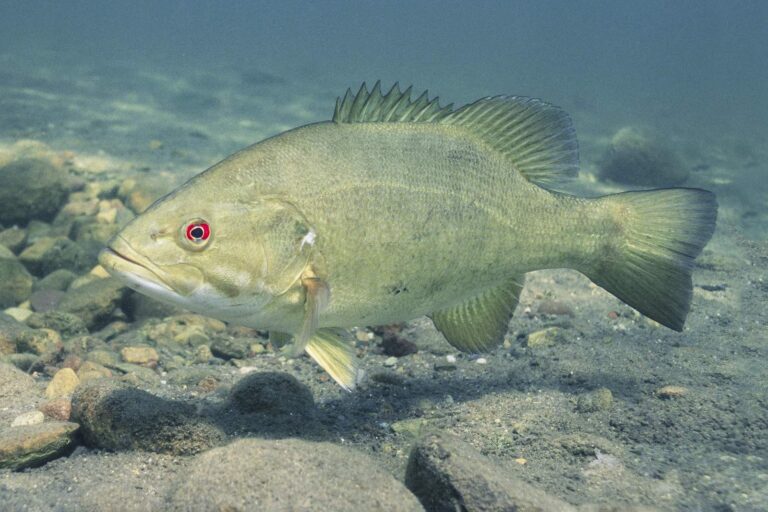
Photo: Yellowstone National Park, Public domain

Photo: Oregon Department of Fish & Wildlife, CC BY-SA 2.0

Photo: USFWS Mountain-Prairie, Public domain

Photo: USFWS Mountain-Prairie, CC BY 2.0

Taylorsville Lake in a handful of questions
Which county roads lead to Taylorsville Lake?
Look in Anderson and Spencer counties on a road map; the closest Census town, Taylorsville, is about 7 miles away.
How big is Taylorsville Lake by the KDFWR note?
The KDFWR note says 3,014 acres.
Where does the KDFWR layer let a trailered boat onto Taylorsville Lake?
5 ramps and carry-down launches are on file; try Chowning Lane Boat Ramp on Taylorsville Lake.
Which species does KDFWR list at Taylorsville Lake?
KDFWR lists largemouth bass, smallmouth bass, white crappie, black crappie, hybrid striped bass, white bass and blue catfish in its rules or stocking rows.
Does a black bass length minimum apply on Taylorsville Lake?
KDFWR, the guide and the KAR print 10 special-regulation lines for it; the limits band quotes each.
Which KDFWR license covers a day at Taylorsville Lake?
Anglers 16 and older need a Kentucky fishing license; the 2026 guide prints $24.31 for the resident annual license and $58.14 for nonresidents.
Where can a boatless angler fish Taylorsville Lake?
KDFWR lists 1 pier or bank site; start at Taylorsville Tailwater Bank Access.
Which Kentucky tackle store on our list serves Taylorsville Lake?
Taylorsville Lake Marina Inc, about 3 miles away is the first shop we list.
What is the lake level at Taylorsville Lake?
USGS reports it; the value is in the level band.
Load the cooler and head for Taylorsville Lake
Each fee and limit table is a click away.